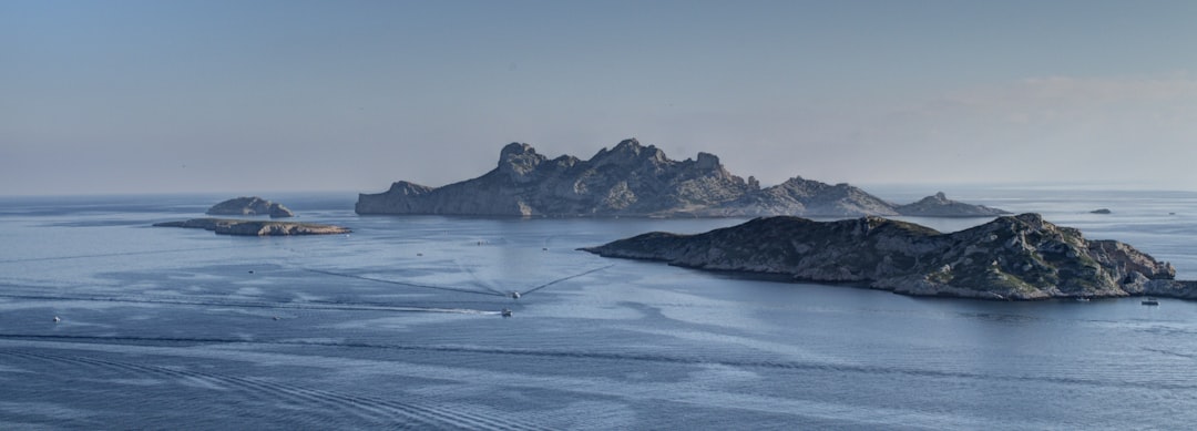
Antarctica, the Earth’s southernmost continent, represents a frontier of scientific inquiry and a repository of environmental extremes. Its ice-bound landscape, perpetually shrouded in mystery, has long fueled speculation and inspired tales of the extraordinary. Beyond its role as a critical regulator of global climate and a unique ecosystem, Antarctica holds the potential for archaeological and geological discoveries that could redefine our understanding of Earth’s ancient past, particularly regarding the possibility of buried structures or long-lost civilizations.
Antarctica’s isolation and inhospitable climate have preserved it from extensive human disturbance, creating an environment unlike any other on Earth. This pristine state, however, also renders investigations exceptionally challenging. The continent’s vast ice sheet, reaching depths of several kilometers, acts as an impediment to direct observation and exploration, effectively entombing any potential secrets beneath its frozen mantle. The sheer scale of this ice mass makes searching for anomalies akin to finding a needle in a global haystack, albeit a haystack composed of ancient ice.
Geological and Geophysical Anomalies
Scientific expeditions to Antarctica have, over decades, revealed a complex geological substrate beneath the ice. Radar and seismic imaging techniques have provided glimpses of mountain ranges, subglacial lakes, and river systems, demonstrating that the continent’s topography is far from a uniform, featureless plain. It is within this intricate subglacial landscape that some have theorized the potential for artificial structures to exist, long hidden from view.
The Ice Sheet as a Historical Archive
The Antarctic ice sheet is not merely a frozen mass; it is a meticulously preserved historical record. Ice cores drilled from various locations provide data on past atmospheric conditions, volcanic activity, and even cosmic impacts, extending back hundreds of thousands of years. This temporal depth suggests that if any ancient civilization or significant structure once existed on the continent, its remnants, or at least environmental indicators of its presence, might be preserved within or beneath the ice.
Recent explorations into the hidden city secrets of Antarctica have unveiled intriguing possibilities about ancient civilizations and their potential existence beneath the ice. For those interested in delving deeper into this captivating topic, an insightful article titled “Antarctica’s Hidden City: Unveiling the Secrets Beneath the Ice” provides a comprehensive overview of the latest discoveries and theories surrounding this enigmatic region. You can read more about it by visiting this link.
Perennial Hypotheses: Unproven but Lingering
For centuries, various theories have circulated regarding the possibility of ancient civilizations or advanced structures hidden beneath Antarctica’s ice. These hypotheses, often rooted in anecdotal evidence, speculative interpretations of ancient maps, or extrapolations from geological data, continue to captivate public imagination despite the lack of definitive scientific proof.
The Piri Reis Map Controversy
One of the most frequently cited pieces of evidence in support of an ancient Antarctic civilization is the Piri Reis map, an Ottoman-era world map compiled in 1513. Proponents of subglacial structures often point to the map’s apparent depiction of an ice-free Queen Maud Land coastline, arguing that this suggests knowledge of Antarctica before its official discovery in 1820. This interpretation posits that the map’s source material must have predated the last glaciation of this region, potentially by thousands of years.
Cartographic Dating Challenges
However, mainstream cartography attributes the accuracy of specific features on the Piri Reis map to chance or a combination of various source maps with different projections and inherent inaccuracies. The representation of the southern landmass is often viewed as a speculative outline of Terra Australis Incognita, a hypothesized southern continent prevalent in ancient and medieval cartography, rather than a factual depiction of Antarctica. The coastline depicted does not precisely match modern Antarctic geography, and alternative explanations for its features exist.
Evidence from Ancient Flood Myths
Another line of argument draws parallels between global flood myths and a potential cataclysmic event that could have rapidly frozen or submerged a once-temperate Antarctica. Ancient texts and oral traditions across diverse cultures often speak of a global deluge, leading some to speculate about a unified event that dramatically altered Earth’s geography.
Geological Inconsistencies
Geological records, while indicating past periods of significant climate change and sea-level fluctuations, do not support a geologically sudden global flood event of the magnitude required to entirely submerge continents or rapidly glacialize a vast temperate landmass like Antarctica within a human-observable timeframe. The processes of glaciation and deglaciation operate on millennial timescales, far exceeding the lifespan of any human civilization.
Subglacial Topography: A Canvas for Interpretation
Modern remote sensing technologies have allowed scientists to peer beneath Antarctica’s ice sheet with unprecedented clarity. The resulting subglacial maps reveal a dramatic landscape of mountains, valleys, and vast basins, providing a foundation for understanding the continent’s subsurface geology.
Lake Vostok and Other Subglacial Lakes
The discovery of Lake Vostok, a vast freshwater lake located nearly 4,000 meters beneath the ice, catalyzed intense scientific interest. This and over 400 other known subglacial lakes present unique ecosystems isolated for millions of years, offering insights into astrobiology and the potential for life in extreme environments.
Absence of Artificial Structures
While these subglacial environments are fascinating from an extremophile biology perspective, detailed geophysical surveys of Lake Vostok and other similar features have consistently revealed natural geological formations. There has been no verifiable evidence of artificial structures, regular geometric patterns indicative of construction, or any anomalies that cannot be explained by natural geological processes. The deep, irregular bedrock formations observed are characteristic of ancient continental rifts and mountain-building events.
The Ellsworth Mountains Anomaly
Reports occasionally surface about unusual formations in regions like the Ellsworth Mountains, where radar or satellite imagery might show what appear to be unnatural straight lines or geometric shapes. These anomalies often trigger renewed speculation about concealed cities or installations.
The Role of Pareidolia
Such observations are typically attributed to pareidolia, the psychological phenomenon where the mind perceives a familiar pattern where none actually exists. In satellite imagery, natural geological features, shadows, or even sensor artifacts can, under certain lighting conditions, create illusions of artificiality. Without corroborating evidence from ground-penetrating radar, seismic surveys, or direct exploration, these visual anomalies remain within the realm of subjective interpretation. The rigorous scientific process demands independent verification and replicable observations to move from hypothesis to accepted fact.
Scientific Exploration and Methodologies
The scientific community approaches the exploration of Antarctica’s subglacial environment with a rigorous methodology, employing cutting-edge technologies to probe the ice and the bedrock beneath. This systematic approach is critical for distinguishing natural phenomena from any potential anthropogenic features.
Ice-Penetrating Radar and Seismic Surveys
Ice-penetrating radar (IPR) is a primary tool for mapping subglacial topography. It works by transmitting radio waves into the ice and detecting the reflections from the ice-bedrock interface and internal ice layers. Seismic surveys, which use sound waves to create images of geological structures, complement radar data by providing additional information about the composition and density of the subsurface.
Limitations and Interpretive Ambiguities
While powerful, these technologies have limitations. The resolution of IPR decreases significantly with depth and through dense ice, making it difficult to detect small or subtle features. The interpretation of radar and seismic data requires expertise and careful analysis, as geological structures can sometimes mimic artificial forms. Distinguishing between a natural fault line and a buried wall, for example, requires precise data and often multiple complementary methodologies.
Subglacial Drilling and Sample Collection
Directed drilling operations, such as those conducted for the Subglacial Lake Scientific Access (SLSA) program, offer the most direct means of investigating subglacial environments. These projects aim to collect samples of water, sediment, and ice from beneath the ice sheet, providing direct biological and geological evidence.
Environmental and Technical Challenges
Subglacial drilling is fraught with technical and environmental challenges. Extreme cold, immense ice pressure, and the imperative to prevent contamination of pristine subglacial environments necessitate highly specialized and expensive equipment. The areas reachable by drilling are also extremely limited, representing only tiny pinpricks on Antarctica’s vast canvas, making broad surveys for artificial structures impractical through this method alone. The primary objective of these drilling projects has been scientific understanding of subglacial limnology and glaciology, not archaeology.
Recent discoveries in Antarctica have sparked intrigue about the possibility of hidden cities beneath the ice, leading researchers to explore the implications of these findings. The secrets of this frozen continent may hold answers to ancient civilizations and their advanced technologies. For those interested in delving deeper into this fascinating topic, you can read more in the related article on hidden city secrets found at Real Lore and Order. This exploration not only sheds light on Antarctica’s mysteries but also invites us to reconsider our understanding of human history.
Moving Forward: The Future of Antarctic Discovery
| Secret/Discovery | Description | Location | Year Reported | Source Type |
|---|---|---|---|---|
| Subglacial Lake Vostok | Large freshwater lake hidden beneath 4 km of ice, possibly harboring unknown microbial life. | East Antarctica | 1996 | Scientific Research |
| Ancient Ruins Claims | Unverified reports of ancient structures beneath the ice, speculated to be remnants of lost civilizations. | Various locations under ice sheets | 2000s | Conspiracy Theories |
| Hidden Ice Tunnels | Natural ice caves and tunnels discovered, some extending for kilometers, possibly used by early explorers. | Antarctic Peninsula | 2010 | Exploration Reports |
| Secret Military Bases Rumors | Allegations of covert military installations beneath the ice, though no concrete evidence exists. | Unknown | Ongoing | Speculation |
| Ancient Fossilized Forest | Discovery of fossilized tree remains indicating Antarctica was once forested and warmer. | Transantarctic Mountains | 2012 | Scientific Discovery |
The ongoing exploration of Antarctica continues to push the boundaries of scientific knowledge. While the current body of scientific evidence does not support the existence of a “mysterious city” beneath the ice, the very nature of discovery implies an openness to new data and re-evaluation.
Advanced Remote Sensing
Future advancements in remote sensing technologies, including higher-resolution radar and novel geophysical techniques, may offer enhanced capabilities to penetrate the ice and resolve finer details of the subglacial landscape. The integration of artificial intelligence and machine learning could also aid in pattern recognition within vast datasets, potentially identifying anomalies that human eyes might overlook.
The Search for Micrometeorites and Anthropogenic Traces
Even if large structures are not found, the search for microscopic or molecular traces of past human or proto-human activity remains a frontier. For instance, the analysis of deep ice cores could theoretically reveal unusual concentrations of specific elements or isotopes that indicate long-ago industrial activity elsewhere on the continent. Similarly, a broader analysis of sediment samples from subglacial rivers could look for finely dispersed anthropogenic material, though the preservation of such material over thousands or millions of years under an ice sheet would be highly improbable.
Rethinking Antarctica’s Past Climate
Understanding Antarctica’s paleoclimate is crucial. Geologists and paleoclimatologists continually refine models of past ice sheet extent and thickness, providing a clearer picture of when and where the continent might have been ice-free enough to support complex life or human presence. The period many “lost city” theories reference involves times when global sea levels were dramatically different and temperatures were either much colder, leading to more glaciation, or much warmer, potentially leading to less ice.
The Dynamic Nature of the Ice Sheet
The Antarctic ice sheet is not static. Its extent and thickness have fluctuated significantly throughout geological history. While parts of Antarctica were indeed ice-free in the distant past (millions of years ago), these periods predate the generally accepted timelines for advanced human civilization. The presence of significant ice cover for the vast majority of the last several hundred thousand years presents a formidable chronological barrier to theories of recent advanced civilizations. The continent, in its modern form, has been largely inhospitable to human habitation for immensely long periods.
In conclusion, the notion of a ‘mysterious city’ hidden beneath Antarctica’s vast ice sheet remains a compelling narrative, an enigma that sparks the imagination. Yet, within the rigorous framework of scientific inquiry, verifiable evidence to support such claims is consistently absent. Current geological and glaciological data point towards a continent shaped by natural forces over eons, its subglacial landscape a testament to tectonic activity, volcanic processes, and the relentless march of ice. While the allure of the unknown will undoubtedly continue to inspire speculative theories, the scientific community maintains a diligent, data-driven approach, systematically unraveling the authentic, albeit perhaps less dramatic, secrets preserved within the Earth’s most enigmatic continent. The true wonders of Antarctica lie in its unique ecosystems, its role as a climate sentinel, and the profound scientific insights it offers into Earth’s past and future.
FAQs
What is the concept of hidden cities in Antarctica?
Hidden cities in Antarctica refer to rumored or speculative underground or concealed settlements that some believe exist beneath the ice. These ideas often stem from conspiracy theories or unverified claims rather than established scientific evidence.
Are there any known research stations or settlements in Antarctica?
Yes, Antarctica hosts numerous scientific research stations operated by various countries. These stations are temporary or semi-permanent and are used for scientific studies related to climate, biology, geology, and other fields. However, they are not hidden cities but well-documented facilities.
Is there any scientific evidence supporting the existence of ancient or hidden cities in Antarctica?
No credible scientific evidence supports the existence of ancient or hidden cities beneath Antarctica’s ice. The continent is primarily covered by a thick ice sheet, and while there are geological features and subglacial lakes, no verified archaeological sites or cities have been discovered.
Why do some people believe in hidden cities or secrets in Antarctica?
Beliefs in hidden cities or secrets in Antarctica often arise from a combination of mystery surrounding the continent, limited public access, and speculative interpretations of satellite images or historical accounts. Popular culture and conspiracy theories also contribute to these ideas.
What is the purpose of international treaties regarding Antarctica?
The Antarctic Treaty System regulates international relations concerning Antarctica. It promotes peaceful scientific cooperation, prohibits military activity, and protects the continent’s environment. The treaty ensures that Antarctica remains a natural reserve dedicated to science and does not support secretive or unauthorized settlements.