
The dense jungle canopy, a verdant shroud over history, has long been a formidable adversary for archaeologists. Time, rain, and relentless vegetation conspire to bury the secrets of past civilizations, rendering vast swathes of potential discovery invisible to the naked eye. Yet, in the year 2024, a powerful technological ally, Light Detection and Ranging, or LiDAR, continues to revolutionize the field, acting as a digital archaeologist, peeling back these layers of green to reveal the skeletal remains of forgotten cities and the intricate patterns of ancient landscapes. This technology, once a niche tool, has become an indispensable instrument in the modern archaeological toolkit, unlocking previously inaccessible sites and offering unprecedented insights into the lives and societies of our ancestors. As we delve into the archaeological breakthroughs of 2024, it becomes clear that LiDAR is not merely an aid but a transformative force, reshaping our understanding of human history.
LiDAR’s journey into the archaeological realm is a testament to technological evolution and interdisciplinary innovation. Initially developed for military applications and atmospheric studies, its potential for revealing hidden terrain was recognized by archaeologists grappling with the limitations of traditional surveying methods. For decades, explorers and researchers painstakingly hacked through undergrowth, meticulously mapped surface features, and relied on serendipitous discoveries. These methods, while yielding significant finds, were often slow, labor-intensive, and limited in their scope. The sheer scale of many ancient sites, particularly those swallowed by dense forests or obscured by sediment, presented an almost insurmountable challenge.
The Dawn of Aerial Surveying
The advent of aerial photography in the early 20th century marked a significant step forward, allowing for broader perspectives and the identification of subtle patterns indicative of human activity. However, even aerial views could be obscured by vegetation. The development of remote sensing technologies in the latter half of the century offered further advancements, but it was the refinement and widespread availability of LiDAR that truly democratized the power of seeing beneath the surface.
How LiDAR Works: A Pulse of Illumination
At its core, LiDAR functions by sending out pulses of laser light from an aircraft, typically a plane or a drone, which then bounces off the Earth’s surface. A sensor records the returning light, measuring the time it takes for each pulse to travel to the ground and back. By precisely calculating this travel time, LiDAR instruments can determine the distance between the sensor and the reflecting surface. When combined with positional data from GPS and inertial measurement units, this information creates a detailed three-dimensional map of the terrain. The key to its archaeological prowess lies in its ability to penetrate vegetation. While the laser pulses are reflected by leaves and branches, enough energy penetrates the canopy to reach the ground. Crucially, the software used to process LiDAR data can then filter out these vegetation returns, leaving behind a digital representation of the bare earth, as if the forest had vanished into thin air. This capability is akin to having a superpower, allowing archaeologists to “see through” obstacles that have confounded them for centuries.
From Forest Floors to Riverbeds: LiDAR’s Broadening Scope
While LiDAR has proven exceptionally effective in forested regions, its application is not limited to these environments. In 2024, the technology is increasingly being employed to map submerged archaeological sites, assess coastal erosion and its impact on heritage, and even analyze geological formations that may have preserved ancient human settlements. The ability to generate seamless, high-resolution topographical models regardless of ground cover is transforming how archaeological surveys are conducted, from initial reconnaissance to detailed site mapping.
Recent advancements in lidar technology have revolutionized archaeological discoveries, allowing researchers to uncover hidden structures and landscapes previously obscured by vegetation. A fascinating article detailing these breakthroughs can be found at this link. In 2024, archaeologists utilized lidar to reveal ancient civilizations in dense forests, providing invaluable insights into human history and settlement patterns. This innovative approach not only enhances our understanding of the past but also highlights the potential for future discoveries in unexplored regions.
Unearthing Lost Settlements: The Power of LiDAR in Forested Regions
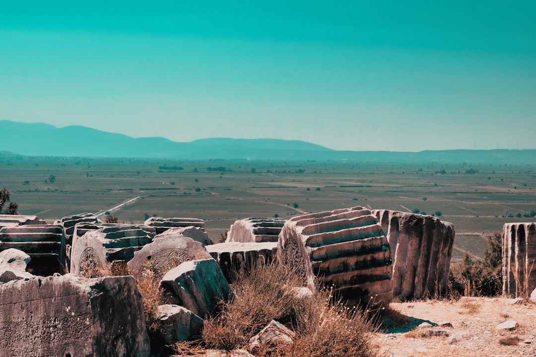
The most dramatic and widely publicized LiDAR-driven archaeological breakthroughs in 2024 continue to emerge from dense jungle environments, where the technology’s capacity to strip away vegetative cover is its greatest asset. These sites, often hidden in plain sight for millennia, are now being revealed not as scattered ruins, but as intricately planned and densely populated urban centers. The extent and complexity of these discovered settlements are frequently exceeding prior assumptions, forcing a re-evaluation of the scale and sophistication of ancient societies.
Mesoamerica: A City of Kings and Canals
In the heart of the Petén Basin in Guatemala, a region already renowned for its Mayan archaeological treasures, 2024 has seen the publication of extensive LiDAR surveys that have revealed the true footprint of ancient cities. What were once perceived as isolated ceremonial centers are now understood as sprawling metropolises, interconnected by a vast network of roads, causeways, and, most strikingly, sophisticated hydraulic systems. These new maps showcase the intricate planning and engineering prowess of the Maya, demonstrating an understanding of water management that allowed them to thrive in a challenging tropical environment. The sheer density of structures unearthed — residential areas, agricultural terraces, plazas, and even defensive fortifications — paints a picture of population sizes and organizational complexity far greater than previously estimated, challenging the notion of Mayan collapse and instead highlighting their resilience and adaptability. Imagine a tapestry woven by human hands, so vast and intricate that only by stepping back, or in this case, by digitally lifting the heavy weave of the forest, can its full grandeur be appreciated.
Southeast Asia: Rice Paddies and Citadel Walls
Regions such as Cambodia and Thailand, where dense jungle conceals the remnants of ancient Khmer and subsequent kingdoms, have also been profoundly impacted by LiDAR. In 2024, ongoing research continues to build upon previously released data, identifying previously unknown temple complexes, extensive agricultural landscapes that fed burgeoning populations, and even early urban planning beyond the immediate vicinity of major known sites. The LiDAR data can map ancient rice paddies, suggesting sophisticated agricultural management and a deep understanding of ecological niches. Furthermore, the identification of defensive earthworks and moats reveals insights into regional political dynamics and potential conflicts, offering a more nuanced understanding of life beyond the monumental architecture.
Africa: Landscapes of Lost Civilizations
While often associated with Mesoamerica and Southeast Asia, LiDAR is proving equally invaluable in uncovering Africa’s rich archaeological heritage. In regions like the Sudan and parts of West Africa, where historical records are sparse and vegetation can be a significant impediment to fieldwork, LiDAR is lifting the veil on ancient urbanism and agricultural systems. Discoveries in 2024 are continuing to illuminate the scale of kingdoms and empires that once flourished, revealing the extent of their infrastructure and their capacity to shape their environments.
Rethinking Ancient Infrastructure: Roads, Waterways, and Urban Planning
The ability of LiDAR to precisely map the ground surface has fundamentally altered our understanding of ancient infrastructure. It is no longer sufficient to attribute a few scattered ruins to a civilization; LiDAR analysis now reveals the connective tissue that held these societies together, the sophisticated systems they employed to manage resources and move people and goods. This has led to a profound re-evaluation of the scale and organizational capacity of ancient polities.
The Arteries of Empire: Rediscovering Ancient Road Networks
One of the most significant recurring discoveries facilitated by LiDAR is the revelation of extensive and complex ancient road networks. These are not merely dirt paths but often highly engineered causeways, raised above marshy ground or cut into hillsides, demonstrating meticulous planning and significant labor investment. The 2024 archaeological discourse is rife with examples of LiDAR data revealing these ancient arteries, connecting settlements, facilitating trade, and undoubtedly serving military and administrative purposes. Understanding the scale and connectivity of these road systems provides crucial insights into the economic power, political reach, and social organization of ancient civilizations. It’s like finding the hidden circulatory system of a long-deceased giant, revealing how vital nutrients and information once flowed.
Water as the Lifeblood: Uncovering Hydraulic Systems
In many regions, particularly those with challenging water availability or prone to seasonal flooding, LiDAR has been instrumental in uncovering intricate hydraulic systems. These include canals, reservoirs, dams, and agricultural terracing designed to manage water resources for irrigation, domestic use, and even defense. The sophistication and scale of these ancient water management systems underscore the advanced engineering knowledge and organizational capabilities of these societies. The discoveries in 2024 continue to showcase this, with evidence of complex urban water supply systems and vast agricultural landscapes made possible by controlled water distribution.
The Blueprint of Cities: Urban Layouts Revealed
Beyond individual structures, LiDAR is providing archaeologists with the rare opportunity to examine the overall urban planning of ancient settlements. The technology can reveal the deliberate organization of residential areas, public spaces, ceremonial precincts, and defensive perimeters, offering insights into the social hierarchy, cultural values, and daily life of the inhabitants. In 2024, the analysis of LiDAR data is leading to a deeper understanding of how ancient cities were designed and how they functioned as living, breathing entities, rather than just collections of buildings.
Beyond the Surface: LiDAR and Landscape Archaeology
LiDAR’s capabilities extend beyond the immediate confines of settlements to encompass the broader archaeological landscape. By generating detailed topographical maps, it allows archaeologists to understand how ancient peoples interacted with and modified their environments on a large scale, revealing patterns of resource utilization, land management, and territorial organization.
Agricultural Terraces and Land Modification
Across many parts of the world, LiDAR has been instrumental in identifying extensive systems of agricultural terracing. These structures, often subtle at ground level and easily obscured by vegetation or erosion, become strikingly clear in LiDAR-generated elevation models. The 2024 research is continuing to build upon the understanding of how these terraces transformed hillsides into productive farmland, allowing for increased food production and supporting larger populations. Beyond terraces, LiDAR can reveal evidence of land clearance, soil management, and other forms of landscape modification that speak to a sustained and deliberate human imprint on the environment.
The Ghostly Traces of Ancient Populations
LiDAR can also reveal more ephemeral traces of past human activity. Subtle changes in elevation, linear features that might not be immediately apparent, or the patterns of soil and vegetation can all be indicators of ancient settlement, agricultural fields, or even migratory routes. These are the whispers of past presence that LiDAR can amplify for the modern ear. The ongoing analysis in 2024 continues to uncover these subtle features, providing a more comprehensive picture of human presence across vast geographical areas.
Paleoenvironmental Reconstruction and Human Impact
By revealing the detailed topography, LiDAR data can be integrated with paleoclimate and paleoenvironmental studies. This allows archaeologists to reconstruct past environmental conditions and to assess the impact of human activities on these environments over time. Understanding how ancient societies adapted to or altered their landscapes is crucial for understanding their sustainability and their ultimate fate.
Recent advancements in lidar technology have significantly enhanced archaeological discoveries, allowing researchers to uncover hidden structures and landscapes that were previously obscured by vegetation. An intriguing article discussing these developments can be found at Real Lore and Order, where experts share insights on how lidar is revolutionizing our understanding of ancient civilizations. This innovative approach not only reveals new sites but also provides a clearer picture of historical contexts, making it an exciting time for archaeology.
The Future of Discovery: Ongoing Advancements and Ethical Considerations
| Discovery | Location | Date Discovered | Significance | Lidar Technology Used | Area Covered (sq km) |
|---|---|---|---|---|---|
| Ancient City Ruins | Guatemala | March 2024 | Revealed previously unknown urban layout | High-resolution airborne lidar scanning | 150 |
| Burial Mounds Complex | Mississippi, USA | January 2024 | Identified over 50 new burial mounds | Drone-mounted lidar system | 25 |
| Lost Road Network | Peru | May 2024 | Mapped extensive Incan road system | Satellite-based lidar | 300 |
| Neolithic Settlement | France | April 2024 | Discovered settlement layout and fortifications | Terrestrial lidar scanning | 10 |
| Temple Complex | Cambodia | February 2024 | Uncovered hidden temple structures beneath jungle | Airborne lidar with multispectral imaging | 80 |
As LiDAR technology continues to evolve and its application in archaeology becomes more sophisticated, the future promises even more groundbreaking discoveries. However, this powerful tool also brings with it important ethical considerations that must be thoughtfully addressed.
Miniaturization and Accessibility: The Rise of Drones
The increasing miniaturization and affordability of drone technology have made LiDAR accessible to a wider range of archaeological projects, from small university field schools to large-scale national surveys. Drones offer greater flexibility in data acquisition, allowing for higher resolution mapping of smaller areas and access to remote or challenging terrain. The proliferation of drone-based LiDAR in 2024 is democratizing access to this technology, enabling more researchers to participate in cutting-edge discoveries.
Integrated Data and AI: Deeper Insights
The future of LiDAR in archaeology lies not just in the technology itself but in its integration with other data sources and the application of advanced analytical techniques. Combining LiDAR data with satellite imagery, ground-penetrating radar, and archaeobotanical findings, for example, can provide a more holistic understanding of ancient sites. Furthermore, the application of artificial intelligence and machine learning algorithms to LiDAR data is showing immense promise in automatically identifying features and patterns that might be missed by human interpreters, accelerating the pace of discovery.
Preservation and Community Engagement: Responsible Discovery
As LiDAR reveals more about previously unknown or understudied sites, it raises crucial questions about their preservation and management. The increased visibility of these sites can make them vulnerable to looting and unregulated tourism. It is paramount that the archaeological community works closely with local authorities and indigenous communities to ensure that these discoveries are managed responsibly. The ethical imperative of respecting cultural heritage and ensuring that discoveries benefit the communities from which they originate is a growing focus in 2024 and beyond. The power of LiDAR is undeniable, but its application must be tempered with wisdom and a commitment to responsible stewardship of our shared past.
WATCH NOW ▶️ WARNING: The Giza Muon Scans Just Changed Everything
FAQs
What is LiDAR technology and how is it used in archaeology?
LiDAR (Light Detection and Ranging) is a remote sensing technology that uses laser pulses to create high-resolution 3D maps of the Earth’s surface. In archaeology, it helps detect and map ancient structures, landscapes, and features hidden beneath dense vegetation or soil without excavation.
What are some significant archaeological discoveries made using LiDAR in 2024?
In 2024, LiDAR technology has led to the discovery of previously unknown ancient cities, complex road networks, and ceremonial sites in regions such as Central America, Southeast Asia, and Africa. These findings have provided new insights into ancient civilizations and their development.
How does LiDAR improve the efficiency of archaeological surveys?
LiDAR allows archaeologists to quickly survey large and difficult-to-access areas with high precision. It reduces the need for extensive ground excavation by revealing hidden features from aerial scans, saving time and resources while minimizing environmental impact.
Are there limitations to using LiDAR in archaeological research?
Yes, LiDAR cannot detect artifacts or features buried deep underground and may require complementary methods like ground-penetrating radar or excavation. Additionally, dense urban areas or water bodies can limit the effectiveness of LiDAR scanning.
What future developments are expected in LiDAR technology for archaeology?
Future advancements may include higher resolution sensors, improved data processing algorithms, and integration with other remote sensing technologies. These improvements will enhance the ability to detect smaller or more subtle archaeological features and provide more detailed site analyses.