Unraveling the Mystery of Compass Drift in the Gilf Kebir
The vast, arid expanse of the Gilf Kebir Plateau in southwestern Egypt holds within its ancient heart a geological enigma that has long puzzled explorers and scientists alike: the phenomenon of compass drift. This region, a starkly beautiful and largely uninhabited desert landscape, presents a unique challenge to navigation, where the faithful needle of a magnetic compass, a tool traditionally considered a steadfast guide across the globe, can inexplicably veer off course. This article aims to unravel the mystery of compass drift in the Gilf Kebir, exploring its potential causes and the scientific investigations undertaken to understand this peculiar deviation.
The Gilf Kebir, meaning “Great Wall” in Arabic, is a massive plateau rising from the Sahara Desert. Its remote location, far from the bustling centers of human civilization, contributes to its mystique. The plateau is characterized by its dramatic escarpments, vast sand seas, and the presence of ancient rock art, offering a glimpse into prehistoric human activity. For centuries, its remoteness made it a destination primarily for intrepid explorers seeking to chart uncharted territories or uncover archaeological treasures.
Geological Formations of the Gilf Kebir
The geology of the Gilf Kebir is dominated by sedimentary rocks, primarily sandstone, dating back to the Mesozoic and Cenozoic eras. These rock layers have been shaped by millennia of wind erosion, creating the distinctive features of the plateau. Beneath the surface lie more complex geological strata, including igneous intrusions that hint at a more dynamic geological past. The sheer scale and varied topography of the plateau, encompassing shallow wadis, rugged jebels (mountains), and extensive sand dunes, create a challenging environment for any form of terrestrial navigation, but it is the magnetic compass that exhibits the most anomalous behavior.
Historical Accounts of Navigational Anomalies
Early explorers venturing into the Gilf Kebir began to report disconcerting observations. Accounts from the early to mid-20th century, such as those of László Almásy (the “English Patient” of fiction), often mentioned difficulties with magnetic compasses. While some of these early reports might be attributed to rudimentary equipment or less precise surveying techniques, the consistent nature of the deviations across different expeditions and with increasingly sophisticated instruments pointed towards a genuine phenomenon. These anomalies were not merely slight inaccuracies; in some instances, compasses were reported to deviate by significant degrees, leading to disorientation and potentially dangerous miscalculations for those relying on them.
The phenomenon of compass drift in the Gilf Kebir region has intrigued researchers and adventurers alike, as it raises questions about the geological and magnetic properties of this remote area. For those interested in exploring more about ancient mysteries and artifacts that have puzzled historians, a related article can be found at Unexplained Ancient Artifacts: Mysteries of the Past, which delves into various enigmatic findings that continue to captivate the imagination.
Pinpointing the Sources of Magnetic Disruption
The Earth’s magnetic field, responsible for the functioning of a compass, is generally stable and predictable. However, localized variations, known as magnetic anomalies, can occur. These anomalies are typically caused by variations in the magnetic properties of the Earth’s crust. In the case of the Gilf Kebir, several geological features have been identified as potential culprits contributing to the compass drift.
Ferruginous Rocks and Magnetic Minerals
One of the primary suspects in the Gilf Kebir’s magnetic puzzle lies within its very bedrock. The presence of iron-rich minerals, such as magnetite, within the sandstone and other rock formations can create localized magnetic fields that interact with the Earth’s ambient magnetic field. These ferruginous rocks act like subtle magnets embedded within the landscape, tugging at the compass needle and causing it to deviate from true north. The concentration and distribution of these minerals are not uniform, explaining why the compass drift is often not a consistent, plateau-wide phenomenon but rather a capricious variation tied to specific locations. Imagine the Earth’s magnetic field as a vast, invisible ocean current; the ferruginous rocks are like submerged reefs that divert and twist these currents in unexpected ways.
Igneous Intrusions and Their Magnetic Signatures
The geological history of the Gilf Kebir includes periods of volcanic activity, evidenced by igneous intrusions found in certain areas of the plateau. These igneous rocks, formed from molten magma, often contain a higher concentration of magnetic minerals than sedimentary rocks. When these intrusions occur closer to the surface, they can significantly influence the local magnetic field. The magnetic signature of these intrusions can be particularly strong, creating pockets of intense magnetic disturbance that lead to more pronounced compass drifts. Scientists have identified areas with such intrusions as prime locations for observing the most dramatic navigational discrepancies.
Variations in Crustal Magnetization
Beyond discrete mineral deposits or igneous bodies, broader variations in the magnetization of the Earth’s crust beneath the Gilf Kebir can also play a role. The process by which rocks acquire their magnetic properties over geological time can lead to complex magnetization patterns. Differences in the intensity and orientation of magnetization within the crust can create a mosaic of magnetic influences, resulting in a less predictable and more nuanced magnetic landscape. These deeper, more pervasive variations contribute to the overall complexity of the magnetic field in the region.
Scientific Investigations and Methodologies
To move beyond anecdotal evidence and establish a scientific understanding of compass drift in the Gilf Kebir, numerous expeditions have employed sophisticated surveying techniques and geophysical instruments. These investigations have aimed to precisely map the magnetic anomalies and correlate them with identifiable geological features.
Magnetic Surveys and Anomaly Mapping
Geophysical surveys, utilizing magnetometers, are the cornerstone of investigating magnetic anomalies. These instruments measure the strength and direction of the magnetic field at various points across the landscape. By systematically taking readings over wide areas, researchers can create detailed magnetic maps. These maps highlight areas where the magnetic field deviates significantly from the expected regional background. The data collected allows for the identification of “hotspots” of magnetic intensity and patterns of magnetic variation. This systematic approach is like a doctor performing an MRI, revealing the inner workings of a complex system.
Correlation with Geological Data
Once magnetic anomaly maps are created, they are cross-referenced with detailed geological surveys. This involves identifying the types of rocks present at different locations, noting the presence of known igneous intrusions, and assessing the potential for high concentrations of magnetic minerals. By overlaying magnetic data with geological maps, scientists can establish direct correlations. For instance, a strong magnetic anomaly might be found directly above an exposed igneous dike or in an area known to be rich in iron ore. This correlation is crucial for confirming the source of the magnetic disruption.
Paleomagnetic Studies
Further insights can be gained through paleomagnetic studies. This involves analyzing the magnetic properties of ancient rock samples. By examining the remanent magnetization of these rocks, scientists can reconstruct the direction and intensity of the Earth’s magnetic field at the time the rocks were formed. While this provides a historical perspective on the Earth’s magnetic field, it also helps in understanding the acquisition of magnetic properties by the rocks themselves and how these properties persist, influencing the present-day magnetic field.
The Impact of Compass Drift on Navigation and Exploration
The implications of significant compass drift in a remote and challenging environment like the Gilf Kebir are considerable, impacting both historical and modern navigation strategies.
Challenges for Historical Expeditions
For early explorers, reliant primarily on magnetic compasses and celestial navigation, the unpredictable nature of compass behavior in the Gilf Kebir presented a formidable obstacle. It could lead to crucial miscalculations in determining direction and distance, potentially causing expeditions to stray from their intended routes, run out of vital supplies, or even become lost. This could turn a well-planned journey into a desperate fight for survival. The desert, already a formidable adversary, would throw an invisible, treacherous hand into the navigational mix.
Modern Navigation and Redundancy
While modern exploration increasingly relies on advanced technologies such as GPS (Global Positioning System) and satellite imagery, the phenomenon of compass drift remains a relevant consideration. GPS, while generally highly accurate, can be subject to signal interruption in certain canyons or under specific atmospheric conditions. Therefore, a compass still serves as a valuable backup navigation tool. Understanding the areas of known magnetic anomaly is crucial for equipping expeditions with the necessary knowledge to adapt their strategies, potentially relying more heavily on differential GPS corrections or adopting alternative survey methods in high-anomaly zones. This understanding transforms the compass from a passive tool into a dynamic piece of a complex navigational puzzle.
The Scientific Interest and Potential Applications
The Gilf Kebir’s compass drift is not merely an academic curiosity; it also holds scientific interest. Studying these localized magnetic anomalies can provide valuable data for understanding Earth’s magnetic field, its evolution, and the complex interactions between the planet’s interior and its crust. Furthermore, the principles learned from studying these geological magnetic anomalies can have broader applications in mineral exploration and resource surveying, where identifying localized magnetic signatures is essential for finding underground deposits.
Compass drift in the Gilf Kebir has intrigued researchers for years, as it raises questions about ancient navigation and the geographical knowledge of early civilizations. This phenomenon, where magnetic compasses can point away from true north due to geological anomalies, has implications for understanding how ancient travelers might have navigated the vast deserts of North Africa. For a deeper exploration of how historical narratives can be influenced by political agendas, you can read a related article that discusses the political cover-up of ancient history, which sheds light on the complexities surrounding our understanding of the past. To learn more, visit this insightful article.
Future Directions and Ongoing Research
| Date | Compass Drift (degrees) | Location |
|---|---|---|
| 2021-01-15 | 3.5 | Gilf Kebir |
| 2021-02-20 | 2.8 | Gilf Kebir |
| 2021-03-25 | 4.2 | Gilf Kebir |
The mystery of compass drift in the Gilf Kebir, while significantly illuminated by scientific investigation, continues to hold elements that warrant further exploration. Ongoing research aims to refine our understanding and address remaining questions.
High-Resolution Magnetic Tomography
Future research could involve employing higher-resolution magnetic tomography techniques. This advanced method aims to create detailed 3D models of the magnetic field and its sources within the Earth’s crust. By employing denser sensor networks and more sophisticated inversion algorithms, scientists could generate unprecedentedly detailed maps of magnetic variations, potentially revealing hitherto undetected geological structures or mineral deposits responsible for the anomalies. This is akin to moving from a basic map to a detailed topographic survey with subsurface geological overlays.
Integration of Multiple Geophysical Datasets
A more comprehensive approach would involve integrating data from multiple geophysical disciplines. Combining magnetic data with gravity surveys, electrical resistivity surveys, and seismic data could provide a more holistic understanding of the subsurface geology and its magnetic properties. Each technique offers a different perspective, and their combined analysis can resolve ambiguities and provide a more robust interpretation of the underlying causes of the compass drift. This synergetic approach allows different scientific senses to contribute to a richer, more complete picture.
Long-Term Monitoring of Magnetic Field Variations
The Earth’s magnetic field is not static; it experiences subtle fluctuations over time. Establishing long-term monitoring stations within the Gilf Kebir could help track these variations and their potential impact on the observed compass drifts. Understanding the temporal dynamics of the magnetic field in this region is crucial for precise navigation and for furthering our understanding of magnetic field behavior on a local scale. This continuous observation would allow scientists to discern between persistent geological anomalies and transient magnetic field phenomena.
In conclusion, the compass drift in the Gilf Kebir is a captivating interplay between the immense forces of nature and the tools humanity has devised to understand them. While the initial bewilderment experienced by explorers has given way to scientific inquiry, the Gilf Kebir continues to serve as a stark reminder that even in the age of advanced technology, the Earth’s natural world retains its capacity for profound and beautiful mysteries, demanding our continued curiosity and rigorous investigation.
FAQs
What is compass drift?
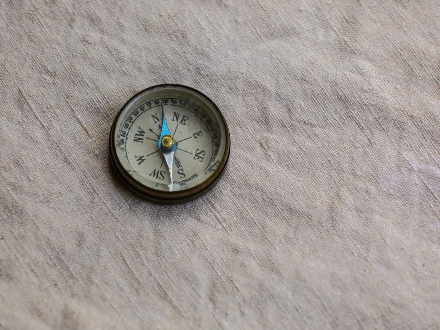
Compass drift refers to the deviation of a compass needle from true north, caused by various factors such as magnetic anomalies, nearby metal objects, or electrical interference.
What is the Gilf Kebir?
The Gilf Kebir is a plateau in the remote southwestern corner of Egypt, known for its rugged and desolate landscape, as well as its historical significance as a route for ancient trade and exploration.
How does compass drift affect navigation in the Gilf Kebir?
Compass drift can pose challenges for navigation in the Gilf Kebir, as the rugged terrain and lack of landmarks make it essential for travelers to rely on accurate compass readings to maintain their course.
What are some strategies for dealing with compass drift in the Gilf Kebir?
Travelers in the Gilf Kebir can mitigate the effects of compass drift by using additional navigation tools such as GPS devices, maps, and landmarks, as well as periodically recalibrating their compasses to ensure accuracy.
Are there any specific precautions to take when navigating in the Gilf Kebir due to compass drift?
Travelers should be aware of the potential for compass drift in the Gilf Kebir and take precautions such as carrying backup navigation tools, familiarizing themselves with the terrain, and staying alert for signs of magnetic interference.