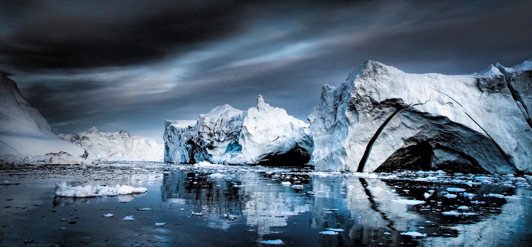
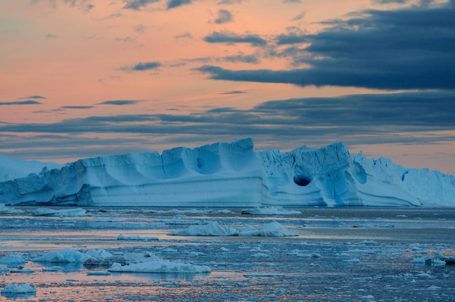
The vast, ancient expanse of the Greenland Ice Sheet conceals a geological landscape sculpted by time and hidden from direct observation. Beneath its frigid dominion lie subglacial structures, a complex array of landforms, hydrological systems, and potentially, geological features that challenge our understanding of ice sheet dynamics and Earth’s cryosphere. These hidden realms, illuminated by increasingly sophisticated geophysical techniques, offer a window into processes that have shaped and continue to influence Greenland’s ice, its meltwater runoff, and its contribution to global sea-level rise.
The sheer thickness of the Greenland Ice Sheet, in places exceeding three kilometers, renders direct exploration of the bedrock and its features an immense undertaking. For decades, our understanding of what lay beneath was largely speculative, inferred from the behavior of glaciers and the limited rock samples retrieved from the ice margins. However, the advent of airborne geophysical surveys, particularly ice-penetrating radar, has revolutionized our ability to map this hidden topography. These technologies emit radio waves that penetrate the ice and reflect off the bedrock, allowing scientists to construct three-dimensional models of the subglacial landscape.
Ice-Penetrating Radar: Peering Through the Ice
Ice-penetrating radar works by transmitting pulses of electromagnetic radiation into the ice sheet. As these waves encounter changes in dielectric properties – primarily at the ice-bedrock interface but also at internal ice layers – they are reflected back to receivers on the aircraft. The time it takes for the signal to travel down and back, combined with a known velocity of radio waves in ice, allows for the calculation of ice thickness. More advanced radar systems, employing multiple frequencies and sophisticated signal processing, can resolve finer details of the subglacial surface, revealing features such as mountains, valleys, and even residual sediments. The resolution is limited, however, by the complexity of the ice itself, including internal layers and saturated ice zones.
Other Geophysical Methods: Complementary Insights
While radar is the primary tool, other geophysical methods provide complementary data. Magnetic surveys can reveal variations in the magnetic properties of the bedrock, hinting at different geological formations. Gravimetry measures subtle variations in the Earth’s gravitational field, which can be influenced by the density of underlying rocks, offering clues about the composition and structure of the subglacial crust. Seismic surveys, though logistically challenging to conduct over the vast ice sheet, can provide more detailed information about subsurface geological structures. The integration of data from these diverse methods is crucial for building a comprehensive picture of the subglacial environment.
Recent discoveries beneath the Greenland ice have sparked intrigue among researchers, suggesting the presence of non-human structures that may date back thousands of years. These findings have led to various theories about ancient civilizations and their potential impact on the environment. For a deeper exploration of this topic, you can read the article titled “The Ancient City Planning Disaster” which delves into the implications of such structures and their significance in understanding human history. You can find it here: The Ancient City Planning Disaster.
Subglacial Hydrology: The Plumbing Beneath the Ice
One of the most significant discoveries in subglacial research has been the pervasive presence of water. Far from being a dry, static interface, the base of the Greenland Ice Sheet is a dynamic hydrological system, characterized by channels, lakes, and the flow of meltwater. This subglacial plumbing plays a critical role in the movement of the ice itself.
Subglacial Lakes: Hidden Reservoirs
Airborne radar has revealed the presence of numerous subglacial lakes, bodies of liquid water trapped beneath the ice. These lakes vary in size, from small puddles to vast expanses hundreds of square kilometers in area. Their presence is often inferred from radar reflections that indicate a smooth, specular surface at the ice-bedrock interface, consistent with a water layer. The formation of these lakes is complex, involving basal melting due to geothermal heat, frictional heat generated by ice movement, and the pressure of the overlying ice.
Formation and Drainage of Subglacial Lakes
The evolution of subglacial lakes is an active area of research. They can form and drain episodically, a process known as “subglacial lake outburst floods.” The filling of a lake increases the water pressure at the base of the ice, potentially reducing friction and accelerating ice flow. When a lake drains, it can do so through ice tunnels or by eroding the bedrock, releasing a significant volume of water and sediment and potentially triggering or influencing ice flow dynamics downstream.
Subglacial Drainage Systems: Glacial Rivers and Channels
Beneath the ice, extensive drainage networks of rivers and channels transport meltwater from the interior of the ice sheet towards the coast. These systems can be characterized by wide, braided channels or narrow, incised tunnels. The flow within these channels is influenced by pressure gradients, the slope of the bedrock, and the amount of water available from surface melt and basal melting. Understanding the geometry and connectivity of these drainage systems is essential for predicting how meltwater will be routed and how it will impact ice flow and coastal processes.
The Role of Basal Melting in Water Production
Basal melting is a primary source of water for subglacial hydrological systems. Geothermal heat flux from the Earth’s interior, coupled with frictional heating from ice movement, contributes to melting at the ice-bedrock interface. In warmer regions or where ice flow is rapid, this melting can be substantial, providing the water needed to fill lakes and drive drainage systems. The efficiency of basal melting is directly influenced by the temperature and properties of the ice base and the underlying bedrock.
Subglacial Landforms: Evidence of Past and Present Processes
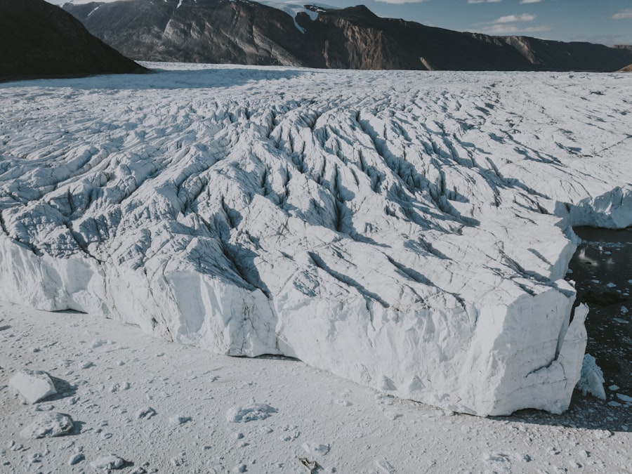
The interaction between the ice and the bedrock has sculpted a variety of landforms beneath the Greenland Ice Sheet. These features provide invaluable insights into the history of glaciation, the erosional and depositional power of ice, and the current state of the ice-bedrock interface.
Erosional Features: Scars of Ice Movement
The relentless movement of ice over bedrock can lead to significant erosion. Features such as glacial
Depositional Features: Sedimentary Signatures
Beneath the ice, sediments are deposited by glacial meltwater and the ice itself. These deposits can include sandur plains, moraines, and till. Identifying these features can reveal information about the thermal regime of the ice base. For instance, a cold, frozen bed is less likely to erode and deposit sediment than a warmer, thawed bed. The nature and distribution of these sedimentary features can also indicate the proximity of the ice margin and the types of hydrological processes that were dominant in different areas.
Bedforms: Indicators of Flow Dynamics
Microscopic bedforms, such as ripples and dunes, can develop at the ice-bedrock interface, particularly in areas with flowing water. These bedforms are analogous to those found in rivers and deserts and can provide detailed information about the direction and velocity of subglacial water flow. Their presence suggests a dynamic hydrological regime and a relatively uncoupled basal ice condition.
Climate Change and the Subglacial Environment: A Cascading Impact
The accelerating warming of the Arctic due to climate change is having a profound impact on Greenland’s ice sheet, and these changes are clearly being echoed in the subglacial environment. This interaction is complex and can lead to feedback loops that further influence ice loss.
Increased Surface Meltwater: Fueling Subglacial Systems
Warmer temperatures are leading to a significant increase in surface meltwater production in Greenland. This meltwater can percolate through crevasses and moulins to reach the base of the ice sheet, lubricating the interface and potentially accelerating ice flow. The increased influx of water can also reorganize existing subglacial drainage systems, leading to more efficient transport of meltwater to the ocean.
The Impact of Meltwater on Ice Sheet Dynamics
The increased lubrication at the ice base can reduce basal friction, allowing the ice to flow more rapidly towards the sea. This phenomenon, known as “basal sliding,” is a significant contributor to Greenland’s overall mass loss. The timing and distribution of surface meltwater are therefore critical factors in controlling ice sheet behavior and its contribution to sea-level rise. Understanding how this meltwater interacts with the complex subglacial topography and hydrology is a paramount scientific challenge.
Subglacial Geothermal Heat: A Constant Factor
While surface meltwater is a dynamic and increasing factor, the Earth’s internal heat flux remains a constant influence on the subglacial environment. Geothermal heat contributes to basal melting, particularly in areas with thinner ice or where the heat flow from the mantle is higher. In regions where surface meltwater contributions are minimal, geothermal heat can be the dominant driver of basal melt and subglacial water production. The interplay between geothermal heat and increasing surface meltwater influences the overall thermal regime at the ice-bedrock interface.
Recent discoveries beneath the Greenland ice have sparked intrigue among scientists, as they suggest the presence of non-human structures that could reshape our understanding of ancient civilizations. These findings have led researchers to explore the implications of such structures on historical mapping and geographical knowledge. For a deeper dive into how evolving maps reflect our understanding of the world, you can read more in this insightful article on the evolution of maps.
Future Research and Unanswered Questions: Navigating the Unknowns
| Non Human Structure | Location | Description |
|---|---|---|
| Subglacial Lake | Greenland Ice Sheet | A body of liquid water underneath the ice, possibly supporting microbial life. |
| Ice Caves | Greenland Ice Sheet | Natural hollows within the ice, formed by meltwater or geothermal heat. |
| Subglacial Channels | Greenland Ice Sheet | Channels or tunnels carrying meltwater beneath the ice, affecting ice flow and stability. |
Despite significant advances in our ability to study subglacial environments, many questions remain unanswered. The complexity of these hidden realms, coupled with the logistical challenges of direct observation, ensures that subglacial research will remain a frontier of scientific exploration for years to come.
Direct Observation: The Ultimate Goal
While geophysical methods provide broad-scale data, direct observation of subglacial features, water, and biological communities remains a challenging but ultimate goal. This could involve the development of autonomous underwater vehicles capable of navigating subglacial channels, or novel drilling techniques that can access and sample these environments with minimal disturbance. Such direct observations would provide invaluable ground-truth data to refine geophysical models and offer unprecedented insights into the processes at play.
The Search for Subglacial Life
The possibility of life existing in subglacial environments, isolated for millennia and dependent on chemosynthetic processes, is a tantalizing prospect. The discovery of microbial life in other extreme environments, such as deep-sea hydrothermal vents and Antarctic subglacial lakes, suggests that similar ecosystems could exist beneath Greenland’s ice. Investigating these potential life forms would require specialized sampling techniques that prevent contamination and preserve delicate biological structures.
Refining Ice Flow Models: Predicting Global Impacts
A more comprehensive understanding of subglacial topography, hydrology, and thermal conditions is essential for improving the accuracy of ice flow models. These models are critical for predicting future ice loss from Greenland and its contribution to global sea-level rise. By incorporating detailed subglacial data, scientists can develop more robust simulations of how changes in meltwater, basal sliding, and ice sheet dynamics will unfold in a warming world. The subglacial realm is not merely a geological curiosity; it is a critical component in understanding the future of our planet’s coastlines and the millions of people who live near them. The mysteries under Greenland’s ice are slowly yielding their secrets, but the journey of discovery is far from over.
FAQs
What is the non-human structure under the Greenland ice?
The non-human structure under the Greenland ice refers to a mysterious object or formation that has been detected beneath the ice sheet in Greenland. Its exact nature and origin are currently unknown.
How was the non-human structure discovered?
The non-human structure was discovered using ice-penetrating radar technology, which allows scientists to see beneath the thick layers of ice in Greenland. The radar data revealed the presence of an unusual and unexpected feature beneath the ice.
What are some theories about the origin of the non-human structure?
There are various theories about the origin of the non-human structure, ranging from natural geological formations to potential man-made or extraterrestrial origins. However, without further investigation and analysis, it is difficult to confirm any specific theory.
What are the implications of the discovery of the non-human structure?
The discovery of the non-human structure has sparked curiosity and speculation among scientists and the public. It has raised questions about the history of the Greenland ice sheet and the potential for unknown or unexpected features to be hidden beneath the ice.
What are the next steps in investigating the non-human structure?
The next steps in investigating the non-human structure may involve further radar surveys, ice core sampling, and potentially even direct exploration of the area beneath the ice. Scientists and researchers are likely to continue studying the data and considering various hypotheses in order to better understand the nature of the mysterious structure.