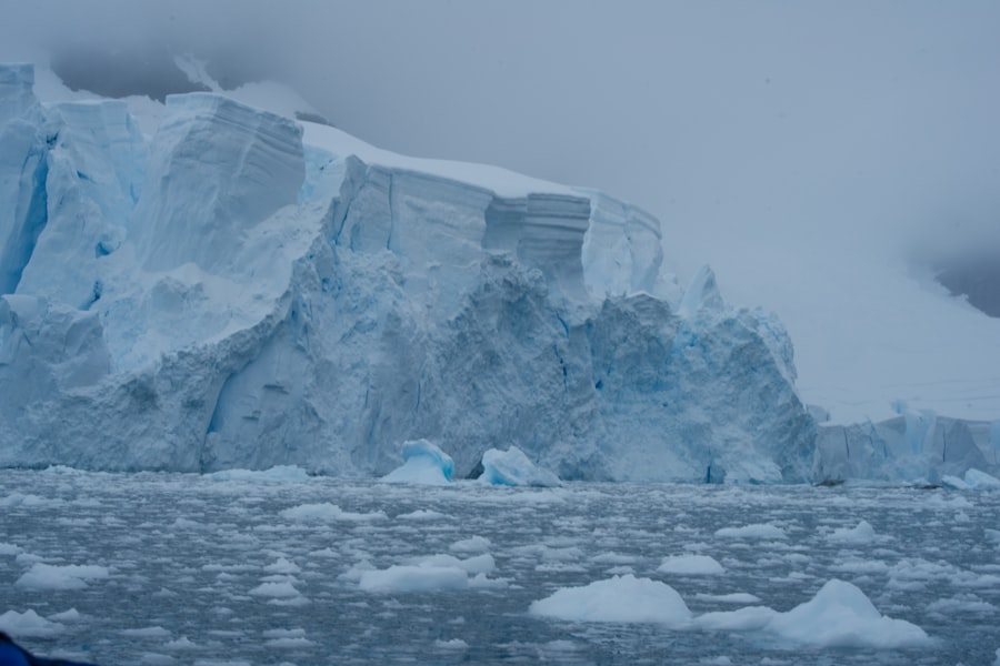
The vast, White Continent, shrouded in perpetual ice, holds within its frozen depths a chronicle of Earth’s climatic past, a history largely obscured until recent advancements in geophysical surveying and data analysis began to peel back its icy facade. The Antarctic ice sheet, a colossal entity covering approximately 14 million square kilometers and containing about 90% of the world’s fresh water, is a dynamic system shaped by millennia of accumulation and ablation. Uncovering its history is not merely an academic pursuit; it is essential for understanding past climate change, predicting future sea-level rise, and comprehending the intricate feedbacks within the Earth system. Satellite imagery and ground-based investigations, when integrated and visualized on comprehensive maps, provide compelling evidence for the evolution of this immense ice mass.
Beneath the seemingly uniform expanse of Antarctic ice lies a complex and varied landscape, a hidden topography that profoundly influences ice flow, stability, and past behavior. Mapping this subglacial bedrock is a critical first step in deciphering the ice sheet’s history. Without understanding the contours of the land upon which the ice rests, interpreting its thickness variations and past extents would be an impossible task.
Remote Sensing Technologies: The Eyes Above
The sheer inaccessibility of the Antarctic bedrock necessitates the use of sophisticated remote sensing technologies. Airborne surveys, flown by specialized aircraft equipped with advanced instrumentation, are the primary means of penetrating the ice.
Ice-Penetrating Radar: Echoes from Below
Ice-penetrating radar systems emit radio waves that travel through the ice and reflect off the bedrock interface. By analyzing the time it takes for these echoes to return, scientists can determine the ice thickness at various points. The strength and characteristics of the reflected signal also provide clues about the composition and roughness of the bedrock. Numerous airborne radar surveys, conducted over decades by national Antarctic programs, have generated vast datasets across the continent. These data have been meticulously processed and compiled to create detailed maps of ice thickness.
Gravity and Magnetic Field Measurements: Inferring Subsurface Structure
Complementary geophysical methods, such as gravimetry and magnetometry, are also employed from the air. Variations in the Earth’s gravity field can indicate differences in subsurface rock density, suggesting the presence of mountains, valleys, or different geological formations beneath the ice. Similarly, magnetic anomalies can reveal the presence of igneous rocks or other magnetic minerals. These datasets, when integrated with radar information, provide a more holistic picture of the subglacial landscape, helping to differentiate between solid bedrock, sedimentary basins, and even subglacial water bodies.
Integrating Diverse Datasets: The Power of Synthesis
The true power of mapping subglacial topography emerges when these disparate datasets are integrated and visualized. Sophisticated Geographic Information Systems (GIS) are used to combine radar altimetry, gravity anomalies, and magnetic data, creating comprehensive digital elevation models (DEMs) of the Antarctic bedrock.
Creating Digital Elevation Models (DEMs): Visualizing the Hidden Continent
These DEMs transform abstract geophysical measurements into tangible, three-dimensional representations of the underlying landmass. They reveal ancient mountain ranges, vast sedimentary basins, and deep rift valleys, many of which would be otherwise unknown. The influence of these topographic features on ice dynamics is profound. For instance, ice sheets tend to flow more slowly over elevated areas and can accumulate in depressions. Understanding these channeling effects is crucial for modeling past ice sheet behavior.
Identifying Drainage Basins and Basins of Accumulation: Ice Flow Pathways
The DEMs allow scientists to identify major subglacial drainage basins and areas where ice is likely to accumulate. These features act as conduits and reservoirs, guiding the flow of ice towards the coast and influencing the overall stability of the ice sheet. Mapping these pathways provides insight into how ice might have responded to past climate shifts, potentially accelerating or decelerating its flow.
The history of the Antarctic ice sheet is crucial for understanding the impacts of climate change on global sea levels. Recent studies have provided compelling evidence of how the ice sheet has evolved over millennia, revealing patterns that could predict future changes. For a deeper insight into the implications of melting ice sheets and their potential effects on island nations, you can explore the article titled “The Threat of Sinking Island Nations” available at this link. This article discusses the broader consequences of rising sea levels, which are closely linked to the dynamics of the Antarctic ice sheet.
Ice Core Records: Frozen Archives of Atmospheric History
While bedrock topography sets the stage, the ice itself is the primary archive of past climate. Antarctic ice cores, drilled deep into the ice sheet, offer an unparalleled proxy record of atmospheric composition, temperature, and precipitation over hundreds of thousands of years.
Drilling Techniques: Accessing Ancient Ice Strata
The process of extracting ice cores is a testament to human ingenuity and perseverance in an extremely challenging environment. Specialized drilling rigs, often operating on remote ice shelves or inland stations, are used to penetrate thousands of meters of ice.
Thermal Drilling: Melting Through the Ice
Thermal drills, which use hot water or an electric heating element to melt their way through the ice, are commonly employed. As the drill progresses, sections of the ice are extracted and carefully cataloged. The depth of the drill hole directly correlates to the age of the ice, with deeper ice representing older periods.
Mechanical Drilling: Extracting Intact Ice Sections
Mechanical drills, which use rotating cutters to break up the ice, are also used. These methods are essential for obtaining pristine ice samples that can be analyzed without contamination from drilling fluids. The careful retrieval of ice core sections is paramount for preserving the integrity of the paleoclimate record.
Analyzing Ice Core Components: Unlocking Past Climates
Once retrieved, ice cores are transported to specialized laboratories for meticulous analysis. Each layer of ice contains valuable information about the climate at the time it formed.
Trapped Air Bubbles: Atmospheric Composition Proxies
Tiny air bubbles trapped within the ice provide a direct sample of the ancient atmosphere. By analyzing the composition of these bubbles, scientists can determine past concentrations of greenhouse gases like carbon dioxide (CO2), methane (CH4), and nitrous oxide (N2O). These measurements reveal the historical fluctuations of these key climate drivers.
Isotopic Ratios: Temperature and Precipitation Proxies
The isotopic composition of the water molecules (H2O) within the ice also provides crucial climate information. The ratio of different oxygen isotopes (e.g., 18O to 16O) and hydrogen isotopes (e.g., deuterium to hydrogen) in the ice is directly related to the temperature at the time of snowfall. Warmer periods lead to a higher proportion of heavier isotopes. Similarly, isotopic ratios can also reflect changes in the moisture source and transport.
Dust and Volcanic Ash: Environmental Indicators
The presence of dust particles and volcanic ash layers within the ice provides valuable contextual information. Dust influx can indicate drier conditions and increased atmospheric circulation, while volcanic ash layers act as distinct time markers, allowing for the correlation of different ice cores and the dating of specific events.
Reconstructing Past Ice Sheet Extents: Evidence from the Landscape

Beyond the ice sheet itself, geological evidence preserved on the Antarctic continent and its surrounding shelves provides crucial clues about the maximum extent of the ice sheet during past glacial periods. Mapping these features requires a combination of fieldwork and remote sensing.
Glacial Landforms: Scorched Earth Remnants
The scouring power of an advancing ice sheet leaves indelible marks on the landscape. Identifying and mapping these features helps delineate the furthest reach of past ice lobes.
Moraines: Debris Piles of Glacial Advance
Moraines, consisting of till and other glacial debris deposited at the margins of an ice sheet, are some of the most direct indicators of past ice extent. Identifying and dating these moraines, particularly those forming distinct arcuate ridges, can precisely define the limits of ice cover during specific glacial maxima.
Striations and Roches Moutonnées: Sculpted Bedrock
The movement of ice over bedrock polishes and engraves the underlying rock. Glacial striations, parallel grooves etched into the rock surface by rocks embedded in the ice, indicate the direction of ice flow. Roches moutonnées, streamlined rock formations with a gently sloping up-ice side and a steep, plucked down-ice side, further reveal the erosive forces of glacial movement.
Raised Shorelines and Marine Terraces: Sea Level Indicators
In coastal areas, evidence of past sea levels provides an independent measure of ice sheet behavior. During periods of extensive glaciation, vast quantities of water are locked up in terrestrial ice sheets, leading to lower global sea levels.
Glacio-Isostatic Rebound: The Earth’s Slow Response
The immense weight of an ice sheet depresses the Earth’s crust. As ice sheets retreat, the crust slowly rebounds, a process known as glacio-isostatic adjustment. This rebound can cause formerly submerged coastlines to be uplifted above current sea level, leaving behind a series of raised beaches and marine terraces. Mapping these features helps to reconstruct past sea levels and infer the extent of ice loading.
Sediment Cores from the Continental Shelf: Submerged Evidence
The Antarctic continental shelf, now largely submerged, holds a wealth of information about past ice sheet behavior. Sediment cores recovered from the seabed can contain diamictons (unsorted glacial sediment), ice-rafted debris, and evidence of subglacial erosion, all indicating past glaciation. These cores provide direct evidence of ice sheet grounding lines and the presence of ice shelves.
Numerical Modeling: Simulating Ice Sheet Dynamics
The data gathered from bedrock mapping, ice cores, and geological evidence are indispensable for building and validating numerical models of ice sheet behavior. These models allow scientists to simulate the complex processes that govern ice sheet growth, flow, and retreat over geological timescales.
Ice Sheet Models: Computational Frameworks for Understanding
Ice sheet models are sophisticated computer programs that represent the ice sheet as a grid of cells and simulate the physical processes occurring within and around it.
Thermomechanical Ice Flow: The Physics of Movement
These models incorporate the principles of fluid dynamics and thermodynamics to simulate how ice deforms and flows under its own weight. Factors such as ice temperature, basal friction, and the influence of underlying bedrock topography are crucial inputs.
Ice-Ocean Interactions: The Role of the Marine Environment
For ice shelves and marine-terminating glaciers, the interaction with the ocean is a critical factor. Models incorporate oceanographic data, such as sea surface temperature and salinity, to simulate the melting of ice shelves from below, which can lead to significant ice loss and accelerated glacier discharge.
Assimilation of Paleoclimate Data: Improving Model Accuracy
The true power of ice sheet modeling lies in its ability to assimilate and test against the wealth of paleoclimate data. By comparing model outputs with ice core records and geological reconstructions, scientists can refine model parameters and gain confidence in their simulations.
Testing Hypotheses of Past Ice Sheet Behavior: Understanding Drivers of Change
Numerical models allow scientists to test various hypotheses about the drivers of past ice sheet changes. For example, they can investigate the relative roles of orbital forcing, greenhouse gas concentrations, and internal ice sheet dynamics in explaining major deglaciation events.
Predicting Future Ice Sheet Response: The Critical Link to Sea Level Rise
Ultimately, the goal of ice sheet modeling is to predict how the Antarctic ice sheet will respond to future climate change. By running models under various emissions scenarios, scientists can estimate the potential contribution of Antarctic ice melt to global sea-level rise, a critical concern for coastal communities worldwide.
Recent studies on the history of the Antarctic ice sheet have revealed significant insights into its evolution and the impact of climate change. Researchers have utilized advanced mapping techniques to create detailed visualizations of ice sheet dynamics over millennia. For a deeper understanding of how global geopolitical factors influence scientific exploration, you might find this article on the new space race particularly interesting. It discusses the competition for lunar resources and its implications for Earth-based research, including climate studies. You can read more about it in this related article.
Historical Maps and Visualization: The Synthesis of Evidence
| Time Period | Ice Sheet Status | Evidence |
|---|---|---|
| Early Holocene | Retreating | Analysis of sediment cores |
| Mid-Holocene | Stable | Ice core data |
| Little Ice Age | Advancing | Historical records and ice core data |
| Modern Era | Retreating | Satellite observations and ice core data |
The culmination of decades of research and technological advancement is the creation of comprehensive historical maps of the Antarctic ice sheet. These maps are not static representations but dynamic visualizations that synthesize diverse lines of evidence, offering unprecedented insight into the continent’s past.
Chronological Reconstructions: A Timeline of Ice
These maps often present chronological reconstructions, illustrating the waxing and waning of the Antarctic ice sheet over different geological periods. They depict areas that were consistently glaciated, formerly glaciated regions, and areas that may have remained ice-free refugia.
Mapping Interglacial Episodes: Periods of Reduced Ice Cover
By carefully studying geological records, scientists can identify periods when the Antarctic ice sheet was significantly smaller than its present-day extent. Maps depicting these interglacial episodes are crucial for understanding the natural variability of the ice sheet and the potential for significant ice loss under warmer conditions.
Reconstructing Glacial Maxima: The Peak of Ice Sheet Extent
Conversely, maps that delineate the maximum extent of the Antarctic ice sheet during past glacial periods are essential for understanding the drivers and consequences of widespread glaciation. These reconstructions highlight the vast continental areas that would have been covered by thick ice, impacting global sea levels and climate patterns.
Superimposing Multiple Datasets: A Holistic View
The most powerful historical maps integrate multiple layers of geophysical, geological, and paleoclimate data. This allows for a holistic understanding of the ice sheet’s evolution.
Combining Bedrock Topography with Ice Extent: Understanding Controls on Flow
Superimposing maps of subglacial topography onto reconstructions of past ice extents reveals how the underlying landmass influenced the shape and flow of the ice sheet. This helps explain why ice might have advanced or retreated along specific pathways.
Integrating Ice Core Data with Model Outputs: Validation and Refinement
Overlaying ice core records onto model simulations on these historical maps provides a visual means of validating and refining model predictions. Discrepancies between model outputs and actual data can highlight areas where our understanding of ice sheet processes needs improvement.
In conclusion, the history of Antarctica’s ice sheet is an intricate tapestry woven from geophysical measurements, paleoclimatic proxies, and sophisticated numerical models. The development and refinement of magnetic, gravity, and radar surveys have illuminated the hidden bedrock topography. Ice cores act as frozen time capsules, preserving atmospheric composition and temperature signals. Geological evidence on the continent and its margins provides tangible proof of past ice sheet extents. These disparate pieces of evidence, when integrated and visualized through comprehensive historical maps, offer an invaluable perspective on the profound climatic shifts that have shaped our planet. The ongoing efforts to uncover and map Antarctica’s ice sheet history are not merely about understanding the past; they are a critical endeavor for anticipating the future of Earth’s climate and sea levels.
FAQs
What is the history of the Antarctica ice sheet?
The Antarctica ice sheet has a long history, with evidence suggesting that it formed around 34 million years ago. Over time, the ice sheet has expanded and contracted in response to changes in climate.
What does the map of Antarctica’s ice sheet history show?
The map of Antarctica’s ice sheet history provides a visual representation of how the ice sheet has evolved over millions of years. It shows the extent of the ice sheet during different time periods, allowing researchers to track its growth and retreat.
How is the history of Antarctica’s ice sheet determined?
Scientists determine the history of Antarctica’s ice sheet through various methods, including studying ice cores, sediment samples, and geological formations. These methods provide valuable information about past climate conditions and the behavior of the ice sheet.
What does the proof of Antarctica’s ice sheet history tell us about climate change?
The proof of Antarctica’s ice sheet history can help researchers understand how the ice sheet has responded to past climate changes. This information is crucial for predicting how the ice sheet may behave in the future in response to ongoing climate change.
Why is understanding Antarctica’s ice sheet history important?
Understanding Antarctica’s ice sheet history is important for gaining insights into past climate dynamics, predicting future changes in the ice sheet, and assessing the potential impact on global sea levels. This knowledge is essential for informing climate change mitigation and adaptation strategies.