Satellite Radar Reveals Stunning Imagery of the Sahara Desert
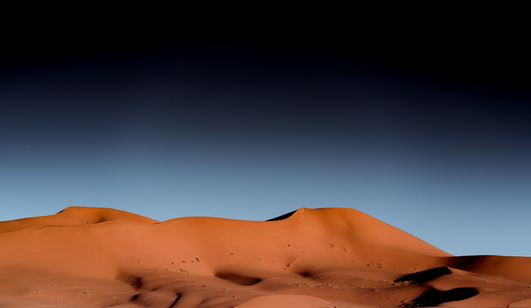
The Sahara Desert, a vast expanse of arid land that dominates the northern third of Africa, has long been a subject of human fascination and scientific inquiry. Its seemingly featureless surfaces, sculpted by wind and time, have presented unique challenges for exploration and understanding. However, recent advancements in satellite radar technology have begun to unveil a hidden world beneath the sands, revealing intricate geological formations and ancient landscapes that were previously obscured. These sophisticated imaging techniques are not only providing unprecedented detail of the desert’s topography but also offering crucial insights into its past and the dynamic processes that continue to shape it.
For decades, researchers relied on conventional aerial photography and ground surveys to map the Sahara. While these methods provided valuable information, they were largely limited to what was visible on the surface. The dense cover of sand dunes, which can reach hundreds of meters in height, effectively concealed the underlying bedrock and geological structures. The advent of Synthetic Aperture Radar (SAR) has fundamentally changed this paradigm. SAR systems, mounted on satellites, emit microwave pulses towards the Earth’s surface and analyze the backscattered signals. These signals can penetrate various materials, including dry sand, allowing them to “see” through the dunes and map what lies beneath.
How SAR Technology Works
SAR operates by sending radio waves to the ground and measuring the reflected signal. The time it takes for the signal to return, and its intensity, provide information about the distance and reflectivity of the surface. Different materials and structures reflect these waves in distinct ways, allowing scientists to differentiate between rock types, water bodies, and even changes in elevation. The “synthetic aperture” aspect refers to the process where the satellite uses its motion to simulate a much larger antenna, significantly improving its resolution. This allows for the creation of highly detailed maps and imagery, comparable to those produced by optical sensors but with the added advantage of all-weather and day-or-night imaging capabilities.
Penetrating Capabilities of Microwaves
The key to SAR’s success in the Sahara lies in the specific wavelengths of microwave radiation it employs. These wavelengths are capable of passing through dry sand relatively unimpeded. Water, however, absorbs and scatters these microwaves, which is why SAR imagery can reveal the presence of underground water sources or ancient riverbeds that are now buried. The depth to which these microwaves can penetrate is dependent on the moisture content of the sand; drier sand allows for deeper penetration. This characteristic is paramount in exploring hyper-arid regions like the Sahara where surface moisture is minimal.
Interferometric SAR (InSAR) for Topography
A specialized application of SAR, known as Interferometric SAR (InSAR), is particularly valuable for generating precise topographic maps. InSAR utilizes two SAR images acquired from slightly different orbital positions. By comparing the phase differences of the radar signals in these two images, InSAR can detect minute changes in elevation – down to centimeter-level accuracy. This technique has been instrumental in creating high-resolution digital elevation models (DEMs) of the Sahara, revealing subtle variations in the landscape that would be imperceptible to the naked eye. These DEMs are crucial for understanding drainage patterns, fault lines, and ancient erosional features.
Limitations and Considerations
While SAR technology is powerful, it is not without its limitations. The penetration depth is significantly reduced in the presence of moisture. Therefore, areas with even slight dampness in the sand, or regions that have experienced recent rainfall, can appear opaque to SAR. Additionally, interpreting SAR imagery requires specialized knowledge. The backscattered signals are influenced by a multitude of factors, including surface roughness, dielectric properties of the materials, and incidence angle of the radar beam. Therefore, a thorough understanding of geological principles and radar physics is essential for accurate data interpretation.
The Role of Soil Moisture
The presence of soil moisture acts as a major impediment to SAR penetration. Water molecules have a high dielectric constant, meaning they strongly interact with the electromagnetic waves emitted by SAR. This interaction causes significant scattering and absorption, effectively blocking the radar signal from reaching deeper subsurface layers. In the Sahara, while generally dry, localized moisture pockets can exist due to historical precipitation events, underground aquifers, or even dew formation. Recognizing these moisture signatures is vital for differentiating between truly bedrock features and those influenced by hydration.
Surface Roughness and Material Properties
The way a surface reflects radar signals is also determined by its physical characteristics. Rough surfaces tend to scatter radar waves diffusely, resulting in a weaker and more widespread backscatter. Smooth surfaces, conversely, can act as specular reflectors, sending the signal back in a specific direction. The composition of the underlying material also plays a role; different rock types and mineral compositions have varying dielectric properties, influencing how they interact with radar waves. Therefore, a sophisticated analysis considers both the textural and compositional aspects of the subsurface when interpreting SAR data.
Satellite radar imagery of the Sahara Desert has become an invaluable tool for researchers studying climate change and desertification. By analyzing these images, scientists can monitor changes in vegetation cover, soil moisture, and land use over time, providing critical insights into the environmental challenges facing this vast region. For further reading on the implications of advanced technologies in resource management, you can explore the article on the economic value of lunar helium-3 at this link.
Ancient Waterways: Tracing the Ghosts of Rivers
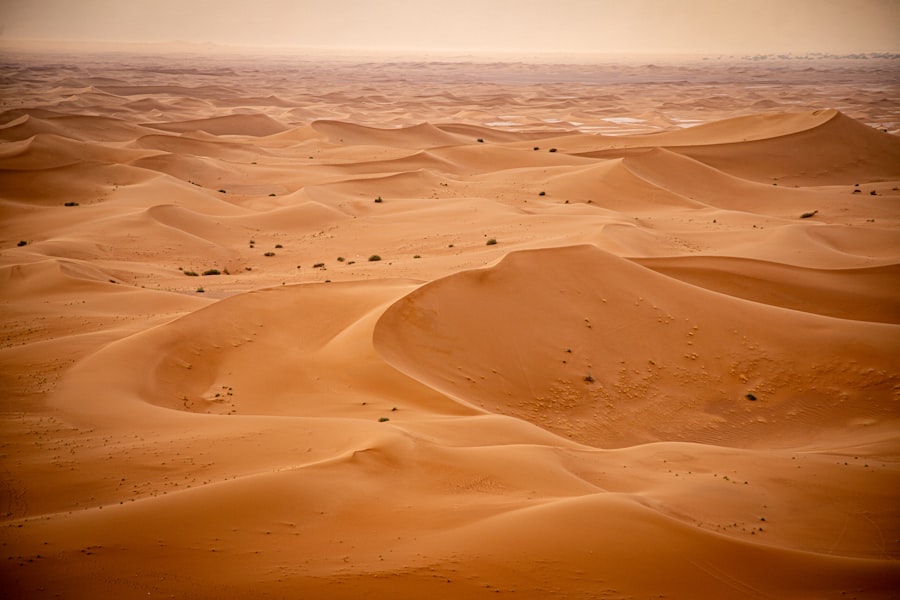
One of the most profound revelations from satellite radar mapping of the Sahara is the widespread evidence of ancient river systems. For millennia, the Sahara was not the arid desert it is today. During past wetter climatic periods, vast rivers flowed across the landscape, carving out valleys and supporting lush ecosystems. These ancient riverbeds, now buried under meters of sand, are being illuminated by SAR imagery, offering a tangible connection to a forgotten past.
Mapping Buried River Valleys
SAR’s ability to penetrate sand has allowed for the mapping of extensive networks of these ancient rivers. The outlines of former channels, meanders, and floodplains are becoming visible in the radar data, providing a detailed picture of the hydrological history of the region. These discoveries challenge previous assumptions about the extent and intensity of these ancient water systems. The patterns revealed suggest a far more interconnected and dynamic hydrological landscape than previously understood.
Identifying Palæochannels
Radar interferometry, in particular, has been effective in identifying subtle topographic depressions that correspond to buried river channels. Even when the overlying sand is several meters thick, InSAR can detect these minimal variations in elevation, which are indicative of the softer sediments that once filled the riverbeds compared to the surrounding bedrock. These detected palæochannels are crucial for understanding ancient migration routes, settlement patterns, and the availability of resources in prehistoric times.
Sediment Accumulation Patterns
The study of sediment accumulation within these buried river systems provides further insights. SAR data can reveal variations in sediment density and composition, allowing researchers to infer the flow dynamics of the ancient rivers and the types of materials they transported. This information helps in reconstructing the paleoenvironment, including the erosional processes and depositional environments that characterized the Sahara during its wetter phases.
Implications for Paleoenvironments
The mapping of these ancient rivers has significant implications for understanding past climate change. Their presence indicates periods of significantly higher rainfall and a different climatic regime for the Sahara. The extent and density of these river networks can help scientists reconstruct the past hydrological cycle and the geographical distribution of water sources. This, in turn, aids in modeling future climate scenarios and understanding the resilience of arid and semi-arid regions to environmental shifts.
Reconstructing Ancient Rainfall Patterns
By mapping the extent and nature of these ancient river systems, scientists can infer the patterns of ancient rainfall. The presence of large, perennial rivers suggests prolonged periods of substantial precipitation, while smaller, ephemeral channels might indicate seasonal or flash flood events. Integrating this data with other paleoclimate proxies, such as pollen records or sediment analysis, allows for a more comprehensive understanding of past climatic variability.
Understanding Past Biodiversity
The existence of flowing water in the Sahara would have supported a diverse range of flora and fauna. The identification of ancient river systems provides potential locations for the discovery of fossilized remains and other evidence of past life. Understanding the ecological niches created by these waterways can shed light on the biodiversity that once thrived in this now-barren landscape and how it adapted to shifting climatic conditions.
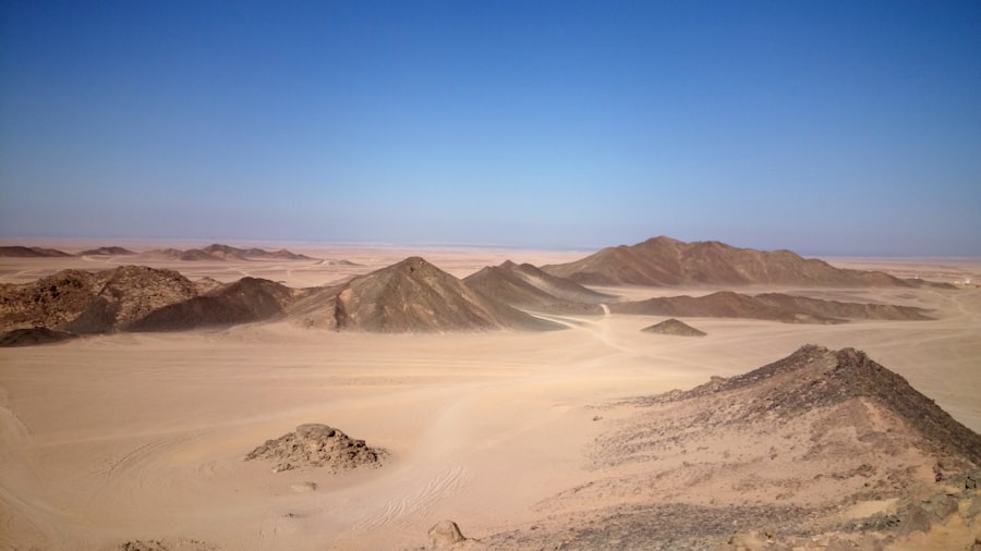
Uncovered Geology: Insights into Tectonic Activity and Mineral Resources
Beyond the hydrological record, satellite radar imagery is also revealing crucial details about the Sahara’s underlying geology, including evidence of tectonic faults, volcanic activity, and potential mineral deposits. The ability of SAR to penetrate sand and reveal bedrock structures is invaluable for geological mapping and exploration in this vast and under-surveyed region.
Identifying Fault Lines and Structural Features
SAR data has been instrumental in identifying major fault lines and other structural discontinuities within the Sahara’s bedrock. These features are often obscured by sand, but radar backscatter patterns can highlight their presence, indicating areas of past or ongoing tectonic stress. Understanding these geological structures is vital for assessing seismic hazards and comprehending the tectonic evolution of the African continent.
Detecting Geomorphological Anomalies
Subtle changes in surface roughness and morphology, visible in SAR imagery, can be indicative of underlying geological structures. For example, areas of fractured or uplifted bedrock might exhibit unique radar backscatter characteristics. By analyzing these geomorphological anomalies, geologists can infer the presence of faults that might not be visible at the surface.
Differentiating Rock Types
Different rock types have distinct dielectric properties that influence how they reflect radar signals. SAR analysis can assist in differentiating between various lithological units, helping to map out the geological formations beneath the sand cover. This has implications for understanding regional geological history and the formation of various landforms.
Potential for Mineral Exploration
The ability to map subsurface geology with SAR opens up new avenues for mineral exploration. Certain geological formations are known to be associated with specific mineral deposits. By identifying these formations beneath the sand, SAR data can guide targeted exploration efforts, potentially leading to the discovery of valuable resources in previously inaccessible areas.
Identifying Intrusion Zones
Volcanic intrusions and areas of past magmatic activity can leave distinctive signatures in SAR imagery. These zones might be characterized by altered rock types or specific structural patterns that can be detected by radar. Such discoveries are important for understanding the volcanic history of the Sahara and its potential for geothermal energy or mineralisation.
Mapping Sedimentary Basins
The Sahara contains extensive sedimentary basins, which are important for both hydrocarbon exploration and understanding the depositional history of the region. SAR can help delineate the boundaries of these basins and reveal the underlying structural controls on their formation. This information is crucial for regional geological mapping and resource assessment.
Desertification and Environmental Change: Monitoring Transformation Over Time
The Sahara is a dynamic environment, and satellite radar imagery offers a powerful tool for monitoring changes occurring across its vast landscape. While the focus has often been on ancient discoveries, the continuous monitoring capabilities of SAR are crucial for understanding contemporary environmental processes, including desertification and the impact of climate change.
Tracking Dune Migration and Landscape Evolution
SAR can track the movement of sand dunes over time, providing quantitative data on the rate and direction of dune migration. This information is vital for understanding the impact of wind erosion and for predicting areas that may be at risk from encroaching sands. By comparing SAR images acquired at different times, scientists can map these dynamic landscape changes with precision.
Quantifying Dune Field Dynamics
By analyzing sequential SAR images, researchers can map the boundaries of dune fields and measure changes in their surface area and volume. This allows for the quantification of aeolian processes and their impact on the surrounding environment. Understanding these dynamics is critical for land management and for anticipating the effects of altered wind patterns.
Monitoring Vegetation Cover Changes
While the Sahara is predominantly arid, some areas do support sparse vegetation, which can be sensitive to changes in rainfall and temperature. SAR can detect subtle variations in radar backscatter that are associated with changes in vegetation cover. This allows for the monitoring of areas undergoing desertification or experiencing a resurgence of plant life, offering insights into ecological resilience.
Assessing the Impact of Climate Change
The Sahara is particularly vulnerable to the impacts of global climate change. SAR data can contribute to understanding these impacts by monitoring changes in surface hydrology, vegetation cover, and geomorphological features that are indicative of climatic shifts. This data can inform adaptation strategies and climate modeling efforts.
Detecting Changes in Arid Land Cover
The progression of desertification can lead to a reduction in vegetation and a shift towards more arid land cover. SAR imagery can help to identify areas where these changes are occurring, allowing for targeted interventions and mitigation efforts. The ability to monitor these subtle shifts over a large area is a significant advantage of satellite radar.
Understanding Drought Impacts
Persistent drought conditions can lead to significant changes in the Sahara’s landscape, including drying of ephemeral water bodies and increased soil erosion. SAR data can provide a broad-scale assessment of these impacts, helping to identify areas most severely affected and to understand the spatial patterns of drought-induced environmental degradation.
Satellite radar imagery of the Sahara Desert has become an invaluable tool for researchers studying climate change and desertification. By analyzing these images, scientists can track changes in vegetation and land use over time, providing crucial insights into the environmental challenges facing this vast region. For a deeper understanding of how such technologies can impact resource management and asset protection, you might find this article on safe havens during economic uncertainty particularly interesting. It discusses various strategies for safeguarding assets, which can be relevant in the context of environmental changes driven by climate factors. You can read more about it here.
Future Prospects and Scientific Frontiers
| Metrics | Data |
|---|---|
| Resolution | High-resolution satellite radar imagery |
| Coverage | Complete coverage of the Sahara desert |
| Frequency | Regular updates and monitoring |
| Features | Detailed topographic and surface information |
| Applications | Environmental monitoring, land use planning, and research |
The application of satellite radar technology to the study of the Sahara Desert is still in its early stages, and the future holds immense potential for further discoveries. As radar technology continues to advance, and as more data accumulates, our understanding of this iconic landscape will undoubtedly deepen.
Enhanced Resolution and Penetration Capabilities
Future generations of SAR systems are expected to offer even higher resolutions and improved penetration depths. This will allow for the mapping of finer geological details and the investigation of deeper subsurface structures. Advancements in sensor design and processing algorithms will further enhance the ability to distinguish between different materials and to interpret complex geological formations.
Multi-frequency and Polarimetric SAR
The development of multi-frequency and polarimetric SAR systems will provide more sophisticated ways to analyze the backscattered signals. Different radar frequencies interact with the surface in varying ways, and polarimetry provides information about the orientation and shape of scattering elements. Combining these approaches will yield richer datasets, enabling more nuanced interpretations of subsurface features and material properties.
Temporal Resolution and Change Detection
An increase in the temporal resolution of SAR imaging will enable more frequent monitoring of dynamic processes in the Sahara. This will be crucial for tracking rapid environmental changes, such as flash floods or sandstorms, and for understanding the immediate impacts of these events. Continuous monitoring also allows for the tracking of long-term trends with greater accuracy.
Integration with Other Remote Sensing Data
The true power of SAR lies in its integration with other remote sensing data, such as optical imagery and spectral data. By combining different types of information, scientists can create a more comprehensive picture of the Sahara’s surface and subsurface. Optical sensors can provide information about surface color and vegetation type, while spectral data can reveal mineral composition.
Synergistic Analysis for Comprehensive Understanding
Combining SAR data with optical and spectral imagery allows for a synergistic approach to analysis. For instance, SAR might reveal a buried geological structure, while optical imagery might show associated surface features or vegetation anomalies. This integrated approach leads to a more robust and reliable interpretation of the observed phenomena.
Advancing Climate and Geological Models
The wealth of data generated by satellite radar will significantly contribute to the refinement of climate and geological models. Improved understanding of past hydrological systems, tectonic activity, and landscape evolution will lead to more accurate predictions of future climate scenarios and geological processes within the Sahara and similar arid regions worldwide.
The Sahara Desert, once perceived as a uniform expanse of sand, is now revealing its hidden complexity thanks to the transformative power of satellite radar. From the ghosts of ancient rivers to the intricate details of its bedrock geology, these stunning images are reshaping our understanding of this iconic landscape and its place in Earth’s long and dynamic history.
FAQs
What is satellite radar imagery?
Satellite radar imagery is a type of remote sensing technology that uses radar to create images of the Earth’s surface. It can be used to monitor changes in the environment, such as land use, vegetation, and water levels.
How is satellite radar imagery used in the Sahara Desert?
Satellite radar imagery is used in the Sahara Desert to monitor changes in the landscape, such as desertification, sand dune movement, and water sources. It can also be used to track the movement of people and animals in the desert.
What are the benefits of using satellite radar imagery in the Sahara Desert?
The benefits of using satellite radar imagery in the Sahara Desert include the ability to monitor environmental changes, track natural resources, and assist in disaster management. It also provides valuable data for scientific research and conservation efforts.
What are the limitations of satellite radar imagery in the Sahara Desert?
Limitations of satellite radar imagery in the Sahara Desert include the inability to capture fine details, such as small-scale vegetation or individual animal movements. Additionally, weather conditions and cloud cover can affect the quality of the imagery.
How can satellite radar imagery of the Sahara Desert contribute to global understanding of climate change?
Satellite radar imagery of the Sahara Desert can contribute to global understanding of climate change by providing data on desertification, land degradation, and changes in water sources. This information can help scientists and policymakers better understand the impacts of climate change on arid regions.