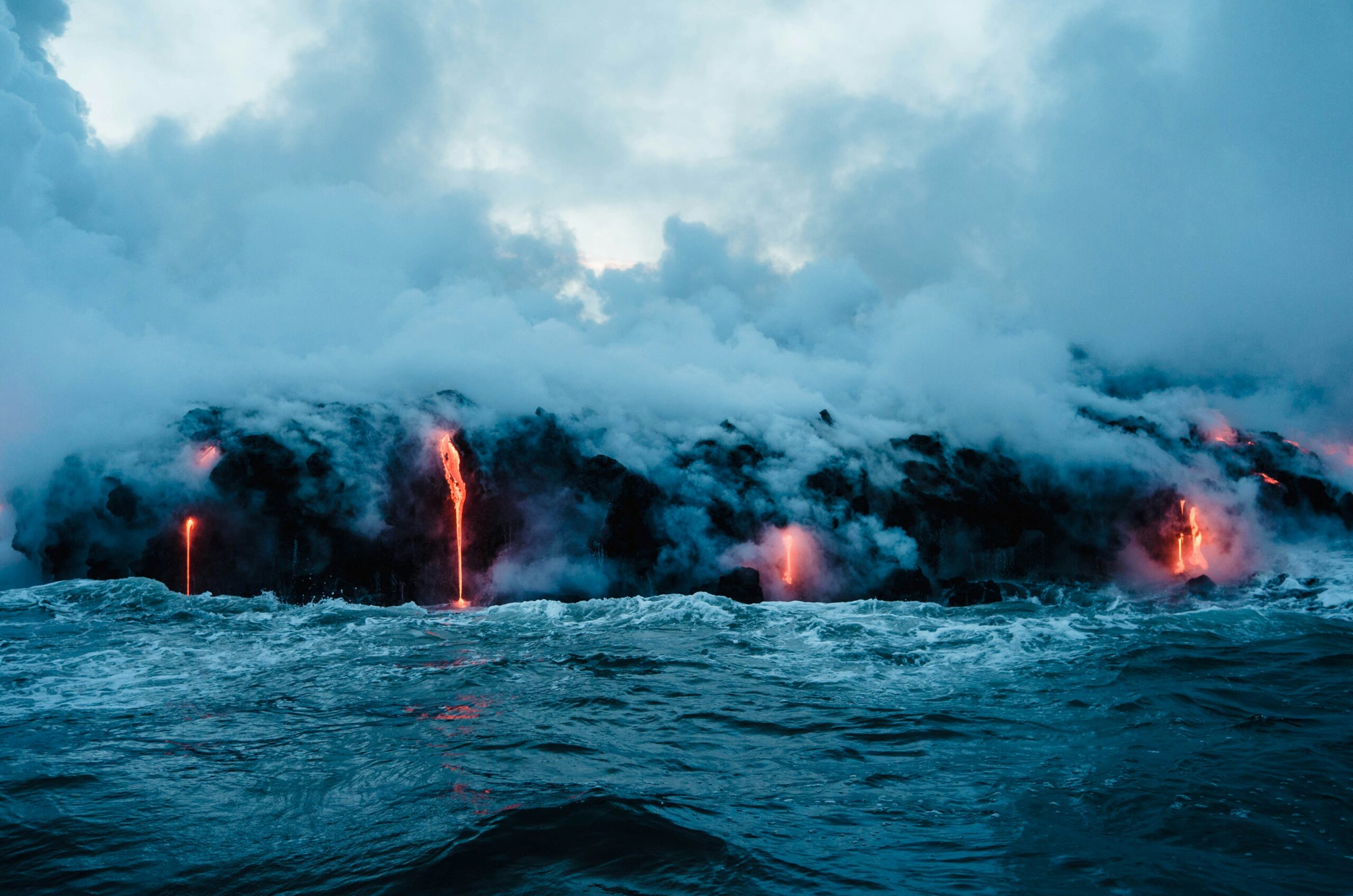
Hekla, a stratovolcano situated in southern Iceland, has long been a source of both awe and trepidation. Its imposing silhouette, often cloaked in clouds, has earned it the moniker “The Gateway to Hell” among ancient Norse myths. However, beyond its folkloric connotations, Hekla represents a potent geological force capable of unleashing immense power. The potential for another significant eruption, often referred to as Hekla 3, is a subject of considerable scientific interest and a lingering concern for the region and beyond. Understanding the volcano’s history, its current monitoring, and the potential consequences of its activity is crucial for preparedness and mitigating risks.
Hekla’s volcanic history is a testament to its destructive and transformative power. For millennia, its eruptions have shaped the Icelandic landscape, leaving behind a legacy of ash, lava, and altered topography. The volcano’s activity is not characterized by frequent, small eruptions, but rather by periods of dormancy punctuated by explosive, Plinian events that can release vast quantities of ash and volcanic gases into the atmosphere.
The Scale of Historical Eruptions
The geological record reveals a pattern of powerful eruptions from Hekla. These events are not mere historical anecdotes; they have had tangible impacts on human civilization and the environment.
The Hekla 1104 Eruption: A Cataclysmic Event
One of the most significant eruptions in Hekla’s documented history occurred in 1104 CE. This event is believed to have been a VEI 5 (Volcanic Explosivity Index) eruption, signifying a substantial release of volcanic material. The eruption produced significant ashfall over a wide area, impacting agricultural land and human settlements. Stories from this period speak of widespread devastation and a profound alteration of the local environment. The sheer volume of ash ejected would have darkened the sky for extended periods, affecting plant growth and animal life.
The 1783 Laki Eruption and Hekla’s Role
While the infamous 1783 Laki eruption was a fissure eruption and not directly from Hekla’s summit, it is important to note that Hekla can contribute to broader volcanic activity in Iceland. The Laki eruption, a catastrophic event in its own right, had far-reaching global consequences due to its massive release of sulfur dioxide, which led to atmospheric cooling and crop failures across Europe. While Hekla did not erupt simultaneously with Laki, its potential to participate in such large-scale volcanic events underscores the broader volcanic interconnectedness of the region. Understanding the dynamics of Iceland’s volcanic system is key to grasping the full potential of any single volcano.
The 1947-1948 Eruption: A Modern Wake-Up Call
More recently, the 1947-1948 eruption serves as a stark reminder of Hekla’s ongoing potential. This eruption, also considered a significant event, ejected a large volume of ash and lava. While the eruption’s impact was primarily localized, it provided valuable data for seismologists and volcanologists studying Hekla’s behavior. The eruption produced a significant lava flow and a substantial ash plume, although its reach was less extensive than some of its more ancient predecessors. This event marked a critical period of scientific observation and data collection that continues to inform our understanding of the volcano.
The 2000 Eruption: A Glimpse of Hekla’s Current Form
The most recent significant eruption from Hekla occurred in February 2000. This eruption was considerably smaller in scale than its historical counterparts, lasting for several hours and producing a moderate ash plume. However, it was crucial from a scientific perspective. It allowed researchers to test and refine their monitoring equipment and predictive models. The 2000 eruption demonstrated that Hekla remains an active volcano, albeit with a different eruptive style in its most recent manifestation. The ash from this eruption reached altitudes of 10-12 kilometers, affecting air traffic in the immediate vicinity.
The Geological Makeup of Hekla
Hekla’s volcanic structure and the magma beneath it are key to understanding its eruptive potential. It is a stratovolcano, meaning it is built up of many layers of hardened lava, tephra, pumice, and volcanic ash. This layered structure can influence the way eruptions occur, particularly in regards to their explosivity.
Rhyolitic vs. Basaltic Magma
Hekla’s magma is characterized by its composition, which often leans towards being more silica-rich, leading to more viscous and potentially more explosive eruptions. While basaltic magmas are more fluid and tend to produce effusive lava flows, more silica-rich magmas, like those found at Hekla, can trap gases more effectively. This trapping builds up pressure, leading to explosive blasts when the pressure is eventually released. This viscous magma is a key factor in Hekla’s reputation for explosive activity.
The Rift Zone Connection
Hekla is situated within the Icelandic rift zone, a region where the North American and Eurasian tectonic plates are pulling apart. This geological setting provides a constant supply of magma to the region, fueling volcanic activity. Hekla’s position within this active tectonic boundary is a fundamental reason for its sustained volcanic nature. Its connection to the Mid-Atlantic Ridge is a primary driver of its geothermal and volcanic activity.
The Hekla 3 volcanic eruption, which occurred around 2,000 years ago, is a significant event in the study of Icelandic geology and its impact on climate. This eruption is often discussed in relation to ancient cartography, as it may have influenced the mapping of the region in subsequent centuries. For a deeper understanding of how historical events like volcanic eruptions have shaped our understanding of geography, you can read more in this article on ancient cartography and modern science: Piri Reis Map: Ancient Cartography and Modern Science.
The Science of Seismicity: Listening to Hekla’s Murmurs
The scientific community is deeply invested in understanding and monitoring Hekla’s subsurface activity. Seismological networks are crucial for detecting the subtle tremors that often precede a volcanic eruption, acting as an early warning system. These networks are designed to capture the minute vibrations within the Earth’s crust that indicate magma movement and pressure build-up.
Seismic Monitoring Techniques
A variety of sophisticated techniques are employed to listen to the Earth’s whispers emanating from Hekla. The goal is to detect even the slightest change in seismic activity that could signal an impending eruption.
Seismometers and Their Role
Seismometers are the primary instruments used to detect ground motion. These sensitive devices measure vibrations in the Earth’s crust, and their data is analyzed to identify the origin, depth, and magnitude of seismic events. The density of seismometers around Hekla is crucial for pinpointing the location and nature of any subsurface unrest.
Tremor Analysis and Volcano-Tectonic Earthquakes
Scientists analyze different types of seismic signals. Volcano-tectonic (VT) earthquakes, for instance, are generated by the fracturing of rock as magma moves. Harmonic tremor, on the other hand, is a continuous seismic signal that can indicate the movement of magma or fluids within the volcanic system. Differentiating these signals is key to understanding the volcano’s internal processes.
Interpreting Seismic Data
The raw data from seismometers needs expert interpretation to translate the vibrations into meaningful information about Hekla’s state. This interpretation is a complex process, involving pattern recognition and comparison with historical data.
Identifying Magma Movement
The precise location and depth of seismic events can reveal whether magma is ascending towards the surface. A migration of earthquake swarms towards the surface is a significant indicator of impending volcanic activity.
Deformational Changes and GPS
Beyond seismicity, scientists also monitor ground deformation. Precisely placed GPS stations can detect millimeter-scale changes in the shape of the volcano’s surface, indicating swelling or subsidence caused by the movement of magma. These measurements provide valuable complementary data to seismic readings.
Gas Emissions: A Chemical Barometer
Volcanic gases, such as sulfur dioxide and carbon dioxide, are also monitored. Changes in the composition and flux of these gases can signal changes in the magma chamber. An increase in sulfur dioxide emissions, for example, can indicate that magma is rising closer to the surface.
The Hekla 3 Enigma: When Will the Giant Awaken?

The term “Hekla 3” is not a formal scientific designation but rather a shorthand used to refer to the next potentially significant eruption from Hekla, following the major historical events. Predicting the exact timing of volcanic eruptions is an inexact science, but scientists are constantly refining their models and understanding of Hekla’s cyclical nature.
The Concept of Recurrence Intervals
Volcanologists often study recurrence intervals, which are the average periods between large eruptions. While Hekla does not exhibit perfectly regular intervals, historical data provides a basis for estimating potential future activity. However, it is crucial to remember that these are statistical averages, not precise predictions.
Challenges in Predicting Hekla’s Eruptions
The complexity of Hekla’s subsurface plumbing and the influence of regional tectonic forces make precise prediction exceptionally challenging. The volcano’s history shows variability in both the size and timing of its eruptions, which complicates simple extrapolation.
The Role of Uncertainties
Geological systems are inherently complex and influenced by numerous interacting factors. The precise conditions under which magma will breach the surface, the rate of magma accumulation, and the structure of the conduit are all subject to significant uncertainties.
The Science of Forecasting and Alert Levels
While precise prediction remains elusive, the scientific community employs forecasting techniques and a system of alert levels to communicate the potential risk associated with Hekla.
Alert Level Systems in Iceland
Icelandic volcanologists use a three-color alert system: green (no activity), yellow (potential for activity), and red (active eruption). These levels are based on continuous monitoring of seismic activity, ground deformation, and gas emissions.
The “In-Situ” vs. “Ex-Situ” Data Challenge
Scientists face the challenge of interpreting data collected “in-situ” (at the volcano) and comparing it with “ex-situ” knowledge gleaned from past eruptions and other volcanoes. This requires a comprehensive understanding of volcanic dynamics globally.
The Monitoring Network and International Collaboration
The monitoring of Hekla is a continuous, multi-faceted effort involving dedicated scientists and sophisticated technology. International collaboration plays a vital role in sharing data, expertise, and best practices for volcanic monitoring.
Icelandic Meteorological Office (IMO) and Institute of Earth Sciences
The primary responsibility for volcanic monitoring in Iceland falls to the Icelandic Meteorological Office (IMO) and the Institute of Earth Sciences at the University of Iceland. These institutions are at the forefront of research and operational monitoring.
Global Networks and Data Sharing
Data from Hekla is often shared with international volcanological centers, allowing for broader analysis and comparison with other active volcanoes worldwide. This global perspective enhances understanding of volcanic processes.
Potential Impacts of a Hekla 3 Eruption: Beyond Iceland’s Borders

A significant eruption from Hekla, particularly one with explosive characteristics, could have far-reaching consequences, extending well beyond the immediate vicinity of the volcano. The sheer volume of ash and gases released could impact aviation, climate, and economies across the globe.
Aviation Hazards: The Peril of Ash Clouds
Volcanic ash poses a severe threat to air travel. Fine particles of ash can damage aircraft engines, leading to engine failure, and can obscure visibility. The catastrophic potential of ash clouds necessitates constant vigilance and swift action by aviation authorities.
Impact on Air Traffic Control
A large ash plume can force the closure of airspace, leading to widespread flight cancellations and disruptions. This has significant economic implications for airlines and travelers. The 2010 Eyjafjallajökull eruption, for example, caused one of the largest air-traffic shutdowns in peacetime.
Engine Vulnerability and Mitigation Strategies
Aircraft engines have a low tolerance for volcanic ash. Strategies to mitigate this risk include rerouting flights, grounding aircraft, and utilizing real-time ash dispersion modeling to predict the movement of ash clouds.
Ashfall Impacts: Local and Regional Devastation
The direct impact of ashfall can be devastating for local communities, agriculture, and infrastructure. The weight of ash can collapse buildings, smother vegetation, and contaminate water supplies.
Agricultural Disruption and Food Security
Ashfall can render agricultural land unusable for extended periods, impacting crop yields and livestock. This can have profound implications for regional food security.
Infrastructure Damage and Decontamination
Heavy ash accumulation can damage roads, power lines, and other critical infrastructure. The cleanup and decontamination process can be extensive and costly.
Climatic Implications: A Global Concern
Large explosive volcanic eruptions can inject significant amounts of sulfur dioxide into the stratosphere, where it converts into sulfate aerosols. These aerosols can reflect sunlight back into space, leading to a temporary cooling of the Earth’s climate.
Stratospheric Aerosols and Global Cooling
The presence of sulfate aerosols in the stratosphere can have a measurable impact on global temperatures. The extent of this cooling depends on the volume and altitude of the aerosol injection. The Laki eruption’s known climatic impact is a testament to this phenomenon.
Long-Term Environmental Effects
Beyond immediate climatic shifts, volcanic eruptions can have longer-term environmental consequences, including changes in rainfall patterns and atmospheric chemistry. The persistence of aerosols in the stratosphere can influence these changes for years.
The Hekla 3 volcanic eruption is a significant event in Iceland’s geological history, and understanding its impact on the environment and surrounding areas is crucial for researchers. For those interested in exploring how such natural phenomena can influence future developments, a related article discusses the complexities of managing space traffic in cislunar space, highlighting the interconnectedness of Earth’s geological activities and advancements in space exploration. You can read more about this fascinating topic in the article navigating the future of cislunar space traffic management.
Preparedness and Mitigation: Facing the Volcano’s Fury
| Metrics | Data |
|---|---|
| Volcano Name | Hekla 3 |
| Location | Iceland |
| Year of Eruption | ~1000 AD |
| VEI (Volcanic Explosivity Index) | 6 |
| Impact | Significant ashfall and environmental effects |
Given the potential threat posed by Hekla, preparedness and mitigation strategies are paramount. This involves a multi-pronged approach, encompassing scientific monitoring, emergency planning, and public education.
Emergency Response Planning and Evacuation
Robust emergency response plans are essential to ensure the safety of those living in proximity to Hekla. These plans outline evacuation procedures, the establishment of shelter, and the provision of essential services.
Early Warning Systems and Communication Protocols
Effective early warning systems and clear communication protocols are vital for timely alerts and coordinated responses. Ensuring that the public understands the alert levels and knows how to react is critical.
Evacuation Routes and Resource Allocation
Designated evacuation routes and the pre-positioning of resources such as food, water, and medical supplies are key components of effective emergency planning.
Public Education and Awareness Campaigns
Educating the public about the risks associated with Hekla and providing guidance on how to prepare for an eruption is crucial for community resilience.
Understanding Volcanic Hazards
People living in volcanic regions need to understand the specific hazards associated with Hekla, including ashfall, pyroclastic flows (if applicable), and potential lahars (volcanic mudflows).
Personal Preparedness and Safety Measures
Public awareness campaigns can empower individuals to take steps to protect themselves and their families, such as preparing emergency kits and knowing evacuation procedures.
International Cooperation and Disaster Management
Volcanic eruptions do not respect national borders. International cooperation is vital for sharing information, resources, and expertise in the event of a significant eruption.
Coordinated Response Efforts
In the event of a large eruption, coordinated international response efforts will be necessary to manage widespread disruptions, particularly in aviation.
Sharing of Scientific Data and Best Practices
Continuous collaboration among volcanologists and disaster management agencies globally helps to refine monitoring techniques and improve preparedness strategies. The lessons learned from one eruption, no matter where it occurs, can be invaluable for others.
The threat of a significant eruption from Hekla, or “Hekla 3” as it is informally known, remains a tangible concern. While the exact timing is uncertain, the volcano’s history of powerful eruptions and its ongoing seismic activity serve as a constant reminder of its potential. The scientific community’s dedicated monitoring efforts, coupled with robust emergency planning and public awareness, are the linchpins in our ability to mitigate the risks associated with this formidable natural force. By understanding Hekla’s past, diligently monitoring its present, and preparing for its future, humanity can strive to coexist with this magnificent, yet potentially dangerous, geological giant.

Scientists Found Earth’s Hidden Timestamp
FAQs
What is the Hekla 3 volcanic eruption?
The Hekla 3 volcanic eruption refers to the third major eruption of the Hekla volcano in Iceland. The Hekla volcano is one of Iceland’s most active and well-known volcanoes, and its eruptions have historically been significant and impactful.
When did the Hekla 3 volcanic eruption occur?
The Hekla 3 volcanic eruption occurred approximately 8,200 years ago, during the Holocene epoch. This eruption was one of the many eruptions that have taken place at the Hekla volcano over its long history.
What were the impacts of the Hekla 3 volcanic eruption?
The Hekla 3 volcanic eruption had significant impacts on the surrounding environment and landscape. It resulted in the deposition of a thick layer of volcanic ash and tephra, which affected the local ecosystems and landforms. The eruption also likely had regional and global impacts on climate and air quality.
Is the Hekla volcano still active today?
Yes, the Hekla volcano is still considered to be active today. It has had numerous eruptions in the past few centuries, with the most recent eruption occurring in 2000. The volcano is closely monitored by scientists and is a subject of ongoing research and study.
What precautions are in place for potential future eruptions of the Hekla volcano?
Given the active nature of the Hekla volcano, there are various precautions and preparedness measures in place for potential future eruptions. These include monitoring the volcano’s activity, developing emergency response plans, and educating the local population about volcanic hazards and safety measures.