The earth holds secrets, not just of molten rock and shifting continents, but of ancient human hands that shaped its surface and left their indelible marks. Geology, the study of the earth’s physical structure and substance, and archaeology, the exploration of human history and prehistory through the excavation of sites and the analysis of artifacts and other physical remains, are disciplines seemingly as distinct as the strata of sedimentary rock and the fragments of pottery. Yet, a closer examination reveals a profound and intricate interplay between them, a symbiotic relationship that allows for deeper understanding of our planet’s past and our species’ journey across it. This exploration delves into the fascinating ways geology informs and enriches archaeological discovery, transforming barren landscapes into vibrant tapestries of human existence.
The very ground upon which archaeologists tread is a product of geological processes. From the broad strokes of continental drift that determined the distribution of resources to the fine details of soil composition, geology provides the fundamental framework within which human societies arose, flourished, and ultimately vanished. Understanding these geological underpinnings is not merely an academic exercise; it is crucial for locating, excavating, and interpreting archaeological sites with accuracy.
Locating Lost Civilizations: Geological Clues to Habitation
The search for ancient human settlements is often as much a geological quest as it is an archaeological one. Early humans, like all life, were inextricably linked to their environment, seeking out locations offering access to water, food, and shelter. These geological features often leave tell-tale signs that can guide archaeologists to potential sites.
Water Sources: Rivers, Lakes, and Archaeological Sites
The presence of reliable water sources has been a cornerstone of human civilization throughout history. Rivers, in particular, have served as arteries for trade, transportation, and sustenance. Archaeological sites are disproportionately found along riverbanks, in floodplains, and near ancient lakes. Geologists, through the study of fluvial geomorphology (the study of rivers and their landforms), can identify ancient river channels that may no longer be visible on the surface, or understand patterns of sedimentation that might preserve and bury ancient settlements. The analysis of sediment cores can reveal past hydrological regimes, indicating periods of drought or abundance, which in turn can help archaeologists understand the viability of ancient settlements. For instance, the discovery of early agricultural communities in Mesopotamia is deeply intertwined with the geological understanding of the Tigris and Euphrates river systems and their complex irrigation potential.
Mineral Resources: Stone, Metals, and Early Technology
The availability of natural resources, dictated by geological formations, has profoundly shaped human technological development. Ancient toolkits, architecture, and art are all direct reflections of the geological bounty of a region. The presence of chert, obsidian, jade, and other lithic materials has allowed for the creation of cutting tools, weapons, and decorative objects. The extraction and working of these materials created evidence of early industrial activity, leaving behind quarries, debitage (waste material from tool production), and hearths.
Obsidian: A Volcanic Mirror to Prehistoric Trade Networks
Obsidian, a volcanic glass, is particularly valuable for archaeologists. Its conchoidal fracture (a type of fracture that produces smooth, curved surfaces) allows for the creation of extremely sharp edges, making it ideal for projectile points and knives. The geographical distribution of obsidian sources is well-defined by geology. By analyzing the chemical composition of obsidian artifacts found at a site, archaeologists can trace their origin to specific volcanic flows. This allows for the reconstruction of ancient trade networks and migration patterns, revealing how far these materials traveled and the extent of human interaction. The famous obsidian quarries of Çatalhöyük in Turkey, for example, highlight the importance of this volcanic resource in early Neolithic societies.
Metallic Ores: The Dawn of the Metal Ages
The discovery and exploitation of metallic ores – copper, tin, iron – mark major turning points in human history. The geological occurrence of these metals in accessible deposits allowed for the development of metallurgy, fundamentally changing toolmaking, warfare, and societal structures. Archaeological sites associated with mining, smelting, and metalworking are inherently geological in their context. Identifying the specific mineral deposits from which these metals were extracted allows archaeologists to understand the technological capabilities and economic foundations of ancient societies.
Topography and Settlement Patterns: Mountains, Valleys, and Defense
The physical landscape, sculpted by geological forces over millennia, profoundly influences settlement patterns. Mountains can offer natural defenses and provide access to unique resources, while valleys often facilitate agriculture and shelter from harsh winds. Understanding the geological history of a region’s topography is crucial for interpreting why certain areas were chosen for settlement and others were avoided.
Defensive Sites: Hillforts and Stratigraphic Evidence
The strategic placement of ancient defensive structures, such as hillforts and fortified settlements, is directly linked to the geological features of the landscape. These sites are often located on elevated terrain, offering natural advantages against attack. Archaeological excavations within these fortifications can reveal multiple layers of occupation, each corresponding to different periods of construction and defense. The geological stability of the underlying rock formations is also important for the longevity and feasibility of such structures.
Reconstructing Past Environments: Paleoenvironmental Proxies in Geological Deposits
Geology provides a wealth of indirect evidence for reconstructing past environments. The sediments, fossils, and geological formations preserved in the earth act as invaluable “paleoenvironmental proxies,” offering glimpses into ancient climates, ecosystems, and landscapes that would otherwise be lost to time.
Sediment Analysis: Decoding Ancient Climates and Landscapes
The study of sediments, from fine clays to coarse gravels, can reveal a great deal about the conditions under which they were deposited. Geologists analyze sediment layers for their composition, grain size, and structure to infer past environmental processes.
Pollen and Phytoliths: Vegetation History and Climate Change
Within sediments, microscopically preserved plant remains like pollen grains and phytoliths (rigid, microscopic silica structures found in plants) provide a direct record of past vegetation. Changes in the types and abundance of pollen and phytoliths over time indicate shifts in plant communities, which in turn are strong indicators of climatic conditions. For example, an increase in pollen from drought-tolerant grasses might suggest a drier climate, while a rise in arboreal pollen could point to a more forested environment. This information is vital for archaeologists trying to understand the resources available to ancient populations and the environmental pressures they faced.
Foraminifera and Diatoms: Aquatic Ecosystems and Sea Level Fluctuations
In marine and freshwater sediments, the fossilized shells of microscopic organisms like foraminifera (marine protozoa) and diatoms (single-celled algae) offer insights into past aquatic environments. The species present are sensitive to changes in salinity, temperature, and water depth, allowing geologists to reconstruct past oceanic conditions and sea-level fluctuations. This is crucial for understanding coastal settlements and the impact of climate change on human populations.
Geochronology: Dating the Past with Geological Clocks
One of the most critical contributions of geology to archaeology is the ability to establish reliable timelines for past events. Geochronological methods, which involve dating geological materials, provide the temporal framework for archaeological interpretations.
Radiocarbon Dating: Carbon’s Half-Life as an Archaeological Tool
Radiocarbon dating, perhaps the most well-known geochronological technique, relies on the decay of the radioactive isotope carbon-14. Organic materials, such as bone, charcoal, and wood, absorb carbon-14 from the atmosphere during their lifetime. After death, this isotope decays at a known rate (its half-life is approximately 5,730 years). By measuring the remaining amount of carbon-14 in an artifact or organic sample, archaeologists can determine its age. This technique has revolutionized our understanding of the chronology of prehistoric cultures.
Other Dating Methods: Beyond Carbon
While radiocarbon dating is invaluable for materials up to around 50,000 years old, other geological dating methods extend further back in time. Thermoluminescence dating can be used on pottery and heated stones, dating the last time they were exposed to high temperatures. Optically Stimulated Luminescence (OSL) dating can date sediments, revealing when they were last exposed to sunlight. Potassium-argon dating and U-series dating are employed for much older geological materials, such as volcanic rocks associated with hominin fossil sites, pushing back the timeline of human evolution. These diverse dating techniques, rooted in geological principles, provide the bedrock for establishing the sequence of human presence and development.
The intersection of geology and archaeology offers fascinating insights into ancient civilizations and their environments. For instance, the article “Exploring the Shift: Companies Flocking to Mexico from China” delves into how geological factors influence economic decisions and migration patterns, which can also impact archaeological sites. Understanding the geological context can enhance our interpretation of archaeological findings, revealing how ancient peoples adapted to their landscapes. To read more about this intriguing topic, visit this article.
The Earth as a Witness to Human Impact
The presence of humans is not a passive phenomenon; it actively shapes and alters the geological landscape. Archaeological sites themselves are often the result of human modification of the earth, and the study of these impacts provides a unique lens through which to understand human behavior and societal development.
Anthropogenic Landscapes: Shaping the Earth Through Human Activity
Human societies have, from their earliest beginnings, interacted with and transformed their physical environments. These transformations, often invisible to the untrained eye, are etched into the geological record and are a key focus of geoarchaeology.
Agriculture and Soil Formation: Terraces, Irrigation, and Erosion
The advent of agriculture marked a significant acceleration in human-induced landscape modification. The clearing of land, the creation of fields, and the development of irrigation systems all have tangible geological consequences. Terracing, for example, reshapes slopes to create arable land, altering natural drainage patterns and influencing soil erosion. Irrigation canals can change groundwater levels and lead to salinization of soils. The study of these agricultural landscapes, their soil profiles, and their hydrological impacts falls squarely within the realm of geoarchaeology.
Soil Stratigraphy and Human Land Use
The layers of soil (soil stratigraphy) at an archaeological site are a direct reflection of human land use. Layers of compacted earth, organic matter accumulation, and altered soil chemistry can indicate periods of cultivation, habitation, or abandonment. The presence of specific artifacts within these soil layers allows archaeologists to correlate human activity with particular environmental conditions and geological processes.
Construction and Extraction: Quarries, Mines, and Earthworks
The construction of buildings, monuments, and defensive structures often involved significant excavation and modification of the landscape. Quarries and mining operations, directly driven by the availability of geological resources, left behind unmistakable scars on the earth.
Quarry Sites: Tracing the Source of Stone Tools and Architecture
The identification of ancient quarry sites is a direct output of geological and archaeological collaboration. Geologists can identify the specific rock formations from which materials were extracted, while archaeologists can uncover the tools and techniques used by ancient quarry workers. The spatial distribution of quarry sites relative to habitation sites can reveal trade routes, labor organization, and the scale of construction projects. The massive stone quarries of ancient Egypt, for instance, are a testament to advanced geological understanding and immense human effort.
Earthworks and Monumental Construction
The creation of large-scale earthworks, such as mounds, defensive ramparts, and ceremonial structures, represents a significant alteration of the local topography. Geologists can analyze the composition and depositional patterns of these earthworks, providing insights into the engineering capabilities and social organization of the societies that built them. For example, the analysis of sediment layers in Roman roads can reveal the construction techniques and the chronological layering of their development.
Geoarchaeology: The Synthesis of Earth Science and Human History
Geoarchaeology, a specialized sub-discipline, lies at the very heart of the intersection between geology and archaeology. It employs geological methods and principles to address archaeological questions, bridging the gap between the natural and human past.
Site Formation Processes: Understanding How Sites Are Created and Preserved
A fundamental concern in geoarchaeology is understanding “site formation processes” – the natural and cultural factors that contribute to the creation, destruction, and preservation of archaeological sites. This involves analyzing how geological processes like erosion, sedimentation, volcanic activity, and soil formation interact with human activities.
Taphonomy in Geoarchaeology: From Human to Fossil
Taphonomy, the study of the processes that affect organic remains from the time of death to their discovery as fossils, is crucial in geoarchaeology. It helps distinguish between natural deposition and human placement of artifacts and remains, and it informs interpretations of how skeletal remains were deposited and preserved. For instance, understanding how animal bones accumulate in caves (natural processes) versus how they are curated and utilized by humans is vital for distinguishing between natural faunal assemblages and archaeological evidence of diet.
Geoarchaeological Investigations: Tools and Techniques
Geoarchaeologists utilize a range of scientific tools and techniques to analyze geological materials and their relationship to archaeological evidence.
Micromorphology: The Microscopic World of Sediments
Micromorphology involves the microscopic examination of thin sections of soil and sediments. This technique allows geoarchaeologists to identify fossil structures, such as remnants of ancient hearths, clay-lined pits, or even traces of human footprints, which are invisible to the naked eye within the sediment matrix. It can reveal subtle changes in depositional environments and human activities that might otherwise be overlooked.
Geochemical Analysis: Uncovering the Chemical Signatures of Human Activity
Geochemical analysis of soils and sediments can reveal chemical anomalies that are indicative of human activity. Elevated levels of certain elements, such as phosphorus (often associated with human or animal waste) or traces of smelting byproducts, can pinpoint areas of past habitation or industrial activity. This approach provides a powerful, non-destructive method for identifying and characterizing archaeological features.
The Future of the Intersection: A Deeper Dive into Our Shared Past
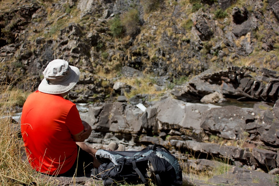
As technology advances and our understanding of geological processes deepens, the synergy between geology and archaeology is poised to grow even stronger. New analytical techniques and a more integrated approach promise to unlock even more profound insights into the human story.
The intersection of geology and archaeology offers fascinating insights into ancient civilizations and their environments. Recent studies have highlighted how geological formations can influence archaeological findings, shedding light on human adaptation to changing landscapes. For those interested in the broader implications of scientific advancements, a related article discusses the latest developments in counter-space weapons, showcasing how technology can shape our understanding of both history and modern geopolitics. You can read more about this intriguing topic in the article found here.
High-Resolution Dating and Chronological Refinement
The relentless pursuit of more precise dating methods continues to push the boundaries of archaeological understanding. As dating technologies become more sophisticated, archaeologists can refine their chronologies with unprecedented accuracy, allowing for more nuanced interpretations of cultural change, migration, and societal development.
Cosmogenic Nuclide Dating: Dating the Surfaces of Stone Artifacts
Emerging techniques like cosmogenic nuclide dating, which involves measuring the accumulation of isotopes produced by cosmic ray interactions in rocks, are beginning to be applied to archaeological contexts, particularly for dating the surfaces of stone artifacts or the time since a rock shelter was last occupied. This opens up new avenues for dating sites that were previously difficult to date with existing methods.
Paleoenvironmental Reconstruction and Climate Change Studies
The current global climate crisis underscores the importance of understanding past climate fluctuations and their impact on human societies. Geoarchaeology offers invaluable data for these studies, providing direct evidence of how past populations adapted to, or were impacted by, environmental changes.
Multi-Proxy Approaches: Combining Geological and Archaeological Data
The future of paleoenvironmental reconstruction lies in multi-proxy approaches, where data from various geological and archaeological sources are integrated. By combining sedimentological data, fossil records, paleobotanical evidence, and archaeological findings, researchers can build more comprehensive and robust models of past environments and human-environment interactions. This integrated approach is crucial for understanding the long-term dynamics of our planet and the resilience of human societies.
Digital Earth and Data Integration
The digital revolution is transforming how geological and archaeological data are collected, analyzed, and shared. Geographic Information Systems (GIS) and other digital tools are enabling researchers to overlay diverse datasets, revealing previously unseen patterns and connections.
Virtual Excavations and Digital Heritage
The creation of 3D models of archaeological sites and geological formations, often derived from remote sensing data and laser scanning, allows for virtual excavations and detailed analysis without disturbing delicate sites. This digital approach preserves heritage and facilitates wider collaboration and dissemination of research. The integration of geological models with archaeological reconstructions can create immersive experiences, allowing the public to engage with the deep past in new and exciting ways.
In conclusion, the intersection of geology and archaeology is not merely a theoretical construct but a vibrant and dynamic field of research. The earth, in its immense geological complexity, provides the stage upon which human history has unfolded, and it preserves the evidence of our presence. By understanding the geological processes that have shaped our planet and by employing geological tools and principles, archaeologists can unearth deeper truths about our collective past, revealing the intricate tapestry of human ingenuity, environmental adaptation, and the enduring legacy we leave upon the Earth. The continued collaboration between geologists and archaeologists promises to illuminate ever more layers of our shared history, fostering a more comprehensive and nuanced understanding of ourselves and our place on this dynamic planet.

Scientists Found Earth’s Hidden Timestamp
FAQs
What is the relationship between geology and archaeology?
Geology and archaeology are closely related as geology provides the foundation for understanding the landscapes and materials that archaeologists study. Geology helps archaeologists understand the formation of landscapes, the distribution of resources, and the preservation of artifacts.
How does geology contribute to archaeological research?
Geology contributes to archaeological research by providing information about the formation and composition of the earth’s surface, which helps archaeologists locate and interpret ancient sites, understand the geological processes that affect artifact preservation, and analyze the materials used by ancient civilizations.
What are some examples of how geology and archaeology intersect?
Examples of how geology and archaeology intersect include the study of ancient landscapes, the analysis of stone tools and building materials, the investigation of ancient climate and environmental changes, and the use of geological techniques to date archaeological sites.
How does understanding geology benefit archaeologists?
Understanding geology benefits archaeologists by providing insights into the formation and preservation of archaeological sites, helping to interpret the geological context of artifacts and ancient landscapes, and contributing to the reconstruction of past environments and human activities.
What are some challenges in integrating geology and archaeology?
Challenges in integrating geology and archaeology include the need for interdisciplinary collaboration, the complexity of geological processes affecting archaeological sites, and the interpretation of geological data within the context of archaeological research.