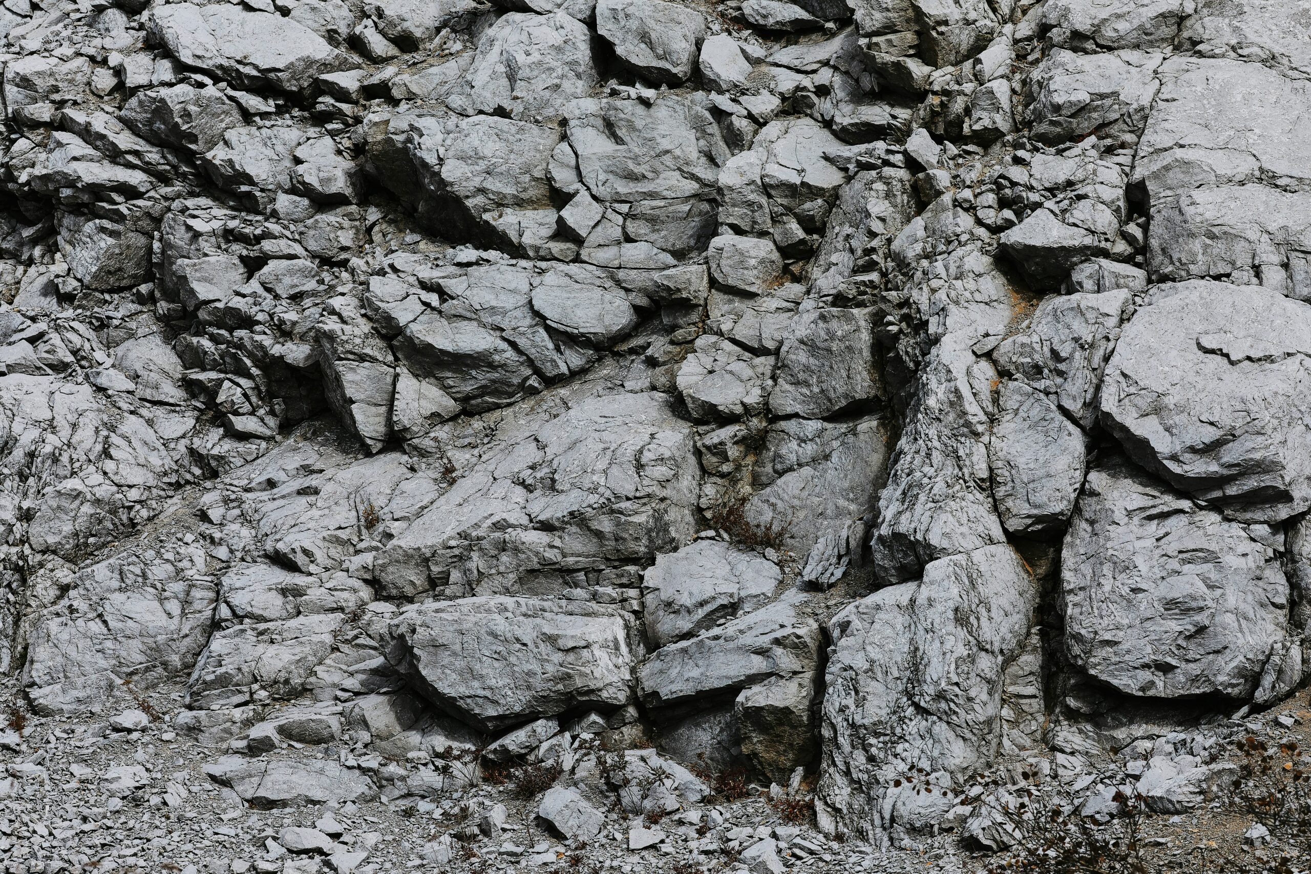
Rocks, seemingly static and inert, are in fact keepers of an extraordinary chronicle, a silent testament to immense spans of time and dramatic transformations. Geologists, the planet’s detectives, possess the unique ability to decipher these stony narratives, unraveling the Earth’s deep past through meticulous observation, scientific inquiry, and a profound understanding of geological processes. Their work, often carried out in remote landscapes or within the controlled environments of laboratories, is essential for comprehending everything from the formation of continents and the origins of life to the distribution of valuable resources and the mitigation of natural hazards. Tracing rocks, as it were, is not merely an academic pursuit; it is a fundamental endeavor that shapes our understanding of our home planet and our place within its grand, unfolding story.
The Geologist’s Toolkit: Instruments of Discovery
To unlock the secrets held within the Earth’s crust, geologists employ a diverse array of tools, ranging from the seemingly simple to the highly sophisticated. Each piece of equipment serves a specific purpose in the ongoing investigation, contributing to a comprehensive picture of geological history and processes. The reliance on both field and laboratory methods underscores the multifaceted nature of geological research.
Field Observations: The Foundation of Geological Understanding
The bedrock of geological research is laid in the field, where geologists directly interact with the Earth’s surface. This hands-on approach allows for the collection of contextualized data, a crucial element for accurate interpretation. Without the understanding gained from observing rocks in their natural setting, laboratory analysis often lacks its full explanatory power.
The Compass and Clinometer: Orienting the Unseen
Essential for mapping and structural analysis, the compass provides orientation, indicating cardinal directions. Coupled with a clinometer, which measures the dip and strike of rock layers – the angle and direction of their inclination relative to the horizontal plane – geologists can reconstruct the complex folding and faulting that has deformed the Earth’s crust over millennia. This seemingly basic data is vital for understanding tectonic forces and the history of mountain building. Mapping these orientations across a region allows for the identification of larger geological structures, such as anticlines and synclines, revealing the immense pressures that have shaped the land.
The Rock Hammer: A Tool for Direct Revelation
The humble rock hammer is perhaps the most iconic tool of the field geologist. More than just a means to break off samples, it’s an instrument of examination. With a few carefully placed strikes, geologists can expose fresh rock surfaces, free from weathering and alteration, revealing the true composition, texture, and internal structures of the rock. This allows for direct observation of minerals, grain size, and any visible fossils or evidence of past geological activity. The subtle nuances of how a rock fractures can also provide clues about its internal strength and the stresses it has endured.
Detailed Note-Taking and Photography: Preserving the Moment
Accurate and comprehensive field notes are as important as the samples collected. Geologists meticulously record observations about rock type, layering, weathering patterns, the presence of faults, joints, and any other significant features. Alongside these notes, detailed photographs are taken, often with a scale bar for reference, to document the context of the samples and the broader geological setting. These records are invaluable for later analysis and for communicating findings to other scientists. The ability to mentally revisit a site through detailed notes and images is a crucial aspect of the geological scientific method.
Laboratory Analysis: Unveiling the Microscopic and Molecular
Once samples are collected, the true analytical work often begins in the laboratory. Here, sophisticated instruments allow geologists to examine the rocks at scales ranging from microscopic to molecular, revealing their elemental composition, age, and the conditions under which they formed.
Microscopes: Windows to the Mineral World
The petrographic microscope is a cornerstone of geological laboratory work. By preparing thin sections of rock – incredibly thin slices mounted on glass slides – geologists can examine the individual mineral grains and their relationships with transmitted light. This reveals crystal shapes, optical properties, and intergrowths that are invisible to the naked eye, allowing for precise mineral identification and an understanding of how the rock solidified or metamorphosed. Polarizing filters and different illumination techniques further enhance the visibility of specific mineral characteristics. Electron microprobes and scanning electron microscopes (SEMs) can provide even higher resolution, allowing for the analysis of mineral chemistry and the fine details of rock texture at the nanoscale.
Geochronological Techniques: Dating the Deep Past
Determining the age of rocks is fundamental to understanding geological timelines. Geologists employ a variety of geochronological techniques, which rely on the predictable decay of radioactive isotopes within minerals. Radiometric dating methods, such as Uranium-Lead (U-Pb) dating of zircons or Potassium-Argon (K-Ar) dating of feldspars, can provide remarkably precise ages for igneous and metamorphic rocks, stretching back billions of years. For younger rocks, techniques like Carbon-14 dating (though limited to organic materials and more recent geological periods) or luminescence dating may be used. These dating methods are crucial for correlating rock units across vast distances and for constructing the geological timescale.
Geochemical Analysis: The Rock’s Chemical Fingerprint
Geochemical analysis provides a detailed chemical composition of rocks. Techniques like X-ray fluorescence (XRF) or inductively coupled plasma mass spectrometry (ICP-MS) can determine the abundance of major, minor, and trace elements within a rock sample. This chemical fingerprint can reveal the rock’s origin (e.g., whether it formed from a mantle plume or within continental crust), the source of its materials, and the conditions of its formation and alteration. Understanding the elemental composition can also help in the exploration for mineral and energy resources.
Geologists employ various techniques to trace the origins and movements of rocks, utilizing methods such as radiometric dating and isotopic analysis to uncover the geological history of an area. This process not only helps in understanding the formation of the Earth’s crust but also provides insights into past environmental conditions. For a fascinating exploration of how archaeological digs can reveal hidden histories, you can read about a particularly intriguing case in the article titled “The Curse of the Mummy’s Tomb: The Dig That Should Have Stayed Buried” found at this link.
The Language of Rocks: Mineralogy and Petrology
The foundation of understanding any rock lies in its constituent minerals and the rock type itself. Mineralogy, the study of minerals, and petrology, the study of rocks, are the twin pillars upon which much of geological interpretation rests. Each mineral and each rock type tells a story about its genesis and the environment it experienced.
Mineralogy: The Building Blocks of the Earth
Minerals are naturally occurring, inorganic solids with a definite chemical composition and a specific crystalline structure. Their individual properties – color, hardness, luster, cleavage, and fluorescence – are not merely aesthetic but are direct reflections of their atomic arrangement and chemical bonding.
Identifying Minerals: A Detective’s Skill
The identification of minerals is a critical first step in rock analysis. Geologists learn to recognize common minerals based on their physical properties, often using a Mohs hardness scale to compare the scratch resistance of unknown minerals against a set of known standards. The way a mineral breaks (cleavage) or fractures, its crystal habit (the characteristic shape of its crystals), and its streak (the color of its powder) are also important diagnostic features. In the laboratory, techniques like X-ray diffraction (XRD) can provide definitive mineral identification by analyzing the unique pattern of diffraction that occurs when X-rays interact with the mineral’s crystal lattice.
The Significance of Crystal Structure
The arrangement of atoms within a mineral’s crystal lattice dictates many of its properties. For instance, the difference between diamond and graphite, both composed solely of carbon atoms, lies in their crystal structures. Diamond’s tightly packed, tetrahedral structure makes it incredibly hard, while graphite’s layered structure allows its atoms to slide past each other, making it soft and useful as a lubricant. Understanding these structural differences is key to understanding mineral behavior and formation.
Petrology: Classifying and Understanding Rock Types
Petrology encompasses the study of the origin, occurrence, composition, structure, and history of rocks. Rocks are broadly classified into three main categories: igneous, sedimentary, and metamorphic, each formed through distinct geological processes.
Igneous Rocks: Born of Fire
Igneous rocks form from the cooling and solidification of molten rock, known as magma (beneath the Earth’s surface) or lava (on the surface). Their texture – the size, shape, and arrangement of their mineral grains – provides crucial clues about their cooling history. Fine-grained igneous rocks like basalt indicate rapid cooling, typically at the surface, while coarse-grained rocks like granite suggest slow cooling deep within the Earth. The mineral composition of igneous rocks further classifies them, with rocks rich in silica and aluminum (felsic) differing from those richer in iron and magnesium (mafic).
Sedimentary Rocks: Layered Histories
Sedimentary rocks are formed from the accumulation and cementation of rock fragments (clasts), mineral grains, or organic matter, often in layers. The study of sedimentary rocks involves interpreting the processes of weathering, erosion, transport, deposition, and lithification. The size and sorting of clasts in conglomerate or sandstone, for example, can indicate the energy of the transporting medium (e.g., a fast-flowing river or a gentler stream). The presence of fossils within sedimentary rocks is paramount for understanding past life and environments, offering insights into ancient climates and ecosystems. The study of these layers, known as stratigraphy, forms the backbone of geological mapping and the construction of geological time scales.
Metamorphic Rocks: Transformed by Heat and Pressure
Metamorphic rocks are formed when pre-existing rocks (igneous, sedimentary, or even other metamorphic rocks) are subjected to increased temperatures, pressures, or chemically active fluids, causing them to recrystallize and change their mineralogy and texture. The type of metamorphism experienced – contact metamorphism near intrusions or regional metamorphism associated with mountain building – leaves distinct imprints on the rock. Foliation, a layered or banded appearance, is a common characteristic of many metamorphic rocks, reflecting the alignment of platy or elongated minerals under directional pressure. Examples include marble (from limestone), slate (from shale), and schist. The mineral assemblages in metamorphic rocks can be powerful indicators of the temperature and pressure conditions they endured.
The Dynamic Earth: Plate Tectonics and Geodynamics
The Earth is not a static sphere but a geologically active planet, constantly reshaped by internal forces. The theory of plate tectonics provides the overarching framework for understanding these large-scale geological processes, explaining seismic activity, volcanism, and the formation of mountains and oceans.
Plate Boundaries: Where the Continents Collide and Separate
The Earth’s lithosphere is broken into a series of large, rigid plates that move relative to each other. The interactions at these plate boundaries are the drivers of most geological phenomena.
Convergent Boundaries: Collision and Subduction
At convergent boundaries, tectonic plates collide. This can lead to the creation of vast mountain ranges, such as the Himalayas, formed by the collision of the Indian and Eurasian plates. In other scenarios, denser oceanic plates are forced beneath lighter continental plates in a process called subduction, driving volcanic arcs and deep ocean trenches. The immense pressure and heat generated at these boundaries contribute to the formation of regional metamorphic rocks. The detailed mapping of seismic activity and volcanic chains provides direct evidence of these plate interactions.
Divergent Boundaries: The Birth of New Crust
At divergent boundaries, tectonic plates move apart. This process is responsible for the creation of new oceanic crust at mid-ocean ridges, where magma rises from the mantle to fill the gap. The Mid-Atlantic Ridge is a prime example of a divergent boundary. On continents, rifting can occur, leading to the formation of rift valleys, which may eventually evolve into new ocean basins. The geological structures and rock types found in these areas offer insights into the processes of continental breakup and seafloor spreading.
Transform Boundaries: Plates Sliding Past Each Other
At transform boundaries, tectonic plates slide horizontally past each other. This movement is not smooth and is often accompanied by significant seismic activity. The San Andreas Fault in California is a well-known example of a transform boundary. While these boundaries do not typically involve the creation or destruction of crust, the immense friction and stress buildup can lead to powerful earthquakes. Understanding the slip rates and stress accumulation along these faults is critical for seismic hazard assessment.
Mantle Dynamics: The Engine Beneath the Crust
The movement of tectonic plates is driven by convection currents within the Earth’s mantle, a thick layer of silicate rock between the crust and the core. Hotter, less dense material rises, while cooler, denser material sinks, creating a slow but powerful circulation that drags the overlying plates along.
Mantle Plumes: Hotspots of Volcanic Activity
Mantle plumes are columns of superheated rock that rise from deep within the Earth’s mantle, often independent of plate boundaries. As a plume ascends, it can melt, leading to volcanic activity at the surface. The Hawaiian Islands are a classic example of a volcanic chain formed by a mantle plume passing beneath a moving tectonic plate. Studying the chemistry and isotopic composition of the lavas erupted from hotspots can provide clues about the composition and origin of deep mantle material. These geological hotspots are valuable sites for understanding the long-term thermal evolution of the Earth.
The Role of Asthenosphere and Lithosphere
The lithosphere, the rigid outer shell of the Earth comprising the crust and upper mantle, is broken into tectonic plates. Beneath the lithosphere lies the asthenosphere, a partially molten and ductile layer of the upper mantle. The asthenosphere’s plasticity allows the rigid lithospheric plates to move over it, much like rafts floating on a viscous fluid. The understanding of these rheological properties is fundamental to geodynamic modeling.
Tracing Earth’s History: Stratigraphy and Paleontology
The layered nature of sedimentary rocks provides a chronological record of past environments and life. Stratigraphy, the study of rock layers, and paleontology, the study of fossils, are inextricably linked in reconstructing Earth’s ancient past.
Stratigraphy: Reading the Layers of Time
Stratigraphy is the science of layered rocks. By understanding fundamental principles like the Law of Superposition (older layers are deposited beneath younger layers) and the Principle of Lateral Continuity (sedimentary layers extend laterally until they thin out or encounter a barrier), geologists can decipher the relative ages of rock formations and reconstruct depositional environments.
Unconformities: Gaps in the Geological Record
Unconformities represent periods of erosion or non-deposition, creating breaks in the otherwise continuous rock record. Identifying and characterizing unconformities is crucial for understanding periods of geological change, such as uplift and erosion or transgressions and regressions of ancient seas. These breaks in the stratigraphy are as informative as the layers themselves, marking significant shifts in geological conditions.
Lithostratigraphy and Biostratigraphy: Correlation and Dating
Lithostratigraphy uses the physical characteristics of rock layers (lithology) to correlate formations across different areas. Biostratigraphy, on the other hand, uses the fossil content of sedimentary rocks to establish relative ages and correlate rock units. Certain fossils, known as index fossils, are particularly useful for dating because they existed for relatively short geological periods but were widespread. The integration of these stratigraphic approaches allows for the construction of detailed geological maps and the correlation of rock successions over vast regions.
Paleontology: Whispers from Ancient Worlds
Paleontology is the study of fossils, the preserved remains or traces of ancient life. Fossils provide invaluable direct evidence of evolution, past ecosystems, and environmental conditions.
Fossil Preservation: A Rare Occurrence
Fossilization is a relatively rare process, requiring specific conditions for organic remains to be preserved. Common types of fossilization include permineralization (where minerals fill the porous spaces of bone or wood), cast and mold formation (where the original organism dissolves, leaving an imprint), and carbonization (where organic material is compressed into a thin film of carbon). The discovery of exceptionally preserved fossils, such as those found in amber or fine-grained shale, can reveal exquisite details of ancient anatomy.
Reconstructing Ancient Ecosystems
By studying the types of fossils found in a particular rock layer, paleontologists can reconstruct ancient ecosystems and environments. The presence of marine fossils, for example, indicates a past marine environment, while fossilized plant remains can reveal information about past climates and vegetation. The relationships between different fossil organisms can also shed light on predator-prey dynamics and competitive interactions. Understanding these past ecosystems helps us appreciate the long-term evolutionary trajectory of life on Earth.
Evolution and Extinction: The Story of Life’s Journey
Fossils are the primary evidence for the theory of evolution. The gradual changes observed in fossil lineages over geological time demonstrate the process of natural selection and the diversification of life. Paleontology also documents major extinction events, such as the Cretaceous-Paleogene extinction that wiped out the non-avian dinosaurs. Studying these extinction events and the subsequent recovery of life provides insights into the resilience and adaptability of biological systems in the face of catastrophic environmental change.
Geologists employ various techniques to trace the origins and movements of rocks, allowing them to understand the geological history of an area. One fascinating method involves analyzing isotopic compositions, which can reveal the conditions under which the rocks formed. For a deeper insight into how different fields approach complex issues, you might find this article on the government’s approach to nationalizing retirement particularly interesting. It explores how systematic analysis can lead to significant policy decisions, much like how geologists interpret rock data. You can read more about it here.
Applied Geology: Resources, Hazards, and the Future
The knowledge gained from tracing rocks has profound practical applications, impacting our daily lives in numerous ways, from the extraction of essential resources to the mitigation of natural hazards. Geologists play a crucial role in ensuring a sustainable future.
Resource Exploration: Fueling Modern Civilization
The Earth’s crust is a treasure trove of valuable resources, including minerals, metals, fossil fuels, and groundwater. Geologists are at the forefront of identifying and extracting these resources responsibly.
Mineral and Metal Deposits: The Foundation of Industry
Geologists employ their understanding of rock formation processes and structural geology to locate deposits of economically important minerals and metals. For example, they study igneous intrusions and hydrothermal systems to find zones rich in copper, gold, or rare earth elements. Sedimentary environments are investigated for deposits of coal, oil, natural gas, and various industrial minerals like limestone and gypsum. The application of geophysical methods, such as magnetic and gravity surveys, further aids in subsurface exploration.
Groundwater Resources: A Vital Water Supply
Understanding the subsurface geology is essential for managing and protecting groundwater resources. Geologists map aquifers – underground layers of rock or sediment that can hold and transmit groundwater – and assess their recharge rates and potential for contamination. This knowledge is crucial for ensuring a sustainable supply of potable water for communities and for agriculture. The interaction between surface water and groundwater is a key area of study for managing water budgets.
Natural Hazard Assessment and Mitigation: Protecting Communities
Geological processes can pose significant risks to human populations. Geologists assess and monitor these hazards, working to minimize their impact.
Earthquakes and Volcanic Eruptions: Understanding and Predicting
Geologists study faulting and seismic activity to assess earthquake risks in different regions. They monitor volcanic activity, analyzing seismic data, gas emissions, and ground deformation to predict and warn of potential eruptions. Understanding the geological factors that control the location and style of volcanic eruptions is vital for developing effective hazard mitigation strategies. The mapping of active fault lines and the identification of potentially active volcanoes are critical components of land-use planning in hazard-prone areas.
Landslides and Flooding: Predicting and Preventing Catastrophes
The stability of slopes and the dynamics of river systems are heavily influenced by geological factors. Geologists assess areas prone to landslides, examining soil types, rock structure, and groundwater levels. They also study river morphology and sediment transport to understand flood risks and develop strategies for flood control, such as the identification of appropriate locations for levees and reservoirs. The long-term geological evolution of a landscape plays a significant role in determining its susceptibility to these natural processes.
Environmental Geology: Safeguarding Our Planet
Geologists are increasingly involved in addressing environmental challenges, from waste disposal to climate change.
Waste Disposal and Site Remediation: Protecting the Environment
The safe disposal of hazardous waste is a critical environmental concern. Geologists evaluate potential sites for landfills and other waste disposal facilities, assessing their geological suitability to prevent contamination of soil and groundwater. They also play a role in remediating contaminated sites, developing strategies to clean up pollutants and restore affected environments. The understanding of groundwater flow and the behavior of contaminants within geological media is paramount.
Climate Change and Geological Evidence: A Long-Term Perspective
The geological record provides a long-term perspective on Earth’s climate. By studying ice cores, sedimentary layers, and fossil evidence, geologists can reconstruct past climate patterns and understand the natural cycles of climate change. This historical context is invaluable for understanding the current trends of anthropogenic climate change and for predicting potential future impacts. The study of ancient shorelines, for example, can reveal past sea-level fluctuations caused by variations in global temperature.
In conclusion, tracing rocks is far more than an abstract scientific pursuit. It is a fundamental endeavor that allows us to read the Earth’s autobiography, to understand the forces that have shaped our planet over eons, and to navigate its present and future challenges. Through their meticulous work, geologists provide the essential knowledge that underpins our understanding of the world beneath our feet, ensuring a more informed and sustainable relationship with our dynamic home. The ongoing quest to decipher the stony narratives of our planet continues to reveal astonishing insights, reminding us of the immense timescales and powerful processes that have forged the Earth we inhabit.

The Boulder That Shouldn’t Exist
FAQs
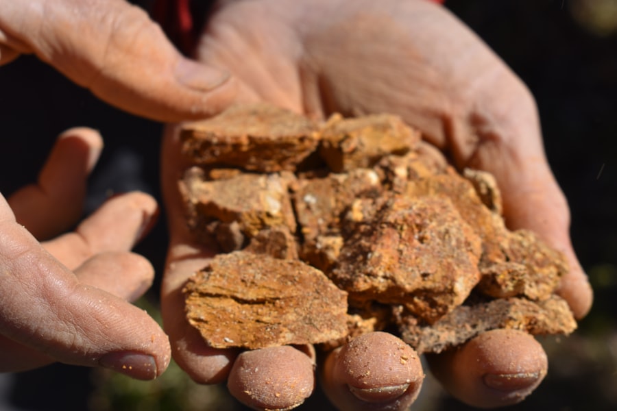
What tools do geologists use to trace rocks?
Geologists use a variety of tools to trace rocks, including hand lenses, rock hammers, compasses, GPS devices, and geological maps.
How do geologists identify the age of rocks?
Geologists use a method called radiometric dating to determine the age of rocks. This involves measuring the amount of radioactive isotopes in the rock and calculating how long it has been decaying.
What is the process of tracing the origin of rocks?
Geologists trace the origin of rocks by studying their mineral composition, texture, and structure. They also analyze the surrounding geological features and use techniques such as geochemical analysis and isotopic dating.
How do geologists use fossils to trace rocks?
Geologists use fossils found in rocks to determine the age of the rock and the environment in which it formed. By studying the type of fossils present and their distribution, geologists can infer the age and depositional environment of the rock.
What are the practical applications of tracing rocks for geologists?
Tracing rocks allows geologists to understand the Earth’s history, reconstruct past environments, locate natural resources, and assess geological hazards. It also helps in the exploration and extraction of minerals and fuels.