Unraveling the Mysteries of Glacial Geology
The Earth’s surface, as it appears today, is a testament to an ancient and dynamic history. Among the most profound shapers of this landscape are glaciers. These colossal rivers of ice, born from accumulated snowfall over millennia, possess an astonishing power to sculpt, transport, and deposit earth materials. Glacial geology, therefore, is the scientific discipline dedicated to understanding these icy architects and the indelible marks they leave upon our planet. It is a field that bridges the disciplines of geology, geomorphology, climatology, and even paleontology, offering a window into past climates, tectonic processes, and the very evolution of Earth’s surface. To unravel the mysteries of glacial geology is to embark on a journey through time, deciphering the stories etched into rocks, landforms, and even the composition of our atmosphere by the ceaseless movement of ice.
The genesis of a glacier is a deceptively simple yet crucial process. It begins with snowfall, a seemingly ephemeral phenomenon. However, under specific conditions, this snowfall does not melt entirely during the warmer months. Accumulation begins. The weight of overlying snow compresses the snow beneath it, transforming it from delicate snowflakes into granular snow, then into firn, a dense, semi-frozen snow resembling small ice pellets. As this process continues year after year, and the firn layer thickens, the pressure intensifies dramatically.
Snow Accumulation and Transformation
The transformation from snow to glacial ice is a testament to the power of pressure and time. In regions with consistent cold temperatures and sufficient snowfall, typically at high altitudes or high latitudes, snow accumulates year after year. The initial snowflakes, with their intricate crystalline structures, are relatively buoyant and easily compressible. As more snow falls, the lower layers are subjected to increasing weight. This pressure causes the air spaces between the snow crystals to shrink.
From Granular Snow to Firn
The first stage of transformation sees the snow becoming more dense and less fluffy. The delicate arms of the snowflakes begin to break down, and the snow crystals start to merge, forming a more granular texture. This transitional stage is known as granular snow. As the accumulation continues and the pressure increases, the individual grains of snow begin to deform and fuse together. This process further reduces pore space and increases density. The product of this compression is firn, a material that is still permeable to air but has a more compact and ice-like appearance. Firn often resembles coarse-grained ice or compacted sugar. The transition from granular snow to firn is a gradual one, typically occurring over years to decades, depending on the rate of snowfall and the surrounding temperature.
The Formation of Glacial Ice
The critical threshold for the formation of glacial ice is reached when the firn layer becomes so thick and dense that the air is effectively squeezed out. Under immense pressure, the firn grains recrystallize, becoming larger and interlocked. This process effectively seals off the air pockets, and the material becomes solid, impermeable glacial ice. This ice is not merely frozen water; it is a metamorphic rock, formed under enormous geological pressures. The characteristic blue color of glacial ice is a result of light absorption: as ice becomes denser and purer, it absorbs red and yellow wavelengths of light, reflecting predominantly blue light. This density and purity are achieved through the complete exclusion of air bubbles, a hallmark of true glacial ice.
The Dynamics of Ice Flow
Once a sufficient mass of ice has accumulated, gravity takes over. Glaciers are not static entities; they are dynamic, flowing bodies of ice. This flow is driven by a combination of internal deformation and basal sliding.
Internal Deformation: Creeping Under Pressure
The immense weight of a glacier causes its ice to deform internally. Even though ice is a solid, under sustained pressure, it behaves like a very viscous fluid over geological timescales. The ice crystals begin to deform and rearrange themselves. Think of it like a very thick, slow-moving molasses. This internal deformation is known as creep. Under extreme pressure, the ice grains within the glacier begin to slide past each other, and the crystalline structure of the ice itself can deform. This allows the glacier to move downslope, albeit very slowly, often at rates measured in centimeters or meters per year. The rate of internal deformation is influenced by temperature, ice thickness, and the composition of the ice itself.
Basal Sliding: The Slippery Floor
In many cases, glacial movement is significantly enhanced by basal sliding. This occurs when the base of the glacier is warm enough to melt, creating a thin layer of meltwater between the ice and the underlying bedrock. This meltwater acts as a lubricant, allowing the entire mass of the glacier to slide more rapidly over the bedrock. Factors contributing to basal melting include geothermal heat from the Earth’s interior and friction generated by the ice moving over the bedrock. If the bedrock is smooth and relatively impermeable, basal sliding can be the dominant mode of movement, leading to faster glacial advance. Conversely, if the glacier is frozen to its bed, movement occurs primarily through internal deformation.
Glacial geology is a fascinating field that explores the impact of glaciers on the Earth’s landscape, climate, and ecosystems. For those interested in understanding how geological processes shape our environment, a related article discussing the economic implications of trade between the U.S. and Mexico can provide valuable insights into how these processes influence human activities. You can read more about this topic in the article found here: Sheinbaum’s Impact on U.S.-Mexico Trade.
Sculpting the Earth: The Erosive Power of Glacial Ice
As glaciers flow, they are not simply passive observers of the landscape. Their immense weight and abrasive ice particles transform the underlying topography with remarkable force. Glacial erosion is a paramount force in shaping Earth’s most dramatic mountainous and polar regions, leaving behind a suite of distinctive landforms.
Abrasion: The Grinding Action of Ice
The surface of a glacier is often littered with rock debris, from fine dust to large boulders. As the ice flows, this debris is dragged along the bedrock, acting like sandpaper. This process, known as abrasion, grinds away at the underlying rock, smoothing and polishing its surface. The effect of abrasion is a gradual removal of bedrock, contributing to the deepening and widening of valleys.
Striations and Grooves: The Scars of Movement
When examining glacial bedrock, geologists often find deep grooves and parallel scratches, known as striations. These are direct evidence of the abrasive action of embedded rocks within the glacier. The direction of these striations provides a clear indication of the path the glacier took, offering invaluable clues about past ice flow dynamics. These marks are akin to the scratches left by a heavy-duty sander on a piece of wood, but on a colossal geological scale.
Rock Flour: The Unseen Grinder
The fine material produced by abrasion, often referred to as rock flour, is a potent erosional agent. This pulverized rock, composed of incredibly fine mineral particles, is suspended within the glacial meltwater. As this meltwater flows, it continues to abrade and transport sediment, further contributing to the erosive power of the glacier and influencing the characteristics of glacially fed rivers and lakes.
Plucking: The Ice’s Grip on the Rock
Beyond abrasion, glaciers also employ a process called plucking, or quarrying. When a glacier flows over irregular bedrock, meltwater can seep into cracks and fissures. As temperatures drop, this meltwater freezes, expanding and widening the cracks. When the glacier moves again, it can exert enough force to break off chunks of rock, which are then incorporated into the ice and carried away.
Roche Moutonnées: Sculpted Boulders
A classic example of plucking is the formation of roche moutonnées – streamlined, asymmetrical rock hills. The up-ice side, facing the flow of the glacier, is typically smoother and more rounded due to abrasion, while the down-ice side is often steeper and more rugged, characterized by the jagged shapes formed by plucking. These landforms are often described as resembling sheep huddled together, hence their French name.
The Depositional Legacy: Glacial Landforms
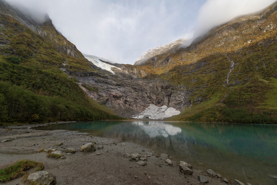
The journey of a glacier is not solely destructive. As ice melts, the vast quantities of sediment it has carried are deposited, creating a diverse array of landforms that tell a story of glacial retreat and activity. These depositional features are crucial for understanding past glacial extents and environments.
Till: The Unsorted Blanket of Sediment
The most fundamental glacial deposit is till. This is a heterogeneous mixture of clay, silt, sand, gravel, and boulders, directly deposited by melting ice. Till is characteristically unsorted and unstratified, meaning its components are jumbled together without any discernible layering or size segregation. This is because the ice dumps its debris indiscriminately as it melts.
Moraines: Ridges of Deposited Debris
Moraines are perhaps the most recognizable glacial depositional landforms. They are ridges or mounds of till that mark the former margins of a glacier. Different types of moraines are indicative of different glacial processes and histories.
Terminal Moraines: The Edge of Retreat
Terminal moraines are formed at the furthest extent of a glacier’s advance. As the glacier melts, it deposits its accumulated load of till at its snout. This creates a ridge that marks the maximum ice cover. Subsequent retreats of the glacier can leave behind multiple terminal moraines, forming a series of arcs or bands across the landscape.
Lateral and Medial Moraines: Building Up the Sides
Lateral moraines form along the sides of a glacier, as till is deposited against valley walls. When two glaciers merge, their adjacent lateral moraines can fuse to form a medial moraine, a prominent ridge running down the center of the combined glacier.
Drumlins: Streamlined Hills of Till
Drumlins are teardrop-shaped hills composed of till, with their long axis aligned in the direction of ice flow. They are formed beneath a moving glacier, likely through a combination of till deposition and differential erosion. Their smooth, streamlined shape indicates the direction of past glacial movement.
Stratified Drift: Sorted by Meltwater
While till is unsorted, deposits made by glacial meltwater are sorted and stratified. This material, known as stratified drift or outwash, is laid down by streams and rivers flowing from the melting glacier.
Outwash Plains: Spreading Out the Sediment
Outwash plains are broad, relatively flat areas formed by the deposition of sediment carried by meltwater streams. These plains often exhibit a gently sloping surface and contain layers of sand and gravel, reflecting the sorting and depositional processes of flowing water.
Eskers: Winding Rivers of Sand and Gravel
Eskers are long, winding ridges of sand and gravel that are deposited by meltwater streams flowing within, beneath, or upon a glacier. These streams often carved tunnels through the ice, and as the glacier receded, the abandoned stream channels became preserved as sinuous ridges on the landscape.
Kames: Irregular Mounds of Sorted Material
Kames are irregular mounds or hills composed of sorted sand and gravel, formed by the deposition of sediment in depressions or crevasses on the stagnant ice margin or within the glacier itself.
Glacial Landforms in Water: Lakes and Fjords
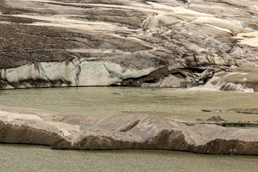
Glaciers not only shape terrestrial landscapes but also exert a profound influence on aquatic environments, creating unique and breathtaking features. The erosive and depositional power of ice can dramatically alter coastlines and create vast inland water bodies.
Glacial Lakes: Carved and Created
The formation of lakes is a common consequence of glacial activity. The erosive power of glaciers can carve out basins in bedrock, which then fill with water as the ice melts. Additionally, the deposition of moraines can act as natural dams, impounding meltwater and forming lakes.
Kettle Lakes: Depressions from Buried Ice
Kettle lakes are formed when blocks of ice become buried in glacial outwash. As these ice blocks melt, they leave behind depressions in the ground, which then fill with water, creating small, often circular lakes.
Finger Lakes: Elongated Valleys of Meltwater
The well-known Finger Lakes region of New York is a prime example of glacially carved valleys filled with water. These elongated lakes were carved by massive ice sheets that eroded pre-existing river valleys, deepening and widening them before they were filled with meltwater.
Fjords: The Inundated Glacial Troughs
Fjords are dramatic, often deep, and steep-sided inlets of the sea, formed by the erosion of valleys by glaciers during periods of glaciation. As the glaciers retreated, the sea intruded into these U-shaped glacial troughs, creating the characteristic fjord landscape.
The U-Shaped Valley: A Glacial Hallmark
The underlying geomorphology of a fjord is the U-shaped valley, a direct product of glacial erosion. Unlike river valleys, which are typically V-shaped, glacial valleys are broadened and deepened by the immense erosive power of ice, resulting in a distinctive U-shape with steep, often sheer sides.
Post-Glacial Marine Intrusion
The formation of fjords is completed as sea levels rise following deglaciation. The ocean floods the glacially carved valleys, creating the long, narrow, and often very deep inlets characteristic of fjord coastlines found in Norway, Alaska, Chile, and New Zealand.
Glacial geology is a fascinating field that explores the processes and formations created by glaciers over time. For those interested in learning more about this subject, a related article delves into the hidden secrets of Antarctica and how its icy landscape has shaped our understanding of climate change. You can read more about this intriguing topic in the article Unveiling Antarctica’s Hidden Secrets, which highlights the significant role glaciers play in our planet’s geological history.
Unveiling Past Climates: The Paleoclimatic Archives of Ice
| Glacial Geology Explained | ||
|---|---|---|
| Glacial Erosion | Formation of Glacial Landforms | Glacial Deposits |
| Processes of abrasion and plucking | Moraines, drumlins, eskers, and kames | Till, outwash, and loess |
| Impact on landscape and topography | Distinctive features created by glaciers | Composition and distribution of glacial sediments |
Beyond shaping the physical landscape, glaciers serve as invaluable archives of Earth’s past climate. The ice itself, along with the sediment trapped within and beneath it, contains a wealth of information that allows scientists to reconstruct ancient climatic conditions with remarkable detail.
Ice Cores: Frozen Time Capsules
Perhaps the most direct and informative paleoclimatic archives are ice cores drilled from the vast ice sheets of Antarctica and Greenland. These cylindrical samples of ice encapsulate ice and trapped air bubbles from millennia of snowfall.
Trapped Air Bubbles: A Window to the Atmosphere
The tiny air bubbles trapped within glacial ice are essentially miniature samples of Earth’s ancient atmosphere. By analyzing the composition of the gases within these bubbles, scientists can determine past atmospheric concentrations of greenhouse gases like carbon dioxide and methane, as well as isotopes of oxygen and hydrogen, which provide clues about past temperatures.
Isotopic Analysis: Temperature Proxies
The ratio of different isotopes of oxygen (e.g., 18O to 16O) and hydrogen (e.g., deuterium to hydrogen) in glacial ice is directly related to the temperature at the time the precipitation fell. This relationship acts as a powerful thermometer, allowing scientists to reconstruct past temperature fluctuations over tens to hundreds of thousands of years.
Glacial Sediments and Geochemistry: Indirect Evidence
While ice cores provide direct atmospheric samples, glacial sediments also offer indirect but vital paleoclimatic information. The type of sediment deposited, its grain size distribution, and the geochemical signatures within it can all indicate past climatic conditions.
Pollen Analysis: A Record of Vegetation
Pollen grains preserved in glacial lake sediments or within till can provide information about past vegetation types. Changes in pollen assemblages over time can reveal shifts in climate, as different plant communities are adapted to specific temperature and precipitation regimes.
Geochemical Signatures of Rock Types and Provenance
The geochemical analysis of glacial deposits can help scientists understand the provenance of the ice and the underlying bedrock. This can provide clues about past glacial movements and the types of rocks that were eroded and transported. Furthermore, certain geochemical indicators within the sediments can be sensitive to variations in temperature and moisture, offering additional paleoclimatic insights.
Glacial geology, therefore, is a multifaceted discipline that offers profound insights into Earth’s dynamic history. From the slow, inexorable grind of ice shaping mountains to the delicate preservation of ancient atmospheres within ice cores, the study of glaciers continues to unravel the mysteries of our planet, revealing a story of climate change, geological transformation, and the enduring power of ice. The ongoing research in this field is crucial for understanding contemporary climate change and predicting future impacts on our planet.

The Boulder That Shouldn’t Exist
FAQs
What is glacial geology?
Glacial geology is the study of the geological processes and landforms associated with glaciers, including their formation, movement, and the impact they have on the landscape.
How are glaciers formed?
Glaciers are formed from compacted snow that accumulates over time, eventually turning into ice. This process occurs in areas where the snowfall exceeds the rate of melting, leading to the formation of glaciers.
What are some common glacial landforms?
Common glacial landforms include moraines, drumlins, eskers, and cirques. Moraines are ridges of debris left behind by a glacier, drumlins are elongated hills formed by glacial action, eskers are winding ridges of sediment deposited by meltwater, and cirques are bowl-shaped depressions at the head of a glacier.
How do glaciers impact the landscape?
Glaciers can have a significant impact on the landscape by shaping the land through processes such as erosion, deposition, and transportation of sediment. They can carve out valleys, create lakes, and leave behind distinctive landforms.
What can the study of glacial geology tell us about Earth’s history?
The study of glacial geology can provide insights into past climate conditions, the movement of ice sheets, and the changes in sea level. By examining glacial deposits and landforms, scientists can reconstruct the history of Earth’s climate and understand how glaciers have shaped the landscape over time.