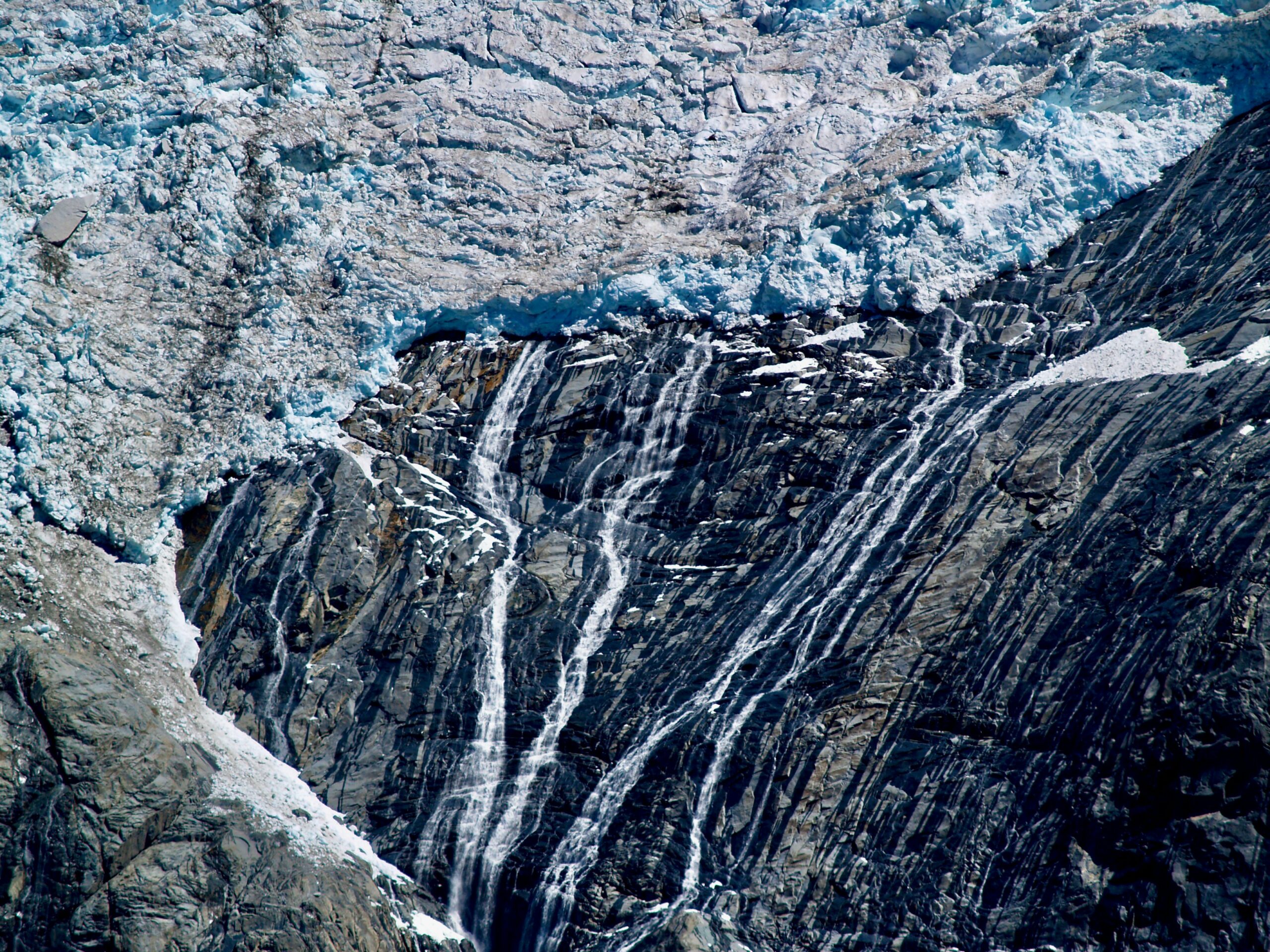
The slow, relentless march of glaciers has sculpted our planet’s landscapes over millennia, leaving behind an astonishing array of geological features. Far from being passive rivers of ice, these massive frozen entities are active agents of erosion and deposition, shaping mountains, carving valleys, and creating unique landforms. Understanding the science behind glacial deposition is key to deciphering the Earth’s history and appreciating the dynamic power of ice. This article delves into the intricate processes by which glaciers deposit their loads, transforming vast landscapes and leaving behind a rich tapestry of geological evidence.
Glaciers are essentially enormous, mobile rivers of ice, formed over centuries as snow accumulates, compresses, and recrystallizes. Their bulk and immense pressure grant them considerable power, enabling them to act as both powerful erosional agents and highly effective transporters of geological material.
How Glaciers Acquire Their Load
Glaciers don’t simply scoop up sediment; their load is acquired through a combination of processes occurring at the glacier’s base and along its sides. This material, ranging from fine silt to colossal boulders, becomes an integral part of the ice, carried along like a geological conveyor belt.
Freeze-Thaw Weathering at the Bedrock
One of the primary mechanisms for acquiring sediment is through freeze-thaw weathering at the glacier’s base. As meltwater seeps into cracks and fissures in the bedrock beneath the ice, it can freeze. Water expands when it freezes, exerting significant pressure that widens these cracks. Repeated cycles of freezing and thawing can break off fragments of rock, creating a supply of material that can be entrained by the glacier.
Plucking and Quarrying
Glaciers employ a process known as “plucking” or “quarrying” to dislodge larger rock fragments. As the ice flows over irregular bedrock, downward pressure can cause the ice to melt slightly and refreeze in cavities and depressions. When the glacier then moves forward, it grips these frozen rock pieces and pulls them away from the bedrock. Imagine pulling a loose brick from a wall – this is analogous to what happens during quarrying. The basal ice, often carrying abrasive rock debris, also acts like sandpaper, further eroding the bedrock and contributing to the glacial load.
Frost Shoving and Abasion
In some instances, particularly where permafrost is present beneath the glacier, a process called “frost shoving” can contribute to the load. The expansion of ice within saturated soils or fractured rock can push large masses upwards and outwards, making them accessible for plucking. Additionally, the abrasive action of rock fragments already embedded in the basal ice against the underlying bedrock is known as “abasion.” This grinding and scraping process wears down the bedrock and creates a fine pulverized material (glacial flour) that is also incorporated into the ice.
The Immense Carrying Capacity of Glaciers
The sheer volume and weight of glaciers are astounding. A large glacier can contain trillions of tons of ice. This immense mass exerts tremendous pressure on the underlying terrain, facilitating the entrainment of sediment. The ice itself acts as a viscous fluid, capable of carrying a vast array of material, from microscopic particles to massive erratics that dwarf human structures.
Basal Load vs.englacial Load
The material transported by a glacier is categorized into two main types: the basal load and the englacial load. The basal load consists of sediment that is in direct contact with the glacier’s base and is therefore subject to the most intense abrasion, plucking, and freeze-thaw action. This load typically includes larger rock fragments, cobbles, and boulders. The englacial load, on the other hand, refers to debris that is carried within the body of the ice itself. This material can be incorporated through crevasses opening and debris falling in, or through subglacial melting and refreezing events. While englacial debris also experiences abrasion, it is generally less intense than at the base, resulting in a mix of angular and rounded fragments, along with fine sediment.
Subglacial Transport Mechanisms
The movement of sediment at the glacier’s base is a complex process. Theories suggest that the basal ice can deform plastically, allowing the incorporated debris to move along with the ice flow. In some cases, a thin layer of meltwater may exist between the ice and the bedrock, facilitating sliding and the transport of sediment. The rate at which this material is transported is directly linked to the glacier’s overall velocity. Faster-flowing glaciers are more efficient at moving their glacial load.
Glacial deposition is a fascinating geological process that shapes our landscapes, leaving behind a variety of landforms such as moraines, drumlins, and outwash plains. For a deeper understanding of how these processes relate to human history and industry, you might find the article on the evolution of the American factory worker insightful. It explores how the changing environment, including glacial activity, has influenced industrial development in the United States. You can read more about it in this article: The Evolution of the American Factory Worker.
Deposition: The Glacier’s Creative End
As a glacier retreats, melts, or experiences changes in its ice dynamics, it releases the vast quantities of sediment it has been carrying. This release, known as glacial deposition, is responsible for the formation of a diverse range of distinctive landforms that characterize glaciated regions. The nature of the deposited material and the landforms it creates are heavily influenced by the processes of transport and how the ice melts.
Till: The Unsorted Signature of Glacial Deposition
The most characteristic deposit left by a glacier is till. Till is unsorted and unstratified glacial drift, meaning it contains a wide range of grain sizes, from clay and silt to sand, gravel, cobbles, and boulders, all mixed together without any discernible layering or sorting by water or wind. This haphazard mixture is a direct consequence of the glacier’s depositional process.
Characteristics of Till
The defining feature of till is its heterogeneity. A single deposit can contain fine clay particles alongside massive cobbles, all seemingly at random. This lack of sorting indicates that the material was dropped directly from the melting ice, without the influence of sorting agents like running water or wind, which would arrange particles by size. Till often appears dense and compacted, especially if deposited beneath a moving glacier. Its lithology – the types of rocks present – can provide valuable clues about the glacier’s upstream source area.
Types of Till
While broadly defined as unsorted drift, different types of till can be distinguished based on how and where they were deposited.
Lodgement Till
Lodgement till is deposited at the base of a glacier as it moves. As the ice slowly melts away at the base, it loses its ability to carry its load, and this material is plastered onto the ground beneath. Lodgement till is typically dense, compact, and often exhibits a fabric (alignment of elongated clasts) parallel to the direction of ice flow. It is a very common and widespread glacial deposit.
Melt-out Till (or Ablation Till)
Melt-out till is deposited as the ice melts from the top or sides of the glacier. This material, which was previously englacial or supraglacial (on the surface of the ice), slumps or falls to the ground as the ice disappears. Melt-out till is generally less compact and less sorted than lodgement till. It can also be more heterogeneous in texture and composition, reflecting the diverse origins of the englacial debris. In some cases, melt-out till can form thin layers or lenses, and it is more likely to contain organic material that was trapped in the ice.
Stratified Drift: The Influence of Meltwater
While till represents direct deposition from ice, many glacial landscapes are also shaped by meltwater streams that flow from or beneath glaciers. These streams carry and deposit sediment with a sorting and layering, a marked contrast to the unsorted till.
Outwash Plains
As glaciers melt, large volumes of water are produced. These meltwater streams carry glacial sediment away from the ice margin, spreading it out to form extensive, relatively flat areas known as outwash plains, or sandur. The water sorts the sediment by size, with coarser materials deposited closer to the glacier and finer materials carried further away. The surface of an outwash plain is often crisscrossed by braided stream channels, reflecting the fluctuating flow of meltwater.
Eskers
Eskers are long, sinuous ridges of sand and gravel that are deposited by meltwater streams flowing within, beneath, or on top of glaciers. These streams often flow in tunnels or channels within the ice. As the glacier melts and retreats, the roof of the tunnel collapses, leaving behind a ridge of the deposited sediment. The winding nature of eskers reflects the meandering course of the subglacial or englacial streams.
Kames
Kames are irregular mounds or hills composed of sand, gravel, and till. They are formed by the deposition of sediment into depressions on the glacier’s surface or into crevasses, where meltwater streams or ice melt can deposit their loads. When the surrounding ice melts away, these accumulated sediments are left standing as isolated features. Kames can vary greatly in size and shape, depending on the size and configuration of the ice depression or crevasse.
Kame Terraces
Kame terraces are relatively flat-topped ridges or platforms of sand and gravel that form along the sides of glacial valleys. They are created by meltwater streams flowing between the valley wall and the stagnant or slowly moving ice. As the ice retreats, the sediment deposited by these streams forms a terrace that mirrors the shape of the valley.
Glacial Lakes and Their Deposits
Glacial lakes, often dammed by ice or moraines, are significant environments for sediment deposition. The quiet waters of these lakes allow fine-grained sediments to settle out, creating distinct stratigraphic layers.
Varves
When a glacial lake is fed by meltwater streams that carry sediment, and when the lake is covered by ice or experiences distinct seasonal temperature changes, the deposition can become rhythmically layered. These layers are known as varves. Each varve typically consists of two parts: a coarser, lighter-colored layer deposited during the warmer, more active melt season when sediment influx is high, and a finer, darker-colored layer deposited during the colder, less active winter season when deposition is minimal. Counting varves can provide a precise chronology of glacial lake history and, by extension, glacial retreat.
Lake Sediments
Beyond varves, glacial lakes accumulate a variety of sediments. These can include fine clays and silts, as well as coarser materials dropped by icebergs that calved into the lake (ice-rafted debris). The chemical composition of lake sediments can also provide insights into the climate and environmental conditions during glacial times.
Landforms of Glacial Deposition: Sculpted by Ice and Meltwater
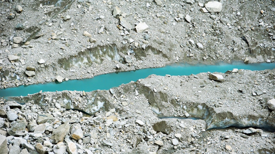
The depositional processes of glaciers are responsible for some of the most iconic and extensive landforms found in glaciated regions. These features are not only aesthetically striking but also provide invaluable historical records of past glacial activity.
Moraines: The Ridges of Entrained Debris
Moraines are perhaps the most recognizable landforms created by glacial deposition. They are ridges or mounds of till or other glacial debris that are accumulated at the edges or beneath a glacier. Moraines act as markers of the glacier’s extent and movement history.
Terminal Moraines
A terminal moraine, also known as a end moraine, marks the furthest extent of a glacier’s advance. As the glacier pushes forward, it accumulates sediment at its snout, forming a ridge. When the glacier then retreats, this ridge of debris is left behind, marking the maximum extent of the ice. Terminal moraines can be substantial features, often forming arcs across the landscape.
Lateral Moraines
Lateral moraines are formed along the sides of a glacier. As the ice erodes the valley walls, debris is incorporated and then deposited along the margins of the glacier. These appear as ridges parallel to the valley sides, often found within the glaciated valley itself. They are typically composed of till and can vary greatly in height and width.
Medial Moraines
When two glaciers merge, the lateral moraines from each glacier meet at the junction and are carried down the combined glacier as a single ridge. This is a medial moraine. Such features indicate the confluence of past ice flows and can be traced for long distances.
Ground Moraines
Ground moraines are widespread, undulating sheets of till deposited beneath a retreating glacier. They are often the most extensive glacial depositional landforms, covering large areas and creating rolling topography. Unlike the more defined ridges of other moraines, ground moraines are generally less distinct and can be masked by later depositional or erosional processes.
Recessional Moraines
Recessional moraines are formed as a glacier pauses during its retreat. As it melts back, it may stabilize for a period, depositing a ridge of debris similar to a terminal moraine. These moraines are found behind the terminal moraine and are often parallel to it, indicating pauses in the glacial retreat.
Drumlins: Streamlined Hills of Ice
Drumlins are elongated, streamlined hills composed of till, often with a steeper, more abrupt uphill (stoss) end and a gently sloping downhill (lee) end. They are shaped by the flow of ice over the till beneath, suggesting that they were formed or reshaped by ice movement. The orientation of drumlins typically indicates the direction of past ice flow.
Formation Theories
The exact formation mechanism of drumlins is still debated, but the prevailing theories suggest they are formed either by ice molding pre-existing till or by aeolian (wind-related) deposition and subsequent ice molding. The streamlined shape suggests that the ice flowed over and sculpted these features. The longer axis of a drumlin always points in the direction of ice movement.
Kame and Kettle Topography
The combination of kames (mounds of sand and gravel) and kettles (depressions formed by the melting of buried ice blocks) creates a distinctive hummocky and pitted landscape known as kame and kettle topography. This irregular terrain is a direct result of ice blocks melting and leaving behind depressions, while the surrounding areas become hummocky due to the deposition of meltwater sediments.
Kettle Lakes
Kettle lakes are ponds or small lakes that form in kettles. As the buried ice block melts, it leaves a depression that can then fill with water. The rims of kettle lakes are often composed of glacial sediment, and the water within them can vary in depth and clarity depending on the underlying glacial deposits.
The Evidence Left Behind: Interpreting Glacial Deposits
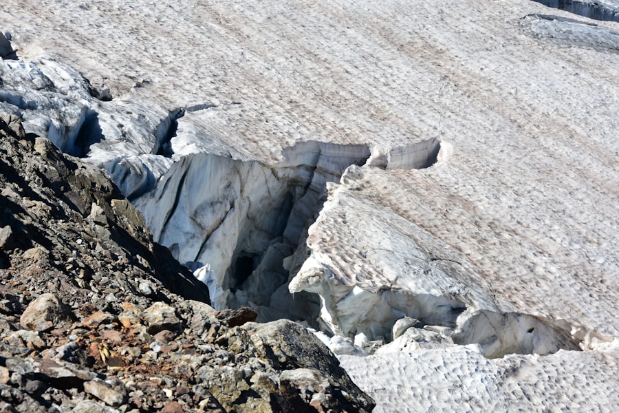
The study of glacial deposits is fundamental to understanding Earth’s Quaternary history, including past climate changes, ice sheet dynamics, and sea-level fluctuations. Geologists and geomorphologists meticulously analyze these deposits to reconstruct past environments and events.
Paleoclimate Reconstruction
The characteristics of glacial deposits provide crucial information about past climates. The type of till, its composition, and its relationship to other deposits can indicate the extent and intensity of past glaciations. Varved lake sediments offer precise dating and detailed records of meltwater activity, which is directly linked to temperature and precipitation patterns. The presence of ice-rafted debris in marine sediments can also indicate the proximity of ice sheets and their calving behavior.
Ice Flow Reconstruction
The orientation of features like drumlins, eskers, and the fabric of tills can be used to reconstruct the direction and patterns of past ice flow. This information is vital for understanding the dynamics of large ice sheets and how they responded to changes in the climate. By mapping these features across a landscape, scientists can create detailed maps of paleoglaciology.
Paleoenvironmental Reconstruction
Beyond climate, glacial deposits can also reveal insights into the paleoenvironment. Fossil organic material trapped in till or meltwater sediments can provide evidence of plant and animal life that existed before or during glaciation. The lithology of the deposited rocks can also tell us about the geology of the areas that the glaciers traversed, offering clues about the bedrock composition of regions that are now covered by ice or sediment.
Dating Glacial Events
Various dating techniques are employed to precisely date glacial deposits and by extension, glacial events. Radiocarbon dating can be used for organic materials found within or overlying glacial deposits. Optically Stimulated Luminescence (OSL) and Thermoluminescence (TL) dating can date sediments that have been exposed to sunlight or heat, respectively. Cosmogenic nuclide dating, which measures the accumulation of certain isotopes in rocks exposed to cosmic rays, is particularly useful for dating moraines and other features that were buried by ice.
Glacial deposition is a fascinating process that shapes our landscapes, leaving behind unique geological features such as moraines and drumlins. For those interested in exploring related topics, an insightful article on advancing lunar operations with autonomous systems can provide a different perspective on how natural processes influence technological advancements. You can read more about it in this article, which discusses the importance of understanding environmental factors in extraterrestrial settings.
Glacial Deposition in a Modern Context: Ongoing Processes and Future Implications
| Glacial Deposition Metrics | Explanation |
|---|---|
| Moraines | These are ridges of glacial till that are deposited along the edges of a glacier. |
| Drumlins | These are elongated hills of glacial till that are formed parallel to the direction of ice flow. |
| Erratics | These are large boulders that are transported and deposited by glaciers, often in areas with different rock types. |
| Glacial Till | This is the unsorted and unstratified material that is deposited directly by the glacier as it melts. |
While the most dramatic evidence of glacial deposition comes from past ice ages, glaciers continue to actively deposit sediment today in high-latitude and high-altitude regions. Understanding these ongoing processes is crucial for predicting the impact of climate change on glaciated environments.
Contemporary Glacial Deposition
Active glaciers worldwide continue to erode, transport, and deposit material. In polar regions like Antarctica and Greenland, vast ice sheets are constantly shaping the underlying bedrock and depositing sediment at their margins. Alpine glaciers, though smaller, also play a significant role in shaping their mountain environments through depositional processes. These modern glaciers provide living laboratories for geologists to study the mechanics of deposition in real-time.
Impact of Climate Change
Global warming is leading to the accelerated melting of glaciers worldwide. This melting has profound implications for glacial deposition. As glaciers retreat, they release vast amounts of previously trapped sediment, potentially leading to increased sedimentation in proglacial lakes and rivers. This can impact aquatic ecosystems and alter local hydrology. Furthermore, the destabilization of glacial ice can increase the risk of glacial lake outburst floods (GLOFs) and rock avalanches, which are themselves dramatic forms of geomorphic change.
Resource Management and Hazards
Understanding glacial deposition is also important for resource management and hazard assessment. Glacial deposits can contain valuable mineral resources, and their formation and distribution are studied for exploration purposes. Conversely, areas prone to glacial deposition can be susceptible to hazards such as landslides and floods. Predicting the behavior of glaciers and understanding their depositional legacies is therefore critical for ensuring the safety and sustainability of communities living in glaciated regions. The science of glacial deposition, therefore, is not merely an academic pursuit but a vital tool for understanding our planet’s past, present, and future.

The Boulder That Shouldn’t Exist
FAQs
What is glacial deposition?
Glacial deposition refers to the process by which glaciers deposit sediments, such as rocks, sand, and gravel, as they move and melt. This process plays a significant role in shaping the landscape and forming various landforms.
What are the different types of glacial deposition?
There are several types of glacial deposition, including till deposition, which occurs when glaciers directly deposit sediments, and outwash deposition, which happens when meltwater from glaciers carries and deposits sediments.
What landforms are created by glacial deposition?
Glacial deposition can create various landforms, including moraines, drumlins, eskers, and kames. Moraines are ridges of till deposited by glaciers, while drumlins are elongated hills formed by glacial deposition.
Where can glacial deposition be found?
Glacial deposition can be found in regions that have experienced glaciation, such as parts of North America, Europe, and Asia. Evidence of glacial deposition can also be found in areas that were once covered by glaciers, such as the Great Lakes region in North America.
How does glacial deposition impact the environment?
Glacial deposition can have significant impacts on the environment, including shaping the landscape, creating fertile soil for agriculture, and influencing the flow of rivers and streams. It also plays a role in the formation of valuable natural resources, such as gravel and sand deposits.