The earth’s fury, while devastating in its immediate impact, can also serve as a spectral historian, burying civilizations and preserving their stories for millennia. Earthquake archaeology, a specialized discipline, delves into the seismic events of the past, uncovering a unique tapestry of human history frozen in time by the very forces that sought to destroy it. These cataclysmic upheavals, capable of leveling cities and collapsing structures in moments, paradoxically create unparalleled archaeological sites, offering a snapshot of daily life immediately before and during the disaster. By studying the fragmented remains, the jumbled debris, and the altered landscapes left behind by ancient earthquakes, archaeologists can piece together narratives that would otherwise be lost to the ravages of erosion, human habitation, and the passage of time.
Earthquake archaeology operates on a fundamental principle: rapid burial and disruption. When the ground shakes violently, buildings collapse, walls tumble, and entire structures can be instantaneously inundated by earth, sand, or mudslides. This process acts like a natural time capsule, sealing away artifacts, architectural elements, and even human remains in a protective layer. Unlike sites that succumb to gradual decay or deliberate destruction, earthquake-affected zones offer a more pristine and comprehensive glimpse into a specific moment. The debris itself becomes an archive, its stratigraphy telling a story of the sequence of destruction and the immediate aftermath.
The Nature of Seismic Destruction
The geological processes unleashed by earthquakes are instrumental in their archaeological preservation. Thrust faults can bring older rock layers to the surface, potentially exposing buried sites in new ways. Landslides, triggered by seismic shaking, can bury entire settlements under tons of earth and rock, halting any further disturbance. Liquefaction, where saturated soil loses its strength and behaves like a liquid, can cause structures to sink or tilt precariously, preserving their foundation and lower levels in a dramatic fashion. Tsunamis, often a secondary effect of undersea earthquakes, can inundate coastal areas, burying settlements under layers of sand and silt, and in some cases, transporting artifacts far from their original context, creating fascinating but complex archaeological puzzles.
Stratigraphy as a Seismic Storyteller
Archaeological stratigraphy, the study of the layers of soil and debris, is particularly crucial in earthquake archaeology. The distinct layers created by a seismic event and its immediate aftermath provide invaluable chronological markers. Archaeologists can differentiate between a pre-earthquake occupation layer, the catastrophic collapse layer, and subsequent post-earthquake reoccupation or abandonment. This layered history allows for precise dating of events and a detailed understanding of how societies responded to seismic disasters, whether through rebuilding, migration, or abandonment of the impacted area. The way artifacts are found within these layers, whether still in situ within collapsed structures or scattered by the force of the quake, offers insights into the nature of the disaster and the activities of the inhabitants just prior to its occurrence.
Earthquake archaeology is a fascinating field that explores the impact of seismic events on ancient civilizations and their structures. A related article that delves into the broader implications of technology and defense in the context of natural disasters can be found at this link. This article discusses the role of artificial intelligence in enhancing our preparedness for various threats, including those posed by natural disasters like earthquakes, highlighting the intersection of technology and archaeology in understanding and mitigating the effects of such catastrophic events.
Locating and Identifying Seismic Sites
The identification of earthquake-archaeological sites is a multifaceted endeavor, often requiring a combination of geological assessment, historical records, and on-the-ground fieldwork. Unlike many archaeological sites that are discovered through surface finds or accidental encounters, earthquake sites can be more elusive, often buried deep beneath the modern landscape. The distinctive patterns of destruction, the unique geological formations resulting from seismic activity, and the analysis of historical accounts of past earthquakes all play a vital role in guiding researchers to potential locations.
Geological Clues and Fault Lines
Geological investigations are fundamental to earthquake archaeology. The presence of active fault lines, identified through geological surveys and seismic monitoring, provides immediate clues to areas that have experienced past earthquakes. Geologists can map ancient fault scarps, evidence of ground rupture, and sedimentary layers that indicate past seismic events. Evidence of liquefaction features, such as sand volcanoes or collapsed buildings that have sunk into the ground, are also strong indicators of past seismic activity. Analyzing the geological context of a potential site, including soil composition and sediment types, can help archaeologists understand the specific nature of the seismic event and its impact.
Historical Accounts and Written Evidence
Historical records, where available, can be invaluable in pinpointing potential earthquake-archaeological sites. Ancient texts, chronicles, and inscriptions sometimes describe devastating earthquakes that have impacted specific regions. While these accounts may lack precise scientific detail, they can provide crucial geographical references and descriptions of destruction that, when cross-referenced with geological and archaeological evidence, can lead to the identification of lost settlements. For instance, accounts of entire cities collapsing or being submerged could point to a site that was buried by a seismic event and subsequent geological changes.
Recognizing Patterns of Destruction
Archaeologists develop a keen eye for recognizing the characteristic “fingerprints” of earthquake destruction. This includes examining the orientation and collapse patterns of buildings. Were walls uniformly toppled in a particular direction? Are architectural elements scattered in a chaotic but patterned manner? The presence of specific types of damage, such as the characteristic “crazing” of pottery or the shattering of glass, can also suggest the intense forces of an earthquake. The juxtaposition of intact objects with shattered structures offers a compelling narrative of destruction. In some cases, the rapid burial itself leaves a distinctive mark, with layers of sediment sealing away what was present on the surface.
The Treasures Unearthed: Artifacts and Architecture in Time Capsules
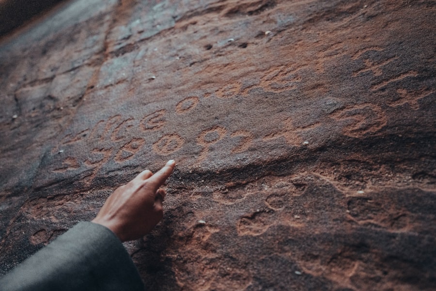
The remarkable preservation offered by earthquake sites yields an extraordinary wealth of information. Artifacts are often found in domestic contexts, precisely where they were being used or stored at the moment of collapse. Architectural remains are frozen in states of ruin, providing unparalleled insights into construction techniques, urban planning, and the sheer scale of past settlements. These frozen moments allow for a visceral connection to the lives of people who lived and died in these seismic throes.
Domestic Life Captured in the Rubble
One of the most compelling aspects of earthquake archaeology is the glimpse it offers into the minutiae of daily life. Artifacts like pottery vessels, tools, cooking implements, and personal adornments are frequently found in situ, on floors or within collapsed walls, exactly as they were left. This provides invaluable information about household activities, diet, and the material culture of a society at a specific point in time. Imagine finding a table still set for a meal, or a loom with partially woven fabric, suddenly entombed by the earth – these are the poignant discoveries that earthquake archaeology facilitates. The state of these artifacts, whether they are intact, shattered, or remarkably preserved, also speaks to the intensity of the seismic event.
Architectural Insights from Collapsed Structures
The collapse of buildings under seismic stress offers a unique opportunity to study architectural styles, construction methods, and the structural integrity of ancient edifices. Foundations remain intact, walls stand in fractured sections, revealing the layering of construction and repairs. The way buildings fell, the patterns of their collapse, can inform engineers and architects about the seismic vulnerabilities of different construction techniques. For example, studying the collapse of a Roman amphitheater after an earthquake might reveal why certain sections failed while others, perhaps built with different materials or techniques, remained partially standing. The scale and layout of settlements, often revealed by the buried foundations of homes and public buildings, provide crucial data for understanding urban planning and social organization.
The Human Element: Burials and Skeletal Remains
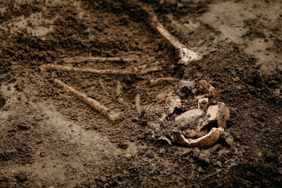
Earthquake sites can also yield significant discoveries regarding human remains. In instances where people were trapped within collapsed structures, their skeletal remains can be preserved, offering vital information about demographics, health, diet, and even the cause of death. The posture and positioning of these remains can sometimes indicate the chaotic and terrifying moments of the earthquake. Such findings provide a profoundly human dimension to the archaeological narrative, reminding us that these were once living communities. The analysis of these remains can also contribute to our understanding of past diseases, nutritional deficiencies, and the physical stresses of ancient life.
Reconstructing the Moment of Impact
The primary goal of earthquake archaeology is not merely to excavate artifacts, but to reconstruct the moments of destruction and the immediate aftermath of seismic events. By meticulously analyzing the archaeological evidence – the stratigraphy, the artifact distribution, the architectural damage – researchers can create detailed models of how a site was affected. This involves understanding the sequence of events, the direction and magnitude of the seismic forces, and the resulting landscape alterations.
Digital Reconstructions and Simulations
Modern technology plays a crucial role in reconstructing the impact of ancient earthquakes. 3D scanning and photogrammetry allow for the creation of highly detailed digital models of excavated structures and artifacts. These models can then be used to generate virtual reconstructions of the site as it stood before the earthquake, and to simulate the effects of seismic shaking. Advanced software can model the forces involved, predicting how buildings would have collapsed and how debris would have been distributed. These digital simulations allow archaeologists to test hypotheses and to visualize the catastrophic event in a way that was previously impossible.
Understanding Post-Seismic Responses
Beyond the immediate destruction, earthquake archaeology also sheds light on how past societies responded to seismic disasters. Did they rebuild on the same spot? Did they relocate? Were there periods of abandonment followed by reoccupation? The presence or absence of subsequent settlement layers, the techniques used in any rebuilding efforts, and the changes in the material culture can reveal a great deal about the resilience, resourcefulness, and decision-making processes of ancient communities in the face of catastrophic events. This understanding has direct relevance to modern disaster preparedness and response strategies.
Earthquake archaeology offers fascinating insights into how seismic events have shaped human history and settlement patterns. For those interested in the broader context of historical mapping and its implications on understanding past civilizations, a related article discusses the contributions of Ottoman cartography in the context of global exploration. You can read more about this intriguing subject in the article on Piri Reis and Ottoman cartography, which highlights the intricate relationship between geography and historical events. To explore this further, visit this link.
Broader Implications and Lessons Learned
| Site | Location | Year | Findings |
|---|---|---|---|
| Pompeii | Italy | 79 AD | Preserved buildings and artifacts due to volcanic eruption |
| San Francisco | United States | 1906 | Revealed structural damage and urban planning changes |
| Lisbon | Portugal | 1755 | Impacted architectural styles and city layout |
The study of earthquake archaeology extends far beyond the academic realm, offering valuable lessons for contemporary societies grappling with their own seismic vulnerabilities. By understanding how past civilizations coped with and were shaped by earthquakes, we can gain a deeper appreciation for the long-term impact of these natural disasters and inform our own strategies for mitigation, preparedness, and recovery.
Informing Modern Engineering and Urban Planning
The insights gleaned from earthquake archaeology have direct applications in modern engineering and urban planning. Studying the failure modes of ancient structures under seismic stress can inform the design of more resilient buildings and infrastructure today. For instance, understanding how certain ancient building materials or construction techniques performed during earthquakes can lead to the development of new, robust materials and techniques for seismic-resistant construction. Examining the layout of resilient ancient cities, or those that were effectively rebuilt after major seismic events, can offer valuable lessons for contemporary urban planning, especially in earthquake-prone regions.
The Long Shadow of Seismic History
Earthquake archaeology demonstrates that seismic events are not isolated occurrences but are part of a long and ongoing geological history that has shaped human civilization. By unearthing the past, we gain a profound respect for the power of natural forces and the enduring spirit of human adaptation. It reminds us that our built environments are constantly interacting with the dynamic processes of the Earth, and that understanding past seismic impacts is crucial for navigating our seismic future. The lessons learned from these ancient disasters offer a valuable perspective on the challenges and triumphs of human resilience in the face of nature’s most destructive potential, underscoring the importance of learning from our seismic past to build a more secure future.

The Lost City That Was Never Really Lost
FAQs
What is earthquake archaeology?
Earthquake archaeology is the study of the effects of earthquakes on human societies and their material culture. It involves examining the archaeological record to understand how earthquakes have impacted past civilizations.
What can earthquake archaeology tell us about past earthquakes?
Earthquake archaeology can provide valuable information about the intensity, frequency, and impact of past earthquakes. By studying the remains of buildings, infrastructure, and artifacts, researchers can reconstruct the effects of earthquakes on ancient societies.
How does earthquake archaeology contribute to our understanding of seismic hazards?
By analyzing the archaeological evidence of past earthquakes, researchers can gain insights into the long-term patterns of seismic activity in a region. This information can help assess the potential risks and vulnerabilities of modern communities to future earthquakes.
What are some examples of significant findings in earthquake archaeology?
Significant findings in earthquake archaeology include the discovery of ancient cities and settlements that were destroyed by earthquakes, as well as evidence of seismic retrofitting and building techniques used by past societies to mitigate earthquake damage.
How does earthquake archaeology inform modern disaster preparedness and response?
The insights gained from earthquake archaeology can inform modern strategies for disaster preparedness and response. By understanding how past societies coped with earthquakes, modern communities can learn valuable lessons for mitigating the impact of future seismic events.