Unraveling Earthquake and Tsunami History
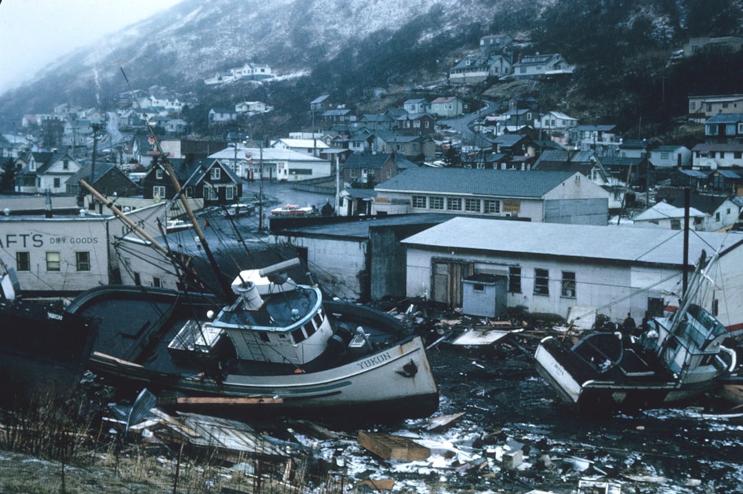
Earthquakes and tsunamis, primal forces capable of reshaping landscapes and challenging human resilience, have long been intertwined chapters in the Earth’s tumultuous history. For millennia, human civilizations have witnessed and chronicled these devastating events, piecing together fragmented narratives of destruction and survival. While the immediate impact of a powerful earthquake or a towering tsunami is often etched in collective memory, the deeper, more ancient history of these phenomena lies hidden within the geological record, a testament to the planet’s dynamic forces. Unraveling this history is not merely an academic pursuit; it is a crucial endeavor for understanding present-day risks and preparing for future cataclysms.
The Earth is a geologically active planet, a colossal jigsaw puzzle of tectonic plates perpetually in motion. These plates, immense slabs of lithosphere, float upon the semi-fluid asthenosphere. Their slow, relentless drift, driven by the heat and convection currents within the Earth’s mantle, creates zones of intense stress and strain along their boundaries. When this accumulated stress is suddenly released, it manifests as an earthquake, a violent shaking of the ground. In oceanic regions, particularly where tectonic plates converge or subduct, a powerful undersea earthquake can displace vast volumes of water, triggering the devastating wave trains known as tsunamis.
The Silent Archives: Geological Evidence of Past Events
The Earth’s crust and seafloor hold a profound and often unsettling memory of past seismic and tsunami events. Like pages in a weathered book, geological formations bear the scars of ancient tremors and the fingerprints of colossal waves. Geologists and scientists specializing in paleoseismology and paleotsunamis have developed sophisticated techniques to unearth this hidden history, extending our understanding far beyond the reach of written records. These disciplines employ a variety of methods to decipher the story told by rocks, sediments, and landforms.
Sedimentology: The Layered Legacy of Destruction
Sedimentation is a continuous process, with layers of material accumulating over time. When an earthquake strikes, especially near the coast or in a valley, it can trigger landslides and sediment slumping, disrupting the normal depositional pattern. These disruptions create distinct layers with chaotic mixing of sediments, jumbled boulders, and other evidence of sudden, forceful displacement.
Identifying Liquefaction Features: Shaking the Ground Apart
One of the most compelling indicators of past earthquakes in sedimentary sequences is the presence of liquefaction features. During intense seismic shaking, saturated sandy and silty soils can lose their strength and behave like a liquid. This phenomenon causes the ground to ripple, injects sand into overlying layers, and can result in the formation of sand volcanoes or dikes. Paleoseismologists meticulously examine sediment cores and exposed outcrops for these distinctive structures, which can pinpoint the timing and intensity of past seismic events.
Tracing Deformed Stratigraphy: The Wrinkled Record of Stress
Earthquakes impart significant stress on the Earth’s crust, leading to deformation of rock layers. Faulting, folding, and tilting of strata are direct consequences of seismic activity. In areas prone to historical earthquakes, geologists can identify ancient fault scarps – cliff-like features formed by ground displacement – and deformed sedimentary layers that reveal the magnitude and direction of past ground motion. These deformed layers, when dated using radiometric methods, provide a chronological record of seismic events.
Paleotsunami Deposits: The High-Water Marks of Ancient Fury
Tsunamis leave their own unique geological signature, particularly along coastlines. When a tsunami inundates land, it carries with it distinctive sediment and debris from the seafloor and coastal environments. These deposits, often found inland from the present-day coastline, offer undeniable evidence of prehistoric wave events.
Characterizing Tsunami Gravels: The Boulder’s Tale
One hallmark of tsunami deposits is the presence of coarse-grained material, such as cobbles and boulders, transported far inland. These are often deposited in a chaotic manner, mixed with finer sediments, and are readily distinguishable from locally derived materials. The size and distribution of these anomalous gravels can indicate the immense power and reach of ancient tsunami waves.
Identifying Silt and Clay Signatures: The Finer Whispers
Beyond the dramatic boulder deposits, finer sedimentological evidence also points to tsunamis. Tsunami waves can erode existing coastal and shallow marine sediments and redeposit them inland as a distinct layer characterized by a fining upwards sequence (coarser material at the base, fining towards the top) or by the presence of marine organic matter in terrestrial settings. Identifying these fine-grained tsunami signatures requires meticulous sampling and analysis of sediment cores.
The history of earthquakes and tsunamis is a fascinating subject that reveals the powerful forces of nature and their impact on human civilization. For those interested in exploring the geological phenomena that have shaped our world, a related article can be found at The Mystery of Baalbek’s Massive Stones, which delves into the ancient structures that have withstood the test of time, including the effects of seismic activity in the region. This article provides insights into how such monumental constructions have been influenced by the earth’s movements throughout history.
Human Memory and Early Records: Chronicles of Catastrophe
While geological evidence provides a deep temporal context, human records offer a more immediate and often emotional perspective on earthquakes and tsunamis. For centuries, civilizations have documented these events, their narratives shaped by the devastation, the loss of life, and the societal impact. These historical accounts, though sometimes prone to exaggeration or mythologizing, provide invaluable insights into the frequency and characteristics of seismic and tsunami activity in historical times.
Ancient Civilizations and the Unseen Forces
Early civilizations, often lacking a scientific understanding of geological processes, attributed earthquakes and tsunamis to divine anger, supernatural forces, or mythical creatures. Nevertheless, their descriptions, even in allegorical form, offer clues about the occurrences.
Mesopotamian Chronicles: Whispers from the Fertile Crescent
The fertile river valleys of Mesopotamia, prone to seismic activity from the Anatolian plate, have yielded early written accounts of ground shaking. Cuneiform tablets, dating back thousands of years, sometimes contain descriptions of collapses and widespread destruction that are consistent with significant earthquakes. These records, while sparse, represent some of the earliest human attempts to document seismic phenomena.
Classical World Accounts: Echoes from Greece and Rome
The ancient Greeks and Romans, situated in seismically active regions around the Mediterranean, provided more detailed historical accounts. Writers like Thucydides described the catastrophic earthquake that devastated Helike in 373 BCE and the subsequent tsunami that further compounded the destruction. Roman historians also chronicled major seismic events, contributing to a growing body of historical data on earthquake occurrences in the region.
The Age of Exploration and Expanding Archives
With the advent of European exploration and the establishment of global trade routes, written records of earthquakes and tsunamis began to proliferate across different continents. Missionaries, colonial administrators, and navigators documented events in new lands, expanding the geographical scope of historical seismic and tsunami observation.
Jesuit Missionaries’ Observations: Eyes on the New World
Jesuit missionaries, with their widespread presence in the Americas, often served as early chroniclers of local events. Their letters and reports sometimes described significant earthquakes and the devastating impact of tsunamis on coastal communities in regions like Mexico, Chile, and Japan, providing a crucial layer of historical data for these areas.
Maritime Logs and Ship Captains’ Diaries: Witness to Coastal Fury
Seafaring nations meticulously maintained logbooks and captains’ diaries. These records, particularly in the age of sail, often contain observations of unusual sea behavior, sudden drops in sea level, and the arrival of powerful waves that are unmistakably descriptions of tsunamis. These maritime archives are invaluable for understanding tsunami impacts on coastal populations and maritime infrastructure.
Modern Scientific Investigations: Tools for Decoding the Past
The 20th and 21st centuries have witnessed a dramatic evolution in the scientific tools and methodologies employed to understand earthquake and tsunami history. Sophisticated instrumental networks, advanced geological surveying techniques, and computational modeling have revolutionized our ability to reconstruct past events and predict future ones.
Seismology and Instrumental Records: The Pulse of the Planet
The development of the seismograph in the early 20th century marked a turning point in our ability to monitor earthquakes. Continuous, instrumental recordings of seismic waves provide precise data on the timing, location, and magnitude of earthquakes, forming a comprehensive historical dataset for the last century.
Global Seismic Networks: An Unblinking Eye
Modern seismic networks, comprised of thousands of seismometers strategically placed across the globe, continuously record seismic activity. The data generated by these networks allows scientists to analyze earthquake patterns, identify active faults, and establish a robust historical record of seismic events, particularly over the last few decades.
Earthquake Catalogs: Compiling Lived Experiences
Scientists maintain comprehensive earthquake catalogs that compile information from instrumental records, historical accounts, and archaeological evidence. These catalogs are essential resources for geologists, providing a chronological database of seismic occurrences that is crucial for risk assessment and hazard mapping.
Oceanography and Tide Gauges: Measuring the Ocean’s Scars
The study of oceanography, coupled with the development of tide gauges and other oceanic monitoring instruments, has been instrumental in understanding tsunami generation and propagation.
Tide Gauge Records: Tracing the Waves’ Arrival
Tide gauges, strategically located along coastlines, continuously measure sea level. For the past century and a half, their records have documented the arrival of tsunamis, providing invaluable data on their height, arrival times, and the extent of coastal inundation. This data is crucial for verifying geological and historical accounts.
Deep-Sea Tsunami Detection Systems: Listening to the Ocean’s Depths
Modern technology has enabled the deployment of deep-sea tsunami detection systems, such as the Deep-ocean Assessment and Reporting of Tsunamis (DART) buoy network. These systems provide real-time measurements of tsunami wave characteristics in the open ocean, allowing for rapid warnings and contributing to a richer dataset for understanding tsunami behavior.
Reconstructing Past Events: Integrating Disciplines for a Fuller Picture
The most comprehensive understanding of earthquake and tsunami history emerges from the integration of geological, historical, and instrumental data. By synthesizing information from these diverse sources, scientists can reconstruct past events with unprecedented detail and accuracy, painting a more complete picture of the planet’s seismic and tidal past.
Paleo-Earthquake Studies: Unearthing Fault Line Secrets
Paleo-earthquake studies focus on directly investigating past earthquakes through the examination of fault systems. By excavating trenches across active faults, geologists can expose evidence of past ground displacement, such as offset layers of sediment and rock.
Trenching and Geochronology: Digging into Time
Trenching across active fault zones allows geologists to visualize the history of fault ruptures. The displaced layers within the trench can be dated using techniques like radiocarbon dating of organic material or optically stimulated luminescence (OSL) dating of sediments, providing precise timelines for past earthquakes. This research helps identify the recurrence intervals of large earthquakes on specific faults.
Paleoseismic Investigations of Subduction Zones: The Ultimate Source
Subduction zones, where one tectonic plate slides beneath another, are responsible for some of the most powerful earthquakes and devastating tsunamis on Earth. Paleoseismic investigations in these regions are particularly critical and challenging, often involving the study of uplifted marine terraces and the analysis of tsunami deposits kilometers inland.
Paleotsunami Reconstruction: Mapping the Waves’ Reach
Paleotsunami research aims to reconstruct the characteristics of ancient tsunami events. This involves identifying and mapping tsunami deposits, analyzing their sedimentological properties, and using numerical models to infer the tsunami’s source, magnitude, and run-up heights.
Dating Tsunami Deposits: Pinpointing the Anomaly
Accurate dating of tsunami deposits is paramount for their interpretation. Techniques such as radiocarbon dating of fossilized organic matter within the deposit, or thermoluminescence dating of associated sediments, help to establish the time frame of the tsunami event. This allows for correlation with geological or historical records of seismic activity.
Numerical Modeling of Past Tsunamis: Simulating the Deluge
Once tsunami deposits are identified and dated, numerical models are employed to simulate the likely characteristics of the tsunami that created them. By inputting parameters such as the potential earthquake source characteristics and bathymetry, these models can reproduce wave propagation and inundation patterns, helping researchers to estimate the tsunami’s size and impact.
Understanding the history of earthquakes and tsunamis is crucial for comprehending their impact on societies and ecosystems. For a deeper insight into how natural disasters can lead to significant changes in geography and human settlement, you might find it interesting to explore an article about the global crisis of disappearing countries. This article highlights the challenges faced by nations affected by climate change and natural disasters, which can be linked to seismic activities. You can read more about this pressing issue in the article here.
The Importance of Understanding Earthquake and Tsunami History for the Future
The meticulous unraveling of earthquake and tsunami history is not a backward-looking academic exercise; it is a critical investment in our future. By understanding the past, we gain invaluable insights into the processes that drive seismic and tidal hazards, enabling us to better prepare for the inevitable challenges ahead.
Hazard Assessment and Risk Mitigation: Building a Safer Tomorrow
A deep understanding of past earthquake and tsunami occurrences is fundamental to assessing current seismic and tsunami hazards. By analyzing recurrence intervals, magnitudes, and spatial distribution of past events, scientists can develop more accurate hazard maps.
Seismic Hazard Maps: Identifying Vulnerable Areas
Seismic hazard maps are crucial tools for urban planning, building codes, and disaster preparedness. These maps, informed by paleoseismic data and historical records, highlight areas with a high probability of experiencing strong ground shaking, guiding construction practices to withstand seismic forces.
Tsunami Evacuation Zones: Learning from the Past’s Inundation
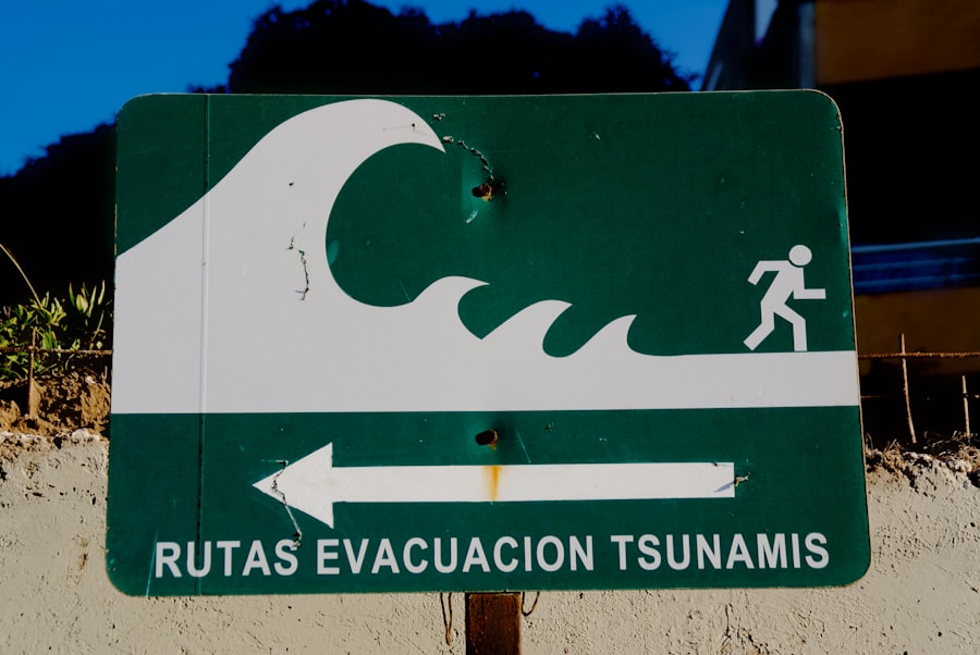
Tsunami inundation maps, derived from paleotsunami studies and historical accounts, delineate areas at risk of being flooded by future tsunamis. These maps are essential for establishing safe evacuation routes and planning effective emergency response strategies, ensuring that communities can react swiftly and safely to impending tidal threats.
Education and Public Awareness: Empowering Communities
Sharing the knowledge gained from unraveling earthquake and tsunami history is vital for fostering public awareness and preparedness. Educating communities about these natural hazards empowers them to take proactive measures for their safety.
Science Communication: Bridging the Gap
Effective science communication plays a crucial role in translating complex scientific findings into understandable information for the public. Public lectures, engaging exhibits, and accessible online resources can demystify the science behind earthquakes and tsunamis, fostering a sense of informed preparedness.
Promoting Disaster Preparedness Drills: Practicing for the Unforeseen
Understanding the history of these events underscores the importance of regular disaster preparedness drills for earthquakes and tsunamis. Practicing evacuation procedures and emergency response protocols in schools, workplaces, and communities can significantly improve survival rates by ensuring that individuals know what to do when disaster strikes.
In conclusion, the history of earthquakes and tsunamis is a vast and intricate tapestry woven from geological evidence, human recollections, and scientific observation. Each thread, from the silent whispers of ancient sediment layers to the precise readings of modern instruments, contributes to a more profound understanding of our planet’s dynamic nature. By continuing to unravel this history, we not only honor the memory of those lost to these powerful forces but also empower ourselves with the knowledge to build more resilient communities and navigate the challenges of a geologically active world.

The Lost City That Was Never Really Lost
FAQs
What is the history of earthquakes and tsunamis?
Earthquakes and tsunamis have been occurring throughout Earth’s history. The earliest recorded earthquake dates back to 1769 BC in the Shandong province of China. Tsunamis have also been documented throughout history, with one of the most devastating being the 2004 Indian Ocean tsunami.
How often do earthquakes and tsunamis occur?
Earthquakes occur every day around the world, but most are too small to be felt. On average, there are about 20,000 earthquakes each year with a magnitude of 6.0 or higher. Tsunamis are less frequent, with only a few occurring each year, but they can be extremely destructive.
What are some of the most significant earthquakes and tsunamis in history?
Some of the most significant earthquakes in history include the 1906 San Francisco earthquake, the 1964 Alaska earthquake, and the 2011 Tohoku earthquake in Japan. The 2004 Indian Ocean tsunami and the 2011 Tohoku tsunami are among the most devastating tsunamis in history.
How do earthquakes and tsunamis impact the environment and human populations?
Earthquakes can cause landslides, avalanches, and ground ruptures, while tsunamis can lead to widespread flooding and coastal erosion. Both natural disasters can result in loss of life, destruction of infrastructure, and long-term economic and environmental impacts.
What measures are in place to mitigate the impact of earthquakes and tsunamis?
Countries prone to earthquakes and tsunamis have implemented various measures to mitigate their impact, including early warning systems, building codes for earthquake-resistant structures, and public education and preparedness programs. International cooperation and research also play a crucial role in understanding and mitigating the impact of these natural disasters.