The restless earth has a long and dramatic history of upheaval. Beneath its ever-shifting crust lie stories of civilizations that once thrived, their vibrant centers now swallowed by the very ground that once supported them. Among the most poignant losses are ancient ports, the lifeblood of trade, culture, and connection for burgeoning societies. These coastal gateways, once bustling with ships and merchants, have frequently been claimed by the devastating power of earthquakes, sinking beneath the waves or buried deep within the earth, leaving behind enigmatic ruins that whisper of a forgotten past.
Throughout human history, coastal regions have been prime real estate for settlement. Their proximity to vital trade routes, access to food resources, and often fertile land made them ideal for establishing communities. However, these very locations also made them incredibly vulnerable to seismic activity. Tectonic plates, constantly grinding and shifting, release immense energy in the form of earthquakes. When these events strike coastal areas, the consequences can be catastrophic, leading to widespread destruction and, in many cases, the permanent alteration of the landscape.
The Mechanics of Coastal Collapse: Tsunami and Subsidence
Earthquakes striking beneath or near the ocean are particularly perilous for coastal infrastructure. The violent shaking can trigger massive underwater landslides, which in turn generate tsunamis. These colossal waves, often amplified by the shape of the seabed and coastline, can inundate coastal cities, sweeping away buildings, people, and the very foundations of their existence.
Beyond the immediate destructive force of a tsunami, earthquakes can also cause permanent geological changes. Subsidence, the gradual sinking of land, is a common consequence of seismic activity in coastal zones. This sinking can be caused by various factors, including the liquefaction of saturated soils due to the shaking, or the deformation of the earth’s crust itself. Over time, even a modest amount of subsidence, coupled with rising sea levels (which can be exacerbated by climate change), can lead to a city or port being permanently submerged, a silent testament to the earth’s relentless power.
The Role of Geology in Port Vulnerability
The geological composition of coastal areas plays a significant role in how they respond to seismic events. Soft, water-saturated sediments, often found in deltas and estuaries where many ancient ports were ideally situated for access, are highly susceptible to liquefaction. During an earthquake, these sediments can lose their structural integrity, behaving like a liquid rather than a solid. Buildings and port structures built on such ground can then sink or tilt precariously, leading to their destruction.
Conversely, areas built on more stable bedrock may be more resilient to shaking. However, even solid rock can be fractured and uplifted or dropped by powerful earthquakes, creating faults that can alter coastlines and flood previously dry areas. Understanding the specific geological conditions of an ancient port’s location is crucial to comprehending why it may have been susceptible to a devastating earthquake that led to its demise.
Ancient ports, once bustling centers of trade and commerce, have often succumbed to the devastating effects of earthquakes, leading to their loss and obscurity over time. The study of these lost ports not only sheds light on the historical significance of maritime trade but also highlights the geological vulnerabilities of coastal cities. For a deeper understanding of trade dynamics in modern contexts, you might find the article on the USMCA trade agreement insightful. It explores contemporary trade relationships and agreements that echo the historical importance of ports in facilitating commerce. You can read more about it here: Understanding the USMCA Trade Agreement.
Echoes from the Depths: Notable Cases of Submerged Ports
The archaeological record is replete with tantalizing hints and dramatic discoveries of ancient ports lost to the sea. These submerged wonders offer invaluable insights into maritime history, trade networks, and the resilience, or indeed vulnerability, of ancient societies. Their rediscovery, often through underwater archaeology, allows us to piece together fragments of forgotten narratives.
Alexandria: The Sunken Metropolis
Perhaps one of the most famous examples is the ancient Egyptian city of Alexandria. Founded by Alexander the Great, it quickly rose to prominence as a center of Hellenistic culture and a vital hub for trade along the Mediterranean. Its legendary Pharos, one of the Seven Wonders of the Ancient World, stood as a beacon for sailors. However, Alexandria was not spared by the earth’s fury.
Multiple Seismic Events and Their Impact
Numerous earthquakes, beginning as early as the 4th century CE and continuing for centuries, plagued Alexandria. These seismic events, often accompanied by tsunamis, caused significant damage to the city’s infrastructure, including its harbor facilities. The city’s legendary lighthouse, the Pharos, was progressively damaged by earthquakes and eventually collapsed. Large sections of the ancient city, including its bustling harbors and royal palaces, were dramatically altered or submerged.
Underwater Archaeology: Unveiling a Lost World
For centuries, the remnants of ancient Alexandria lay hidden beneath the waves. It was only through the pioneering work of underwater archaeologists, such as those led by Jean-Yves Empereur, that the true extent of the submerged city began to be revealed. Using advanced sonar technology, diving expeditions, and meticulous excavation, archaeologists have uncovered vast areas of the ancient port, including remnants of the royal harbor, shipwrecks, and even entire buildings. These discoveries have provided invaluable information about the city’s layout, its monumental architecture, and the daily lives of its inhabitants. The sheer scale of the submerged ruins is a stark reminder of the catastrophic power of earthquakes and their ability to reshape coastlines.
Baiae: Rome’s Lost Pleasure Resort
On the Bay of Naples, the opulent Roman resort town of Baiae experienced a similar, albeit more luxurious, fate. In its heyday under the Roman Empire, Baiae was renowned for its thermal waters, extravagant villas, and a lifestyle of unparalleled indulgence for the Roman elite. Its extensive harbor facilities facilitated the arrival of distinguished guests and the transport of goods to this exclusive enclave.
The Sinking of a Luxury Paradise
Like Alexandria, Baiae was not immune to seismic activity. Geological surveys and archaeological evidence point to significant sea-level rise and localized subsidence in the area, largely attributed to seismic events and volcanic activity associated with the Phlegraean Fields, a supervolcano nearby. Over centuries, these geological forces caused large parts of Baiae, including its luxurious bathhouses, temples, and its vital harbor, to sink beneath the clear waters of the bay.
The Underwater Archaeological Park of Baiae
Today, the remains of Baiae offer a unique glimpse into Roman luxury and leisure. The Parco Archeologico Sommerso di Baia (Underwater Archaeological Park of Baiae) allows visitors to explore the submerged ruins through guided diving tours or glass-bottomed boats. Divers can witness the ghostly outlines of Roman mosaics, marble statues, and the very foundations of the port structures that once facilitated access to this lost paradise. The park is a testament to both the grandeur of Roman civilization and the relentless geological forces that ultimately reclaimed it.
The Seismic Scar: Evidence of Ancient Quakes
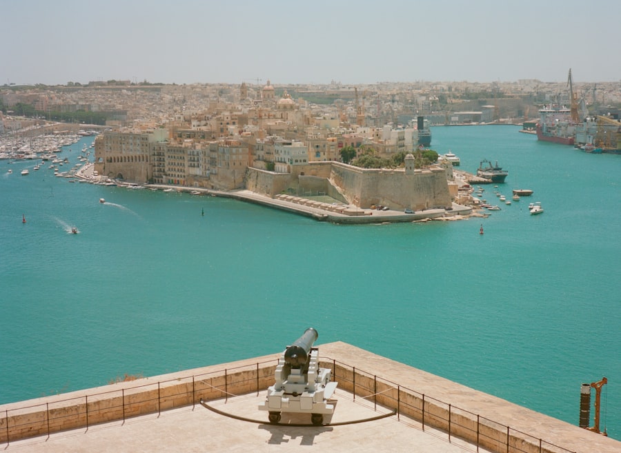
The geological record itself often bears witness to the seismic events that have shaped our planet. For archaeologists and geologists, deciphering these natural archives is crucial for understanding the demise of ancient settlements, particularly those that were coastal. The evidence of earthquakes can manifest in various forms, from fractured bedrock to layers of sediment disturbed by violent shaking.
Liquefaction and its Archaeological Aftermath
As mentioned earlier, liquefaction is a dangerous phenomenon that can occur during earthquakes, especially in areas with loose, water-saturated soils. When this happens, the ground loses its strength and can flow like a liquid. For ancient port structures built on such foundations, the consequences are devastating. Buildings can collapse, and docks can buckle and sink.
Identifying Liquefaction Layers
Archaeologists can identify the telltale signs of past liquefaction in the soil layers. Disturbed sediment, contorted bedding, and the presence of “sand volcanoes” (conical mounds of sand that erupt from the ground during liquefaction) are all indicators of a past seismic event. When these layers are found in conjunction with the remains of port infrastructure, it provides strong evidence that an earthquake was a contributing factor to its destruction and subsequent abandonment.
The Impact on Wooden Structures and Foundations
Wooden pilings, often used to construct ancient piers and docks, are particularly vulnerable to liquefaction. The shaking can cause these pilings to lose their support, leading to the collapse of the superstructures they held. Similarly, stone foundations can be destabilized and sink into the liquefied soil. The archaeological excavation of a submerged or buried port often reveals these disturbed and collapsed structures, painting a picture of a rapid and violent destruction.
Fault Lines and Coastal Uplift/Subsidence
Major earthquakes are often associated with visible fault lines, cracks in the earth’s surface where tectonic plates have moved relative to each other. In coastal regions, the formation or reactivation of these fault lines can lead to dramatic changes in land elevation.
Evidence in Geological Stratigraphy
Geologists and archaeologists can analyze the geological stratigraphy of a site to identify evidence of uplift or subsidence. Layers of rock and sediment that are out of place, or show signs of abrupt displacement, can indicate past seismic activity. For ancient ports, this might mean finding evidence of a port that was once at sea level now significantly elevated, or conversely, an area that was once dry now permanently submerged due to sinking land.
The Role of Post-Seismic Sea Level Changes
Following a major earthquake, particularly one that causes significant subsidence, the interaction between the altered land elevation and the natural sea level can complete the process of submergence. Even if the earthquake itself did not directly flood the port, the subsequent ingress of the sea into a newly lowered coastal area can lead to its permanent inundation. This is a gradual process that can take centuries to fully manifest, but the initial seismic event is the catalyst.
Uncovering the Lost: The Art and Science of Underwater Archaeology
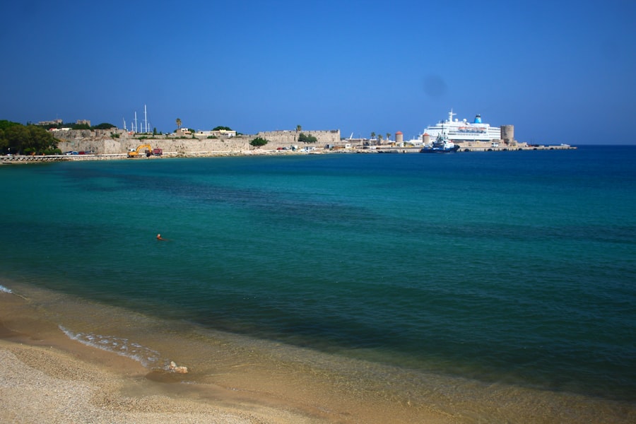
The discovery and excavation of ancient submerged ports are largely the domain of underwater archaeology. This specialized field combines the skills of archaeologists with those of divers, marine engineers, and geophysicists to explore and document the underwater world. It is a challenging yet rewarding endeavor, bringing to light previously inaccessible chapters of human history.
Geophysical Survey: Mapping the Hidden Landscape
Before commencing any physical excavation, underwater archaeologists employ a range of geophysical survey techniques to map the seabed and identify potential archaeological sites. These non-destructive methods provide a vital overview of the underwater landscape, revealing anomalies that could indicate the presence of submerged structures.
Sonar and Multi-Beam Echosounders
Sonar (Sound Navigation and Ranging) technology uses sound waves to detect objects and map the seafloor. Multi-beam echosounders, a more advanced form of sonar, can create highly detailed three-dimensional maps of the seabed, revealing the topography and identifying any submerged features. These maps can highlight irregular shapes that suggest man-made structures, such as walls, jetties, or sunken ships.
Side-Scan Sonar for Detailed Imaging
Side-scan sonar provides even more detailed images, essentially acting like a camera that sweeps the seafloor. It can reveal the texture and shape of objects, allowing archaeologists to differentiate between natural geological formations and man-made artifacts. This technology is invaluable for pinpointing the location and extent of submerged ports.
Diving and Excavation: Delicate Work Beneath the Waves
Once potential sites are identified, divers descend to conduct visual inspections and, if necessary, begin the meticulous process of excavation. This work is considerably more challenging than land-based archaeology due to the constraints of water, visibility, and the need for specialized equipment.
The Precision of Underwater Excavation
Underwater excavation requires meticulous planning and execution. Archaeologists use specialized tools, such as water dredges and airlifts, to carefully remove sediment without damaging delicate artifacts. Each artifact or structural element is meticulously documented, photographed, and often digitally recorded in three dimensions before being carefully lifted or surveyed in situ. The goal is to preserve as much contextual information as possible, as much of this evidence is ephemeral once exposed to the air.
The Importance of Preservation and Conservation
Artifacts recovered from underwater environments often require immediate and specialized conservation to prevent their degradation once they are brought to the surface. Wood, metal, and ceramics can be particularly susceptible to changes in salinity, temperature, and oxygen levels. Advanced conservation techniques are employed to stabilize these materials, ensuring their long-term preservation for study and display in museums.
The study of ancient ports lost to earthquakes reveals the fragility of human achievements in the face of natural disasters. These once-thriving hubs of trade and culture, now submerged or buried, offer a glimpse into the past and highlight the importance of understanding geological risks. For those interested in exploring the broader implications of treaties and agreements that govern human activities, you might find this article on the relevance of the Outer Space Treaty particularly insightful. You can read more about it here.
Lessons from the Lost: Understanding Resilience and Vulnerability
“`html
| Port Name | Location | Year Lost | Earthquake Magnitude |
|---|---|---|---|
| Port of Caesarea | Israel | 363 AD | Unknown |
| Port of Ephesus | Turkey | 614 AD | Unknown |
| Port of Lechaion | Greece | 6th century AD | Unknown |
“`
The study of ancient ports lost to earthquakes offers invaluable lessons, not only about the past but also about the present and future. By understanding the factors that led to their demise, we can better inform our own coastal development and disaster preparedness strategies.
Rethinking Coastal Development in Seismic Zones
The prevalence of ancient ports succumbing to seismic threats serves as a stark reminder that coastal areas are inherently dynamic and vulnerable. This knowledge should influence how we plan and build in these regions today.
Modern Engineering and Seismic Resilience
Contemporary engineering has made tremendous strides in building structures that can withstand seismic forces. However, the continued development of cities and infrastructure in earthquake-prone coastal zones necessitates ongoing research and the implementation of the most robust anti-seismic measures. This includes designing buildings with flexible foundations, incorporating shock-absorbing materials, and establishing strict building codes that account for maximum credible seismic events.
Lessons from Ancient Architects
While ancient builders lacked our modern technology, they possessed a deep understanding of their local environments. Their successes and failures, as revealed by archaeological investigations of lost ports, can still offer valuable insights. Observing how certain materials or construction techniques fared (or failed) during seismic events can inform contemporary design choices. For instance, understanding why a particular type of foundation failed under liquefaction can inform the design of new foundations in similar geological conditions.
The Ongoing Threat and Future Preparedness
The earth continues to tremble, and the threat of earthquakes remains a constant reality for coastal communities worldwide. The submerged remnants of ancient ports are not just historical curiosities; they are tangible warnings from the past.
Early Warning Systems and Evacuation Plans
The development of sophisticated earthquake early warning systems, coupled with comprehensive evacuation plans, are crucial for mitigating the impact of future seismic events on coastal populations. These systems can provide precious minutes of advance notice, allowing people to reach safer locations before the catastrophic shaking or subsequent tsunamis strike.
The Importance of Historical Context in Risk Assessment
By studying the historical patterns of earthquakes and their impact on ancient settlements, we gain a deeper understanding of the long-term risks associated with specific regions. This historical context is vital for accurate risk assessment, informing urban planning, infrastructure investment, and the development of effective disaster preparedness strategies. The ghosts of forgotten ports serve as a potent reminder that ignoring the earth’s powerful forces can lead to devastating consequences, and that preparedness, informed by the lessons of the past, is paramount.

The Lost City That Was Never Really Lost
FAQs
What are ancient ports lost to earthquakes?
Ancient ports lost to earthquakes refer to historical port cities and harbors that were destroyed or submerged due to seismic activity. These ports were once thriving centers of trade and commerce, but are now lost to the forces of nature.
How were ancient ports affected by earthquakes?
Ancient ports were often built in coastal areas, making them vulnerable to the destructive power of earthquakes. Seismic activity can cause the land to shift, leading to the sinking or destruction of port structures, as well as the submergence of the surrounding land.
Can ancient ports lost to earthquakes be rediscovered?
Yes, with advancements in technology such as underwater archaeology and remote sensing, it is possible to rediscover and study ancient ports that have been lost to earthquakes. These methods allow researchers to explore and document submerged archaeological sites.
What can we learn from studying ancient ports lost to earthquakes?
Studying ancient ports lost to earthquakes can provide valuable insights into the history of maritime trade, urban development, and the impact of natural disasters on human settlements. It can also help us understand how past societies adapted to and coped with environmental challenges.
Are there any famous ancient ports lost to earthquakes?
Yes, there are several famous ancient ports that were lost to earthquakes, such as the ancient city of Helike in Greece, which was submerged by a tsunami in 373 BC, and the ancient port of Caesarea Maritima in Israel, which was heavily damaged by earthquakes in the 6th and 7th centuries AD.