The gentle lapping of water against a lake shore often belies the profound historical archives held within its depths. Scientists, akin to archaeologists of the Earth’s past, have long recognized the immense value of lake sediment cores in reconstructing climate history. These seemingly inert layers of mud and organic matter are, in fact, meticulously preserved chronicles of environmental change, offering invaluable insights into past temperatures, precipitation patterns, vegetation, and even human activity. By employing sophisticated techniques, researchers can “read” these sediments, unraveling centuries, millennia, and even millions of years of climatic evolution with remarkable detail. This article delves into the science of uncovering climate history through lake sediment analysis, exploring the methods, the information decoded, and the crucial role it plays in understanding our planet’s dynamic past and its potential future.
Understanding Sediment Deposition
Lakes act as natural sediment traps. Rivers and streams flowing into a lake carry with them eroded soil, decaying organic matter from surrounding vegetation, and airborne particles. When these streams enter the calmer waters of the lake, their sediment-carrying capacity diminishes, causing the suspended particles to settle to the bottom. This natural process, known as sedimentation, creates distinct layers, or strata, over time. The rate of sedimentation can vary depending on factors like the lake’s size, its watershed’s geology, rainfall, and the proximity of human settlements. Faster sedimentation rates can lead to finer temporal resolution, allowing for the examination of shorter-term climate fluctuations. Conversely, slower rates might require more sophisticated dating techniques to decipher yearly or decadal changes.
Water chemistry also plays a vital role in sediment deposition. The dissolved minerals and nutrients in the water influence the type of material that settles out. For instance, in lakes with high calcium carbonate content, carbonate precipitation can occur, forming layers of calcium carbonate that can be dated and analyzed. The oxygen levels in the water can also affect the types of organisms that thrive and eventually contribute to the sediment, providing further clues about past environmental conditions.
The Importance of Stratigraphy
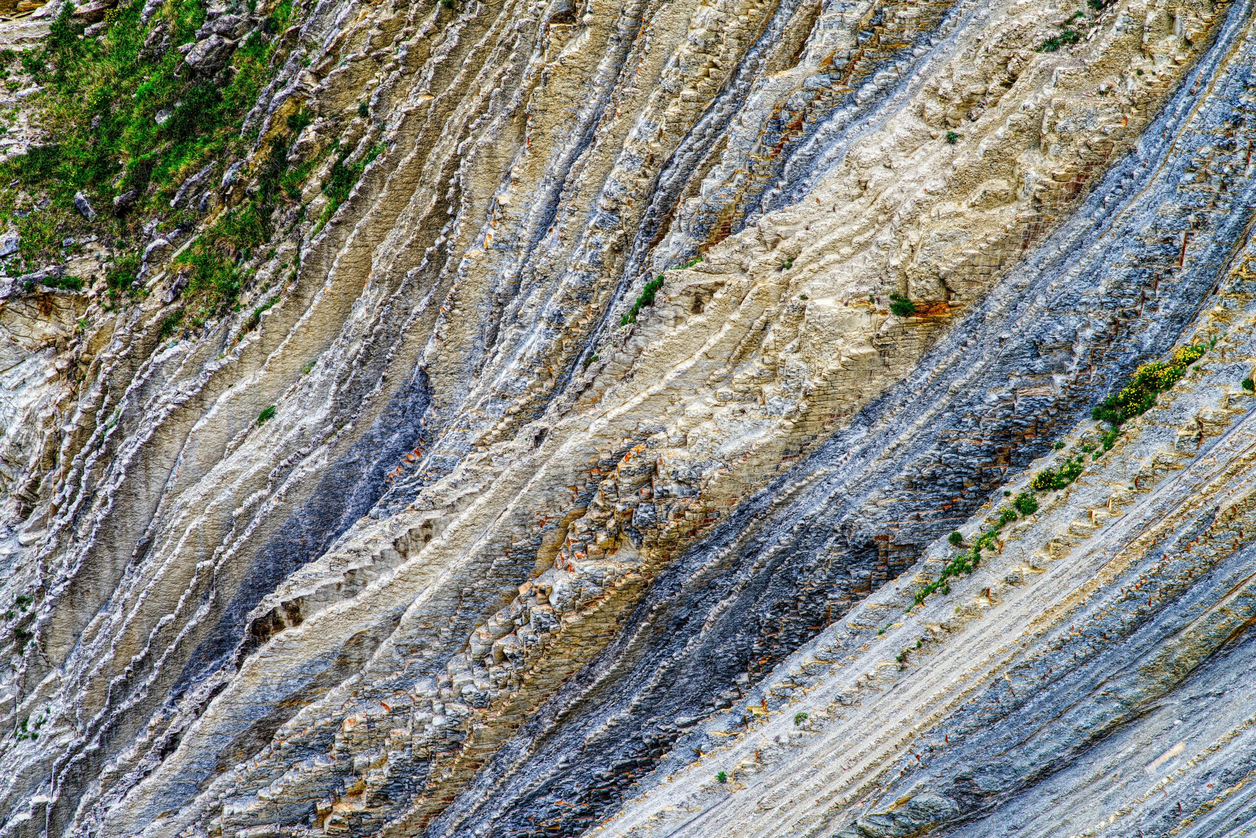
The fundamental principle behind lake sediment analysis is stratigraphy, the study of layered materials. The principle of superposition, observed in rock formations, also applies to lake sediments: in an undisturbed sequence, the oldest layers are at the bottom, and the youngest layers are at the top. Sediment cores, extracted vertically from the lakebed, preserve this temporal sequence. Each distinct layer represents a period of time, and the material within that layer offers a snapshot of the environmental conditions that prevailed during its deposition.
The physical characteristics of these layers – their color, texture, grain size, and compaction – can provide initial clues about the depositional environment. Darker layers often indicate a higher organic content, suggestive of more productive lake waters or surrounding vegetation, which in turn can be linked to warmer or wetter periods. Lighter layers might signify periods of higher mineral input, perhaps from increased erosion due to heavy rainfall or glaciation. The presence of distinct bands, known as varves, is particularly valuable. Varves are annual layers, often formed in glacial lakes where meltwater streams deposit a lighter, coarser layer in spring/summer and a darker, finer layer in autumn/winter. These varves act as natural calendars, allowing for highly precise dating and the reconstruction of annual climate variations.
Lake sediment climate reconstruction is a vital tool for understanding past climate changes and their impacts on ecosystems. A related article that delves into the intricacies of climate reconstruction through sediment analysis can be found at Uncovering the Secrets of the Desert Vault. This article explores how sediment cores can reveal historical climate patterns, providing insights into how ancient environments responded to climatic shifts.
Extracting the Past: Coring Techniques
Sediment Coring: A Window to the Deep
The process of retrieving sediment cores is a delicate but essential step in lake sediment analysis. Various coring devices are employed, each suited to different lake depths and sediment types.
Piston Corers
Piston corers are commonly used for deeper lakes. This device consists of a long, hollow tube with a piston inside. As the tube is driven into the sediment, the piston is held stationary, creating suction that helps the sediment to be drawn cleanly into the tube without significant disturbance. This method is crucial for obtaining long, intact cores that preserve the fine stratification.
Box Corers
Box corers are used for shallower water and for retrieving surface sediment samples. They are essentially a rectangular box that is lowered to the sediment surface and then pushed down, enclosing a volume of sediment. Box cores are excellent for studying the most recent sediment layers and for paleoecological studies that require undisturbed surface samples.
Gravity Corers
Gravity corers are simpler devices that rely on gravity to drive a coring tube into the sediment. While less sophisticated than piston corers, they are effective for obtaining shorter cores or for initial reconnaissance of sediment stratigraphy.
Handling and Preservation of Cores
Once retrieved, sediment cores are precious geological artifacts. They must be handled with extreme care to avoid contamination and preservation of their delicate structure. Cores are typically sealed in protective sleeves, often made of opaque plastic, to prevent light from degrading organic matter and to minimize moisture loss. They are then transported to laboratories where they are meticulously documented, described, and often frozen or refrigerated to halt further biological or chemical activity. The precise labeling of each core segment, including its depth and location, is paramount for accurate interpretation.
Decoding the Sediment Layers: Analytical Methods
Physical and Chemical Analysis
Once prepared, sediment cores undergo a battery of analytical tests, each designed to reveal different aspects of past environmental conditions.
Grain Size Analysis
Examining the size distribution of sediment particles provides clues about the energy of the depositional environment. Larger grains suggest higher energy events, such as floods or strong currents, while finer grains indicate calmer conditions. This can be linked to precipitation patterns and landscape stability.
Magnetic Susceptibility
This technique measures how strongly a material is attracted to a magnetic field. Variations in magnetic susceptibility can indicate changes in the amount and type of magnetic minerals present, which can be derived from the erosion of specific rock types or from atmospheric dust deposition. This can be a proxy for changes in erosion rates, watershed geology, and even volcanic activity.
Geochemical Proxies
The chemical composition of the sediment is a rich source of information.
Carbon and Nitrogen Isotopes
The isotopic ratios of carbon and nitrogen can reveal information about the source of organic matter and the cycling of nutrients in the lake. For example, a shift in carbon isotopes can indicate a change from terrestrial plant input to aquatic plant input, suggesting changes in water level or nutrient availability.
Trace Elements
The concentration of various trace elements can reflect changes in erosion, weathering, and even human activities. For instance, elevated levels of certain metals might indicate industrial pollution or intensified agricultural practices in the past.
Water Content and Organic Matter Content
The amount of water and organic matter within sediment layers can be directly related to past climate. Higher organic matter content often correlates with warmer temperatures and increased biological productivity, while higher water content can indicate periods of drought if the sediment has dried and rehydrated, or it could reflect higher moisture retention in wetter periods.
Biological Proxies: Life Records Entombed
Beyond the inorganic components, lake sediments are teeming with biological remains that offer direct evidence of past life and environmental conditions.
Pollen Analysis (Palynology)
Pollen grains, encased in their resilient outer walls, are remarkably well-preserved in sediments. Different plant species produce distinct types of pollen. By identifying and counting the types of pollen present in each sediment layer, scientists can reconstruct the vegetation composition of the surrounding landscape at different times. Changes in pollen assemblages can then be interpreted as responses to climatic shifts, such as temperature and precipitation changes, which favor different plant communities. For example, an increase in pine pollen might indicate cooler, drier conditions, while an increase in oak pollen might suggest warmer, moister climates.
Diatom Analysis
Diatoms are single-celled algae with intricate silica shells. Their shells are preserved in sediments and are highly sensitive to water chemistry, salinity, and trophic status (nutrient levels). Different diatom species have specific environmental preferences. Analyzing diatom assemblages in sediment cores allows scientists to reconstruct past water quality, pH, and salinity, providing valuable insights into hydrological changes and the impact of nutrient inputs.
Ostracod Analysis
Ostracods are tiny crustaceans that inhabit both freshwater and marine environments. They also secrete hard, calcified shells that are preserved in sediments. Like diatoms, ostracods have distinct environmental preferences, particularly concerning temperature, salinity, and oxygen levels in the water. Their shells can also preserve isotopic signatures that provide direct temperature reconstructions.
Macrofossil Analysis
Larger organic remains, known as macrofossils, such as seeds, leaves, wood fragments, and insect exoskeletons, can also provide direct evidence of past environments. The presence of certain species of plants or animals can indicate specific climatic conditions or habitat types. For example, finding fossilized beech nuts might suggest a certain range of temperature and rainfall that supported beech tree growth.
Chronology: Placing Events in Time
Dating the Sediments
Accurate dating of sediment layers is fundamental to reconstructing a meaningful climate history. Without a reliable timeline, the observed changes in sediment composition would be largely uninterpretable.
Radiocarbon Dating (¹⁴C Dating)
Radiocarbon dating is a widely used method for dating organic material in lake sediments, typically up to around 50,000 years old. This technique relies on the decay of the radioactive isotope carbon-14. By measuring the amount of ¹⁴C remaining in organic samples, scientists can calculate the time elapsed since the organism died.
Lead-210 (²¹⁰Pb) and Cesium-137 (¹³⁷Cs) Dating
For dating more recent sediments (within the last few hundred years), Lead-210 and Cesium-137 are valuable. ²¹⁰Pb is a naturally occurring radioactive isotope that is absorbed by sediment particles. Its concentration decreases predictably over time, allowing for dating. ¹³⁷Cs is a human-produced radionuclide, a byproduct of nuclear weapons testing, that was released into the atmosphere and subsequently deposited onto surfaces, including lakebeds. The presence of a distinct peak of ¹³⁷Cs in sediment layers can often be precisely dated to the mid-20th century, providing a marker for recent sedimentation rates.
Paleomagnetic Dating
The Earth’s magnetic field has reversed its polarity numerous times throughout geological history. These reversals are recorded in the magnetic minerals within sediments. By comparing the paleomagnetic signature of a sediment core to the known record of magnetic reversals, scientists can assign age ranges to sediment layers.
Varve Counting
As mentioned earlier, in lakes where annual sediment layers (varves) are clearly preserved, counting these layers can provide highly precise chronological control, effectively creating a calendar of past environmental events. This method is particularly valuable for reconstructing decadal-scale climate variability.
Astronomical Tuning
In some cases, sediment sequences can be “tuned” to known astronomical cycles, such as variations in Earth’s orbit and tilt, which are known to influence climate. By identifying patterns in the sediment record that correlate with these cyclical variations, scientists can refine age models and improve the temporal resolution of their reconstructions, especially for very long sediment cores spanning hundreds of thousands of years or more.
Lake sediment climate reconstruction is a fascinating field that provides insights into past climate conditions by analyzing sediment layers. This method helps researchers understand how ancient civilizations adapted to changing environments. For instance, a related article discusses how ancient techniques for surviving drought can inform modern practices. You can read more about this intriguing connection in the article on surviving drought and ancient civilization techniques here.
Reconstructing Past Climates and Environments
| Location | Time Period | Climate Proxy | Reconstruction Method |
|---|---|---|---|
| Lake X | 1000-1500 AD | Sediment composition | Pollen analysis |
| Lake Y | 1200-1700 AD | Organic matter | Isotope analysis |
| Lake Z | 800-1300 AD | Microfossils | Spectral analysis |
Interpreting Proxies for Climate Variables
The diverse array of proxies analyzed from lake sediments allows for the reconstruction of various climate variables.
Temperature Reconstruction
Isotopic analysis of certain biological remains, such as ostracod shells or plant waxes, can provide direct estimations of past surface and water temperatures. Changes in the abundance of temperature-sensitive plant pollen or tree lines can also be used to infer past temperature regimes.
Precipitation and Hydrological Changes
The grain size of sediments, the presence of specific mineral precipitates, and the types of aquatic organisms (like diatoms) are all sensitive indicators of precipitation patterns and hydrological changes. For instance, evidence of increased erosion and coarser sediment deposition can point to periods of heavy rainfall and flooding, while the presence of halophilic (salt-loving) diatoms might indicate periods of drought and increasing lake salinity.
Vegetation Shifts and Terrestrial Ecosystems
Pollen analysis is the cornerstone of reconstructing past vegetation. Changes in plant communities are direct responses to climatic shifts and provide a broad picture of past environmental conditions. The presence of pollen from specific forest types or grassland species can indicate prevailing temperature and moisture regimes.
Human Impact and Land-Use Change
The sediment record can also reveal the impact of human activities on the environment. An increase in pollen from agricultural crops, the presence of charcoal from fires, or elevated levels of certain pollutants or introduced species can indicate past land-use changes, deforestation, or the introduction of new agricultural practices.
Case Studies and Broad-Scale Reconstructions
Lake sediment studies have contributed significantly to our understanding of past climate variability on regional and global scales.
Past Interglacial and Glacial Periods
Sediment cores from various regions have provided detailed insights into the cycles of glacial and interglacial periods. These reconstructions highlight the natural fluctuations in global temperature and ice sheet extent, providing crucial context for understanding current warming trends.
Holocene Climate Variability
The Holocene epoch, the last ~11,700 years, has been a period of generally stable climate compared to the preceding ice age. However, lake sediment records reveal a complex pattern of regional climate fluctuations within the Holocene, including periods of drought, increased rainfall, and temperature shifts, which have influenced human settlement and agricultural development.
Evidence of Abrupt Climate Change
Some lake sediment records have captured evidence of abrupt climate change events, characterized by rapid and significant shifts in environmental conditions. Understanding the drivers and impacts of these past events is crucial for assessing the potential for future abrupt climate shifts.
Recent studies in lake sediment climate reconstruction have shed light on past environmental changes, revealing valuable insights into historical climate patterns. For a fascinating exploration of how ancient navigation techniques were influenced by these climatic shifts, you can read more in the article on unraveling the ancient navigation mystery. This connection between sediment analysis and historical navigation underscores the importance of interdisciplinary research in understanding our planet’s complex climate history. To learn more about this intriguing topic, visit this article.
The Future of Paleoclimate Research
Advanced Techniques and Interdisciplinary Approaches
High-Resolution Analysis and Multi-Proxy Studies
The trend in paleoclimate research is towards higher resolution analyses, aiming to reconstruct climate variability on decadal and even annual timescales. This is achieved through increasingly sophisticated analytical techniques and the combination of multiple proxies within a single sediment core. By integrating data from various sources, researchers can achieve a more robust and nuanced understanding of past environmental dynamics.
Modeling and Data Synthesis
The paleoenvironmental data extracted from lake sediments is increasingly being integrated with climate models. These models can help to not only test hypotheses about past climate forcings but also to predict potential future climate scenarios. Furthermore, global databases of paleoclimate reconstructions are being developed, allowing for synthesized views of past global climate patterns.
Relevance to Modern Climate Change
The study of past climate through lake sediment analysis is not merely an academic exercise; it holds profound relevance for understanding and addressing contemporary climate change. By examining how Earth’s climate system has responded to natural forcings in the past, scientists can refine their understanding of climate sensitivity and predict how the planet might react to the unprecedented rates of anthropogenic greenhouse gas emissions. The detailed reconstructions of past temperatures, precipitation patterns, and sea-level changes provide essential boundary conditions and validation data for climate models, improving their accuracy and their ability to project future climate trajectories. Ultimately, the silent archives within lake sediments offer a vital perspective on the long-term variability of our planet’s climate, grounding our understanding of current changes within a much grander geological context and informing our strategies for a sustainable future.

The Ancient World Buried Beneath the Sahara
FAQs
What is lake sediment climate reconstruction?
Lake sediment climate reconstruction is a scientific method used to study past climate conditions by analyzing the layers of sediment at the bottom of lakes. By examining the composition and characteristics of the sediment layers, researchers can infer information about past climate patterns, such as temperature, precipitation, and environmental changes.
How is lake sediment climate reconstruction conducted?
Lake sediment climate reconstruction involves collecting sediment cores from the bottom of lakes and analyzing them in a laboratory. Researchers use various techniques, such as sedimentology, geochemistry, and paleoecology, to study the physical, chemical, and biological properties of the sediment layers. These analyses provide valuable information about past climate conditions and environmental changes.
What can lake sediment climate reconstruction tell us about past climates?
Lake sediment climate reconstruction can provide insights into past climate variability, including long-term trends and short-term fluctuations. By studying the sediment layers, researchers can identify periods of warmer or cooler temperatures, changes in precipitation patterns, and the impact of natural events such as volcanic eruptions or wildfires on the environment.
What are the limitations of lake sediment climate reconstruction?
While lake sediment climate reconstruction is a valuable tool for studying past climates, it has some limitations. For example, the interpretation of sediment records can be complex and may involve uncertainties. Additionally, the availability of suitable lake sediment records for specific time periods and regions can be limited, which may affect the accuracy of the reconstructions.
What are the applications of lake sediment climate reconstruction?
Lake sediment climate reconstruction has various applications, including contributing to our understanding of past climate dynamics, providing context for current climate change, and informing future climate projections. This information can be used to support environmental and resource management, as well as to inform policy decisions related to climate change adaptation and mitigation.