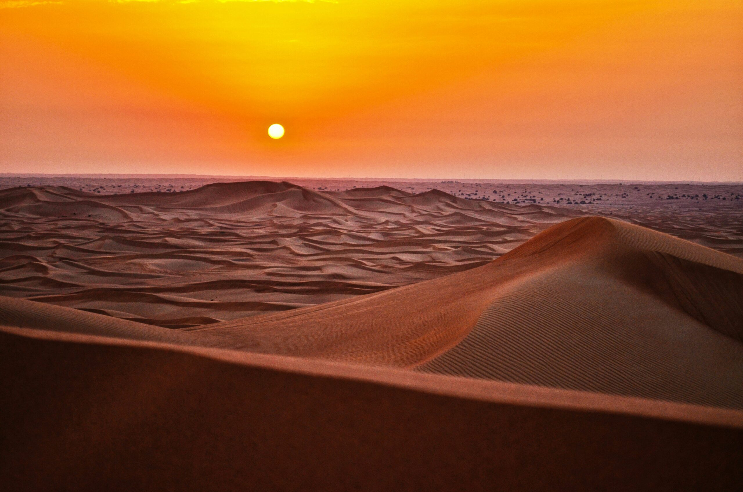
The vast, ochre expanse of the Sahara Desert, a name synonymous with aridity and endless sand dunes, holds within it a secret history, a testament to a time when its landscape was far from the hyper-arid region it is today. For centuries, whispers of ancient water bodies in this seemingly parched realm have intrigued explorers and scientists alike. Recent advancements in remote sensing technologies and meticulous geological investigations are now peeling back the layers of time, revealing a complex and vibrant subsurface world of ancient lakes that once dotted the Sahara.
The Sahara Desert, in its current state, is a formidable environment, characterized by extremely low rainfall, intense solar radiation, and sparse vegetation. However, geological evidence and proxy data tell a drastically different story for a significant portion of its past. These ancient lakes, remnants of a bygone era, are not merely scattered puddles but represent extensive lacustrine systems that played a crucial role in shaping the region’s ecology and supporting early human civilizations.
The Paleoclimate of the Sahara: A Shifting Narrative
The Sahara’s climatic past is a tale of dramatic oscillations between wet and dry periods, driven by complex interactions between Earth’s orbital parameters, atmospheric circulation patterns, and ocean currents. During interglacial periods, particularly the African Humid Period, which spanned roughly from 14,700 to 5,300 years ago, the Sahara and the Sahel experienced significantly increased rainfall. This abundance of water transformed the desert into a savanna, supporting diverse flora and fauna, and creating ideal conditions for human settlement.
Orbital Forcing and Monsoonal Intensification
The primary driver behind these wet periods is believed to be changes in Earth’s orbit, specifically variations in its tilt and the shape of its orbit around the sun. These variations, known as Milankovitch cycles, influence the amount of solar radiation reaching different parts of the Earth. During specific orbital configurations, the Northern Hemisphere received more summer insolation, leading to a stronger monsoon system that pushed further north into the Sahara, bringing substantial rainfall.
The Role of Atmospheric Dynamics
Beyond orbital influences, the interaction of atmospheric pressure systems played a critical role. A stronger Intertropical Convergence Zone (ITCZ), the band of low pressure where the trade winds of the Northern and Southern Hemispheres converge, would have been further north, delivering moisture across a wider area. This shifted atmospheric dynamics effectively turned the Sahara into a fertile landscape, nurturing the very lakes that are now being rediscovered.
Evidence in the Landscape: Geomorphological Clues
The landscape itself bears witness to the presence of these ancient water bodies. Geologists have identified numerous landforms that are unequivocally indicative of former lakes and rivers. These include ancient shorelines, lacustrine sediments, and fossilized riverbeds, all preserved beneath layers of sand and dust, waiting to be unearthed.
Ancient Shorelines: The Ghostly Rings of the Past
One of the most compelling pieces of evidence for ancient lakes are the well-preserved ancient shorelines. These elevated rims and terraces, often hundreds of meters above the current desert floor, mark the historical boundaries of these expansive water bodies. In many areas, these shorelines are remarkably distinct, etched into the landscape by the relentless action of wave erosion and deposition. Their aerial extent can be immense, hinting at lakes that rivaled many of the world’s largest freshwater bodies today.
Lacustrine Sediments: The Unspoken Archives
Beneath the surface, buried sediments hold invaluable information about the conditions within these ancient lakes. Core samples extracted from these deposits reveal layered sequences of fine-grained muds, clays, and organic matter, characteristic of deposition in calm lake environments. Analysis of these sediments, including the types of minerals present, the presence of fossilized diatoms (microscopic algae), and pollen grains, provides detailed insights into the water depth, salinity, and surrounding vegetation of the ancient lakes.
Fossilized River Systems: The Artery Network of a Lost World
The ancient lakes were not isolated bodies of water but were interconnected by a complex network of rivers. Fossilized river channels, revealed through satellite imagery and geophysical surveys, demonstrate the arterial pathways that supplied and drained these vast aquatic systems. These channels, often meandering and wide, suggest a much more humid climate with consistent water flow, a stark contrast to the ephemeral wadis that occasionally appear after rare rainfall events in the modern Sahara.
The Sahara Desert, known for its vast arid landscapes, was once home to ancient lakes that supported diverse ecosystems. These lakes played a crucial role in shaping the region’s history and the lives of early human civilizations. For a deeper understanding of how memory and mnemonic devices can help us unlock the mysteries of our past, you can explore this related article on ancient memory grids at Unlocking Ancient Memory Grids: Mnemonic Devices.
Unveiling the Subsurface Giants: Modern Detection Techniques
The sheer scale and often buried nature of these ancient lakes have made their discovery a formidable challenge. However, the advent of sophisticated remote sensing technologies has revolutionized our ability to peer beneath the desert’s sandy veil, revealing the vastness of these submerged aquatic systems.
Satellite Imagery and Radar: Seeing Through the Sand
Satellite-based remote sensing has been instrumental in identifying the subtle signatures of ancient lake beds and associated features that are not always visible from the ground. Multiple spectral bands can highlight variations in soil composition and moisture content, hinting at areas of former inundation. More powerfully, Synthetic Aperture Radar (SAR) has proven particularly effective. SAR can penetrate dry sand to some extent, revealing buried geological structures, including the outlines of ancient lake basins and their shorelines.
Multispectral and Hyperspectral Imaging: Unveiling Subtle Signatures
By analyzing the way different wavelengths of light are reflected and absorbed by the Earth’s surface, multispectral and hyperspectral imaging can differentiate between various soil types and geological formations. Areas that were once covered by water often have distinct mineralogical compositions and sediment textures that can be detected from orbit, even after millennia of burial. These techniques help to map out the extent of ancient lacustrine deposits.
Synthetic Aperture Radar (SAR): Penetrating the Dunes
SAR systems emit radar pulses and measure the strength and timing of the backscattered signal. Because dry sand is relatively transparent to certain radar frequencies, SAR can effectively “see” beneath the dunes. This allows for the mapping of buried geological features, such as ancient shorelines, deltaic deposits, and even the subtle depressions that mark former lake basins. Different SAR polarizations can also provide information about the geometry and structure of subsurface features.
Geophysical Surveys: Probing the Earth’s Interior
Once promising areas are identified through satellite imagery, ground-based geophysical surveys are employed to gather more detailed information about the subsurface. These non-invasive techniques measure physical properties of the Earth’s materials to infer geological structures and water content.
Ground Penetrating Radar (GPR): High-Resolution Subsurface Imaging
Ground Penetrating Radar (GPR) uses radar pulses to create detailed cross-sectional images of the subsurface. Similar to SAR, it can reveal buried layers and features. GPR is particularly useful for mapping stratigraphy within ancient lake sediments, identifying buried shorelines, and understanding the thickness of sediment layers. Its high resolution makes it ideal for characterizing the internal structure of these lost aquatic environments.
Electrical Resistivity Tomography (ERT): Mapping Water and Sediments
Electrical Resistivity Tomography (ERT) measures the electrical resistance of the ground. Water-saturated sediments and clay-rich deposits, indicative of former lake environments, generally have lower electrical resistivity than dry sands or bedrock. ERT surveys can therefore map out the extent of these wetter, sediment-rich areas and distinguish them from the surrounding dry desert. This technique is invaluable for identifying potential groundwater resources associated with ancient lake systems.
Seismic Reflection and Refraction: Delineating Deep Structures
For deeper structures and larger-scale features, seismic surveys are employed. These techniques involve generating sound waves (either artificially or from natural sources) and measuring how they travel through the Earth’s subsurface. Differences in wave speed and reflection patterns can reveal significant geological boundaries, including the deeply buried basins of ancient lakes and the underlying bedrock topography.
Case Studies: Discoveries in the Sands

The application of these advanced techniques has led to remarkable discoveries, unveiling specific ancient lake systems that paint a vivid picture of a Sahara teeming with life. These case studies provide concrete examples of the scale and significance of these submerged water bodies.
Mega-Lakes of the Paleolithic Sahara
Evidence suggests the existence of colossal lakes during the Paleolithic period, some potentially larger than any of today’s freshwater lakes. These ancient mega-lakes, such as Mega-Chad and the original Lake Mega-Mali, would have transformed vast swathes of the Sahara into inland seas, supporting a rich ecosystem and serving as crucial hubs for early human migration and settlement.
Lake Mega-Chad: A Ghost of the Mighty Sea
Lake Mega-Chad, a name that evokes the ancient African continent, is believed to have been one of the largest freshwater lakes on Earth during the African Humid Period. Its basin, now mostly buried and arid, once covered an area estimated to be roughly the size of the Caspian Sea. Discoveries of ancient shorelines, fossilized fish bones, and archaeological sites within its former catchment area provide compelling evidence of its immense size and the vibrant life it sustained. The remnants of this once-mighty sea now lie dormant, its memory preserved in the geological record.
The Western Sahara Water System: A Network of Ancient Reservoirs
Extensive research in the Western Sahara has revealed a complex network of ancient lake systems. These lakes, now largely buried under sand dunes, were once interconnected, forming a vast aquatic landscape that provided vital resources for hunter-gatherer societies. The identification of these lake basins and their shorelines through satellite imagery and ground surveys has helped to re-evaluate the migratory routes and settlement patterns of early humans in this region.
The Oasis Belts: Modern Echoes of Ancient Lakes
In some instances, the presence of ancient lakes has left significant traces that influence modern hydrogeology. Ancient lake beds often act as impermeable layers or porous reservoirs, influencing the flow and storage of groundwater. This can contribute to the formation of modern oases, providing a continuous link between the wetter past and the arid present.
The Great Sand Sea and its Subterranean Waters
The Great Sand Sea, a vast erg in the western desert of Egypt, is not solely characterized by its shifting sands. Beneath its seemingly endless dunes lie extensive deposits of ancient lake sediments. These sediments, along with inferred ancient river channels, have acted as significant aquifers, storing vast quantities of fossil water from the African Humid Period. This subterranean water is now a crucial resource, feeding some of Egypt’s most important oases, a direct testament to the ancient lakes that once dominated the landscape.
The Chad Basin’s Hydrological Legacy
The modern Lake Chad, though significantly diminished, is a mere shadow of its former glory. The ancient Lake Mega-Chad, its supersized predecessor, has left an indelible hydrological legacy on the Chad Basin. The sedimentary record beneath the basin reveals the cyclical filling and drying of this massive lake, and its ancient shorelines extend far beyond the present-day boundaries of Lake Chad. The understanding of these ancient lake dynamics is crucial for managing the scarce water resources of the region today.
The Significance of Uncovering Ancient Lakes

The discovery and study of these ancient Saharan lakes are not merely an academic exercise in paleoclimatology. They hold profound implications for our understanding of Earth’s climate system, the evolution of life, and the history of human civilization.
Reconstructing Past Climates: A Window into Earth’s Variability
The detailed study of ancient lake sediments provides invaluable data for reconstructing past climate conditions. By analyzing the composition of these sediments, the types of fossils found, and isotopic signatures, scientists can gain a precise understanding of temperature, rainfall patterns, and atmospheric composition during different climatic periods. This information is crucial for developing more accurate climate models and projecting future climate change impacts.
Paleolacustrine Sediments as Climate Archives
Paleolacustrine sediments act as natural archives of past climate. The layers within these sediments record changes in precipitation, temperature, and vegetation over time. For instance, the presence of specific pollen types can indicate the abundance of certain plant species that are sensitive to climatic conditions. Likewise, the geochemistry of the sediments can reveal information about water salinity, alkalinity, and evaporation rates, all of which are directly linked to climate.
Isotopic Analysis: Unlocking Secrets of Water Source and Temperature
Isotopic analysis of water molecules and organic matter preserved in lake sediments provides critical insights into past climate. The ratio of different isotopes of oxygen and hydrogen in water can reveal information about the source of precipitation and the temperature at which it fell. Similarly, isotopic analysis of plant remains can shed light on past temperatures and atmospheric carbon dioxide levels.
Understanding the Evolution of Life: Habitats for Ancient Ecosystems
These ancient lakes provided vast and diverse habitats for a wide range of flora and fauna. The discovery of fossilized remains of fish, amphibians, reptiles, and even larger mammals within and around ancient lake beds provides direct evidence of their presence and the rich ecosystems they supported. These findings contribute to our understanding of how life adapted to changing environmental conditions and the evolutionary pathways taken by various species.
Fossil Fauna and Flora: Evidence of a Thriving Biome
The discovery of fossilized remains of a diverse array of organisms within the sediments of ancient Saharan lakes offers compelling evidence of their ecological richness. Remains of various fish species indicate stable freshwater environments. Fossilized vegetation, like reeds and aquatic plants, paints a picture of lush shorelines. Furthermore, the presence of fossils belonging to animals that require significant water resources, such as hippos, crocodiles, and various herbivores, highlights the expansive and life-sustaining nature of these ancient aquatic systems.
Migratory Pathways and Biodiversity Hotspots
The presence of these large water bodies would have created crucial migratory corridors for animals and facilitated the dispersal of plant species. Ancient lake systems likely served as biodiversity hotspots, attracting a wide array of species and contributing to the overall richness of life in the region. Tracing these ancient migratory routes through fossil evidence can help us understand past faunal distributions and evolutionary processes.
The Cradle of Civilization: Human Adaptation and Migration
Perhaps the most compelling aspect of these discoveries is our understanding of early human history. The periods when the Sahara was wet were times of significant human migration and settlement. Ancient lakes provided reliable sources of water and supported abundant game and plant life, creating ideal conditions for hunter-gatherer societies to thrive. Archaeological evidence, including stone tools, rock art, and burial sites found in close proximity to ancient lake beds, speaks volumes about the human presence and adaptation to these once-fertile landscapes.
Archaeological Sites in Ancient Lake Beds: Traces of Early Human Life
Numerous archaeological sites have been discovered within the former basins of these ancient lakes. The presence of stone tools, pottery fragments, and hearths within lacustrine sediments indicates that early humans directly utilized these environments. These findings suggest that the ancient lakes were not only sources of sustenance but also central to the social and cultural lives of these ancient populations.
Rock Art: Depicting a Lost World
The iconic rock art found across the Sahara often depicts scenes that are strikingly different from the desert landscapes of today. Many of these petroglyphs and pictographs show abundant wildlife, including giraffes, elephants, lions, and cattle, as well as activities like hunting and fishing, which would have been impossible in the present-day arid environment. This vibrant artistic record serves as a powerful visual testament to a wetter Sahara, a world that was once teeming with life, directly echoing the presence of the ancient lakes.
Ancient lakes in the Sahara Desert have long fascinated researchers, revealing insights into the region’s climatic history and the life that once thrived there. A related article explores the intriguing connections between ancient civilizations and their navigation techniques, shedding light on how they adapted to their environments. For more on this topic, you can read about the Minoan civilization’s celestial navigation methods in this insightful piece here. Understanding these ancient practices can provide a deeper appreciation of how human ingenuity has evolved in response to changing landscapes.
Challenges and Future Directions
| Lake Name | Location | Size | Age |
|---|---|---|---|
| Lake Chad | Chad, Cameroon, Niger, Nigeria | 1,350 sq mi | 10,000 years |
| Lake Megachad | Chad | 17,806 sq mi | 2.5 million years |
| Lake Fezzan | Libya | 1,300 sq mi | Prehistoric |
Despite the remarkable progress made in uncovering the secrets of the Sahara’s ancient lakes, significant challenges remain. The vastness of the desert, the difficulty of accessing remote areas, and the expense of advanced research technologies necessitate continued innovation and international collaboration.
Advancing Research and Exploration
Future research will likely focus on integrating data from various sources to create more comprehensive reconstructions of past lake systems. Developing even more advanced remote sensing technologies capable of deeper penetration and higher resolution will be crucial. Furthermore, continued ground-based fieldwork and the application of novel analytical techniques will be vital for unlocking the full potential of these ancient aquatic archives.
Interdisciplinary Collaboration: A United Approach
Unraveling the complex history of the Sahara’s ancient lakes requires a multidisciplinary approach. Geologists, climatologists, paleontologists, archaeologists, and remote sensing specialists must work together, sharing their expertise and data. This interdisciplinary collaboration fosters a more holistic understanding, connecting the geological formations to the life that inhabited them and the humans who adapted to them.
Technological Innovation: Pushing the Boundaries of Discovery
The relentless pursuit of knowledge demands continuous technological innovation. The development of new sensor technologies for satellites and drones, advancements in drone-based ground exploration, and the refinement of subsurface imaging techniques will be critical. Imagine future capabilities that allow for real-time, high-resolution subsurface mapping of vast desert regions, revolutionizing our ability to discover and study these hidden remnants of a wetter past.
The Importance of Conservation
As we uncover these ancient lake systems, it is crucial to consider their conservation. While they are remnants of the past, their geological formations and sedimentary records hold invaluable scientific information. Protecting these sites from disturbance, both natural and human-induced, is essential for future research and for preserving our planet’s history.
Preserving the Geological Heritage
The ancient lake beds and their associated sedimentary deposits are irreplaceable geological heritage. They represent a tangible link to Earth’s past and provide a unique laboratory for scientific study. Efforts to map, document, and protect these vulnerable sites are paramount to ensure that future generations can continue to learn from them.
Understanding Climate Change Through a Historical Lens
The study of Saharan ancient lakes offers a powerful perspective on the Earth’s climate sensitivity and its potential for dramatic shifts. By understanding how and why these lakes formed and disappeared, we gain crucial insights into the drivers of climate change and the potential impacts of future warming. This historical understanding is not just about the past; it is essential for navigating the challenges of our present and future.
In conclusion, the Sahara Desert, once imagined as an eternal wasteland, is progressively revealing its true nature: a landscape sculpted by water, harboring the profound secrets of its wetter past. The ongoing uncovering of its ancient lakes is a testament to human curiosity and technological ingenuity, offering an unparalleled window into Earth’s dynamic climate, the evolution of life, and the very origins of human civilization. Each unearthed shoreline and sediment layer is a story, waiting to be read, retold, and understood, reminding us that even in the most arid of places, life and water once flourished.

The Ancient World Buried Beneath the Sahara
FAQs
What are ancient lakes in the Sahara Desert?
Ancient lakes in the Sahara Desert are remnants of large bodies of water that existed in the region thousands of years ago. These lakes were formed during periods of increased rainfall and were once vital sources of water for the flora and fauna of the area.
How were ancient lakes formed in the Sahara Desert?
Ancient lakes in the Sahara Desert were formed through a combination of tectonic activity, climate change, and fluctuations in rainfall patterns. These factors led to the creation of depressions in the landscape that eventually filled with water, forming the ancient lakes.
What evidence exists of ancient lakes in the Sahara Desert?
Evidence of ancient lakes in the Sahara Desert includes the presence of fossilized aquatic species, sedimentary deposits, and shoreline features such as beach ridges and terraces. Additionally, satellite imagery and geological surveys have revealed the remnants of ancient lake basins across the region.
What is the significance of ancient lakes in the Sahara Desert?
Ancient lakes in the Sahara Desert are significant because they provide valuable insights into the region’s past climate and environmental conditions. Studying these ancient lakes can help scientists understand how the Sahara has evolved over time and how it may continue to change in the future.
How are ancient lakes in the Sahara Desert being studied?
Scientists are studying ancient lakes in the Sahara Desert through a combination of field research, geological surveys, satellite imagery analysis, and the examination of sediment cores. These methods help researchers reconstruct the history of the ancient lakes and understand their impact on the Sahara’s ecosystem.