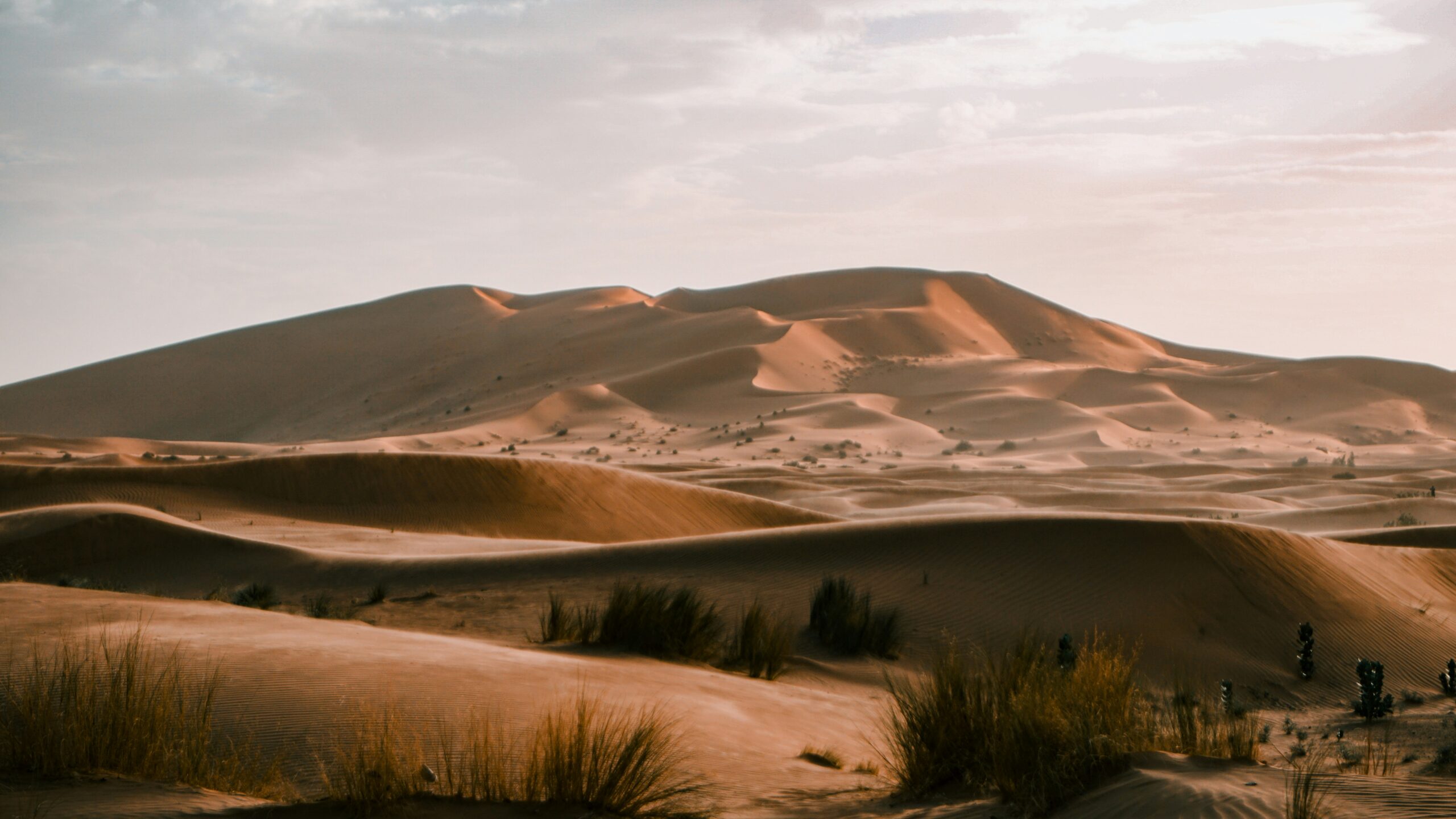
The sun blazes down on a parched, ochre landscape, a familiar image of the Sahara Desert. Dust devils dance across cracked earth, and sparse, hardy vegetation clings to existence. This is the Sahara we know. But etched within its arid expanses lie whispers of a forgotten epoch, a time when this seemingly inhospitable region pulsed with life, a verdant paradise teeming with rivers, lakes, and grasslands. The journey to unraveling this astonishing transformation, from its lush past to its arid present, is a testament to human scientific endeavor, a captivating story of piecing together a monumental natural history. Scientists, armed with an array of sophisticated tools and an insatiable curiosity, have meticulously reconstructed the “Green Sahara,” revealing a saga of climate change and the profound resilience of ecosystems.
The first brushstrokes in painting the picture of a Green Sahara come from the patient, persistent work of geologists. They are the chroniclers of Earth’s deep past, and their observations in the Sahara have been nothing short of revelatory. Their tools are not brushes and pigments, but core drills, geological hammers, and an intimate understanding of rock formations and sediment layers.
Sedimentary Clues: Layers of Time
Beneath the surface of the modern Sahara lie vast, ancient sediments that hold the secrets of its past. Geologists examine these layers, searching for telltale signs of water and life.
Paleochannels and Alluvial Fans
The presence of ancient riverbeds, or paleochannels, is a primary indicator of past water flow. These winding networks, often buried beneath sand dunes, are evidence of significant hydrological systems that once crisscrossed the region. Alluvial fans, fan-shaped deposits of sediment left by rivers at the foot of mountains, further corroborate the existence of powerful watercourses that have long since disappeared. Examining the composition and structure of these deposits allows scientists to infer the volume and energy of the water that transported them.
Lake Bed Deposits: Echoes of Inland Seas
The Sahara was once dotted with numerous large lakes, some comparable in size to modern-day North American Great Lakes. Geologists identify ancient lake beds by distinctive sedimentary structures. These can include fine-grained muds, clays, and diatomaceous earth, the microscopic shells of single-celled aquatic organisms that thrive in freshwater environments. The presence of fossilized fish, mollusks, and aquatic plants within these deposits provides undeniable evidence of thriving lacustrine ecosystems. Analyzing the chemical composition of these sediments can also reveal information about salinity and water depth.
Ooids and Stromatolites: Biomarkers of Ancient Waters
Specific mineral formations found within these ancient lake beds act as powerful biomarkers. Ooids, small spherical grains of calcium carbonate that form in shallow, agitated marine or lacustrine waters, are frequently discovered. Their presence indicates conditions suitable for the precipitation of calcium carbonate, often associated with warm, shallow, and oxygenated water. Even more compelling are stromatolites, layered sedimentary structures formed by the growth of cyanobacteria. These microbial mats trap and bind sediment, creating distinctive, dome-like formations. The existence of stromatolites, particularly in freshwater lake environments, is strong evidence of microbial life thriving in a watery past.
Volcanic Ash Layers: Chronological Anchors
Interspersed within these sedimentary layers are often layers of volcanic ash. While seemingly destructive, these ash layers serve as invaluable chronological markers. Volcanic eruptions are discrete events, and the ash they deposit can be radiometrically dated. By dating these ash layers, scientists can establish precise timelines for the sedimentary sequences they are found within, allowing them to anchor the reconstructions of the Green Sahara to specific periods in Earth’s history.
Scientists have made significant strides in reconstructing the Green Sahara, a lush landscape that existed thousands of years ago, by analyzing sediment cores and ancient pollen data. This research sheds light on how climate changes transformed the Sahara from a vibrant ecosystem into the arid desert we know today. For further insights into how environmental shifts impact economies and societies, you can read a related article on the recent financial implications of such changes in “Stocks Soar Amid Dollar Collapse” available at this link.
The Atmospheric Architect: Paleoclimate Reconstructions
While geology provides the raw materials, understanding the atmospheric conditions that shaped the Green Sahara requires a different set of scientific tools and expertise. Paleoclimatologists reconstruct past climates by analyzing various proxies, indirect indicators that reflect atmospheric conditions at the time of their formation.
Ice Cores: Polar Archives of Global Change
Though the Sahara itself doesn’t hold easily accessible ice cores, those drilled in Greenland and Antarctica provide crucial global context. These frozen archives trap air bubbles from the atmosphere of millennia past. By analyzing the composition of these air bubbles, particularly the isotopes of oxygen and hydrogen in the ice and trapped gases, scientists can determine past temperatures and atmospheric circulation patterns. These global insights help explain the larger-scale climatic shifts that influenced the Sahara.
Pollen Analysis: Botanical Fingerprints of Past Vegetation
Pollen, the microscopic reproductive units of plants, are incredibly durable and can be preserved for millennia in sediments and lake cores. Palynologists, scientists who study pollen, extract and analyze these tiny grains. The types of pollen found in Sahara sediments reveal the plant communities that once thrived there. An abundance of pollen from grasses, trees, and aquatic plants would indicate a much wetter environment than the present-day desert. Changes in pollen assemblages over time provide a clear record of vegetation shifts in response to climatic changes.
Isotopes in Sediments and Fossils: Tracing Water Sources and Temperature
Stable isotopes found in the shells of ancient organisms (like mollusks and ostracods) and in mineral deposits within sedimentary cores offer further insights. The ratio of different isotopes of oxygen and carbon in these materials can reveal information about the temperature of the water they formed in, the salinity of the water, and even the source of the precipitation. For instance, analyzing the isotopic composition of ancient fish otoliths (ear bones) can reveal the water conditions and dietary habits of these extinct fish, painting a picture of their aquatic environment.
Speleothems: Cave Chronicles of Rainfall
In caves within or near the Sahara region, stalactites and stalagmites (speleothems) can serve as valuable climate archives. These mineral formations grow slowly from dripping water, and the isotopic composition of the water incorporated into their structure reflects the rainfall patterns at the time of their formation. By dating and analyzing speleothems, scientists can reconstruct past periods of increased rainfall and humidity.
The Timing of the Bloom: Dating the Green Epochs

Reconstructing the Green Sahara is not just about knowing that it was green, but when it was green. Establishing precise timelines is critical to understanding the triggers and duration of these verdant periods.
Radiocarbon Dating: The Carbon Clock
For more recent geological periods, radiocarbon dating is a cornerstone technique. This method relies on the radioactive decay of carbon-14, an isotope present in organic materials like wood, charcoal, and bone. By measuring the remaining amount of carbon-14, scientists can determine the age of organic samples up to about 50,000 years old, providing a robust timeline for the presence of life during the Green Sahara epochs.
Optically Stimulated Luminescence (OSL) Dating: Dating the Sands
For dating sedimentary materials like sand grains, Optically Stimulated Luminescence (OSL) dating is crucial. This technique measures the amount of light energy stored within a mineral grain (typically quartz or feldspar) that has been exposed to sunlight. When a sediment is buried, it stops being exposed to sunlight, and the trapped energy begins to accumulate. By measuring the accumulated energy, scientists can determine how long ago the sediment was last exposed to sunlight – effectively, when it was buried. This allows for the dating of dune formation and deposition events.
Uranium-Series Dating: For Older Carbonates
For dating older carbonate materials, such as the shells of mollusks or certain mineral precipitates found in lake deposits, Uranium-series dating is employed. This method relies on the radioactive decay of uranium isotopes into stable lead isotopes through a series of intermediate daughter isotopes. By measuring the ratios of these isotopes, scientists can date samples ranging from tens of thousands to hundreds of thousands of years old.
Correlating with Global Ice Core Records: A Cosmic Calendar
Crucially, these dating methods are often cross-verified and correlated with robust global climate records, particularly the precisely dated ice cores from Greenland and Antarctica. By matching climatic events indicated by Sahara proxies with events recorded in ice cores (such as periods of warmer global temperatures or shifts in atmospheric circulation), scientists can imbue the Sahara timeline with global significance and greater accuracy.
The Dance of the Monsoons: Unraveling the Driving Forces

The dramatic transformations of the Sahara are intrinsically linked to the movement and intensity of atmospheric circulation patterns, most notably the African monsoon system. Scientists have worked to understand how these weather systems shifted and in turn sculpted the landscape.
The Obliquity Theory: Earth’s Wobble and Orbital Cycles
A fundamental driver of long-term climate change is Earth’s orbital variations, known as Milankovitch cycles. These cycles, including changes in Earth’s axial tilt (obliquity), the eccentricity of its orbit, and the precession of its equinoxes, influence the amount and distribution of solar radiation received by the planet. The obliquity of Earth’s axis has a particularly strong influence on the intensity of seasons. When Earth’s tilt is greater, summers are hotter and winters are colder, leading to increased evaporation and the potential for intensified monsoons. Scientists have found strong correlations between periods of higher obliquity and the occurrence of the Green Sahara.
The African Monsoon: A Seasonal Breath of Life
The African monsoon is a complex weather phenomenon driven by the differential heating of land and ocean. During certain periods in Earth’s history, shifts in atmospheric pressure gradients caused the monsoon system to extend much further north than it does today, bringing significant rainfall to the Sahara. The northward expansion of the monsoon allowed for the formation of large lakes and rivers, supporting lush vegetation. Understanding the interplay between orbital forcing and the monsoon is key to understanding the Green Sahara.
Atmospheric Circulation Models: Simulating Past Climates
Sophisticated atmospheric circulation models are used to simulate past climate conditions. By inputting parameters derived from paleoclimate evidence, such as orbital forcings and estimates of past ocean temperatures, these models can replicate the plausible atmospheric conditions that would have led to a Green Sahara. These simulations help to test hypotheses and refine our understanding of the complex interactions within the climate system.
Paleo-wind Patterns: Guiding the Sands
The direction and intensity of past winds also played a significant role, not only in shaping the landscape through erosion and deposition but also in influencing atmospheric moisture transport. Studying ancient dune formations and the orientation of fossilized riverbeds can provide clues to past wind patterns, helping to reconstruct the atmospheric circulation dynamics that facilitated the Green Sahara.
Scientists have made significant strides in understanding the ancient climate of the Sahara Desert, revealing how it transformed from a lush, green landscape to the arid region we know today. This fascinating research sheds light on the environmental changes that occurred over thousands of years, providing insights into past ecosystems and human migration patterns. For those interested in exploring related topics, you might find this article on the economic implications of resource scarcity intriguing, as it discusses how historical shifts in environments can impact currency and trade systems. To read more, visit this article.
Legacy and Lessons: The Enduring Relevance of the Green Sahara
| Metrics | Data |
|---|---|
| Time Period | 5,000 to 11,000 years ago |
| Method | Analysis of fossilized pollen, charcoal, and other plant remains |
| Findings | Indicate a wetter climate and more vegetation in the Sahara region |
| Impact | Provides insights into past climate change and human adaptation |
The story of the Green Sahara is more than just a fascinating glimpse into Earth’s past; it carries profound lessons for our present and future. It demonstrates the Earth’s capacity for dramatic climatic shifts and the vulnerability of ecosystems to these changes, as well as their remarkable ability to rebound under favorable conditions.
The Fragility of Ecosystems: Lessons in Resilience
The dramatic transition from a verdant landscape to the arid expanse of the Sahara highlights the inherent fragility of ecosystems in the face of climatic shifts. The Green Sahara reminds us that even seemingly stable environments are subject to vast, long-term changes. It underscores the importance of understanding the delicate balance that sustains life and the potential consequences of disrupting that balance.
Climate Change: A Recurring Theme
The cyclical nature of the Green Sahara, with its periods of verdant life followed by aridity, serves as a powerful reminder that climate change is not a new phenomenon. While the drivers of past changes differed from those of contemporary anthropogenic climate change, the underlying principles of how climate systems respond to altered forcings remain relevant. Studying these past transitions provides invaluable context for understanding the challenges we face today.
The Future of Arid Lands: Insights for Adaptation
The ability of the Sahara to support life in the past offers hope and inspiration for managing arid and semi-arid regions in the future. While the exact conditions that fostered the Green Sahara may not be replicated, the understanding gained from studying its transition can inform strategies for drought resilience, water management, and sustainable land use in other parts of the world facing similar challenges.
Scientific Collaboration: A Global Endeavor
The reconstruction of the Green Sahara is a triumph of interdisciplinary scientific collaboration. Geologists, paleoclimatologists, palynologists, geochemists, and atmospheric modelers have all contributed their unique expertise to build a comprehensive picture. This collaborative spirit, transcending national borders and academic disciplines, is essential for tackling complex scientific questions and providing critical insights into our planet’s past, present, and future. The persistent quest to understand the Green Sahara continues to inspire new generations of scientists to look beyond the visible landscape and delve into the deep time that shaped our world.

The Ancient World Buried Beneath the Sahara
FAQs
What is the Green Sahara?
The Green Sahara refers to a period in the Earth’s history, approximately 5,000 to 11,000 years ago, when the Sahara Desert was a lush and fertile region with abundant vegetation and wildlife.
How did scientists reconstruct the Green Sahara?
Scientists reconstructed the Green Sahara by analyzing sediment cores from ancient lake beds and using climate models to simulate the environmental conditions of the region during that time period.
What did the reconstruction of the Green Sahara reveal?
The reconstruction of the Green Sahara revealed that the region experienced a significant shift from a wet and vegetated landscape to the arid desert environment that exists today. This shift was driven by changes in Earth’s orbit and the tilt of its axis, as well as changes in ocean currents and atmospheric circulation patterns.
Why is the reconstruction of the Green Sahara important?
The reconstruction of the Green Sahara is important because it provides valuable insights into the Earth’s climate system and how it has changed over time. It also helps scientists better understand the factors that can lead to dramatic shifts in regional climate and ecosystems.
What are the implications of the Green Sahara reconstruction for current climate change research?
The Green Sahara reconstruction has implications for current climate change research by highlighting the potential for rapid and dramatic shifts in regional climate and ecosystems in response to natural and human-induced factors. It also underscores the importance of understanding past climate changes in order to better predict and mitigate future changes.