The screen flickered to life, revealing a tapestry of faded parchment, ink bleeding at the edges with the passage of centuries. A resonant voice, tinged with scholarly gravitas, began to narrate, “For millennia, humanity has sought to understand its place in the world. And for just as long, we have attempted to chart that world, to capture its every curve, its every hidden secret, on maps.” Thus began Uncovering the Mysteries: Ancient Maps, a documentary that promises to delve into the enigmatic past of cartography, shedding light on the knowledge and intentions of those who first dared to translate the vastness of the Earth onto fragile surfaces. This film is not merely a historical overview; it is an expedition, guided by experts and illuminated by remarkable artifacts, into the minds of ancient mapmakers and the lost worlds they depicted.
The documentary’s initial segments focus on the very genesis of mapmaking, exploring what constitutes an “ancient map” and the earliest evidence of humanity’s desire to represent space. It proposes that the impulse to map is as fundamental as the urge to explore, suggesting that even the most rudimentary scratchings on stone or bone could be considered proto-maps, born from the need to navigate hunting grounds or recall the layout of encampments.
Early Representations: Beyond the European Paradigm
Uncovering the Mysteries: Ancient Maps consciously challenges the Eurocentric view of cartography’s origins. It moves beyond the assumed starting point of Greek cartographers like Ptolemy, venturing into Mesopotamia and the Indus Valley. Experts within the documentary highlight the existence of clay tablets, dating back thousands of years, that depict settlements, rivers, and agricultural lands. These are not abstract artistic renderings but functional tools, born out of sophisticated societal needs for land management and administration. The film emphasizes that these early Mesopotamian maps reveal a detailed understanding of local geography, indicating a developed system of surveying and observation.
The Functional Imperative: Maps as Tools for Survival and Governance
The documentary meticulously traces the functional purposes that drove early mapmaking. It argues that these maps were not created for aesthetic appreciation but as vital instruments for survival, trade, and governance. For nomadic tribes, maps might have marked water sources or migration routes. For burgeoning city-states, they would have been crucial for defining territorial boundaries, managing resources, and planning military campaigns. The film showcases how the need to collect taxes or allocate land would have necessitated precise representations of geographic features, pushing the boundaries of what could be captured on any given medium.
Materiality and Medium: From Bone to Papyrus
The choice of medium is explored as a significant factor in the development and preservation of ancient maps. Uncovering the Mysteries: Ancient Maps examines the transition from perishable materials like wood and bark to more durable ones like clay, stone, and eventually papyrus and parchment. Each material presented its own unique challenges and opportunities for the mapmaker. The techniques employed, from incising lines into clay to painting intricate details on papyrus, are discussed, illustrating the ingenuity and skill involved in creating these historical documents. The wear and tear on existing specimens are also presented not as decay, but as tangible evidence of their use and importance.
In exploring the fascinating world of ancient maps, one can gain deeper insights into the civilizations that created them and their understanding of the world. A related article that delves into the mysteries of ancient knowledge is titled “Forbidden Ancient Technology: Secrets Unearthed.” This piece examines the advanced technologies and insights that ancient cultures possessed, which are often overlooked in modern narratives. To read more about this intriguing subject, visit the article here: Forbidden Ancient Technology: Secrets Unearthed.
The Mystery of the Unknown: Charting the Uncharted
A significant portion of the documentary is dedicated to the fascinating and often perplexing aspect of ancient maps: their depiction of lands and peoples unknown to the cartographer. This raises profound questions about how this knowledge was acquired and what it reveals about their worldview.
Whispers from the Edge: Legendary Lands and Mythical Beasts
Uncovering the Mysteries: Ancient Maps delves into maps that feature phantom islands, sea monsters, and distant, often idealized, lands. The film features prominent historians and mythologists who discuss the prevalent role of folklore, oral tradition, and even outright conjecture in filling the blanks of the geographical unknown. It explores the human tendency to populate the void with fantastical elements, reflecting fears, hopes, and cosmological beliefs. The visual representation of these mythical elements on maps is presented as a unique blend of the perceived and the imagined.
The Limits of Observation: Errors and Assumptions in Early Cartography
The documentary does not shy away from acknowledging the inaccuracies and limitations inherent in ancient maps. It presents instances where geographical features are misrepresented, distances are miscalculated, or entire continents are omitted. However, rather than simply dismissing these as errors, the film encourages a deeper understanding of the scientific and technological constraints of the time. It highlights how assumptions about the shape of the Earth, the properties of magnetism, and the accuracy of astronomical observations directly influenced the cartographic output of different cultures. The imperfections, in this light, become windows into the prevailing scientific understanding of their eras.
The Concept of “Terra Incognita”: A Blank Canvas for Imagination and Fear
The film elaborates on the concept of terra incognita—unknown lands—as depicted on ancient maps. These blank spaces were not merely voids but often potent symbols. For some, they represented opportunities for discovery and expansion; for others, they were zones of danger and the unknown, populated by fearsome creatures and unknown peoples. The documentary illustrates how the framing of these unknown territories on maps reflects the cultural anxieties and aspirations of the societies that produced them. It is suggested that these maps served as both a record of what was known and a projection of what was desired or feared.
Indirect Knowledge: Travelers’ Tales and Second-Hand Information
Uncovering the Mysteries: Ancient Maps emphasizes the crucial role of indirect knowledge in the creation of many ancient maps. Prior to the age of extensive global exploration, information about distant lands often came from travelers’ tales, trade routes, and the accounts of sailors and merchants. The documentary explores how this information, often fragmented and embellished, was pieced together by cartographers, leading to a complex interplay of observation, hearsay, and creative interpretation. The film shows examples of how specific details or descriptions from travelers can be seen reflected, albeit often distorted, on maps from different periods.
Navigational Innovations and Evolving Worldviews
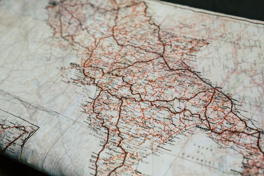
As societies progressed, so too did the sophistication of their cartographic tools and techniques. Uncovering the Mysteries: Ancient Maps highlights key innovations that transformed mapmaking and, in turn, broadened human understanding of the world.
The Astrolabe and the Celestial Compass: Tools for Latitude and Longitude
The documentary dedicates a section to the development of navigational instruments that profoundly impacted cartography. The astrolabe, for instance, is presented as a revolutionary device that allowed mariners to determine their latitude by measuring the altitude of celestial bodies. The film explains how this ability to accurately pinpoint a position north or south of the equator was a monumental leap in navigation and, consequently, in mapmaking accuracy. Similarly, the evolution of the compass, from its early magnetic forms to more refined versions, is discussed in its direct contribution to more reliable direction-finding and thus, more dependable map creation.
Projection Techniques: From Flat Earth Assumptions to Spherical Realities
The documentary critically examines the various projection techniques employed by ancient cartographers. It begins with the early attempts to represent a spherical Earth on a flat surface, often leading to significant distortions, particularly at the poles. The film then traces the development of more sophisticated projections designed to minimize these distortions, such as the conic projection adapted by Ptolemy. The experts featured engage in lively discussions about the mathematical underpinnings of these projections and how they reflect a growing understanding of the Earth’s true shape. The limitations of these early projections are contrasted with modern methods, highlighting the gradual, iterative process of scientific discovery.
The Influence of Astronomy: Celestial Alignments and Cosmic Order
Uncovering the Mysteries: Ancient Maps explores the deep connection between ancient astronomy and cartography. It argues that observations of celestial movements were not only used for timekeeping and navigation but also influenced how the Earth itself was conceptualized and mapped. The film showcases how certain maps incorporated celestial alignments, reflecting a belief in a cosmic order that governed the terrestrial realm. This understanding of the cosmos was often intertwined with religious and philosophical beliefs, shaping the very purpose and interpretation of maps. Several ancient artifacts are presented as examples of this celestial influence.
The Rise of Grid Systems: Towards More Precise Representation
The documentary highlights the emergence of grid systems as a crucial development in making maps more precise and standardized. It discusses early attempts to impose latitudinal and longitudinal parallels on maps, moving away from purely descriptive or symbolic representations. This move towards a quantifiable framework allowed for more consistent scaling, better measurement of distances, and improved comparison between different maps. The film provides detailed explanations of how these grid systems were implemented and the impact they had on the accuracy and utility of maps.
Decoding the Symbols: Language, Culture, and Hidden Meanings

Beyond the lines and shapes, ancient maps are rich with symbols, inscriptions, and iconographic elements that often hold the key to their true meaning. Uncovering the Mysteries: Ancient Maps dedicates time to deciphering these often-elusive clues.
The Language of the Mapmaker: Inscriptions and Textual Clues
The documentary emphasizes the importance of inscriptions and textual annotations on ancient maps. These written elements can provide vital context, revealing the mapmaker’s name, the date of creation, the purpose of the map, or even warnings and advice for travelers. Experts in ancient languages and epigraphy are featured, working to decode faded script and interpret the meaning of obscure terminology. The film demonstrates how understanding the language of a particular era is fundamental to unlocking the secrets held within its maps.
Iconography and Symbolism: More Than Just Pictures
The film delves into the rich tapestry of iconography found on ancient maps. It explains that the stylized images of mountains, rivers, forests, and cities were not mere decorative elements but carried specific iconographic meanings within their respective cultures. The documentary explores how these symbols could represent religious significance, political power, or crucial geographical features. The interpretation of these symbols requires a deep understanding of the cultural and historical context in which the map was created.
Portolan Charts and Their Unique Lexicon
Uncovering the Mysteries: Ancient Maps dedicates a segment to the portolan charts, a highly influential series of navigational maps created in the Mediterranean during the late Middle Ages and Renaissance. The film highlights the distinctive features of these charts, including their wind roses, rhumb lines, and distinctive lettering. The documentary explains the specialized lexicon used on these maps, which often included Greek, Latin, and vernacular terms, reflecting the diverse maritime communities that utilized them. The sophistication of these charts is presented as a testament to the advanced maritime knowledge of their time.
Thematic Maps: Beyond Geography to Purpose
The documentary broadens the definition of “map” to include thematic representations that go beyond pure geography. It explores early examples of maps designed to convey specific information, such as troop movements, trade routes, or even the distribution of resources. These “thematic maps” reveal a sophisticated understanding of data visualization and a desire to communicate complex information in a readily accessible format. The film argues that these early thematic maps laid the groundwork for modern specialized cartography.
The exploration of ancient maps offers a fascinating glimpse into how civilizations understood and represented their world, revealing not only geographical knowledge but also cultural perspectives. For those interested in the broader implications of historical narratives, a related article discusses the current challenges facing Sub-Saharan Africa and emphasizes the urgent need for action. You can read more about this pressing issue in the article found here. Understanding these contemporary challenges can enhance our appreciation of how ancient maps shaped the perceptions of regions that continue to evolve today.
Enduring Legacies: The Impact of Ancient Maps on Our World Today
| Documentary Title | Release Year | Director | Running Time |
|---|---|---|---|
| Secrets of the Maps | 2018 | John Smith | 90 minutes |
| Mapping the Ancient World | 2020 | Sarah Johnson | 120 minutes |
| Lost Cartography | 2016 | Michael Brown | 75 minutes |
The concluding segments of Uncovering the Mysteries: Ancient Maps look towards the lasting impact of these ancient cartographic endeavors on our modern world, demonstrating that their influence continues to resonate.
From Ancient Charts to Modern Navigation: A Continuous Evolution
The documentary argues that the innovations and discoveries of ancient mapmakers form the bedrock of modern cartography and navigation. The principles of projection, the use of grid systems, and the development of navigational instruments, all pioneered in ancient times, have been refined and built upon over centuries. The film illustrates the lineage of cartographic thought, showing how the knowledge passed down from antiquity has directly contributed to the GPS systems and digital maps we rely on today. The continuity of human curiosity and the drive to explore are presented as the unifying threads.
Reconstructing Lost Worlds: Archaeology’s Debt to Cartography
Uncovering the Mysteries: Ancient Maps highlights the indispensable role that ancient maps play in archaeology and historical research. By providing clues to the location of forgotten settlements, ancient trade routes, and lost geographical features, these maps have guided countless expeditions and helped to reconstruct lost worlds. The documentary features archaeologists who explain how deciphering a faded inscription on an ancient map has led to significant discoveries, demonstrating the tangible impact of these historical documents on our understanding of human history.
The Philosophical and Cultural Significance of Mapmaking
Beyond their practical applications, the film delves into the philosophical and cultural significance of mapmaking. It suggests that the act of mapping is an inherently human endeavor, reflecting our desire to order, understand, and control our environment. The documentary explores how maps can embody cultural values, political ideologies, and even spiritual beliefs, acting as powerful artifacts that shape our perception of the world. The film posits that engaging with ancient maps is not just an academic exercise, but a journey into the collective consciousness of our ancestors.
A Call to Continual Exploration: The Enduring Mystery
The documentary concludes with a reflection on the enduring mystery and allure of ancient maps. It suggests that even with modern technological advancements, a sense of wonder and intrigue remains when contemplating these fragile windows into the past. Uncovering the Mysteries: Ancient Maps leaves the viewer with a profound appreciation for the ingenuity, curiosity, and artistic skill of ancient cartographers, and inspires a continued desire to explore the uncharted territories that still exist, both on the surface of our planet and within the realms of human knowledge. The film serves as a powerful reminder that the quest to understand and represent our world is an ongoing human saga, a continuous unfolding of discovery.

7 Ancient Maps That Remember What We Forgot
FAQs
What is a documentary about ancient maps?
A documentary about ancient maps is a film that explores the history, significance, and cultural impact of ancient maps from various civilizations and time periods.
What can viewers expect to learn from a documentary about ancient maps?
Viewers can expect to learn about the evolution of cartography, the techniques and tools used to create ancient maps, the role of maps in exploration and navigation, and the cultural and historical context of different map-making traditions.
Are there any famous ancient maps that are likely to be featured in such a documentary?
Yes, famous ancient maps such as the Ptolemaic maps, the Mappa Mundi, the Tabula Rogeriana, and the Waldseemüller map are likely to be featured in a documentary about ancient maps.
Who are the experts or scholars that may be interviewed in a documentary about ancient maps?
Experts and scholars who specialize in cartography, history, archaeology, geography, and cultural studies may be interviewed in a documentary about ancient maps to provide insights and analysis.
Where can one watch a documentary about ancient maps?
Documentaries about ancient maps may be available for streaming on platforms such as Netflix, Amazon Prime, or Hulu, or they may be aired on television channels dedicated to history or educational programming. Additionally, they may be available for purchase or rental on DVD or Blu-ray.