
The ceaseless grey expanse of the North Sea, a place familiar for its turbulent weather and vital fishing grounds, conceals a secret far older and more profound than any storm. Beneath the restless waves lies a submerged landscape, a ghost of a landmass known as Doggerland, a place where prehistoric humans once walked, hunted, and lived. For millennia, this was a thriving terrestrial world, a vast plain connecting mainland Europe to Britain, teeming with life and rich with resources. Now, only the whispers of its existence are carried by the currents, waiting to be uncovered and understood.
The initial glimpses of Doggerland’s existence came not from grand expeditions, but from the mundane realities of fishing and dredging. As trawlers dragged their nets across the seabed, they began to pull up not just fish, but artifacts that defied easy explanation. Stone tools, carved bone fragments, and even the remains of ancient human settlements, impossibly found miles offshore, hinted at a lost world. These serendipitous finds, initially treated as curiosities, gradually began to paint a picture of a submerged continent, a testament to the dramatic geological shifts that have reshaped our planet.
The Accidental Archaeologists: Fishermen and Their Hauls
For centuries, the fishermen of the North Sea have been the unwitting custodians of Doggerland’s secrets. Their nets, designed to scoop up the bounty of the ocean, often snagged on something more ancient. The stories began to accumulate: fishermen pulling up wooden spears from depths where land should not be, finding polished stone axes embedded in the catch, or even encountering what appeared to be fragments of worked bone, too intricate to be natural formations. These were not isolated incidents; the consistent reports from different vessels, across various stretches of the North Sea, started to form a pattern that could no longer be ignored. It was a testament to their hard work and keen observation that these early clues were ever brought to the attention of scientists.
Early Scientific Interest and the Growing Puzzle
The scientific community, initially, might have been skeptical of these tales. The notion of a lost landmass beneath the North Sea was a radical idea, challenging existing geological and archaeological models. However, as the volume of retrieved artifacts grew and the geological evidence of fluctuating sea levels became more robust, a paradigm shift began. Explorers and geologists started to take these fishermen’s findings seriously, recognizing them as potential evidence of a submerged prehistoric landscape. The puzzle of Doggerland began to take shape, an incomplete picture composed of fragmented clues.
In exploring the intricate relationship between environmental changes and economic stability, an interesting article titled “Could the Fed Seize 401k and IRA Savings?” delves into the potential implications of financial policies on personal savings, which can be indirectly affected by the ecological shifts highlighted in “The Lost World Beneath the North Sea.” Understanding these connections is crucial as both articles address the broader themes of security—be it environmental or financial. For more insights, you can read the article here: Could the Fed Seize 401k and IRA Savings?.
Reconstructing a Prehistoric Landscape
Understanding Doggerland is not a matter of simply digging. It requires a multi-disciplinary approach, piecing together evidence from seafloor mapping, paleontology, and archaeology. Scientists are employing cutting-edge technology to paint a vivid picture of this lost world, revealing its topography, its flora and fauna, and the lives of its ancient inhabitants.
Sub-Seabed Mapping and the Unveiling of Topography
The first crucial step in understanding Doggerland was to map its physical form. Sophisticated sonar and seismic imaging technologies have been employed to peer beneath the sediment layers that currently cover the ancient landscape. These technologies can distinguish between different types of rock and sediment, revealing the contours of the submerged land. They have shown that Doggerland was not a flat, featureless plain, but a varied terrain with river valleys, rolling hills, and even ancient coastlines. These maps have become the canvas upon which the story of Doggerland is being painted.
Echoes of Ancient Rivers: Mapping Drainage Patterns
One of the most significant discoveries from sub-seabed mapping has been the identification of ancient river systems. These are the arteries of the submerged land, tracing the paths of major rivers that would have flowed across Doggerland. Their ancient courses are still visible, etched into the seafloor, providing vital clues about the drainage of the landscape. These river valleys were likely the cradles of life, attracting both humans and animals, and their mapping is fundamental to understanding settlement patterns.
The Shape of the Land: Ancient Coastlines and Topographical Features
Beyond the rivers, mapping has revealed the broader topographical features of Doggerland. Scientists have identified ancient shorelines, indicating where the land met the sea millennia ago. They have also discovered evidence of hills, hollows, and other landforms that would have shaped the lives of its inhabitants. Understanding this topography is crucial for reconstructing the environment in which Doggerland’s people lived.
Paleontological Clues: Flora, Fauna, and the Environment
The remnants of long-dead organisms provide invaluable insights into the environment of Doggerland. The bones and fossilized plant matter recovered from the seabed tell a story of a temperate, perhaps even sub-tropical, climate that supported a rich ecosystem.
Remains of Giants: Mammoths, Aurochs, and Other Prehistoric Wildlife
The discovery of mammoth tusks, the massive bones of aurochs, and other megafauna skeletons underscores the abundance of wildlife that once roamed Doggerland. These findings provide a glimpse into the food chain and the challenges and opportunities they presented to early human hunters. The presence of these large herbivores suggests a landscape rich in vegetation, supporting thriving populations.
Seeds of the Past: Evidence of Ancient Vegetation
While animal remains are striking, the preservation of plant matter offers a more nuanced understanding of the environment. Seeds, pollen, and even fragments of ancient trees, recovered from the seabed, paint a detailed picture of Doggerland’s flora. Scientists can reconstruct the types of forests, grasslands, and wetlands that existed, indicating a climate more temperate than the present-day North Sea. This information is crucial for understanding the resources available to the inhabitants.
The Human Story of Doggerland
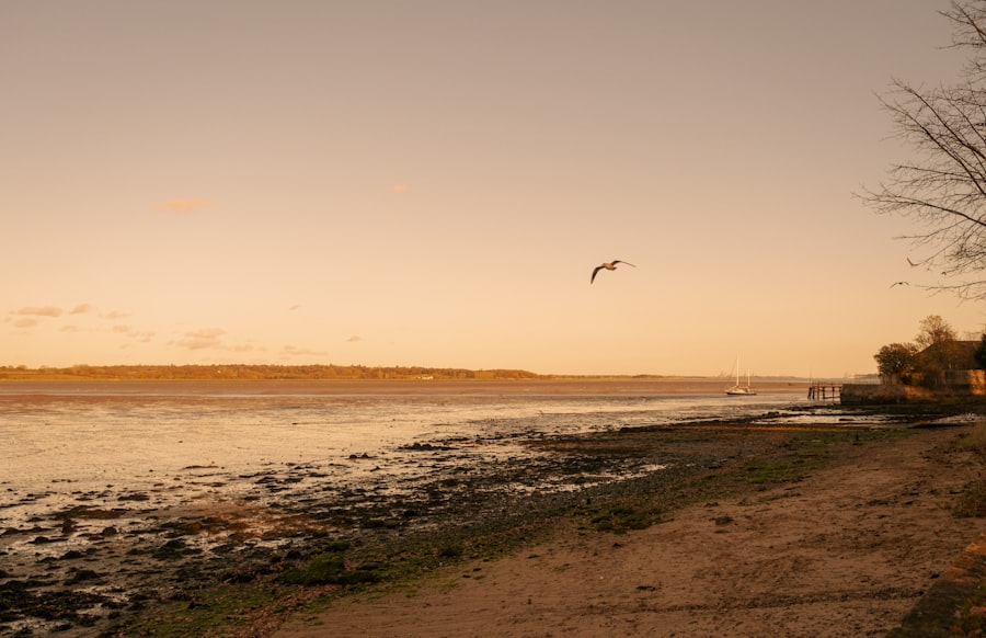
Doggerland was not an uninhabited wilderness; it was a homeland for Mesolithic communities. The archaeological evidence, though sparse, speaks volumes about their lives, their ingenuity, and their ultimate fate.
Tools of Survival: Stone, Bone, and Wood Artifacts
The artifacts recovered from Doggerland are the tangible links to its human inhabitants. Stone tools, often made from flint, reveal sophisticated knapping techniques. Bone points and needles suggest skill in crafting tools for hunting and sewing. Wooden artifacts, though rarer due to preservation challenges, offer glimpses into woodworking and potentially even more complex constructions.
Flint Knapping: The Art of Early Toolmaking
The abundance of flint and the finely crafted stone tools found are a testament to the skill of Doggerland’s inhabitants. Examining the fracture patterns and the types of raw materials used provides insights into their knowledge of geology and their toolmaking processes. These tools were not crude implements; they were the sophisticated instruments of survival for a hunter-gatherer society.
Bone and Antler Craftsmanship: Adapting to Resources
The use of bone and antler for tools and ornaments highlights the resourcefulness of these prehistoric people. They skillfully transformed readily available materials into sharp points for spears, needles for sewing hides, and potentially decorative items for personal adornment. This demonstrates an intimate understanding of the properties of different animal parts.
The Elusive Wood: Glimpses of Wooden Artifacts
While wood decays more readily than stone or bone, every fragment recovered from Doggerland is a treasure. The discovery of worked wood, such as fragments of spears or possibly even structural elements, hints at a more complex relationship with their environment and a capacity for more advanced crafts. These finds, though rare, provide crucial insights into a softer side of their material culture.
Settlement Patterns and Social Structures
While no complete villages have been unearthed, fragments of evidence suggest how and where people lived. Postholes, hearths, and concentrations of artifacts point towards the existence of settlements, albeit likely nomadic or semi-nomadic.
Traces of Campsites: Hearth Remains and Artifact Concentrations
The discovery of hearths, the ancient fire pits around which people gathered, is a strong indicator of human presence and activity. Associated with these hearths are often concentrated scatters of stone tools, animal bones, and other debris, suggesting areas where people lived, ate, and worked. These ephemeral sites are the breadcrumbs left by generations of Doggerland inhabitants.
Evidence of Movement: Nomadic Lifestyles and Seasonal Camps
The nature of the finds, often scattered across significant areas, suggests a lifestyle dictated by the availability of resources. It is likely that Mesolithic communities in Doggerland were nomadic or semi-nomadic, following animal herds and seasonal plant growth. Evidence of multiple, perhaps temporary, campsites across the landscape supports this theory.
Artwork and Symbolism: The First Glimpses of Culture
While not as prolific as in later periods, there are tantalizing hints of artistic expression and symbolic thought among the people of Doggerland. Engraved bones and carefully crafted decorative elements suggest a capacity for abstract thought and cultural expression.
Engraved Bones: Decoding Prehistoric Aesthetics
The discovery of bones with intricate engravings, patterns, and perhaps even zoomorphic depictions, is particularly exciting. These artifacts offer a window into the minds of Doggerland’s people, revealing their aesthetic sensibilities and potentially their understanding of the world around them. Deciphering the meaning behind these engravings is a significant challenge for archaeologists.
Personal Adornment and Identity
The presence of what appear to be beads and other small decorative items suggests that personal adornment played a role in Doggerland society. These items might have signified status, group affiliation, or simply personal taste, offering a glimpse into individual identity in a prehistoric context.
The Cataclysm: The Inundation of Doggerland

The story of Doggerland is ultimately one of loss, of a vibrant land swallowed by the rising seas. The precise timing and mechanisms of its submersion are still being debated, but the evidence points to a series of catastrophic events.
The Melting Ice and Rising Tides: Global Sea Level Change
The end of the last Ice Age brought about a dramatic increase in global temperatures, leading to the melting of vast ice sheets. This meltwater flowed into the oceans, causing sea levels to rise inexorably. Doggerland, situated at a relatively low elevation, was particularly vulnerable to these changes.
The Slow Creep: Gradual Submergence Over Millennia
While some dramatic events may have accelerated the process, the inundation of Doggerland was, for the most part, a gradual process that unfolded over thousands of years. The sea slowly crept in, encroaching on the land, altering coastlines, and gradually reducing the habitable area.
The Great Surge: Potential for Catastrophic Flooding Events
Scientists are increasingly exploring the possibility of more rapid and catastrophic flooding events that may have played a role in Doggerland’s final demise. Theories include the collapse of glacial ice dams, leading to sudden surges of water, or even underwater landslides that triggered tsunamis.
The Storegga Slide: A Potential Game-Changer
One of the most significant geological events that may have impacted Doggerland is the Storegga Slide, a massive submarine landslide off the coast of Norway that occurred around 8,200 years ago. The resulting mega-tsunami is believed to have inundated large parts of the North Atlantic, potentially including Doggerland.
The Tsunami’s Reach: Devastation and Displacement
The Storegga Slide tsunami was a cataclysm of immense proportions. It is estimated to have reached heights of tens of meters and traveled far inland. If Doggerland was still largely above water at this time, such an event would have been devastating, likely causing widespread destruction and forcing its inhabitants to flee.
A World Transformed: The Final Loss of Land
The Storegga Slide, more than any other single event, may have been the final nail in Doggerland’s coffin. It would have dramatically reshaped the landscape, transforming what was once a connected landmass into a scattered archipelago that was eventually fully submerged by the encroaching ocean.
In exploring the mysteries of our planet’s history, “The Lost World Beneath the North Sea” offers a fascinating glimpse into submerged landscapes and ancient ecosystems. For those interested in the broader implications of climate change and historical environmental shifts, a related article titled Uncovering Ancient Climate Collapse delves into the hidden narratives of past climate events and their impact on human civilization. This connection between submerged worlds and climate history highlights the intricate relationship between our environment and the stories it holds.
Modern Explorations and Future Prospects
| Metrics | Data |
|---|---|
| Depth of the North Sea | Up to 700 feet |
| Age of the submerged landscape | 10,000 years old |
| Area covered by the landscape | 10,000 square miles |
| Discovery of the landscape | 2002 |
The study of Doggerland is a vibrant and evolving field, with new technologies and discoveries constantly pushing the boundaries of our understanding. The future holds the promise of even more remarkable insights into this lost world.
Technological Advancements in Underwater Archaeology
The development of new technologies has revolutionized the exploration of Doggerland. Remotely operated vehicles (ROVs), autonomous underwater vehicles (AUVs), and advanced imaging techniques allow scientists to explore the seabed with unprecedented detail and precision.
ROVs and AUVs: Exploring the Deep Frontier
ROVs, tethered to surface vessels, and AUVs, operating independently, can navigate the complex underwater terrain of Doggerland, capturing high-resolution imagery and collecting samples. These robots are the eyes and hands of archaeologists in this challenging environment.
Advanced Sonar and Laser Scanning: Creating Digital Reconstructions
Beyond basic mapping, advanced sonar and laser scanning technologies can create remarkably detailed 3D models of the submerged landscape. These digital reconstructions allow scientists to virtually walk through Doggerland, analyze its features, and plan future excavations.
Ongoing Research and the Search for Key Sites
The search for more significant archaeological sites on Doggerland continues. Researchers are poring over geological data and sonar images, looking for anomalies that might indicate the presence of more substantial settlements or important cultural deposits.
Targeting Promising Areas: Predicting Where to Look
By combining geological knowledge, paleoclimate data, and the distribution of known artifacts, researchers are developing predictive models to identify areas on the seabed that are most likely to yield significant archaeological finds.
The Dream of a Major Discovery: Unearthing a Living Site
The ultimate dream for Doggerland archaeologists is to discover a well-preserved Mesolithic settlement, a place where organic materials might have been protected by the seabed sediments. Such a discovery would provide an unparalleled window into the daily lives, social structures, and cultural practices of its former inhabitants.
Connecting the Past to the Present: Understanding Human Adaptation
The study of Doggerland is not just about delving into the past; it offers valuable lessons for the present and future. Understanding how prehistoric humans adapted to dramatic environmental changes, such as rising sea levels, can provide insights into our own challenges in the face of climate change.
Lessons for Climate Change Adaptation: Historical Parallels
The story of Doggerland serves as a powerful reminder of the planet’s dynamic nature and the profound impact of climate change. By studying how prehistoric communities coped with rising seas, we can gain valuable perspectives and potential strategies for adapting to future environmental shifts.
Reimagining Our Coastal Heritage: A Lost Connection
The discovery and ongoing study of Doggerland reconnect us with a lost chapter of human history and our relationship with the continent. It reminds us that the land we inhabit is not static, and that beneath the waves lie stories waiting to be told, shaping our understanding of our place on Earth.

The Forgotten World Beneath the North Sea
FAQs
What is the North Sea and why is it significant?
The North Sea is a marginal sea of the Atlantic Ocean located between Great Britain, Scandinavia, Germany, the Netherlands, Belgium, and France. It is significant due to its rich biodiversity, economic importance for fishing and oil and gas extraction, and its historical and cultural significance.
What is the “Lost World” beneath the North Sea?
The “Lost World” beneath the North Sea refers to the prehistoric landscape that existed thousands of years ago when the sea level was much lower. This landscape included rivers, lakes, forests, and even human settlements, which have been preserved beneath the seabed.
How was the “Lost World” discovered?
The “Lost World” was discovered through the use of advanced technology such as sonar and seismic imaging, which allowed scientists to create detailed maps of the seabed. Additionally, artifacts such as mammoth tusks and ancient tools have been found by fishermen and dredging operations.
What is the significance of the discoveries beneath the North Sea?
The discoveries beneath the North Sea provide valuable insights into the prehistoric environment and human activity in the region. They also have the potential to contribute to our understanding of climate change, sea level rise, and the migration patterns of ancient human populations.
What are the challenges and opportunities associated with exploring the “Lost World” beneath the North Sea?
Challenges include the preservation of the archaeological sites, environmental impact of exploration, and the potential for conflict with commercial activities such as fishing and energy extraction. Opportunities include the potential for scientific research, cultural heritage preservation, and the development of sustainable tourism.