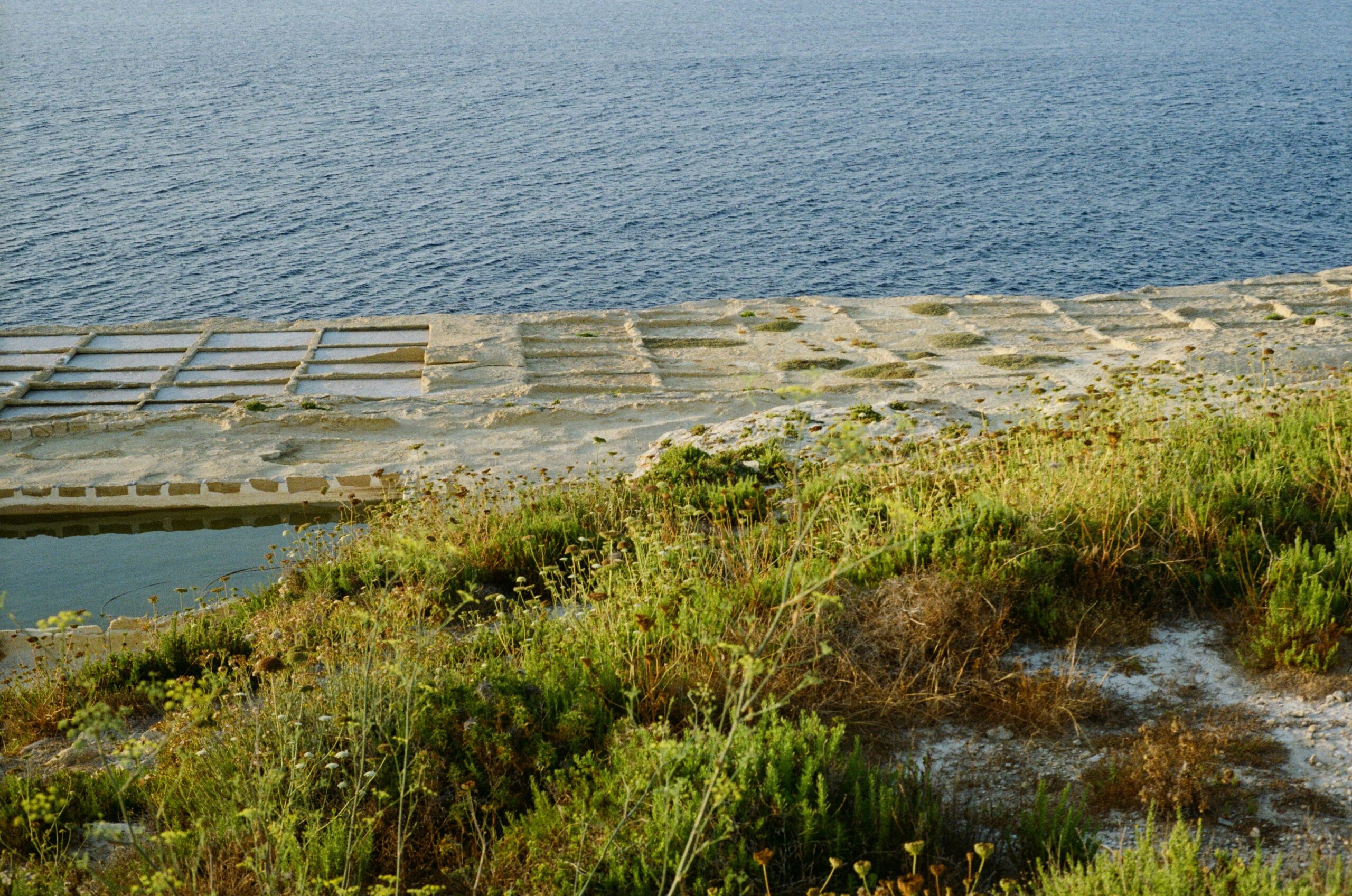
The Earth’s surface is a dynamic canvas, constantly reshaped by a myriad of geological processes. Among these, evaporation – the transformation of liquid water into vapor – plays a surprisingly profound and often underestimated role in sculpting landscapes, particularly in regions experiencing extreme aridity. Unraveling the geology of extreme evaporation is akin to deciphering a grand, slow-motion narrative written in salt crystals, mineral deposits, and the subtle deformation of the land. This article delves into the multifaceted geological impacts of extreme evaporation, exploring the mechanisms, landforms, and scientific significance of these arid environments.
At its core, extreme evaporation is a consequence of an imbalanced hydrological cycle. In arid and hyper-arid regions, the rate of water loss through evaporation far surpasses the rate of precipitation and surface water input. Understanding the interplay of these climatic and geological factors is crucial for comprehending the ensuing geological phenomena.
Aridity and its Causes
The defining characteristic of regions prone to extreme evaporation is their aridity, a condition often driven by a combination of atmospheric circulation patterns, geographic location, and topographic influences.
Atmospheric Circulation Patterns
Global atmospheric circulation plays a pivotal role in establishing and maintaining arid conditions. Subtropical high-pressure belts, characterized by descending dry air, are notorious for suppressing rainfall and promoting evaporation. Diurnal temperature ranges in these regions are often significant, with hot days accelerating the process of water loss from any available surface.
Rain Shadow Effects
Mountain ranges act as formidable barriers to moisture-laden air masses. As air rises over a mountain, it cools, precipitating most of its moisture on the windward side. By the time the air descends on the leeward side, it is significantly drier, creating a “rain shadow” effect. These leeward sides of mountain ranges often become hyper-arid environments where evaporation reigns supreme.
Continental Interiors
Vast continental interiors, far from oceanic moisture sources, are also prone to aridity. The journey of air masses over land leads to progressive drying, especially if they encounter drying factors like mountain ranges or high-pressure systems along the way.
The Role of Water Availability and Salinity
Even in extremely arid climates, water does not entirely disappear. Its presence, however, is often ephemeral or exists in specialized hydrological settings, profoundly influencing the evaporation process.
Ephemeral Water Bodies
Temporary lakes, playas, and ephemeral streams are crucial incubators for evaporation-driven geology. These water bodies persist only after infrequent rainfall events or snowmelt. As they dry, they leave behind a legacy of deposited minerals.
Groundwater Discharge and Saline Springs
In some arid regions, groundwater, having percolated through mineral-rich subterranean layers, can discharge at the surface, either through springs or by seeping into dry lakebeds. This groundwater is often laden with dissolved salts, creating a concentrated brine that leads to even more pronounced evaporite deposition.
The Salt Concentration Feedback Loop
As water evaporates from these sources, the dissolved salts become increasingly concentrated. This higher salt concentration lowers the vapor pressure of the water, making it even more susceptible to evaporation. This creates a positive feedback loop, intensifying the evaporative process and accelerating mineral precipitation.
Extreme evaporation geology is a fascinating subject that explores the processes and consequences of intense evaporation in various geological settings. For those interested in how historical maps can provide insights into geological features and landscapes, a related article can be found at Exploring Topkapi Palace with Piri Reis Map. This article delves into the significance of the Piri Reis map and its implications for understanding ancient geography, which can complement the study of extreme evaporation and its effects on the Earth’s surface.
Landforms Sculpted by Extreme Evaporation
The relentless work of evaporation, coupled with the deposition of dissolved minerals, gives rise to a suite of distinctive geological landforms, each telling a story of water’s vanishing act.
Playas and Salt Flats
Perhaps the most iconic landforms associated with extreme evaporation are playas, also known as salt flats or dry lakes. These are large, flat, and often saline depressions that periodically hold water after rainfall events.
Playal Lakes and their Cycles
The formation of playa lakes is a direct consequence of arid climate. During infrequent rain, these basins fill, creating shallow, temporary bodies of water. The high evaporation rates then cause the water to recede, leaving behind a concentrated brine.
Evaporite Deposition Processes
As the brine concentrates through evaporation, dissolved minerals begin to precipitate out of solution. The order of precipitation is governed by the solubility of different salts. Initially, carbonates and sulfates may precipitate, followed by chlorides, and finally the more soluble sulfates and halites at the very end of the drying cycle. This layered deposition creates the characteristic stratigraphy of evaporite sequences.
Salt Crust Formation and Morphology
The surface of a playa is often covered by a salt crust, the morphology of which can vary significantly depending with the specific mineralogy and the rate of evaporation. Common forms include honeycomb or cracked patterns resulting from desiccation and crystallization stresses. In some instances, extensive halite (rock salt) deposits can form, creating vast, blindingly white landscapes.
Salt Pans and Salars
Closely related to playas, salt pans and salars are extensive, flat, and saline basins characterized by thick, accumulated evaporite deposits. Salars, in particular, are found in high-altitude, endorheic (closed) basins, often in the Andes of South America, where unique geological and climatic conditions foster immense salt accumulations.
Endorheic Basins and Water Accumulation
Endorheic basins are drainage systems that do not discharge to the ocean. In arid environments, these basins become traps for surface runoff, leading to the formation of lakes or playas. With prolonged aridity, these water bodies become highly saline.
Mineralogical Diversity of Salars
Salars are renowned for their diverse mineralogy, often hosting not only halite but also vast quantities of other salts like borates, nitrates, and sulfates. The economic significance of these deposits, particularly for lithium extraction from brines, has brought significant scientific attention to salars.
Formation of Salt Polygons and Textures
The repeated wetting and drying of the salt crust within salt pans and salars leads to the development of intricate salt polygons, similar to those seen on playas. The textures can range from smooth, crystalline surfaces to rough, granular accumulations.
Gypsum and Calcite Deposits
Beyond halite, extreme evaporation also leads to the precipitation of other significant evaporite minerals, most notably gypsum and calcite. These minerals are typically less soluble than halite and can form distinct geological features.
Selenites and Gypsum Flowers
Selenite, a crystalline form of gypsum, can precipitate in intricate, often tabular or prismatic crystals, especially in playa environments where fine sediments are incorporated into the mineral growth. Gypsum flowers, delicate, radiating crystal clusters, can also form under specific conditions of supersaturation and evaporation.
Caliche and Calcrete Formations
Caliche and calcrete are terms used to describe soil horizons or surface crusts cemented by calcium carbonate, derived from the dissolution and reprecipitation of calcite. While not solely a product of extreme evaporation, these formations are prevalent in arid and semi-arid environments where episodic wetting and drying cycles promote the upward migration and deposition of dissolved calcium carbonate.
The Geological Significance of Evaporite Formations
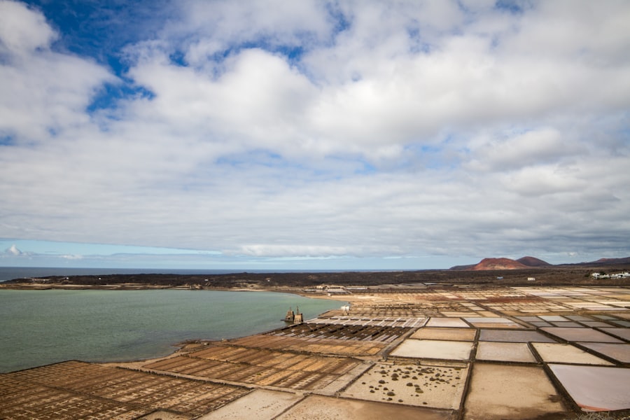
The geological records left behind by extreme evaporation are far more than just interesting landscapes; they are invaluable archives of past climate, hydrological conditions, and even biological activity.
Paleoenvironmental Reconstruction
The mineralogy and stratigraphy of evaporite sequences provide a powerful lens through which to reconstruct past environmental conditions.
Climatic Proxies in Evaporites
The types of minerals that precipitate are directly related to the salinity and temperature of the water body. For instance, the presence of certain hydrated sulfates can indicate specific temperature ranges. The thickness and layering of evaporite deposits can also reflect fluctuations in precipitation and evaporation rates over geological timescales.
Isotopic Signatures for Paleoclimate
Stable isotopes of elements like oxygen and hydrogen, found within the mineral structure of evaporites, can reveal details about the source of the water and the prevailing atmospheric conditions at the time of deposition. Changes in isotopic ratios can flag shifts in precipitation patterns, evaporation intensity, and even the elevation of the evaporative basin.
Source Rocks for Hydrocarbons and Other Resources
Evaporite formations, particularly those rich in organic matter, can serve as crucial source rocks for the generation of hydrocarbons.
Source Rocks for Petroleum
Certain types of evaporites, such as organic-rich shales interbedded with evaporite layers, can accumulate organic matter under anoxic conditions within ephemeral lakes or marine basins. Subsequent burial and heating can transform this organic matter into oil and natural gas.
Mineral Resources from Evaporite Deposits
Evaporite deposits are also significant sources of various commercially valuable minerals. Sylvite and carnallite, potassium-bearing salts, are economically important and often found in thick evaporite sequences. Borates, nitrates, and lithium brines represent other key resources derived from evaporative environments.
Understanding Geochemical Cycles
The process of evaporation and subsequent mineral precipitation plays a vital role in the cycling of elements through the Earth’s crust and atmosphere.
Salt Removal from Terrestrial Systems
Evaporation is a primary mechanism for removing dissolved salts from continental drainage basins. Without this process, terrestrial environments would become increasingly saline, rendering them inhospitable to life.
Atmospheric Input of Salts
While evaporation removes salts from the land, the transport of salt particles and aerosols into the atmosphere contributes to weathering processes and can influence cloud formation and precipitation in downwind regions.
The Influence of Extreme Evaporation on Geodynamic Processes
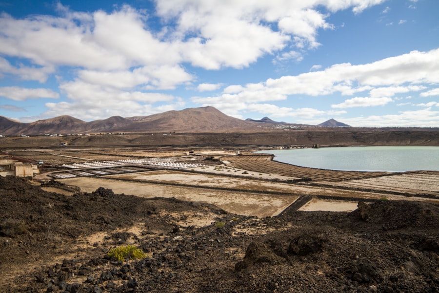
While often overlooked, extreme evaporation can exert subtle yet significant influences on broader geodynamic processes, particularly in low-lying and tectonically active regions.
Subsidence and Diapirism of Evaporite Layers
The accumulation of thick evaporite sequences, particularly those dominated by halite, can have profound effects on the underlying crust.
Density Inversions and Buoyancy
Halite is significantly less dense than overlying sedimentary rocks. This density inversion creates a potential for buoyancy-driven movement. Over geological time, the force of gravity can cause these ductile halite layers to deform, flow, and even rise towards the surface.
Salt Diapirs and Structures
The upward migration of halite masses, known as salt diapirs or salt domes, can create significant structural complexities in the overlying strata. These structures can trap hydrocarbons, influence local topography, and even affect patterns of erosion and deposition. The immense pressure exerted by these rising salt masses can also contribute to regional subsidence.
Influence on Sedimentary Basin Evolution
The presence of extensive evaporite deposits can significantly alter the thermal and mechanical evolution of sedimentary basins.
Thermal Insulation Effects
Thick evaporite layers, particularly halite, have relatively low thermal conductivity. This can act as an insulating blanket, affecting the rate at which heat flows from the Earth’s interior to the surface. This can, in turn, influence the maturation of organic matter and the generation of hydrocarbons.
Mechanical Weakness of Evaporite Layers
Evaporite layers are mechanically weak and prone to deformation. This can lead to localized zones of subsidence, faulting, and folding within basins, influencing the overall structural architecture and depositional patterns.
Impact on Permafrost and Glacial Environments
In polar and high-altitude regions where extreme cold and aridity coexist, evaporation can interact with permafrost and glacial ice in complex ways.
Salt Entrapment in Permafrost
During periods of thaw and subsequent refreezing, saline brines can be drawn towards the surface by capillary forces and then trapped within the permafrost. This salt can lower the freezing point of water, leading to unique cryostructural features and affecting the stability of permafrost landscapes.
Albedo Changes and Evaporation Effects
Salt-encrusted surfaces, whether on glaciers or permafrost, tend to have lower albedo (reflectivity) than pure ice or snow. This reduces the amount of solar radiation reflected back into space, leading to increased absorption and potentially enhanced melting, further influencing the evaporation process and the dynamics of glacial retreat.
Extreme evaporation geology is a fascinating field that explores the processes and formations resulting from intense evaporation conditions, often leading to unique mineral deposits and geological structures. For those interested in the broader implications of advanced technologies in extreme environments, a related article discusses the role of artificial intelligence in autonomous space defense, which highlights how innovative solutions can be applied in challenging conditions. You can read more about this intriguing topic in the article found here.
Studying Extreme Evaporation: Methods and Challenges
| Metrics | Data |
|---|---|
| Evaporation Rate | High |
| Geological Formation | Extreme |
| Location | Desert regions |
| Impact | Formation of salt flats |
Investigating the geological manifestations of extreme evaporation presents unique challenges and necessitates specialized methodologies.
Field Mapping and Remote Sensing
The vast and often inhospitable nature of arid regions requires a combination of on-the-ground observation and advanced remote sensing techniques.
Geomorphological Analysis
Detailed field mapping of landforms, mineral deposits, and structural features is fundamental. This involves painstakingly documenting the spatial relationships between different geological elements and observing the processes in action.
Satellite Imagery and GIS
Satellite imagery, particularly from platforms equipped with multispectral and hyperspectral sensors, offers an invaluable tool for mapping large-scale evaporite deposits, identifying mineral variations, and monitoring changes in playa lake extent over time. Geographic Information Systems (GIS) are then used to integrate and analyze this data.
Laboratory Analysis of Evaporite Samples
The mineralogical and chemical composition of evaporite samples holds crucial clues to their formation history.
X-ray Diffraction (XRD) and Petrography
XRD is used to identify the crystalline mineral phases present in evaporite samples. Petrographic analysis, involving the microscopic examination of thin sections, provides insights into the textures, fabric, and relationships between different mineral grains, offering a detailed understanding of the depositional environment.
Geochemical and Isotopic Analysis
Detailed geochemical analysis, including elemental composition and isotopic ratios, is essential for reconstructing the source of the brines, understanding the dissolution and precipitation processes, and providing paleoclimatic information.
Numerical Modeling and Simulation
Advanced computational techniques are increasingly employed to simulate the complex processes involved in extreme evaporation and its geological consequences.
Hydrological and Evaporation Models
These models aim to simulate the movement of water through arid landscapes, the feedback loops between evaporation and salinity, and the rates of mineral precipitation under various climatic scenarios.
Geodynamic and Structural Models
Numerical models are used to explore the behavior of evaporite layers under gravitational forces, simulating the formation of salt diapirs, the development of complex structural traps, and the impact of evaporite deformation on basin evolution.
Challenges in Studying Evaporite Geology
Despite advancements, studying evaporite geology faces inherent difficulties.
Preservation Bias
Evaporite deposits, especially those formed in ephemeral environments, are susceptible to erosion and dissolution. This can lead to a preservation bias, with younger deposits being more likely to survive than older ones.
Complex Formation Environments
The interplay of numerous factors – including climate, topography, groundwater hydrology, and tectonic activity – makes the formation of evaporites a complex process, often making it challenging to isolate the precise influence of individual factors.
Remote and Inhospitable Environments
Many extreme evaporative environments are located in remote and harsh terrains, posing logistical and safety challenges for researchers.
Conclusion: The Enduring Legacy of Vanishing Water
Extreme evaporation is not merely a process of water loss; it is a powerful geological architect, capable of carving out unique landscapes and leaving behind a rich stratigraphic record. From the dazzling white expanses of salt flats to the intricate crystal formations and the potential for significant structural deformation, the geology of extreme evaporation offers a compelling testament to the enduring power of natural processes, even in the most seemingly barren of environments.
Unraveling this geology provides invaluable insights into past climates, the formation of essential mineral resources, and the intricate workings of geochemical cycles. As our understanding of these arid and hyper-arid regions grows, so too does our appreciation for the subtle yet profound ways in which the disappearance of water sculpts our planet, shaping its surface, its subsurface, and its ongoing geological narrative. The study of extreme evaporation is a continuous journey into understanding the Earth’s dry, yet far from inactive, frontiers.

When the Mediterranean Became a Desert | The Messinian Salinity Crisis Explained
FAQs
What is extreme evaporation geology?
Extreme evaporation geology refers to the geological processes and formations that are a result of intense evaporation of water from a particular area. This can lead to the formation of unique geological features such as salt flats, evaporite deposits, and desert landscapes.
What are some examples of extreme evaporation geology?
Some examples of extreme evaporation geology include the Bonneville Salt Flats in Utah, the Salar de Uyuni in Bolivia, and the Danakil Depression in Ethiopia. These areas are known for their vast salt flats and unique geological formations resulting from extreme evaporation.
How does extreme evaporation impact the environment?
Extreme evaporation can have significant impacts on the environment, leading to the formation of unique ecosystems adapted to high salinity and arid conditions. It can also result in the concentration of minerals and salts, which can have implications for local water quality and soil fertility.
What causes extreme evaporation geology?
Extreme evaporation geology is primarily caused by high temperatures, low humidity, and limited precipitation in a particular area. These conditions lead to the rapid evaporation of water, leaving behind concentrated mineral deposits and unique geological formations.
How is extreme evaporation geology studied and researched?
Researchers study extreme evaporation geology through field observations, geological mapping, remote sensing techniques, and laboratory analysis of evaporite deposits. They also use climate data and modeling to understand the environmental conditions that contribute to extreme evaporation and its geological impacts.