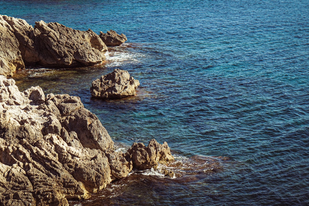
The vast expanse of the Mediterranean basin, a cradle of civilizations and a crossroads of cultures, possesses a geological history as rich and complex as its human past. Beneath the shimmering surface of the sea and the sun-drenched landscapes of its bordering continents lies a testament to millennia of geological forces: the Mediterranean Erosion Surface. This colossal geomorphological feature, often overlooked in favor of more dramatic tectonic events, offers profound insights into the long-term denudation processes that have shaped the region. Exploring this ancient surface is not merely an academic pursuit; it is an endeavor to understand the very foundations upon which the Mediterranean world has been built.
The concept of an “erosion surface” refers to a landform that has been largely reduced to a relatively flat or gently undulating plain by the relentless weathering and denudation of the Earth’s crust over immense periods. These surfaces, also known as peneplains or pediplains, represent a stage in the landscape’s evolution where erosional forces have largely overcome tectonic uplift, effectively leveling the terrain. The Mediterranean Erosion Surface is not a single, pristine plain but rather a complex assemblage of ancient, planated areas that have been subsequently uplifted, dissected, and modified by tectonic activity and climatic shifts. Its recognition and study require a meticulous examination of geological strata, landform analysis, and geochronological data.
Defining the Ephemeral: The Scale and Scope of the Surface
The sheer scale of what can be considered part of the Mediterranean Erosion Surface is vast. It encompasses large swathes of North Africa, the Iberian Peninsula, southern Italy, the southern Balkans, and parts of the Aegean and Anatolian regions. While not a continuous, unbroken plain today, its remnants are scattered across varying elevations, telling a story of repeated planation and subsequent geological upheaval.
Identifying the Patches: Remnants and Recognition
Identifying these ancient erosion surfaces requires careful geological mapping and interpretation. Geologists look for characteristic landforms such as widespread, gently sloping surfaces that truncate underlying geological structures, indicating extensive erosion. These surfaces are often preserved as remnants, capped by more resistant rock layers or overlain by younger sedimentary deposits. The recognition of these features is crucial for understanding the regional tectonic history and the magnitude of erosion that has occurred.
Time and Titles: Assigning Ages to Planation Events
Assigning precise ages to the formation of these erosion surfaces is a challenging but critical aspect of their study. Geochronological dating techniques, such as radiometric dating of igneous rocks associated with the surfaces or dating of overlying sedimentary layers, are employed. Different planation events have occurred throughout the Cenozoic era, with some surfaces potentially dating back to the Eocene or Oligocene epochs, while others might represent younger, Pliocene or even Pleistocene etchplanation phenomena.
The Sculptors of the Surface: Dominant Erosional Processes
The Mediterranean Erosion Surface is a product of a dynamic interplay between climate, tectonics, and the lithology of the underlying rocks. Over millions of years, a variety of erosional processes have worked to flatten the land, each contributing to the intricate geological tapestry we observe today.
The Power of Water: Fluvial and Marine Denudation
Fluvial erosion, the relentless work of rivers, has been a primary architect of planar surfaces. Meandering rivers, on their way to the sea, erode their banks and valley floors, gradually lowering the elevation and creating wide, flat valleys. Over extended periods, these valleys can coalesce to form extensive erosion surfaces. Marine erosion, particularly significant in a region so intimately defined by its seas, has also played a crucial role. Coastal erosion, wave action, and marine transgression and regression have also contributed to the flattening of landscapes over geological timescales.
The Sun and the Rain: Chemical and Physical Weathering
Beyond the direct erosive power of water, the weathering of rocks has prepared the ground for removal. Chemical weathering, driven by rain and atmospheric agents, breaks down the mineral components of rocks, making them more susceptible to erosion. Physical weathering, such as freeze-thaw cycles in higher altitudes or thermal expansion and contraction in arid regions, also contributes to the fragmentation of rocks. These processes, operating at the grain level, are the initial steps in the long journey of material transport.
The Slow Grind: Gravitational Mass Movements
While often associated with more dramatic events, slow gravitational mass movements, such as creep and solifluction (in colder climes), also contribute to the overall leveling of landscapes by gradually transporting weathered material downslope. Over geological time, these imperceptible movements can contribute significantly to the smoothing of the terrain.
Mediterranean erosion surfaces are a fascinating topic that highlights the complex interplay between geological processes and environmental factors. For those interested in understanding how such natural phenomena can influence broader scientific discussions, a related article on lunar defense strategies can provide intriguing insights. You can read more about this topic in the article titled “Blue Origin’s Role in Lunar Defense” available at this link.
Tectonic Interventions: Reshaping the Ancient Plains
The Mediterranean region is renowned for its seismic activity and dramatic mountain building, largely driven by the complex collision of the African and Eurasian tectonic plates. These tectonic forces have not only created the mountain ranges but have also profoundly influenced the fate of the erosion surfaces, uplifting, tilting, and folding them into the complex geological formations we see today.
The Upheaval: Uplift and Exhumation of Planed Surfaces
Major tectonic uplift events are responsible for exhuming ancient erosion surfaces, bringing them to higher elevations where they can be dissected and studied. The Sierra Nevada in Spain, the Atlas Mountains in North Africa, and the Apennines in Italy all showcase uplifted remnants of planed surfaces. The degree of uplift varies, leading to erosion surfaces found at significantly different altitudes across the basin.
Mountain Building and Planation Cycles: A Cyclic Relationship
The history of the Mediterranean is characterized by cycles of mountain building followed by periods of relative tectonic quiescence, allowing for erosion surfaces to develop. Following a tectonic uplift event that creates mountains, erosion begins to wear them down. If tectonic activity subsides for a sufficient duration, a new erosion surface can form. Subsequent uplift then exposes this surface, setting the stage for the next cycle.
Faulting and Folding: Deforming the Once-Flat Landscape
The forces of plate tectonics manifest as faulting and folding, which have significantly deformed the once-planar erosion surfaces. Faulting can displace blocks of land, creating scarps and altering drainage patterns, while folding can create anticlines and synclines, warping the erosion surface into wave-like structures. These deformations are crucial indicators of the tectonic stresses the region has experienced.
Subsidence and Sea Level Changes: The Influence of Ocean Dynamics
Beyond direct tectonic uplift, the Mediterranean Erosion Surface has also been shaped by periods of tectonic subsidence and fluctuating sea levels. Extensive subsidence can lead to the submergence of erosion surfaces, preserving them beneath shallow marine sediments, as seen in parts of the continental shelf. Conversely, eustatic sea-level changes, driven by glacial-interglacial cycles, have repeatedly inundated and exposed coastal plains, influencing the extent and preservation of erosion surfaces.
Submerged Plains: The Hidden Story Beneath the Waves
A significant portion of the Mediterranean Erosion Surface lies submerged beneath the waters of the Mediterranean Sea. Continental shelves and submerged areas often preserve ancient, planed surfaces that were once exposed land. Understanding these submerged landscapes provides crucial clues about the post-Last Glacial Maximum sea-level rise and the extent of erosion that occurred during periods of lower sea levels.
Coastal Terraces: Echoes of Higher Sea Levels
Coastal terraces, stair-like landforms that run parallel to the coastline at various elevations, are often interpreted as remnants of ancient erosion surfaces that have been uplifted. These terraces can represent elevated marine terraces, formed by wave-cut platforms during periods of higher sea levels and subsequent uplift, or terrestrial erosion surfaces bevelled by marine action during transgressions.
Climatic Variations: The Fluctuating Hand of the Environment

The Mediterranean climate, characterized by hot, dry summers and mild, wet winters, has not been constant throughout geological time. Throughout the Cenozoic, the region has experienced significant climatic shifts, from more humid to more arid conditions, each influencing the dominant erosional processes and the morphology of the erosion surfaces.
Aridity and Etchplanation: The Desert’s Influence
Periods of increased aridity, particularly during the Neogene and Quaternary, have favored etchplanation. Etchplanation is a process where weathering occurs at depth, breaking down rocks and leading to the formation of inselbergs or the eventual planation of the landscape when the weathered material is removed. Arid environments allow for deep weathering before subsequent erosion can remove the altered rock.
Chemical Alteration: The Role of Humidity and Temperature
The intensity of chemical weathering is directly linked to temperature and moisture availability. Warmer temperatures accelerate the rate of chemical reactions, while sufficient moisture is needed to carry out the dissolution and hydrolysis of minerals. Even in predominantly arid regions, seasonal rainfall can facilitate significant chemical alteration over geological timescales.
Regolith Formation: The Product of Deep Weathering
Etchplanation results in the formation of a thick layer of weathered rock debris known as regolith. This regolith can be extremely deep, sometimes tens of meters, and its removal by erosion agents is what ultimately leads to the formation of a planated surface. The composition and thickness of the regolith are key indicators of past climatic conditions.
Humid Periods and Accelerated Denudation: The Reign of Rivers
Conversely, periods of increased humidity would have favored more vigorous fluvial erosion. Higher rainfall would have led to increased river discharge and sediment transport, accelerating the process of denudation and contributing to the widening of valleys and the flattening of the landscape.
Increased Drainage Basins and River Networks
More humid climates typically support larger and more interconnected drainage networks. This expansion of river systems would have intensified the erosional processes, carving deeper valleys and contributing to a more rapid reduction in topographic relief.
Sediment Transfer to Depocenters: Nourishing the Seas
Increased erosion during humid periods would have resulted in a greater flux of sediment to the Mediterranean Sea, influencing the depositional environments and the formation of sedimentary basins. These sediments, in turn, can provide valuable records of the erosional processes and the surrounding landscape.
Unraveling Paleogeography: The Mediterranean Erosion Surface as a Time Capsule

The preserved remnants of the Mediterranean Erosion Surface act as geological time capsules, offering invaluable insights into the paleogeography, past climates, and tectonic history of the region. By studying their elevation, composition, and relationship to surrounding geological features, scientists can reconstruct past landscapes and understand the long-term evolution of this dynamic region.
Reconstructing Past Landscapes: Mapping the Ancient Terrain
The distribution and elevation of different erosion surfaces provide a blueprint for reconstructing past topographic conditions. By mapping these remnants, geologists can infer where ancient plains once existed and how they were subsequently deformed by tectonic forces.
Topographic Reconstruction Tools: GIS and Geomorphometry
Geographic Information Systems (GIS) and geomorphometric analysis are essential tools for studying erosion surfaces. These technologies allow for the digital elevation modeling of terrain, the identification of planated surfaces, and the quantitative analysis of slope and relief, aiding in the reconstruction of past landscapes.
Drainage Network Evolution: From Ancient Rivers to Modern Systems
The evolution of drainage networks can be traced by understanding how ancient erosion surfaces have been incised and modified. The alignment of ancient river valleys, preserved in buried surfaces or uplifted remnants, can reveal the paleodrainage patterns and how they have responded to tectonic activity and climate change.
Paleoclimate Indicators: Whispers from the Past
The remnants of erosion surfaces and the associated weathering profiles can serve as paleoclimate archives. The chemical composition of weathered materials, the presence of specific mineral assemblages, and the depth of regolith can all provide clues about past temperature and moisture regimes, helping to reconstruct the climatic history of the Mediterranean.
Fossil Evidence within Sediments: A Biological Link
Sedimentary layers found on or above erosion surfaces can contain fossil evidence, such as pollen, plant remains, or microfossils. This biological evidence can offer direct insights into the paleoenvironment and the flora and fauna that inhabited these ancient landscapes.
Geochemical Signatures: Tracing Past Environments
The geochemical signatures within rocks and soils associated with erosion surfaces can also be diagnostic of past environmental conditions. Isotopic analysis, for example, can provide information about the source of water, the degree of chemical weathering, and the past atmospheric composition.
Mediterranean erosion surfaces are fascinating geological formations that reveal the dynamic processes shaping our planet. For those interested in understanding the broader implications of environmental changes, a related article discusses essential financial strategies during uncertain times, which can be particularly relevant as natural disasters often impact economies. You can read more about these financial tips in the article here. Understanding both geological and economic resilience is crucial for navigating the complexities of our changing world.
The Mediterranean Erosion Surface in Modern Research: Future Directions and Significance
| Location | Erosion Surface (sq km) | Rate of Erosion (cm/year) |
|---|---|---|
| Spain | 3,000 | 1.5 |
| Italy | 2,500 | 1.2 |
| Greece | 1,800 | 0.9 |
The study of the Mediterranean Erosion Surface is far from complete. Ongoing research continues to refine our understanding of its formation, evolution, and significance, offering crucial insights for various fields, from geology and paleoclimatology to resource exploration and hazard assessment.
Advancements in Dating Techniques: Refining Chronologies
Recent advancements in geochronological techniques, such as cosmogenic nuclide dating and improved luminescence dating methods, are allowing for more precise dating of erosion surfaces. This improved temporal resolution is crucial for establishing accurate chronologies of planation events and their correlation with tectonic and climatic episodes.
U-Pb Dating of Detrital Zircons: Unlocking Source Rock Histories
The analysis of detrital zircons within sedimentary cover overlying erosion surfaces provides valuable provenance information. U-Pb dating of these zircons can reveal the age and geological history of the source rocks from which the eroded material originated, offering insights into the tectonic processes that contributed to landscape evolution.
Paleomagnetism and Magnetic Stratigraphy: Aligning Geological Records
Paleomagnetic studies, which analyze the magnetic signature of rocks, can be used to correlate sedimentary sequences and determine their depositional ages. When applied to sediments associated with erosion surfaces, this technique helps to refine the timing of planation events and their relationship to Earth’s magnetic field reversals.
Implications for Resource Exploration: Unlocking Hidden Wealth
Understanding the formation and preservation of erosion surfaces has practical implications for resource exploration. Ancient, buried peneplains can act as traps for hydrocarbons and other mineral deposits. Their identification and characterization are therefore vital for the oil and gas industry, as well as for the search for valuable mineral resources.
Hydrocarbon Traps: Ancient Reservoirs Beneath the Surface
The relatively flat and porous nature of some erosion surfaces, when buried and overlain by impermeable caprocks, can create ideal conditions for the formation of hydrocarbon reservoirs. Identifying these ancient structural traps is a key objective in hydrocarbon exploration.
Mineral Deposits: Inherited and Supergene Mineralization
Erosion surfaces can also be associated with mineral deposits. Supergene enrichment, a process where weathering and groundwater movement concentrate valuable metals near the surface, can occur on erosion surfaces. Furthermore, the erosion of mineralized source rocks can lead to the deposition of placer deposits on these ancient plains.
Understanding Natural Hazards: Seismic and Landslide Risks
The tectonic activity that has deformed the Mediterranean Erosion Surface is also responsible for seismic hazards and landslides. By understanding the past deformational history of these surfaces and their relationship to active fault systems, geologists can better assess the seismic and landslide risks in specific areas, informing hazard mitigation strategies.
Fault Scarps and Seismic Activity: Direct Evidence of Tectonic Stress
The presence of fault scarps cutting across erosion surfaces provides direct evidence of recent tectonic activity and the potential for future earthquakes. Mapping and analyzing these features are crucial for understanding seismic hazard.
Slope Stability and Erosion Surface Morphology: Predicting Landslide Susceptibility
The morphology of dissected erosion surfaces, particularly their steepness and the presence of underlying weathered rock layers, can influence slope stability. Understanding how these ancient landforms have been dissected by erosion can help in predicting areas susceptible to landslides. The exploration of the Mediterranean Erosion Surface, therefore, is not just a journey into the deep past but a vital endeavor for understanding the present and shaping a safer future for the lands and peoples surrounding this timeless sea.

When the Mediterranean Became a Desert | The Messinian Salinity Crisis Explained
FAQs
What is the Mediterranean erosion surface?
The Mediterranean erosion surface is a large, ancient erosional surface that developed during the late Cretaceous and early Tertiary periods. It is characterized by extensive erosion and the formation of a flat, low-lying landscape across the Mediterranean region.
How was the Mediterranean erosion surface formed?
The formation of the Mediterranean erosion surface is attributed to a combination of tectonic uplift, sea level changes, and climate fluctuations during the late Cretaceous and early Tertiary periods. These factors led to the erosion of the land surface and the development of a widespread, flat landscape.
What are the features of the Mediterranean erosion surface?
The Mediterranean erosion surface is characterized by extensive erosion, the development of flat-topped hills and plateaus, and the presence of deeply incised river valleys. The surface is often covered by sedimentary deposits and is an important geological feature in the Mediterranean region.
What is the significance of the Mediterranean erosion surface?
The Mediterranean erosion surface provides valuable insights into the geological history and evolution of the Mediterranean region. It also serves as an important marker for understanding past tectonic and climatic events, and has implications for the study of landscape evolution and sedimentary processes.
How is the Mediterranean erosion surface studied?
Researchers study the Mediterranean erosion surface through geological mapping, sedimentary analysis, and the use of dating techniques to determine the age of the surface and associated landforms. They also use remote sensing and geophysical methods to investigate the extent and characteristics of the erosion surface.