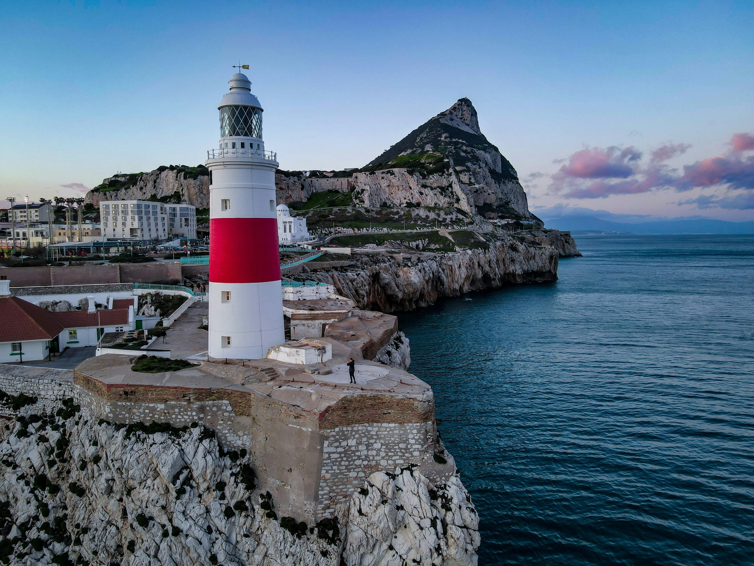
The Strait of Gibraltar, a narrow band of azure water separating Europe from Africa, is far more than a mere maritime passage. It is a geological crucible, a dynamic arena shaped by titanic forces over eons, where the very fabric of the Earth has been stretched, fractured, and molded. This seemingly confined waterway pulsates with a rich geological history, a narrative etched into its seabed, its surrounding coastlines, and the very currents that surge through it. Understanding the geological wonders of the Strait reveals a story of planetary evolution, the constant interplay of tectonic plates, and the profound impact of water on land.
The Strait of Gibraltar owes its very existence to an epic, ongoing struggle between two of Earth’s colossal tectonic plates: the Eurasian Plate and the African Plate. This ceaseless dance, a slow-motion ballet of immense geological power, has dictated the shape and character of this pivotal region for millions of years. The complex interaction between these plates is the primary architect of the Strait, responsible for its formation, its depth, and the dramatic landscapes that flank its shores.
The African Plate’s Advance
For tens of millions of years, the African Plate has been pushing northward, a relentless advance that has been instrumental in the closure of ancient oceans and the birth of mountain ranges. This northward drift is not a uniform movement; rather, it is characterized by complex rotations and shear zones, particularly as it interacts with the Iberian Peninsula and the larger Eurasian Plate. This aggressive push has directly impacted the southern edge of the Iberian Plate, leading to significant geological stress and deformation.
Consequences for Southern Iberia
The pressure exerted by the African Plate has resulted in the uplift and fragmentation of what is now southern Spain and Portugal. This has led to the formation of mountain ranges like the Betic Cordillera. These complex geological structures are not simply passive responses; they are active zones of mountain building, characterized by folding, faulting, and the emplacement of rock masses over considerable distances. The topography of the Andalusian coast, with its rugged hills and dramatic cliffs, is a direct testament to this tectonic assault.
The Eurasian Plate’s Resistance
As the African Plate advances, it encounters resistance from the Eurasian Plate, a vastly larger and more stable continental mass. The region where these two giants meet is a zone of intense geological activity, characterized by subduction, collision, and transform faulting. The Strait of Gibraltar lies within this highly tectonically active boundary, a testament to the ongoing struggle and accommodation between these two continental behemoths.
The Gibraltar Arc: A Monument to Collision
One of the most striking geological manifestations of this tectonic interaction is the Gibraltar Arc. This arcuate belt of folded and faulted rocks extends across southern Spain and into North Africa, encircling the western Mediterranean. It represents a zone of intense compression and crustal shortening, where the leading edge of the African Plate has crumpled and deformed the rocks ahead of it. The presence of rock units in this region that originated from deep within the Earth’s mantle, now exposed at the surface, speaks to the immense forces involved in their exhumation.
The geology of the Strait of Gibraltar is a fascinating subject that highlights the complex interactions between tectonic plates and the Mediterranean Sea. For those interested in exploring related topics, an insightful article can be found at Understanding Bank Bail-Ins and Dodd-Frank, which, while primarily focused on financial regulations, touches upon the broader implications of geographical and geological factors in economic contexts.
The Messenger of the Atlantic and the Mediterranean
The geological narrative of the Strait of Gibraltar is inextricably linked to its identity as a crucial oceanic gateway. It is the sole natural connection between the vast Atlantic Ocean and the semi-enclosed Mediterranean Sea, and this unique hydrological role has profound geological implications, both past and present. The continuous exchange of water between these two major bodies dictates currents, salinity levels, and sedimentation patterns, all of which are sculpted by the underlying geology.
The Atlantic’s Influx
The Atlantic Ocean, with its immense volume and tidal influences, exerts a powerful gravitational pull on the Strait. This results in a significant influx of Atlantic water into the Mediterranean. This water, cooler and less saline than the Mediterranean’s surface waters, plays a vital role in the oceanographic processes of the entire basin. Geologically, this constant influx contributes to erosion and sedimentation along the Strait’s edges.
Shaping the Seabed with Currents
The powerful tidal currents generated by the Atlantic’s push and the Mediterranean’s response are a significant geological force in themselves. These currents, particularly during spring tides, can reach considerable speeds, scouring the seabed and transporting vast quantities of sediment. They are responsible for the formation of intricate sand waves, seabed dunes, and the erosion of softer rock formations. This dynamic seabed is a constantly shifting landscape, sculpted by the relentless flow of water.
The Mediterranean’s Outflow
Conversely, the denser, saltier surface waters of the Mediterranean Sea are driven eastward as a less noticeable outflow. While less visually dramatic than the Atlantic influx, this outflow also contributes to the geological processes shaping the Strait. The interaction between these distinct water masses creates unique conditions that influence the deposition of sediments and the chemical weathering of the coastline.
Sedimentation Patterns: A Delicate Balance
The balance between the Atlantic influx and the Mediterranean outflow, along with the input of detritus from the surrounding landmasses, creates complex sedimentation patterns within the Strait. Fine silts and clays are transported and deposited in calmer areas, while coarser sands and gravels are moved by stronger currents. Understanding these patterns is crucial for comprehending the geological evolution of the Strait’s seabed and the potential for future sediment accumulation or erosion.
The Shadow of the Tethys: Ancient Ocean Remnants
The geological story of the Strait of Gibraltar is also a chronicle of lost oceans. Millions of years ago, a vast oceanic realm known as the Tethys Sea occupied the space that now sits between Europe and Africa. The complex tectonic forces that shaped the region not only created the Strait but also preserved echoes of this ancient ocean in the geological record.
The Remnants of the Tethys Sea
The rocks that form the southern Iberian Peninsula and the northern Moroccan coast bear undeniable evidence of their marine origins. Fossiliferous limestones, rich in the remains of ancient marine organisms, are testament to the time when these lands were submerged beneath the Tethys Sea. The presence of ophiolites, fragments of oceanic crust and upper mantle thrust onto continental margins, further underscores the oceanic past of this region.
Allochthonous Units: Islands of Oceanic Crust
During the collisional events that shaped the Betic-Riffian mountain belt, large slices of Tethyan oceanic crust, known as ophiolites, were detached from their original oceanic setting and transported inland. These “allochthonous units” are now found scattered throughout the geological formations surrounding the Strait, providing invaluable insights into the composition and structure of the ancient Tethys seafloor.
The Messinian Salinity Crisis: A Dramatic Desiccation
Perhaps one of the most dramatic geological events to have impacted the Strait and the wider Mediterranean basin was the Messinian Salinity Crisis, which occurred approximately 5.96 to 5.33 million years ago. During this period, tectonic uplift and a drop in global sea levels likely caused the Strait to become partially or fully closed off from the Atlantic.
The Salt Lakes of the Mediterranean
Without its connection to the Atlantic, the Mediterranean Sea began to evaporate, leading to the deposition of immense evaporite layers – vast deposits of salt, gypsum, and other minerals – across the seafloor and surrounding land. These evaporite deposits, found in drill cores and exposed in coastal cliffs, are a stark reminder of the time when the Mediterranean was transformed into a giant salt pan, a desiccated wasteland dotted with hyper-saline lakes. The subsequent re-opening of the Strait, the “Zanclean Flood,” was an event of catastrophic proportions, rapidly refilling the basin.
The Coastal Sculptures: Erosion and Deposition

The geological wonders of the Strait are not confined to its subterranean depths or its ancient past; they are vividly displayed along its captivating coastlines. The relentless forces of erosion, driven by both the sea and the atmosphere, have sculpted dramatic cliffs, secluded coves, and broad expanses of beach, each telling a story of geological adaptation and resilience.
The Rock of Gibraltar: A Monolithic Sentinel
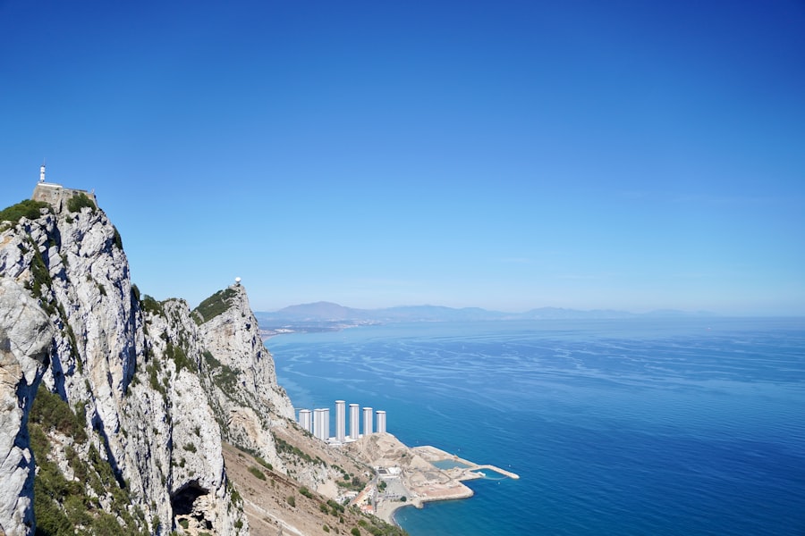
The most iconic geological feature of the region is undoubtedly the Rock of Gibraltar. This towering limestone promontory, a solitary monolith rising majestically from the sea, is a geological marvel in its own right. Composed primarily of Jurassic limestone, it represents a significant uplifted block of ancient seabed.
Karst Landscapes and Caves
The porous nature of Gibraltar’s limestone has led to the development of extensive karst landscapes. Over millennia, rainfall has dissolved the rock, creating a labyrinth of caves, tunnels, and underground passages. The famous St. Michael’s Cave, with its breathtaking stalactites and stalagmites, is a testament to the slow but persistent power of chemical weathering and water infiltration. These caves have also harbored evidence of early human habitation, further highlighting their geological significance.
The Moroccan Coast: A Rugged Frontier
Across the Strait, the Moroccan coast presents a different, yet equally compelling, geological tapestry. Here, rugged mountain ranges plunge towards the sea, their slopes etched by erosion and punctuated by dramatic cliffs. The Rif Mountains, a continuation of the geological processes that shaped southern Iberia, offer spectacular geological vistas.
Fjords and Eroded Headlands
While not true fjords in the glacial sense, the deeply incised valleys and bays along the Moroccan coast often resemble them, sculpted by fluvial erosion and wave action. The constant battering of Atlantic waves against the more resistant rock formations has created impressive headlands, sea stacks, and arches, showcasing the power of coastal geomorphology.
The Andalusian Coast: Diverse Expressions
The Spanish coastline flanking the Strait is equally diverse. From the sandy beaches of the Costa de la Luz to the dramatic cliffs and coves of the Costa del Sol, the geological influences are varied. Areas of softer marl and clay are more susceptible to erosion, creating gentler slopes and wider beaches, while harder limestones and sandstones form steeper gradients and more rugged shorelines.
The Impact of Sea Level Fluctuations
Throughout geological time, fluctuating sea levels have also played a crucial role in shaping the Andalusian coast. Raised beaches, now found well above the current sea level, are evidence of past higher sea levels, while submerged features indicate periods of lower sea levels. These fluctuations are intrinsically linked to global climate change and tectonic activity, further demonstrating the interconnectedness of geological processes.
The geology of the Strait of Gibraltar is a fascinating subject, as it serves as a crucial connection between the Atlantic Ocean and the Mediterranean Sea, influencing both marine biodiversity and geological formations. Recent studies have explored the tectonic activity in this region, shedding light on how it has shaped the surrounding landscapes over millions of years. For a deeper understanding of how geological factors can impact strategic locations, you might find this article on military implications of lunar payload services particularly interesting, as it discusses the broader context of how geography affects geopolitical dynamics. You can read more about it here.
Preserving a Living Laboratory: Challenges and Conservation
| Geological Feature | Description |
|---|---|
| Location | The Strait of Gibraltar is a narrow strait that connects the Atlantic Ocean to the Mediterranean Sea and separates Spain in Europe from Morocco in Africa. |
| Formation | The strait was formed through the combination of tectonic processes, including the movement of the African and Eurasian tectonic plates, and the erosion caused by the flow of water over millions of years. |
| Geological Importance | The strait is a crucial location for studying tectonic activity and its impact on the Earth’s surface. It also plays a significant role in the exchange of water between the Atlantic and the Mediterranean, influencing ocean currents and marine life. |
| Underwater Geology | The seabed of the strait is characterized by a complex geology, including underwater mountains, deep trenches, and sedimentary deposits, which provide valuable insights into the region’s geological history. |
The geological wonders of the Strait of Gibraltar are not static relics of the past; they constitute a dynamic and living laboratory, a place where geological processes continue to unfold and where unique ecosystems have evolved in response to these geological conditions. Preserving this invaluable natural heritage is paramount for both scientific understanding and ecological sustainability.
Fragile Ecosystems Shaped by Geology
The unique geological setting of the Strait has fostered a remarkable array of biodiversity. The complex bathymetry, the mixing of Atlantic and Mediterranean waters, and the varied coastal habitats – from rocky shores to sandy bottoms – create niches for a multitude of marine and terrestrial species. Specific geological formations can harbor unique flora and fauna adapted to those conditions.
The Importance of Submarine Geology
The geological complexity of the seabed, including underwater canyons, seamounts, and areas of intense hydrothermal activity, supports specialized marine life. Understanding this submarine topography and its geological underpinnings is vital for the conservation of these often-overlooked ecosystems.
Threats to Geological Integrity
Despite its immense geological significance, the Strait of Gibraltar faces numerous threats, including pollution, unsustainable coastal development, and the potential impacts of climate change. These anthropogenic pressures can accelerate erosion, alter sedimentation patterns, and damage fragile geological formations, potentially leading to irreversible loss of this natural heritage.
Sustainable Management and Research
Effective conservation strategies require a multidisciplinary approach, integrating geological understanding with ecological expertise. Continued geological research is essential to monitor ongoing processes, understand past events, and inform decisions regarding coastal management and the protection of marine resources. Promoting sustainable tourism and responsible maritime practices are also crucial steps in safeguarding the geological and ecological integrity of this extraordinary region.
In conclusion, the Strait of Gibraltar is a geological masterpiece, a testament to the immense creative and destructive forces that have shaped our planet. From the tectonic collision that forged its existence to the relentless sculpting power of water and the echoes of ancient oceans, its geological wonders offer a compelling narrative of Earth’s dynamic history. It is a place where the past is written in the rocks and revealed in the currents, a vital intersection of continents and oceans, and a precious natural laboratory that demands our continued study and unwavering protection.

When the Mediterranean Became a Desert | The Messinian Salinity Crisis Explained
FAQs
What is the geological significance of the Strait of Gibraltar?
The Strait of Gibraltar is a narrow strait that connects the Atlantic Ocean to the Mediterranean Sea and separates Europe from Africa. It is of great geological significance as it represents the boundary between two major tectonic plates, the Eurasian Plate and the African Plate.
How was the Strait of Gibraltar formed geologically?
The formation of the Strait of Gibraltar is attributed to the tectonic forces that have been at work in the region for millions of years. The movement of the African Plate towards the Eurasian Plate has led to the opening of the strait and the creation of the present-day landforms.
What are the major geological features of the Strait of Gibraltar?
The major geological features of the Strait of Gibraltar include the Rock of Gibraltar, which is a prominent limestone monolith, and the surrounding underwater topography, which includes deep channels and basins. These features are a result of the complex geological processes that have shaped the region.
What are the geological hazards associated with the area around the Strait of Gibraltar?
The region around the Strait of Gibraltar is prone to geological hazards such as earthquakes and tsunamis. The tectonic activity in the area can lead to seismic events, and the underwater topography can potentially generate tsunamis that could affect the surrounding coastlines.
How does the geology of the Strait of Gibraltar impact the environment and human activities in the region?
The geology of the Strait of Gibraltar has a significant impact on the environment and human activities in the region. It influences the marine ecosystems, coastal erosion, and the availability of natural resources. Additionally, the geological hazards in the area pose challenges for infrastructure and development.