Uncovering History: Modern Archaeology Techniques
For millennia, the silent stories of our past lay buried, waiting for the patient and persistent hand of the archaeologist to bring them to light. Yet, the image of the trowel-wielding scholar meticulously brushing away soil has evolved dramatically. Modern archaeology, armed with a bewildering array of cutting-edge technologies, is revolutionizing our understanding of ancient civilizations, transforming the field from a slow, painstaking excavation into a dynamic, interdisciplinary pursuit. These sophisticated techniques are not only accelerating discovery but also allowing for more precise, less invasive investigations, revealing nuanced details about human life and societal development that were previously unimaginable. The quest for knowledge now extends beyond the tangible artifacts, delving into the very fabric of the earth and the intricate chemical signatures left behind.
Before a single shovel breaks ground, the modern archaeologist employs a battery of non-invasive survey techniques to identify potential sites and understand their subsurface characteristics. These methods are crucial for minimizing disturbance to potentially fragile archaeological deposits and for maximizing the efficiency of excavation efforts. They dictate where and how to dig, transforming guesswork into informed decision-making. The landscape itself, once a passive backdrop, has become an active participant in the archaeological narrative, revealing its secrets through a symphony of electromagnetic waves, sound pulses, and aerial observations.
Remote Sensing: Seeing from Above
Remote sensing technologies provide archaeologists with a bird’s-eye view, offering unprecedented insights into the wider context and potential locations of ancient settlements and features. These powerful tools allow for the identification of subtle anomalies on the ground surface that might indicate buried structures, pathways, or even agricultural systems. The ability to survey vast areas quickly and efficiently is a game-changer, particularly in regions with challenging terrain or where widespread land development poses a constant threat to undiscovered heritage.
Satellite Imagery: A Global Perspective
High-resolution satellite imagery, often acquired through multispectral or hyperspectral sensors, can detect faint variations in vegetation health, soil composition, and surface topography that correlate with buried archaeological remains. Different wavelengths of light interact with materials in distinct ways, and by analyzing these spectral signatures, archaeologists can identify patterns indicative of ancient human activity. For instance, differences in plant growth above buried walls or ditches can be readily discernible from space, acting as ghostly outlines of past landscapes. The sheer scale achievable with satellite data allows for reconnaissance of entire regions, pinpointing areas of high archaeological potential for subsequent, more detailed investigation.
Aerial Photography and Drone Technology: Precision Imaging
Traditional aerial photography, taken from manned aircraft at various altitudes, continues to be a valuable tool. However, the advent of Unmanned Aerial Vehicles (UAVs), commonly known as drones, has democratized and revolutionized aerial archaeology. Drones offer unparalleled flexibility, affordability, and the ability to capture imagery at extremely low altitudes with high precision. They can be equipped with various sensors, including high-resolution visible light cameras, thermal cameras, and even LiDAR. This allows for the creation of incredibly detailed orthomosaics (georeferenced aerial images stitched together) and 3D models of landscapes, revealing subtle earthworks, outlines of buildings, and even subtle parch marks that become visible at specific times of day or under particular atmospheric conditions.
Geophysical Survey: Peering Beneath the Surface
Geophysical survey methods employ physical principles to detect anomalies within the subsurface without the need for excavation. These techniques are invaluable for mapping buried features, understanding their stratigraphy, and guiding excavation strategies. They provide a detailed three-dimensional map of what lies beneath the earth’s crust, acting as a powerful prelude to targeted digging.
Ground-Penetrating Radar (GPR): Electromagnetic Echoes of the Past
GPR works by emitting electromagnetic pulses into the ground and analyzing the reflected signals. Different subsurface materials and structures reflect these pulses in unique ways, allowing for the creation of detailed images of buried features. GPR is particularly effective at detecting buried walls, foundations, voids, and even changes in soil composition. Its non-invasive nature makes it ideal for sensitive sites where excavation would be too destructive. The ability to define the depth and geometry of buried features provides archaeologists with crucial information for planning excavations and understanding the spatial relationships between different elements of a site.
Magnetometry: Magnetic Signatures of Human Activity
Magnetometry measures subtle variations in the Earth’s magnetic field caused by buried archaeological features. Burnt materials (like hearths and kilns), ditches filled with organic matter, and even iron artifacts can create distinct magnetic anomalies that can be detected by sensitive magnetometers. These instruments can map out entire settlement layouts, revealing the presence of structures, industrial areas, and refuse pits with remarkable clarity. The magnetic signature left by ancient fires, for example, can persist for millennia, offering a lasting imprint of past activities.
Electrical Resistivity and Conductivity: Measuring Soil Properties
Electrical resistivity and conductivity surveys measure how easily electrical currents pass through the soil. Different materials and soil moisture content have varying electrical properties. Buried stone walls, for instance, tend to have higher resistivity (they resist the flow of electricity), while waterlogged ditches or pits filled with organic material may have lower resistivity (they conduct electricity more readily). These methods are excellent for mapping out buried structures, identifying changes in soil conditions, and delineating boundaries of archaeological features.
Modern archaeology techniques have revolutionized the way we explore and understand ancient civilizations, utilizing advanced technologies such as ground-penetrating radar and 3D modeling to uncover hidden artifacts and structures. For a deeper understanding of how contemporary issues like inflation might impact the preservation of archaeological sites and cultural heritage, you can read a related article that discusses the potential consequences of economic changes on asset management and preservation efforts. Check it out here: Will Inflation Lead to Asset Seizure?.
The Art and Science of Excavation: Precision and Data Management
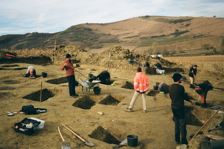
While non-invasive techniques are invaluable for initial assessments, the excavation itself remains the cornerstone of archaeological discovery. However, modern excavation is a far cry from the uncontrolled digs of the past. It is now a highly systematic and meticulously documented process, driven by rigorous scientific principles and an unwavering commitment to data integrity. Every layer of soil, every fragment of pottery, and every speck of bone is treated as a piece of evidence, meticulously recorded and analyzed.
Stratigraphic Excavation: Reading the Layers of Time
The fundamental principle of stratigraphic excavation is the understanding that archaeological sites are formed through a series of depositions, with the oldest layers typically found at the bottom and the youngest at the top. Modern archaeologists employ extremely fine-grained stratigraphic recording, meticulously documenting each depositional layer (stratum) and its contents. This includes detailed descriptions of soil color, texture, composition, and any associated artifacts or features. The accurate interpretation of these layers allows for the chronological ordering of events and the reconstruction of the site’s history.
Contextual Recording: Provenience is Paramount
In modern archaeology, the precise location (provenience) of every artifact and ecofact is paramount. This includes its three-dimensional coordinates (x, y, and z), its stratigraphic layer, and its relationship to other finds. This meticulous recording ensures that the context of discovery is preserved, allowing for later analysis of spatial relationships and associations between different materials. Sophisticated digital recording systems, using tablets and specialized software, have replaced traditional paper records in many field settings, enabling real-time data entry and immediate quality control.
Digital Documentation and 3D Modeling: Capturing Every Detail
The digital revolution has profoundly impacted archaeological documentation. The days of relying solely on hand-drawn plans and written notes are rapidly fading.
Total Stations and GPS: Precise Coordinate System
Total stations and GPS (Global Positioning System) devices are used to record the precise 3D coordinates of every artifact, feature, and excavation point. This creates a highly accurate spatial dataset that forms the foundation for all subsequent analysis and visualization. Differential GPS (DGPS) and Real-Time Kinematic (RTK) GPS offer centimeter-level accuracy, essential for understanding micro-stratigraphy and artifact distribution.
Photogrammetry and Laser Scanning: Creating Digital Replicas
Photogrammetry, the science of making measurements from photographs, has advanced dramatically with the use of drones and advanced software. By taking a series of overlapping photographs from different angles, archaeologists can generate highly detailed, georeferenced 3D models of excavation units, individual artifacts, and even entire landscapes. Laser scanning, using LiDAR (Light Detection and Ranging) technology, achieves similar results, emitting laser pulses to create dense point clouds that accurately represent the three-dimensional form of objects and environments. These digital replicas preserve the site in a virtual space, allowing for study and analysis long after the physical excavation is complete, and can even assist in virtual reconstructions.
The Science Beyond the Artefact: Material Analysis and Interpretation
Once artifacts are excavated, their journey of discovery continues in the laboratory. Modern archaeology integrates a vast array of scientific disciplines to extract maximum information from every find, moving beyond simple identification and dating to understand the material culture, technology, diet, and even the social practices of past populations.
Modern archaeology techniques have significantly evolved, allowing researchers to uncover insights into past human behaviors and environmental interactions. One fascinating aspect of this field is how environmental migration has shaped communities over time. For a deeper understanding of this topic, you can explore the article on environmental migration and its impact on communities at this link. By integrating advanced technologies such as remote sensing and GIS, archaeologists are now able to analyze patterns of migration and settlement in ways that were previously unimaginable, shedding light on the complex relationship between humans and their environments.
Dating Techniques: Unlocking Chronologies
Accurate chronological frameworks are essential for understanding the development of past societies. Modern archaeology utilizes a suite of sophisticated dating techniques to establish timelines.
Radiocarbon Dating (¹⁴C): The Gold Standard for Organic Materials
Radiocarbon dating remains a cornerstone of archaeological chronology, particularly for materials less than 50,000 years old. This method relies on the predictable decay rate of the radioactive isotope carbon-14. By measuring the ratio of ¹⁴C to stable carbon isotopes in organic materials like bone, charcoal, seeds, and wood, scientists can determine the time elapsed since the organism’s death, thereby dating the archaeological context in which it was found. Advances in accelerator mass spectrometry (AMS) have made it possible to date very small samples, increasing the range of recoverable artifacts for dating.
Thermoluminescence and Optically Stimulated Luminescence (TL/OSL): Dating Inanimate Materials
Thermoluminescence (TL) and Optically Stimulated Luminescence (OSL) dating are used to date inorganic materials like pottery, burnt flint, and sediments. These techniques measure the accumulated radiation dose absorbed by crystalline minerals over time, which is released as light when the material is heated (TL) or exposed to light (OSL). They are particularly valuable for dating contexts where organic materials are absent.
Dendrochronology: Tree Rings as Timekeepers
Dendrochronology, the science of tree-ring dating, provides highly precise chronological data by analyzing the annual growth rings of trees. By cross-dating patterns of wide (good growing season) and narrow (poor growing season) rings, it’s possible to establish a continuous chronology that can extend for thousands of years. This method is invaluable for dating wooden structures and artifacts, providing a definitive chronological marker.
Isotope Analysis: Insights into Diet, Migration, and Environment
Stable isotope analysis, examining the ratios of different isotopes of elements like carbon, nitrogen, oxygen, and strontium, provides invaluable insights into the diet, migration patterns, and even the local environment of past populations.
Strontium Isotopes: Tracing Origins
Strontium isotope ratios in human and animal remains can reveal where an individual lived and died. The strontium isotope composition of bedrock varies geographically. By comparing the strontium isotope ratios in teeth or bones to the local geological signatures, archaeologists can determine if an individual grew up in the area or migrated from elsewhere. This has been instrumental in understanding ancient trade routes and population movements.
Carbon and Nitrogen Isotopes: Understanding Diet and Agriculture
The ratio of carbon isotopes (¹³C/¹²C) in bone collagen can reveal the proportion of different plant sources in an individual’s diet, distinguishing between marine, terrestrial, and C3 versus C4 plant consumption. Nitrogen isotopes (¹⁵N/¹⁴N) indicate the trophic level of an individual’s diet, differentiating between herbivory, omnivory, and the consumption of marine resources. These analyses have been crucial in understanding the adoption and impact of agriculture and shifts in subsistence strategies.
Analysis of Ancient DNA (aDNA): Unveiling Genetic Histories
The extraction and analysis of ancient DNA (aDNA) has opened up a revolutionary new frontier in archaeology. By studying the genetic material preserved in ancient human and animal remains, scientists can reconstruct evolutionary histories, understand population migrations, trace the domestication of plants and animals, and even shed light on disease patterns. The ability to analyze DNA from extremely degraded samples, often recovered from challenging environments, has led to paradigm-shifting discoveries about human origins and dispersal.
Digital Archaeology and Data Management: The Future of Archaeological Knowledge

The sheer volume of data generated by modern archaeological techniques necessitates sophisticated approaches to data management, analysis, and dissemination. Digital archaeology is not just about using computers; it’s about rethinking how archaeological knowledge is created, stored, and shared.
Geographic Information Systems (GIS): Spatial Analysis and Visualization
Geographic Information Systems (GIS) are fundamental tools for modern archaeologists. They allow for the integration and analysis of diverse spatial datasets, including survey data, excavation records, environmental information, and historical maps. GIS enables archaeologists to visualize the spatial relationships between different features and artifacts, model past landscapes, and identify patterns that might not be apparent otherwise. They are crucial for site management, regional analysis, and the creation of predictive models for future discoveries.
Databases and Digital Archives: Preserving and Sharing Information
The creation of robust digital databases and archives is essential for the long-term preservation and accessibility of archaeological data. These systems allow for the efficient storage, retrieval, and sharing of information, fostering collaboration among researchers and making findings available to a wider audience. Open-access digital archives are increasingly important for ensuring that the results of archaeological research are not locked away in obscure publications but are readily available to students, educators, and the public.
Citizen Science and Public Engagement: Broadening the Reach of Archaeology
Modern archaeology is also increasingly embracing the power of citizen science. Projects that engage the public in data analysis, such as transcribing historical documents or identifying features in aerial imagery, not only accelerate research but also foster a deeper understanding and appreciation for heritage. Social media and interactive online platforms are also being used to share discoveries and engage the public in the archaeological process, democratizing access to knowledge and fostering a sense of shared responsibility for our collective past.
In conclusion, modern archaeology has transformed from a discipline primarily focused on excavation and artifact collection into a highly sophisticated, multidisciplinary endeavor. The integration of advanced technologies like remote sensing, geophysical survey, digital documentation, and cutting-edge scientific analysis has empowered archaeologists to uncover the past with unprecedented detail, accuracy, and efficiency. These techniques not only allow for the recovery of more information from fragile and diminishing sites but also enable a deeper, more nuanced understanding of the lives, societies, and environments of our ancestors. As technology continues to advance, the future of archaeology promises even more profound revelations, continuously reshaping our understanding of humanity’s long and complex journey.

How Volcanic Glass Solved a 10,000-Year-Old Mystery
FAQs
What are some modern techniques used in archaeology?
Some modern techniques used in archaeology include ground-penetrating radar, LiDAR (Light Detection and Ranging), 3D laser scanning, and remote sensing technologies.
How does ground-penetrating radar work in archaeology?
Ground-penetrating radar (GPR) works by sending radar pulses into the ground and measuring the reflected signals to create an image of subsurface features. This allows archaeologists to detect buried structures and artifacts without excavation.
What is LiDAR and how is it used in archaeology?
LiDAR, or Light Detection and Ranging, is a remote sensing technology that uses laser pulses to create detailed 3D maps of the Earth’s surface. In archaeology, LiDAR is used to uncover hidden archaeological features such as ancient roads, buildings, and landscapes.
How does 3D laser scanning benefit archaeological research?
3D laser scanning allows archaeologists to create highly detailed and accurate digital models of archaeological sites and artifacts. This technology helps in documentation, preservation, and analysis of archaeological finds.
What are the advantages of using remote sensing technologies in archaeology?
Remote sensing technologies, such as satellite imagery and aerial photography, provide a non-invasive way to survey large areas and identify potential archaeological sites. This helps archaeologists to prioritize excavation efforts and conserve cultural heritage.