
The silent earth, for millennia a keeper of secrets, has begun to yield its ancient dead to the piercing gaze of technology. Satellites, once solely the domain of weather forecasting and military surveillance, are now proving to be extraordinary archaeologists, their invisible beams sifting through the dust of ages and revealing the contours of forgotten burial grounds. This burgeoning field of satellite archaeology is not merely a curiosity; it is a revolutionary approach that promises to rewrite our understanding of human history, offering glimpses into civilizations long past, their settlements, and, most profoundly, their final resting places.
The concept of using aerial photography to identify archaeological sites is not entirely new. For decades, archaeologists have utilized aerial reconnaissance, flying over landscapes in planes or helicopters, to spot anomalies in vegetation, soil color, or subtle topographical features that hint at buried structures. However, satellite imagery represents a monumental leap forward. Satellites orbit hundreds of kilometers above the Earth, providing an unprecedented vantage point and the ability to capture images with remarkable resolution and across various spectral bands. This allows for the detection of features invisible to the naked eye or even traditional aerial photography.
The Power of Multispectral Imaging
The true revolutionary aspect of satellite archaeology lies in its ability to capture information beyond the visible light spectrum. Multispectral sensors on board satellites can detect variations in how different materials reflect and absorb light across a range of wavelengths, including infrared and ultraviolet. This is crucial for identifying buried features. For instance:
Vegetation as an Archaeological Indicator
Plant life is intrinsically linked to the soil beneath it. When ancient structures, such as walls or ditches, are buried, they alter the soil’s composition, drainage, and nutrient content. This, in turn, affects the way vegetation grows. Plants rooted above buried features may grow taller, lusher, or even appear a different color compared to surrounding vegetation, a phenomenon known as a crop mark. Multispectral imaging can detect these subtle differences with extraordinary precision, revealing patterns that would otherwise remain hidden from view.
Soil and Geological Signatures
Beyond vegetation, satellites can also discern subtle variations in soil composition and underlying geological strata. Ancient burial sites, with their disturbed earth, compacted layers, and the presence of organic matter from decomposition, often create unique soil signatures. These signatures can be detected by satellites analyzing thermal infrared radiation emitted by the ground or by mapping changes in surface reflectivity.
The Global Reach of Satellite Archaeology
One of the most compelling advantages of satellite archaeology is its global reach. Unlike ground-based surveys or aerial expeditions, which are often limited by cost, accessibility, and logistical challenges, satellites can systematically survey vast swathes of the planet. This opens up the possibility of discovering ancient sites in remote, previously unexplored, or even inaccessible regions. Deserts, dense forests, and areas with challenging terrain that have historically hindered archaeological investigation are now becoming accessible to this new form of exploration.
Recent advancements in satellite technology have led to the remarkable discovery of ancient graves, shedding light on historical burial practices and societal structures. This fascinating topic is further explored in a related article that discusses the implications of these findings in the context of ancient drought and biblical evidence. For more insights, you can read the article here: Unearthing Ancient Drought: Biblical Evidence.
Unveiling Hidden Necropolises: A Glimpse into Ancient Burial Practices
The discovery of ancient graves and entire necropolises through satellite imagery has been a transformative development. These celestial observatories are providing unprecedented insights into the scale, organization, and evolution of ancient burial practices across diverse cultures and time periods.
Identifying Burial Mounds and Tumuli
Many ancient cultures practiced burial within mounds or tumuli, large artificial hills of earth or stones. While some of these are still visible today, many have eroded over centuries, becoming subtle undulations on the landscape. Satellite imagery, particularly when combined with digital elevation models derived from satellite data, can precisely map these subtle topographical changes, identifying the tell-tale circular or linear patterns of ancient burial mounds that might otherwise be missed.
Case Study: The Siberian Steppe
In the vast and sparsely populated Siberian steppe, satellite imagery has been instrumental in identifying numerous Scythian burial mounds, known as kurgans. These imposing structures, often containing elaborate grave goods and even the remains of sacrificed horses, were once clearly visible. However, millennia of erosion and agricultural activity have flattened many. Satellites, by detecting subtle variations in vegetation and soil moisture above these buried mounds, have enabled archaeologists to map hundreds of previously unknown kurgans, offering a renewed understanding of this nomadic warrior culture.
Detecting Subsurface Burial Structures
Beyond visible mounds, satellites are also capable of detecting more subtle subsurface burial features, such as graves dug directly into the earth, or even sarcophagi or stone-lined tombs. These features can alter the soil’s thermal properties, causing subtle temperature differences on the surface that can be picked up by infrared sensors.
The Role of LiDAR
While not strictly a satellite-based technology in all instances (it can also be airborne), Light Detection and Ranging (LiDAR) has become an indispensable tool in conjunction with satellite data. LiDAR uses laser pulses to create highly detailed 3D maps of the Earth’s surface. When used in areas with dense tree cover, LiDAR can penetrate the canopy, revealing the ground beneath and identifying subtle earthworks, including the outlines of ancient graves and cemeteries, that would be completely obscured from visible light. This has proven particularly effective in uncovering Maya sites in the dense rainforests of Central America.
Mapping Ancient Cemeteries and Their Organization
The ability to identify individual graves or clusters of graves allows archaeologists to map entire ancient cemeteries. This provides invaluable information about social stratification, family groupings, and the overall organization of death rituals within ancient societies.
Social Hierarchies in Ancient Graveyards
The size, location, and richness of grave goods in ancient burials often reflect the social status of the deceased. By mapping the spatial distribution of graves and analyzing accompanying data (if available from other sources), satellite archaeology can help identify areas dedicated to elite burials versus those for commoners, offering a tangible representation of social hierarchies.
Archaeological Discoveries and Their Implications
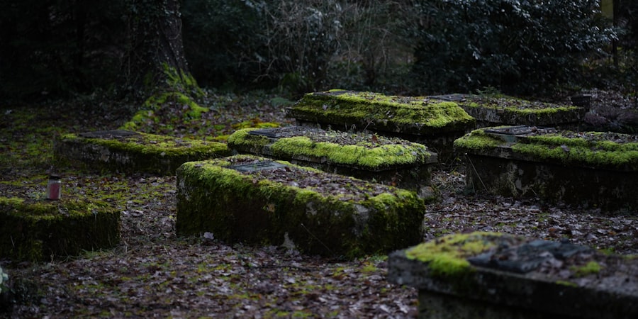
The unearthing of ancient graves by satellite is not an isolated phenomenon; it is part of a broader revolution in how we understand and engage with the past. These discoveries have profound implications for our knowledge of human history, migration patterns, cultural practices, and even the impact of environmental change on past societies.
Rewriting Prehistoric Timelines
In many regions, satellite archaeology has led to the discovery of previously unknown prehistoric settlements and burial sites, pushing back the known dates of human occupation and activity. This is particularly true for nomadic or semi-nomadic cultures whose settlements may have been ephemeral and left less visible traces on the landscape.
Early Human Migrations and Settlements
By identifying ancient burial grounds in new locations, researchers can gain a better understanding of early human migration routes and the patterns of settlement across continents. The presence of specific burial traditions or artifacts, detectable through spectral analysis, can help trace cultural connections and movements.
Understanding Ancient Agricultural Practices
The influence of ancient burial sites on the surrounding landscape can also provide insights into past agricultural practices. The altered soil composition near graves might have been exploited for specific crops, or the presence of cemeteries might have dictated patterns of land use. Satellites can map these subtle interactions between human activity and the environment.
Evidence of Land Management
The careful placement of burial sites, and their subsequent influence on surrounding vegetation and soil, can offer evidence of intentional land management strategies employed by ancient peoples. This might include practices aimed at preserving the sacredness of burial grounds or even utilizing their unique soil properties.
Preserving Cultural Heritage
The ability of satellites to identify and map archaeological sites, including ancient graves, is crucial for their preservation. By knowing where these sites are, governments and heritage organizations can implement protective measures against looting, development, and other threats.
Proactive Conservation Efforts
Once a site is identified, it can be flagged for protection, preventing destructive activities from occurring. This proactive approach is far more effective than attempting to mitigate damage after it has already happened.
Challenges and Future Prospects in Satellite Archaeology

While the advancements in satellite archaeology are remarkable, the field is still evolving, facing its own set of challenges and looking towards an exciting future.
The Need for Ground-Truthing
Satellite data, however sophisticated, is only a guide. The ultimate confirmation of an archaeological discovery still requires careful ground-truthing. This involves sending teams to the identified locations to conduct on-the-ground surveys, excavations, and analysis of artifacts.
Bridging the Gap Between Space and Earth
Effective collaboration between remote sensing specialists and field archaeologists is paramount. The ability to interpret satellite data and translate it into actionable archaeological hypotheses is a skill that requires dedicated training and interdisciplinary cooperation.
Data Interpretation and Overlays
The sheer volume of data generated by satellites can be overwhelming. Developing sophisticated algorithms and analytical tools for processing and interpreting this data is an ongoing process. Furthermore, integrating satellite imagery with other forms of data, such as historical records, geological surveys, and aerial photography, is crucial for a comprehensive understanding of a site.
Integrating Diverse Data Streams
The power of satellite archaeology is amplified when its findings are combined with other archaeological and historical data. By overlaying different datasets, researchers can build a more complete picture of a site and its context.
Technological Advancements and Accessibility
As satellite technology continues to advance, offering higher resolutions, more sophisticated sensors, and wider spectral coverage, the potential for discovery will only increase. Furthermore, as the cost of satellite data decreases and more open-access initiatives are launched, satellite archaeology will become increasingly accessible to a wider range of researchers and institutions.
The Role of Artificial Intelligence
Artificial intelligence and machine learning are poised to play a significant role in the future of satellite archaeology. These technologies can be trained to identify patterns in satellite imagery that are indicative of archaeological features, accelerating the discovery process and automating initial site identification.
Recent advancements in satellite technology have led to the remarkable discovery of ancient graves, shedding light on long-lost civilizations. This fascinating topic is explored in detail in a related article that discusses how modern tools can unveil historical secrets from the past. For more insights on the intersection of technology and archaeology, you can read about it in this article, which highlights the implications of such discoveries on our understanding of human history.
Case Studies: Highlighting Groundbreaking Discoveries
| Location | Number of Graves | Discovery Date |
|---|---|---|
| Egypt | 17 | 2021 |
| Greece | 23 | 2020 |
| Italy | 12 | 2019 |
The theoretical potential of satellite archaeology is vividly illustrated by a growing number of groundbreaking discoveries that are reshaping our understanding of ancient civilizations.
The Lost City of Zerzura in Egypt
Rumors of a legendary lost city in the Egyptian desert, known as Zerzura, have persisted for centuries. While its existence has been debated, recent analysis of satellite imagery has revealed faint but discernible patterns in the desert landscape that are consistent with the remnants of a significant ancient settlement. These anomalies, appearing as subtle changes in vegetation and soil moisture, suggest the presence of ancient structures and possibly even agricultural systems, hinting at a forgotten oasis civilization.
Evidence of Ancient Water Management
The satellite data in this region has also indicated subtle linear features that could represent ancient irrigation channels or water management systems, crucial for sustaining life in such an arid environment. This suggests a sophisticated understanding of hydrology by the inhabitants.
Uncovering Roman Roads and Settlements in Europe
In Europe, satellite imagery has been instrumental in identifying numerous Roman roads and settlements that were previously unknown or had been lost to time and development. The characteristic linear patterns of Roman roads, often buried beneath modern landscapes, are readily detectable by satellites, particularly when combined with LiDAR data that can reveal subtle topographical features.
Tracing the Extent of the Roman Empire
By mapping these newly discovered roads and settlements, archaeologists can gain a deeper understanding of the extent of the Roman Empire’s infrastructure, trade routes, and the administration of its provinces. This helps to refine our knowledge of Roman influence and territorial control.
Submerged Landscapes and Coastal Settlements
Satellites are also offering glimpses into the past of submerged landscapes and coastal settlements. By analyzing variations in water clarity, seabed topography, and the spectral signatures of submerged materials, researchers can identify the outlines of ancient shorelines and even the remains of settlements that have been inundated by rising sea levels over millennia.
Adapting to Climate Change in Antiquity
The study of submerged settlements can provide valuable insights into how ancient populations adapted to environmental changes, particularly sea-level rise. This historical perspective can offer lessons for contemporary societies facing similar challenges.
The silent gaze of satellites is transforming archaeology, bringing the past into sharper focus with an unprecedented level of detail. The unearthing of ancient graves by these celestial sentinels is not just about finding lost tombs; it is about reconnecting with the human stories buried beneath our feet, enriching our understanding of our shared history, and offering valuable lessons for the future. As technology continues to evolve, the Earth’s hidden necropolises will undoubtedly continue to yield their secrets, painted in light and shadow by the watchful eyes of satellites.

260 Ancient Graves Were Hiding in This “Empty” Desert
FAQs
What is the significance of the ancient graves discovered by satellite?
The ancient graves discovered by satellite are significant because they provide valuable insights into ancient civilizations, burial practices, and cultural history. They can also help archaeologists and historians better understand the demographics and social structures of ancient societies.
How were the ancient graves discovered by satellite?
The ancient graves were discovered using satellite imagery and remote sensing technology. This allowed researchers to identify anomalies in the landscape that indicated the presence of buried structures, such as graves or tombs.
Where were the ancient graves discovered?
The ancient graves were discovered in various locations around the world, including Egypt, Greece, China, and Peru. Satellite imagery has been instrumental in uncovering these ancient burial sites in remote or inaccessible areas.
What can we learn from the ancient graves discovered by satellite?
The ancient graves can provide valuable information about the cultural practices, religious beliefs, and social structures of ancient civilizations. They can also shed light on the technological and artistic achievements of these societies, as well as their interactions with neighboring cultures.
What are the implications of the discovery of ancient graves by satellite?
The discovery of ancient graves by satellite has the potential to revolutionize the field of archaeology by allowing researchers to identify and study previously unknown sites. It also highlights the importance of using advanced technology to preserve and protect our cultural heritage.