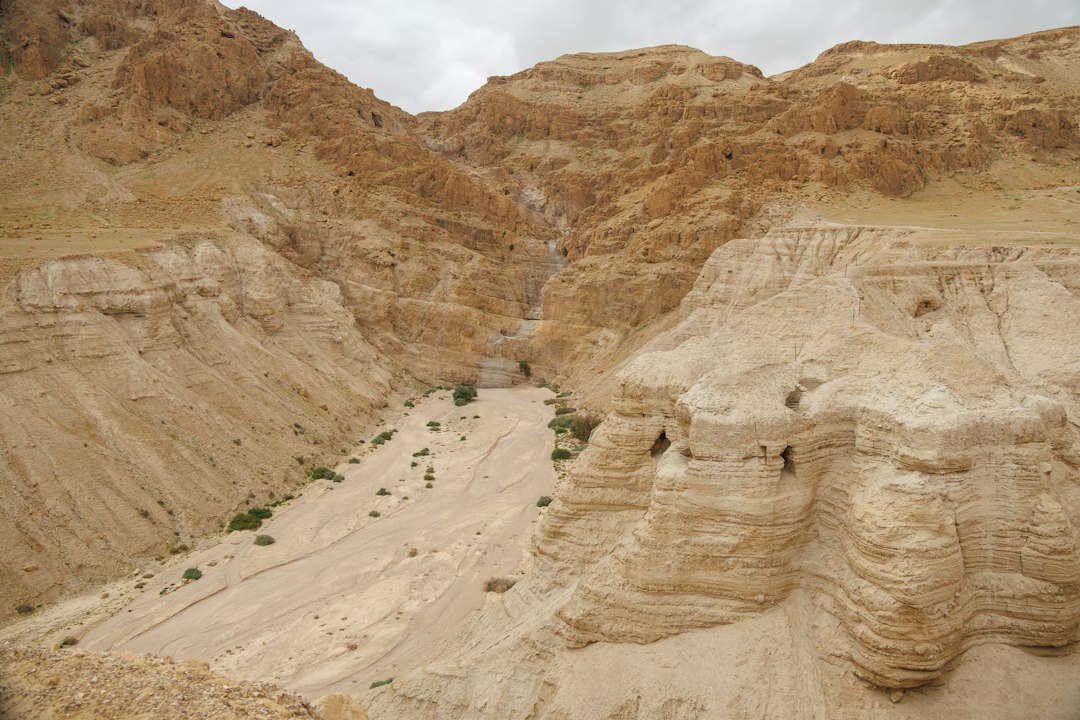
The geological tapestry of North Africa is a chronicle etched in stone, a dramatic narrative spanning billions of years, transforming from the silent depths of ancient oceans to the sun-baked, wind-sculpted vastness of its iconic desert landscapes. This immense region, encompassing a diverse array of terrains from the Atlas Mountains to the Sahara Desert, has been shaped by monumental forces – the slow, inexorable drift of tectonic plates, the fiery birth of volcanoes, the relentless grind of erosion, and the gradual ebb and flow of seas. Understanding its geological history is not merely an academic pursuit; it offers profound insights into the distribution of resources, the patterns of ancient life, and the very foundations of the continents.
The story of North Africa’s geology begins in the dimly understood realms of the Precambrian Eon, a period stretching from the Earth’s formation over 4.5 billion years ago to the dawn of complex life around 541 million years ago. During this primordial era, the African continent, like all others, was a fragmented entity, constantly colliding and coalescing with other landmasses in a ceaseless dance of plate tectonics. These early continental collisions, known as supercontinent cycles, were responsible for building the ancient, stable core of the African craton, the bedrock upon which subsequent geological events would unfold.
The Archean and Proterozoic Eons: Building Blocks of Africa
The earliest formations in North Africa, dating back to the Archean Eon (4.0 to 2.5 billion years ago), are found in the crystalline basement rocks of shields, such as those exposed in parts of the Sahara. These rocks, predominantly granites and gneisses, represent the solidified remnants of molten magma that cooled deep within the Earth’s crust. They are the foundational elements of the continent, a testament to the intense heat and pressure of early Earth.
The Proterozoic Eon (2.5 billion to 541 million years ago) witnessed further growth and stabilization of the African craton. Numerous orogenic events – mountain-building episodes – occurred as continents collided. These collisions thickened the crust, folded and faulted existing rocks, and introduced vast quantities of igneous and metamorphic rocks. Evidence of these ancient mountain ranges, though now heavily eroded, can be found in the geological structure of many North African regions. The formation of sedimentary basins also began during this period, as ancient rivers deposited eroded material and early seas laid down layers of sand, silt, and mud. These sedimentary layers, though often metamorphosed by later events, hold valuable clues about the early environments and the very first microbial life.
Early Volcanic Activity and Crustal Formation
Volcanic activity was a significant feature of the Precambrian. Ancient volcanoes erupted, spewing lava and ash that contributed to the accumulation of volcanic rocks. These eruptions were often associated with rifting events, where the Earth’s crust was stretched and thinned, allowing magma to rise to the surface. The composition of these early volcanic rocks provides information about the mantle beneath and the processes occurring at the nascent plate boundaries. The formation of new oceanic crust in nascent rift zones also played a role in shaping the early geological landscape, though most of this activity predates the formation of the supercontinent Pangea.
The geological history of North Africa is a fascinating subject that reveals the region’s dynamic past, shaped by tectonic movements, climate changes, and the influence of ancient seas. For those interested in exploring how these geological processes have impacted not only the landscape but also the cultural and historical development of North Africa, a related article can provide further insights. You can read more about the broader implications of geological changes in the context of global events in the article found here: The New Space Cold War Explained.
The Paleozoic Era: Seas Advance and Recede
The Paleozoic Era (541 to 252 million years ago) marked a period of significant change for North Africa, characterized by the rise and fall of shallow seas and the progressive assembly of the supercontinent Pangea. The region’s geological history during this era is a complex interplay of deposition, uplift, and sedimentation, laying the groundwork for the dramatic landscapes that would emerge later.
The Cambrian Explosion and Early Marine Life
The Cambrian period, the beginning of the Paleozoic, saw the “Cambrian Explosion,” a remarkable diversification of life in the world’s oceans. North Africa, too, was largely submerged under warm, shallow seas. Sedimentary rocks from this period, often limestones and shales, are rich in fossils of early marine invertebrates, including trilobites and brachiopods. These fossil assemblages provide crucial evidence of the marine ecosystems that thrived in these ancient waters, offering a glimpse into a world vastly different from today’s arid North Africa. The thickness and distribution of these Cambrian sedimentary rocks indicate the extent of the marine transgressions across the continent.
The Ordovician and Silurian: Continental Drift and Mountain Building
During the Ordovician and Silurian periods, North Africa was part of the supercontinent Gondwana. Significant geological events occurred as Gondwana moved across the globe. Evidence of glaciation, particularly in the Ordovician, can be found in the form of tillites and glacial striations in various North African locations. These glacial deposits signify periods of extreme cold and widespread ice sheets. Furthermore, collisions with other continental fragments during this time led to the formation of mountain ranges. These orogenic events, though now largely eroded, left behind folded and faulted rock layers, and intrusions of igneous rocks, particularly in the northeastern parts of the continent.
The Devonian and Carboniferous: Vast Seas and Coal Formation
The Devonian and Carboniferous periods saw North Africa continue its journey as part of Gondwana. Large areas of the continent remained covered by shallow, tropical seas, conducive to the deposition of thick successions of sandstones, shales, and limestones. These sediments often contain abundant fossils of marine plants and animals. Notably, during the Carboniferous, extensive swamp forests thrived in some parts of North Africa, particularly in areas that would later become part of the Variscan orogen. The accumulation and burial of this organic material eventually led to the formation of coal deposits, though significant commercial coal reserves are not as prevalent in North Africa as in some other parts of the world. The geological structures from these periods reveal the tectonic forces at play, including the development of intracontinental basins and the beginnings of the Variscan orogeny in certain regions.
The Mesozoic Era: Pangea Breaks Apart and New Basins Form
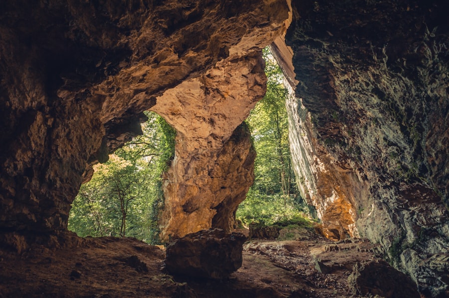
The Mesozoic Era (252 to 66 million years ago) is a pivotal chapter in North Africa’s geological story, marked by the breakup of the supercontinent Pangea and the subsequent formation of the Atlantic Ocean. This period of rifting and separation profoundly reshaped the continent and laid the foundations for many of its characteristic geological features.
The Triassic: Rifting and the Birth of the Atlantic
The Triassic period witnessed the initial stages of Pangea’s fragmentation. The African continent, still connected to its Gondwanan neighbors, began to experience extensional forces that led to the formation of rift valleys. These rift valleys, precursors to major ocean basins, were characterized by volcanic activity and the deposition of terrestrial sediments. In North Africa, evidence of this rifting can be found in the form of basaltic lava flows and sedimentary sequences within these ancient rift systems. The thinning of the crust in these zones also led to subsidence, creating basins where sediments accumulated.
The Jurassic: Opening of the Central Atlantic and Tethys Sea Influence
During the Jurassic period, the rifting intensified, leading to the opening of the Central Atlantic Ocean. This separation caused the northwestern margin of Africa to drift westward, away from North America. Concurrently, the eastern and northern margins of Africa experienced the expansion of the Tethys Sea, a vast ocean that separated the northern and southern continents. This transgression of the Tethys Sea across North Africa led to the deposition of thick sequences of marine sediments, including limestones, marls, and evaporites. These deposits are particularly well-developed in regions like Egypt, Libya, and Algeria, forming significant rock layers that contain valuable fossil evidence and are important sources of hydrocarbons. The Jurassic limestones, in particular, are known for their rich fossil content, including ammonites and marine reptiles.
The Cretaceous: Continued Marine Influence and Early Atlas Formation
The Cretaceous period saw the Tethys Sea continue to dominate the northern parts of North Africa, while the Atlantic Ocean’s influence expanded. Extensive marine deposition continued, creating vast layers of chalks, limestones, and shales. These Cretaceous rock formations are widespread across the region and are often associated with significant oil and gas reserves. Towards the end of the Cretaceous and into the early Tertiary, the geological forces that would eventually lead to the formation of the Atlas Mountains began to manifest. Compressional stresses, related to the collision of the African and Eurasian plates, started to buckle and fold the Earth’s crust in the northwestern parts of the continent. While the major uplift of the Atlas Mountains occurred later, the seeds of this formidable mountain range were sown during this period of tectonic convergence.
The Cenozoic Era: Mountains Rise and Deserts Emerge
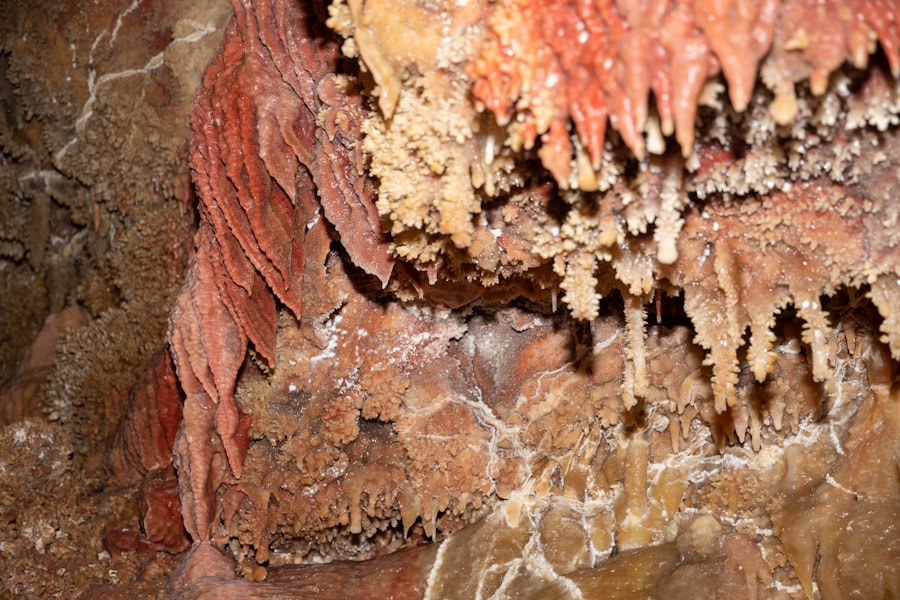
The Cenozoic Era (66 million years ago to the present) is the most recent chapter in North Africa’s geological history and the period during which its iconic desert landscapes and formidable mountain ranges took shape. This era is characterized by significant tectonic activity, extensive erosion, and the dramatic evolution of climate.
The Paleogene and Neogene: The Atlas Orogeny and Continental Uplift
The Paleogene and Neogene periods were dominated by the dramatic uplift and formation of the Atlas Mountains. This colossal mountain range, stretching across Morocco, Algeria, and Tunisia, is the result of the ongoing collision between the African and Eurasian tectonic plates. As these plates converged, the Earth’s crust in the northwestern corner of Africa was compressed, folded, and thrust upwards, creating the majestic peaks and valleys we see today. The Atlas Mountains are a classic example of a fold-and-thrust mountain belt, with complex geological structures, including synclines and anticlines, and numerous fault lines. The uplift was not a singular event but occurred in several phases over millions of years, with periods of intense mountain building interspersed with periods of relative quiescence.
The Quaternary: Aridification and Desertification
The Quaternary period, encompassing the Pleistocene and Holocene epochs, witnessed the dramatic transformation of much of North Africa into arid and semi-arid desert landscapes. This aridity is driven by a complex interplay of global climatic shifts and regional tectonic influences. During glacial periods, atmospheric circulation patterns changed, leading to reduced rainfall across the Sahara and its surrounding regions. This lack of moisture, combined with high temperatures and intense solar radiation, resulted in widespread desertification. Ancient river systems dried up, vegetation cover receded, and wind became the dominant erosional force, sculpting the vast sand dunes, ergs, and rocky plateaus that define the Sahara. While interglacial periods saw some periods of increased rainfall and the temporary re-greening of parts of the Sahara, the overarching trend has been towards increasing aridity. The geological record of this period includes evidence of ancient lakebeds, fossilized river channels, and aeolian (wind-blown) deposits, all testifying to past wetter climates and the subsequent desertification.
The Sahara: A Dynamic Desert Landscape
The Sahara Desert itself is not a static geological entity but a dynamic landscape sculpted by ongoing geological processes. The vast sand seas, or ergs, are formed from the accumulation of wind-blown sand, which is sourced from the erosion of ancient mountains and sedimentary rocks. The characteristic ripple marks and dune formations are a constant testament to the power of wind. In contrast, the hammadas, or stony plateaus, are areas where the fine sand has been stripped away by the wind, leaving behind a surface of bare rock. Regs, or gravel plains, are also common, formed by the selective removal of finer material. The geological history of the Sahara also includes evidence of past volcanic activity, with ancient lava flows and volcanic cones dotting the landscape in certain regions. Furthermore, the subsurface of the Sahara holds vast reserves of groundwater, remnants of wetter periods, which are crucial for life in this arid environment.
The geological history of North Africa is a fascinating subject that reveals the region’s transformation over millions of years, influenced by tectonic activity, climate change, and ancient civilizations. For those interested in exploring how these geological changes have impacted human innovation and technology, a related article can be found at Unlocking Ancient Technology in Times of Scarcity, which delves into the adaptive strategies of societies in response to environmental challenges. This connection between geology and human resilience highlights the intricate relationship between the Earth’s history and the development of ancient technologies in North Africa.
Enduring Legacies: Resources and Future Geological Insights
| Geological Period | Main Events |
|---|---|
| Precambrian | Formation of ancient rocks and the Pan-African orogeny |
| Paleozoic | Deposition of sedimentary rocks and the formation of the Atlas Mountains |
| Mesozoic | Continued mountain building and the opening of the Atlantic Ocean |
| Cenozoic | Uplift and erosion of the Atlas Mountains and the formation of the Sahara Desert |
The geological history of North Africa has left an indelible mark on the region, shaping not only its dramatic landscapes but also its economic and environmental future. The ancient seas and tectonic upheavals have created a treasure trove of natural resources, while the ongoing geological processes continue to influence its present and future.
Hydrocarbon Wealth: Echoes of Ancient Seas
The widespread presence of thick sequences of marine sedimentary rocks, particularly from the Jurassic and Cretaceous periods, has made North Africa a significant producer of oil and natural gas. The ancient Tethys Sea, with its abundant marine life and ideal conditions for organic matter accumulation, provided the source rocks for these valuable hydrocarbons. Subsequent geological processes, including burial, heat, and the formation of structural traps, have preserved and concentrated these resources. Countries like Algeria, Libya, and Egypt owe a substantial portion of their economies to these subterranean legacies of ancient oceans. The geological exploration for these resources continues, revealing more about the subsurface structure and the depositional environments of past eras.
Mineral Resources: Orogenic Gifts
Beyond hydrocarbons, North Africa’s geological past has endowed it with a diverse range of mineral resources. The Precambrian shields and the Variscan and Atlas orogenies have brought valuable metallic ores to the surface, including iron, copper, lead, zinc, and various precious metals. Phosphate deposits, crucial for fertilizer production, are also abundant in certain North African countries, formed from the accumulation of marine organisms rich in phosphorus. The extraction and processing of these minerals are intrinsically linked to understanding their geological origins and the geological formations in which they are found.
Water Resources: Whispers of Past Climates
The vast Sahara Desert, seemingly devoid of water, holds significant underground reserves of fossil groundwater, accumulated during periods of higher rainfall in the Pleistocene and Holocene. These aquifers, often housed within porous sandstone layers, are a lifeline for human settlements and agriculture in this arid region. The geological history of these water bodies is crucial for sustainable water management, as these are non-renewable resources that recharge very slowly, if at all, under present-day arid conditions. Understanding the stratigraphy and hydrogeology of these aquifers is paramount for their responsible exploitation.
The Atlas Mountains: A Living Geological Laboratory
The Atlas Mountains represent a dynamic geological laboratory, offering continuous opportunities for research into plate tectonics, seismicity, and geomorphological processes. The ongoing collision between Africa and Eurasia means that the Atlas region is seismically active, with earthquakes posing a recurrent hazard. Studying the fault systems, the patterns of seismic activity, and the rates of uplift and erosion in the Atlas Mountains provides invaluable data for understanding continental collision zones and predicting future geological events. The diverse rock types and complex geological structures within the Atlas also offer insights into the history of mountain building and the erosional forces that shape mountain landscapes.
In conclusion, the geological history of North Africa is a grand saga of transformation. From the primordial molten rock of the Precambrian to the sweeping sand dunes of the Sahara, each epoch has left its indelible signature. The slow dance of continents, the fiery breath of volcanoes, the patient work of water and wind, and the immense forces of mountain building have all contributed to the magnificent and complex geological legacy of this captivating region. Understanding this history is not just about deciphering the past; it is about comprehending the present and preparing for the geological realities of the future.

They Found a Shark Graveyard in the Egyptian Desert
FAQs
What is the geological history of North Africa?
The geological history of North Africa is characterized by a complex and diverse evolution over millions of years. It includes the formation of ancient mountain ranges, the shifting of tectonic plates, and the influence of climate change on the landscape.
How did the Atlas Mountains form?
The Atlas Mountains in North Africa were formed through the collision of the African and Eurasian tectonic plates. This collision resulted in the uplift of the land and the formation of the mountain range, which stretches across Morocco, Algeria, and Tunisia.
What role did climate change play in shaping North Africa’s geology?
Climate change has played a significant role in shaping the geology of North Africa. Periods of arid conditions and desertification have led to the erosion of landforms and the deposition of sediment, contributing to the diverse geological features found in the region.
How has the movement of tectonic plates influenced North Africa’s geology?
The movement of tectonic plates has had a profound impact on North Africa’s geology. It has led to the formation of mountain ranges, the opening of rift valleys, and the creation of geological faults, which have shaped the landscape and influenced the distribution of natural resources.
What are some notable geological features in North Africa?
Some notable geological features in North Africa include the Sahara Desert, the Nile River, the Libyan Desert, the Hoggar Mountains, and the Great Rift Valley. These features reflect the diverse geological history and natural beauty of the region.