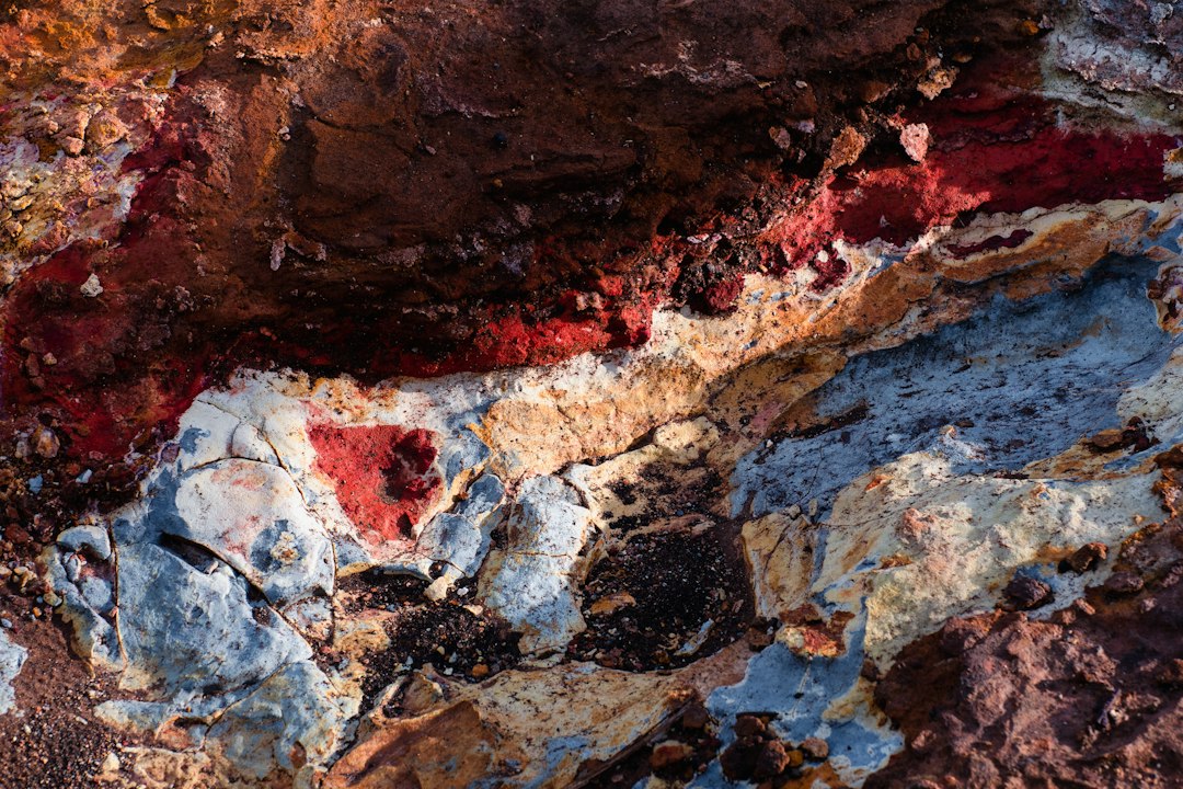
The Earth’s crust, the outermost solid shell of a rocky planet, ocean or natural satellite, is a realm of immense geological significance, holding the secrets of our planet’s formation, its dynamic processes, and the very foundations upon which life has evolved. While its surface is readily observable, the vast majority of the crust lies hidden beneath our feet, a complex and intricate tapestry of rocks, minerals, and geological structures. Unraveling these subterranean mysteries requires a sophisticated arsenal of scientific study techniques, each offering a unique window into the planet’s rocky mantle. These methods, ranging from direct observation of exposed outcrops to sophisticated geophysical imaging, are crucial for understanding tectonic plates, the distribution of natural resources, the causes of earthquakes, and the history of our dynamic planet.
The initial foray into understanding Earth’s crust begins with the most straightforward approach: observing what is visible and accessible. Surface geology, the study of the rocks and landforms on the Earth’s surface, provides the foundational data for all subsequent, more complex investigations. Geologists meticulously map out rock formations, identify different rock types, and analyze their relationships to one another. This visual and tactile exploration lays the groundwork for interpreting subsurface structures.
Field Mapping and Stratigraphy
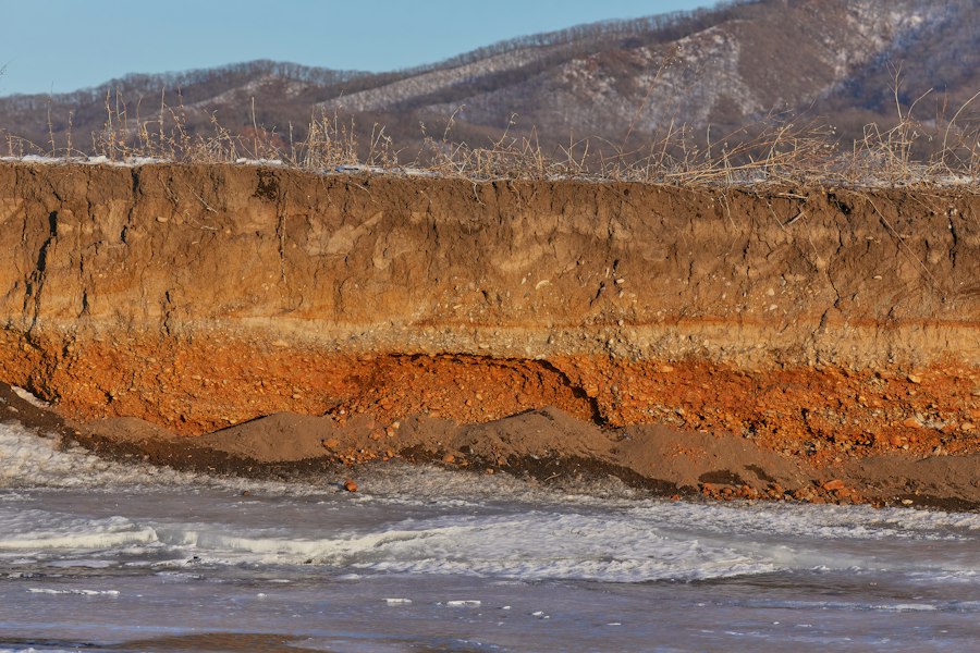
The cornerstone of surface geology is field mapping. Geologists venture into the landscape, armed with compasses, clinometers, hammers, and detailed topographical maps. They record the location, type, and orientation of rock outcrops. This meticulous process involves identifying distinct layers of sedimentary rock, known as strata. The study of these layers, called stratigraphy, is crucial for deciphering the geological history of a region. By analyzing the sequence of rock layers, geologists can infer the relative ages of rock units, the types of environments that existed in the past (e.g., marine, fluvial, desert), and the sequence of geological events that have shaped the land. Features like unconformities, which represent gaps in the geological record due to erosion or non-deposition, are particularly important clues.
Lithological and Mineralogical Analysis
Beyond mapping, geologists conduct detailed lithological and mineralogical analyses of the collected rock samples. Lithology refers to the physical characteristics of a rock, such as its color, texture, grain size, and composition. Mineralogy, on the other hand, focuses on the specific minerals that make up the rock. Through macroscopic observation and the use of hand lenses, geologists can identify common minerals. For more detailed analysis, samples are brought back to the laboratory for examination under microscopes, where thin sections of rock are studied to identify mineral assemblages, textures, and relationships between mineral grains. Techniques like X-ray diffraction (XRD) can precisely identify crystalline minerals, while chemical analysis using methods such as X-ray fluorescence (XRF) or inductively coupled plasma mass spectrometry (ICP-MS) provides information about the elemental composition of the rocks.
Paleontology and Fossil Evidence
For sedimentary rocks, the presence of fossils offers a powerful tool for understanding the past. Paleontology, the study of ancient life, uses fossils to date rock layers (biostratigraphy), reconstruct ancient environments, and trace the evolutionary history of life. The presence of specific fossil species can indicate a particular geological period, allowing for correlations between rock units in different locations. The types of fossils found can also reveal whether an area was once a shallow sea, a deep ocean, or a terrestrial environment, providing crucial context for understanding the depositional history of the crust.
Direct Sampling: Drilling and Coring
While surface observations are invaluable, they only provide a limited view of the crust. To probe deeper, scientists employ drilling techniques. Boreholes are drilled into the Earth’s crust, and the material extracted, known as a core sample, provides a direct physical sample of the subsurface. This is akin to taking a cylindrical biopsy of the Earth.
Rock Core Analysis
Rock core analysis is a highly detailed process. The recovered core is meticulously examined and logged by geologists. This involves identifying rock types, noting the presence of fractures, faults, and mineral veins, and observing any changes in rock properties with depth. Each section of the core is carefully photographed and documented. Laboratory analysis of core samples can include detailed petrographic studies, mineralogical identification, and geochemical analyses to determine the chemical composition and origin of the rocks.
Geotechnical Investigations
Drilling is also essential for geotechnical investigations, particularly in engineering geology and resource exploration. These investigations aim to understand the physical and mechanical properties of the rock and soil to assess its suitability for construction projects, mining operations, or for storing underground resources like carbon dioxide. Parameters such as rock strength, permeability, and density are measured.
Scientists study the Earth’s crust through various methods, including seismic surveys, drilling, and geophysical measurements, to understand its composition and behavior. One fascinating aspect of this research is its relevance to disaster preparedness and response, as highlighted in a related article discussing the U.S. government’s authority in declared disasters. This connection emphasizes the importance of geological studies in mitigating the impacts of natural disasters. For more information, you can read the article here: U.S. Government’s Authority in Declared Disasters.
Geophysical Methods: Peering Beneath the Surface
When direct sampling becomes impractical or impossible due to depth or logistical challenges, geophysical methods come into play. These techniques utilize physical principles to infer the properties of the Earth’s interior without physically disturbing it. They are non-invasive and can provide information about vast subsurface areas.
Seismic Surveys: The Earth’s Ultrasound
Seismic surveys are arguably the most powerful geophysical tool for imaging the Earth’s crust. They work by generating seismic waves – vibrations that travel through the Earth – and recording how these waves reflect and refract off different rock layers and geological structures.
Seismic Reflection
In seismic reflection surveys, a seismic source (such as air guns in marine environments or vibrator trucks on land) generates seismic waves that travel downwards. When these waves encounter a boundary between rock layers with different properties (like density or seismic velocity), a portion of the wave energy is reflected back towards the surface. An array of seismometers, or geophones, strategically placed on the surface or on the seabed, record these returning waves. By analyzing the travel times of these reflected waves, geoscientists can create detailed maps of subsurface geological structures, including faults, folds, and sedimentary layers. This technique is analogous to an ultrasound in medicine, providing cross-sectional images of the subsurface.
Seismic Refraction
Seismic refraction surveys utilize a different principle. Here, seismic waves are deliberately generated at an angle so that they travel down, refract (bend) at the boundary between layers with different seismic velocities, and then travel along the boundary before refracting back up to the surface. By measuring the arrival times of these refracted waves at different distances from the source, geoscientists can determine the seismic velocities of the subsurface layers. This information is crucial for understanding rock composition and the depth to different geological units, particularly for mapping the depth to bedrock.
Seismic Tomography
Seismic tomography takes seismic imaging a step further by using a dense network of seismic sources and receivers. By analyzing how seismic waves are delayed or arrive at different stations as they travel through the Earth, scientists can create 3D models of the Earth’s interior, revealing variations in seismic velocity that can indicate changes in temperature, rock type, or fluid content. This technique is particularly useful for studying large-scale structures like tectonic plates and mantle plumes.
Gravity and Magnetic Surveys: Detecting Density and Compositional Variations
Gravity and magnetic surveys measure subtle variations in the Earth’s gravitational and magnetic fields. These variations are influenced by the density and magnetic properties of the rocks beneath the surface.
Gravity Surveys
Gravity surveys measure the acceleration due to gravity at various points on the Earth’s surface. Denser rocks exert a stronger gravitational pull than less dense rocks. By mapping these subtle gravitational anomalies, geoscientists can infer the presence of subsurface structures like ore bodies (which are often denser than surrounding rock), salt domes (which are less dense), or basement uplifts. These surveys are valuable for regional-scale geological mapping and resource exploration.
Magnetic Surveys
Magnetic surveys measure the Earth’s magnetic field. Many rocks contain magnetic minerals, such as magnetite. The presence and concentration of these minerals influence the local magnetic field. Igneous rocks, in particular, often have strong magnetic signatures. Magnetic surveys can help identify different rock types, locate buried igneous intrusions, and map faults that may have displaced magnetic rock units. This technique is widely used in mineral exploration for identifying iron ore deposits and other magnetic minerals.
Electrical and Electromagnetic Methods: Probing Conductivity
Electrical and electromagnetic methods exploit the fact that different rocks and fluids have varying electrical conductivity and resistivity. These properties are influenced by factors such as mineralogy, pore fluid content, and temperature.
Electrical Resistivity Tomography (ERT)
In ERT, electrical currents are injected into the ground through electrodes, and the resulting voltage differences are measured at other electrodes. The apparent resistivity of the subsurface is then calculated. Areas with high resistivity might indicate dry, solid rock, while areas with low resistivity could be saturated with conductive fluids like groundwater or brine, or contain clay-rich layers. ERT is useful for mapping subsurface stratigraphy, identifying groundwater sources, and detecting contamination plumes.
Electromagnetic (EM) Methods
EM methods use electromagnetic fields to induce electrical currents in the subsurface. The response of these induced currents is then measured. Different EM techniques exist, such as ground-penetrating radar (GPR), which uses high-frequency radio waves to image shallow subsurface structures, and frequency-domain or time-domain EM, which are used for deeper investigations. EM methods are sensitive to variations in conductivity and can be used to map buried geological features, locate conductive ore bodies, and assess groundwater resources.
Remote Sensing and Satellite Imagery: A Global Perspective
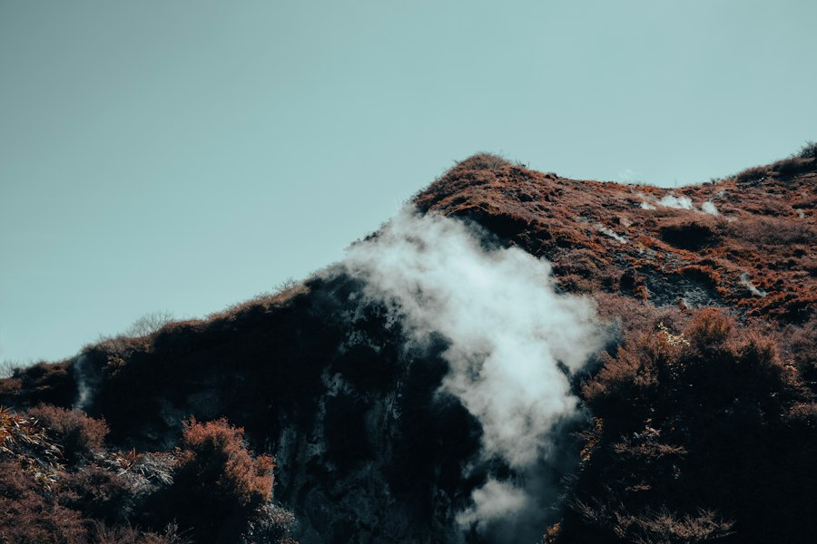
In the modern era, remote sensing technologies, particularly those deployed on satellites, offer a powerful means of studying the Earth’s crust from a distance, providing a broad overview and enabling the detection of subtle surface features that might be missed during ground-based surveys.
Optical and Infrared Imaging
Satellites equipped with optical and infrared sensors capture images of the Earth’s surface in various wavelengths of the electromagnetic spectrum. Different rock types and geological formations have distinct spectral signatures – how they reflect and absorb light at different wavelengths.
Multispectral and Hyperspectral Imaging
Multispectral imaging captures data in several broad wavelength bands, while hyperspectral imaging collects data in hundreds of narrow, contiguous bands. This detailed spectral information allows geoscientists to identify specific minerals and rock types based on their unique spectral absorption and reflection features. For example, certain minerals are strong absorbers of specific wavelengths in the infrared spectrum. This capability is invaluable for mapping large geological provinces, identifying areas of hydrothermal alteration, and searching for mineral deposits.
Thermal Infrared Imaging
Thermal infrared imaging measures the Earth’s surface temperature. Different rocks and soils have varying thermal properties, influencing how they heat up and cool down. Variations in surface temperature can sometimes be related to subsurface geological structures, such as faults or hydrothermal activity. For instance, areas with shallow geothermal activity might exhibit warmer surface temperatures.
Radar and Lidar: Revealing Surface Topography and Structure
Radar (Radio Detection and Ranging) and Lidar (Light Detection and Ranging) are active remote sensing techniques that use emitted energy to probe the surface.
Synthetic Aperture Radar (SAR)
SAR systems emit radar pulses towards the Earth and record the backscattered signal. SAR is particularly useful because it can penetrate clouds and operate day or night, making it effective in diverse weather conditions and geographic locations. Interferometric SAR (InSAR) is a powerful application of SAR that uses multiple radar images of the same area to measure very small changes in the Earth’s surface elevation. This is crucial for monitoring subtle ground deformation associated with earthquakes, volcanic activity, and tectonic plate movement.
Lidar Surveys
Lidar systems emit laser pulses and measure the time it takes for the pulses to return after reflecting off the surface. This allows for the creation of highly accurate digital elevation models (DEMs) of the Earth’s surface. Lidar is exceptionally effective at revealing fine-scale topographic features, such as subtle fault scarps, ancient river channels, and erosional remnants, which can provide critical clues about the underlying geology and tectonic history of an area. It can also penetrate dense vegetation, providing a clearer view of the ground surface.
Geochronology and Isotope Geochemistry: Unlocking Earth’s History
To understand the timing and evolution of Earth’s crust, geochronology and isotope geochemistry are indispensable tools. These techniques allow scientists to determine the absolute ages of rocks and trace the origin and movement of materials within the Earth.
Radiometric Dating: The Clockwork of Geology
Radiometric dating relies on the principle of radioactive decay. Certain unstable isotopes (radioactive parent isotopes) decay into stable isotopes (daughter isotopes) at a constant and predictable rate, known as the decay constant. By measuring the ratio of parent to daughter isotopes in a rock sample and knowing the decay rate, scientists can calculate the time elapsed since the mineral crystallized or the rock formed.
Uranium-Lead (U-Pb) Dating
U-Pb dating, particularly using zircons, is one of the most robust radiometric dating methods. Zircon is a common accessory mineral in many igneous and metamorphic rocks, and it strongly incorporates uranium while excluding lead. The decay of uranium isotopes (U-238 to Pb-206 and U-235 to Pb-207) provides very precise age determinations, often in the millions or billions of years. This method is crucial for dating ancient crustal rocks and understanding the timing of major geological events like mountain building.
Potassium-Argon (K-Ar) and Argon-Argon (Ar-Ar) Dating
K-Ar dating and its more refined version, Ar-Ar dating, are used to date rocks containing potassium-bearing minerals, such as micas and feldspars. These methods are particularly useful for dating volcanic rocks and metamorphic events. Ar-Ar dating involves heating the sample under vacuum to release argon isotopes, allowing for more precise age determinations and the identification of multiple thermal events within a single sample.
Radiocarbon Dating (¹⁴C)
While not applicable to most of Earth’s ancient crust, radiocarbon dating is vital for dating very young geological materials (up to about 50,000 years old) that contain organic carbon, such as sediments, fossils, and archaeological artifacts. It relies on the decay of carbon-14.
Isotope Geochemistry: Tracing Origins and Processes
Isotope geochemistry utilizes the variations in the abundance of different isotopes of elements to understand geological processes and the origins of rocks and materials.
Stable Isotopes
Stable isotopes, which do not undergo radioactive decay, also provide invaluable information. For example, the ratios of oxygen isotopes (¹⁸O/¹⁶O) in minerals can indicate the temperature and the source of water during rock formation or alteration. The ratios of carbon isotopes (¹³C/¹²C) can reveal the source of carbon in rocks, whether it is derived from organic matter, mantle degassing, or other sources. Analyzing sulfur isotopes (³⁴S/³²S) can help decipher the conditions under which sulfide minerals formed.
Radiogenic Isotopes and Trace Elements
Radiogenic isotopes, produced by the decay of long-lived radioactive isotopes, are particularly useful for tracing the source materials of magmas and understanding the evolution of the Earth’s mantle and crust. For instance, the ratios of isotopes like Neodymium (¹⁴³Nd/¹⁴⁴Nd) and Strontium (⁸⁷Sr/⁸⁶Sr) in igneous rocks can indicate whether the magma originated from the mantle, recycled crustal material, or a specific mantle reservoir. Trace element analysis, which measures the abundance of elements present in very small quantities, also provides clues about magma generation, fractional crystallization, and the processes that affect rocks during their geological history.
Scientists study the Earth’s crust through various innovative techniques, including seismic imaging and rock sampling, which help them understand geological processes and the composition of our planet. A related article discusses the influence of ancient elites on knowledge and power, shedding light on how historical perspectives can shape our understanding of natural resources. For more insights, you can read the article here.
Modeling and Numerical Simulations: Recreating Earth’s Processes
| Method | Description | Data Collected | Typical Depth Range | Applications |
|---|---|---|---|---|
| Seismic Reflection | Uses reflected seismic waves to map subsurface structures | Wave travel times, reflection amplitudes | 0-50 km | Mapping faults, sediment layers, crustal thickness |
| Seismic Refraction | Measures refracted seismic waves to determine layer velocities | Wave velocity, travel time | 0-70 km | Determining crustal composition and layering |
| Drilling (e.g., Continental Drilling Projects) | Direct sampling of crustal rocks by drilling boreholes | Rock samples, mineral composition, physical properties | Up to ~12 km | Studying rock properties, geothermal gradients |
| Magnetotellurics (MT) | Measures natural electromagnetic fields to image subsurface resistivity | Electrical resistivity, conductivity profiles | 0-100 km | Mapping fluid content, temperature variations |
| Gravity Surveys | Measures variations in Earth’s gravitational field to infer density variations | Gravity anomalies | Surface to crustal depths | Identifying density contrasts, crustal thickness |
| Geochemical Analysis | Analyzes chemical composition of rock samples | Elemental and isotopic data | Surface samples, drill cores | Understanding crust formation and evolution |
| Petrological Studies | Examines mineralogy and texture of rocks | Mineral content, rock fabric | Surface and subsurface samples | Interpreting geological history and processes |
Once data from observational, geophysical, and geochemical techniques are collected, sophisticated modeling and numerical simulations become essential for interpreting these data and understanding the complex processes that shape Earth’s crust.
Forward Modeling: Predicting Geophysical Signatures
Forward modeling involves using known geological models and physical properties to predict what geophysical measurements would be observed. For example, a geoscientist might create a 3D model of a subsurface salt dome and then use seismic modeling software to predict the seismic reflection profile that would result from such a structure. Comparing these predicted signatures with actual field data helps validate or refine the geological model.
Inverse Modeling: Inferring Subsurface Properties
Inverse modeling works in the opposite direction. It uses observed geophysical data and attempts to infer the most likely subsurface geological structure or properties that would produce those observations. This is a more complex process, often involving iterative adjustments to a model until the predicted data closely match the observed data. Inverse modeling is widely used in seismic tomography, gravity inversion, and electromagnetic inversion to create detailed images of the Earth’s interior.
Geodynamic Modeling: Simulating Tectonic Processes
Geodynamic modeling uses sophisticated computer programs to simulate the long-term behavior of the Earth’s interior, including plate tectonics, mantle convection, and the generation of magmas. These models incorporate physical laws and principles and are often constrained by observational data.
Plate Tectonic Models
These models simulate the movement of tectonic plates over millions of years, helping us understand the formation of mountain ranges, the opening and closing of ocean basins, and the distribution of earthquakes and volcanoes. They can explore the forces driving plate motion, such as mantle convection and slab pull.
Magma Generation and Evolution Models
These simulations explore the complex processes involved in the melting of rocks in the Earth’s mantle and crust, the ascent of magma, and its subsequent evolution through processes like fractional crystallization and assimilation. They help us understand the origin of different igneous rock types and the formation of magmatic ore deposits.
Basin Formation and Subsidence Models
These models investigate the processes that lead to the formation and subsidence of sedimentary basins, which are crucial for the accumulation of fossil fuels and the preservation of geological records. They consider factors like crustal thinning, sediment loading, and thermal subsidence.
In conclusion, uncovering the Earth’s crust is a multifaceted scientific endeavor that relies on a diverse and ever-evolving suite of study techniques. From the fundamental observations of surface geology and direct sampling to the sophisticated imaging capabilities of geophysics, the temporal insights of geochronology, and the predictive power of modeling, each method contributes a vital piece to the grand puzzle of our planet’s rocky shell. By integrating the information gleaned from these varied approaches, scientists continue to deepen our understanding of the Earth’s dynamic past, its present processes, and its potential future.
They Drilled 12 KM Into Earth — Then Everything Changed
FAQs
What is the Earth’s crust?
The Earth’s crust is the outermost layer of the Earth, ranging from 5 to 70 kilometers in thickness. It is composed of solid rock and is divided into several large tectonic plates.
How do scientists study the Earth’s crust?
Scientists study the Earth’s crust using various methods such as seismic imaging, gravity mapping, and satellite technology. These techniques help researchers understand the composition, structure, and movement of the Earth’s crust.
Why is it important to study the Earth’s crust?
Studying the Earth’s crust is crucial for understanding natural disasters like earthquakes and volcanic eruptions. It also helps in locating valuable resources such as minerals and fossil fuels, as well as in predicting geological hazards.
What are some tools used by scientists to study the Earth’s crust?
Scientists use tools like seismometers, ground-penetrating radar, GPS technology, and drones to study the Earth’s crust. These tools provide valuable data on the Earth’s subsurface and help in creating detailed geological maps.
What are some recent discoveries in the study of the Earth’s crust?
Recent discoveries in the study of the Earth’s crust include the identification of new tectonic plate boundaries, the mapping of deep-sea trenches, and the detection of previously unknown fault lines. These discoveries contribute to our understanding of the dynamic processes shaping the Earth’s crust.