Uncovering the Secrets Below: How Scientists Explore Underground
The Earth’s crust, a seemingly solid and familiar shell beneath our feet, is in reality a vast and intricate realm teeming with secrets. Beneath the surface lie complex geological formations, ancient fossil records, hidden water reserves, and vital mineral resources. For centuries, humanity has sought to understand these subterranean mysteries, driven by curiosity, the need for resources, and the desire to decipher Earth’s history. Today, scientists employ a sophisticated arsenal of techniques and technologies to peer into the depths, transforming the exploration of the underground from a daring gamble into a precise and invaluable scientific endeavor. This article delves into the diverse methods and remarkable discoveries that illuminate the hidden world beneath our feet.
Geologists are the primary investigators of the underground, tasked with understanding the composition, structure, and evolution of the Earth’s crust and mantle. Their work often begins on the surface, with meticulous observation and mapping of geological features. However, to truly understand the subsurface, they rely on a range of indirect and direct methods.
Surface Observations and Geophysical Surveys
The journey into understanding the underground often starts with what is visible on the surface. Geologists meticulously map rock outcrops, faults, folds, and other geological structures. These surface features provide crucial clues about the underlying geology, but they represent only a small window into the vastness below. To expand this window, geophysical methods become indispensable.
Seismic Exploration: Listening to the Earth’s Echoes
Perhaps the most powerful tool in the geophysicist’s arsenal is seismic exploration. This technique harnesses the power of seismic waves – vibrations that travel through the Earth’s interior. These waves can be generated naturally by earthquakes or artificially by sources such as dynamite charges or specialized vibrator trucks.
Creating and Detecting Seismic Waves
In artificial seismic surveys, controlled sources emit seismic waves into the ground. As these waves encounter different rock layers, they refract (bend) and reflect (bounce back) off boundaries between these layers. Sensitive instruments called geophones or seismometers, placed at strategic locations on the surface, detect these returning waves. The time it takes for the waves to travel to these detectors, and the characteristics of the returning signals, provide invaluable information about the subsurface.
Interpreting Seismic Data: A Sonic X-ray
The collected seismic data is then processed and analyzed by specialized software. By analyzing the travel times and amplitudes of the reflected and refracted waves, geoscientists can create detailed three-dimensional images of the subsurface. These images can reveal the presence of different rock types, the geometry of rock layers, the location of faults, and even the presence of underground fluids like water or hydrocarbons. Seismic surveys are crucial for oil and gas exploration, but also for understanding aquifer systems, identifying potential sites for geothermal energy, and mapping out the tectonic structure of regions.
Gravity and Magnetic Surveys: Unveiling Density and Magnetization
Beyond seismic waves, geologists also utilize variations in the Earth’s gravity and magnetic fields to infer subsurface structures.
Gravity Surveys: Sensing Density Differences
Gravity surveys measure tiny variations in the Earth’s gravitational pull. Denser rock formations exert a slightly stronger gravitational pull than less dense ones. By measuring these minute differences across an area, geoscientists can map out subsurface anomalies that correspond to variations in rock density. This can help identify salt domes, mineral deposits, or changes in the bedrock. Instruments called gravimeters are used to make these precise measurements.
Magnetic Surveys: Mapping Magnetic Signatures
Similarly, magnetic surveys measure variations in the Earth’s magnetic field. Certain rocks, particularly those containing iron-rich minerals, have their own magnetic signatures. Anomalies in the magnetic field can indicate the presence of magnetic ore bodies, such as iron ore, or provide insights into the geological history of an area, such as the orientation of ancient volcanic intrusions. Magnetometers are the instruments used for these measurements.
Direct Exploration: Drilling and Core Sampling
While geophysical methods provide indirect insights, direct exploration through drilling offers the most definitive understanding of the subsurface. This involves physically penetrating the Earth’s crust to retrieve samples and gather data.
Boreholes and Well Logging: Direct Access to Subsurface Information
Drilling boreholes, or wells, is a fundamental method for direct subsurface investigation. These holes can range from a few meters in depth for shallow geotechnical studies to several kilometers for deep resource exploration or scientific research.
Rock Coring: Bringing the Past to the Present
A key technique during drilling is rock coring. This involves using a specialized drill bit that extracts cylindrical samples of rock, known as cores, from the borehole. These cores are invaluable for geologists, as they provide a physical record of the rock layers encountered. Scientists can then examine the cores visually, study their mineral composition, analyze their physical properties, and even date them using radiometric techniques. This direct examination is crucial for understanding stratigraphy, identifying fossiliferous layers, and characterizing the physical properties of reservoir rocks.
Well Logging: Electronic Eyes in the Deep
Once a borehole is drilled, a suite of instruments, known as logging tools, is lowered into the hole. These tools perform various measurements of the surrounding rock formations and fluids. Electrical resistivity logs, for instance, measure how well the rocks conduct electricity, which can help distinguish between different rock types and the presence of fluids. Gamma ray logs measure natural radioactivity, which is useful for identifying shale layers. Sonic logs measure the travel time of sound waves through the rock, providing information about its porosity and density. These well logs provide continuous profiles of the subsurface, complementing the information obtained from rock cores.
Scientists utilize a variety of techniques to explore what lies beneath the Earth’s surface, including geophysical methods, drilling, and remote sensing. These methods allow them to gather data about underground structures without the need for extensive excavation. For instance, a recent article discusses how archaeologists uncovered a sealed chamber in an ancient city, shedding light on the advanced techniques used to reveal hidden historical sites. To learn more about this fascinating discovery, you can read the full article here: archaeologists uncover sealed chamber in ancient city.
The Secrets of the Deep: Studying Earth’s Interior
While much of our understanding of the underground focuses on the crust, scientists are also deeply interested in the Earth’s deeper layers: the mantle and the core. These regions are inaccessible through conventional drilling, necessitating more ingenious methods.
Seismic Tomography: Mapping the Mantle’s Structure
Seismic tomography is a powerful technique that uses seismic waves from earthquakes to create three-dimensional images of the Earth’s interior, analogous to a medical CT scan.
Using Earthquake Waves as Probes
When earthquakes occur, they generate seismic waves that travel throughout the planet. By analyzing the arrival times and paths of these waves at seismograph stations located all over the world, scientists can infer variations in the temperature and composition of the mantle. Denser, colder regions of the mantle will slow down seismic waves, while hotter, less dense regions will speed them up.
Unveiling Mantle Plumes and Subduction Zones
Seismic tomography has revealed spectacular features within the mantle, such as vast mantle plumes – columns of hot rock rising from the deep mantle – which are thought to be responsible for volcanic hotspots like Hawaii. It has also provided detailed images of subduction zones, where one tectonic plate is forced beneath another, offering insights into the dynamics of plate tectonics.
High-Pressure and High-Temperature Experiments: Simulating Deep Earth Conditions
To understand the behavior of rocks and minerals under the extreme conditions of the Earth’s interior, scientists conduct laboratory experiments that replicate these environments.
Diamond Anvil Cells: Squeezing Rocks to Insanity
Diamond anvil cells are remarkable devices that can generate immense pressures, equivalent to millions of times atmospheric pressure, by squeezing tiny samples of minerals between two brilliant-cut diamonds. Coupled with lasers to heat the samples to thousands of degrees Celsius, these cells allow researchers to study how minerals transform and behave under deep Earth conditions. This research is crucial for understanding the composition of the mantle and core, and the processes that drive plate tectonics.
Large Volume Presses: Scaling Up the Experiment
For larger sample volumes and lower, but still extreme, pressures and temperatures, large volume presses are employed. These machines can compress samples in a controlled manner, allowing for the study of phase transitions and chemical reactions that occur deep within the Earth.
Unearthing Life’s Origins: Subsurface Paleontology and Microbiology
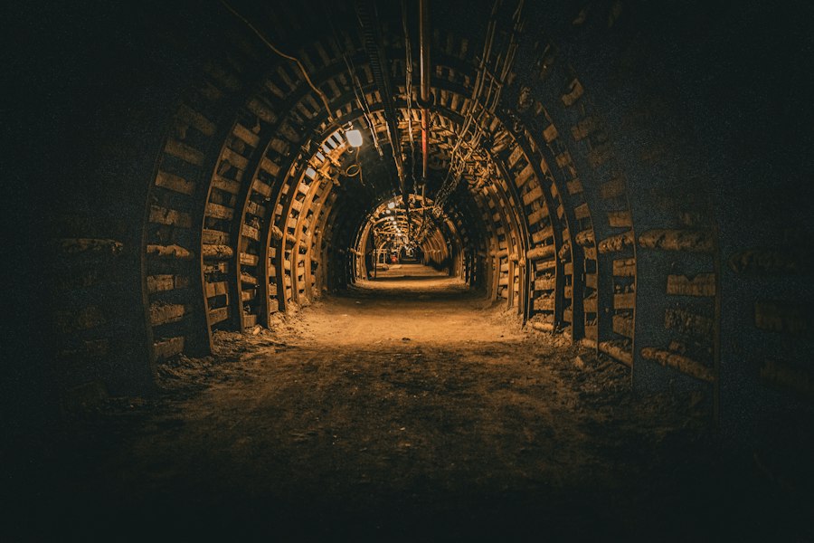
The underground is not just a realm of rocks and minerals; it is also a repository of life, both past and present. Paleontologists and microbiologists explore these hidden environments to understand the evolution of life and to discover novel organisms.
Fossil Discoveries: Windows into Ancient Worlds
Beneath the surface lie vast archives of fossilized life, offering invaluable clues about the history of evolution and the ancient environments of our planet.
Sedimentary Rocks: Nature’s Time Capsules
Fossils are primarily found in sedimentary rocks, which are formed from the accumulation and cementation of sediments like sand, mud, and clay. Over geological time, these layers of sediment can bury organisms, preserving their remains as fossils.
Paleontological Excavations: Delicate Extraction
The process of excavating fossils from the ground is often a meticulous and patient undertaking. Paleontologists carefully brush away surrounding rock, using specialized tools to avoid damaging delicate fossilized structures. Sometimes, entire fossilized skeletons or plants are encased in plaster jackets to protect them during transport back to laboratories for further study.
Fossil Analysis: Reconstructing Past Ecosystems
Once in the lab, fossils are cleaned, studied, and cataloged. Detailed analysis of the morphology, anatomy, and context of fossil discoveries allows scientists to reconstruct ancient ecosystems, understand evolutionary relationships between species, and interpret past environmental conditions. This has led to groundbreaking discoveries about the origins of humans, the evolution of dinosaurs, and the development of plant life.
Deep Biosphere: Life in Extreme Environments
Beyond the fossil record, scientists are discovering that life exists in astonishingly diverse and extreme environments deep within the Earth’s crust, a realm known as the deep biosphere.
Subsurface Microorganisms: The Unseen Majority
Hidden beneath kilometers of rock, microscopic life forms, primarily bacteria and archaea, thrive in the absence of sunlight and in conditions of high pressure and temperature. These “extremophiles” have unique adaptations that allow them to survive and metabolize in these challenging environments.
Sampling the Deep Biosphere: Specialized Techniques
Obtaining samples from the deep biosphere requires specialized drilling and sampling techniques to prevent contamination from surface microbes. Scientists use sterile equipment and carefully designed procedures to collect pristine samples from deep rock formations.
Studying Microbial Metabolism: Energy from the Earth
Research into the deep biosphere is revealing novel metabolic pathways. These microorganisms often derive energy from chemical reactions involving inorganic compounds, such as hydrogen, methane, or sulfur, rather than photosynthesis. Understanding these unique life forms could have significant implications for astrobiology, the search for life beyond Earth, and for potential biotechnological applications.
Water Beneath Our Feet: Hydrogeology and Groundwater Exploration
Water is a fundamental resource for life, and a significant portion of the Earth’s freshwater is stored underground in aquifers. Hydrogeologists are the scientists who study these subterranean water systems.
Aquifer Mapping and Characterization
Identifying and understanding the properties of aquifers is crucial for managing water resources and ensuring sustainable supply.
Geophysical Methods for Water Detection
Geophysical techniques, such as electrical resistivity and ground-penetrating radar (GPR), can be used to detect the presence of water in the subsurface. Water typically has higher electrical conductivity and reflects GPR signals differently than dry rock.
Borehole Data and Pumping Tests: Assessing Water Flow
Direct measurements from boreholes are essential for characterizing aquifers. Scientists measure water levels, water quality, and perform pumping tests to determine the aquifer’s ability to yield water and its transmissivity (how easily water flows through it).
Groundwater Contamination and Remediation
Understanding how pollutants can enter and move through groundwater systems is vital for protecting this precious resource.
Tracing Contaminant Plumes
Hydrogeologists use tracer studies, injecting safe chemical substances into the ground, to track the movement of groundwater and potential contaminants. This helps in identifying the source and extent of pollution.
Developing Remediation Strategies
Once contamination is identified, hydrogeologists work on developing remediation strategies to clean up polluted groundwater. These can involve various techniques, such as pump-and-treat systems, in-situ chemical treatment, or bioremediation.
Scientists employ various techniques to explore what lies beneath the Earth’s surface, including seismic surveys, ground-penetrating radar, and magnetic resonance imaging. These methods allow researchers to create detailed maps of underground structures and materials. For instance, a fascinating article discusses the properties of Egyptian blue pigment, which has intrigued scientists for its unique composition and historical significance. You can read more about this topic in the article here. Understanding such materials not only sheds light on ancient practices but also enhances our knowledge of geological formations.
Resources from the Depths: Mining and Geothermal Energy
| Method | Description | Data/Metrics Collected | Typical Use |
|---|---|---|---|
| Seismic Surveys | Use of controlled seismic waves to map underground structures | Wave travel time, wave velocity, reflection and refraction patterns | Locating oil, gas, and mineral deposits; mapping geological layers |
| Ground Penetrating Radar (GPR) | Radar pulses sent into the ground to detect buried objects and changes in material | Radar wave reflections, depth estimates, material boundaries | Archaeology, utility detection, soil studies |
| Magnetometry | Measures variations in the Earth’s magnetic field caused by underground features | Magnetic field intensity and anomalies | Locating ferrous objects, archaeological sites, and geological structures |
| Electrical Resistivity Tomography (ERT) | Measures electrical resistance of subsurface materials to map underground features | Resistivity values, depth profiles | Groundwater studies, contamination mapping, geological investigations |
| Borehole Drilling and Sampling | Direct extraction of soil and rock samples from underground | Physical samples, core logs, chemical composition, stratigraphy | Detailed geological and geotechnical analysis |
| Gravity Surveys | Measures variations in gravitational field caused by density differences underground | Gravity anomalies, density contrasts | Locating mineral deposits, voids, and geological structures |
The underground is a treasure trove of resources that fuel our modern society, from metals and minerals to the heat of the Earth itself.
Mineral Exploration and Extraction
The search for valuable minerals and metals has driven much of the human exploration of the underground.
Geological Mapping and Prospecting
Exploration begins with geological mapping to identify areas with the potential for mineral deposits. This involves studying rock types, structural features, and the presence of indicator minerals. Geochemists then analyze rock and soil samples for elevated concentrations of target elements.
Geophysical Surveys for Ore Bodies
Geophysical methods play a significant role in pinpointing buried ore bodies. Magnetic surveys can detect iron ore deposits, while induced polarization surveys can identify disseminated sulfide minerals. Gravity surveys can help locate dense mineral deposits.
Drilling and Assaying: Confirming Mineral Value
Once a promising area is identified, exploratory drilling is conducted to obtain rock samples, known as “cores.” These cores are then sent to laboratories for assaying, which determines the concentration of valuable minerals. If the assays are favorable, further drilling is undertaken to define the size, shape, and grade of the deposit.
Geothermal Energy: Harnessing Earth’s Internal Heat
Geothermal energy utilizes the heat generated within the Earth for electricity generation and direct heating.
Identifying Geothermal Prospects
Geothermal reservoirs are typically found in areas with volcanic activity or thin crust, where hot rock is closer to the surface. Geologists study surface manifestations like hot springs and geysers, and employ geophysical methods like seismic surveys and heat flow measurements to identify potential sites.
Drilling for Geothermal Fluids
Once a promising site is identified, deep wells are drilled to access geothermal fluids, which are hot water or steam. These fluids are then brought to the surface to drive turbines and generate electricity.
Sustainable Geothermal Development
Sustainable geothermal development involves careful management of the reservoir to ensure long-term productivity and minimize environmental impact. This includes reinjecting cooled water back into the reservoir and monitoring seismic activity.
In conclusion, the exploration of the underground is a multidisciplinary and ever-evolving field. From the seismic whispers of the mantle to the microscopic life thriving in deep rock, scientists continue to uncover the profound secrets hidden beneath our feet. These discoveries not only expand our knowledge of our planet’s past and present but also hold the key to future resources and a deeper understanding of life itself. The ongoing quest to understand what lies beneath propels innovation and ignites our innate human curiosity about the vast, unseen world that shapes our existence.
They Drilled 12 KM Into Earth — Then Everything Changed
FAQs
1. How do scientists determine what is underground?
Scientists use various methods such as seismic imaging, ground-penetrating radar, borehole logging, and gravity surveys to study the composition and structure of the Earth’s subsurface.
2. What is seismic imaging and how does it help scientists understand what is underground?
Seismic imaging involves sending sound waves into the ground and measuring the reflections to create a detailed image of the subsurface layers. This method helps scientists identify different rock types, faults, and other geological features underground.
3. How does ground-penetrating radar work in determining what is underground?
Ground-penetrating radar uses electromagnetic waves to penetrate the ground and detect changes in subsurface materials. By analyzing the reflected signals, scientists can map out underground structures like buried objects, bedrock, and soil layers.
4. What is borehole logging and how does it contribute to understanding what is underground?
Borehole logging involves lowering instruments into a drilled hole to measure properties such as rock density, porosity, and electrical conductivity. This data helps scientists characterize the subsurface geology and identify potential resources like oil, gas, or water.
5. How do gravity surveys assist scientists in determining what is underground?
Gravity surveys measure variations in the Earth’s gravitational field caused by differences in rock density underground. By analyzing these gravity anomalies, scientists can infer the presence of subsurface structures like faults, mineral deposits, or magma chambers.