
The Soviet Union, a titan of the Cold War, channeled vast resources and intellectual prowess into understanding the very ground beneath its feet. Beyond the overt military and space race rivalries, a silent, subterranean competition unfolded as Soviet geologists pushed the boundaries of scientific knowledge, driven by a unique blend of ideological ambition, resource acquisition, and a deep-seated curiosity about the Earth’s inner workings. These experiments, often conducted in challenging environments and with a characteristic Soviet rigor, left an indelible mark on the field of geology, revealing secrets of the planet and contributing significantly to global scientific understanding, even if some of their motivations were rooted in the geopolitical climate of the era.
The Soviet approach to geology was inextricably linked to the Marxist-Leninist ideology that underpinned the nation. The vastness of the Soviet Union, with its immense mineral wealth, demanded a systematic and scientific approach to resource exploration and exploitation. Geology was not merely an academic pursuit; it was a vital instrument for national development, economic self-sufficiency, and ultimately, the projection of Soviet power.
Resource Nationalism and the Quest for Strategic Minerals
A primary driver for Soviet geological endeavors was the imperative to identify, map, and extract the country’s abundant natural resources. The Soviet Union possessed vast territories, many of which were remote and poorly understood. Geological expeditions were dispatched to these frontiers with the specific goal of locating deposits of oil, gas, coal, precious metals, and crucial industrial minerals. This pursuit was not solely for domestic consumption; it was also about ensuring the Soviet bloc’s independence from Western supply chains and, where possible, leveraging these resources for geopolitical advantage. The discovery and control of vital minerals were seen as a fundamental component of national security and economic resilience.
The Siberian Frontier: A Geological Treasure Trove
Siberia, a colossal expanse of land often synonymous with harsh conditions, was a focal point of Soviet geological exploration. Its vast, largely untouched terrain held immense promise for mineral wealth. Specialized geological institutes were established, and daring expeditions, often involving arduous journeys by foot, truck, and even helicopter, traversed its immense plains and rugged mountains. The goal was to create detailed geological maps that would guide future extraction efforts. These efforts were crucial in unlocking the vast oil and gas reserves that would later become a significant economic engine for Russia.
The Urals: A Geological Heritage and a Modern Focus
The Ural Mountains, historically known for their mineral riches, continued to be a significant area of study. While much of their easily accessible wealth had been exploited in pre-Soviet times, ongoing research aimed to understand their complex geological history and identify deeper, more challenging deposits. Soviet geologists applied new techniques to re-examine these familiar landscapes, seeking to optimize extraction and discover previously overlooked resources.
The Earth Sciences as a Vehicle for Scientific Advancement
Beyond the immediate needs of resource extraction, Soviet geologists were also engaged in fundamental scientific research. Driven by a belief in the power of science and a desire to contribute to global knowledge, they undertook ambitious projects that sought to unravel the Earth’s complex systems. This pursuit of knowledge was often intertwined with the state’s objectives, but it also fostered genuine scientific inquiry.
The Concept of Deep Geology and its Soviet Interpretation
The concept of “deep geology,” the study of the Earth’s crust and mantle, gained significant traction within Soviet scientific circles. This was not merely an academic interest; it was believed that understanding the deep processes of the Earth could unlock new resources and provide insights into geological phenomena like earthquakes and volcanic activity. The Soviet Union invested heavily in deep drilling projects, aiming to penetrate to unprecedented depths and sample the Earth’s interior.
Understanding Plate Tectonics: A Soviet Perspective
While the global scientific community was grappling with the revolutionary ideas of plate tectonics, Soviet geologists were also contributing to this developing field. Their extensive fieldwork in diverse geological settings, coupled with their advanced theoretical work, provided unique perspectives and data that informed the broader understanding of continental drift and seafloor spreading.
During the Cold War, Soviet geology experiments played a crucial role in understanding the Earth’s resources and enhancing military capabilities. These experiments not only focused on mineral extraction but also involved extensive research into seismic activity and geological formations. For a deeper insight into the implications of government actions on private property, including the potential for seizure related to such scientific endeavors, you can read a related article at this link.
The Great Depths: Pioneering Deep Drilling Experiments
The Soviet Union’s commitment to understanding the Earth’s interior led to some of the most ambitious deep drilling projects ever undertaken. These endeavors were not just about reaching significant depths; they were about gathering unprecedented samples and data from layers of the Earth that had previously been inaccessible, pushing the limits of drilling technology and engineering.
The Kola Superdeep Borehole: A Monument to Scientific Ambition
Perhaps the most iconic of these projects was the Kola Superdeep Borehole, located on the Kola Peninsula in northwestern Russia. This monumental undertaking, which began in 1970 and continued for over two decades, aimed to drill as deep as possible into the Earth’s crust. The primary scientific objective was to study the continental crust and the Mohorovičić discontinuity (the Moho), the boundary between the Earth’s crust and mantle.
Technical Challenges and Innovations
Drilling to such extreme depths presented immense technical hurdles. The temperatures and pressures encountered were extraordinary, pushing equipment and materials to their absolute limits. Soviet engineers and geologists developed innovative solutions, including specialized drill bits, advanced mud circulation systems, and novel methods for casing the borehole. The project required a sustained commitment of resources and a remarkable level of perseverance.
Scientific Discoveries and Surprises from the Depths
The data and samples retrieved from the Kola Superdeep Borehole yielded a wealth of scientific discoveries. Geologists were surprised to find evidence of ancient microbial life at depths previously thought to be sterile. The composition of the rocks and fluids encountered challenged existing models of the Earth’s crust and provided crucial information about its formation and evolution. The project provided direct evidence for the composition of the upper mantle, offering insights into seismic wave propagation and the thermal regime of the Earth’s interior.
Other Deep Drilling Projects: Expanding the Scope
While the Kola Superdeep Borehole often garners the most attention, the Soviet Union undertook other significant deep drilling projects across its vast territory. These projects, though perhaps less famous, contributed to a broader understanding of the Earth’s crustal structure and composition.
The Ukhta Borehole: Investigating Hydrocarbon Potential
In the oil-rich region of Ukhta, deep drilling projects were initiated to explore the deeper hydrocarbon reserves. These efforts were critical for sustaining the Soviet Union’s energy production and ensuring its energy security. The geological formations in this region offered a unique opportunity to study the processes of oil and gas formation and accumulation at significant depths.
The Sakhalin Borehole: Unveiling Offshore Resources
Off the coast of Sakhalin Island, in the Russian Far East, deep drilling was employed to explore offshore oil and gas fields. This involved specialized offshore drilling rigs and techniques, showcasing the Soviet Union’s capabilities in complex marine environments. The discoveries made in these areas were vital for the Soviet economy and continue to be important for Russia’s energy sector today.
Beneath the Ice and Tundra: Arctic and Antarctic Geological Expeditions

The Soviet Union’s geographical position and its commitment to scientific exploration led to extensive geological research in the polar regions. The unique geological conditions of the Arctic and Antarctic offered unparalleled opportunities to study pristine geological records and understand the processes shaping these extreme environments.
Arctic Exploration: Unlocking Subsurface Secrets
The Arctic, with its vast frozen landscapes and strategic importance, was a major focus of Soviet geological activity. Expeditions traversed the immense expanses of Siberia and the Arctic islands, seeking to map mineral resources, understand permafrost dynamics, and study the underlying geological structures.
Permafrost Studies and their Global Implications
Understanding permafrost, the perennially frozen ground, was a critical area of Soviet research. This was vital for construction, infrastructure development, and resource extraction in the Arctic. Their meticulous studies of permafrost’s thermal regime, composition, and behavior provided invaluable data for predicting its response to climate change, a contribution that remains highly relevant today.
Geological Mapping of Arctic Shelves
The Soviet Union invested heavily in exploring the geological potential of its Arctic continental shelves. This involved extensive geophysical surveys and the deployment of specialized research vessels. The aim was to identify hydrocarbon reserves and other mineral resources hidden beneath the shallow Arctic seas.
Antarctic Research: A Continent of Scientific Discovery
The Soviet Union was a prominent player in Antarctic exploration and research, establishing numerous research stations and conducting extensive geological surveys. Antarctica, with its pristine ice sheets and exposed rock formations, offered a unique window into Earth’s past.
Ice Core Analysis and Paleoclimatology
Soviet scientists were at the forefront of ice core drilling and analysis in Antarctica. These ice cores act as invaluable archives of past climate and atmospheric conditions, providing data on temperature, atmospheric composition, and even volcanic activity stretching back hundreds of thousands of years. This research was crucial for understanding long-term climate trends and the impact of greenhouse gases.
Geochronology and the History of the Southern Continent
Geological expeditions in Antarctica focused on dating rock formations and understanding the continent’s tectonic history. This involved collecting samples and employing radiometric dating techniques to reconstruct the geological past of Antarctica, revealing its connections to other southern continents during the age of Gondwana.
The Earth’s Interior: Seismology and the Study of Earthquakes
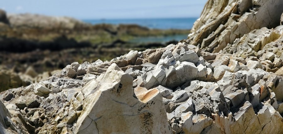
The Soviet Union placed a strong emphasis on seismology, the study of earthquakes and seismic waves. This was driven by a desire to understand the fundamental processes of plate tectonics, to develop better earthquake prediction methods, and to protect its population from seismic hazards.
Establishing a Global Seismic Network
The Soviet Union developed an extensive network of seismic stations across its territory and supported the establishment of similar networks in allied countries. This comprehensive network allowed for the precise recording and analysis of seismic activity worldwide, contributing significantly to the global understanding of seismic events.
The Study of Seismic Wave Propagation
Soviet seismologists were pioneers in studying how seismic waves travel through the Earth’s interior. By analyzing the travel times and characteristics of these waves, they were able to infer the structure and composition of the Earth’s mantle and core, providing crucial data for geophysical models.
Early Warning Systems and Disaster Preparedness
While the concept of precise earthquake prediction remained elusive, Soviet researchers made significant strides in developing early warning systems and improving disaster preparedness. Their understanding of seismic patterns and fault line behavior informed building codes and evacuation strategies in seismically active regions.
Deep Earth Structure and the Earth’s Core
The study of earthquakes also provided vital clues about the Earth’s deep interior, including the transition zone between the mantle and the outer core, and the nature of the inner core itself. Soviet seismological data played a crucial role in refining models of the Earth’s layered structure.
Investigating Mantle Convection
Seismic tomography, a technique that uses seismic waves to create three-dimensional images of the Earth’s interior, was further developed by Soviet scientists. This allowed for the visualization of mantle convection currents, the slow churning of rock that drives plate tectonics and influences volcanic activity.
The Mysteries of the Earth’s Core
The Earth’s core, a region of extreme temperature and pressure, remained a subject of intense scientific fascination. Soviet seismological research contributed to understanding the density, composition, and state of matter within the core, including the generation of the Earth’s magnetic field.
During the Cold War, Soviet geology experiments played a crucial role in understanding the Earth’s resources and enhancing military capabilities. These experiments not only focused on mineral exploration but also on the geological mapping of various regions, which had significant implications for both economic and strategic purposes. For a deeper insight into how such geological studies can impact various sectors, you can read more about it in this related article on the effects of regulatory changes on deposits. Check it out here.
Beyond the Iron Curtain: Soviet Contributions to Global Geology
| Experiment Name | Year Conducted | Location | Objective | Methodology | Key Findings |
|---|---|---|---|---|---|
| Project K | 1965-1971 | Semipalatinsk Test Site, Kazakhstan | Seismic detection of underground nuclear tests | Underground nuclear explosions to study seismic wave propagation | Established seismic signatures of nuclear blasts, aiding test ban treaty monitoring |
| Deep Drilling Experiment | 1970-1984 | Kola Peninsula, Russia | Study Earth’s crust composition and structure | Drilling to a depth of 12,262 meters | Discovered unexpected rock formations and temperature gradients in deep crust |
| Geophysical Survey of Kamchatka | 1958-1963 | Kamchatka Peninsula, Russia | Mapping volcanic and seismic activity | Seismic and magnetic field measurements | Improved understanding of volcanic activity and tectonic movements |
| Artificial Seismic Source Tests | 1975-1980 | Ural Mountains, Russia | Develop seismic detection techniques for military applications | Controlled explosions and seismic wave monitoring | Enhanced seismic detection sensitivity and discrimination of natural vs artificial events |
Despite the geopolitical divisions of the Cold War, Soviet geological research often found its way into the global scientific discourse. Through publications, international conferences, and collaborations where possible, Soviet geologists shared their findings, enriching the collective understanding of our planet.
Publications and Scientific Exchange
Soviet scientific journals, though sometimes challenging for Western researchers to access, contained a wealth of geological data and theoretical advancements. Key findings often trickled into international journals through translated abstracts or collaborative publications, ensuring that the broader scientific community could benefit from Soviet research.
International Conferences and Symposia
Soviet geologists participated in international geological congresses and specialized symposia, presenting their research and engaging with colleagues from around the world. These exchanges, even amidst political tensions, fostered a degree of scientific camaraderie and facilitated the dissemination of knowledge.
The Legacy of Soviet Geological Research
The legacy of Soviet geological experiments during the Cold War is multifaceted. They not only provided a deeper understanding of the Earth’s resources and processes but also demonstrated the remarkable ingenuity and perseverance of Soviet scientists. Their contributions continue to inform geological research today, serving as a testament to the enduring power of scientific inquiry, even in the most challenging of geopolitical landscapes. The ambition and scale of their endeavors, particularly in deep drilling and polar exploration, stand as a significant chapter in the history of Earth science.
They Drilled 12 KM Into Earth — Then Everything Changed
FAQs
What were the Soviet geology experiments during the Cold War?
During the Cold War, the Soviet Union conducted various geology experiments to explore and exploit natural resources within its territory and gain a strategic advantage over the United States.
What were the main goals of the Soviet geology experiments?
The main goals of the Soviet geology experiments were to identify and extract valuable minerals, oil, and gas reserves, as well as to assess the geological stability of potential nuclear test sites.
How did the Soviet geology experiments impact the Cold War?
The Soviet geology experiments played a significant role in the Cold War by providing the Soviet Union with valuable resources for industrial and military purposes, strengthening its economy and military capabilities.
What methods were used in the Soviet geology experiments?
The Soviet geology experiments utilized a variety of methods, including seismic surveys, drilling, geological mapping, and remote sensing technologies to study the Earth’s crust and identify potential resource-rich areas.
Were there any environmental consequences of the Soviet geology experiments?
Yes, there were environmental consequences of the Soviet geology experiments, including habitat destruction, pollution from mining activities, and disruption of ecosystems in the areas where the experiments were conducted.