The Challenge of Authenticity
The Nazca Lines, etched into the arid plains of southern Peru, represent one of archaeology’s most enduring enigmas. These colossal geoglyphs, depicting a menagerie of animals, geometric shapes, and anthropomorphic figures, have captivated imaginations for decades. Their sheer scale, precision, and age – dating back over 1,500 years to the Nazca culture (c. 100 BCE – 800 CE) – raise fundamental questions about their creation, purpose, and, crucially, their authenticity. While widespread acceptance attributes these remarkable artworks to the ancient Nazca people, the possibility of later interventions, natural degradation, or even deliberate misinterpretations necessitates a rigorous process of field verification. The challenge lies not just in deciphering the ancient intent behind these vast designs, but in confirming that what we see today is indeed a faithful reflection of that original creation, unmarred by subsequent human activity or the relentless march of time.
The Foundation of Authenticity: Archaeological Context and Initial Discoveries
The initial discovery and subsequent early investigations of the Nazca Lines laid the groundwork for understanding their existence and potential age. Maria Reiche, a German mathematician and archaeologist, dedicated much of her life to studying and preserving these geoglyphs. Her meticulous mapping and measurements, beginning in the 1940s, brought the Nazca Lines to global prominence. Reiche’s work, while groundbreaking, was largely based on visual observation and interpretation. She systematically documented the figures, noting their connections to astronomical alignments, and firmly attributed them to the Nazca culture based on pottery shards and other artifacts found in the vicinity. This foundational research, however, predated many of the sophisticated scientific dating and analytical techniques available today. The early acceptance of the Nazca Lines as ancient Nazca creations was built upon a combination of observation, inference, and a general lack of evidence to the contrary. The sheer scale and apparent antiquity of the geoglyphs made the idea of them being a modern hoax or significant later alteration highly improbable to most researchers. Nevertheless, the absence of definitive, direct dating of the lines themselves, beyond their association with Nazca pottery, left a theoretical space for questioning.
Navigating Skepticism: Addressing Persistent Questions and Theories
Despite the strong scholarly consensus, persistent skepticism and alternative theories regarding the authenticity of the Nazca Lines have always lingered. These range from proposals of post-Nazca origins to more outlandish claims involving extraterrestrial intervention. The sheer improbability of ancient peoples possessing the knowledge and technology to create such precise and massive designs on a scale visible only from great heights has fueled speculation. Theories suggesting the lines were created by later cultures, or even that they have been significantly altered or embellished over time, necessitate a direct confrontational approach through field verification. Understanding these skeptical viewpoints is crucial for designing a robust verification process that can systematically address and refute unsubstantiated claims, while also acknowledging any potential complexities. The absence of a clear, universally agreed-upon purpose for the lines also contributes to the aura of mystery, allowing room for doubt about their original intent and execution.
The verification process of the Nazca geoglyph field has garnered significant attention in recent years, particularly as researchers employ advanced technologies to enhance their understanding of these ancient designs. A related article that explores the advancements in technology for space domain awareness, which can be paralleled to the methods used in geoglyph verification, can be found at this link. This article discusses how innovative approaches in technology can aid in the analysis and preservation of historical sites, much like the techniques being utilized to study the Nazca lines.
The Pillars of Verification: Scientific Methodologies in the Field
The process of authenticating the Nazca Geoglyphs relies on the application of rigorous scientific methodologies directly within the field. This involves a multidisciplinary approach, integrating various techniques to gather empirical evidence that can either support or challenge existing hypotheses. The goal is to move beyond speculative interpretations and establish a verifiable historical record. This requires careful planning, meticulous execution, and objective analysis of the data collected. The verification process is not a single event but an ongoing endeavor, evolving with technological advancements and new archaeological discoveries.
Unearthing the Past: Excavation and Stratigraphic Analysis
Direct excavation provides invaluable insights into the original construction of the Nazca Lines. While the lines themselves are surface features, the surrounding areas and any associated structures can reveal crucial chronological information. Excavations aim to uncover artifacts, tools, and architectural remnants that can be directly linked to the period of geoglyph creation. Stratigraphic analysis, the study of rock and soil layers, is paramount. By examining the layers of earth and debris, archaeologists can determine the sequence of events, distinguishing between original construction materials, later disturbances, and natural sedimentation.
Identifying Original Materials and Construction Techniques
The identification of the original materials used to create the Nazca Lines is a cornerstone of verification. The Nazca people achieved their designs by removing the reddish-brown desert varnish from the surface rocks, exposing the lighter-colored soil beneath. Fieldwork focuses on meticulously analyzing these exposed surfaces. This includes identifying the depth of the removed material, the type of soil exposed, and any residual evidence of tools or techniques used for their removal. Examining the edges of the lines can reveal whether they are sharp and distinct, indicative of original craftsmanship, or if they show signs of erosion or subsequent modification. The consistency of the exposed soil across different parts of a geoglyph can also be indicative of a unified creation process. Furthermore, the study of the excavated soil itself can yield microscopic evidence of human activity, such as charcoal fragments for dating or traces of organic materials that might have been used in the construction process.
The Significance of Associated Artifacts and Features
The discovery of artifacts in direct association with the geoglyphs provides crucial contextual evidence for their age and attribution to the Nazca culture. Pottery shards, tools, and any structural remnants found within or immediately adjacent to the lines are meticulously cataloged and analyzed. If these artifacts are unequivocally of Nazca origin and found in a context that suggests they were deposited during the time of the geoglyphs’ creation, their presence strengthens the authenticity claim. Conversely, the discovery of artifacts from significantly later periods within the geoglyph lines themselves would raise serious questions about their original construction and integrity. Such finds would necessitate further investigation to determine whether they represent later intrusions, a different cultural period of use, or even deliberate alteration.
Dating the Deserts: Scientific Chronological Techniques
Beyond the visual evidence, scientific dating techniques are indispensable for establishing the temporal framework of the Nazca Lines. These methods provide objective measurements of age, moving beyond inferences based on associated artifacts alone. The accuracy and reliability of these techniques are crucial for confirming the Nazca origins of the geoglyphs.
Radiocarbon Dating and its Applications
Radiocarbon dating, specifically the analysis of carbon-14 isotopes in organic materials, is a primary tool for dating ancient contexts. In the case of the Nazca Lines, radiocarbon dating can be applied to organic materials found within the soil layers disturbed during the geoglyphs’ creation. This might include charcoal fragments from ancient fires, plant remains, or even human or animal bones found in situ. The presence of such materials in undisturbed layers beneath or within the lines can provide a direct age estimate for the construction event. Careful sampling techniques are essential to ensure that only materials directly related to the geoglyph creation are dated, avoiding contamination from later sources. The consistency of radiocarbon dates obtained from multiple samples across different geoglyphs provides robust evidence for a common period of origin.
Luminescence Dating for Soil and Sediment Analysis
Luminescence dating techniques, such as optically stimulated luminescence (OSL) and thermoluminescence (TL), offer complementary dating methods for sediments. These techniques date the last time mineral grains were exposed to sunlight or heat. In the context of the Nazca Lines, luminescence dating can be applied to the soils that were excavated to create the lines, as well as to any overlying or underlying undisturbed layers. By dating the sediment that was disturbed to create the geoglyphs, researchers can establish when this disturbance occurred. Similarly, dating the undisturbed layers above the lines can indicate the earliest possible time they could have been covered and thus provide a minimum age. This method is particularly valuable when organic materials for radiocarbon dating are scarce or absent, offering a reliable way to date the physical context of the geoglyphs.
Geophysical and Remote Sensing Investigations
While direct excavation and dating are crucial, non-intrusive geophysical and remote sensing techniques offer broad-scale insights and help to map the extent and structure of the geoglyphs without disturbing the fragile desert surface. These methods can reveal features that are not immediately apparent to the naked eye.
Ground Penetrating Radar (GPR) and its Discoveries
Ground Penetrating Radar (GPR) uses radar pulses to image the subsurface. When applied to the Nazca Lines, GPR can detect subsurface anomalies, such as buried structures, changes in soil composition, or even evidence of former excavation activities that are no longer visible on the surface. This technology can help researchers understand the depth of the trenches that form the lines and identify any hidden features or modifications that might have occurred. For instance, GPR surveys can reveal the presence of compacted soil layers beneath the lines, suggesting deliberate filling or stabilization efforts. It can also help identify areas where the lines might have been altered or partially re-excavated over time by detecting differences in subsurface density and structure.
Aerial and Satellite Imagery Analysis
Aerial and satellite imagery, particularly when analyzed using advanced spectral and spatial resolution techniques, plays a vital role in mapping, monitoring, and identifying features of the Nazca Lines. High-resolution imagery can reveal subtle variations in the ground surface that indicate the presence of geoglyphs, even in areas that appear featureless from the ground. This allows for the comprehensive mapping of known and potentially undiscovered geoglyphs. Furthermore, comparing historical aerial photographs with contemporary imagery can reveal changes in the geoglyphs over time, providing clues about erosion rates, natural degradation, or any evidence of human intervention. Specialized spectral analysis can sometimes differentiate between different types of rock and soil, helping to confirm the original materials and identify areas of potential alteration.
The Crucial Role of Conservation and Monitoring
Authenticating the Nazca Geoglyphs is not merely a matter of establishing their origin and age. It is an ongoing process that necessitates continuous monitoring and proactive conservation efforts. The very elements that have preserved these ancient artworks for centuries also pose threats to their continued existence.
Protecting the Ancient Canvas: Contemporary Threats and Vulnerabilities
The fragile desert environment of Nazca is susceptible to a range of threats that can compromise the integrity of the geoglyphs. Understanding these vulnerabilities is fundamental to developing effective authentication and preservation strategies.
Environmental Degradation: Wind, Rain, and Erosion
The primary agents of degradation are natural environmental factors. Wind erosion can gradually wear away the exposed soil, softening the lines and eventually obscuring them. Infrequent but intense rainfall events can lead to flash floods, which can scour the geoglyphs and alter their original form. Even temperature fluctuations can contribute to the weathering of the desert varnish and underlying soil. The long-term impact of these natural processes must be understood and accounted for when assessing the original state of the geoglyphs. Field verification must distinguish between natural erosion patterns and evidence of deliberate alteration.
Human Impact: Tourism, Development, and Vandalism
Human activities pose significant threats. Uncontrolled tourism, with people walking directly on the geoglyphs, can cause irreparable damage by compacting the soil and eroding the delicate lines. Infrastructure development, such as roads or agricultural projects, can directly destroy or fragment geoglyphs. Even accidental damage, such as vehicle tracks, can obscure or alter the designs. Furthermore, while rare, instances of vandalism, where individuals deliberately deface the geoglyphs, are a direct assault on their authenticity and historical record. Field verification protocols must be designed to identify and document any such damage, differentiating it clearly from original creation or natural erosion.
The Necessity of Ongoing Monitoring and Documentation
To effectively authenticate and preserve the Nazca Geoglyphs, a continuous program of monitoring and meticulous documentation is essential. This provides a baseline for assessing change and identifying threats.
Establishing Baseline Data and Tracking Changes
The first step in effective monitoring is establishing comprehensive baseline data. This involves detailed mapping, high-resolution photography, and 3D scanning of each geoglyph. This data serves as a benchmark against which future changes can be measured. Regular surveys, using consistent methodologies, are then conducted to track any alterations, however minor. This could include changes in line width, depth, or the appearance of new erosion patterns. The goal is to create a detailed historical record of the geoglyphs’ condition over time, allowing researchers to discern between natural weathering and human-induced impacts.
Implementing Protective Measures and Access Control
Based on monitoring data, appropriate protective measures are implemented. This often involves restricting access to sensitive areas to prevent foot traffic and vehicular damage. The construction of elevated walkways or viewing platforms allows for observation without direct contact. In some cases, stabilizing the edges of the geoglyphs with inert materials or implementing erosion control measures might be necessary. Strict access control protocols are vital, ensuring that only authorized personnel with specific research or conservation mandates are permitted to enter designated areas. The verification process itself must be conducted with the utmost care to avoid causing any additional disturbance.
The Interpreter’s Lens: Reconstructing Nazca Intent
Beyond the physical authentication of the geoglyphs, the process of field verification also involves an interpretative element – the reconstruction of the Nazca people’s intentions and the cultural context surrounding their creation. This requires drawing upon a broad range of archaeological and anthropological knowledge.
Beyond the Lines: Understanding the Nazca Culture
The geoglyphs did not exist in a vacuum. They were created by a complex society with its own beliefs, rituals, and social structures. Understanding this broader cultural framework is essential for interpreting the meaning and purpose of the lines.
Settlement Patterns and Social Organization
The distribution of Nazca settlements in relation to the geoglyphs provides clues about their relationship. Are settlements concentrated near specific figures? Are there discernible patterns in where people lived in relation to the lines they created? Analyzing the layout of ancient villages, the presence of ceremonial centers, and the evidence of social stratification can help shed light on who might have been involved in the creation and use of the geoglyphs and how they fit into the broader social fabric. For example, if certain geoglyphs are found near significant residential areas, it might suggest a more domestic or communal purpose, while proximity to ceremonial sites could imply religious or ritualistic functions.
Ritual Practices and Belief Systems
The Nazca people’s religious beliefs and ritualistic practices are key to understanding the motivations behind the geoglyphs. Were they offerings to deities? Representations of mythological figures? Markers for sacred journeys or rituals? Archaeological evidence from Nazca burials, ceramic iconography, and ceremonial sites can provide glimpses into their worldview. Field verification efforts can look for correlations between the placement of geoglyphs and the locations of ritualistic activities or offerings. The interpretation of the animal and anthropomorphic figures depicted in the geoglyphs, drawing parallels with known Nazca art and mythology, also contributes to understanding their symbolic meaning.
Deciphering Meaning: Symbolic Representation and Function
The ultimate goal of authentication is to move towards understanding what the Nazca people intended to communicate and achieve through these monumental artworks. This involves a careful consideration of the symbolic language and potential functions of the geoglyphs.
Iconography and Symbolism in Nazca Art
The Nazca culture possessed a rich and complex visual language. Field verification involves meticulously documenting the iconography of the geoglyphs and comparing it with that found on Nazca ceramics, textiles, and other artifacts. Recurring motifs, such as birds, monkeys, and serpents, likely carried specific symbolic meanings within Nazca cosmology. Analyzing these symbols in their broader context helps to unlock potential interpretations of the geoglyphs as representations of deities, spirits, ancestral figures, or cosmological concepts. The precise execution of these figures, often with attention to detail, suggests a deliberate symbolic intent.
Astronomical Alignments and Calendrical Functions
One of the most enduring theories about the Nazca Lines is their connection to astronomical observations. Field verification includes precise measurement of the orientations of the geoglyphs to celestial bodies, such as the sun, moon, and stars. If a statistically significant number of lines align with significant astronomical events, such as solstices or equinoxes, it strongly suggests a calendrical or astronomical function. This could have been for agricultural planning, tracking seasonal cycles, or for ritualistic purposes tied to celestial events. The meticulous planning required for such alignments further supports the idea of a sophisticated understanding of astronomy among the Nazca people.
The verification process of the Nazca geoglyph field has garnered significant attention from researchers and archaeologists alike, as they seek to understand the intricate designs and their historical context. A related article discusses the complexities of supply chains in Mexico, which can impact archaeological projects and preservation efforts. For more insights on how these logistical challenges affect various fields, you can read about it in this article.
The Future of the Lines: Continuing the Legacy of Discovery
| Verification Step | Description | Tools/Methods Used | Duration | Outcome Metrics |
|---|---|---|---|---|
| Preliminary Survey | Initial site assessment to identify geoglyph locations and conditions | Satellite imagery, aerial photography, GPS mapping | 2 weeks | Number of geoglyphs identified: 50+ |
| Field Inspection | On-site verification of geoglyphs’ physical state and measurements | Ground GPS units, drones, photographic documentation | 4 weeks | Accuracy of geoglyph dimensions: ±5 cm |
| Data Analysis | Processing collected data to confirm authenticity and condition | GIS software, 3D modeling tools | 3 weeks | Confirmed geoglyphs: 48; Condition rating: Good to Fair |
| Reporting | Compilation of findings and recommendations for preservation | Technical reports, maps, photographic archives | 2 weeks | Report completeness: 100%; Preservation priority assigned |
The authentication of the Nazca Geoglyphs is not a finite pursuit but an ongoing journey of discovery. As technology advances and our understanding of the Nazca culture deepens, new avenues for verification and interpretation will undoubtedly emerge. The commitment to rigorous scientific inquiry, coupled with a deep respect for the ancient creators, will ensure that these extraordinary artworks continue to inspire and inform for generations to come.
Embracing New Technologies and Interdisciplinary Collaboration
The future of Nazca geoglyph authentication lies in the continued embrace of cutting-edge technologies and the fostering of interdisciplinary collaboration. As research progresses, new tools and approaches will unlock further insights into these ancient marvels.
Advancements in Digital Mapping and 3D Modeling
The increasing sophistication of digital mapping technologies, including drone-based photogrammetry and lidar scanning, allows for the creation of highly detailed and accurate 3D models of the Nazca Geoglyphs. These models not only aid in precise documentation and monitoring but also enable virtual reconstructions and analysis of the geoglyphs from perspectives that were previously impossible. This allows for a deeper understanding of their spatial relationships and potential interactions. Furthermore, these digital archives can be shared globally, fostering collaboration among researchers and facilitating the dissemination of findings.
The Synergy of Archaeology, Anthropology, and Environmental Science
The most robust authentication of the Nazca Geoglyphs will come from the synergy of multiple disciplines. Archaeologists will continue to excavate and analyze material culture, anthropologists will interpret the social and ritualistic context, and environmental scientists will provide crucial data on the paleoenvironment and long-term degradation processes. This interdisciplinary approach allows for a holistic understanding of the geoglyphs, moving beyond isolated pieces of evidence to a comprehensive narrative that validates their authenticity and illuminates their profound significance. The ongoing dialogue between these fields will refine our understanding of how the geoglyphs were created, used, and how they have endured to the present day.
Preserving a Global Heritage for Future Generations
The Nazca Geoglyphs are not merely archaeological artifacts; they are a UNESCO World Heritage site and a testament to human ingenuity and artistic expression. The ongoing process of authentication and the commitment to their preservation are vital for ensuring that this invaluable cultural legacy is passed on to future generations.
The Ethical Imperative of Preservation
There is an inherent ethical imperative to preserve the Nazca Geoglyphs in their current state, as accurately as possible, for future study and appreciation. This means prioritizing conservation efforts, minimizing intrusive research methods, and promoting responsible tourism. The goal is not to recreate the geoglyphs, but to understand and protect them as they are, acknowledging that their very existence is a fragile inheritance. Field verification, therefore, must always be conducted with a primary focus on the minimal impact principle.
Inspiring Wonder and Continued Research
The enduring mystery and monumental scale of the Nazca Geoglyphs will continue to inspire wonder and fuel scientific inquiry for years to come. The process of authenticating these ancient artworks is a testament to the human drive to understand our past, to unravel the intentions of those who came before us, and to safeguard the remarkable achievements that connect us across millennia. Each verified detail, each new discovery, adds another layer to the rich tapestry of the Nazca legacy, ensuring that these enigmatic lines continue to provoke curiosity and deepen our appreciation for the ingenuity of the ancient world.
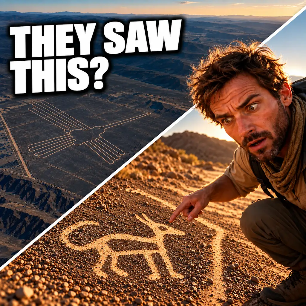
AI Found New Nazca Drawings—Could People See Them from the Ground?
FAQs
What is the Nazca geoglyph field verification process?
The Nazca geoglyph field verification process is a method used to confirm the authenticity and accuracy of the geoglyphs found in the Nazca Desert in Peru.
Who is responsible for conducting the Nazca geoglyph field verification process?
The Nazca geoglyph field verification process is typically conducted by archaeologists, historians, and experts in the field of geoglyphs and ancient civilizations.
What are the steps involved in the Nazca geoglyph field verification process?
The steps involved in the Nazca geoglyph field verification process may include on-site inspections, aerial surveys, ground-penetrating radar scans, and analysis of historical records and data.
Why is the Nazca geoglyph field verification process important?
The Nazca geoglyph field verification process is important because it helps to ensure the preservation and protection of the Nazca geoglyphs, as well as to provide accurate information about their origins, meanings, and cultural significance.
What are some challenges faced during the Nazca geoglyph field verification process?
Some challenges faced during the Nazca geoglyph field verification process may include environmental factors such as erosion and weathering, as well as logistical challenges related to accessing remote and rugged terrain.