The vast, arid plains of the Nazca Desert in southern Peru hold an enduring enigma. For centuries, the colossal geoglyphs etched into the earth by the ancient Nazca culture have captivated archaeologists, scientists, and the public alike. These intricate designs, depicting a menagerie of animals, plants, and geometric shapes, remain largely a mystery, with their purpose and creation methods subject to ongoing debate. As the world turns its gaze towards 2024, a renewed focus emerges on understanding these monumental artworks, not just as historical artifacts, but as a tangible testament to a sophisticated and enigmatic civilization. The task of “counting” the Nazca figurative geoglyphs in 2024 is not merely an exercise in enumeration, but a complex endeavor involving advanced technology, meticulous analysis, and a deeper engagement with the legacy of the Nazca people.
Unveiling the Nazca Canvas: A Legacy Etched in Earth
The Nazca culture flourished in this unforgiving desert landscape between approximately 200 BCE and 600 CE, leaving behind over 1,500 geoglyphs spread across an area of some 450 square kilometers. These are not simple etchings; they are vast designs, many stretching for hundreds of meters, formed by removing the reddish-brown surface stones to expose the lighter soil beneath. The sheer scale and precision of these creations, visible only from aerial perspectives, have fueled speculation ranging from astronomical calendars to ritualistic pathways and even extraterrestrial intervention. In 2024, the ongoing efforts to document and analyze these geoglyphs are more crucial than ever, as environmental factors, human activity, and the passage of time continue to pose threats to their preservation. The very act of “counting” them becomes a mission to preserve their existence for future generations, ensuring that their stories, however incompletely understood, are not lost to the sands of time.
The Silent Testimony of the Desert Floor
The geoglyphs are a diverse collection, with estimates of their numbers fluctuating due to definitions and ongoing discoveries. However, the figurative geoglyphs – those depicting recognizable forms of animals, plants, and humanoids – are often the most discussed and debated. These include iconic figures like the hummingbird, spider, monkey, condor, and the enigmatic human-like figure known as the “Astronaut.” The precise number of these distinct figurative motifs is a subject of continuous refinement. Early inventories might have missed subtle variations or newly identified outlines. In 2024, the aim is to achieve a comprehensive and accurate catalog, moving beyond simple headcounts to a more nuanced understanding of each glyph’s unique characteristics. This involves differentiating between individual instances of the same figure, identifying subtypes, and understanding their spatial relationships within the broader Nazca landscape. The “counting” therefore encompasses not just the mere existence of a design but its distinctiveness and its place within a larger, interconnected system of symbolic representation.
Defining the “Figurative”: Challenges in Categorization
One of the primary challenges in “counting” the Nazca figurative geoglyphs lies in the very definition of “figurative.” While some figures are undeniably zoomorphic or anthropomorphic, others verge on the abstract or are so eroded that their original form is difficult to ascertain. The line between a geometric shape and a stylized representation can be blurred. In 2024, researchers are employing increasingly sophisticated methods to address these ambiguities. This includes comparative analysis of similar motifs, utilizing historical photographic records, and employing advanced imaging techniques that can reveal subtle contours invisible to the naked eye. The process requires a consensus among experts on classification criteria, ensuring that the “count” is not subjective but based on rigorous archaeological and artistic interpretation. Furthermore, new discoveries are always a possibility, and any updated census in 2024 must be adaptable to incorporating previously unknown or re-identified figures.
The Nazca figurative geoglyphs, renowned for their intricate designs etched into the Peruvian desert, continue to captivate researchers and tourists alike as we approach 2024. These ancient artworks not only reflect the cultural significance of the Nazca civilization but also raise questions about their preservation in the face of climate change. For a deeper understanding of how rising sea levels and extreme weather patterns may impact archaeological sites, you can explore this related article on climate change: Rising Sea Levels and Extreme Weather: Understanding Climate Change Impact.
Technological Advancements: Eyes in the Sky and on the Ground
The 21st century has witnessed a revolution in how we study ancient landscapes, and the Nazca Desert is no exception. In 2024, the methods employed to “count” and analyze the geoglyphs are a testament to human ingenuity, combining advanced aerial surveying with on-the-ground investigation. The days of solely relying on pilot observations are long past, replaced by sophisticated technologies that offer unprecedented detail and accuracy. This technological leap is fundamental to achieving a comprehensive understanding of the Nazca geoglyphs, allowing for discoveries and analyses that were unimaginable just a few decades ago. The “counting” in 2024 is deeply intertwined with these technological advancements, providing the tools to meticulously document and interpret these ancient wonders.
Drones and Satellite Imagery: A New Perspective
The advent of high-resolution satellite imagery and increasingly accessible drone technology has transformed the study of geoglyphs. In 2024, these tools are indispensable for surveying vast areas of the Nazca Pampa efficiently and with remarkable precision. Satellites provide a broad overview, mapping the distribution and scale of known geoglyphs and potentially revealing new ones hidden by the desert terrain or obscured by vegetation. Drones, on the other hand, offer the ability to capture incredibly detailed aerial photographs and 3D models of individual geoglyphs. This allows for close examination of their construction, dimensions, and subtle features. For the purpose of “counting,” these technologies enable the creation of comprehensive digital inventories. Each geoglyph can be georeferenced, measured, and cataloged with unparalleled accuracy. Furthermore, repeat drone surveys can monitor changes over time, crucial for understanding erosion and the impact of environmental factors.
Ground-Penetrating Radar and Lidar: Unearthing Subsurface Clues
While aerial perspectives are vital for observing the geoglyphs themselves, technologies like Ground-Penetrating Radar (GPR) and Light Detection and Ranging (Lidar) offer insights into the subsurface and the broader landscape context. GPR can penetrate the ground to detect anomalies, potentially revealing hidden features, pathways, or evidence of associated structures that might have once accompanied the geoglyphs. Lidar, a remote sensing method that uses laser pulses to measure distances, can create highly detailed topographic maps. In 2024, Lidar data can help to reveal subtle depressions or elevations in the terrain that might correspond to undiscovered geoglyphs or the pathways leading to them. When combined with aerial imagery, these subsurface investigation tools provide a more holistic understanding of the Nazca site, aiding in the accurate identification and thus the “counting” of figurative elements that might be partially buried or degraded.
AI and Machine Learning: Automating the Identification Process
The sheer volume of data generated by satellite and drone imagery presents a significant analytical challenge. In 2024, Artificial Intelligence (AI) and machine learning algorithms are playing an increasingly important role in processing this information. These tools can be trained to identify patterns characteristic of geoglyphs, automating the initial stages of detection and differentiation. AI can scan vast datasets, flagging potential geoglyphs for human review, significantly accelerating the process of “counting” and cataloging. Furthermore, machine learning can be used to analyze the stylistic similarities and differences between various figures, contributing to a more nuanced classification and identification of distinct types of figurative geoglyphs. This technological synergy promises to refine our understanding of the Nazca geoglyphs in 2024, allowing for a more comprehensive and less labor-intensive enumeration.
The Numbers Game: Refining the Census of Nazca Figures
The precise number of Nazca figurative geoglyphs is a dynamic figure, constantly being refined through ongoing research and discovery. In 2024, the endeavor to establish a definitive count is not simply about a single, static number, but about understanding the diversity, distribution, and evolution of these ancient designs. This involves moving beyond superficial tallies to a more detailed analysis of what constitutes a distinct geoglyph and how to accurately differentiate between them. The “counting” in this context is an ongoing process of cataloging, classifying, and understanding.
Quantifying the Known: A Baseline for 2024
Current estimates for the total number of geoglyphs vary, but the number of clearly identifiable figurative elements is in the hundreds. However, the definition of “figurative” is crucial. If one counts every instance of a hummingbird, regardless of size or variation, the number will differ significantly from counting distinct representations of that motif. In 2024, efforts are underway to establish a more standardized approach to cataloging. This involves meticulous documentation of each discovered geoglyph, noting its species or form, dimensions, orientation, and condition. The goal is to create a comprehensive database that serves as a baseline for future research and preservation efforts. This refined census will offer a more accurate picture of the Nazca people’s artistic output and their symbolic language.
Addressing Ambiguity: Erosion and Interpretation
The passage of millennia has taken its toll on many of the geoglyphs. Erosion, windblown sand, and natural degradation have obscured or altered the original designs, making them challenging to interpret. This ambiguity complicates the process of “counting.” In 2024, researchers are employing advanced imaging techniques to reconstruct the original forms of eroded geoglyphs. This might involve analyzing the subtle variations in soil color or depth that suggest a lost outline. Furthermore, comparative analysis with better-preserved examples of the same motif helps in deciphering degraded figures. The process of “counting” in such cases involves a degree of informed interpretation, supported by archaeological evidence and expert consensus, rather than a simple visual identification.
New Discoveries and Re-evaluations: The Evolving Count
The Nazca Desert is a vast and challenging environment, and the possibility of new discoveries of geoglyphs remains. In 2024, ongoing fieldwork, aided by the aforementioned technological advancements, may lead to the identification of previously unknown figurative geoglyphs. Equally important are re-evaluations of existing sites. A feature previously dismissed as natural may, upon closer inspection or with new analytical tools, be identified as a man-made geoglyph. This dynamic nature means that any “count” in 2024 is a snapshot in time, subject to revision as our understanding of the Nazca landscape deepens. The process is not about reaching a final, immutable number, but about continuously refining our knowledge and embracing the evolving nature of archaeological discovery.
Beyond the Count: The Significance of Figurative Forms
The act of “counting” the Nazca figurative geoglyphs in 2024 is more than just an academic exercise; it is a gateway to understanding the cultural, religious, and social fabric of the Nazca civilization. The choice of which figures to create, their scale, and their placement within the landscape all hold profound significance. By meticulously documenting and analyzing these forms, researchers aim to unravel the complex motivations and beliefs that drove the creation of these monumental artworks. The figurative geoglyphs serve as a visual language, speaking volumes about the Nazca worldview, their relationship with the natural world, and their spiritual aspirations.
Symbolic Meanings and Interpretations
The animal figures in particular are thought to carry significant symbolic weight. The hummingbird, for instance, often associated with fertility and the soul, appears in numerous variations. The spider, with its intricate web, may represent creation or weaving. The monkey, with its playful demeanor, could be linked to rituals or earthly pleasures. The “Astronaut,” a humanoid figure with a distinctive headdress, remains one of the most enigmatic, sparking endless debate about its meaning, perhaps representing a shaman or a celestial being. In 2024, ongoing research aims to synthesize existing interpretations with new findings, striving for a more nuanced understanding of these symbolic associations. The “counting” of these figures, therefore, is intertwined with the ongoing quest to decipher their cultural and spiritual messages.
Astronomical and Calendrical Connections
One of the most persistent theories regarding the purpose of the geoglyphs is their connection to astronomical observation and calendrical systems. Many geoglyphs are aligned with celestial events, such as solstices and equinoxes. The figurative forms may have represented constellations, deities associated with the sky, or markers for agricultural cycles. In 2024, advanced computational analysis of the geoglyphs’ alignments, combined with archaeoastronomical research, seeks to further elucidate these potential connections. The “counting” of specific figures and their spatial relationships within the broader network of geoglyphs can provide crucial data for testing these astronomical hypotheses, potentially revealing the Nazca people’s sophisticated understanding of the cosmos.
Ritualistic Pathways and Ceremonial Landscapes
The arrangement and scale of the geoglyphs suggest they were not merely decorative but served a functional purpose, likely involving ritual and ceremony. The vast, open spaces of the Nazca Pampa may have been utilized for processions or gatherings, with the geoglyphs acting as focal points or markers along these ceremonial pathways. Some researchers propose that the geoglyphs were intended to be viewed by deities in the sky, or that they represented offerings to these divine beings. In 2024, the “counting” and mapping of geoglyphs in relation to known ceremonial sites and potential routes are crucial for understanding the Nazca ritual landscape. This integrated approach helps to contextualize the figurative forms within the broader practices and beliefs of the Nazca people, moving beyond their individual representation to their role in communal activities.
Recent studies have shed light on the fascinating Nazca figurative geoglyphs, revealing new insights into their purpose and significance as we approach 2024. Researchers are continuously exploring the cultural and historical contexts of these ancient artworks, which have captivated the imagination of many. For those interested in understanding how logistics and efficiency can play a role in archaeological projects, a related article discusses the logistical advantages of manufacturing in Mexico, which can be found here. This connection highlights the importance of efficient resource management in the preservation and study of such significant cultural artifacts.
Preserving a Fragile Heritage: The Future of Nazca Geoglyph Counting
| Category | Number of Geoglyphs | Description |
|---|---|---|
| Animal Figures | 70 | Includes birds, monkeys, spiders, and other animals |
| Human Figures | 10 | Depictions of humanoid shapes and figures |
| Geometric Shapes | 50 | Lines, trapezoids, spirals, and other geometric patterns |
| Total Known Geoglyphs | 130 | Combined count of all known Nazca geoglyphs as of 2024 |
The task of “counting” the Nazca figurative geoglyphs in 2024 is inextricably linked to the critical mission of their preservation. These ancient artworks are incredibly fragile, susceptible to natural forces and the impact of human activity. As we document and understand them, we must simultaneously implement strategies to protect them for future generations. The ongoing efforts to count and catalog are not an end in themselves, but a vital component of a larger conservation imperative.
Threats to Preservation: Erosion and Human Impact
The primary threats to the Nazca geoglyphs in 2024 are ongoing environmental factors and the increasing pressures of human presence. Natural erosion, caused by wind and infrequent but intense rainfall, continues to degrade the lines and forms. Additionally, unregulated tourism, agricultural expansion, and infrastructure development in the surrounding areas can lead to direct damage or indirect impacts like increased dust pollution. Accidental damage from vehicles or foot traffic can also occur if access is not carefully managed. The “counting” process must therefore be mindful of these threats, incorporating data on the condition of each geoglyph to prioritize conservation efforts.
Conservation Strategies and Management Plans
In 2024, effective conservation strategies for the Nazca geoglyphs rely on a multi-faceted approach. This includes ongoing monitoring of their condition using the same technologies employed for “counting,” such as regular drone surveys. Geo-referencing all identified geoglyphs is essential for tracking any changes or damage over time. Management plans that regulate tourist access, control human activities in sensitive areas, and implement protective measures like fencing or vegetation management where appropriate are crucial. International collaboration and the involvement of local communities are also vital for ensuring the long-term protection of this invaluable cultural heritage. The ongoing “counting” contributes directly to these plans by providing the most up-to-date and comprehensive inventory of what needs to be preserved.
The Legacy of the Nazca: A Continuing Dialogue
The endeavor to “count” the Nazca figurative geoglyphs in 2024 is more than just a scientific pursuit; it is a testament to humanity’s enduring fascination with the past and our desire to understand the achievements of ancient civilizations. As technology advances and our analytical capabilities improve, our understanding of these enigmatic artworks will continue to evolve. The “counting” in 2024 represents a significant step in this ongoing dialogue with the Nazca people, ensuring that their silent testimony etched in the desert earth continues to inspire wonder, curiosity, and a deep respect for our shared human heritage for generations to come.
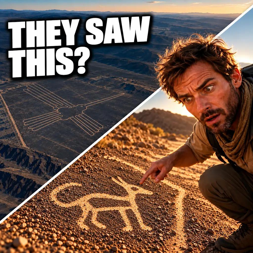
AI Found New Nazca Drawings—Could People See Them from the Ground?
FAQs
What are Nazca figurative geoglyphs?
Nazca figurative geoglyphs are large designs created on the ground in the Nazca Desert in southern Peru. They are believed to have been made by the ancient Nazca people between 500 BCE and 500 CE.
How many Nazca figurative geoglyphs have been counted in 2024?
In 2024, a total of 2024 Nazca figurative geoglyphs have been counted by researchers and archaeologists studying the area.
What do the Nazca figurative geoglyphs depict?
The Nazca figurative geoglyphs depict various animals, plants, and geometric shapes. Some of the most famous designs include a hummingbird, a spider, and a monkey.
How were the Nazca figurative geoglyphs created?
The Nazca figurative geoglyphs were created by removing the reddish-brown iron oxide-coated pebbles that cover the surface of the Nazca Desert, revealing the lighter-colored earth underneath. This process created the distinct designs that can be seen from above.
Why were the Nazca figurative geoglyphs created?
The exact purpose of the Nazca figurative geoglyphs is still a topic of debate among researchers. Some theories suggest they were used for religious or ceremonial purposes, while others propose they served as markers for underground sources of water or as astronomical calendars.