
What’s an Acadian French Canadian Cluster Map and Why Should You Care?
In simple terms, an Acadian French Canadian Cluster Map is a way of visualizing how Acadian and French Canadian communities are spread out and interconnected. Think of it like a demographic snapshot that uses data to show where people who identify with these cultural groups live, and importantly, how those populations cluster together. It’s not just about drawing dots on a map; it’s about understanding the underlying social, historical, and geographical factors that shape these communities. If you’re interested in cultural heritage, language preservation, migration patterns, or even just understanding the diverse fabric of North America, these maps offer some fascinating insights. They help us move beyond broad generalizations and see the specific nuances of where and how these vibrant cultures thrive.
The Acadian French Canadian cluster map provides valuable insights into the distribution and cultural significance of Acadian communities in North America. For those interested in exploring how regional demographics can influence economic relations, a related article can be found at Charting the Future of US-Mexico Trade Relations, which discusses the impact of cultural clusters on trade dynamics and regional partnerships. This connection highlights the importance of understanding cultural geography in the context of economic development.
The Genesis of Acadian and French Canadian Identity
Before diving into the maps themselves, it’s crucial to have a basic understanding of who Acadian and French Canadians are. These aren’t monolithic groups, but rather distinct cultures with shared origins.
Roots in New France
Both Acadian and French Canadian identities trace their lineage back to the early French settlers who arrived in North America in the 17th century. The primary areas of settlement were along the St. Lawrence River (leading to French Canadian identity) and in the Maritimes, particularly in what is now Nova Scotia, New Brunswick, and Prince Edward Island (leading to Acadian identity).
The initial colonizing efforts were driven by a mix of trade, religious zeal, and the desire for resources. Life was often challenging, with settlers facing harsh climates, disease, and intermittent conflict with Indigenous peoples and rival European powers. Despite these hardships, distinct cultural practices, dialects, and social structures began to form.
Divergent Paths: The Great Upheaval and Beyond
While both groups shared French roots, their historical trajectories diverged significantly, particularly after the British gained control of Acadia in the early 18th century.
The Deportation of the Acadians (Le Grand Dérangement)
One of the most defining and tragic events for Acadians was the “Grand Dérangement,” or the Great Upheaval, beginning in 1755. The British, fearing Acadian loyalty to the French and unwilling to have a potentially hostile population within their territory, forcibly expelled thousands of Acadians from their lands. Families were separated, homes were burned, and communities were shattered.
This deportation led to Acadians scattering across North America, with many eventually finding their way to Louisiana (where they evolved into Cajuns), other parts of Canada, and even back to France. Despite this immense trauma, Acadian culture persisted, often in isolated pockets, and a strong sense of collective identity emerged from shared hardship and resilience.
The Evolution of French Canadian Identity
In contrast, the French Canadian population, primarily concentrated along the St. Lawrence River, largely remained under British rule but maintained a greater degree of cultural and linguistic autonomy. While they also faced pressures to assimilate, their larger population base and a more established societal structure allowed for the preservation of French language, religion (predominantly Catholicism), and cultural traditions.
Over time, the French Canadian identity solidified, particularly in Quebec, which became the heartland of this cultural group. Debates around language rights, political autonomy, and cultural distinctiveness have been central to the French Canadian experience for centuries.
Deconstructing the Cluster Map: What the Data Reveals
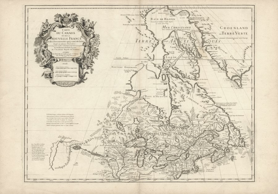
An Acadian French Canadian Cluster Map isn’t just a pretty picture; it’s a tool for understanding the spatial distribution and density of these populations. The “clusters” represent areas where individuals identifying with Acadian or French Canadian heritage are more concentrated.
Geographical Hotspots
When you look at these maps, certain geographical areas consistently emerge as key “hotspots.”
Quebec: The French Canadian Epicenter
Unsurprisingly, Quebec stands out as the primary locus of French Canadian population density. Within Quebec, you’ll see intense clustering in urban centers like Montreal and Quebec City, but also significant concentrations in rural and semi-rural areas throughout the province. The maps illustrate the deep historical roots of French Canadian settlement across the St. Lawrence Valley and beyond. This dense concentration underscores the cultural and linguistic dominance of French in Quebec and its role as the core of French Canadian identity.
The Maritimes: Acadian Strongholds
In the Atlantic provinces, the maps highlight specific regions where Acadian populations are particularly concentrated. This often includes parts of New Brunswick (especially the northern and eastern regions), certain coastal areas of Nova Scotia (like parts of Cape Breton Island and southwestern Nova Scotia), and pockets of Prince Edward Island. These are areas where the legacy of Acadian settlement and the efforts of cultural revitalization have resulted in discernible demographic clusters. The maps help visualize how Acadians, despite historical displacement, have maintained strongholds and rebuilt communities.
Beyond the Core: Transnational and Migratory Patterns
Cluster maps often reveal more than just the traditional heartlands. They can illuminate areas where Acadian and French Canadian populations have migrated and established communities over time. This includes:
- Other Canadian Provinces: You might see clusters in Ontario, particularly in regions with historical French-speaking populations, and in Western Canada (Manitoba, Saskatchewan, Alberta, British Columbia) where migration for economic opportunities has occurred.
- The United States: For Acadians, the most prominent cluster outside of Canada is in Louisiana, where they evolved into the distinct Cajun culture. However, maps might also show smaller clusters in bordering US states like Maine and Vermont, reflecting historical migration and cross-border communities. For French Canadians, you might see historical clusters in New England states that were once destinations for economic migration.
Factors Shaping the Clusters
The formation and characteristics of these clusters are influenced by a complex interplay of factors.
Historical Settlement Patterns
The initial colonial land grants, agricultural suitability, and strategic locations all played a role in where early French and Acadian settlers established themselves. The maps are, in essence, a visualization of these historical decisions and their enduring demographic impact.
Economic Opportunities
Migration to areas with better job prospects, whether in resource extraction, industry, or later service sectors, has significantly shaped where communities are found today. For example, French Canadian migration to industrial centers in Ontario or the US, or Acadian migration to fishing communities, are reflected in the data.
Language and Cultural Preservation Efforts
Areas with strong institutional support for the French language and Acadian culture, such as schools, cultural organizations, and government services, tend to foster and maintain denser clusters. These efforts can encourage younger generations to remain in or return to these communities.
Geographic Boundaries and Proximity
Natural features like rivers, coastlines, and mountain ranges, as well as political borders, have influenced settlement patterns and community development. Proximity to existing communities can also encourage further clustering through chain migration.
Resilience and Return Migration
The survival of Acadian culture after the Deportation is a testament to resilience. Modern cluster maps can also show instances of “return migration” or the strengthening of existing communities as people choose to reconnect with their heritage.
The Significance of Acadian and French Canadian Cluster Maps
These maps are more than just demographic tools; they are powerful visual narratives that tell stories of heritage, resilience, and cultural continuity.
The Acadian French Canadian cluster map provides valuable insights into the distribution of Acadian communities across North America, highlighting their unique cultural heritage and historical significance. For those interested in understanding how various factors, including government policies, can impact communities, a related article discusses the implications of real estate ownership and the risks of government seizure. You can read more about this important topic in the article here.
Understanding Language Vitality
One of the most immediate insights from cluster maps is their relevance to language preservation. Densely populated areas with a strong presence of French speakers, particularly outside of Quebec, are crucial for maintaining the vitality of the French language and its regional dialects (like Acadian French). The maps can help identify areas where language transmission is strong and where support might be most needed. They highlight where immersion schools, French-language media, and community language events are most likely to be impactful.
Illuminating Migration and Diaspora
Cluster maps offer a clear visual representation of Acadian and French Canadian migration patterns throughout history and into the present day. They help us understand how these populations have spread across North America and beyond, forming diasporic communities. This is particularly important for understanding the evolution of Acadian culture into the distinct Cajun identity in Louisiana, or the historical French-speaking communities in New England.
Informing Cultural Policy and Support
For governments, cultural organizations, and community leaders, these maps are invaluable for targeted policy development and resource allocation.
Resource Allocation
Knowing where specific communities are concentrated allows for more effective distribution of funding for cultural initiatives, educational programs, and heritage preservation projects. It helps ensure that resources reach the populations that can benefit most directly.
Education and Language Planning
Understanding cluster densities is critical for planning French-language education services, including the establishment of French schools or immersion programs. It can also inform strategies for language revitalization in areas where the

Cajun or French Canadian? The DNA Looked the Same—Until Researchers Looked Closer
FAQs
What is an Acadian French Canadian cluster map?
An Acadian French Canadian cluster map is a visual representation that shows the distribution and concentration of Acadian French Canadian populations in a specific geographic area.
How is an Acadian French Canadian cluster map created?
An Acadian French Canadian cluster map is created by analyzing demographic data, such as census information, to identify areas where Acadian French Canadians reside in large numbers. This data is then plotted on a map to visually represent the clusters.
What is the significance of an Acadian French Canadian cluster map?
An Acadian French Canadian cluster map is significant as it helps researchers, policymakers, and community members understand the spatial distribution of Acadian French Canadian populations. It can provide insights into cultural heritage, migration patterns, and community development.
How can an Acadian French Canadian cluster map be used?
An Acadian French Canadian cluster map can be used to identify areas where there is a high concentration of Acadian French Canadians, which can be helpful for cultural preservation efforts, language revitalization programs, and community outreach initiatives.
Are there any limitations to using an Acadian French Canadian cluster map?
While an Acadian French Canadian cluster map can provide valuable insights, it is important to note that the data used to create the map may have limitations, such as underrepresentation of certain populations or inaccuracies in reporting. Additionally, the map may not capture the full complexity of Acadian French Canadian identity and culture.