Network Density Analysis of Ancient Travel Routes Reveals Connectivity Patterns
Unearthing the Threads of Ancient Movement
The study of ancient civilizations often hinges on understanding how people, goods, and ideas moved across their landscapes. For millennia, human societies have shaped the terrain, forging pathways that facilitated trade, communication, migration, and conquest. These ancient routes, often ephemeral and erased by time, represent a fundamental aspect of social organization and the diffusion of culture. Traditionally, archaeologists and historians have pieced together these networks through textual records, artifact distribution, and the identification of physical remnants like roads and settlements. However, these methods can be inherently biased, favoring more prominent or durable evidence. A more comprehensive approach is needed to reconstruct the intricate tapestry of ancient connectivity, and network density analysis offers a powerful quantitative lens through which to achieve this. By treating ancient routes as a network of nodes and edges, researchers can apply sophisticated analytical techniques to uncover patterns of interaction, identify crucial junctures, and understand the underlying drivers of their formation and maintenance. This article delves into how network density analysis, a subfield of graph theory and spatial analysis, is revolutionizing our understanding of ancient travel, revealing nuanced connectivity patterns that were previously invisible.
The inherent challenge in studying ancient travel lies in its often-invisible nature. While monumental structures and surviving texts provide glimpses into the lives of elites, the everyday movements of ordinary people, traders, and messengers are far harder to reconstruct. The vast majority of ancient pathways were not paved roads but rather footpaths, animal trails, and sea routes, many of which have long since disappeared from the landscape or been repurposed. Artifact dispersal, while informative, can be influenced by factors beyond direct travel, such as trade intermediaries or gift exchange. Textual evidence, while invaluable, is often fragmented, biased towards literate societies, and may focus on specific types of journeys rather than the comprehensive movement of people and goods. Network density analysis, by contrast, treats the entire reconstructed landscape of potential and actual pathways as a single, interconnected system. It allows for the quantitative assessment of relationships between different points on the map, moving beyond individual route descriptions to a holistic understanding of the entire connectivity structure. This shift in perspective is crucial for moving beyond anecdotal evidence to robust, data-driven insights into the dynamics of ancient societies.
Network density analysis of ancient travel routes provides valuable insights into the connectivity and movement patterns of past civilizations. This analysis can reveal how trade, cultural exchange, and military strategies were influenced by the geography of travel networks. For a deeper understanding of how strategic advantages in different terrains can shape historical narratives, you may find the article on the militarization of the moon particularly interesting. It explores the implications of strategic positioning and resource allocation in a different context, which can parallel the considerations of ancient travel routes. You can read more about it here: The Militarization of the Moon: Strategic Advantages.
The Foundations of Ancient Network Analysis
Defining the Nodes and Edges of Antiquity
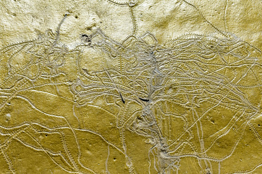
At its core, network density analysis relies on the conceptualization of a network as a collection of points (nodes) connected by lines (edges). In the context of ancient travel, these nodes can represent a variety of entities. Settlements, from small hamlets to major urban centers, are obvious candidates. Beyond static locations, nodes can also encompass resource sites (e.g., mines, fertile agricultural land, water sources), important religious or ceremonial centers, strategic defensive positions, or even significant natural landmarks that served as waypoints. The careful selection and definition of these nodes are critical. They must be grounded in archaeological and historical evidence, reflecting places where human activity was significant enough to warrant being considered a point of origin, destination, or significant passage.
The edges, in turn, represent the connections between these nodes. These are the ancient travel routes themselves. Again, the definition of an edge requires careful consideration. It can be a documented ancient road, a reconstructed path based on topographic analysis and settlement patterns, a known maritime or riverine route, or even a probabilistic pathway inferred from the proximity of settlements and the presence of suitable terrain. The attributes of these edges are also important. They can include estimates of travel time or difficulty, the capacity of the route to carry goods or people, or the historical period during which the route was likely in use. The precision with which nodes and edges are defined directly impacts the accuracy and interpretability of the subsequent network analysis. For instance, if nodes are defined too broadly, they might obscure critical micro-level connections. Conversely, if edges are too generalized, they may fail to capture important variations in route accessibility or purpose.
Quantifying Connectivity: Metrics and Measures
Once the ancient landscape is represented as a network of nodes and edges, a range of quantitative metrics can be employed to assess its density and connectivity. These metrics allow researchers to move beyond subjective descriptions of routes to objective comparisons and analyses. One of the most fundamental concepts is degree centrality, which measures the number of connections a node has. A settlement with a high degree centrality is likely a significant hub, connecting to many other places. Conversely, a node with low degree centrality might be a more isolated or specialized location.
Another crucial metric is betweenness centrality. This measures how often a node lies on the shortest path between other pairs of nodes. Nodes with high betweenness centrality act as critical intermediaries or choke points in the network. Disrupting such a node could significantly fragment the overall connectivity of the system. For example, a fortress guarding a crucial mountain pass would likely exhibit high betweenness centrality. Closeness centrality, on the other hand, measures how close a node is to all other nodes in the network. Nodes with high closeness centrality can reach all other nodes quickly, suggesting they are well-positioned for rapid dissemination of information or goods.
Beyond node-specific metrics, edge density can be calculated to assess the overall connectedness of the network. A high edge density indicates that there are many routes relative to the number of potential connections. This might suggest a well-developed and highly interactive system. Conversely, a low edge density might point to a more dispersed or less integrated society. Clustering coefficients can also be used to understand how interconnected the immediate neighbors of a node are. A high clustering coefficient suggests that if two nodes are connected to a third node, they are also likely to be connected to each other, indicating the formation of tightly knit clusters or regions. The application of these and other graph-theoretic measures allows for a quantitative assessment of network structure, revealing patterns that are not immediately apparent from a visual inspection of route maps.
Applications of Network Density Analysis in Archaeology

Mapping Trade Empires and Resource Access
The application of network density analysis to ancient travel routes offers profound insights into the mechanisms of trade and the management of resources in past societies. By identifying nodes with high centrality (both degree and betweenness), researchers can pinpoint key trading hubs and transit points that facilitated the movement of goods over long distances. For instance, analyzing the network of Roman roads in the Iberian Peninsula could reveal how legions and merchants moved between resource-rich areas and major urban centers, highlighting the strategic importance of certain settlements and their connection to the broader imperial economy.
Furthermore, network analysis can illuminate the relationship between settlements and the resources they depended upon. By overlaying the locations of resource sites (e.g., mines for metals, quarries for stone, fertile agricultural lands) onto the reconstructed travel network, researchers can assess the accessibility of these resources to different populations. A settlement with a low degree of connectivity might be forced to rely on local resources, while a settlement with high connectivity could tap into a wider hinterland or even long-distance trade networks for its supplies. This can help explain the rise and fall of settlements, their economic specialization, and the potential for resource competition or conflict. The density of routes connecting resource-rich areas to population centers can also be an indicator of the intensity and efficiency of resource exploitation and distribution systems.
Understanding the Diffusion of Culture and Ideas
Beyond the material exchange of goods, ancient networks played a crucial role in the transmission of cultural practices, technological innovations, religious beliefs, and even diseases. Network density analysis can help visualize and quantify the pathways through which these intangible elements diffused. By treating cultural traits or religious symbols as “markers” that travel along the network, researchers can analyze their distribution patterns and infer the routes of transmission. For example, if a specific pottery style or religious icon is found in settlements along a particular set of interconnected routes, it suggests that these routes were conduits for cultural exchange.
High centrality nodes, particularly those with significant betweenness, are likely to have been important nodes of cultural transmission. Ideas and practices emanating from a central authority or a hub of innovation could spread outwards through these conduits. Conversely, the density of connections between different cultural groups can be indicative of the degree of their interaction and the potential for syncretism or the adoption of foreign ideas. The analysis of maritime networks, for instance, can reveal how seafaring cultures exchanged not only goods but also myths, artistic styles, and technological knowledge across vast distances. Understanding the network structure thus provides a framework for understanding the complex processes of cultural diffusion and the interconnectedness of ancient societies on a conceptual and ideological level.
Military Strategy and Political Control
The strategic importance of ancient routes for military operations and the maintenance of political control cannot be overstated. Network density analysis can illuminate how military forces moved, how supplies were provisioned, and how authority was projected across territories. For empires, a well-developed and dense network of roads was essential for rapid troop deployment, communication, and the efficient suppression of rebellions. Analyzing the network density around strategic fortifications, borders, and administrative centers can reveal the priorities of military planners and the effectiveness of their logistical networks.
Key nodes with high betweenness centrality, such as mountain passes or river crossings, often represented critical chokepoints that were heavily defended and controlled. The density of routes leading to and from these points would reflect their strategic significance. Furthermore, the presence of a dense network within a conquered territory could indicate a deliberate strategy to integrate that region into the empire, facilitating the movement of administrators, tax collectors, and soldiers. Conversely, sparse or poorly maintained networks in frontier regions might suggest areas of less direct control or constant threat. By quantifying the connectivity of these networks, researchers can gain a deeper understanding of the military logistics, strategic considerations, and the very nature of political power projection in the ancient world.
Case Studies and Methodological Advancements
Examining the Silk Road: A Network Perspective
The Silk Road, a legendary network of trade routes connecting East and West, is a prime candidate for network density analysis. While much has been written about the goods and peoples that traversed these routes, a network-centric approach can reveal deeper patterns of connectivity and interaction. By mapping the known oases, caravan cities, and major entrepots along the Silk Road as nodes, and the documented or inferred routes as edges, researchers can analyze the network’s structure.
Analysis might reveal that certain cities, like Samarkand or Dunhuang, possessed extremely high centrality, acting as critical junctures where multiple routes converged. This would explain their historical prominence and the concentration of diverse populations and cultural influences. The density of routes within different regions, such as Central Asia versus the Tarim Basin, could indicate varying levels of economic activity and the ease of passage. Examining the evolution of this network over time, by analyzing different phases of its use, could also reveal shifts in trade patterns, the rise and fall of specific routes, and the impact of political changes on connectivity. For instance, periods of imperial stability might be characterized by a more interconnected and dense network, while periods of fragmentation could lead to the emergence of more localized or fragmented route systems. The quantitative analysis of Silk Road networks could thus move beyond descriptive accounts to a robust understanding of its structural dynamics and the flow of information and goods.
Navigating the Seas: Maritime Network Analysis
Ancient maritime travel, though often less visible than terrestrial routes, was crucial for trade, exploration, and cultural exchange. Reconstructing and analyzing ancient maritime networks presents unique challenges, primarily due to the ephemeral nature of sea routes and the difficulty in precisely dating wrecks or charting ancient ports. However, advancements in underwater archaeology, alongside textual and artifactual evidence, are allowing for increasingly sophisticated reconstructions.
By treating major ports, islands that served as waypoints, and areas of known maritime activity as nodes, and the navigable sea passages as edges, network analysis can be applied. Metrics can reveal the most important maritime hubs, the key sea lanes that facilitated long-distance trade, and the relative accessibility of different coastal regions. The density of connections between island chains, for example, can highlight the role of archipelagos as stepping stones in prehistoric migrations or as centers of maritime trade. Analyzing the network of Phoenician trade routes, for instance, could reveal how they dominated the Mediterranean by establishing a dense network of colonies and trading posts, allowing them to connect disparate resource-rich areas with major consumption centers. The study of ancient riverine networks also falls under this umbrella, examining how waterways were utilized for transport and how they shaped settlement patterns and economic development.
Incorporating Uncertainty and Evolution: Advanced Techniques
A significant methodological advancement in network density analysis is the incorporation of uncertainty and the explicit modeling of network evolution. Ancient data is rarely complete or precise. Therefore, employing probabilistic methods to assign edge weights or to infer the existence of routes is crucial. Techniques such as Bayesian inference or agent-based modeling can be used to simulate the formation and evolution of networks over time, taking into account factors like population growth, technological advancements, and environmental changes.
For instance, when reconstructing ancient pathways based on terrain and settlement proximity, probabilistic methods can assign a likelihood score to each potential edge, reflecting the confidence in its existence. This allows for the creation of ensemble networks, where different plausible network configurations are analyzed. Furthermore, analyzing snapshots of the network at different temporal intervals allows researchers to study how connectivity changed in response to historical events, such as the rise of new empires, the introduction of new technologies, or major environmental shifts. This dynamic approach moves beyond static representations to a more nuanced understanding of how ancient networks were shaped by and, in turn, shaped historical processes. The development of sophisticated visualization tools also plays a vital role in making these complex analyses accessible and interpretable for a wider audience.
In exploring the intricate web of ancient travel routes, network density analysis offers valuable insights into the connectivity and significance of these pathways. A related article discusses the implications of historical trade practices and their impact on modern economies, which can be found at this link. Understanding how these routes functioned not only enhances our knowledge of past civilizations but also sheds light on contemporary issues surrounding trade and commerce.
Challenges and Future Directions
| Region | Number of Nodes | Number of Edges | Network Density | Average Degree | Clustering Coefficient | Dominant Travel Mode |
|---|---|---|---|---|---|---|
| Silk Road (Central Asia) | 120 | 340 | 0.048 | 5.67 | 0.32 | Caravan |
| Roman Empire | 95 | 280 | 0.063 | 5.89 | 0.41 | Roads (Chariots, Walking) |
| Inca Empire | 80 | 210 | 0.067 | 5.25 | 0.37 | Footpaths |
| Ancient Egypt | 70 | 150 | 0.062 | 4.29 | 0.29 | River and Road |
| Mesopotamia | 65 | 140 | 0.067 | 4.31 | 0.35 | River and Road |
The Data Dilemma: Gaps and Biases
Despite the immense potential of network density analysis, its application in archaeology is fundamentally constrained by the availability and quality of data. Ancient evidence is inherently incomplete and often biased. Textual records are rare, fragmented, and often focus on the activities of elites. Archaeological remains can be subject to destruction, erosion, and differential preservation. The very act of reconstructing a network involves interpretation and inference, which can introduce its own biases. For instance, a focus on major, well-preserved roads might overlook the extensive use of less visible footpaths or riverine routes.
The spatial resolution of archaeological data can also be a significant limitation. If settlements are only identified at a broad regional level, the fine-grained connectivity between smaller hamlets or farmsteads will be lost. Similarly, dating evidence for routes can be imprecise, making it difficult to construct accurate temporal snapshots of network evolution. Overcoming these data limitations requires interdisciplinary collaboration, the integration of diverse data sources (archaeological, textual, environmental, geographical), and the development of robust methodologies for handling uncertainty and missing information. Future research must continue to prioritize rigorous data collection and the development of analytical techniques that acknowledge and, where possible, mitigate these inherent challenges.
Bridging Scales and Disciplines: Towards Holistic Understanding
The future of ancient network analysis lies in its ability to bridge different scales of analysis and foster greater interdisciplinary collaboration. Currently, studies often focus on specific regions or time periods. However, a truly holistic understanding of ancient connectivity requires examining how local networks were embedded within larger regional and supra-regional systems. This means integrating the analysis of small-scale, intra-settlement pathways with broader trade routes, and examining how these interacted with maritime networks.
Furthermore, a deeper collaboration between archaeologists, geographers, historians, computer scientists, and mathematicians is essential. Archaeologists provide the empirical data and historical context, while geographers and computer scientists offer the analytical tools and methodologies. Historians can help interpret the findings within broader historical narratives. This interdisciplinary approach will not only refine the analytical techniques but also lead to more robust and meaningful interpretations of the ancient world. Future research should aim to develop standardized methodologies and open-source tools that facilitate collaborative research and the sharing of data, accelerating the pace of discovery and deepening our understanding of the interconnectedness of past human societies.
The exploration of ancient travel routes through the lens of network density analysis is an ongoing and evolving field. As new data emerges and analytical techniques become more sophisticated, our understanding of how ancient peoples moved, interacted, and shaped their world will continue to deepen. The threads of connectivity, once lost to time, are being rewoven, revealing the intricate and dynamic tapestry of human history. The ongoing development of these analytical approaches promises to unlock further secrets of past societies, illuminating the fundamental role of connectivity in their rise, resilience, and eventual transformations.

The 2.7% Statistic That Terrifies Roman Historians
FAQs
What is network density analysis in the context of ancient travel routes?
Network density analysis is a method used to study the interconnectedness and intensity of connections within a network of ancient travel routes. It helps researchers understand the level of traffic and importance of different routes in the network.
How is network density calculated in the analysis of ancient travel routes?
Network density is calculated by dividing the actual number of connections in the network by the total number of possible connections. A higher density value indicates a more interconnected network with denser travel routes.
What insights can be gained from network density analysis of ancient travel routes?
By analyzing network density, researchers can identify key hubs or nodes that were crucial for travel and trade in ancient times. They can also determine the efficiency and resilience of the network in facilitating communication and exchange between different regions.
How does network density analysis contribute to our understanding of ancient civilizations?
Studying the density of ancient travel routes can provide valuable insights into the social, economic, and political dynamics of past civilizations. It helps us comprehend the extent of interactions, cultural exchanges, and resource distribution that shaped ancient societies.
What are some limitations of using network density analysis for studying ancient travel routes?
One limitation is that the analysis relies heavily on available data, which may be incomplete or biased. Additionally, network density analysis does not account for factors such as topography, climate, or geopolitical events that could have influenced the actual usage of travel routes in ancient times.