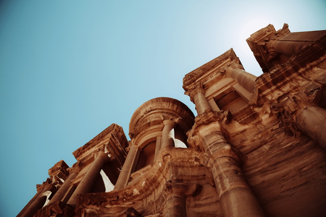
The Enduring Legacy: Ancient Marvels Reimagined Through Digital Lenses
The grandeur of classical antiquity, from the towering aqueducts of Rome to the intricate temples of Greece, continues to inspire awe and wonder. These monumental feats of engineering and architectural genius, forged by human ingenuity and labor, have long been subjects of fascination for historians, archaeologists, and the public alike. For centuries, our understanding of these ancient structures was primarily derived from written accounts, surviving ruins, and artistic representations. However, the advent of advanced software tools has revolutionized the way we can study, interpret, and even recreate these historical marvels, offering unprecedented insights into their construction, functionality, and societal impact. This article explores the transformative power of modern digital technologies in modeling classical antiquity infrastructure, detailing the methodologies, benefits, and future possibilities of this dynamic field.
In the realm of classical antiquity infrastructure modeling, the integration of advanced computer software has revolutionized our understanding of ancient engineering feats. A related article that explores the intersection of technology and historical analysis is titled “NASA to Control Moon’s Water Ice,” which discusses innovative approaches to resource management in extraterrestrial environments. This article highlights the importance of modeling and simulation in understanding complex systems, a principle that can also be applied to the infrastructure of ancient civilizations. For more insights, you can read the article here: NASA to Control Moon’s Water Ice.
Unveiling the Blueprint: Data Acquisition and Reconstruction

The journey of digitally modeling ancient infrastructure begins with the meticulous acquisition of data from the physical world and historical records. This phase is crucial, as the accuracy and richness of the input directly influence the fidelity of the final digital representation. Without a solid foundation of reliable data, even the most sophisticated software tools will produce speculative and potentially misleading models.
Archaeological Survey and Documentation
Archaeological fieldwork forms the bedrock of digital reconstruction. Traditional methods, such as manual surveying and sketching, have been augmented and significantly enhanced by contemporary technologies. Laser scanning, for instance, generates highly precise point clouds of existing ruins, capturing intricate details of stonework, dimensions, and spatial relationships that might otherwise be missed or difficult to measure manually. Photogrammetry, another powerful technique, involves taking numerous overlapping photographs of an object or site from different angles. Sophisticated software can then stitch these images together to create detailed 3D models, often with remarkable texture and color fidelity. Drones equipped with high-resolution cameras and LiDAR sensors have become indispensable tools, enabling rapid and safe aerial surveys of large sites, providing aerial perspectives and volumetric data that were once the exclusive domain of expensive and time-consuming aerial photography. Ground-penetrating radar (GPR) and magnetometry also play vital roles, revealing subsurface features such as foundations, buried walls, and drainage systems without invasive excavation, thus preserving the archaeological integrity of the site.
Textual and Iconographic Evidence Integration
Beyond physical remains, classical antiquity infrastructure is extensively documented in surviving written texts and visual representations. Ancient authors like Vitruvius, Pliny the Elder, and Frontinus provided invaluable descriptions of building techniques, materials, and the purpose of various structures. These textual sources, when carefully analyzed and contextualized, offer crucial information about aspects not always preserved in ruins, such as the original appearance, the methods of construction, and the intended use of a feature. Similarly, ancient coins, mosaics, frescoes, and reliefs often depict buildings and infrastructure, albeit stylized. While these artistic renditions may not be to scale or perfectly accurate, they can offer clues about proportions, decorative elements, and the surrounding environment. Advanced natural language processing (NLP) techniques can assist in sifting through vast digital archives of ancient texts, identifying relevant descriptions and cross-referencing them with archaeological findings. Geographic Information Systems (GIS) are instrumental in integrating these diverse data streams. By georeferencing all gathered information – from scan data and photogrammetry to textual descriptions and map overlays – GIS platforms create a unified spatial framework. This allows researchers to visualize the distribution of infrastructure, understand its relationship to the landscape, and analyze its interconnectedness within ancient urban or rural systems.
Reverse Engineering and Deductive Modeling
In cases where physical evidence is scarce or entirely absent, researchers often resort to reverse engineering and deductive modeling. This process involves using known principles of physics, engineering, and architectural design, combined with available textual and visual clues, to infer the form and function of lost infrastructure. For example, understanding Roman concrete technology and the principles of arch construction allows for the digital reconstruction of missing sections of aqueducts or bridges, even if only fragments remain. Similarly, studying the typical layout of Roman villas or Greek agoras, informed by numerous well-preserved examples, can guide the speculative reconstruction of less documented sites. This iterative process often involves creating hypotheses about the original structure and then testing them against available evidence and engineering plausibility. When dealing with complex systems like Roman road networks, researchers might use computational modeling to simulate traffic flow or logistical challenges, which can then inform the placement and design of connecting routes or waypoints. The goal is not necessarily to create a single, definitive model, but rather to explore plausible reconstructions and understand the range of possibilities, acknowledging the inherent uncertainties.
Building Worlds: Software Platforms and Methodologies

The actual construction of digital models of ancient infrastructure relies on a diverse suite of specialized software tools and distinct methodological approaches. These technologies allow for the translation of raw data into tangible, interactive, and analytical digital representations.
3D Modeling and Visualization Software
At the heart of digital reconstruction lies 3D modeling software. Programs such as Blender, Autodesk Maya, and 3ds Max are commonly used to create detailed geometric models from point cloud data or to build structures from scratch based on architectural plans and historical research. These tools enable the creation of highly accurate replicas of buildings, bridges, aqueducts, and urban layouts, incorporating intricate details like stonework textures, decorative elements, and the precise dimensions of components. Specialized architectural modeling software, like SketchUp or Revit (though often used for contemporary architecture, its principles apply), can also be adapted for historical reconstruction, particularly for more standardized elements. Beyond static representation, game engines like Unity and Unreal Engine are increasingly employed. Their powerful rendering capabilities allow for the creation of immersive virtual environments where users can explore reconstructed sites in real-time, offering an unparalleled sense of scale and context. These platforms are not just for visualization; they can also be used to develop interactive experiences, allowing users to engage with the model, activate virtual mechanisms, or even experience simulated daily life within the ancient environment.
Geographic Information Systems (GIS) for Spatial Analysis
Geographic Information Systems (GIS) are indispensable for understanding the spatial context of ancient infrastructure. Software like ArcGIS and QGIS allows for the creation and analysis of maps and spatial data. This is crucial for understanding how infrastructure like roads, aqueducts, and canals interacted with the natural landscape. By overlaying digital models of infrastructure onto historical topographical maps or modern-day terrain data, researchers can analyze drainage patterns, understand the challenges of terrain in construction, and map the flow of resources and people. GIS also facilitates the integration of various data layers, including archaeological survey data, textual references to locations, and satellite imagery. This allows for the identification of previously unknown connections between different infrastructure elements, the assessment of their reach and influence, and the study of urban planning strategies. For instance, a GIS analysis could reveal how a Roman road network was strategically designed to connect military outposts, agricultural centers, and major cities, optimizing logistical efficiency. The ability to perform spatial queries and analyses within a GIS environment provides a powerful framework for interpreting the functional significance of ancient infrastructure within its broader environmental and societal context.
Simulation and Analysis Tools
The digital models generated are not merely static representations; they can be animated and subjected to simulations to understand the functionality and performance of ancient infrastructure. Computational Fluid Dynamics (CFD) software, for example, can be used to simulate the flow of water through aqueducts, allowing researchers to test different gradients, capacities, and potential blockages, thereby gaining insights into their hydraulic efficiency and maintenance needs. Finite Element Analysis (FEA) can be employed to model the structural integrity of ancient bridges and buildings, simulating how they would have withstood loads from traffic, seismic activity, or the passage of time, providing a better understanding of their engineering principles and longevity. Traffic simulation software can be used to model the movement of goods and people along ancient roads, helping to understand logistical challenges, trade routes, and the economic impact of these networks. By simulating environmental factors like wind and rain, researchers can also gain insights into how these elements might have affected the durability and maintenance of structures. These simulation tools transform digital models from mere visualizations into dynamic analytical instruments, offering a deeper, data-driven understanding of how these ancient systems truly functioned.
Illuminating Functionality: From Static Forms to Dynamic Processes
One of the most profound contributions of advanced software tools is their ability to move beyond static representations of infrastructure and illuminate its dynamic functionality and operational processes. This allows for a more comprehensive understanding of how these ancient marvels operated in real-world scenarios.
Hydraulic Engineering and Water Management
Ancient societies placed immense importance on water management, and their infrastructure reflects this critical need. Aqueducts, reservoirs, and drainage systems were sophisticated engineering feats designed to supply water for drinking, irrigation, bathing, and industrial purposes. With advanced software, the flow of water through these systems can be accurately simulated. By inputting precise topographical data, measured channel dimensions, and estimated flow rates (derived from historical texts or archaeological evidence of sediment deposition), researchers can use CFD software to model water velocity, pressure, and volume within aqueducts. This allows for the verification of historical claims about their capacity and efficiency. Simulations can also reveal potential points of failure, such as weak points in construction that might be prone to leaks or blockages, and demonstrate how ancient engineers may have compensated for these issues, perhaps through strategically placed weirs or settling tanks. Understanding the precise gradients used in Roman aqueducts, for example, can be visualized and analyzed to understand the delicate balance required to ensure continuous water flow over vast distances without the need for pumps. This level of detailed analysis provides concrete evidence for the ingenuity of ancient hydraulic engineers and the meticulous planning involved in their projects.
Structural Integrity and Load-Bearing Capacities
The immense scale and longevity of many classical structures are testaments to their structural soundness. Advanced software tools, particularly FEA, enable the digital stress-testing of these ancient designs. By creating detailed 3D models of elements like arches, vaults, columns, and entire buildings, and then applying simulated loads (such as the weight of a roof, the pressure of traffic on a bridge, or even the forces exerted by wind and earthquakes), researchers can analyze stress distribution and identify potential weak points. This helps to explain why certain structures have endured for millennia while others have succumbed to the ravages of time. For instance, analyzing the keystone in a Roman arch under simulated pressure can demonstrate how the forces are distributed outwards and downwards, explaining its load-bearing capacity. Similarly, modeling the stresses on a marble column in a Greek temple can reveal how the material and its shape were optimized to carry significant weight. These simulations provide a quantitative basis for understanding the principles of ancient structural engineering, often confirming the practical wisdom and empirical knowledge that guided their builders, even in the absence of formal engineering equations as we understand them today.
Urban Planning and Network Dynamics
Classical cities were complex organisms, and their infrastructure played a vital role in their functioning. GIS and network analysis tools allow for the modeling and understanding of these urban systems as dynamic entities. By mapping the distribution of roads, water conduits, sewage systems, and public spaces, researchers can analyze how they interconnected and facilitated daily life. Network analysis can reveal the most important thoroughfares, identify bottlenecks, and understand the efficiency of logistical chains for trade and resource distribution. Simulating the movement of people and goods through these networks can offer insights into population density, economic activity, and the overall livability of ancient urban environments. Furthermore, by integrating infrastructure models with data on residential areas, public buildings, and defensive structures, researchers can gain a comprehensive understanding of urban planning strategies, social stratification, and the spatial organization of power and influence within a city. For example, analyzing the proximity of certain types of housing to public water fountains or the distribution of temples throughout a city can reveal important social and religious patterns.
In the realm of classical antiquity, the modeling of infrastructure has become a fascinating area of study, particularly with the advent of advanced computer software that allows researchers to visualize ancient urban layouts and transportation networks. This technology not only aids in understanding the complexities of historical societies but also draws intriguing parallels to modern challenges, such as those faced by nations like the Maldives. For a deeper insight into contemporary issues related to infrastructure and environmental sustainability, you can explore this related article on the Maldives, which highlights the precarious situation of a nation on the brink of collapse due to rising sea levels. You can read more about it here.
Bridging Eras: Education, Preservation, and Future Applications
| Software Name | Primary Use | Modeling Capabilities | Supported Periods | Output Formats | Platform | Notable Features |
|---|---|---|---|---|---|---|
| Rome Reborn | 3D Reconstruction of Ancient Rome | Urban infrastructure, buildings, roads | Classical Antiquity (1st century AD) | 3D models, VR environments | Windows, Mac | Highly detailed city-scale modeling, interactive tours |
| ArcGIS | Geospatial Analysis and Mapping | Terrain, roads, aqueducts, city layouts | Classical Antiquity to Modern | GIS layers, maps, 3D visualizations | Windows | Spatial analysis, integration with archaeological data |
| AutoCAD | Detailed Architectural Modeling | Building plans, infrastructure schematics | Classical Antiquity (reconstruction) | DWG, DXF, 3D models | Windows, Mac | Precision drafting, extensive plugin support |
| Blender | 3D Modeling and Animation | Buildings, artifacts, terrain | Classical Antiquity (reconstruction) | OBJ, FBX, STL, 3D animations | Windows, Mac, Linux | Open-source, customizable, photorealistic rendering |
| CityEngine | Procedural City Modeling | Urban infrastructure, street networks | Classical Antiquity to Modern | 3D city models, GIS export | Windows, Mac | Procedural generation, integration with GIS data |
The impact of modeling classical antiquity infrastructure extends far beyond academic research. These digital reconstructions offer powerful new avenues for public engagement, heritage preservation, and inspire future innovations.
Enhancing Public Understanding and Engagement
The digital realm provides an unparalleled opportunity to make the complex world of classical antiquity accessible and engaging for a broad audience. Interactive 3D models and virtual reality (VR) or augmented reality (AR) experiences allow people to explore reconstructed sites as if they were there, transcending the limitations of physical access to ruins or the need for extensive prior knowledge. Imagine walking through a meticulously recreated Roman Forum, interacting with virtual representations of daily life, or seeing a Roman aqueduct in its full glory, complete with flowing water. These immersive experiences foster a deeper appreciation for the ingenuity and scale of ancient achievements. Educational programs can leverage these digital tools to create dynamic learning materials for schools and universities, bringing history to life in ways that textbooks alone cannot. Museums can use VR exhibits to allow visitors to explore sites that are inaccessible or have been lost to time, offering a powerful and memorable educational encounter. Furthermore, the dissemination of these models through online platforms and virtual tours democratizes access to heritage, making it available to anyone with an internet connection.
Digital Preservation and Heritage Management
In an era where historical sites are increasingly vulnerable to environmental degradation, natural disasters, and the pressures of tourism, digital modeling offers a vital form of preservation. Detailed 3D models serve as an invaluable digital archive, capturing the precise form and state of a site at a given moment. This is crucial for monitoring changes over time and for planning effective conservation strategies. If a structure is damaged or destroyed, the digital model provides a blueprint for reconstruction or restoration, ensuring that the original form and integrity are maintained as accurately as possible. GIS can also be used to manage heritage sites, mapping the location of artifacts, identifying areas requiring conservation, and planning visitor flow to minimize impact. For sites that are entirely lost or exist only as fragmented ruins, digital modeling allows for their virtual reconstruction, preserving their memory and educational value for future generations. This digital twin concept ensures that even if the physical manifestation fades, the knowledge and aesthetic experience of these ancient marvels can persist.
Inspiring Contemporary Design and Engineering
The study of classical antiquity infrastructure is not merely an academic exercise; it offers profound lessons for contemporary design and engineering. The principles of sustainability, material efficiency, and elegant functionality that characterized many ancient structures continue to be relevant. By meticulously modeling and analyzing these ancient systems, we gain a deeper understanding of their success and can extract valuable lessons for modern challenges. For example, the Roman approach to concrete, its durability and adaptability, is being re-examined in light of modern material science. The efficient water management systems of ancient civilizations offer insights into sustainable water resource management in arid regions today. Furthermore, the aesthetic principles and harmonious integration of infrastructure with the landscape found in classical designs can inspire architects and urban planners to create more beautiful, functional, and contextually sensitive environments. The study of ancient infrastructure, facilitated by advanced software, thus creates a feedback loop, informing not only our understanding of the past but also shaping the innovations of the future.
Challenges and Future Frontiers
Despite the remarkable progress, the digital modeling of classical antiquity infrastructure is an ongoing endeavor, facing its own set of challenges and pointing towards exciting future frontiers. The complexity of these ancient systems and the often-incomplete nature of surviving evidence necessitate continuous refinement of techniques and interpretation.
Addressing Data Gaps and Interpretive Ambiguities
One of the most persistent challenges is the inherent incompleteness of archaeological data. Physical ruins are often eroded, buried, or have been repurposed over centuries, leaving significant gaps in our understanding of their original form and function. Textual and iconographic evidence can be fragmented, biased, or difficult to interpret accurately. This necessitates a degree of informed speculation and hypothesis testing in the modeling process. Advanced software tools can help to manage these ambiguities by allowing for the creation of multiple plausible reconstructions, each with a clearly articulated set of assumptions. Sensitivity analysis within simulation models can also help to understand how variations in input data might affect the overall results, highlighting areas of uncertainty. Future developments in AI and machine learning could potentially assist in identifying patterns in fragmented data and generating more robust hypotheses, but human expertise and critical interpretation will remain paramount. The ongoing dialogue between archaeologists, historians, and digital modelers is crucial for ensuring that digital reconstructions are grounded in rigorous scholarship and acknowledge the inherent limitations of our knowledge.
Advancing Interdisciplinary Collaboration and Accessibility
The successful modeling of classical antiquity infrastructure is fundamentally an interdisciplinary effort. It requires close collaboration between archaeologists, historians, architects, engineers, computer scientists, and conservationists. Each discipline brings a unique set of skills and perspectives that are essential for a comprehensive and accurate digital representation. Future progress will depend on fostering even stronger collaborative environments, perhaps through shared digital platforms and standardized data formats that facilitate cross-disciplinary communication and data integration. Furthermore, making these advanced tools and the resulting models more accessible to a wider range of researchers and institutions, particularly in regions with fewer resources, is crucial for democratizing the field. Open-source software initiatives and the development of user-friendly interfaces for complex modeling and simulation tools can play a significant role in this regard. The goal is to empower a broader community of scholars to engage with and contribute to the digital reconstruction of our shared ancient heritage.
Exploring New Technological Frontiers
The field is constantly being pushed forward by emerging technologies. Virtual and augmented reality continue to evolve, offering increasingly realistic and interactive ways to experience ancient sites. The development of real-time ray tracing and advanced rendering techniques will allow for even more photorealistic visualizations. Beyond visualization, the integration of AI into simulation tools could lead to more intelligent and adaptive models, capable of predicting structural behavior or optimizing infrastructure performance in novel ways. The use of digital twins – dynamic, evolving digital replicas of physical assets – is a frontier that holds immense potential for heritage management, allowing for continuous monitoring and predictive maintenance of even the most fragile ancient structures. As technologies like haptic feedback advance, it might even become possible to “feel” the texture of ancient stone or the vibrations of a simulated Roman road. The ongoing evolution of these technologies promises to unlock even deeper levels of understanding and engagement with the material legacy of classical antiquity, ensuring its enduring relevance for generations to come.

The 2.7% Statistic That Terrifies Roman Historians
FAQs
What is classical antiquity infrastructure modeling computer software?
Classical antiquity infrastructure modeling computer software is a specialized type of software that allows users to digitally recreate and analyze ancient infrastructure and architectural designs from the classical antiquity period.
How does classical antiquity infrastructure modeling computer software work?
This software utilizes advanced 3D modeling techniques and historical data to reconstruct ancient structures such as temples, amphitheaters, aqueducts, and more. Users can explore these virtual reconstructions and study the engineering and design principles behind them.
What are the benefits of using classical antiquity infrastructure modeling computer software?
Using this software can help researchers, historians, and archaeologists gain a deeper understanding of ancient civilizations, their technological advancements, and the construction methods used in classical antiquity. It also allows for virtual preservation of historical sites.
Can classical antiquity infrastructure modeling computer software be used for educational purposes?
Yes, this software can be a valuable educational tool for students studying history, archaeology, architecture, and engineering. It provides a hands-on way to explore and learn about ancient structures and their significance in history.
Are there any limitations to classical antiquity infrastructure modeling computer software?
While this software can offer detailed reconstructions of ancient infrastructure, it is important to note that some aspects may be based on assumptions or interpretations due to gaps in historical records. Additionally, the accuracy of the reconstructions may vary depending on the available data and research sources.