The Foundation of Ancient Endeavors: Understanding Logistics Through Archaeological Mapping
The study of ancient civilizations is often framed by their monumental architecture, intricate art, and sophisticated social structures. However, the underlying engine that powered these achievements, enabling the movement of people, resources, and ideas, was their logistics infrastructure. From the vast Roman road networks to the intricate canal systems of Mesopotamia, understanding how ancient societies moved goods and sustained their populations is crucial for a holistic interpretation of their past. Archaeological mapping, a multifaceted discipline that blends fieldwork, remote sensing, and Geographic Information Systems (GIS), has emerged as a pivotal tool for uncovering and analyzing these often-hidden logistical arteries. This article will delve into the various archaeological mapping methods employed for the analysis of ancient logistics infrastructure, exploring their principles, applications, and the insights they yield.
Recent advancements in archaeological mapping methods have shed light on ancient logistics infrastructure, revealing how past civilizations managed their resources and transportation networks. For a deeper understanding of these techniques and their implications for our knowledge of ancient builders, you can explore the article titled “Uncovering Ancient Builders’ Secrets” available at this link. This resource provides valuable insights into the methodologies used to uncover the complexities of ancient logistics systems.
Unearthing the Invisible: Traditional and Digital Fieldwork Techniques
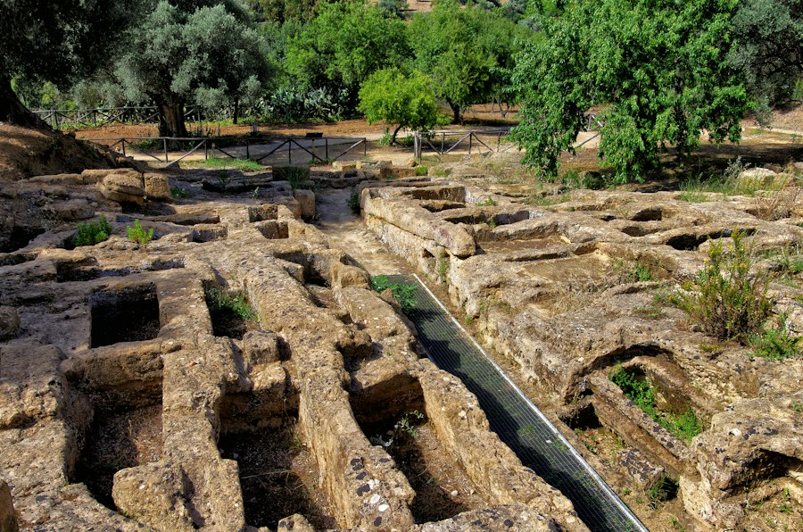
The bedrock of any archaeological investigation, including the study of logistics, lies in meticulous fieldwork. While technology has revolutionized the process, the fundamental principles of careful observation, recording, and documentation remain paramount. Traditional methods, often augmented by modern tools, are essential for identifying and characterizing the physical remains of ancient infrastructure.
Systematic Survey and Transect Sampling
Systematic surveys are designed to cover a given area in a structured manner, ensuring that no potential evidence is overlooked. Transect sampling involves dividing the landscape into parallel strips or grids and systematically walking these lines, recording any archaeological features encountered. For logistics analysis, this means paying close attention to linear features that might indicate pathways, roads, or watercourses, as well as concentrations of artifacts that could point to staging areas, settlements along routes, or material processing sites. The density and type of surface finds within specific transects can provide initial clues about the intensity of use and the nature of goods transported along a particular route. These surveys are often complemented by gridded surface collection, where the study area is divided into smaller squares, and all artifacts within each square are collected, bagged, and mapped. This granular approach allows for spatial analysis of artifact distribution, helping to differentiate between general habitation areas and specialized logistical hubs.
Geophysical Survey for Subsurface Detection
While surface surveys reveal visible remnants, geophysical methods are indispensable for detecting buried features that are not apparent to the naked eye. Ground-penetrating radar (GPR), magnetometry, and electrical resistivity are key techniques employed to map subsurface anomalies. GPR uses radio waves to create an image of subsurface layers, effectively “seeing” beneath the soil. It is particularly useful for identifying linear features like buried roads, ditches, or foundations of structures associated with logistics, such as toll houses or depots. Magnetometry measures variations in the Earth’s magnetic field, which can be caused by features such as fired clay (hearths, kilns) or disturbed soil, often associated with human activity and the construction or maintenance of infrastructure. Electrical resistivity measures the resistance of the soil to an electric current, highlighting differences in soil composition and moisture content, which can delineate buried walls, compacted earth surfaces, or water-filled channels. These techniques provide a non-destructive means of identifying potential logistical features before any costly or destructive excavation begins, allowing for targeted investigation.
Excavation and Stratigraphic Analysis
When geophysical surveys or surface finds suggest the presence of significant logistical infrastructure, targeted excavation becomes necessary. Excavation allows for direct observation and recovery of material evidence. Stratigraphic analysis, the study of the layering of soil and cultural deposits, is crucial for understanding the sequence of construction, use, and abandonment of these features. For logistics analysis, this means meticulously recording the layers that constitute a road surface, identifying different phases of repair or expansion, and dating the deposits associated with its use. The presence of specific artifact types within different stratigraphic layers can indicate the types of goods being transported and the economic activities associated with the route. For instance, finding amphorae fragments associated with a specific road segment might suggest the transport of wine or olive oil. The excavation of associated features, such as ditches, embankments, or associated structures, provides further context about the engineering and maintenance of the infrastructure.
The Aerial and Orbital Perspective: Remote Sensing in Logistics Analysis

In recent decades, remote sensing technologies have revolutionized archaeological mapping, offering broad-area coverage and the ability to detect features previously invisible from the ground. These techniques provide synoptic views of landscapes, revealing patterns and connections that might be missed through localized fieldwork alone.
Aerial Photography and Photogrammetry
Aerial photography, dating back to the early 20th century, has been a powerful tool for identifying archaeological features. Subtle variations in soil moisture, vegetation growth (crop marks), or shadows cast by subtle earthworks can reveal the presence of buried infrastructure. Different types of aerial photography, including black and white, color, infrared, and false-color infrared, can highlight different types of features. Photogrammetry, the science of making measurements from photographs, allows for the creation of three-dimensional models and accurate maps from overlapping aerial images. This enables detailed measurement of the dimensions, gradients, and alignments of ancient roads, canals, and other linear features, providing crucial data for understanding their engineering and logistical function. The ability to analyze multiple historical aerial photographs from different periods can also reveal changes in the landscape and the evolution of logistical networks over time.
Satellite Imagery and Multispectral Analysis
Satellite imagery offers continuous and global coverage, providing a vast resource for archaeological mapping. Different types of satellite sensors capture data across various spectral bands (multispectral and hyperspectral imagery), which can reveal information beyond what is visible to the human eye. For example, specific minerals or vegetation types associated with ancient construction materials or soils might be detectable through their spectral signatures. High-resolution satellite imagery can also be used to identify subtle topographic changes indicative of ancient pathways or water management systems. Furthermore, satellite imagery is invaluable for regional-scale analysis, allowing researchers to identify broad patterns of settlement and infrastructure development across vast territories, which is essential for understanding the overall logistical strategies of ancient societies. The ability to acquire imagery over time allows for the monitoring of landscape changes and the detection of new features that may emerge due to erosion or agricultural activity.
LiDAR and Digital Elevation Models
Light Detection and Ranging (LiDAR) is a particularly transformative remote sensing technology for archaeological mapping. LiDAR uses pulsed laser beams to measure distances to the Earth’s surface, generating highly accurate and detailed Digital Elevation Models (DEMs). By stripping away the overlying vegetation (either digitally or through processing), LiDAR can reveal subtle topographic features such as ancient roads, field boundaries, canals, and earthworks that are otherwise obscured by forests or dense undergrowth. The precision of LiDAR data allows for the precise measurement of road widths, gradients, and the extent of associated features like drainage ditches and embankments. This is crucial for calculating travel times, understanding the engineering challenges of construction, and assessing the capacity of these networks. The creation of bare-earth DEMs from LiDAR data is fundamental for reconstructing the original landscape and understanding how ancient peoples interacted with and modified it for logistical purposes.
The Digital Workbench: Geographic Information Systems (GIS) for Spatial Analysis
The vast datasets generated by traditional fieldwork and remote sensing techniques would be unwieldy and difficult to interpret without powerful analytical tools. Geographic Information Systems (GIS) have become indispensable for integrating, analyzing, and visualizing spatial data related to ancient logistics infrastructure.
Data Integration and Georeferencing
GIS allows for the integration of diverse datasets, including survey data, geophysical prospection results, aerial and satellite imagery, LiDAR-derived DEMs, historical maps, and excavation records, all within a common spatial framework. Georeferencing ensures that all these disparate layers are accurately aligned to real-world coordinates, enabling direct comparison and analysis. This integration is crucial for building a comprehensive picture of an ancient logistical network, where individual components—a road segment here, a potential port there, a series of settlements along a route—can be brought together to understand their interconnectedness. For instance, a road identified through LiDAR can be overlaid with artifact distributions from a surface survey and the locations of potential production sites, allowing for a robust analysis of resource flow.
Network Analysis and Least-Cost Path Modeling
One of the most powerful applications of GIS in logistics analysis is network analysis. This involves modeling the connectivity of identified infrastructure features to understand movement patterns. Network analysis can identify the shortest or most efficient routes between points of origin and destination, considering factors like distance, slope, and potential terrain barriers. Least-cost path modeling is a sophisticated technique within network analysis that assigns “costs” to traversing different terrain types or infrastructure segments. By minimizing these costs, the model can predict the most likely routes ancient travelers or traders would have taken. This can reveal previously unknown connections, identify bottlenecks in the network, and provide insights into the strategic importance of certain routes or locations. Applying these models to different periods can also reveal changes in logistical priorities and the development of more efficient transport systems over time.
Spatial Statistics and Pattern Recognition
GIS enables the application of spatial statistical methods to identify patterns and relationships within the mapped data. Techniques such as hot spot analysis can identify areas with a high concentration of logistical features or associated artifacts, potentially indicating major hubs, depots, or highly trafficked zones. Spatial autocorrelation measures the degree to which features are clustered or dispersed, helping to understand the organization and extent of logistical networks. Furthermore, GIS can be used to perform buffer analysis around identified routes or settlements to understand their sphere of influence or the areas they served. These analytical approaches move beyond simply mapping features to understanding the underlying processes and human behaviors that shaped the logistical landscape.
Recent advancements in archaeological mapping methods have significantly enhanced our understanding of ancient logistics infrastructure, revealing how past civilizations managed their resources and transportation networks. For a deeper insight into the implications of these findings, you can explore an article discussing the vulnerabilities faced by islands in the context of historical logistics and modern challenges. This article highlights the intricate relationship between geography and infrastructure, shedding light on how ancient practices can inform contemporary issues. To read more about this topic, visit this insightful article.
Case Studies and Interpretive Frameworks for Ancient Logistics
| Mapping Method | Description | Application in Ancient Logistics Infrastructure | Advantages | Limitations |
|---|---|---|---|---|
| Remote Sensing (Satellite Imagery) | Use of satellite images to detect surface anomalies and landscape features | Identifying ancient roads, canals, and storage facilities from above | Large area coverage, non-invasive, cost-effective | Limited resolution, affected by vegetation and modern development |
| LIDAR (Light Detection and Ranging) | Laser scanning to create high-resolution topographic maps | Revealing hidden infrastructure like roads, terraces, and warehouses beneath forest canopy | High precision, penetrates vegetation, detailed 3D models | Expensive, requires specialized equipment and expertise |
| Geophysical Survey (Ground Penetrating Radar, Magnetometry) | Detecting subsurface features through electromagnetic methods | Mapping buried storage pits, foundations, and transport routes | Non-destructive, good for subsurface mapping | Depth limitations, affected by soil composition |
| Traditional Surveying (Total Station, GPS) | Manual measurement of site features and coordinates | Documenting visible remains of logistics infrastructure like roads and docks | Accurate positioning, useful for detailed site plans | Time-consuming, limited to accessible areas |
| GIS (Geographic Information Systems) | Digital analysis and integration of spatial data from multiple sources | Analyzing spatial relationships and logistics networks over time | Data integration, spatial analysis, visualization | Requires data input, technical expertise |
The theoretical application of mapping techniques gains its full meaning when applied to specific archaeological contexts. Examining case studies where archaeological mapping has been instrumental in understanding ancient logistics provides concrete examples of the power and potential of these methods.
Case Study: Roman Roads and Supply Lines
The Roman Empire, renowned for its extensive and well-engineered road network, provides a prime example. LiDAR surveys in various regions of the Roman Empire have revealed extensive and often subtle road alignments previously unknown. GIS analysis of these mapped roads, coupled with the identification of Roman settlements, forts, and ports, allows for detailed reconstruction of supply lines for legions, provision of urban centers, and movement of trade goods. By analyzing gradients and terrain, researchers can estimate travel times and the logistical challenges faced by Roman surveyors and engineers. The identification of specific milestones, wayside stations (mansiones), and bridges further adds layers of detail to our understanding of the efficiency and organization of Roman logistics. Mapping also allows for the identification of variations in road construction and maintenance across different regions, reflecting local resources and imperial priorities.
Case Study: Maritime and Riverine Networks in Ancient Egypt
Ancient Egypt’s reliance on the Nile River for transportation and communication presents another compelling case study. While the Nile itself is a natural artery, the mapping of associated infrastructure, such as harbors, canals, and ancient port facilities, reveals the sophisticated human modifications to facilitate logistics. Geophysical surveys can identify buried harbor structures or the remnants of canal dredging, while aerial imagery and LiDAR can map the extent of ancient waterways and their connections to settlements. GIS analysis can model the flow of goods along the Nile and its tributaries, from agricultural produce originating in the fertile Nile Valley to stone from quarries and finished goods moved between major urban centers. The mapping of cemeteries and burial sites along the river can also provide insights into the social stratification and movement of people within these logistical networks.
Case Study: Pre-Columbian Andean Road Systems
The Inca Empire’s vast and complex road system (Qhapaq Ñan) in the Andes mountains is a testament to incredible engineering and logistical planning in challenging terrain. Archaeological mapping, combining systematic survey, LiDAR, and photogrammetry, has been crucial in revealing the full extent and complexity of this network. GIS analysis allows for the reconstruction of routes, the identification of Inca waystations (tambos), bridges, and storehouses (collcas), and the understanding of how these elements functioned together to facilitate the movement of goods, information, and people across diverse ecological zones. Analyzing the construction techniques and materials used in different sections of the road reveals variations in labor organization and resource allocation. The steep gradients and extreme altitudes present unique challenges that mapping helps to elucidate, demonstrating the sophisticated understanding of surveying and engineering that underpinned their logistical success.
Challenges and Future Directions in Archaeological Logistics Mapping
Despite the remarkable advancements in archaeological mapping, several challenges persist, and future research promises to push the boundaries of what is possible in understanding ancient logistics.
Data Gaps and Preservation Issues
One significant challenge is the inherent incompleteness of the archaeological record. Many logistical features, particularly those made of perishable materials or those located in environments prone to rapid erosion or deposition, may have been lost to time. Identifying and mapping these ephemeral features requires innovative techniques and a deep understanding of landscape dynamics. Furthermore, the accessibility of sites can be a limiting factor, with many important logistical networks located in remote or politically unstable regions. The increasing impact of climate change also poses a threat to existing archaeological sites, necessitating urgent efforts in documentation and preservation.
Integrating Interdisciplinary Approaches
The future of archaeological logistics mapping lies in even greater interdisciplinary collaboration. Integrating data from environmental science, geomorphology, and paleoecology can provide crucial context for understanding how ancient environments shaped and were shaped by logistical networks. For example, reconstructing past river courses or understanding soil erosion rates can inform our interpretation of the stability and viability of ancient waterways. Collaboration with engineers and computer scientists can lead to the development of more sophisticated modeling tools and analytical techniques, allowing for more nuanced interpretations of logistical efficiency and resource management. The increasing use of drones for high-resolution aerial mapping and data collection is also a promising avenue for future research.
Moving Towards Predictive Modeling and Digital Preservation
Future research will likely focus on developing more sophisticated predictive models to identify potential undocumented logistical infrastructure. By analyzing the relationship between known features and environmental or topographic variables, archaeologists can develop algorithms to forecast areas where similar infrastructure might exist. Furthermore, the digital preservation of archaeological data is becoming increasingly critical. Creating comprehensive, multi-layered digital archives of mapped logistics infrastructure will ensure its accessibility for future research and for heritage management purposes, safeguarding this vital aspect of human history for generations to come. The ongoing development of open-source GIS platforms and data sharing initiatives will also facilitate broader access and collaborative research.

The 2.7% Statistic That Terrifies Roman Historians
FAQs
What is archaeological mapping?
Archaeological mapping is the process of creating detailed visual representations of archaeological sites, features, and landscapes using various techniques such as surveying, remote sensing, and Geographic Information Systems (GIS).
How are ancient logistics infrastructure mapped using archaeological methods?
Ancient logistics infrastructure, such as roads, bridges, and ports, can be mapped using techniques like ground surveys, aerial photography, LiDAR (Light Detection and Ranging), and satellite imagery to identify and document these features on the landscape.
Why is mapping ancient logistics infrastructure important in archaeology?
Mapping ancient logistics infrastructure is crucial for understanding how past societies organized and managed the movement of goods, people, and information. It provides insights into trade networks, communication routes, and the overall socio-economic structure of ancient civilizations.
What role does Geographic Information Systems (GIS) play in archaeological mapping methods?
GIS allows archaeologists to store, analyze, and visualize spatial data related to ancient logistics infrastructure. By integrating various layers of information, GIS helps researchers identify patterns, relationships, and spatial contexts that contribute to a better understanding of past human activities.
How do modern technologies enhance archaeological mapping of ancient logistics infrastructure?
Modern technologies such as drones, 3D laser scanning, and advanced satellite imagery have revolutionized the way archaeologists map ancient logistics infrastructure. These tools provide high-resolution data, improve accuracy, and allow for non-invasive documentation of archaeological sites on a large scale.