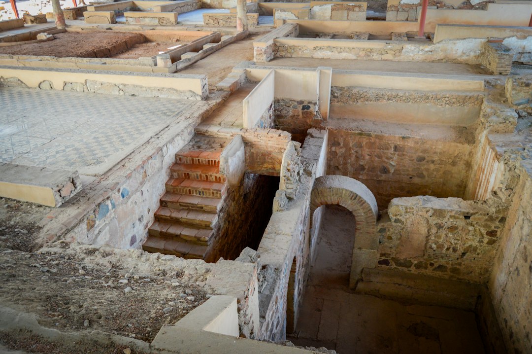
The sands of time, often unforgiving, have buried vast swathes of human history, leaving behind tantalizing fragments and vast unknowns. Among these lost legacies, the intricate network of Roman roads stands as a particularly potent symbol of their advanced civilization. These arteries of empire, stretching across Europe, North Africa, and the Middle East, facilitated trade, troop movements, and cultural exchange. Yet, with the decline of Rome, many of these meticulously constructed pathways have faded from view, reclaimed by nature, built over by subsequent generations, or simply lost to the vagaries of time. Reconstructing these lost Roman pathways, however, is no longer a matter solely for archaeologists with trowels and brushes. A new frontier is being explored, one where the power of advanced computer models is unlocking secrets long held by the earth, offering unprecedented insights into the engineering genius and logistical prowess of the Roman world.
Unearthing the Ghostly Trails of Empire
The process of modern archaeological investigation, while invaluable, is inherently constrained by the physical evidence that remains. Digging is a destructive process, and the scope of potential discoveries is limited by resources and the sheer scale of the Roman Empire. The concept of a “lost” Roman road implies a path that is no longer clearly discernible on the surface. This could be due to erosion, agricultural activity, the construction of modern settlements, or the natural process of vegetation growth. Traditional methods of identifying such roads often relied on aerial photography, which could reveal subtle crop marks or soil discolorations indicative of buried structures. Geophysical surveys, such as ground-penetrating radar or magnetometry, could also detect anomalies beneath the surface. However, these techniques, while powerful, are often localized in their application and require significant on-the-ground effort. The challenge of reconstructing a vast, interconnected network from scattered evidence is immense, and it is here that computational approaches begin to offer transformative solutions. The ambition is not merely to identify individual road segments but to reconstruct the entire logical and physical pathways that connected Roman settlements, military forts, and important strategic locations. This requires understanding not just where a road might have been, but how it was designed to function within a broader logistical and geographical context.
The Scarcity of Direct Evidence
The most immediate challenge in reconstructing lost Roman pathways is the scarcity of direct, surface-level evidence. Centuries of change mean that many roads have been completely obliterated. Imagine trying to trace a forgotten highway across a continent where the landscape has been reshaped by agriculture, deforestation, and the growth of modern cities. The original construction techniques, such as the multi-layered foundation of statumen, rudus, and nucleus topped with summum dorsum (the paved surface), are rarely preserved in their entirety. Even when remnants are found, they might be isolated sections, making it difficult to connect them into a coherent whole. Furthermore, the Romans were not always rigidly bound to straight lines. While they famously favored direct routes where possible, geographical obstacles – mountains, rivers, marshes – necessitated deviations and compromises. These deviations, often dictated by terrain and engineering feasibility, are precisely the aspects that are most easily lost to time and are therefore the hardest to predict without extensive empirical data. The assumption of a straight line between two points, while a useful initial hypothesis, often fails to account for the sophisticated environmental considerations that influenced Roman engineering.
The Role of Ancillary Data Streams
To overcome the limitations of direct evidence, researchers are increasingly turning to a diverse array of ancillary data. This includes historical texts, which, while often cryptic, can provide clues about routes and significant landmarks. Ancient itineraries, such as the Antonine Itinerary or the Peutinger Table, offer valuable, albeit incomplete, geographical information. Maps from later periods, even if not depicting Roman roads directly, can reveal landscape features that might have guided Roman engineers, such as pre-existing tracks or natural corridors. The study of place names, often retaining echoes of Roman presence, can also offer directional hints. Moreover, geological and topographical data are crucial. Understanding the natural drainage patterns, the types of soil, and the gradients of the land provides essential context for how a road would have been built and where it would have been most feasible to traverse. The availability of high-resolution digital elevation models (DEMs) has been a game-changer, allowing researchers to analyze the landscape in unprecedented detail and identify subtle features that might suggest the presence of a buried road. This multi-faceted approach, drawing from textual, historical, and environmental datasets, forms the bedrock upon which computational models are built.
Recent advancements in reconstructing lost Roman pathways through computer modeling have opened new avenues for understanding ancient infrastructure. A related article that delves into the complexities of governance and control in modern contexts, including space, can be found at this link. This exploration of governance parallels the challenges faced in preserving and reconstructing historical pathways, highlighting the importance of managing both ancient and contemporary systems effectively.
Algorithms of Antiquity: Computational Approaches
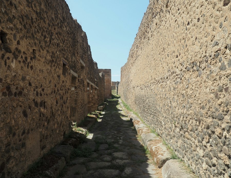
The digitization of historical data, coupled with the exponential growth in computational power, has opened up entirely new avenues for historical reconstruction. Advanced computer models are not simply tools for visualizing existing data; they are powerful engines for generating hypotheses, testing theories, and revealing patterns that would be invisible to the human eye or impossible to discern through traditional methods. The core idea is to simulate the decision-making processes of Roman engineers, taking into account the constraints and objectives they would have faced. This involves not only understanding the physical landscape but also the social, economic, and military imperatives that shaped Roman infrastructure. The complexity of these models lies in their ability to integrate multiple variables and predict outcomes that are both geographically plausible and historically consistent. The ultimate goal is to create a dynamic, interactive representation of the Roman road network, one that can be explored and refined as new data emerges.
Predictive Modeling and Landscape Analysis
Predictive modeling forms the cornerstone of this computational approach. Researchers develop algorithms that are trained on known Roman road segments and the geographical characteristics of those areas. These algorithms learn to associate specific landscape features with the presence of Roman roads. For instance, they might identify that Roman roads were often built on ridges to avoid marshy lowlands or that they tended to follow river valleys for water and ease of construction. Once trained, these models can be applied to areas with less direct evidence, predicting the most probable locations for lost Roman pathways. This is not a process of guesswork but of informed probability. The models take into account factors such as slope, soil type, proximity to water sources, and the relative elevation of the terrain. By analyzing the digital elevation models and other geospatial data, the algorithms can identify areas that possess similar characteristics to known Roman road locations, flagging them as potential sites for further investigation. This allows archaeologists and historians to focus their efforts on the most promising areas, maximizing the efficiency of their research.
Simulating Roman Engineering Constraints
Beyond simply identifying potential routes, advanced computer models can also simulate the actual engineering constraints that Roman builders faced. The Romans were renowned for their practical approach to engineering. They understood the limitations of their tools and materials. They also understood the importance of gradients for wheeled traffic and the need for stable foundations. Computer models can incorporate these considerations. For example, an algorithm might be programmed to favor routes with gradients below a certain threshold, reflecting the limitations of oxen-drawn carts and early vehicles. It could also incorporate factors related to soil stability, identifying areas where building a durable road would have been exceptionally difficult or expensive. Furthermore, the models can consider the strategic and logistical objectives. If a known Roman fort is identified, the model can predict the most likely routes connecting it to other settlements or resources, prioritizing directness where feasible and practicality where necessary. This simulation of Roman engineering thought process allows for a more nuanced and accurate reconstruction of their pathways.
Integrating Diverse Datasets: A Holistic Approach
The true power of these computational approaches lies in their ability to integrate a vast array of disparate datasets into a cohesive analysis. This includes not only the geospatial and topographical data mentioned earlier but also historical texts, archaeological survey data, and even modern land use information. For instance, a model might correlate predicted Roman road routes with areas where historical texts mention significant travel or trade. It could also cross-reference predictions with geophysical survey data, confirming or refuting potential road locations identified by the computer. By bringing together all available information, researchers can create a more robust and reliable picture of the Roman road network. This holistic approach acknowledges that the Roman world was a complex system, and its infrastructure was shaped by a multitude of factors. The integration of diverse datasets allows for the identification of synergistic relationships and the validation of hypotheses across different domains of evidence.
From Theory to Practice: Case Studies and Successes
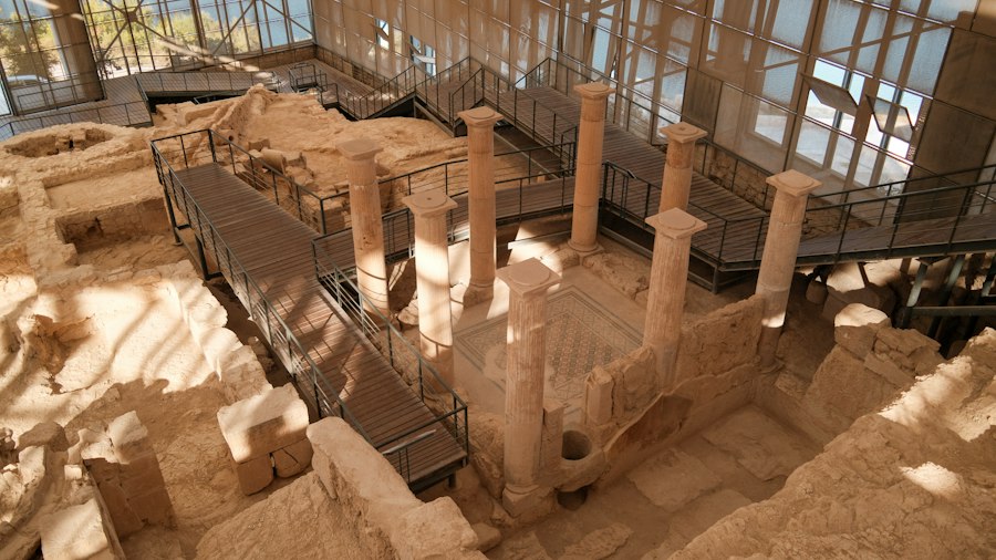
The theoretical power of computer modeling needs to be validated by practical application. Fortunately, numerous projects are already demonstrating the efficacy of these advanced techniques in unearthing lost Roman pathways. These case studies provide concrete examples of how computational approaches can supplement and even surpass traditional archaeological methods, leading to new discoveries and a deeper understanding of Roman infrastructure. The success of these projects serves as a powerful testament to the potential of this interdisciplinary field.
Mapping the Forgotten Legions’ March
One of the most compelling applications of these models is in understanding the military logistics of the Roman Empire. The vast network of Roman roads was a critical component of their military machine, enabling rapid troop deployment and efficient supply lines. By reconstructing lost military roads, researchers can gain new insights into campaign routes, the location of ephemeral marching camps, and the strategic considerations that underpinned Roman military expansion. For instance, in regions where Roman legions operated extensively, such as Britain or Germany, computer models can be used to predict the likely routes of supply lines connecting forts and supply depots. These predicted routes can then be cross-referenced with known archaeological finds, such as marching camp sites or scattered pottery sherds, to confirm their accuracy. The ability to visualize these likely troop movements and supply chains in a dynamic, 3D environment can revolutionize our understanding of Roman military strategy and the logistical challenges they overcame.
Rediscovering Trade Routes and Economic Networks
The Roman Empire was also a vibrant economic powerhouse, and its road network was fundamental to facilitating trade and commerce. Lost Roman pathways often represent forgotten arteries of trade, connecting vital production centers with burgeoning urban markets. Computer models can help to identify these routes by analyzing the distribution of trade goods, the location of known Roman settlements with economic significance (e.g., mines, quarries, agricultural centers), and the most geographically efficient connections between them. For example, a model might predict a Roman road connecting a known source of high-quality marble with a major city where that marble was used in construction. The discovery of such a route, previously unknown, can significantly alter our understanding of Roman economic networks and the extent of their trade relationships. Furthermore, by mapping these trade routes, researchers can also begin to understand the economic impact of Roman infrastructure on the regions it traversed, identifying areas that flourished due to improved connectivity.
Enhancing Heritage Management and Preservation
The insights gained from reconstructing lost Roman pathways have direct implications for heritage management and preservation. By accurately mapping these ancient routes, archaeologists and heritage organizations can better identify and protect these invaluable remnants of the past. Modern development projects, such as road construction or urban expansion, can inadvertently damage or destroy buried Roman roads. Advanced computer models can provide crucial data to inform planning decisions, helping to mitigate the impact of such developments and ensure that these historical sites are preserved for future generations. The ability to predict the likely path of a Roman road in an area earmarked for development allows for proactive measures to be taken, such as conducting targeted surveys or rerouting construction plans. This proactive approach is far more effective and less costly than discovering a significant Roman road after it has already been damaged.
The Future of Roman Reconstruction: Integration and Evolution
The field of reconstructing lost Roman pathways using computer models is still in its relative infancy, yet its trajectory is one of rapid advancement and increasing sophistication. The current successes are merely a glimpse of what lies ahead. As computational power continues to grow and new data sources become available, the accuracy and scope of these reconstructions will undoubtedly expand. The focus is shifting from isolated road segments to comprehensive network analysis, and from simply identifying routes to understanding their nuanced interactions within the Roman world. The ongoing evolution of these techniques promises to unlock ever deeper layers of understanding about this influential civilization.
Towards Dynamic and Interactive Roman Landscapes
The ultimate vision for this field is the creation of dynamic and interactive 3D models of the Roman Empire’s infrastructure. Imagine not just a static map but a living, breathing digital representation where users can virtually traverse the Roman roads, explore the associated settlements, and understand the logistical and economic forces that shaped them. These models would allow for unprecedented levels of research and public engagement, bringing the Roman world to life in ways previously unimaginable. Such platforms would enable researchers to test complex hypotheses in real-time, visualizing the impact of different road-building decisions or the flow of goods and troops across the empire. For the public, it would offer an immersive educational experience, fostering a deeper appreciation for the ingenuity and scale of Roman achievements.
The Role of Artificial Intelligence and Machine Learning
Artificial intelligence (AI) and machine learning (ML) are poised to play an increasingly significant role in this field. These technologies can process vast amounts of data and identify complex patterns that might elude human analysis. For instance, ML algorithms can be trained to recognize subtle textual clues in ancient documents that might indicate the presence of a Roman road, or to analyze satellite imagery for even more ephemeral surface features. Furthermore, AI can be used to optimize route prediction algorithms, constantly learning and improving their accuracy based on new data. The integration of AI and ML will allow for more sophisticated and nuanced reconstructions, moving beyond simple predictive models to systems that can actively infer missing information and generate highly probable scenarios. This will enable researchers to uncover more lost pathways with greater confidence and efficiency.
Collaboration and Open Data Initiatives
The reconstruction of lost Roman pathways is inherently an interdisciplinary endeavor, requiring collaboration between archaeologists, historians, computer scientists, geographers, and engineers. Furthermore, the success of these projects hinges on the accessibility of data. Open data initiatives, where research findings and datasets are made publicly available, are crucial for fostering collaboration and accelerating progress. By sharing their models, algorithms, and digitized data, researchers can build upon each other’s work, leading to more comprehensive and accurate reconstructions of the Roman road network. This collaborative approach, combined with the power of advanced computational tools, promises to usher in a new era of understanding the enduring legacy of Roman infrastructure.
Recent advancements in reconstructing lost Roman pathways have been significantly enhanced by innovative computer modeling techniques. These models allow researchers to visualize and analyze ancient routes with remarkable accuracy, shedding light on how these pathways influenced trade and communication in the Roman Empire. For those interested in the intersection of historical geography and technology, a related article discusses the intriguing aspects of ancient cartography and its implications for modern understanding, which can be found here: decoding the Piri Reis map. This exploration not only highlights the sophistication of ancient navigational methods but also complements the ongoing efforts to map out the intricate network of Roman roads.
The Enduring Legacy of Roman Infrastructure
| Metric | Description | Value | Unit | Notes |
|---|---|---|---|---|
| Number of Known Roman Roads | Total documented Roman roads used as input data | 85 | roads | Includes major and minor roads |
| GIS Data Points | Geospatial coordinates used for modeling | 12,500 | points | Derived from archaeological surveys and satellite imagery |
| Model Accuracy | Percentage of reconstructed pathways matching archaeological evidence | 87 | % | Validated against known road segments |
| Computational Time | Time taken to run the reconstruction algorithm | 3.5 | hours | On a standard workstation |
| Algorithm Type | Primary computational method used | Graph-based shortest path | N/A | Incorporates terrain and historical constraints |
| Terrain Data Resolution | Resolution of elevation data used in modeling | 30 | meters | From digital elevation models (DEM) |
| Number of Reconstructed Pathways | Estimated lost pathways generated by the model | 42 | paths | Pending archaeological verification |
| Historical Data Sources | Number of ancient texts and maps referenced | 15 | sources | Includes Roman itineraries and medieval maps |
The pursuit of reconstructing lost Roman pathways is more than an academic exercise; it is a quest to understand the foundations of a civilization that profoundly shaped the modern world. The Romans were masters of engineering and organization, and their infrastructure, particularly their road network, was a testament to their ambition and capability. By employing advanced computer models, researchers are not simply locating old roads; they are piecing together the physical and logical framework that enabled the Roman Empire to function and thrive. This endeavor offers a powerful reminder of human ingenuity and the enduring impact of thoughtful planning and construction on the course of history.
Connecting Past and Present Through Digital Reconstruction
The digital reconstruction of lost Roman pathways serves as a vital bridge between the past and the present. It allows us to visualize and understand the world as the Romans experienced it, revealing the intricate connections that bound their vast empire together. These reconstructions can inform contemporary debates about infrastructure development, urban planning, and the principles of sustainable engineering. By studying the successes and failures of Roman infrastructure, we can glean valuable lessons that remain relevant today. The digital realm provides an accessible and engaging platform for sharing this knowledge, making the achievements of the Romans tangible and relatable for a global audience.
A Deeper Appreciation for Roman Ingenuity
The sheer scale and sophistication of the Roman road network, even in its lost forms, continue to inspire awe. Reconstructing these pathways using advanced computer models allows for a deeper appreciation of the Romans’ engineering prowess, their meticulous planning, and their understanding of the landscape. It highlights their ability to overcome immense geographical challenges and to create systems that were both functional and durable, many of which served as the foundation for later European road networks. This renewed understanding of their ingenuity extends beyond mere technical skill, revealing their strategic foresight and their commitment to connectivity as a cornerstone of their power and prosperity.
Informing Future Infrastructure Development
The principles and methodologies employed in reconstructing lost Roman pathways have direct relevance for contemporary infrastructure development. The Roman approach to route selection, gradient management, and materials science, when analyzed through modern computational lenses, offers valuable insights into efficient and sustainable construction practices. By understanding how the Romans adapted to their environment and engineered resilient pathways, we can inform current practices, potentially leading to more environmentally conscious and long-lasting infrastructure projects. The lessons learned from deciphering the logic behind ancient routes can guide the planning of modern transportation networks, ensuring they are not only efficient but also harmonize with the natural landscape.
The ongoing work in reconstructing lost Roman pathways represents a significant advancement in historical research. It demonstrates how the integration of cutting-edge technology with rigorous scholarly inquiry can unlock forgotten chapters of human history, offering not only a clearer picture of the past but also valuable lessons for the future. The silent roads of the Roman Empire are slowly but surely being revealed, not through dusty excavation alone, but through the powerful, illuminating glow of the digital age.

The 2.7% Statistic That Terrifies Roman Historians
FAQs
What is the purpose of the computer model for reconstructing lost Roman pathways?
The computer model is designed to digitally recreate ancient Roman road networks that have been lost to time, providing valuable insights into the infrastructure and transportation systems of the Roman Empire.
How does the computer model reconstruct lost Roman pathways?
The computer model uses a combination of historical data, geographical information, and advanced algorithms to simulate the most likely routes of ancient Roman roads based on known locations and topographical features.
What are some potential benefits of reconstructing lost Roman pathways using a computer model?
Reconstructing lost Roman pathways can help historians and archaeologists better understand the extent of the Roman road network, trade routes, and communication systems, as well as shed light on the economic, social, and political dynamics of the Roman Empire.
Are there any limitations to using a computer model to reconstruct lost Roman pathways?
While computer models can provide valuable insights, they are based on assumptions and data inputs that may not always be accurate. Additionally, factors such as natural disasters, urban development, and other historical events can impact the accuracy of the reconstructed pathways.
How can the findings from the computer model for reconstructing lost Roman pathways be applied in modern times?
The findings from the computer model can be used to inform conservation efforts, urban planning, and heritage management strategies in regions that were once part of the Roman Empire. Additionally, the insights gained from reconstructing lost Roman pathways can help us better understand the development of infrastructure and transportation systems in ancient civilizations.