The revelation of over 50,000 miles of Roman roads, meticulously mapped through cutting-edge technology, has fundamentally reshaped our understanding of the Roman Empire’s vast infrastructure and its profound impact on the ancient world. This monumental undertaking, born from a fusion of historical scholarship and modern geospatial analysis, has unveiled a network far more extensive and intricately woven than previously imagined. The sheer scale of these arteries of communication and commerce paints a vivid picture of Roman logistical prowess, military might, and the deep integration of its conquered territories.
The Discovery of a Hidden Network
The process of uncovering this immense road network was not a singular event but rather a culmination of years of dedicated research, archaeological fieldwork, and the transformative power of aerial and satellite imagery. For centuries, historians and archaeologists have pieced together fragments of Roman roads, relying on surviving physical remnants, textual descriptions, and local traditions. However, the true extent and interconnectedness of this ancient highway system remained largely elusive, obscured by the passage of time, natural erosion, and the subsequent overlay of later human activity. This new mapping project has brought these hidden pathways into sharp focus, revealing a skeletal framework that once pulsed with the lifeblood of an empire.
Advancements in Remote Sensing Technology
The breakthrough in mapping this vast network can be directly attributed to significant advancements in remote sensing technologies. Techniques such as Light Detection and Ranging (LiDAR) have proven to be particularly transformative. LiDAR, which uses laser pulses to measure distances and create detailed 3D representations of the Earth’s surface, can penetrate dense vegetation and reveal subtle topographic features that would otherwise remain invisible. By flying aircraft equipped with LiDAR scanners over potential road corridors, researchers could effectively “see through” forests and other overgrowth, identifying the characteristic linear depressions and embankments that signal the presence of ancient Roman roads. This technology bypasses the limitations of traditional archaeological methods, which often require extensive excavation and can be prohibitively expensive and time-consuming over large areas.
Integrating Historical Data with Modern Analysis
Crucially, this project did not solely rely on technological prowess. The success hinges on the synergistic integration of cutting-edge geospatial analysis with existing historical and archaeological data. Researchers meticulously cross-referenced their findings with ancient texts, including itineraries, military records, and administrative documents that alluded to road systems. Archaeological excavation reports, detailing known road segments and settlements connected by them, also served as vital anchor points. This interdisciplinary approach allowed for the verification of LiDAR-generated pathways and the contextualization of the newly discovered routes within the broader historical narrative of Roman expansion and governance. The digital mapping tools employed enabled the systematic layering of this disparate information, creating a comprehensive and dynamic representation of the Roman road network.
The extensive network of Roman roads, which spanned thousands of miles across the ancient empire, played a crucial role in facilitating trade, military movement, and cultural exchange. For a deeper understanding of how infrastructure impacts economies, you might find the article on tariffs and trade loopholes insightful. It discusses modern economic strategies that can be likened to the logistical advantages provided by Roman roads. You can read more about this topic in the article titled “Cracking the Mexico Tariff Loophole” available at this link.
The Strategic Importance of Roman Roads
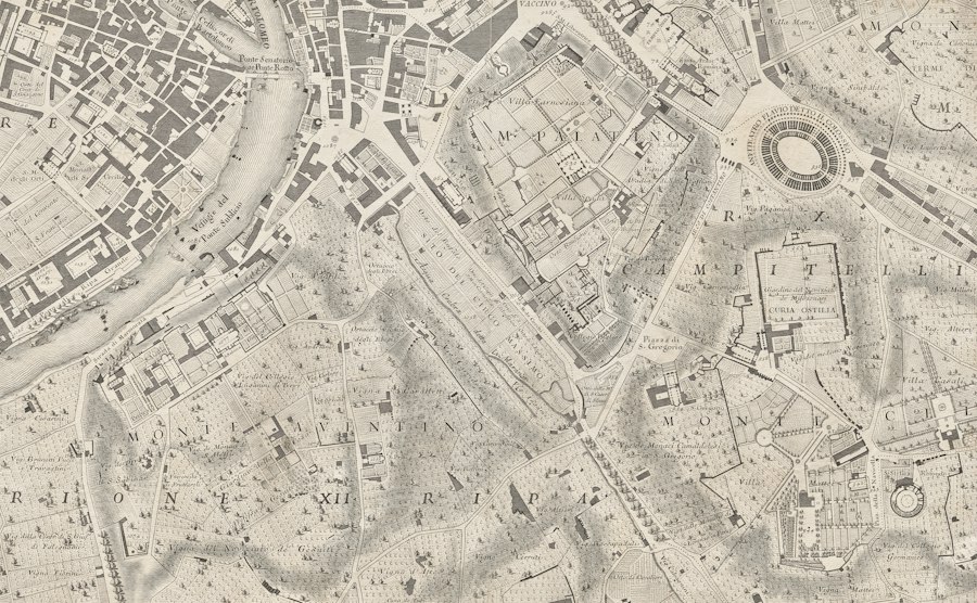
The sheer scale of the mapped road network underscores its critical role in the functioning and expansion of the Roman Empire. These were not mere pathways; they were meticulously engineered arteries of power, facilitating military movements, enabling efficient trade, and binding disparate regions into a cohesive political and cultural entity. The strategic placement and construction of these roads speak volumes about Roman foresight and their understanding of logistics and control.
Military Mobilization and Control
The primary impetus behind the vast Roman road network was undoubtedly military. These roads were designed to allow for the rapid deployment of legions to any frontier of the empire, enabling swift responses to rebellions, barbarian incursions, and the projection of Roman power. The straightness and durability of many Roman roads, often built with layered foundations of stone and gravel, allowed for remarkably efficient marching. Soldiers could traverse significant distances in a single day, maintaining discipline and formation. Beyond troop movement, these roads also facilitated the transport of supplies, siege equipment, and communication through couriers. The ability to move armies and their logistical support swiftly was a cornerstone of Roman military dominance and a key factor in their ability to conquer and maintain such a vast territory.
Facilitating Trade and Economic Integration
While military imperatives were paramount, the economic benefits of the Roman road system were equally profound. The roads provided a secure and reliable means for merchants to transport goods across the empire, fostering trade and economic integration. Commodities such as grain, wine, olive oil, pottery, and luxury items flowed along these routes, connecting producers with distant markets. This facilitated the specialization of regional economies and contributed to the overall prosperity of the empire. The existence of well-maintained roads also reduced the cost and risk of transportation, encouraging greater commercial activity and the growth of towns and cities along these arterial routes. This economic interconnectedness fostered a sense of shared prosperity and reinforced the Roman identity across diverse populations.
Administrative Governance and Communication
Beyond military and economic functions, the Roman road network played a vital role in the administration and governance of the empire. The efficient movement of officials, tax collectors, and messengers ensured that imperial decrees could be disseminated quickly and effectively throughout the vast territories. The roads facilitated the flow of information, allowing Rome to maintain a degree of central control over its provinces. The establishment of roadside stations, known as mansiones and mutationes, provided essential services for travelers, including lodging, food, and fresh horses, further streamlining official and commercial journeys. This administrative efficiency was crucial for maintaining order, collecting taxes, and integrating conquered populations into the Roman system.
Engineering Marvels and Construction Techniques
The construction of the Roman road network was a testament to the engineering prowess and organizational capabilities of the Romans. These roads were not merely cleared paths; they were sophisticated civil engineering projects, designed for durability, efficiency, and longevity. The sheer scale of the undertaking, involving vast labor forces and the systematic application of engineering principles, remains a remarkable achievement even by modern standards.
Laying the Foundation for Longevity
Roman roads were built to last, and their enduring legacy is a testament to the quality of their construction. The typical Roman road featured a layered structure, beginning with a foundation of large stones or rubble. This was followed by layers of smaller stones and gravel, compacted to create a stable base. The uppermost layer, or pavement, varied depending on the region and available materials, often consisting of tightly packed gravel, local stones, or even flagstones in more important routes. Drainage was a critical consideration, with ditches often dug along the sides to channel water away from the roadbed, preventing erosion and frost damage. The meticulous planning and execution of these construction techniques ensured that many Roman roads remained serviceable for centuries.
The Role of the Roman Army in Construction
The Roman army was not only the primary beneficiary of the road network but also its principal architect. Legionaries were skilled laborers, trained in construction and engineering. Building roads was a standard part of their duties, particularly during periods of campaigning or garrison duty in newly conquered territories. This not only provided employment and strategic infrastructure but also instilled discipline and a sense of purpose. The army possessed the organizational capacity, the manpower, and the engineering knowledge to undertake projects of such magnitude. It is estimated that hundreds of thousands of soldiers were involved in road construction over the centuries, effectively turning the empire’s military into its primary civil engineering corps.
Standardized Design and Regional Variations
While Roman roads generally adhered to standardized design principles, there were notable regional variations influenced by local topography, climate, and available materials. Straightness was a common objective, particularly for major arterial routes, reflecting the desire for speed and directness. However, in mountainous or challenging terrain, engineers would deviate to find more practical routes, employing sophisticated techniques for cutting through hillsides or constructing bridges and viaducts. The width of the roads also varied, with major imperial highways being wider to accommodate heavy traffic and military formations, while smaller provincial roads might be narrower. This adaptability ensured that the Roman road network could effectively traverse the diverse landscapes of the empire.
The Legacy and Enduring Impact
The recently mapped network of over 50,000 miles of Roman roads offers a powerful lens through which to re-examine the empire’s enduring legacy. These ancient thoroughfares, once vibrant with the commerce and movement of a dominant civilization, continue to shape our world in subtle yet significant ways. Their influence extends beyond mere physical remnants, impacting our understanding of history, urban development, and even modern infrastructure.
Rediscovering Lost Connections and Trade Routes
The detailed mapping has brought to light previously unknown connections between settlements and revealed the full extent of ancient trade routes. It allows historians to trace the flow of goods and ideas with unprecedented clarity, identifying economic hubs and their dependencies that were previously only speculated. This has led to a deeper understanding of regional specialization within the empire and how different parts of the Roman world were interconnected. The rediscovery of these routes can also shed light on the migration patterns of people and the diffusion of cultural practices.
Informing Modern Urban Planning and Infrastructure
The principles of Roman road construction – durability, efficient drainage, and strategic placement – continue to inform modern civil engineering and urban planning. Many of the foundational concepts in road building, such as the importance of a stable base and effective drainage systems, can be traced back to Roman practices. Furthermore, the locations of many modern towns and cities owe their existence to the Roman road network, with ancient settlements growing into bustling urban centers along these well-established routes. The study of Roman infrastructure provides invaluable lessons for contemporary projects, demonstrating the long-term benefits of investing in robust and well-planned public works.
A Window into Roman Society and Daily Life
The meticulously mapped roads are more than just lines on a map; they are tangible links to the past, offering invaluable insights into Roman society and daily life. They speak of the empire’s organizational capacity, its ambition, and its ability to mobilize resources on an immense scale. By understanding where these roads led, what they connected, and how they were used, we gain a more profound appreciation for the logistical challenges and triumphs of governing such a vast and diverse entity. The roads facilitate our understanding of the movement of people, the spread of ideas, and the very fabric of Roman existence, providing a rich tapestry of information for historians, archaeologists, and the public alike.
The extensive network of Roman roads, which spanned thousands of miles across the empire, played a crucial role in facilitating trade and communication. For those interested in the economic implications of such infrastructure, a fascinating article discusses the current dynamics of currency in relation to historical trade systems. You can explore this topic further in the article about the gold versus silver currency crisis, which draws parallels between ancient practices and modern financial systems. Understanding these connections can provide valuable insights into how infrastructure influences economic stability.
Future Research and Unanswered Questions
| Region | Mapped Length (miles) | Mapped Length (kilometers) | Notes |
|---|---|---|---|
| Italy | 50,000 | 80,467 | Core of the Roman road network |
| Gaul (modern France) | 20,000 | 32,187 | Extensive road system connecting major cities |
| Britannia (Britain) | 8,000 | 12,875 | Roads built for military and trade purposes |
| Hispania (Spain and Portugal) | 15,000 | 24,140 | Important trade routes |
| Germania | 5,000 | 8,047 | Less dense network due to terrain |
| North Africa | 10,000 | 16,094 | Roads connecting Roman settlements and ports |
| Total Estimated Mapped Length | 108,000 | 173,810 | Approximate total length of mapped Roman roads |
The revelation of over 50,000 miles of Roman roads is a monumental achievement, but it is by no means the end of the story. This groundbreaking mapping project opens up a wealth of new avenues for research and leaves many fascinating questions yet to be answered, promising further revelations about the Roman world.
Verifying and Detailing Additional Routes
While the 50,000-mile figure represents a significant portion of the known network, it is highly probable that more Roman roads remain undiscovered, hidden beneath centuries of accumulation or in regions yet to be comprehensively surveyed. Future research will likely focus on refining the existing data, verifying the newly identified routes through on-the-ground archaeological investigation, and continuing aerial surveys in areas that were either inaccessible or not prioritized in the initial project. The ongoing

The 2.7% Statistic That Terrifies Roman Historians
FAQs
How were the miles of Roman roads mapped?
The miles of Roman roads were mapped using a variety of methods, including ground surveys, aerial photography, LiDAR technology, and historical records.
What is the total length of Roman roads that have been mapped?
The total length of Roman roads that have been mapped is estimated to be around 250,000 miles across the ancient Roman Empire.
Why were Roman roads built in such a vast network?
Roman roads were built in a vast network to facilitate the movement of troops, goods, and information throughout the Roman Empire, aiding in trade, communication, and military conquest.
What materials were used to construct Roman roads?
Roman roads were typically constructed using several layers of materials, including a foundation of stones or gravel, a layer of sand or mortar, and a top layer of tightly fitted stones or bricks known as “pavement.”
How did the Roman road network influence modern road systems?
The Roman road network served as a model for modern road systems, with many modern highways and infrastructure projects following the straight, durable, and well-engineered design principles of Roman roads.