
The Longitude Problem has long been recognized as one of the most significant challenges in the history of navigation. It refers to the difficulty sailors faced in determining their east-west position while at sea, a task that was crucial for safe and accurate maritime travel. Unlike latitude, which could be easily calculated by observing the North Star or the sun’s position, longitude required a more complex understanding of time and distance.
The inability to accurately measure longitude led to countless shipwrecks and navigational errors, making it a pressing issue for explorers and traders alike. As maritime trade expanded during the Age of Exploration, the need for a reliable method to determine longitude became increasingly urgent. The vast oceans presented both opportunities and dangers, and the stakes were high for those who ventured into uncharted waters.
The quest for a solution to the Longitude Problem not only shaped the course of navigation but also influenced global trade patterns and international relations. The story of this quest is one of ingenuity, perseverance, and the relentless pursuit of knowledge.
Key Takeaways
- The Longitude Problem was a critical challenge in navigation that hindered accurate sea travel and trade.
- Early solutions involved astronomical observations and rudimentary tools but lacked precision.
- Advances in the 16th century laid the groundwork for improved navigation techniques and instruments.
- The Longitude Act of 1714 incentivized the development of accurate timekeeping devices essential for determining longitude.
- Solving the Longitude Problem revolutionized global exploration and maritime trade, influencing modern navigation systems.
Early attempts at solving the Longitude Problem
In the early days of exploration, sailors relied on rudimentary methods to estimate their position at sea. Dead reckoning, a technique that involved calculating one’s current position based on a previously determined location, was commonly used. However, this method was fraught with inaccuracies due to factors such as wind, currents, and human error.
As a result, many early navigators found themselves lost or off course, leading to disastrous consequences. Various attempts were made to devise methods for calculating longitude more accurately. One of the earliest proposals came from the ancient Greeks, who suggested using the moon’s position relative to fixed stars as a means of determining time differences between locations.
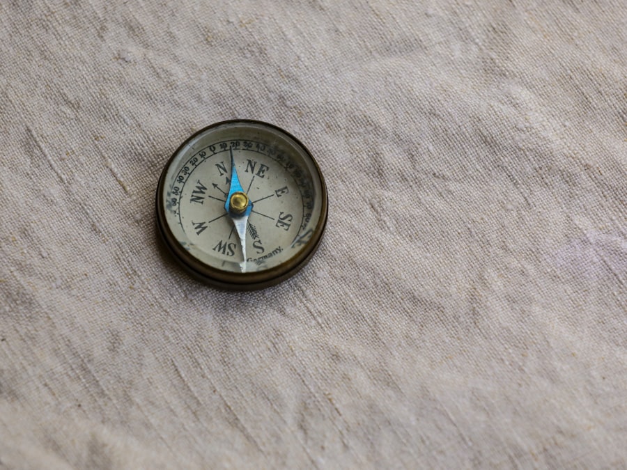
However, this method proved impractical due to the complexities involved in lunar observations. Throughout the centuries, other ideas emerged, including the use of magnetic compasses and celestial navigation techniques, but none provided a reliable solution to the Longitude Problem.
The role of the 16th century advancements in navigation

The 16th century marked a pivotal period in the evolution of navigation, characterized by significant advancements in maritime technology and knowledge. The introduction of more accurate maps and charts allowed sailors to navigate with greater confidence, while improvements in ship design enhanced their ability to withstand rough seas. The development of navigational instruments such as the astrolabe and quadrant also played a crucial role in helping sailors determine their latitude.
Despite these advancements, the Longitude Problem remained unsolved. Navigators continued to grapple with the challenge of accurately measuring time at sea, which was essential for calculating longitude. The growing demand for reliable navigation methods fueled further exploration and experimentation, as mariners sought innovative solutions to this age-old dilemma.
The 16th century thus laid the groundwork for future breakthroughs in navigation that would ultimately lead to the resolution of the Longitude Problem.
The impact of the Longitude Problem on maritime trade
The Longitude Problem had far-reaching implications for maritime trade during its prominence. As European nations expanded their empires and engaged in global commerce, the ability to navigate accurately became paramount. Merchants faced significant risks when transporting goods across vast oceans, as miscalculations could result in lost cargo or shipwrecks.
The inability to determine longitude effectively hindered trade routes and limited economic opportunities. Moreover, the consequences of navigational errors extended beyond individual voyages; they affected entire nations and their economies. For instance, ships that strayed off course could inadvertently enter hostile waters or collide with uncharted landmasses, leading to diplomatic tensions and conflicts.
As a result, solving the Longitude Problem was not merely a matter of improving navigation; it was essential for fostering international trade relations and ensuring the prosperity of nations engaged in maritime commerce.
The search for a solution: technological advancements
| Year | Event/Development | Key Figure | Method/Approach | Significance |
|---|---|---|---|---|
| 1514 | Publication of “De Magnete” | William Gilbert | Study of Earth’s magnetism | Laid groundwork for understanding magnetic compasses, crucial for navigation |
| 1569 | Mercator Projection introduced | Gerardus Mercator | Map projection aiding navigation | Improved sea navigation by representing lines of constant course |
| Late 1500s | Attempts to determine longitude at sea | Various navigators and scholars | Use of lunar distances and dead reckoning | Early efforts to solve longitude problem, but methods were inaccurate |
| 1598 | Publication of “The Art of Navigation” | Pedro de Medina | Navigation manual including longitude concepts | Disseminated knowledge on navigation techniques including longitude estimation |
The quest for a solution to the Longitude Problem spurred numerous technological advancements throughout the centuries. As navigators sought more precise methods for determining their position at sea, inventors and scientists began developing innovative tools and devices. One notable advancement was the creation of more sophisticated chronometers, which allowed sailors to keep accurate time aboard their vessels.
In addition to timekeeping devices, advancements in cartography played a crucial role in addressing the Longitude Problem. The production of detailed maps that incorporated new discoveries enabled navigators to better understand their surroundings and make informed decisions about their routes. These technological innovations not only improved navigation but also contributed to a growing body of knowledge about the world’s oceans and geography.
The role of astronomy in solving the Longitude Problem
Astronomy emerged as a key discipline in the search for a solution to the Longitude Problem. By observing celestial bodies such as stars and planets, navigators could gain valuable insights into their position on Earth. The development of astronomical tables and almanacs provided sailors with essential data for making accurate calculations at sea.
One particularly influential figure in this regard was Sir Isaac Newton, whose work on celestial mechanics laid the foundation for understanding how celestial bodies move through space. His theories helped navigators appreciate the relationship between time and position, ultimately leading to more effective methods for calculating longitude. As astronomy continued to evolve, it became an indispensable tool for mariners seeking to navigate with precision.
The development of accurate timekeeping devices
The development of accurate timekeeping devices was perhaps one of the most significant breakthroughs in solving the Longitude Problem. In the 18th century, clockmaker John Harrison made remarkable strides in creating marine chronometers that could withstand the harsh conditions at sea while maintaining precise timekeeping. His inventions revolutionized navigation by allowing sailors to calculate their longitude based on the difference between local time and Greenwich Mean Time.
Harrison’s work culminated in the creation of H4, a highly accurate marine chronometer that demonstrated unprecedented reliability. This device enabled sailors to determine their position with remarkable accuracy, significantly reducing navigational errors and enhancing safety at sea. The success of Harrison’s chronometers marked a turning point in maritime navigation and underscored the importance of timekeeping in solving one of history’s most enduring challenges.
The Longitude Act of 1714 and the search for a solution
In recognition of the urgent need for a solution to the Longitude Problem, the British government enacted the Longitude Act of 1714. This legislation offered substantial financial rewards for anyone who could develop an effective method for determining longitude at sea. The act spurred intense competition among inventors, scientists, and navigators, all eager to claim the prize.
The Longitude Act not only incentivized innovation but also highlighted the significance of solving this problem for national interests. As Britain sought to expand its naval power and enhance its maritime trade capabilities, finding a reliable method for determining longitude became a matter of national pride and economic necessity. The act catalyzed advancements in navigation technology and fostered collaboration among various disciplines as individuals worked tirelessly toward a common goal.
The legacy of the Longitude Problem in modern navigation
The legacy of the Longitude Problem continues to resonate in modern navigation practices. The solutions developed during this historical quest laid the groundwork for contemporary navigational techniques that rely on advanced technology such as GPS (Global Positioning System). While today’s navigators benefit from satellite technology that provides real-time positioning data, they owe much to the pioneering efforts of those who sought to solve the Longitude Problem centuries ago.
Moreover, the story of the Longitude Problem serves as a reminder of humanity’s enduring quest for knowledge and understanding. It illustrates how challenges can drive innovation and collaboration across disciplines, ultimately leading to breakthroughs that shape society as a whole. The lessons learned from this historical endeavor continue to inform modern approaches to navigation and exploration.
The impact of solving the Longitude Problem on global exploration
The resolution of the Longitude Problem had profound implications for global exploration. With accurate methods for determining longitude now available, explorers could venture into uncharted territories with greater confidence and precision. This newfound ability opened up new trade routes and facilitated contact between distant cultures, fostering an era of exploration that reshaped world history.
As explorers embarked on ambitious voyages across oceans previously deemed perilous, they contributed to an expanding body of knowledge about geography, cultures, and ecosystems. The ability to navigate accurately not only enhanced trade but also paved the way for scientific discoveries that would transform humanity’s understanding of the world. The impact of solving the Longitude Problem thus extended far beyond navigation; it played a crucial role in shaping global interactions and fostering cultural exchange.
the lasting significance of the 16th century efforts to navigate the Longitude Problem
The efforts made during the 16th century to address the Longitude Problem laid a crucial foundation for future advancements in navigation and exploration. While many challenges remained unsolved at that time, these early endeavors sparked curiosity and innovation that would ultimately lead to breakthroughs in maritime technology. The quest for accurate longitude determination became emblematic of humanity’s relentless pursuit of knowledge—a pursuit that continues today.
In reflecting on this historical journey, it becomes clear that solving complex problems often requires collaboration across disciplines and generations.
As we navigate our own uncertainties today, we can draw lessons from history about perseverance, creativity, and the importance of seeking answers beyond conventional boundaries.
For a deeper understanding of this historical dilemma and its implications, you can read more in the article available at Real Lore and Order. This resource provides insights into the struggles faced by seafarers and the eventual breakthroughs that transformed navigation.
WATCH THIS! 🗺️ The Map That Proves Humans Explored Earth 5,000 Years Too Early
FAQs
What was the longitude problem in the sixteenth century?
The longitude problem in the sixteenth century referred to the difficulty sailors and navigators faced in determining their east-west position (longitude) accurately while at sea. Unlike latitude, which could be measured by the sun or stars, longitude required precise timekeeping, which was not yet possible.
Why was solving the longitude problem important during the sixteenth century?
Solving the longitude problem was crucial for safe and accurate navigation, especially during the Age of Exploration. Accurate longitude measurements helped prevent shipwrecks, improved trade routes, and enhanced naval military strategy.
What methods were used in the sixteenth century to try to determine longitude?
In the sixteenth century, navigators primarily relied on dead reckoning, which estimated position based on speed, direction, and time traveled. Some attempted to use lunar distances or celestial events, but these methods were not yet reliable or practical.
Who were some key figures involved in addressing the longitude problem?
While the longitude problem became more prominent in later centuries, early explorers and scientists such as Gerardus Mercator and later John Harrison contributed to the development of navigation techniques and instruments that eventually helped solve the problem.
When was the longitude problem finally solved?
The longitude problem was effectively solved in the 18th century with the invention of the marine chronometer by John Harrison, which allowed sailors to keep accurate time at sea and thus calculate longitude precisely.
What impact did the longitude problem have on exploration and trade?
The inability to determine longitude accurately limited the safety and efficiency of sea voyages, leading to shipwrecks and lost cargo. Solving the problem greatly expanded global exploration, improved maritime trade, and contributed to the rise of European colonial empires.
Were there any early inventions in the sixteenth century aimed at solving the longitude problem?
In the sixteenth century, advancements such as the development of more accurate clocks and improved navigational instruments like the astrolabe and cross-staff were made, but these were insufficient for solving the longitude problem at sea.