Throughout the annals of human history, mysteries have captivated the imagination of scholars, adventurers, and the general public alike. These enigmas often revolve around lost civilizations, unexplained artifacts, and the remnants of ancient cultures that have long since faded into obscurity. Among the tools employed to unravel these historical puzzles, cartography stands out as a vital discipline.
The art and science of map-making not only serve as a means of navigation but also provide a visual representation of human understanding of geography, culture, and history. By examining maps from various epochs, historians can glean insights into the lives of those who came before us, revealing connections and narratives that might otherwise remain hidden. Cartography has evolved significantly over the centuries, transitioning from rudimentary sketches to sophisticated digital representations.
This evolution has allowed historians and archaeologists to explore historical mysteries with unprecedented precision. Maps can illustrate trade routes, territorial boundaries, and even the spread of ideas and technologies across regions. As such, they are invaluable in piecing together the complex tapestry of human history.
The interplay between cartography and historical inquiry not only enriches our understanding of the past but also invites further exploration into the mysteries that continue to intrigue us.
Key Takeaways
- Cartography is essential for uncovering and understanding historical mysteries and lost civilizations.
- Advanced techniques like GIS enhance the ability to analyze and interpret historical maps.
- Maps help decode ancient texts and reveal hidden landscapes and lost cities.
- Historical map analysis provides insights into famous explorers’ routes and significant events.
- The future of cartography promises deeper discoveries in history through technological advancements.
The Role of Cartography in Uncovering Historical Secrets
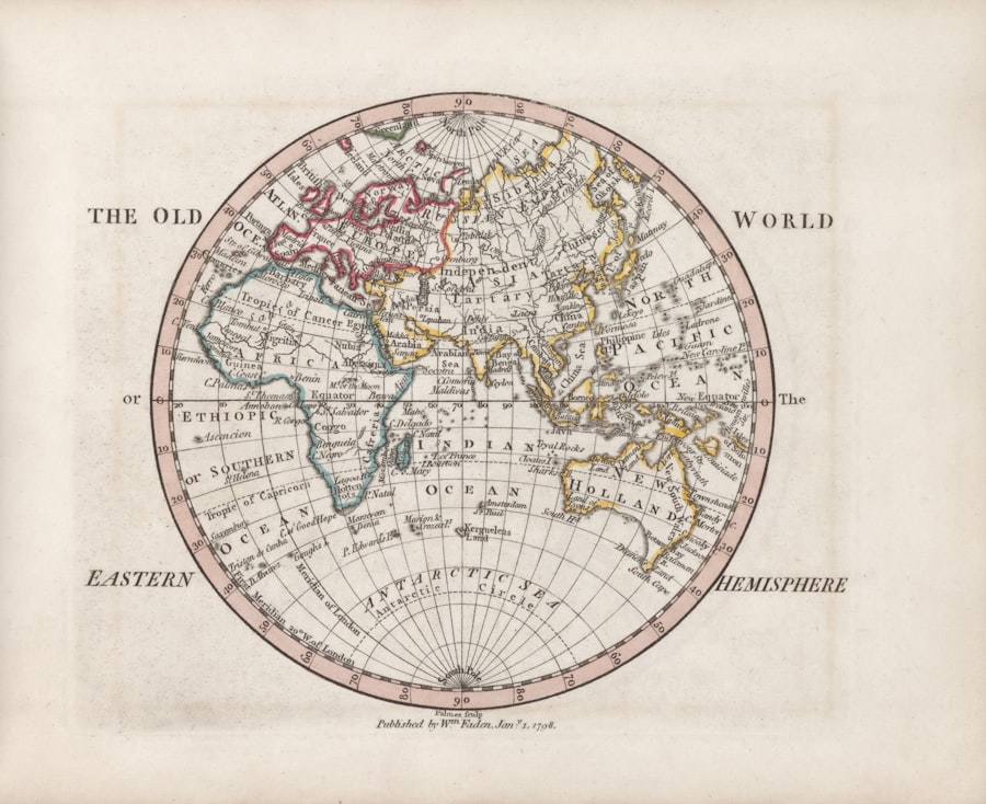
The role of cartography in historical research cannot be overstated. Maps serve as both artifacts and analytical tools, offering a window into the geographical knowledge and cultural priorities of their creators. By studying historical maps, researchers can identify shifts in political power, economic trends, and social dynamics over time.
For instance, a map depicting trade routes from centuries ago can reveal not only the flow of goods but also the cultural exchanges that occurred along those paths. Such insights can lead to a deeper understanding of how civilizations interacted and evolved. Moreover, cartography can illuminate forgotten histories.
Many ancient maps contain annotations or symbols that hint at lost cities or unexplored territories. By cross-referencing these maps with archaeological findings, historians can uncover secrets that have remained buried for centuries. The meticulous study of cartographic details can lead to significant breakthroughs in understanding historical events or cultures that have been overlooked or misrepresented in traditional narratives.
In this way, cartography acts as a bridge between the past and present, allowing modern scholars to engage with historical mysteries in innovative ways.
Mapping Ancient Civilizations: Using Cartography to Understand Lost Cultures
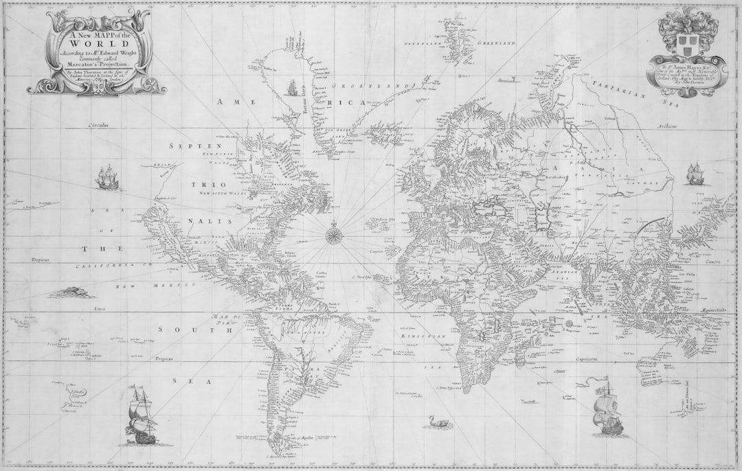
The mapping of ancient civilizations is a fascinating endeavor that sheds light on cultures that have long since vanished from the pages of history. By analyzing maps from different periods, researchers can reconstruct the geographical context in which these societies thrived. For example, the study of ancient Mesopotamian maps reveals not only the layout of cities like Babylon and Ur but also their relationship to surrounding landscapes such as rivers and mountains.
This spatial understanding is crucial for grasping how these civilizations adapted to their environments and interacted with neighboring cultures. Furthermore, cartography allows historians to visualize the extent of ancient empires and their influence on surrounding regions. The Roman Empire, for instance, is often depicted through maps that illustrate its vast reach across Europe, North Africa, and parts of Asia.
These visual representations help contextualize historical events such as conquests and trade relationships, providing a clearer picture of how power dynamics shifted over time. By mapping ancient civilizations, scholars can better appreciate the complexities of human development and the myriad factors that contributed to the rise and fall of cultures.
Solving the Riddles of Lost Cities and Civilizations Through Maps
Lost cities have long been a source of intrigue for historians and archaeologists alike. The allure of uncovering a forgotten civilization often drives expeditions into uncharted territories. Maps play a crucial role in this quest for discovery, serving as guides that point researchers toward potential sites of interest.
Historical maps may contain clues about the locations of these lost cities, often marked by symbols or annotations that hint at their significance. In recent years, advancements in technology have further enhanced the ability to locate lost cities through cartographic analysis. Satellite imagery and aerial surveys can be combined with historical maps to identify patterns in the landscape that may indicate human habitation.
For example, researchers have successfully used this approach to locate ancient Maya cities hidden beneath dense jungle canopies. By overlaying modern satellite images with historical maps, they can pinpoint areas where structures may lie buried, thus solving some of the riddles surrounding these enigmatic civilizations.
Cartographic Techniques for Revealing Hidden Historical Landscapes
| Historical Mystery | Cartographic Artifact | Date | Location | Notable Features | Current Theories |
|---|---|---|---|---|---|
| Vinland Map | Vinland Map | Circa 1440 | Europe / North America | Depicts part of North America before Columbus | Possibly a 20th-century forgery; debated authenticity |
| Piri Reis Map | Piri Reis Map | 1513 | Ottoman Empire (Turkey) | Shows parts of the Americas and Antarctica | Based on older maps; Antarctica depiction controversial |
| Hereford Mappa Mundi | Hereford Mappa Mundi | Circa 1300 | Hereford, England | Medieval world map with religious and mythological elements | Reflects medieval worldview; symbolic rather than geographic |
| Dieppe Maps | Dieppe Maps | 16th Century | France | Detailed coastlines of Australia and Americas | Suggests early knowledge of Australia; origins debated |
| Babylonian World Map | Imago Mundi | 6th Century BCE | Babylon (Iraq) | Oldest known world map; schematic and symbolic | Represents Babylon as center of the world; mythological features |
The techniques employed in cartography have evolved dramatically over time, enabling historians to reveal hidden landscapes that tell stories of past civilizations. Traditional methods such as surveying and triangulation have been complemented by modern technologies like Geographic Information Systems (GIS) and remote sensing. These tools allow researchers to analyze spatial data with remarkable accuracy, uncovering features that may not be visible to the naked eye.
One notable technique involves the use of LiDAR (Light Detection and Ranging) technology, which can penetrate dense vegetation to reveal underlying topography. This method has proven invaluable in regions like Central America, where ancient structures are often obscured by thick jungle growth. By creating detailed three-dimensional maps of the terrain, researchers can identify remnants of roads, buildings, and agricultural fields that were once part of thriving civilizations.
Such revelations not only enhance our understanding of historical landscapes but also challenge preconceived notions about the capabilities of ancient societies.
The Power of Geographic Information Systems (GIS) in Historical Research
Geographic Information Systems (GIS) have revolutionized the field of historical research by providing powerful tools for analyzing spatial data. This technology allows historians to create layered maps that integrate various types of information, such as demographic data, archaeological findings, and environmental factors. By visualizing these elements together, researchers can uncover patterns and relationships that might otherwise go unnoticed.
For instance, GIS can be used to map the distribution of artifacts across a region, revealing insights into trade networks or settlement patterns. By analyzing how these artifacts are spatially related, historians can draw conclusions about social organization and cultural exchange within ancient societies. Additionally, GIS enables researchers to model historical landscapes based on environmental changes over time, providing a dynamic view of how civilizations adapted to shifting conditions.
This multifaceted approach enhances our understanding of history by allowing for a more nuanced exploration of how geography influenced human behavior.
Uncovering the Truth Behind Historical Events Through Map Analysis
Map analysis serves as a critical tool for uncovering the truth behind significant historical events. By examining maps created during specific periods, historians can gain insights into military campaigns, territorial disputes, and diplomatic relations. For example, maps depicting battlefields can reveal strategic decisions made by commanders and the geographical challenges they faced.
Such analyses can lead to a deeper understanding of why certain events unfolded as they did. Moreover, maps can provide context for understanding historical narratives that may have been shaped by bias or misinformation. By comparing contemporary maps with those from earlier periods, researchers can identify shifts in territorial claims or changes in political boundaries that reflect broader societal transformations.
This process not only helps clarify historical events but also encourages critical thinking about how history is recorded and interpreted.
Mapping the Paths of Famous Explorers and Conquerors
The journeys undertaken by famous explorers and conquerors have left an indelible mark on history, shaping our understanding of geography and cultural exchange.
These maps not only chart physical journeys but also reflect the ambitions and motivations behind exploration.
By studying the maps created during these voyages, historians can gain insights into the challenges faced by explorers as they navigated uncharted territories. For instance, early maps often included fantastical elements or inaccuracies based on limited knowledge of distant lands. Analyzing these representations allows researchers to understand how perceptions of geography evolved over time and how explorers’ experiences influenced subsequent cartographic practices.
Using Cartography to Decode Ancient Texts and Manuscripts
Cartography is not limited to physical maps; it also extends to ancient texts and manuscripts that contain geographical references or descriptions. Scholars often turn to these documents to decode information about lost cities or trade routes mentioned in historical accounts. By cross-referencing textual descriptions with existing maps, researchers can identify potential locations for archaeological exploration.
For example, ancient texts may describe a city located near a river or mountain range, providing clues about its geographical context. By mapping these references onto contemporary landscapes or historical maps, scholars can narrow down search areas for lost civilizations or significant sites mentioned in literature. This interdisciplinary approach combines literary analysis with cartographic techniques to unlock new dimensions in our understanding of history.
The Influence of Cartography on Historical Fiction and Literature
The impact of cartography extends beyond academic research; it has also significantly influenced historical fiction and literature. Authors often rely on maps to create immersive worlds that transport readers to different times and places. By incorporating accurate geographical details into their narratives, writers enhance the authenticity of their stories while engaging readers’ imaginations.
Maps serve as visual aids that help readers navigate complex plots or understand character journeys within historical contexts. For instance, fantasy novels inspired by real-world geography may include detailed maps that illustrate fictional kingdoms alongside actual locations. This blending of fact and fiction not only enriches storytelling but also encourages readers to explore historical themes through imaginative lenses.
The Future of Cartography in Uncovering Historical Mysteries
As technology continues to advance at an unprecedented pace, the future of cartography holds immense potential for uncovering historical mysteries yet to be revealed. Innovations such as augmented reality (AR) and virtual reality (VR) are poised to transform how historians engage with maps and spatial data. These technologies could allow users to experience historical landscapes firsthand or visualize changes over time in an interactive manner.
Furthermore, ongoing developments in data collection methods will likely enhance our ability to analyze vast amounts of information related to geography and history. As more archaeological sites are discovered and documented through digital means, cartographers will be able to create increasingly detailed representations of past civilizations. This convergence of technology and cartography promises to deepen our understanding of history while inspiring future generations to explore the mysteries that continue to shape our world today.
Its ability to visualize complex relationships between geography and culture enriches our understanding of human history while inviting further exploration into the enigmas that remain unsolved. As technology continues to evolve, so too will the potential for cartography to illuminate new facets of our past—ensuring that the quest for knowledge remains an enduring pursuit for generations to come.
One fascinating aspect of historical mysteries is the role of cartography in uncovering lost civilizations and forgotten places. For those interested in exploring this topic further, the article on Real Lore and Order delves into how ancient maps have led researchers to significant archaeological discoveries, shedding light on our understanding of history and geography.
WATCH THIS! 🗺️ The Map That Proves Humans Explored Earth 5,000 Years Too Early
FAQs
What is historical cartography?
Historical cartography is the study and creation of maps from past periods. It involves analyzing old maps to understand how people in different eras viewed and represented the world.
Why are historical maps important?
Historical maps provide valuable insights into the geographical knowledge, cultural perspectives, political boundaries, and exploration history of the time when they were created.
What are some common mysteries associated with historical maps?
Common mysteries include unexplained landmasses, inaccuracies in coastlines, the presence of places that do not exist today, and the origins of certain maps whose creators or purposes remain unknown.
How do historians verify the accuracy of old maps?
Historians compare old maps with archaeological evidence, written records, and modern geographical data to assess their accuracy and understand the context in which they were made.
What is the significance of the Piri Reis map in historical cartography?
The Piri Reis map, created in 1513, is famous for its detailed depiction of parts of the Americas and is often discussed for its advanced knowledge of geography for its time.
Can historical maps reveal lost civilizations or lands?
While some historical maps suggest the existence of lost lands or civilizations, these claims are often debated and require corroboration from archaeological and historical research.
How have cartographic techniques evolved over time?
Cartographic techniques have evolved from hand-drawn maps based on explorers’ reports to highly accurate digital maps created using satellite imagery and geographic information systems (GIS).
Where can one find collections of historical maps?
Historical maps can be found in national libraries, museums, university archives, and specialized online databases dedicated to cartographic history.
What challenges do researchers face when studying historical maps?
Challenges include deciphering old languages and symbols, dealing with map deterioration, understanding the historical context, and distinguishing between myth and fact in map content.
How do historical maps contribute to our understanding of history?
They help trace the development of human knowledge, trade routes, territorial changes, and cultural interactions, offering a visual narrative of historical events and worldviews.