Unveiling the Submerged Past
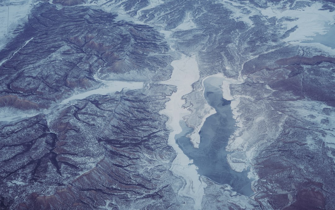
The Earth’s history is a tapestry woven with epochs of dramatic change, none perhaps as transformative as the Ice Ages. During these frigid periods, colossal glaciers advanced and retreated across continents, sculpting the very bedrock of our planet. While many of their grandest creations are readily visible – towering mountains, vast plains, and deep fjords – an equally significant, yet largely hidden, legacy lies beneath the surface of our oceans and large lakes. These are the submerged Ice Age valleys, vast depressions carved by glacial meltwater and ice, now cradling secrets of a forgotten world. Their exploration promises not only to reveal breathtaking, hidden landscapes but also to deepen our understanding of past climates, ice sheet dynamics, and even the migratory routes of early humans.
The concept of submerged valleys is not new. Geologists and oceanographers have long theorized their existence, drawing parallels with the exposed glacial valleys found on land. However, the sheer scale and remoteness of many offshore environments have made their detailed investigation a formidable challenge. It is only with the advent of advanced sonar technologies, high-resolution seismic imaging, and sophisticated sub-aquatic robotic systems that the true extent and complexity of these submerged landscapes are finally coming into focus. This article delves into the fascinating world of exploring these open water Ice Age valleys, charting the methods employed, the discoveries being made, and the profound implications of unearthing these lost terrains.
In the quest to understand the geological and climatic changes that have shaped our planet, researchers are increasingly focusing on the search for open water ice age valleys. These valleys, formed during the last glacial period, hold valuable insights into past ecosystems and climate patterns. A related article that delves into the broader implications of historical climate shifts is available at The Mysterious Causes of the Bronze Age Collapse, which explores how environmental factors may have contributed to significant societal changes in ancient civilizations.
The Glacial Architects and Their Work

The powerful forces of the Ice Ages were the primary sculptors of these remarkable valleys. Understanding their geological processes is crucial to appreciating the scale and nature of these submerged features. As massive ice sheets expanded, they exerted immense pressure on the underlying landmass. This pressure, combined with the erosive power of ice itself, began to grind away at the bedrock, creating broad, U-shaped troughs. However, the most dramatic valley formation often occurred not directly under the ice, but through the immense volumes of meltwater that flowed from the retreating glaciers.
Meltwater Channels and Subglacial Erosion
During glacial periods, vast quantities of meltwater would pool beneath and at the margins of the ice sheets. This water, under immense hydrostatic pressure, could carve deep channels into the bedrock. These channels, often far larger than any modern river system, would then serve as conduits for the immense flow of water and sediment. In some instances, these subglacial meltwater systems could become so extensive that they effectively dissected the landscape, creating intricate networks of canyons and valleys that were later submerged as sea levels rose.
The Retreat and Inundation
The end of an Ice Age brought about a dramatic transformation. As global temperatures rose, the immense ice sheets began to melt at an accelerated rate. This process not only released vast quantities of freshwater into the oceans, causing sea levels to rise dramatically, but it also left behind a dramatically altered landscape. The valleys carved by ice and meltwater, once exposed to the atmosphere, were gradually inundated by the rising seas. Depending on the rate of sea-level rise and the underlying topography, these valleys could become shallow fjords, deep estuaries, or vast, submerged plains dotted with the remnants of glacial deposition. The depth and character of these submerged valleys are a direct testament to the magnitude of glacial erosion and the subsequent eustatic changes in sea level.
Navigating the Unseen Depths
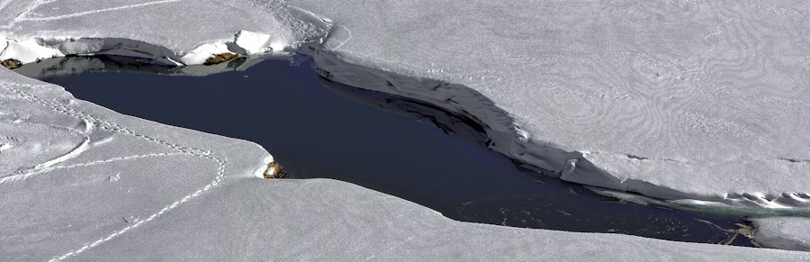
The exploration of open water Ice Age valleys presents unique challenges. Unlike terrestrial expeditions, where geologists can directly examine rock formations and landforms, the underwater realm necessitates the use of specialized tools and techniques to “see” and “map” these hidden landscapes. The development of increasingly sophisticated marine surveying technologies has been pivotal in this endeavor.
The Eyes Beneath the Waves: Sonar and Remote Sensing
Sonar, or Sound Navigation and Ranging, is the cornerstone of underwater landscape mapping. Multibeam echosounders, mounted on survey vessels, emit sound waves that travel through the water column and reflect off the seafloor. By measuring the time it takes for these echoes to return, sophisticated software can generate highly detailed bathymetric maps, essentially creating a 3D representation of the seafloor topography. These maps can reveal the dramatic contours of submerged valleys, identifying their depth, width, and sinuosity. Further advances in sidescan sonar provide even more detailed imagery of the seafloor surface, allowing for the identification of sediment types, rock outcrops, and even larger submerged features within the valleys.
Peering into the Earth’s Crust: Seismic Imaging
While sonar provides a surface view, seismic imaging allows researchers to look beneath the seafloor. This technique involves generating seismic waves, typically through the use of air guns, which penetrate the seabed. These waves reflect off different geological layers and structures beneath the surface. By analyzing these reflected waves, geophysicists can construct detailed cross-sections of the subsurface, revealing the stratigraphy, the presence of buried valleys, and the nature of the underlying bedrock. This is crucial for understanding the full extent of glacial erosion and the geological history of the region. Sub-bottom profilers, a type of seismic survey, offer even higher resolution for mapping shallow subsurface features, perfect for identifying the infill of ancient valleys.
The Hands of Exploration: Underwater Vehicles
To truly understand the composition and context of these submerged valleys, direct sampling and visual inspection are necessary. This is where remotely operated vehicles (ROVs) and autonomous underwater vehicles (AUVs) play a vital role. Equipped with high-definition cameras, sampling arms, and sensor packages, these robotic explorers can navigate the depths, collecting sediment cores, rock samples, and high-resolution imagery of the valley walls and floors. AUVs, programmed to follow specific survey routes, can efficiently map large areas, while ROVs, piloted by operators, can conduct detailed investigations of specific features of interest.
Unearthing the Treasures Within
The exploration of open water Ice Age valleys is not merely an academic exercise in mapping ancient topography; it is a quest for tangible evidence of past environments, life, and human activity. The sediments and geological formations preserved within these submerged landscapes act as a time capsule, offering invaluable insights into periods of profound environmental change.
Clues to Past Climates and Ice Sheet Behavior
The sedimentary layers within submerged valleys provide a remarkably preserved record of past climates. Analysis of fossilized pollen, diatoms, and marine microfossils within sediment cores can reveal detailed information about the temperature, salinity, and ecological conditions that prevailed during and after the Ice Ages. These records can be correlated with ice core data from Greenland and Antarctica, helping scientists to refine models of past climate change and to understand the complex interplay between ice sheets, oceans, and the atmosphere. The shape and fill of the valleys themselves offer direct evidence of the erosive power of ice and meltwater, and the subsequent depositional processes that occurred as sea levels rose.
Submerged Landscapes and Biodiversity
These valleys often host unique and diverse ecosystems. The sheltered environments within the deeper parts of the valleys can provide refuge for marine life, and the presence of hard substrates like bedrock can support specialized communities of sessile organisms. Discoveries of ancient, submerged forests and peat deposits within some valleys provide a vivid glimpse of terrestrial landscapes that were once a familiar sight on land. These findings not only enhance our understanding of past biodiversity but also highlight the dramatic impact of sea-level rise on terrestrial and marine environments. Such sites can also be important for the conservation of marine species.
Traces of Our Ancestors: Paleolithic Migration Routes
Perhaps one of the most compelling discoveries emerging from the exploration of submerged valleys relates to human history. As sea levels rose, extensive coastal plains that were once dry land became inundated. These plains are now thought to have served as crucial migration corridors for Paleolithic humans and animals. Submerged valleys, with their potential for freshwater sources and sheltering terrain, may have been important focal points for early human settlement and movement. The discovery of submerged archaeological sites, such as ancient hearths, tool scatters, or even human remains, within these valleys would revolutionize our understanding of early human dispersal and adaptation. The search for such sites is an ongoing and incredibly exciting frontier in paleoanthropology.
Researchers exploring the formation of open water ice age valleys have uncovered fascinating insights into how these landscapes were shaped by ancient climatic conditions. A related article delves into the broader implications of environmental changes and their impact on natural resources, which can be particularly relevant for understanding the dynamics of these valleys. For more information, you can read about it in this detailed analysis that discusses the intersection of climate and resource management.
Case Studies: Glimpses of Submerged Worlds
| Metric | Description | Value/Range | Unit | Notes |
|---|---|---|---|---|
| Valley Length | Length of open water ice age valleys identified | 5 – 50 | km | Varies depending on region and ice age period |
| Valley Depth | Average depth of valleys carved by glacial meltwater | 10 – 200 | meters | Deeper valleys indicate prolonged meltwater flow |
| Age of Valleys | Estimated age based on sediment dating | 10,000 – 120,000 | years BP | Corresponds to last and previous ice ages |
| Water Flow Rate | Estimated meltwater flow during valley formation | 100 – 1,000 | m³/s | Calculated from valley morphology and sediment transport |
| Sediment Thickness | Thickness of sediment deposits in valleys | 1 – 30 | meters | Indicates duration and intensity of meltwater activity |
| Valley Slope | Average gradient of valley floor | 0.5 – 5 | degrees | Steeper slopes suggest rapid water flow |
| Ice Age Period | Ice age during which valley was formed | Last Glacial Maximum, Saale, Weichselian | N/A | Varies by geographic location |
While the exploration of submerged Ice Age valleys is a global endeavor, several regions have provided particularly compelling insights into these hidden landscapes. These case studies illustrate the diverse nature of these features and the breadth of knowledge they can impart.
The North Sea Basin: A Prehistoric Land Bridge
The North Sea, a relatively shallow body of water today, was once a vast, dry landmass during the last Ice Age, connecting Britain to continental Europe. This area, often referred to as “Doggerland,” was carved by extensive river systems and glacial meltwater channels. Modern sonar and seismic surveys have revealed the complex network of these ancient valleys and riverbeds beneath the seabed. The discovery of Mesolithic artifacts, including flint tools and structures, on the North Sea floor provides direct evidence of human activity in this now-submerged landscape. Studies of sedimentary cores from this region are yielding invaluable data on past vegetation, climate, and the timing of the inundation that ultimately transformed this prehistoric land bridge into the sea we know today.
The Gulf of Maine: Glacial Sculpting and Human Echoes
Off the coast of New England, the Gulf of Maine features a complex bathymetry characterized by numerous deep channels and basins, many of which are interpreted as submerged glacial valleys. These features were carved by the immense Laurentide Ice Sheet. Explorations using multibeam sonar have mapped these valleys in remarkable detail, revealing their glacial origins. Research in this region has also focused on finding evidence of early human presence. While direct archaeological finds within the deepest valleys are rare, the presence of submerged coastal deposits and the understanding of past sea-level curves suggest that these areas may have been important foraging grounds for Paleo-Indians as the coastline receded.
The Fjords of Norway: Frozen Giants and Submerged Secrets
The dramatic fjords of Norway are textbook examples of glacial valleys carved by ice. However, their exploration extends far beyond the visible water’s edge. Advanced sub-bottom profiling and seismic surveys have revealed that these fjords continue far out onto the continental shelf, extending as submerged canyons and valleys. These offshore extensions are remnants of the same glacial forces that shaped the modern fjords. Sedimentary studies in these submerged extensions are providing crucial data on the dynamics of past ice sheets that covered Scandinavia, their meltwater systems, and the subsequent rise of sea levels that transformed the landscape.
Researchers exploring the mysteries of ancient landscapes have recently turned their attention to the search for open water ice age valleys, which could provide valuable insights into past climate conditions. A fascinating article on the topic can be found here, where the connection between historical maps and geological formations is discussed. Understanding these valleys not only sheds light on the Earth’s climatic history but also helps scientists predict future environmental changes.
The Future of Submerged Landscape Exploration
The exploration of open water Ice Age valleys is a rapidly evolving field, driven by technological innovation and an ever-growing appreciation for the scientific and historical significance of these hidden terrains. The current achievements are merely the tip of the iceberg, with vast expanses of our oceans and lakes yet to be systematically explored.
Technological Advancements and New Discoveries
The continued development of high-resolution sonar, advanced seismic imaging techniques, and increasingly sophisticated autonomous and remotely operated underwater vehicles will undoubtedly lead to more detailed and comprehensive mapping of submerged valleys. Innovations in sensor technology, allowing for real-time geochemical and biological analysis in situ, will further enhance the scientific return from these expeditions. The integration of artificial intelligence and machine learning in data processing and interpretation promises to accelerate the discovery and analysis of these complex datasets, potentially revealing patterns and features that might otherwise go unnoticed.
Expanding the Scope: Paleovalley Networks and Global Impact
Future research will likely focus on understanding the connectivity and scale of entire paleovalley networks, both regionally and globally. By piecing together data from different exploration programs, scientists can begin to reconstruct the continental-scale drainage systems that existed during the Ice Ages, revealing the routes of massive meltwater floods and the pathways of glacial ice movement. The implications of this research extend beyond geology and climatology, holding immense potential for understanding the dispersal of ancient flora and fauna, and crucially, the migratory routes and settlement patterns of early human populations across the planet. The ongoing exploration of these submerged landscapes is not just about looking back; it is about understanding the fundamental processes that have shaped our planet and the history of life upon it. The submerged Ice Age valleys represent a vast, untapped archive, and their continued exploration promises to unveil a wealth of knowledge for generations to come.

Beneath the Ice: Surviving the Ice Age 20,000 Years Ago
FAQs
What are open water ice age valleys?
Open water ice age valleys are ancient valleys that were carved by glaciers during the last Ice Age and are now filled with water, creating long, narrow bodies of water.
Where can open water ice age valleys be found?
Open water ice age valleys can be found in regions that were once covered by glaciers, such as parts of North America, Europe, and Asia.
How were open water ice age valleys formed?
Open water ice age valleys were formed by the movement of glaciers, which carved out deep channels in the landscape. When the glaciers melted, these channels filled with water, creating the valleys we see today.
What makes open water ice age valleys significant?
Open water ice age valleys are significant because they provide valuable insights into the Earth’s past climate and geological history. They also support unique ecosystems and habitats for various plant and animal species.
Are open water ice age valleys accessible to visitors?
Some open water ice age valleys are accessible to visitors for recreational activities such as boating, fishing, and hiking. However, it is important to respect these fragile ecosystems and follow any regulations in place to protect them.