Unearthing Earth’s Frozen Past: A Chronicle of Geological Shifts
The Earth’s climatic history is punctuated by dramatic shifts, none more profound than the recurring cycles of ice ages. These periods of extensive glaciation, where vast ice sheets covered significant portions of the planet, have sculpted landscapes, influenced the evolution of life, and continue to hold secrets about Earth’s dynamic geological processes. Deciphering the timing, duration, and causes of these ancient cold spells is a monumental undertaking, relying on the painstaking analysis of geological evidence. From the deepest ocean sediments to the highest mountain peaks, scientists are piecing together a complex narrative of glacial epochs, revealing intricate patterns woven into the fabric of Earth’s geology. The understanding of these ice ages is not merely an academic pursuit; it offers crucial insights into the planet’s climate sensitivity, the long-term carbon cycle, and the potential future trajectories of our own warming world.
Recent studies on geological shifting patterns during ancient ice ages have revealed significant insights into how climate change has shaped our planet’s landscape. For a deeper understanding of these phenomena, you can explore the article titled “The Impact of Ice Ages on Earth’s Geological Features” available at Real Lore and Order. This article delves into the intricate relationship between glacial movements and the formation of various geological structures, providing a comprehensive overview of how past ice ages continue to influence our environment today.
The Sedimentary Archives of Climate Change
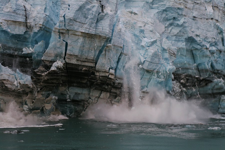
The geological record, particularly the thick layers of sediment accumulating on the ocean floor and in ancient lakebeds, serves as an invaluable archive of Earth’s climatic past. These fine-grained deposits, often laid down over millions of years, contain a wealth of information, from the fossilized remains of microscopic organisms to the chemical signatures of past ocean temperatures and atmospheric composition. By carefully extracting and analyzing these sedimentary cores, geologists can reconstruct a detailed timeline of past climate states, including the onset and retreat of ice ages.
Microscopic Fossils as Paleothermometers
Among the most powerful tools for reconstructing past temperatures are the fossilized shells of microscopic marine organisms, particularly foraminifera. These single-celled creatures, which drift in the ocean’s currents, incorporate elements from the surrounding seawater into their calcium carbonate shells. The ratio of different isotopes of oxygen within these shells, specifically oxygen-18 to oxygen-16, is highly sensitive to the temperature of the water in which they formed. During colder periods, when large amounts of water were locked up in ice sheets, the ocean became enriched in the heavier oxygen-18 isotope. Conversely, warmer periods saw a greater abundance of the lighter oxygen-16 isotope in seawater.
Scientists retrieve long cores of sediment from the ocean floor, often hundreds of meters in length. These cores represent a continuous deposition of material stretching back millions of years. Within these cores, the layers containing foraminifera fossils are meticulously sampled and analyzed. By measuring the oxygen isotope ratios in the shells of foraminifera from different depths in the core – and thus different time periods – researchers can create a detailed graph of past ocean temperatures. This “oxygen isotope curve” provides a robust proxy for global ice volume and temperature, allowing for the identification and dating of glacial and interglacial periods. The resolution of these records is remarkable, often allowing scientists to distinguish between cycles lasting tens of thousands of years, aligning with Milankovitch cycles, and longer-term, more fundamental shifts in Earth’s climate system.
Chemical Traces of Atmospheric Composition
Beyond temperature, the chemical composition of ancient atmospheres can also be inferred from sedimentary records. Tiny air bubbles trapped within ice cores drilled from glaciers and ice sheets provide direct samples of past atmospheres, but for older ice ages where ice cores are not available, scientists turn to other geochemical proxies. For instance, the ratio of carbon isotopes in marine sediments can reveal information about the global carbon cycle and atmospheric carbon dioxide levels. Certain types of marine organisms, such as plankton, utilize carbon from dissolved inorganic carbon in seawater to build their shells. The isotopic composition of their carbon, when preserved in sediments, reflects the isotopic composition of the dissolved inorganic carbon pool, which in turn is influenced by atmospheric CO2.
Furthermore, the presence of specific trace elements and their isotopic ratios in marine sediments can indicate changes in ocean circulation patterns, nutrient availability, and even the frequency and intensity of volcanic activity. For example, variations in the abundance of certain metals can signal periods of increased weathering and erosion, often associated with glacial meltwater runoff, or changes in the rate of organic matter burial, a key process in long-term carbon sequestration. These chemical fingerprints, when combined with fossil evidence, paint a more comprehensive picture of the environmental conditions that prevailed during ancient ice ages. The ability to correlate these chemical proxies with isotopic temperature records allows for a multi-faceted understanding of past climate dynamics, moving beyond single proxies to build robust and consistent reconstructions.
Tectonic Influences and Long-Term Climate Forcing

While orbital variations play a crucial role in the timing of glacial-interglacial cycles on timescales of tens of thousands of years, the initiation and long-term persistence of ice ages are profoundly influenced by slower, but more powerful, geological processes. Tectonic activity, which reshapes continents and mountains over millions of years, and changes in the Earth’s albedo, the reflectivity of its surface, are key drivers of these larger climatic shifts.
Continental Drift and Ocean Circulation
The arrangement of continents plays a pivotal role in determining global climate patterns and the distribution of ice sheets. Over geological timescales, plate tectonics causes continents to drift, collide, and separate. When continents are positioned at high latitudes, particularly around the poles, they are more susceptible to glaciation. The formation of supercontinents like Pangaea, or their subsequent breakup, has been linked to significant shifts in global climate. For instance, the breakup of Pangaea led to the opening of new ocean basins and altered ocean currents, impacting heat distribution across the planet.
Crucially, the configuration of continents dictates the pathways of ocean currents, which are the planet’s primary heat transport system. The opening or closing of oceanic gateways can profoundly alter the flow of warm water towards the poles or cold water towards the equator. The Drake Passage, for example, separating South America and Antarctica, played a significant role in the isolation of Antarctica and its subsequent glaciation by allowing the formation of the Antarctic Circumpolar Current, which effectively insulates the continent from warmer ocean waters. Similarly, the formation of the Isthmus of Panama, connecting North and South America, had profound impacts on both Atlantic and Pacific circulation, influencing climate patterns on a global scale. Understanding these tectonic events is therefore essential for comprehending the fundamental conditions that allow ice ages to occur.
Volcanic Activity and Atmospheric Composition
Volcanic eruptions, both individual large-scale events and sustained periods of increased volcanic activity, can have significant impacts on Earth’s climate, although the long-term influence on ice ages is complex. Short-term cooling can result from the injection of sulfur aerosols into the stratosphere, which reflect solar radiation. However, over much longer timescales, volcanic activity is a major source of carbon dioxide (CO2) to the atmosphere. Periods of intense volcanic outgassing, such as those associated with large igneous provinces, have been linked to elevated atmospheric CO2 levels and warmer global climates, potentially suppressing glaciation.
Conversely, over geological timescales, the weathering of silicate rocks, a process that consumes CO2 from the atmosphere, plays a critical role in regulating Earth’s temperature. Mountain-building events, driven by tectonic uplift, accelerate this weathering process by exposing fresh rock surfaces. Therefore, periods of extensive mountain building, coupled with decreased volcanic CO2 emissions, could contribute to a long-term drawdown of atmospheric CO2, eventually leading to conditions conducive to glaciation. The interplay between volcanic emissions and silicate weathering represents a fundamental feedback mechanism that governs Earth’s climate over millions of years. Analyzing the geological record for evidence of past volcanic provinces and periods of intense mountain building helps to unravel the long-term forcing mechanisms behind ice age cycles.
Milankovitch Cycles: The Orbital Pacemaker
While tectonic and volcanic influences set the stage for long-term climate states, the rhythm of glacial and interglacial periods within an ice age is largely dictated by predictable variations in Earth’s orbit around the Sun, known as Milankovitch cycles. These subtle astronomical changes affect the amount and distribution of solar radiation received by the Earth, acting as a key trigger for the onset and termination of glaciations.
Eccentricity, Obliquity, and Precession
The three main Milankovitch cycles involve:
- Eccentricity: The shape of Earth’s orbit around the Sun varies from nearly circular to slightly elliptical over cycles of approximately 100,000 and 400,000 years. When the orbit is more elliptical, the difference in solar radiation received at perihelion (closest to the Sun) and aphelion (farthest from the Sun) is greater, leading to more extreme seasonal variations.
- Obliquity (Axial Tilt): The tilt of Earth’s axis relative to its orbital plane varies between approximately 22.1 and 24.5 degrees over a cycle of about 41,000 years. A greater axial tilt leads to more extreme seasons, with hotter summers and colder winters at higher latitudes. Conversely, a smaller tilt results in milder seasons.
- Precession: The wobble of Earth’s axis, similar to a spinning top, causes the timing of perihelion and aphelion to shift relative to the seasons. This cycle operates on approximately 23,000 years and influences the intensity of seasons in different hemispheres. For example, when Earth is closest to the Sun during the Northern Hemisphere summer, that summer will be warmer.
Insolation and Ice Sheet Dynamics
These orbital variations influence the amount of solar radiation, or insolation, received at different latitudes and at different times of the year. Crucially, it is the insolation during the summer months at high northern latitudes that appears to be most critical for the growth and decay of ice sheets. If summers are cooler, less snow melts, allowing snow to accumulate year after year and eventually form glaciers and ice sheets. Conversely, warmer summers lead to increased melting and ice sheet retreat.
The strong correlation between the timing of glacial-interglacial cycles, as revealed by sedimentary cores, and the periods of Milankovitch cycles provides compelling evidence for their role as a primary driver. While Milankovitch cycles themselves do not provide enough forcing to explain the full extent of glaciation, they act as a powerful pacemaker, tipping the Earth’s climate system into or out of glacial states when other conditions are favorable. The intricate interplay between orbital forcing and Earth’s internal climate feedbacks, such as changes in atmospheric CO2 and ocean circulation, amplifies these orbital signals, leading to the dramatic swings between ice ages and warmer interglacial periods.
Geological shifting patterns have played a significant role in shaping our planet, particularly during ancient ice ages, which have left lasting impacts on the Earth’s landscape. For those interested in exploring the complexities of these shifts and their effects on climate and geography, a related article can provide valuable insights. You can read more about this fascinating topic in the article found here. Understanding these patterns not only enhances our knowledge of Earth’s history but also informs current climate change discussions.
Glacial Landscapes and Direct Evidence of Ice Ages
| Geological Period | Ice Age Name | Approximate Time Frame (Million Years Ago) | Major Geological Shifts | Glacial Extent (%) | Average Global Temperature (°C) |
|---|---|---|---|---|---|
| Late Proterozoic | Sturtian Glaciation | 720 – 660 | Supercontinent Rodinia breakup, widespread glaciation | 70 | ~10 |
| Late Proterozoic | Marinoan Glaciation | 650 – 635 | Continued Rodinia fragmentation, “Snowball Earth” conditions | 80 | ~8 |
| Late Paleozoic | Late Carboniferous – Early Permian Ice Age | 360 – 260 | Formation of Pangaea, extensive glaciation in southern hemisphere | 50 | ~12 |
| Quaternary | Last Glacial Maximum | 0.026 – 0.019 | Modern continental configurations, ice sheets over North America and Eurasia | 30 | ~6 |
| Quaternary | Holocene Interglacial | 0.0117 – Present | Retreat of ice sheets, stable climate supporting human civilization | 5 | ~14 |
The impact of ice ages is not confined to the geological record; it is etched directly into the Earth’s surface in the form of dramatic glacial landforms. The immense power of moving ice has sculpted mountains, carved valleys, and transported vast quantities of rock and sediment, leaving behind a tangible legacy of past glaciations. Geologists study these landscapes to directly map the extent and thickness of ancient ice sheets.
Erosional and Depositional Landforms
During glacial periods, ice sheets act as enormous bulldozers and excavators. As ice flows downhill, it grinds against the underlying bedrock, abrading and eroding the landscape. This erosional power carves out distinctive U-shaped valleys, sharp mountain peaks (horns), and cirques – bowl-shaped depressions at the heads of valleys. The sheer weight of the ice can also scour out large basins, which later fill with water to form lakes, such as the Great Lakes of North America.
Conversely, as glaciers melt and retreat, they deposit the vast amounts of sediment and rock they have carried. These deposits, known as glacial till, can form a variety of features. Moraines, which are ridges of till, mark the edges of past glaciers. Drumlins are elongated, streamlined hills formed by ice flowing over till. Outwash plains, formed by meltwater streams carrying sediment away from the glacier, can extend for many kilometers. The presence and distribution of these erosional and depositional features provide direct evidence of the extent and direction of ice flow, allowing scientists to reconstruct paleoglaciations with remarkable detail. Mapping these features in conjunction with dating techniques helps to refine timelines of glacial advance and retreat.
Isostatic Depression and Uplift
The immense weight of continental ice sheets, which could be several kilometers thick, exerts a significant downward pressure on the Earth’s crust. This pressure causes the crust to deform and sink, a phenomenon known as isostatic depression. Over geological timescales, the Earth’s mantle behaves like a very viscous fluid, and as the ice melts, the crust slowly rebounds, a process called isostatic uplift.
Evidence of this uplift can be seen in coastal areas that were once covered by ice sheets. Raised beaches, terraces of sand and gravel that are now well above sea level, are clear indicators of isostatic rebound. Similarly, rivers that were once dammed by ice can now flow freely, and former fjords, carved by glaciers and now submerged by the sea, can also offer clues. The rate of isostatic uplift can be measured by studying the geological history of these features and by monitoring modern uplift in formerly glaciated regions. This process provides a direct measure of the immense scale of past ice loads and the slow, but powerful, response of the solid Earth to these changes. Understanding isostatic adjustments is crucial for interpreting sea-level records and for understanding the long-term geological evolution of glaciated regions.
Geological shifting patterns have played a crucial role in shaping our planet’s landscape, particularly during ancient ice ages when massive glaciers carved out valleys and altered ecosystems. Understanding these shifts can provide valuable insights into past climate conditions and their impact on human civilization. For a deeper exploration of how ancient technologies adapted to these changing environments, you can read more in this fascinating article about ancient tech at ancient tech.
The Interplay of Factors: A Complex Climate System
The story of ice ages is not one of a single cause, but rather a complex interplay of multiple geological and astronomical factors. These different elements interact within Earth’s climate system, creating feedback loops that can amplify or dampen climate changes. Understanding these interactions is key to unraveling the precise mechanisms that drive Earth into and out of its frozen epochs.
Carbon Dioxide and Climate Feedbacks
The concentration of greenhouse gases in the atmosphere, particularly carbon dioxide (CO2), is a critical factor in regulating Earth’s temperature. During glacial periods, atmospheric CO2 levels were significantly lower than during interglacial periods. This reduction in CO2 is thought to be a consequence of several processes, including increased burial of organic matter on the seafloor and changes in ocean circulation that reduced the release of CO2 from the deep ocean. The lower CO2 levels then amplified the cooling initiated by Milankovitch cycles.
Conversely, during interglacial periods, as ice sheets melted and sea levels rose, more land area became available for weathering, which draws down CO2 from the atmosphere. However, the release of CO2 from volcanic activity and other geological processes, coupled with the warming itself leading to greater respiration from soils and oceans, can eventually lead to an increase in atmospheric CO2, contributing to the warming trend and the end of glacial conditions. Understanding these carbon cycle feedbacks is essential for predicting how Earth’s climate will respond to future changes in greenhouse gas concentrations. The study of past ice ages provides a natural laboratory for observing these complex feedback mechanisms in action.
Ocean Circulation and Heat Distribution
Ocean currents play a vital role in transporting heat from the tropics towards the poles. Changes in ocean circulation patterns can have profound impacts on global climate. During glacial periods, some evidence suggests that ocean circulation may have slowed down, leading to a more efficient transfer of heat away from the equator and exacerbating cooling at higher latitudes. The formation of large ice sheets can also influence ocean currents by altering salinity and temperature gradients.
For example, the influx of vast amounts of freshwater from melting ice sheets can disrupt thermohaline circulation, a major global ocean conveyor belt driven by differences in temperature and salinity. Disruptions to this circulation can lead to significant regional and global climate shifts. Understanding how ocean circulation has varied throughout Earth’s history, and how these variations correlate with glacial and interglacial periods, is a crucial aspect of ice age research. The intricate connections between ice sheets, sea level, and the global ocean system highlight the interconnectedness of Earth’s climate.

Beneath the Ice: Surviving the Ice Age 20,000 Years Ago
FAQs
What causes geological shifting patterns during ancient ice ages?
Geological shifting patterns during ancient ice ages are primarily caused by the movement of tectonic plates, changes in sea levels, and variations in Earth’s orbit and axial tilt.
How do scientists study geological shifting patterns from ancient ice ages?
Scientists study geological shifting patterns from ancient ice ages by analyzing sediment cores, studying glacial landforms, examining fossil records, and using advanced dating techniques such as radiocarbon dating.
What evidence supports the occurrence of multiple ice ages throughout Earth’s history?
Evidence supporting the occurrence of multiple ice ages throughout Earth’s history includes glacial deposits found in various parts of the world, geological formations shaped by glaciers, and the presence of ancient ice age flora and fauna in fossil records.
How long did ancient ice ages typically last?
Ancient ice ages typically lasted for tens of thousands to millions of years, with alternating periods of glaciation and interglacial periods characterized by warmer temperatures and melting ice sheets.
What impact did ancient ice ages have on Earth’s climate and geography?
Ancient ice ages had a significant impact on Earth’s climate and geography, leading to the formation of large ice sheets, changes in sea levels, shifts in ocean currents, and the reshaping of landscapes through processes such as erosion and deposition.