The world 20,000 years ago was a starkly different place. Gigantic glaciers, the remnants of the Last Glacial Maximum, sculpted vast swathes of the planet, leaving behind an awe-inspiring, and often brutal, landscape. This was an Earth in the throes of its most recent ice age, a period of profound climatic change that reshaped continents and dictated the very survival of life. To truly grasp the Earth’s terrain at this time is to journey back to a frozen frontier, a world where ice reigned supreme and its meltwaters carved the foundations of much of our modern geography.
The Dominion of Ice Sheets
The defining characteristic of the Earth 20,000 years ago was the immense scale of its ice sheets. These weren’t mere snowfields; they were colossal bodies of ice, kilometers thick in places, exerting unimaginable pressure on the land beneath them. Their presence dictated weather patterns, sea levels, and the very distribution of life. Understanding these frozen giants is the first step to comprehending the Earth’s glacial terrain.
Laurentide and Fennoscandian Masters
Dominating the northern hemisphere were two of the largest ice sheets known to have existed: the Laurentide Ice Sheet in North America and the Fennoscandian Ice Sheet in Eurasia. The Laurentide sheet stretched across most of Canada and extended south into the northern United States, reaching as far as modern-day New York and Chicago. Its sheer mass depressed the Earth’s crust beneath it, a phenomenon known as isostatic depression. This immense ice body was responsible for carving out the Great Lakes, shaping the Canadian Shield, and depositing vast quantities of till and moraines across the landscape. Imagine a frozen ocean, miles deep, slowly grinding its way across the land, pulverizing mountains into dust and reshaping river valleys into glacial troughs.
Similarly, the Fennoscandian Ice Sheet covered Scandinavia, the Baltic region, and parts of northwestern Russia. It sculpted the fjords of Norway, smoothed the bedrock of Finland, and contributed to the glacial topography of the British Isles. The interplay between these two colossal ice masses created a complex hydrological system, with meltwaters forming massive proglacial lakes and braided rivers that snaked across the periglacial plains. The landscape was a dynamic canvas of ice erosion and deposition, a testament to the immense power of glaciation.
Smaller Ice Caps and Mountain Glaciers
Beyond the behemoth ice sheets, numerous smaller ice caps and extensive mountain glaciers covered high-altitude regions and polar islands. The ice caps of Greenland, though smaller than their Pleistocene counterparts, still contributed significantly to the global cryosphere. In the Southern Hemisphere, the Antarctic Ice Sheet, while not as extensive as it is today, still exerted a considerable influence. Mountain ranges like the Alps, the Himalayas, and the Rockies were draped in formidable glaciers, carving out U-shaped valleys, cirques, and arêtes. These alpine glaciers, though dwarfed by the continental ice sheets, played a crucial role in shaping mountainous terrains and influencing local climates. Their retreat and advance were sensitive indicators of climatic shifts, providing valuable clues about past temperature fluctuations.
Ice age landscapes from twenty thousand years ago were dramatically shaped by the immense glaciers that covered vast areas of the Earth, creating unique geological features and altering ecosystems. These ancient environments not only influenced the migration patterns of early humans and animals but also left behind a rich tapestry of evidence that scientists continue to study today. For a deeper understanding of how ancient technologies and landscapes have evolved over time, you can explore the article on lost ancient technology at this link.
The Periglacial Realm: Life at the Edge of Ice

Where the ice sheets ended, a harsh and challenging environment known as the periglacial zone took hold. These were lands perpetually on the brink of freezing, characterized by permafrost, sparse vegetation, and dramatic temperature swings. Life in these regions required remarkable adaptations, both for the flora and fauna that inhabited them and for the early human populations that began to explore and exploit these marginal territories.
Frozen Ground and its Sculpting Power
Permafrost, ground that remains frozen for at least two consecutive years, was a ubiquitous feature of the periglacial landscape. This deep, frozen layer influenced drainage patterns, vegetation growth, and landforms. The active layer, the uppermost part of the soil that thaws seasonally, would become waterlogged in summer, leading to unique periglacial features. Features like patterned ground (polygons, circles, and stripes formed by freeze-thaw cycles), pingos (ice-cored hills), and solifluction lobes (slow downslope movement of saturated soil) were common. These processes, driven by repetitive freezing and thawing, created a characteristic mosaic of landforms that differed significantly from the glaciated areas. Imagine a landscape that constantly shifts and settles with the seasons, where the very ground seems to breathe in response to the thermal regime.
Vegetation and Fauna of the Tundra and Steppe
The vegetation of the periglacial zone was dominated by hardy, low-lying plants adapted to cold, dry conditions and a short growing season. Tundra, characterized by mosses, lichens, grasses, and dwarf shrubs, covered areas closer to the ice margins. Further from the ice, vast expanses of cold steppe, grasslands with scattered shrubs, thrived. These grasslands supported herds of large herbivores, including mammoths, woolly rhinoceroses, horses, and bison. These megafauna were the prey of early human hunters and also played a crucial role in shaping the vegetation through their grazing. The interconnectedness of this ecosystem, from the frozen ground to the migrating herds, formed a delicate balance dictated by the prevailing glacial climate.
The Sculpted Landscapes of Meltwater
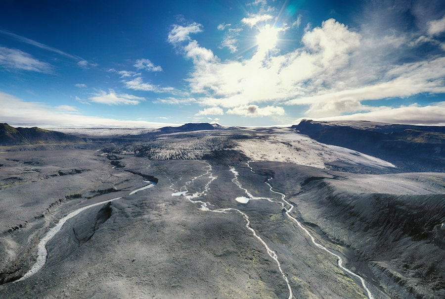
As the massive ice sheets advanced and retreated, they released colossal volumes of meltwater. These powerful rivers, swollen by glacial melt, carved new channels, reshaped existing river systems, and deposited vast amounts of sediment, creating some of the most iconic landforms we see today.
Proglacial Lakes and Outwash Plains
The melting of ice sheets often resulted in the formation of vast proglacial lakes, impounded by ice dams or topographic barriers. Lake Agassiz, a massive glacial lake that once covered parts of Manitoba and North Dakota, is a prime example, leaving behind fertile lakebed sediments that form some of North America’s most productive agricultural regions. Similarly, the Baltic Ice Lake and the Yoldia Sea were enormous bodies of water that occupied the basins now filled by the Baltic Sea.
As meltwaters flowed away from the ice margins, they formed braided river systems that deposited vast outwash plains. These plains, composed of sand, gravel, and till, stretched for hundreds of kilometers. The erosive and depositional power of these meltwater rivers was immense, carrying boulders and fine silt alike, shaping the topography with a relentless, watery force. These outwash plains are often characterized by a distinctive, flat to gently sloping terrain, crisscrossed by numerous shifting channels.
River Valley Transformations and Coastal Changes
Existing river valleys were dramatically altered by glacial meltwater. Many were deepened and widened into characteristic U-shaped glacial troughs, while others were filled with glacial debris. The Missouri River system, for instance, was heavily influenced by glacial meltwater and ice advances, leading to significant changes in its course and volume.
The dramatic lowering of sea levels during the Last Glacial Maximum also played a crucial role in shaping coastal landscapes. With so much water locked up in ice sheets, global sea levels were an estimated 120 meters lower than today. This exposed vast areas of continental shelf, creating land bridges and expanding coastlines. For example, the Bering Land Bridge, connecting Asia and North America, was a crucial corridor for human and animal migration. Coastal erosion and deposition were also influenced by the increased sediment load from glacial meltwater and the altered wave and current patterns.
The Exposed Continental Shelves and Paleocoastlines
The significant drop in global sea levels during the Last Glacial Maximum fundamentally altered the Earth’s coastlines and exposed vast tracts of what are now submerged continental shelves. This geological revelation provides a unique window into past environments and the pathways of early human migration.
Beringia: A Bridge Between Worlds
Perhaps the most significant impact of lowered sea levels was the exposure of Beringia, the land bridge connecting Siberia and Alaska. This vast, relatively dry plain, not just a narrow strip of land but a substantial subcontinent, facilitated the migration of both humans and animals between Asia and North America. The ancestral populations that would eventually populate the Americas crossed Beringia, carrying with them their cultures and technologies. The ecology of Beringia itself would have been a unique periglacial steppe, supporting its own diverse array of flora and fauna. Understanding its extent and environmental conditions is crucial for reconstructing the early peopling of the Americas.
Submerged Landscapes and Paleogeographic Reconstruction
Beyond Beringia, extensive areas of continental shelf were exposed worldwide. The North Sea basin, for example, was largely dry land, forming a vast plain that connected Great Britain to mainland Europe. This “Doggerland” would have been a rich hunting ground for early humans and a habitat for a diverse range of Pleistocene fauna. Similarly, the continental shelves off the coasts of Australia and Southeast Asia were exposed, creating land bridges that facilitated migration across island archipelagos that are now separated by deep ocean. Paleogeographic reconstructions, using bathymetric data, geological evidence, and climate models, are essential for visualizing these lost landscapes and understanding their ecological significance. These reconstructions reveal ancient river valleys, shorelines, and terrestrial environments that existed where oceans now lie.
Ice age landscapes from twenty thousand years ago were characterized by vast expanses of glaciers and dramatic shifts in climate that shaped the Earth’s surface. These ancient environments not only influenced the migration patterns of early humans but also left behind unique geological formations that can still be studied today. For a deeper understanding of how natural processes have evolved over time, you might find it interesting to explore the article on the power of natural filtration systems, which highlights the importance of water in shaping ecosystems. You can read more about it here.
Remnants of a Frozen Age: Modern Landscapes Shaped by Ice
| Metric | Value | Description |
|---|---|---|
| Time Period | ~20,000 years ago | Approximate date during the Last Glacial Maximum |
| Global Temperature | ~6°C cooler than present | Average global temperature drop compared to today |
| Ice Sheet Coverage | ~33 million km² | Extent of continental ice sheets covering North America and Eurasia |
| Sea Level | ~120 meters lower | Global sea levels were significantly lower due to water locked in ice sheets |
| Vegetation | Tundra and Steppe | Dominant plant communities in periglacial regions |
| Atmospheric CO2 | ~180 ppm | Lower carbon dioxide concentration compared to pre-industrial levels |
| Glacial Landforms | Moraines, Drumlin fields, Eskers | Common landscape features formed by glacial activity |
| Permafrost Extent | Extensive | Large areas of permanently frozen ground in northern latitudes |
The geological legacy of the last ice age is not confined to the distant past; it is etched into the very fabric of our modern world. The immense forces of ice and meltwater have sculpted countless landforms that continue to define our planet’s geography and influence our lives.
Glacial Landforms Visible Today
From the majestic fjords of Norway and Chile to the rolling hills of New England and the drumlin fields of Ireland, glacial landforms are ubiquitous. Moraines, the ridges of till deposited at the edges of glaciers, delineate the former extent of ice sheets. Cirques, the bowl-shaped depressions carved by alpine glaciers, are prominent features in mountain ranges. Glacial valleys, often U-shaped and broader than river-carved valleys, serve as pathways for modern rivers and often cradle picturesque lakes. Kettle lakes, formed by the melting of buried ice blocks, dot the landscape in many formerly glaciated regions. These features are not just scenic wonders; they are tangible reminders of the immense power of past glaciation.
The Lasting Impact on Hydrology and Geology
The impact of glacial processes extends to our hydrological systems and geological makeup. The Great Lakes, a direct result of Laurentide Ice Sheet scouring, hold a significant portion of the world’s fresh surface water. Ancient glacial riverbeds now form the courses of many modern rivers, and the sediments deposited by meltwaters contribute to fertile soils in many regions. The isostatic rebound, the gradual rising of the Earth’s crust after the weight of ice sheets was removed, continues to shape landscapes in formerly glaciated areas, leading to subtle but significant geological changes. The very topography of much of the Northern Hemisphere bears the indelible imprint of its frozen past, a testament to the profound and enduring influence of the ice age on Earth’s terrain.