Unveiling the Icy Realm: Navigating the Last Glacial Maximum
The Earth, a planet of dynamic change, has witnessed epochs of profound transformation. Among the most dramatic of these were the glacial periods, eras when vast ice sheets sculpted continents and fundamentally reshaped the planet’s surface. The Last Glacial Maximum (LGM), which occurred roughly between 26,500 and 19,000 years ago, represents the apex of the most recent ice age. It was a time of extreme cold, significantly lower sea levels, and landscapes drastically different from those we inhabit today. Understanding the topography, climate, and ecosystems of this remote past is not merely an academic exercise; it offers crucial insights into Earth’s climate system, the resilience of life, and the deep history of our planet. Mapping these harsh landscapes of the LGM is a complex, multi-disciplinary endeavor, relying on a diverse toolkit of scientific methods to reconstruct a world cloaked in ice.
During the last glacial maximum, researchers focused on mapping out harsh landscapes to better understand the environmental conditions that shaped human migration and adaptation. A related article that explores the complexities of navigating challenging terrains, albeit in a different context, can be found at Securing the Final Frontier: Militarization of Deep Space Logistics. This article delves into the logistical challenges faced in extreme environments, drawing parallels to the difficulties encountered during the last glacial maximum.
Reconstructing the Frozen Giants: The Ice Sheets and Their Dominion
The defining characteristic of the LGM was the colossal scale of its ice sheets. These immense bodies of ice, kilometers thick in places, covered vast swathes of the Northern Hemisphere, profoundly influencing global climate and geography. Their sheer mass exerted immense pressure on the Earth’s crust, causing isostatic depression, a sinking of the land beneath the ice. As these ice sheets advanced and retreated over millennia, they carved out distinctive landforms, leaving behind a geological legacy that scientists can now decipher.
The Laurentide and Fennoscandian Ice Sheets: Architects of North America and Eurasia
The most extensive ice masses during the LGM were the Laurentide Ice Sheet, which blanketed most of Canada and the northern United States, and the Fennoscandian Ice Sheet, dominating Scandinavia, the Baltic region, and parts of northwestern Russia. These ice sheets were not static entities; they flowed outwards from their thickest centers, driven by gravity. Their glacial action was relentless, grinding bedrock, eroding valleys, and transporting vast quantities of sediment and rock.
The Laurentide Ice Sheet, in particular, was a formidable force. Its southern margin extended as far south as the Ohio River valley in North America. Its retreat left behind a distinctive landscape characterized by numerous lakes, moraines (ridges of debris deposited by glaciers), and drumlins (elongated hills formed by glacial ice acting on underlying unconsolidated till or bedrock). The immense weight of the Laurentide Ice Sheet depressed the Canadian Shield by hundreds of meters, a deformation that is still slowly rebounding today.
Similarly, the Fennoscandian Ice Sheet carved out the fjords of Norway, smoothed the rocky terrain of Finland, and deposited vast moraine systems across northern Europe. Its retreat created the intricate archipelagos found in the Baltic Sea and shaped the drainage systems of many Northern European rivers. The sheer volume of water locked up in these ice sheets had a dramatic impact on global sea levels.
Greenland and Antarctic Ice Sheets: Enduring Remnants of the Cold
While the Laurentide and Fennoscandian ice sheets were the dominant features of the Northern Hemisphere during the LGM, the Greenland and Antarctic ice sheets also experienced significant expansion. The Greenland Ice Sheet likely reached its maximum extent, covering almost the entire island and extending onto the surrounding continental shelf. The Antarctic Ice Sheet, already a continent-sized frozen mass, also thickened and extended its margins, though its overall response to LGM conditions was more complex and varied regionally. These ice sheets acted as massive reservoirs of freshwater, contributing significantly to the lowered global sea levels. Their presence had a profound impact on atmospheric circulation patterns and ocean currents, influencing climate far beyond their immediate peripheries.
The Impact of Ice: Shaping Landscapes Through Erosion and Deposition
The erosional power of glacial ice is immense. As ice flows, it picks up and carries debris, ranging from fine dust to massive boulders. This debris acts like sandpaper, grinding against the bedrock beneath. This process of abrasion creates features like U-shaped valleys, cirques (bowl-shaped depressions at the head of a glacier), and roche moutonnées (rock formations shaped by glacial abrasion and plucking).
Deposition is equally significant. When glaciers melt, they release the sediment and rock they have carried. This deposited material, known as till, forms moraines, which can be vast ridges marking the former edge of an ice sheet. Other depositional features include outwash plains, formed by meltwater streams carrying glacial debris, and eskers, sinuous ridges of sand and gravel deposited by meltwater streams flowing within or beneath a glacier. The presence and distribution of these landforms are crucial for reconstructing the past extent and flow paths of LGM ice sheets.
Whispers from the Past: Unraveling Paleoenvironmental Clues
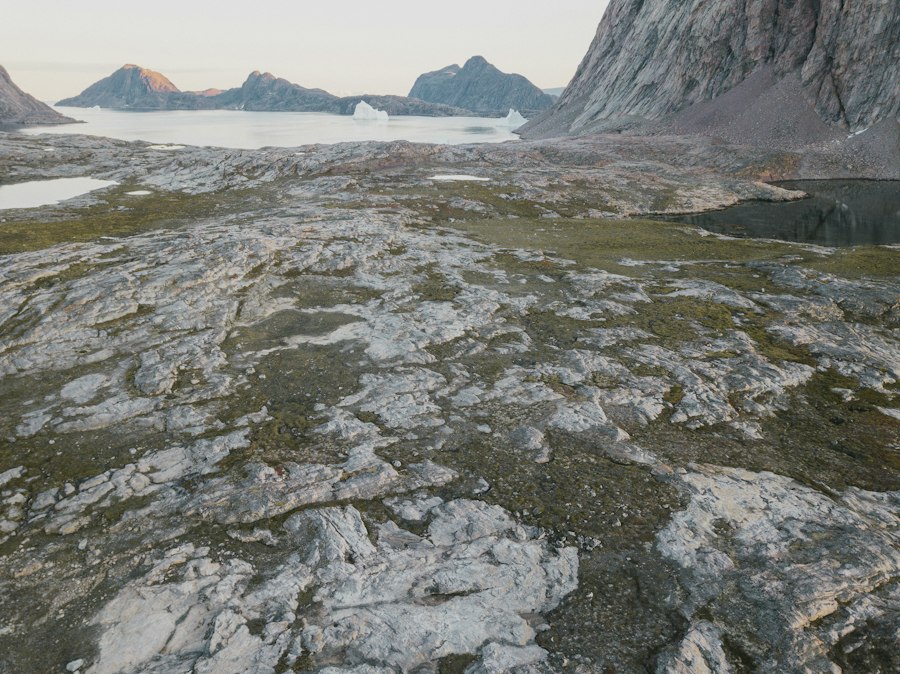
Reconstructing the environments of the LGM is akin to piecing together a colossal jigsaw puzzle, with each scientific discipline providing vital fragments of information. Scientists rely on a variety of proxy indicators, which are indirect measures of past environmental conditions, to paint a picture of a world vastly different from our own. These proxies are found in sediments, ice cores, and fossilized remains, each offering a unique window into the LGM.
Sediment Cores: A Chronicle of Landscapes and Climates
Lake and ocean sediment cores are invaluable archives of past environmental change. As sediments accumulate layer by layer over millennia, they trap pollen, spores, diatoms (single-celled algae), charcoal, and magnetic minerals, among other things. Analyzing these components allows scientists to reconstruct past vegetation, lake productivity, and even fire regimes. For instance, the presence of pollen from cold-adapted grasses and shrubs, alongside the absence of pollen from trees, indicates a treeless steppe-tundra environment.
Marine sediment cores are particularly useful for understanding past ocean temperatures and circulation patterns, as well as the input of ice-rafted debris from melting icebergs. The composition of marine fossils, such as foraminifera (tiny marine organisms with shells), can reveal past ocean temperatures and the isotopic composition of seawater, which is linked to global ice volume. Terrestrial sediment cores from ancient lake beds can reveal changes in water levels, salinity, and the influx of sediment from eroding landscapes.
Ice Cores: Frozen Diaries of Atmospheric Conditions
Antarctic and Greenland ice cores provide an unparalleled record of past atmospheric composition, temperature, and dust deposition. As snow accumulates year after year and compacts into ice, it traps tiny air bubbles. Analyzing the gases within these bubbles, such as carbon dioxide and methane, reveals past atmospheric concentrations of these greenhouse gases. The isotopic composition of the ice itself (specifically oxygen and hydrogen isotopes) can be used to reconstruct past temperatures.
Furthermore, ice cores contain dust particles and volcanic ash, providing evidence of atmospheric circulation patterns and volcanic activity. Layers of ash can be dated radiometrically, helping to correlate ice core records with other paleoclimate archives. The thickness of ice layers can also indicate past snowfall accumulation. These frozen diaries offer a continuous and highly resolved record of climate change over hundreds of thousands of years, making them indispensable for understanding LGM conditions.
Fossil Evidence: Remnants of LGM Life
The fossil record provides direct evidence of the flora and fauna that inhabited the Earth during the LGM. Paleobotanical studies, which examine fossil pollen and plant macrofossils, reveal the composition of past plant communities and the extent of vegetation cover. For example, finding the remains of woolly mammoths or steppe bison indicates the presence of expansive grasslands and cold, dry conditions.
Paleozoological studies, focusing on animal fossils and their distribution, help reconstruct past faunal ranges and migration patterns. The presence of cold-adapted species, such as reindeer, Arctic foxes, and cave bears, is characteristic of LGM environments. The study of ancient DNA from these fossil remains can provide further insights into the genetic makeup and evolutionary history of LGM species, as well as their adaptations to harsh conditions.
The World Without Us: Life in a Glaciated Landscape
The dominance of ice sheets and the resulting climatic shifts meant that life during the LGM existed in a dramatically altered world. Vast areas were uninhabitable, while others supported specialized ecosystems adapted to extreme cold, aridity, and limited resources. Understanding these LGM ecosystems requires piecing together information from paleoenvironmental proxies and fossil evidence.
Steppe-Tundra and Cold Deserts: Expansive Biomes of the LGM
Much of the land not directly covered by ice during the LGM was characterized by vast, open landscapes. In the Northern Hemisphere, these were often steppe-tundra environments – cold, dry grasslands interspersed with low-lying shrubs and dwarf trees. These biomes were a stark contrast to the lush forests found in many regions today. The low temperatures and reduced precipitation limited tree growth, favoring hardy grasses, sedges, and mosses.
These open landscapes were ideal habitats for large herbivores, such as mammoths, mastodons, horses, bison, and reindeer. These animals were well-adapted to the cold and grazed on the abundant vegetation. Their presence, in turn, supported a community of predators, including cave lions, wolves, and hyenas. Human populations, where they existed, would have been nomadic hunter-gatherers, following the herds and exploiting the available resources.
Refuge Areas and Biodiversity Hotspots
While much of the northern continents were dominated by cold, open landscapes, certain regions acted as refugia, areas where more temperate conditions persisted, allowing for the survival of a greater diversity of plant and animal life. These refugia could be found in coastal areas, in sheltered valleys, or in regions with specific microclimates. For example, parts of the southern United States, while experiencing colder and drier conditions, may have retained some forested areas, acting as refuges for species that could not survive in the open steppe.
The concentration of species in these refuge areas meant that they could become important centers of biodiversity. As the LGM waned and ice sheets retreated, these refuge populations would have been crucial for recolonizing the newly deglaciated landscapes. Studying these refugia is vital for understanding the resilience of ecosystems and the evolutionary processes that occurred during periods of extreme environmental stress.
Marine Ecosystems: Shifting Tides and Ice-Scoured Seas
The dramatic drop in sea level during the LGM had profound implications for marine ecosystems. Exposed continental shelves, which are now submerged, became terrestrial landscapes, creating land bridges that facilitated the migration of terrestrial animals and humans between continents. For example, the Bering Land Bridge connected Asia and North America, allowing for the dispersal of species and early human populations.
Oceanographic conditions also changed significantly. With vast amounts of freshwater locked up in ice sheets, ocean salinity increased in some regions. Ocean currents were also altered by the presence of ice sheets and changes in atmospheric circulation. This led to shifts in the distribution of marine life, with some species thriving in colder waters while others retreated to warmer refuges. Icebergs calved from the margins of ice sheets would have also played a role in nutrient distribution and the transport of organisms.
Researchers have made significant strides in understanding the harsh landscapes that characterized the last glacial maximum, revealing how these extreme environments shaped early human migration patterns. A related article discusses the fascinating interplay between climate change and human adaptation during this period, shedding light on how ancient populations navigated and thrived in such unforgiving terrains. For more insights into captivating narratives that explore the intersection of history and environment, you can check out this documentary that delves into the resilience of human beings in challenging circumstances.
Bridging the Divide: Human Migrations and Adaptations
| Metric | Description | Value/Range | Unit | Notes |
|---|---|---|---|---|
| Ice Sheet Coverage | Percentage of Earth’s surface covered by ice sheets | 30 | % | Significantly expanded compared to present day |
| Global Temperature | Average global temperature during the Last Glacial Maximum (LGM) | 4-7 | °C below pre-industrial levels | Varied regionally |
| Sea Level | Global sea level relative to present day | -120 | meters | Due to large volumes of water locked in ice sheets |
| Permafrost Extent | Area covered by permafrost during LGM | ~20 million | km² | Expanded into mid-latitude regions |
| Vegetation Zones | Dominant vegetation types in harsh landscapes | Tundra, Steppe | N/A | Reduced forest coverage |
| Glacial Moraines | Number of mapped major moraines indicating glacier extent | 100+ | count | Used to reconstruct ice sheet boundaries |
| Dust Deposition Rates | Amount of dust deposited in ice cores | 5-20 | mg/cm²/year | Higher rates indicate arid, harsh conditions |
The LGM presented significant challenges for early humans, forcing them to adapt to harsh conditions and navigate altered landscapes. The lowered sea levels created new opportunities for migration, while the scarcity of resources in many areas necessitated ingenious survival strategies. The mapping of LGM landscapes is intrinsically linked to understanding the movements and adaptations of our ancestors.
The Peopling of the Americas: A Journey Across the Bering Land Bridge
One of the most significant human migrations during the LGM was the movement of people from Asia into the Americas. The Bering Land Bridge, exposed by lower sea levels, provided a direct land connection between the two continents. Archaeological evidence suggests that humans began migrating into Alaska and then further into North and South America sometime before or during the LGM, with significant expansion occurring as the ice sheets began to retreat and open up ice-free corridors.
Reconstructing the ice-free corridors that allowed for this migration is a key aspect of LGM mapping. These corridors, often narrow and challenging passages between the Laurentide and Cordilleran ice sheets, would have been vital routes for early populations. Understanding the timing of their opening and the environmental conditions within them is crucial for tracing the routes and timing of human dispersal across the Americas.
Adapting to Extreme Environments: Technology and Social Organization
Surviving in the LGM environment required significant technological innovation and sophisticated social organization. Early humans developed specialized tools for hunting large game, processing hides, and managing resources. The development of tailored clothing, robust shelters, and efficient fire management techniques would have been essential for survival in the extreme cold.
Social structures likely played a critical role in LGM survival. Small, mobile bands of hunter-gatherers would have relied on cooperation for hunting, resource sharing, and defense. The ability to transmit knowledge and skills across generations would have been paramount. The archaeological record, though often sparse, provides glimpses into these adaptations, with evidence of sophisticated toolkits, evidence of specialized hunting strategies, and the presence of nomadic campsites.
The Legacy of LGM Migrations: Shaping Modern Populations
The migrations that occurred during the LGM have had a lasting impact on the genetic and cultural diversity of modern human populations. The peopling of the Americas, for instance, laid the foundation for the diverse Indigenous cultures that developed on the continents. Understanding the routes and timing of these ancient migrations helps us to trace our own deep history and appreciate the remarkable adaptability of our species. The mapping of LGM landscapes, therefore, is not just about understanding ancient geography; it is about understanding the very origins and spread of humanity.
Illuminating the Path Forward: Challenges and Future Directions
Mapping the harsh landscapes of the Last Glacial Maximum is an ongoing scientific endeavor, fraught with challenges but promising significant advancements. As our understanding of past climates and Earth systems deepens, so too does our ability to reconstruct these ancient worlds. The integration of new technologies and interdisciplinary approaches is crucial for pushing the boundaries of our knowledge.
Technological Innovations in Paleoclimate Reconstruction
The field of paleoclimatology is constantly evolving, driven by technological innovation. Advancements in remote sensing, such as the use of satellite imagery to identify glacial landforms and analyze their characteristics, are proving invaluable. High-resolution ice core analysis, coupled with sophisticated climate modeling, allows for more precise reconstruction of past temperatures and atmospheric conditions.
Furthermore, the development of new dating techniques, such as optically stimulated luminescence (OSL) dating of sediments, provides more accurate chronologies for reconstructing past landscapes and human activity. The application of advanced statistical methods and machine learning algorithms to large paleoclimate datasets is also enabling scientists to identify subtle patterns and relationships that might otherwise be missed.
Interdisciplinary Collaboration: A Holistic Approach
The complexity of LGM landscapes necessitates a highly interdisciplinary approach. Geologists, climatologists, paleontologists, archaeologists, and geographers must collaborate closely to integrate their findings. A geological map of ice sheet extent needs to be informed by paleoclimate data to understand the conditions that drove glaciation. Archaeological evidence of human presence must be contextualized within the paleoenvironmental conditions of the time.
This collaborative spirit is essential for building comprehensive models of LGM Earth systems, where the interplay between ice sheets, oceans, atmosphere, and biosphere is understood in its entirety. Sharing data, methodologies, and expertise across disciplines accelerates discovery and allows for a more nuanced and complete understanding of this critical period in Earth’s history.
Unanswered Questions and Future Research Frontiers
Despite significant progress, many questions about the LGM remain unanswered. The precise timing and extent of smaller ice caps and glaciers, particularly in mountainous regions, are still areas of active research. The detailed dynamics of ice sheet behavior, including the mechanisms of rapid ice loss and the role of subglacial hydrology, continue to be investigated.
Further research into the resilience and adaptability of LGM ecosystems, particularly in the face of rapid climate change, offers valuable lessons for understanding modern ecological challenges. The detailed reconstruction of human migration routes and the precise timing of their dispersal across continents remain key areas of inquiry. Ultimately, continued mapping and reconstruction of the harsh landscapes of the Last Glacial Maximum will not only deepen our understanding of Earth’s past but also provide crucial insights for navigating its future.
➡️Life 20,000 Years Ago | When Strangers Claim Your Winter Shelter 🚨
FAQs
What was the Last Glacial Maximum (LGM)?
The Last Glacial Maximum refers to the period during the last Ice Age, approximately 26,500 years ago, when ice sheets were at their greatest extent. During this time, large portions of North America, Europe, and Asia were covered by ice, significantly altering the landscape and climate of the Earth.
How did researchers map harsh landscapes during the LGM?
Researchers utilized a combination of geological evidence, ice core samples, and advanced technologies such as satellite imagery and Geographic Information Systems (GIS) to map the harsh landscapes. These methods allowed scientists to reconstruct past environments and understand how glacial movements shaped the terrain.
What types of landscapes were prevalent during the LGM?
During the LGM, the landscape was characterized by vast ice sheets, tundra, and periglacial environments. Areas that are now temperate or tropical were often covered in ice or experienced extreme cold, leading to the formation of features such as moraines, drumlins, and glacial valleys.
What impact did the LGM have on human populations?
The Last Glacial Maximum had a significant impact on human populations, as many areas became uninhabitable due to extreme cold and ice coverage. However, some groups adapted by migrating to more hospitable regions, leading to changes in settlement patterns and the development of new survival strategies.
How does understanding the LGM help with current climate studies?
Studying the Last Glacial Maximum provides valuable insights into past climate conditions and the Earth’s response to significant changes in temperature and ice cover. This knowledge helps scientists predict future climate scenarios and understand the potential impacts of current global warming trends.