
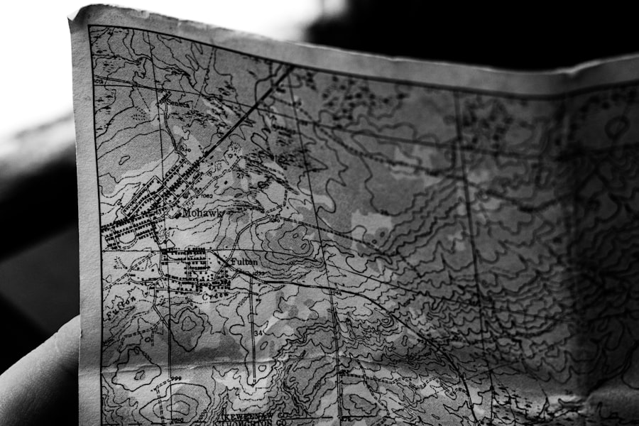
The Piri Reis Map, a remarkable artifact from the early 16th century, has captivated historians, cartographers, and enthusiasts alike since its discovery. Created by the Ottoman admiral and cartographer Piri Reis in 1513, this map is notable not only for its artistic quality but also for its geographical accuracy and the wealth of information it conveys about the world as it was known during the Age of Exploration. The map depicts parts of Europe, Africa, and the Americas, showcasing a blend of ancient and contemporary knowledge that raises questions about the sources and methods used in its creation.
As a historical document, the Piri Reis Map serves as a window into the past, revealing insights into the navigational practices and geographical understanding of the time. The intrigue surrounding the Piri Reis Map extends beyond its visual appeal; it embodies a confluence of cultures and knowledge systems. The map is not merely a representation of landmasses; it is a testament to the interconnectedness of civilizations during an era marked by exploration and discovery.
As scholars delve into its origins and implications, they uncover layers of meaning that reflect the complexities of global interactions in the early 16th century. The Piri Reis Map stands as a symbol of human curiosity and the relentless pursuit of knowledge, inviting further exploration into its historical context and significance.
Key Takeaways
- The Piri Reis Map is a famous world map drawn by Ottoman cartographer Piri Reis in 1513.
- The map is known for its controversial and mysterious features, including accurate depictions of Antarctica and South America.
- The source material for the map is believed to be a combination of various ancient maps and navigational charts.
- Modern scientific analysis has revealed both accurate geographical details and anomalies in the Piri Reis Map.
- The map’s legacy lies in its cultural and historical significance, as well as the ongoing debate and speculation about its origins and accuracy.
The History and Origins of the Piri Reis Map
The Piri Reis Map was created in 1513 by Piri Reis, an Ottoman admiral and navigator who played a significant role in maritime exploration during his time. The map is believed to have been drawn in Istanbul, where Piri Reis was based. It is one of the earliest known maps to depict the New World, specifically parts of South America and the Caribbean, reflecting the burgeoning interest in these regions following Columbus’s voyages.
The map is crafted on a piece of worn parchment, which adds to its historical allure, as it has survived centuries of wear and tear. Piri Reis’s background as a sailor and cartographer greatly influenced his work. He was well-versed in various navigational techniques and had access to a wealth of information from different cultures.
His map incorporates knowledge from earlier cartographers, including ancient Greek and Roman sources, as well as information gathered from explorers who ventured into uncharted territories. This synthesis of knowledge highlights the collaborative nature of cartography during this period, where maps were not solely individual creations but rather collective endeavors that drew upon diverse sources.
The Controversy Surrounding the Piri Reis Map
The Piri Reis Map has sparked considerable debate among historians and scholars regarding its accuracy and implications. One of the primary points of contention is the map’s depiction of Antarctica, which appears to be represented without ice cover. This has led some to speculate that Piri Reis had access to ancient maps that accurately portrayed the continent long before it was officially discovered in modern times.
Such claims have fueled theories about lost civilizations or advanced ancient knowledge that predates recorded history. Additionally, the map’s portrayal of coastlines and geographical features has been scrutinized for its accuracy. While some elements align with contemporary understandings, others appear distorted or misrepresented.
This inconsistency has led to questions about Piri Reis’s sources and methods. Did he rely on firsthand accounts from explorers, or did he incorporate information from earlier maps that may have been flawed? The controversy surrounding these questions continues to inspire research and debate within academic circles.
The Cartographic Features of the Piri Reis Map
| Cartographic Features | Description |
|---|---|
| Map Creator | Piri Reis |
| Creation Date | 1513-1516 |
| Map Type | World map |
| Materials | Parchment |
| Cartographic Accuracy | Debate among scholars |
The Piri Reis Map is distinguished by its intricate cartographic features that reflect both artistic skill and navigational knowledge. The map employs a unique orientation, with south at the top, which was common in Islamic cartography but less so in European maps of the time. This orientation challenges modern viewers’ perceptions and invites them to consider how cultural perspectives shape geographical representation.
In addition to its orientation, the map is adorned with elaborate illustrations, including depictions of animals, ships, and even mythical creatures. These embellishments serve not only an aesthetic purpose but also provide context for understanding the world as perceived by Piri Reis and his contemporaries. The use of color and detail enhances the visual impact of the map, making it a work of art as much as a navigational tool.
Such features underscore the importance of aesthetics in cartography during this period, where maps were often seen as status symbols as well as practical instruments.
The Source Material for the Piri Reis Map
One of the most intriguing aspects of the Piri Reis Map is its diverse source material. Piri Reis himself claimed to have drawn upon over 20 different maps and charts when creating his work, including ancient Greek maps and contemporary European explorations. This eclectic mix raises questions about how knowledge was transmitted across cultures and how different civilizations influenced one another’s understanding of geography.
The inclusion of information from various sources suggests that Piri Reis was not merely a passive recorder of geographical data but an active participant in a broader dialogue about exploration and discovery. His ability to synthesize information from disparate cultures reflects a sophisticated understanding of cartography that transcended regional boundaries. This blending of knowledge highlights the interconnectedness of civilizations during the Age of Exploration, where ideas flowed freely across cultural lines.
The Accuracy and Anomalies of the Piri Reis Map
While the Piri Reis Map is celebrated for its remarkable accuracy in certain areas, it also contains anomalies that have puzzled scholars for centuries. For instance, some coastal outlines are surprisingly precise, particularly those of South America and parts of Africa. However, other regions appear distorted or inaccurately represented, leading to debates about the reliability of Piri Reis’s sources.
One notable anomaly is the depiction of Antarctica without ice cover, which has led some researchers to propose theories about ancient civilizations possessing advanced geographical knowledge. While mainstream historians remain skeptical about such claims, they acknowledge that the map’s inaccuracies may stem from a combination of factors, including misinterpretation of earlier maps or limitations in navigational technology at the time. These discrepancies serve as a reminder that cartography is an evolving discipline shaped by cultural contexts and technological advancements.
Theories and Speculations about the Piri Reis Map
The Piri Reis Map has inspired a plethora of theories and speculations regarding its origins and implications.
These theories often draw upon the map’s depiction of Antarctica and other anomalies that challenge conventional understandings of exploration.
Additionally, some enthusiasts have suggested that the map may hold clues to undiscovered lands or hidden treasures. Such theories often blend historical analysis with elements of mythology and adventure, capturing the imagination of those who seek to unravel its mysteries. While many mainstream historians approach these claims with skepticism, they acknowledge that the map’s enigmatic nature invites exploration beyond traditional academic boundaries.
Modern Scientific Analysis of the Piri Reis Map
In recent years, modern scientific techniques have been employed to analyze the Piri Reis Map more thoroughly than ever before. Advances in imaging technology have allowed researchers to examine the map’s ink composition, materials used, and even potential alterations made over time.
Furthermore, geographic information systems (GIS) have enabled scholars to compare the map’s features with contemporary geographical data. This technological approach has revealed both consistencies and discrepancies between Piri Reis’s representation and modern understandings of geography. Such analyses contribute to ongoing discussions about cartographic accuracy and highlight how technology can enhance historical research.
The Cultural and Historical Significance of the Piri Reis Map
The cultural and historical significance of the Piri Reis Map extends far beyond its geographical content. It serves as a testament to the spirit of exploration that characterized the Age of Discovery, reflecting humanity’s innate desire to understand and navigate the world. The map embodies a moment in history when cultures intersected through trade, exploration, and exchange of ideas.
Moreover, the Piri Reis Map highlights the role of cartography as a tool for power and influence during this period. Maps were not merely practical instruments; they were also symbols of authority that shaped perceptions of territory and ownership. The creation and dissemination of maps like that of Piri Reis played a crucial role in establishing colonial ambitions and territorial claims across newly discovered lands.
The Legacy of the Piri Reis Map
The legacy of the Piri Reis Map endures in contemporary discussions about cartography, exploration, and cultural exchange. It continues to inspire scholars, artists, and adventurers alike who seek to understand its complexities and implications. As a historical artifact, it serves as a reminder of humanity’s quest for knowledge and understanding in an ever-changing world.
In addition to its academic significance, the Piri Reis Map has become a cultural icon representing curiosity and exploration. It has been featured in various exhibitions, documentaries, and popular media, capturing public interest in both history and geography. Its enduring legacy speaks to humanity’s fascination with maps as tools for navigation but also as reflections of cultural identity and historical context.
Unraveling the Enigma of the Piri Reis Map
In conclusion, the Piri Reis Map remains an enigmatic artifact that continues to captivate scholars and enthusiasts alike. Its intricate design, diverse source material, and historical significance offer valuable insights into early 16th-century cartography and exploration. While controversies surrounding its accuracy persist, modern scientific analyses have shed light on its creation process and cultural context.
As researchers continue to explore its mysteries, they uncover layers of meaning that reflect humanity’s enduring quest for knowledge and understanding. The Piri Reis Map stands not only as a testament to an era marked by exploration but also as a symbol of interconnectedness among cultures throughout history. Its legacy endures as a reminder that maps are more than mere representations; they are narratives woven from human experience, curiosity, and ambition—a true reflection of our collective journey through time.
The Piri Reis map, a world map compiled in 1513 by the Ottoman admiral and cartographer Piri Reis, has long been a subject of fascination and conspiracy theories due to its depiction of the Americas and Antarctica with surprising accuracy. Some theorists suggest that the map is evidence of ancient advanced civilizations or even extraterrestrial contact. For those interested in exploring more about the mysterious aspects of historical maps and their implications, a related article can be found on the Real Lore and Order website. This article delves into the intriguing world of ancient cartography and the myths surrounding it. You can read more about these fascinating topics by visiting this article.
WATCH THIS 🧊The US Military Confirmed It: What’s REALLY Under the Antarctic Ice?
FAQs
What is the Piri Reis map?
The Piri Reis map is a world map created by Ottoman admiral and cartographer Piri Reis in 1513. It is notable for its inclusion of the coastlines of the Americas, which were not officially discovered by Europeans until several years later.
What is the conspiracy theory surrounding the Piri Reis map?
The conspiracy theory surrounding the Piri Reis map suggests that it is evidence of advanced ancient civilizations or extraterrestrial contact, as it accurately depicts the coastlines of the Americas and Antarctica before they were officially discovered.
Is there any evidence to support the conspiracy theory?
There is no credible evidence to support the conspiracy theory surrounding the Piri Reis map. The map’s accuracy can be attributed to the compilation of existing geographical knowledge and the use of earlier maps and charts.
What do experts say about the Piri Reis map?
Most experts believe that the Piri Reis map is a remarkable but explainable artifact of early cartography. The map’s accuracy can be attributed to the compilation of existing geographical knowledge and the use of earlier maps and charts.
Is the Piri Reis map considered a reliable source of historical information?
While the Piri Reis map is a valuable historical artifact, it is not considered a reliable source of historical information, particularly regarding the depiction of the Americas and Antarctica. It is important to consult other historical sources for accurate information about these regions.