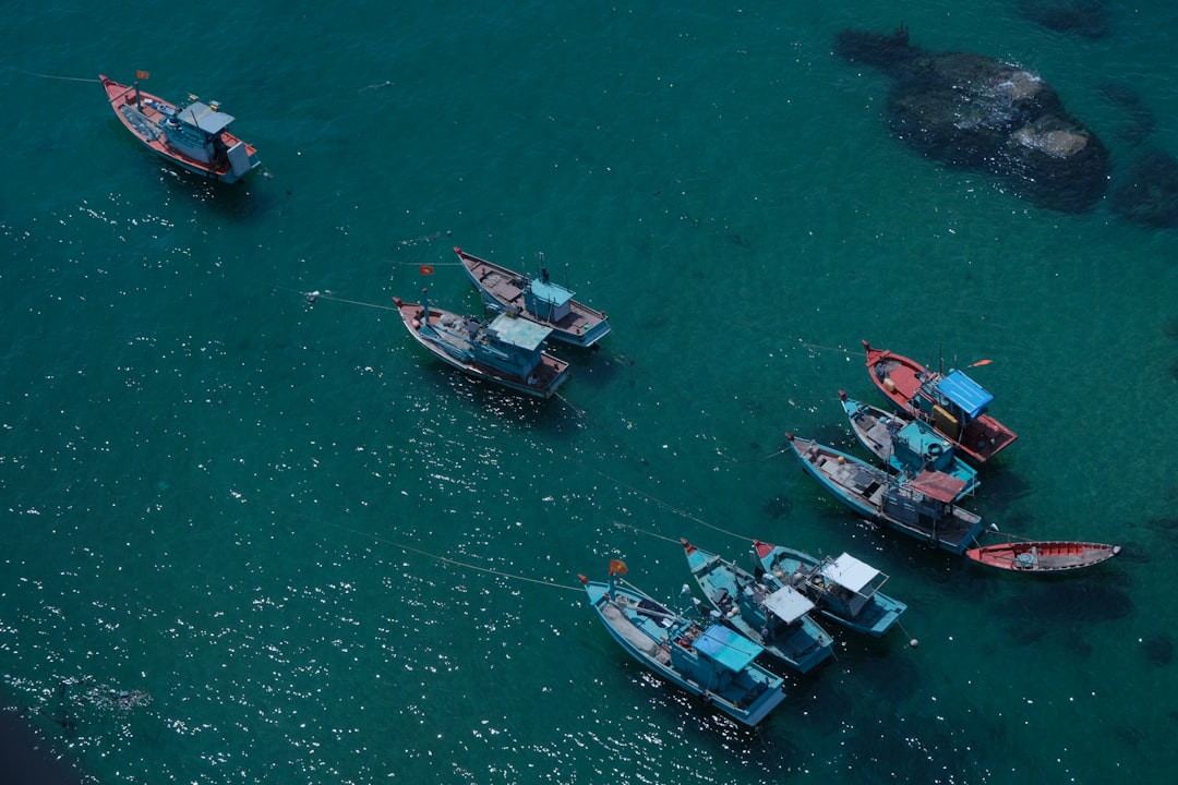
The whispers of ancient mariners, long silenced by the inexorable march of time, are finding their voice once more. For millennia, vast oceans served as both formidable barriers and conduits for human civilization, shaping trade, culture, and knowledge. The ability to navigate these boundless expanses was a technological marvel that unlocked new worlds and fostered unprecedented connections. Evidence unearthed by archaeologists and historians is steadily illuminating the sophisticated techniques and practices employed by these early seafarers, particularly through the enduring legacy of portolan charts – navigational tools of remarkable accuracy and artistry. These unearthed fragments are more than just discolored parchment; they are keys that unlock the secrets of a bygone era of exploration and ingenuity.
Before the advent of sophisticated instruments, ancient mariners relied on a keen understanding of the natural world and rudimentary tools to guide their journeys. These early voyages, undertaken by a variety of cultures globally, laid the groundwork for future maritime expansion. The inherent dangers of the sea demanded not only courage but also a systematic approach to navigation, which evolved organically over centuries.
Celestial Navigation: Reading the Stars and Sun
One of the most fundamental pillars of ancient navigation was the observation of celestial bodies. The sun, in its diurnal passage, provided directional cues and a rudimentary sense of latitude, while the stars offered a more constant, albeit complex, reference system.
The Sun’s Arc: Day-by-Day Direction
Early mariners would have meticulously observed the sun’s path across the sky. Its eastward rise and westward setting were universal directional anchors. Furthermore, by noting the highest point the sun reached in the sky (solar noon), they could infer their approximate latitude, though without precise instruments, this would have been a relative estimate. The changing angle of the sun throughout the day would have also been correlated to time, a crucial element for estimating distances sailed.
The Night Sky’s Compass: Constellations and Polaris
The constellations offered a more stable and reliable navigational aid during the night. Ancient mariners learned to recognize key star patterns, using them as directional markers. The heliacal rising and setting of specific stars, meaning their first appearance or disappearance from view just before sunrise or after sunset, became important indicators for time and position. In the Northern Hemisphere, the Pole Star (Polaris) played a pivotal role. Its apparent immobility in the night sky made it a crucial reference point for maintaining a consistent latitude. While not perfectly fixed, its proximity to the celestial north pole meant that it provided a remarkably stable guide.
Coastal Piloting: Familiar Shores and Landmarks
For many early journeys, particularly those within familiar waters, coastal piloting was the primary method of navigation. This involved relying on visual recognition of prominent landforms, headlands, and islands.
The Art of Memory: Charting the Coastline in the Mind
While not always documented in surviving physical records, the incredible mnemonic abilities of ancient sailors were likely a critical component of coastal piloting. They would have memorized the shapes of coastlines, the positions of distinctive mountains, bays, and river mouths. This mental cartography was a living document, constantly updated with experience.
Proximity to Land: Safer Passages and Known Havens
The preference for remaining within sight of land, or at least within predictable sailing distances from it, offered a sense of security. When land was out of sight, the reliance on other methods would intensify. However, the presence of known ports and safe anchorages along the coast was a fundamental aspect of planning and executing voyages.
Instinct and Experience: The Unseen Navigator
Beyond tangible tools and observations, the accumulated experience and intuition of seasoned mariners played an indispensable role. This “sea sense” was developed over countless voyages and was often difficult to codify but undeniably effective.
Reading the Waves: Subtle Indicators of Depth and Obstructions
Experienced sailors could often discern subtle changes in wave patterns that indicated approaching shoals or underwater obstacles. The way waves broke against submerged hazards provided a palpable warning that instruments could not replicate.
Wind and Current Forecasting: A Natural Phenomenon Understood
Understanding the prevailing winds and currents was paramount. Ancient mariners developed a sophisticated, empirical understanding of seasonal wind patterns and the directional flow of ocean currents, which were crucial for efficient and safe passage. This knowledge was passed down through generations, forming a vital part of maritime tradition.
Recent studies have shed light on the evidence of ancient seafaring practices, particularly through the analysis of portolan charts, which are navigational maps that date back to the medieval period. These charts provide crucial insights into the maritime routes and trade networks of ancient civilizations. For a deeper understanding of this fascinating topic, you can explore the article available at this link, which discusses the significance of these charts in the context of historical navigation and exploration.
The Emergence of Portolan Charts: Navigational Blueprints of the Medieval World
As journeys extended further from shore and became more ambitious, there arose a need for more formalized navigational tools. The portolan chart, a distinct type of nautical map, emerged in the Mediterranean during the late 13th century and revolutionized maritime navigation. These charts were not merely idealized representations of landmasses but practical instruments designed for direct use at sea.
The Anatomy of a Portolan: More Than Just Lines on Parchment
Portolan charts were characterized by a distinctive style and a set of features that made them uniquely suited for their purpose. Their construction indicates a deep understanding of geographical relationships and navigational needs.
Rhumb Lines: The Arteries of the Sea
A defining feature of portolan charts is the intricate network of radiating lines originating from several compass roses. These are known as rhumb lines, or lines of constant bearing. Each line represents a specific compass direction (e.g., North, Northeast, East). Mariners used these lines to plot courses, connect different locations, and estimate distances between ports. They acted as a universal grid, allowing for the transference of bearings from the chart to the ship’s compass, facilitating direct plotting of routes.
Compass Roses: The Heartbeat of Direction
Typically, portolan charts feature one or more compass roses, meticulously drawn circles indicating the cardinal directions and intercardinal points. These roses served as the central reference for the rhumb lines and were indicative of the navigational accuracy and understanding of magnetic variation the chartmakers possessed, or at least aimed for. The precise placement and number of roses could vary, but their purpose remained consistent – to provide a clear directional framework.
Coastal Depictions: Detail Where It Matters Most
Unlike earlier maps that prioritized the depiction of entire continents or idealized geographies, portolan charts focused with remarkable detail on coastlines, harbors, and important landmarks. This practical approach reflected their intended use: navigating along coasts and entering ports. Bays, promontories, islands, and river mouths were rendered with a degree of accuracy that allowed sailors to visually identify their position relative to the charted features.
Soundings and Hazards: Underscoring Safety
Many portolan charts also included markings for water depths (soundings) and indicated potential navigational hazards such as reefs, shoals, and sandbanks. These annotations were crucial for safe passage, especially in unfamiliar waters or when approaching dangerous coastlines. The inclusion of such information underscores the functional and life-saving purpose of these charts.
The Mediterranean Cradle: Where Portolan Charts Took Root
The Mediterranean Sea, with its complex coastlines, numerous islands, and well-established trade routes, provided the ideal environment for the development and proliferation of portolan charts. The region’s vibrant maritime culture fostered the exchange of knowledge and spurred innovation in navigation.
Trade Routes as Catalysts: Connecting Markets and Cultures
The extensive trade networks that crisscrossed the Mediterranean were a powerful impetus for the creation of accurate navigational tools. Merchants and sailors alike required reliable charts to optimize voyage times, reduce risks, and ensure the efficient transport of goods between diverse ports, from Venice and Genoa to Alexandria and Constantinople.
Cartographical Hubs: Centers of Knowledge and Production
Certain cities, such as Genoa, Venice, and Majorca, became renowned centers for the production of portolan charts. Skilled cartographers, often working in guilds or workshops, produced these maps for sale to mariners. The demand for these charts fueled advancements in cartographical techniques and the standardization of their features.
The Diffusion of Knowledge: From Local Secrets to Global Reach
While initially focused on the Mediterranean, the principles and style of portolan charts gradually influenced cartography in other regions. As European voyages of exploration expanded, the foundational understanding of chart construction derived from portolan charts played a role, albeit indirectly, in the development of new navigational maps.
Unearthing the Past: Archaeological Discoveries and Their Significance
The study of ancient seafaring and navigation often relies on the interpretation of fragmented evidence. Archaeological discoveries, however, offer tangible links to the past, providing concrete proof of past capabilities and practices. These findings are like scattered breadcrumbs leading us back to the shores of forgotten journeys.
Shipwrecks as Time Capsules: Vessels Revealing Maritime Technologies
The discovery and excavation of ancient shipwrecks represent some of the most significant archaeological finds related to seafaring. These submerged vessels offer an unparalleled glimpse into the construction, equipment, and cargo of ships from bygone eras, and by extension, the capabilities of the mariners who sailed them.
Hull Construction and Design: Engineering for the Seas
The remains of ship hulls reveal the advanced engineering and shipbuilding techniques employed by ancient civilizations. The materials used, the methods of joining planks, and the overall design of the hull speak to the understanding of hydrodynamics and the stresses of oceanic travel. For example, the discovery of remarkably intact Roman ships has illuminated their robust construction.
Onboard Equipment: Tools of the Trade
Shipwrecks can yield a wealth of information about the navigational and sailing equipment used by ancient mariners. This can include fragments of astrolabes, compasses (though early forms were often less precise and prone to deviation), sounding lines, and anchors. The presence and type of such artifacts directly inform our understanding of their navigation methods.
Cargo and Trade Routes: Mapping Economic Networks
The cargo found within a shipwreck provides invaluable insights into the trade routes and economic networks of the time. By identifying the origin of artifacts and the types of goods transported, archaeologists can reconstruct the maritime paths taken by these vessels and the extent of their reach across the seas.
Artifacts of Navigation: Implements of Guidance
Beyond shipwrecks, the discovery of individual artifacts directly associated with navigation offers crucial pieces of the puzzle. These items, often found in port sites or underwater, are the physical manifestations of the mariner’s craft.
The Rudimentary Compass: Guiding Principles
While early magnetic compasses may not resemble modern instruments, the discovery of magnetic stones (lodestones) or early compass casings provides evidence of their use. The development of more reliable compasses, particularly during the medieval period, was a significant technological leap, allowing for more consistent directional orientation.
Cartographical Fragments: Glimpses of Lost Maps
Occasional discoveries of fragments of ancient maps or charts, even if incomplete, are of immense value. These fragments can reveal stylistic conventions, place names, and geographical representations that corroborate or expand upon existing knowledge. They are like pages torn from the logbooks of history.
The Mariner’s Toolkit: Beyond the Chart
Other artifacts, such as rudimentary measuring tools, markers, or even personal items that might indicate specialized knowledge in astronomy or geography, can contribute to a broader understanding of the mariner’s toolkit and their intellectual resources.
Interpreting the Evidence: Challenges and Advancements in Modern Research
The study of ancient seafaring and portolan charts is not without its challenges. The scarcity of surviving evidence, the wear and tear of time, and the difficulties in interpretation necessitate sophisticated analytical approaches. However, advancements in technology and interdisciplinary collaborations are shedding new light on these ancient practices.
Preservation and Digitization: Safeguarding Fragile Legacies
The fragile nature of parchment, wood, and other organic materials used in ancient nautical artifacts presents a significant challenge for preservation. Modern conservation techniques are crucial for stabilizing and protecting these invaluable remnants of the past.
Controlled Environments: Shielding from Decay
Specialized museums and archives employ controlled environments with precise temperature and humidity levels to slow down the degradation of ancient documents and artifacts. This meticulous care ensures that these pieces of history can be studied by future generations.
High-Resolution Imaging: Revealing Hidden Detail
Advancements in digital imaging technology, such as infrared and ultraviolet photography, allow researchers to reveal details on charts and documents that are no longer visible to the naked eye. Faded inks, hidden annotations, and alterations can be brought to light, offering new interpretations.
Digital Archiving and Access: Democratizing Knowledge
The digitization of portolan charts and other navigational documents is transforming how scholars study them. High-resolution digital copies allow for global access, enabling researchers worldwide to analyze these resources without the need for physical travel. This democratization of knowledge accelerates the pace of discovery.
Interdisciplinary Collaboration: Weaving a Richer Narrative
Understanding ancient seafaring requires a multidisciplinary approach, bringing together the expertise of historians, archaeologists, cartographers, astronomers, and even oceanographers. Each discipline contributes a unique perspective, helping to construct a more comprehensive picture.
Archaeology and Textual Analysis: Complementary Insights
Archaeological discoveries of shipwrecks and artifacts provide material evidence that can corroborate or challenge textual accounts of voyages and navigational practices. Conversely, historical texts can offer context and interpretation for the archaeological findings, creating a synergistic relationship.
Scientific Analysis: Unlocking Material Secrets
Scientific techniques, such as radiocarbon dating, pigment analysis, and dendrochronology (tree-ring dating), can provide precise dating for artifacts and materials. This scientific rigor is essential for establishing timelines and understanding the provenance of discovered items.
Computational Modeling: Simulating Ancient Journeys
Modern computational modeling allows researchers to simulate ancient sailing conditions, wind patterns, and vessel performance. By inputting data from archaeological findings and historical charts, these models can help validate the plausibility of ancient voyages and navigational strategies.
Recent discoveries have shed light on the evidence of ancient seafaring practices, particularly through the examination of portolan charts, which are detailed nautical maps used by sailors in the Mediterranean and beyond. These charts not only illustrate the navigational knowledge of the time but also provide insights into trade routes and maritime culture. For a deeper exploration of this fascinating topic, you can read more about it in this related article on ancient navigation techniques and their significance in maritime history. Check it out here.
The Enduring Influence: Portolan Charts and the Evolution of Navigation
| Metric | Description | Example/Source | Estimated Date |
|---|---|---|---|
| Oldest Known Portolan Chart | Earliest surviving navigational map showing coastlines and ports with remarkable accuracy | Carte Pisane | Circa 1290 CE |
| Evidence of Ancient Seafaring | Archaeological finds indicating long-distance maritime travel and trade | Uluburun Shipwreck artifacts | Circa 14th century BCE |
| Accuracy of Portolan Charts | Degree of coastline accuracy compared to modern maps | Coastline accuracy within 1-2 degrees of latitude/longitude | Medieval period (13th-15th centuries) |
| Use of Compass Rose | Introduction of compass rose for navigation on charts | Portolan charts from Mediterranean region | 13th century CE |
| Seafaring Vessel Types | Types of ships used for ancient maritime navigation | Phoenician biremes, Greek triremes | Circa 1200 BCE – 500 BCE |
| Trade Routes Documented | Ancient maritime trade routes evidenced by portolan charts and artifacts | Mediterranean and Red Sea routes | Bronze Age to Medieval period |
The impact of portolan charts extended far beyond their medieval heyday. Their innovative design and practical application laid the foundation for subsequent developments in nautical cartography and influenced the course of European exploration. The lessons learned from these charts are etched into the very fabric of our understanding of maritime history.
The Age of Discovery: Charting New Horizons
As European powers embarked on voyages of exploration in the late 15th and 16th centuries, the legacy of portolan charts continued to shape navigational practices. While new instruments and techniques emerged, the fundamental principles of plotting courses and representing coastlines often drew upon the established conventions of the portolan tradition.
Building Upon a Legacy: Adapting and Innovating
Explorers like Christopher Columbus and Ferdinand Magellan, though equipped with increasingly sophisticated instruments, still relied on charts that, in their organization and depiction of coastlines, bore the imprint of portolan cartography. The spirit of detailed coastal representation and the understanding of bearings remained core.
The Expanding World Map: From Mediterranean Focus to Global Vision
The portolan charts, initially focused on the Mediterranean, served as a stepping stone in the development of world maps. As navigators ventured further afield, the accumulation of new geographical knowledge gradually led to the expansion and revision of these maps, demonstrating a continuous process of cartographical evolution.
Cartographic Advancements: The Genesis of Modern Maps
The emphasis on accuracy, detail, and the systematic representation of geographical information inherent in portolan charts contributed to the broader development of cartography. Their influence can be seen in the transition from decorative, idealized maps to more scientifically grounded representations of the Earth’s surface.
Projection Systems: Towards a More Accurate Representation
While portolan charts themselves did not employ complex projection systems like Mercator or Lambert, they highlighted the desire for accurate spatial relationships. The eventual development of mathematical map projections was a natural progression from the need for increasingly precise depictions, a need underscored by the success of portolan charts.
The Standardization of Cartography: A Common Language of the Sea
The consistent features and clear conventions of portolan charts helped to establish a degree of standardization in nautical mapping. This facilitated communication and understanding among mariners from different regions, contributing to the development of a shared “language” of the sea, essential for safe and efficient navigation.
The Echoes in Today’s Navigation: A Continuous Thread
While GPS and satellite navigation have revolutionized our ability to traverse the seas today, the fundamental principles of understanding position, direction, and distance, which were so critical to ancient mariners and the creators of portolan charts, remain at the core of maritime navigation. We stand on the shoulders of giants who, with rudimentary tools and profound ingenuity, first charted the watery pathways of our world. The legacy of the portolan chart serves as a powerful reminder of the human drive to explore, to understand, and to chart the unknown.
FAQs
What are portolan charts?
Portolan charts are detailed nautical maps created during the medieval and early Renaissance periods. They were used by sailors for navigation and are characterized by their accurate coastlines, compass roses, and rhumb lines indicating wind directions.
What evidence exists of ancient seafaring?
Evidence of ancient seafaring includes archaeological finds such as ancient shipwrecks, maritime artifacts, coastal settlements, and ancient maps or charts. Additionally, historical records and depictions in art provide insights into early maritime activities.
How do portolan charts demonstrate ancient seafaring knowledge?
Portolan charts demonstrate ancient seafaring knowledge through their precise depiction of coastlines, harbors, and navigational routes. Their accuracy suggests that early sailors had extensive experience and understanding of maritime geography and navigation techniques.
When were portolan charts first developed?
Portolan charts were first developed in the 13th century, primarily in the Mediterranean region. They became widely used by European mariners during the late Middle Ages and Renaissance for coastal navigation.
Why are portolan charts important for understanding ancient maritime history?
Portolan charts are important because they provide concrete evidence of early navigational skills and maritime trade routes. They help historians and archaeologists trace the development of seafaring technology and the extent of ancient maritime exploration and commerce.