
The grandeur of Angkor Wat, a sprawling temple complex in Cambodia, often captivates visitors with its majestic towers and intricate bas-reliefs. However, beneath this aesthetic splendor lies a testament to advanced civil engineering, particularly in the realm of hydraulic management. The Khmer Empire, which flourished from the 9th to the 15th centuries, developed sophisticated water systems that were integral to its agricultural prosperity, urban planning, and even its religious cosmology. Angkor Wat, built in the early 12th century by King Suryavarman II, stands as a crowning achievement of this hydraulic mastery, a complex interwoven with its environment through an elaborate network of canals, reservoirs, and drainage systems. Understanding its hydraulic engineering is crucial to comprehending the longevity and success of the Angkorian civilization.
The Khmer Empire’s agricultural base was predominantly rice cultivation, a crop deeply reliant on consistent water supply, especially in a region characterized by a monsoon climate with distinct wet and dry seasons. The ability to manage water effectively was not merely a convenience but a fundamental necessity for survival and growth.
The Barays: Lifelines of the Empire
Central to Angkor’s hydraulic system were the barays, massive artificial reservoirs that stretched for kilometers. These colossal earthen structures served multiple critical functions, acting as both water storage and distribution hubs.
East Baray and West Baray
The two most prominent barays associated with the Angkor complex are the East Baray and the West Baray. The East Baray, constructed earlier than Angkor Wat, began under King Yasovarman I in the late 9th century. It measures approximately 7.5 by 1.8 kilometers and could hold an immense volume of water. The later and even larger West Baray, commissioned by King Suryavarman I in the early 11th century, spans approximately 8 by 2.1 kilometers and continues to hold water today, demonstrating the enduring quality of its construction. These barays were not simply static pools; they were active components of a dynamic water management scheme.
Construction and Capacity
The construction of these barays involved moving massive quantities of earth, a feat that would be challenging even with modern machinery. Labor was likely organized on a grand scale, involving thousands of workers. The sloping sides of the barays were carefully engineered to prevent erosion and stabilize the structures. Their sheer capacity allowed the storage of rainwater collected during the monsoon season, providing a critical reserve for the dry months. This ensured a multi-seasonal harvest for rice paddies, significantly boosting agricultural output and supporting a large urban population.
Irrigation Systems: Feeding the Masses
The barays were the primary reservoirs, but a complex network of canals distributed their waters to the surrounding agricultural lands. This intricate irrigation system was vital for sustained rice cultivation.
Network of Canals and Ditches
From the barays, a series of main canals branched out, feeding smaller channels and ditches that crisscrossed the agricultural plains. These canals were not only for distribution but also played a role in drainage, preventing waterlogging during heavy rains. The gradient of these canals was meticulously set to ensure a steady flow of water without excessive erosion or stagnation. The design allowed for water control at various points, enabling farmers to direct water to their fields as needed.
Water Control and Distribution
The Khmer engineers utilized sluice gates and weirs to regulate the flow of water. These structures, often made of stone or timber, permitted the opening or closing of channels, diverting water or preventing its flow. This precise control mechanism was essential for managing the delicate balance between too much and too little water, a constant challenge in rice cultivation. The system allowed for the targeted delivery of water to specific areas, maximizing the effective use of this precious resource. The ability to manage water at this scale provided a remarkable level of resilience against natural fluctuations in rainfall.
Angkor Wat, renowned for its stunning architecture and historical significance, also showcases remarkable hydraulic engineering that supported its vast urban landscape. For a deeper understanding of the intricate water management systems that sustained this ancient civilization, you can explore a related article on the topic at Real Lore and Order. This resource delves into the innovative techniques used by the Khmer Empire to harness and distribute water, highlighting the importance of these systems in the development and sustainability of Angkor Wat.
Angkor Wat’s Integration: A Hydro-Architectural Marvel
Angkor Wat itself is not merely an architectural masterpiece but is inextricably linked to the broader hydraulic infrastructure of the Angkor region. Its construction and orientation demonstrate a profound understanding of water dynamics.
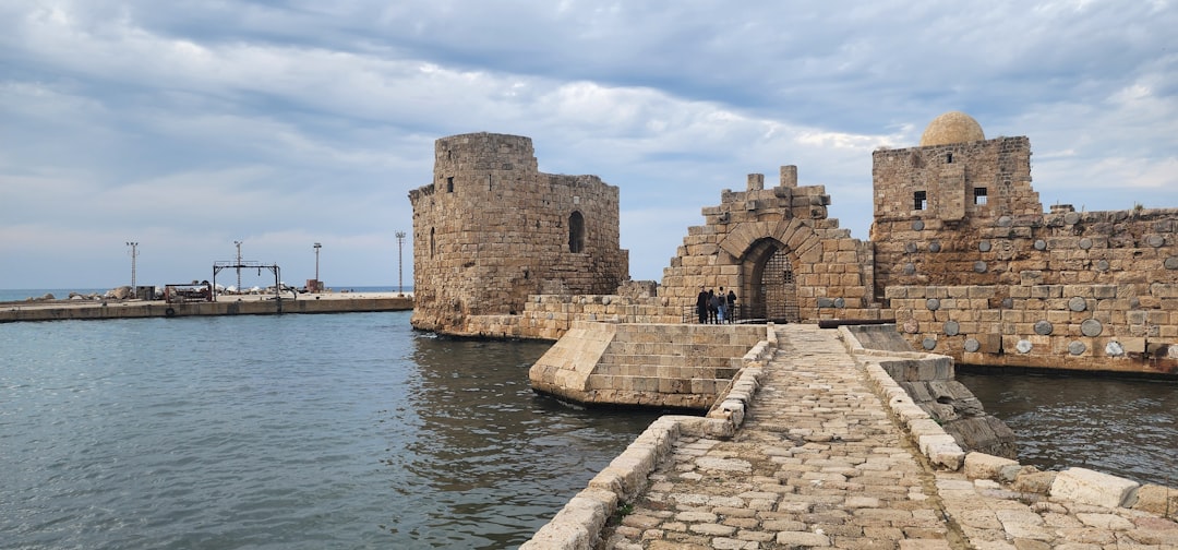
The Moat: Defense and Drainage
The most prominent hydraulic feature immediately surrounding Angkor Wat is its vast moat. This imposing body of water is more than just a decorative element or a symbolic boundary; it served multiple practical functions.
Defensive Barrier
Functionally, the moat acted as a significant defensive barrier, making direct assault on the temple complex incredibly difficult. Its width, often exceeding 190 meters, combined with a depth of several meters, presented a formidable obstacle to any potential invading force. The sheer logistics of bridging or crossing such a wide expanse under hostile conditions would have been daunting.
Water Table Regulation
Beyond defense, the moat played a crucial role in regulating the water table around the temple, a critical engineering consideration given the sandy soil matrix of the region. The presence of such a large body of water helped to stabilize the foundations of the massive stone structures, preventing settling and erosion. It acted as a natural sponge, absorbing excess groundwater during the wet season and releasing it gradually, thus maintaining a more consistent soil moisture level. This passive stabilization was essential for the long-term structural integrity of the heavy stone buildings.
Symbolism and Cosmology
Further, the moat held profound symbolic significance, representing the cosmic ocean that encircles Mount Meru, the mythical home of the devas in Hindu and Buddhist cosmology. This integration of practical engineering with religious symbolism is a hallmark of Khmer architecture, reflecting a worldview where the sacred and the mundane were deeply intertwined. The moat completed the microcosm of the universe that Angkor Wat was designed to be, reinforcing its role as a spiritual center.
Internal Drainage and Water Supply
Within the temple complex itself, ingenious systems were in place to manage rainfall and provide water for rituals and daily use. These internal systems complemented the larger regional hydraulic infrastructure.
Collection and Runoff Management
The broad paved courtyards and terraces of Angkor Wat were meticulously designed to shed rainwater efficiently. Gradients, often subtle, directed water towards specific channels and drains. This prevented excessive pooling and minimized the erosive impact of heavy monsoonal rains on the structure. The design accounted for the immense volume of water that could accumulate during a downpour, ensuring a controlled and directed runoff.
Wells and Cisterns
Internal wells and cisterns, strategically placed within the temple enclosures, provided a localized supply of fresh water for the temple’s inhabitants, monks, and visitors. These sources were essential for daily life and religious ceremonies, reducing reliance on the external canal system for all needs. Their presence indicates a comprehensive approach to water provision, ensuring self-sufficiency within the sacred space. The quality and accessibility of these internal water sources spoke to the sophisticated planning of the complex.
The Engineering Behind the Flow: Techniques and Innovations

The sophisticated hydraulic systems of Angkor Wat and the broader Khmer Empire were not accidental. They were the product of extensive planning, innovative techniques, and a profound understanding of hydrological principles.
Surveying and Planning
Before any earth was moved, extensive surveying and planning were undoubtedly undertaken. The scale of the barays and the precision of the canal networks suggest a high degree of mathematical and observational skill.
Site Selection and Alignment
The selection of sites for the barays and the overall alignment of the canal networks demonstrate a keen awareness of topography and natural water flow. Engineers would have analyzed the landscape to identify optimal locations for water storage, minimizing the need for extensive excavation work. The placement of the East and West Barays, for instance, capitalizes on the gentle slope of the land, allowing gravity to assist in water distribution. This prescient site selection reduced the amount of labor and resources required for construction and ensured the efficiency of the system.
Use of Levels and Gradients
The maintenance of precise levels and gentle gradients across vast distances was crucial for the efficient movement of water without erosion or stagnation. Khmer engineers likely employed a combination of simple yet effective tools, such as water levels, sighting poles, and plumb bobs, to achieve this precision. The consistent gradient of the canals, often barely perceptible to the eye, allowed for a slow, steady flow that minimized sediment buildup and sustained the channel’s integrity. These seemingly rudimentary tools, when utilized by skilled practitioners, yielded results comparable to modern engineering.
Construction Materials and Methods
The enduring nature of Angkor’s hydraulic infrastructure speaks volumes about the quality of the materials and construction methods employed by the Khmer people.
Earthworks and Embankments
The construction of the barays primarily involved massive earthworks, with vast quantities of soil being excavated and shaped into monumental embankments. These embankments were often compacted to ensure stability and reduce permeability. The sheer scale of these operations indicates a highly organized labor force and sophisticated logistical planning. The durability of these earthworks, many still intact after centuries, is a testament to the engineering prowess.
Stone Structures for Water Control
While much of the canal system used earth, critical points, such as sluice gates, spillways, and bridge foundations, were often built with durable sandstone. This use of stone ensured longevity and structural integrity at points of high water stress or where precise control was necessary. The interlocking blocks, often without mortar, demonstrate advanced stonemasonry techniques, creating structures resistant to the forces of water. The choice of materials was deliberate, adapting to the specific demands of each component of the water system.
The Long-Term Impact and Decline

The sophisticated hydraulic engineering of Angkor played a pivotal role in the rise and sustainment of the Khmer Empire. However, it may have also contributed to its eventual decline.
Economic and Societal Benefits
The benefits of this advanced water management system were profound and far-reaching, transforming the landscape and supporting a flourishing civilization.
Sustained Agricultural Production
The primary benefit was the ability to sustain multiple rice harvests annually, even during the dry season. This consistent food supply fueled population growth, supported a complex social hierarchy, and allowed for the diversion of labor towards monumental construction projects like Angkor Wat. The surplus of rice also created opportunities for trade, further enriching the empire. This constant food source provided a strong foundation for the Empire’s power and influence.
Urban Development and Population Density
The reliable water supply facilitated the development of a dense urban center around Angkor, supporting a population estimated to be among the largest pre-industrial cities globally. The hydraulic infrastructure was not just for agriculture but also provided water for drinking, sanitation, and various urban needs. The ability to concentrate a large population in one area was a direct consequence of effective water management, fostering a thriving bureaucratic and religious center.
Challenges and Environmental Vulnerabilities
Despite its brilliance, the Angkorian hydraulic system faced inherent challenges and vulnerabilities that may have contributed to the empire’s eventual decline.
Maintenance and Sedimentation
The immense scale of the system required constant maintenance. Canals and reservoirs were prone to sedimentation, especially during the monsoon season, necessitating regular dredging. As the empire faced political instability or resource depletion, the ability to maintain these extensive systems might have waned, leading to decreased efficiency and agricultural output. The sheer effort required to keep the system operational was immense, a perpetual demand on resources and labor.
Climate Change and Extreme Weather Events
Studies suggest that periods of prolonged drought or unusually heavy monsoons, exacerbated by climate change, may have overwhelmed the system. While designed to mitigate natural fluctuations, extreme climate events could have led to either catastrophic floods or severe water shortages, both detrimental to rice cultivation and the empire’s stability. A system optimized for a certain range of conditions could be severely stressed by deviations beyond that range. Moreover, these events could damage the infrastructure itself, requiring even more resources for repair.
Resource Depletion and Deforestation
The construction and maintenance of such a vast hydraulic network, along with the needs of a large population, would have placed immense pressure on natural resources, particularly timber for construction and fuel. Deforestation, a potential consequence, could have led to increased soil erosion and sedimentation in the barays and canals, further exacerbating maintenance problems and impacting water quality. The intensive use of the environment, while initially beneficial, could have inadvertently sown the seeds of long-term vulnerability.
In conclusion, Angkor Wat stands not only as an artistic and religious icon but also as a monumental achievement in ancient hydraulic engineering. The sophisticated network of barays, canals, and moats demonstrates an unparalleled understanding of water management, allowing the Khmer Empire to flourish for centuries. This mastery of water shaped their landscapes, fed their people, and supported their monumental constructions. While its complex hydrological systems provided immense advantages, they also presented challenges that, combined with other factors, may have played a role in the empire’s eventual transformation. Examining Angkor Wat through the lens of its hydraulic engineering reveals a civilization deeply attuned to its environment, capable of harnessing its power to build a legacy that continues to astound modern observers.
STOP: Why They Erased 50 Impossible Inventions From Your Textbooks
FAQs
What is Angkor Wat’s hydraulic engineering system?
Angkor Wat’s hydraulic engineering system refers to the complex network of reservoirs, canals, moats, and water management structures designed to control and distribute water throughout the Angkor region. This system supported agriculture, urban needs, and religious functions during the Khmer Empire.
Why was hydraulic engineering important for Angkor Wat?
Hydraulic engineering was crucial for Angkor Wat because it enabled the regulation of water supply for rice cultivation, prevented flooding during the monsoon season, and maintained water levels in the temple moats, which had both practical and symbolic significance.
How did the Khmer engineers design the water management system?
Khmer engineers designed the water management system by constructing large barays (artificial reservoirs), canals, and dikes to capture and store rainwater. They also created an intricate network of channels to distribute water efficiently across the landscape, ensuring year-round irrigation and flood control.
What role did the moats around Angkor Wat play in hydraulic engineering?
The moats around Angkor Wat served multiple purposes: they acted as water reservoirs, helped regulate water levels, provided defense, and symbolized the cosmic ocean surrounding Mount Meru, the mythical home of the gods in Hindu cosmology.
How has the study of Angkor Wat’s hydraulic system contributed to modern understanding?
The study of Angkor Wat’s hydraulic system has provided insights into ancient water management techniques, sustainable urban planning, and environmental adaptation. It has also helped archaeologists understand the rise and fall of the Khmer Empire in relation to water resource management.