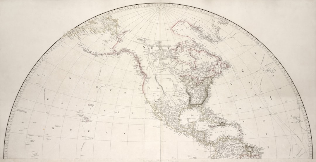
In the annals of cartography, few artifacts have sparked as much intrigue and debate as the 1513 map created by the Ottoman admiral and cartographer Piri Reis. This remarkable document, which is part of a larger world map, is notable not only for its artistic merit but also for its geographical accuracy, particularly concerning regions that were largely unexplored at the time. The map depicts parts of Europe, Africa, and the Americas, but what has captured the imagination of historians and researchers alike is its representation of a landmass that some believe to be Antarctica, long before it was officially discovered.
The existence of this map raises questions about the knowledge and navigational capabilities of ancient civilizations, suggesting that they may have possessed information that has since been lost to time. The Piri Reis map serves as a window into the past, revealing not only the geographical understanding of the early 16th century but also the cultural exchanges that occurred during the Age of Exploration. It is a testament to the interconnectedness of different civilizations and their shared pursuit of knowledge.
As scholars delve deeper into the intricacies of this map, they uncover layers of meaning that challenge conventional narratives about exploration and discovery. The implications of the Piri Reis map extend far beyond its immediate geographical context, inviting a reevaluation of historical timelines and the capabilities of ancient navigators.
Key Takeaways
- The 1513 map is a significant historical artifact that has sparked debate and intrigue due to its depiction of Antarctica before it was officially discovered.
- The Piri Reis Map, created in 1513, is one of the earliest known maps to show Antarctica and has raised questions about how ancient civilizations may have had knowledge of the continent.
- Antarctica’s mysterious past includes theories of it once being an ice-free continent and potentially home to ancient civilizations.
- The implications of an ice-free Antarctica could have significant impacts on our understanding of climate change and the Earth’s history.
- Modern-day expeditions to Antarctica continue to uncover new information and fuel the debate surrounding the 1513 map and its implications for our understanding of the continent.
The Piri Reis Map and its Significance
The Piri Reis map is distinguished by its unique blend of artistic representation and scientific inquiry. Created in 1513, it is one of the oldest surviving maps to depict the New World, showcasing a remarkable level of detail for its time. The map is adorned with illustrations of animals, ships, and even mythical creatures, reflecting the cartographer’s artistic flair while simultaneously serving as a practical navigational tool.
What sets this map apart from others is its inclusion of information derived from various sources, including earlier maps and accounts from explorers who ventured into uncharted territories. This amalgamation of knowledge highlights the collaborative nature of cartography during this period. The significance of the Piri Reis map extends beyond its aesthetic qualities; it challenges established historical narratives regarding the exploration of the Americas.
The map’s depiction of South America and parts of North America suggests that Piri Reis had access to information that was not widely known at the time. This raises questions about the extent of European knowledge about these regions prior to Columbus’s voyages. Furthermore, the potential representation of Antarctica on the map invites speculation about ancient civilizations’ navigational prowess and their ability to traverse vast oceans long before modern technology made such feats possible.
Antarctica’s Mysterious Past
Antarctica has long been shrouded in mystery, with its icy expanse concealing secrets that have captivated explorers and scientists for centuries. The continent’s harsh climate and remote location have made it one of the least understood regions on Earth. However, geological evidence suggests that Antarctica was once a lush, temperate land teeming with life.
Fossils of ancient plants and animals found in sedimentary rock formations indicate that this frozen wasteland was once home to diverse ecosystems. The transition from a verdant landscape to an ice-covered continent raises questions about climate change and Earth’s geological history. The notion that Antarctica may have been inhabited or explored by ancient civilizations adds another layer to its enigmatic past.
Some researchers propose that early human societies may have ventured into this region during periods when it was more hospitable. The possibility of ancient settlements or trade routes existing beneath the ice has fueled speculation about lost civilizations and their potential contributions to human history. As scientists continue to study Antarctica’s geological record, they uncover clues that may reshape our understanding of human migration patterns and environmental changes over millennia.
Theories on the Ice-Free Continent
| Theories | Description |
|---|---|
| Plate Tectonics | Some scientists believe that the continent remained ice-free due to its position over a tectonic plate, which allowed for geothermal heat to keep the ice at bay. |
| Atmospheric Circulation | Others suggest that unique atmospheric circulation patterns in the region prevented the continent from becoming covered in ice. |
| Ocean Currents | Some theories propose that warm ocean currents around the continent played a role in keeping it ice-free. |
Theories surrounding an ice-free Antarctica have gained traction in recent years, particularly as climate change continues to alter global weather patterns. Some scientists posit that during certain geological epochs, such as the Eocene epoch around 50 million years ago, Antarctica was largely free of ice and supported a temperate climate. This hypothesis is supported by fossil evidence indicating that species such as palm trees once thrived in what is now a frozen desert.
The implications of an ice-free Antarctica extend beyond mere curiosity; they challenge existing models of climate history and provide insights into how ecosystems adapt to changing conditions. Moreover, the idea of an ice-free Antarctica raises questions about potential human habitation during these warmer periods. If ancient civilizations had access to a more hospitable Antarctic environment, it opens up possibilities for trade routes and cultural exchanges that have yet to be fully explored.
Theories suggesting that early humans may have ventured into this region during warmer epochs invite researchers to reconsider historical timelines and migration patterns. As scientists continue to investigate these theories, they may uncover evidence that reshapes our understanding of human history and our relationship with the environment.
Exploring the Implications of an Ice-Free Antarctica
The implications of an ice-free Antarctica are profound, not only for our understanding of Earth’s climatic history but also for contemporary discussions surrounding climate change. If Antarctica were to become ice-free again due to rising global temperatures, it would have catastrophic consequences for sea levels worldwide. The melting ice sheets could lead to significant coastal flooding, displacing millions of people and altering ecosystems across the globe.
Understanding how ecosystems functioned in an ice-free state can provide valuable insights into how current species might adapt or perish in response to rapid climate changes. Additionally, an ice-free Antarctica could reveal previously hidden resources, including minerals and fossil fuels, which could further complicate geopolitical dynamics in the region. As nations vie for access to these resources, ethical considerations surrounding environmental preservation and indigenous rights come to the forefront.
The potential for increased human activity in Antarctica raises questions about how best to balance economic interests with ecological sustainability. As researchers explore these implications, they must grapple with the complex interplay between human activity and environmental stewardship.
The Impact on Climate Change Research
Antarctica plays a crucial role in climate change research due to its sensitivity to temperature fluctuations and its influence on global weather patterns. Scientists study ice cores extracted from the continent to gain insights into past climate conditions and predict future trends. These cores contain trapped air bubbles that provide a record of atmospheric composition over thousands of years, allowing researchers to understand how greenhouse gas concentrations have changed over time.
As climate change accelerates, understanding Antarctica’s response becomes increasingly vital for predicting global impacts. Moreover, ongoing research in Antarctica sheds light on feedback mechanisms that could exacerbate climate change. For instance, as ice melts, darker ocean waters are exposed, which absorb more sunlight and heat than reflective ice surfaces.
This process can create a feedback loop that accelerates warming in the region. By studying these dynamics, scientists can develop more accurate models for predicting future climate scenarios and inform policy decisions aimed at mitigating climate change effects. The insights gained from Antarctic research are essential for understanding not only regional changes but also their far-reaching implications for global ecosystems.
Uncovering Ancient Civilizations in Antarctica
The possibility of ancient civilizations existing in Antarctica has long been a topic of speculation among researchers and enthusiasts alike. While mainstream archaeology has yet to provide concrete evidence supporting this notion, some theories suggest that advanced societies may have thrived in warmer periods when the continent was more hospitable. These theories often draw upon legends from various cultures that speak of lost lands or advanced civilizations submerged beneath ice or water.
As scientists continue to explore Antarctica’s geological history, they uncover evidence that could support these theories. For instance, underwater archaeological surveys have revealed submerged landscapes that may have once been above sea level during warmer epochs. If these areas were indeed habitable, they could hold remnants of ancient human activity waiting to be discovered.
While skepticism remains prevalent within the academic community regarding claims of advanced civilizations in Antarctica, ongoing research may eventually yield findings that challenge existing paradigms and expand our understanding of human history.
The Debate Surrounding the 1513 Map
The Piri Reis map has ignited passionate debates among historians, cartographers, and enthusiasts regarding its origins and implications. Some scholars argue that the map is evidence of advanced navigational knowledge possessed by ancient civilizations long before European exploration began in earnest. They point to its detailed depiction of coastlines and landmasses as proof that Piri Reis had access to sources beyond what was available in his time.
Conversely, skeptics contend that while the map is impressive for its era, it does not necessarily indicate contact with Antarctica or other advanced civilizations. They argue that Piri Reis may have relied on secondhand accounts or earlier maps without fully understanding their accuracy. This debate highlights broader questions about how history is constructed and interpreted, emphasizing the need for critical examination of sources and narratives.
Modern-Day Expeditions to Antarctica
Modern-day expeditions to Antarctica are driven by a combination of scientific inquiry and adventure tourism. Researchers from around the world flock to this remote continent to study its unique ecosystems, climate dynamics, and geological history. These expeditions often involve multidisciplinary teams working collaboratively to gather data that can inform our understanding of global processes.
In addition to scientific research, tourism has become increasingly popular in Antarctica over recent decades. Tour operators offer guided tours that allow visitors to experience the continent’s breathtaking landscapes while raising awareness about environmental conservation efforts. However, this influx of tourists also raises concerns about potential ecological impacts on fragile ecosystems already threatened by climate change.
Balancing exploration with preservation remains a critical challenge for those involved in Antarctic expeditions.
The Future of Antarctic Exploration
The future of Antarctic exploration holds promise as advancements in technology continue to enhance our ability to study this remote region.
Additionally, satellite imagery allows researchers to monitor changes over time on a scale previously unimaginable.
As interest in Antarctica grows—both scientifically and commercially—collaboration among nations will be essential for ensuring responsible exploration practices. International agreements governing activities in Antarctica must evolve alongside emerging challenges posed by climate change and resource extraction pressures. By fostering cooperation among nations committed to preserving this unique environment while advancing scientific knowledge, future explorations can contribute positively to our understanding of both Antarctica and our planet as a whole.
What the 1513 Map Means for Our Understanding of Antarctica
The Piri Reis map serves as a powerful reminder of humanity’s enduring quest for knowledge and understanding about our world—particularly regions like Antarctica that remain enigmatic even today. Its existence challenges conventional narratives surrounding exploration while inviting deeper inquiries into ancient civilizations’ capabilities and knowledge systems. As researchers continue to unravel the mysteries surrounding both the Piri Reis map and Antarctica itself, they contribute not only to historical scholarship but also inform contemporary discussions about climate change, environmental stewardship, and our shared future on this planet.
Ultimately, what began as a simple map has evolved into a symbol representing humanity’s relentless pursuit of discovery—a pursuit that will undoubtedly shape our understanding of both history and geography for generations to come.
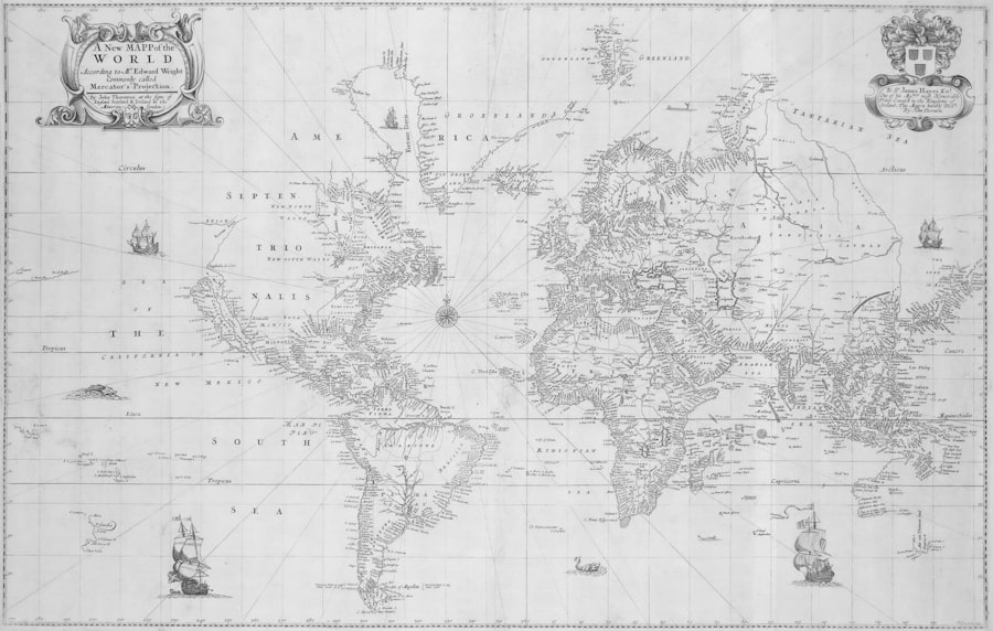
The 1513 map, often attributed to the Ottoman admiral Piri Reis, has long intrigued historians and cartographers due to its depiction of a landmass resembling Antarctica without its ice cover. This enigmatic feature has sparked numerous theories about ancient civilizations and their potential knowledge of the Earth’s geography. For those interested in exploring more about historical maps and their mysteries, a related article can be found on Real Lore and Order’s website. This article delves into the fascinating world of ancient cartography and the secrets these maps might hold. You can read more about it by visiting