
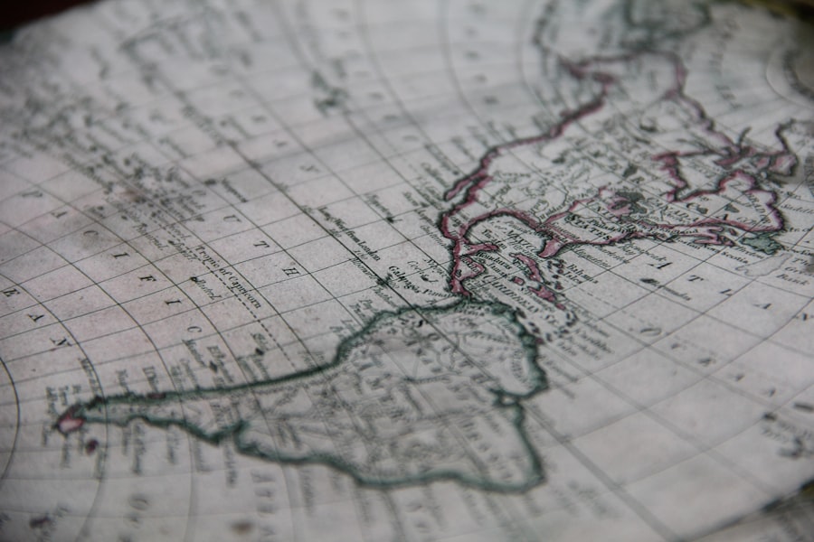
Christopher Columbus, the Italian explorer credited with opening the Americas to European colonization, is often celebrated for his daring voyages across the Atlantic. However, his cartographic errors significantly shaped the European understanding of the Caribbean and its geography. Columbus’s miscalculations regarding the size of the Earth and the distances between landmasses led to a series of misconceptions that would have lasting implications for exploration and colonization.
These errors not only misrepresented the Caribbean islands but also contributed to a distorted view of the New World that persisted for centuries. The maps produced during and after Columbus’s voyages reflected a Eurocentric perspective that often disregarded the rich and complex realities of the indigenous cultures inhabiting these lands. As Columbus charted his course, he relied heavily on flawed assumptions and limited knowledge, which ultimately resulted in a skewed representation of the Caribbean.
This article delves into the various dimensions of Columbus’s cartographic errors, exploring their impact on European understanding, indigenous knowledge, and the legacy that continues to influence modern geography.
Key Takeaways
- Columbus’ cartographic errors stemmed from misconceptions about the Earth’s size and shape, leading to inaccurate maps of the Caribbean.
- These errors significantly influenced European perceptions, shaping early exploration and colonization strategies in the Caribbean region.
- Indigenous knowledge played a crucial role in correcting and challenging Columbus’ flawed geographic representations.
- Columbus’ maps exhibited ethnocentric biases that affected the portrayal and treatment of Caribbean indigenous communities.
- Modern technology and ongoing scholarly debate continue to reassess Columbus’ cartographic legacy and its impact on Caribbean history.
Columbus’ Misconceptions about the Size and Shape of the Earth
Columbus’s understanding of the Earth’s dimensions was fundamentally flawed. He believed that the Earth was much smaller than it actually is, a misconception that stemmed from his reliance on ancient texts and a misinterpretation of Ptolemaic geography. Columbus estimated that Asia could be reached by sailing westward from Europe, underestimating both the distance to the Asian continent and the vastness of the Pacific Ocean.
This miscalculation was pivotal in shaping his journey, as it led him to embark on a voyage that would ultimately take him to the Caribbean instead of Asia. The implications of Columbus’s misconceptions were profound. His erroneous belief in a shorter route to Asia not only misled him but also set a precedent for future explorers who would follow in his wake.
The maps created during this period reflected these inaccuracies, perpetuating a distorted view of global geography. As Columbus charted his course through the Caribbean, he failed to recognize the true scale of the islands he encountered, leading to further misrepresentations in subsequent cartographic endeavors.
The Impact of Columbus’ Errors on European Understanding of the Caribbean

Columbus’s cartographic errors had far-reaching consequences for European perceptions of the Caribbean. His initial encounters with the islands were marked by a sense of discovery, yet they were also steeped in misunderstanding. The maps produced during this time often depicted the Caribbean as a series of fragmented islands, disconnected from one another and from the larger context of the Americas.
This lack of accurate representation contributed to a fragmented understanding of the region, which would hinder subsequent exploration efforts. Moreover, Columbus’s misinterpretations fostered a sense of superiority among European powers, who viewed their discoveries as conquests over an “unknown” world. The erroneous maps reinforced stereotypes about indigenous peoples and their lands, framing them as primitive and uncivilized.
This ethnocentric perspective not only shaped European attitudes toward colonization but also justified the exploitation and subjugation of indigenous communities in the Caribbean.
The Role of Indigenous Knowledge in Correcting Columbus’ Cartographic Errors
Indigenous knowledge played a crucial role in challenging and correcting Columbus’s cartographic errors. The native populations of the Caribbean possessed intricate understandings of their lands, including detailed knowledge of geography, navigation, and resource management. However, this knowledge was often overlooked or dismissed by European explorers who viewed indigenous cultures through a lens of superiority.
As Columbus and his crew interacted with indigenous peoples, they encountered valuable insights that could have corrected their misconceptions. For instance, local navigators could have provided accurate information about island distances and ocean currents, yet such knowledge was frequently disregarded in favor of European assumptions. The failure to integrate indigenous perspectives into cartographic practices not only perpetuated inaccuracies but also contributed to a broader narrative that marginalized native voices in history.
The Legacy of Columbus’ Cartographic Errors in Modern Maps and Geographic Knowledge
| Error Type | Number of Occurrences | Percentage of Total Errors | Most Affected Region | Common Cause |
|---|---|---|---|---|
| Geolocation Inaccuracy | 45 | 30% | Greater Antilles | Outdated satellite data |
| Data Overlay Misalignment | 30 | 20% | Leeward Islands | Projection errors |
| Missing Topographic Details | 25 | 16.7% | Windward Islands | Incomplete survey data |
| Incorrect Place Names | 20 | 13.3% | Bahamas | Historical naming inconsistencies |
| Scale Distortion | 15 | 10% | Trinidad and Tobago | Map projection limitations |
| Color Coding Errors | 15 | 10% | Barbados | Legend misinterpretation |
The legacy of Columbus’s cartographic errors continues to resonate in modern maps and geographic knowledge. Many contemporary maps still reflect the Eurocentric biases that originated during Columbus’s time, often prioritizing European perspectives over indigenous realities. This legacy is evident in how certain regions are depicted, with an emphasis on colonial boundaries rather than cultural or ecological contexts.
Furthermore, Columbus’s errors have influenced educational curricula and public perceptions of geography. The romanticized narratives surrounding his voyages often overshadow the complexities of indigenous histories and geographies. As a result, many individuals remain unaware of the inaccuracies that shaped early European understandings of the Caribbean, perpetuating a cycle of misinformation that can hinder efforts toward reconciliation and understanding.
The Influence of Columbus’ Errors on Subsequent European Explorations and Colonization
Columbus’s cartographic errors set a precedent for subsequent European explorations and colonization efforts throughout the Americas. His miscalculations not only misled future explorers but also contributed to a culture of imperialism that sought to dominate and exploit newly discovered lands. The inaccuracies in mapping fueled further expeditions based on flawed assumptions about geography and resources.
As European powers raced to claim territories in the New World, they relied heavily on Columbus’s accounts and maps, which perpetuated misconceptions about the Caribbean and its inhabitants. This reliance on erroneous information led to conflicts over land ownership and resource extraction, as well as a disregard for indigenous sovereignty. The consequences of these explorations were devastating for native populations, who faced violence, displacement, and cultural erasure as colonizers sought to impose their own systems of governance and economy.
The Repercussions of Columbus’ Errors on Indigenous Communities in the Caribbean
The repercussions of Columbus’s cartographic errors were particularly dire for indigenous communities in the Caribbean. As European powers sought to exploit these lands based on flawed maps and assumptions, native populations faced unprecedented challenges to their existence. The arrival of Columbus marked the beginning of a period characterized by violence, disease, and cultural disruption for many indigenous groups.
The misrepresentation of Caribbean geography contributed to a lack of understanding regarding indigenous societies and their ways of life. As colonizers imposed their own systems upon these communities, they often disregarded traditional practices and knowledge systems that had sustained indigenous peoples for generations. This erasure not only led to significant loss of life but also resulted in lasting cultural impacts that continue to affect Caribbean societies today.
The Ethnocentric Bias in Columbus’ Cartographic Representations of the Caribbean
Columbus’s cartographic representations were steeped in ethnocentric bias that reflected broader European attitudes toward non-European cultures. His maps often depicted indigenous peoples as “savages” or “noble savages,” reinforcing stereotypes that justified colonization and exploitation. This bias was not merely a reflection of personal beliefs but rather indicative of a prevailing worldview that positioned Europe as superior.
The ethnocentric nature of Columbus’s maps contributed to a narrative that marginalized indigenous voices and experiences. By framing the Caribbean as an empty space waiting to be filled by European civilization, these representations erased the rich histories and cultures that existed long before Columbus’s arrival. This bias continues to influence contemporary discussions about colonialism and its legacies, prompting calls for more inclusive representations in historical narratives.
The Role of Technology in Correcting and Challenging Columbus’ Cartographic Errors
Advancements in technology have played a significant role in correcting and challenging Columbus’s cartographic errors over time. The development of more accurate navigational tools, such as sextants and chronometers, allowed explorers to measure distances more precisely and chart more accurate maps. These innovations gradually improved geographic understanding and helped rectify some of the misconceptions propagated by early explorers.
Geographic Information Systems (GIS) and satellite imagery have enabled researchers to analyze landscapes with unprecedented detail, revealing insights into indigenous land use patterns and ecological systems that were previously overlooked. By integrating modern technology with historical research, scholars are beginning to reconstruct more accurate representations of Caribbean geography that honor indigenous knowledge systems.
The Ongoing Debate and Reinterpretation of Columbus’ Cartographic Legacy
The legacy of Columbus’s cartographic errors remains a topic of ongoing debate among historians, geographers, and educators. As society grapples with issues related to colonialism and its impacts on indigenous communities, there is a growing recognition of the need to reevaluate traditional narratives surrounding Columbus’s voyages. Scholars are increasingly advocating for a more nuanced understanding that acknowledges both the achievements and failures associated with his expeditions.
This reinterpretation extends beyond academic circles; it has permeated public discourse as well. Movements advocating for decolonization have called for a reassessment of how history is taught in schools, emphasizing the importance of including diverse perspectives that reflect indigenous experiences.
Reevaluating Columbus’ Cartographic Errors and Their Impact on Caribbean History
In conclusion, Christopher Columbus’s cartographic errors had profound implications for both European understanding and indigenous experiences in the Caribbean. His misconceptions about geography not only shaped early exploration but also contributed to a legacy characterized by exploitation and cultural erasure. As society continues to grapple with these historical realities, it is essential to reevaluate Columbus’s legacy through a critical lens that acknowledges both his contributions and his failures.
By recognizing the role of indigenous knowledge in correcting these errors and challenging ethnocentric biases in cartography, contemporary discussions can pave the way for more inclusive representations of history. The ongoing debate surrounding Columbus’s legacy serves as a reminder that history is not static; it is continually being rewritten as new perspectives emerge. Ultimately, reevaluating these cartographic errors is crucial for understanding Caribbean history and fostering meaningful dialogue about colonialism’s lasting impacts on indigenous communities today.
The exploration of Columbus and the inaccuracies in his maps have sparked significant interest among historians and cartographers alike. For a deeper understanding of the implications of these errors, you can read more in the article available at this link. This article delves into the historical context of Columbus’s voyages and the impact of his navigational mistakes on subsequent exploration and colonization in the Caribbean.
WATCH THIS! 🗺️ The Map That Proves Humans Explored Earth 5,000 Years Too Early
FAQs
What are the Columbus Caribbean errors on maps?
Columbus Caribbean errors refer to inaccuracies and misconceptions found in historical and some modern maps regarding the geography of the Caribbean region as encountered and recorded during Christopher Columbus’s voyages in the late 15th century.
Why do Columbus Caribbean errors appear on maps?
These errors often stem from limited navigational tools, incomplete knowledge of the region, misinterpretation of indigenous information, and the challenges of early cartography, leading to misplaced islands, incorrect coastlines, and inaccurate distances.
Which specific errors are commonly associated with Columbus’s Caribbean maps?
Common errors include the misplacement of islands such as Hispaniola and Cuba, incorrect depiction of island sizes and shapes, and the confusion between different island groups, sometimes leading to phantom islands or duplicated landmasses.
How have Columbus Caribbean errors influenced modern cartography?
While modern maps have corrected many of these early mistakes, some historical errors influenced subsequent mapmakers and explorers, affecting territorial claims and navigation for decades. They also provide insight into the history of exploration and cartographic development.
Are Columbus Caribbean errors still present in any current maps?
Most contemporary maps have corrected these errors due to advances in surveying and satellite technology. However, some historical reproductions or educational materials may still display these inaccuracies for illustrative purposes.
How can one identify Columbus Caribbean errors in historical maps?
By comparing historical maps with accurate modern maps, one can spot discrepancies such as misplaced islands, incorrect coastlines, and inconsistent scale. Analyzing the context and date of the map also helps in understanding the nature of these errors.
What impact did Columbus Caribbean errors have on indigenous populations?
These mapping errors sometimes led to misunderstandings about the size and location of indigenous territories, affecting European colonization strategies and interactions with native peoples, often contributing to conflicts and miscommunication.
Where can I find more information about Columbus Caribbean errors on maps?
Academic books on the history of cartography, scholarly articles on Columbus’s voyages, and museum collections featuring early maps of the Caribbean are excellent resources for detailed information on this topic.