Greenland’s Hidden Corridor: Unveiling Subglacial Topography with BedMachine
Greenland, a vast island often perceived as an icy monolith, harbors a complex and dynamic landscape hidden beneath its sprawling ice sheet. For decades, scientists have sought to understand the intricate topography of the Greenlandic bedrock, a critical factor in comprehending ice sheet behavior, glacial flow, and its contribution to global sea-level rise. Recent advancements in geophysical surveying and data processing, particularly the development and refinement of the BedMachine Greenland dataset, have begun to unlock the secrets of these subglacial realms. This article examines the significance of BedMachine in revealing Greenland’s hidden corridors and the insights they provide into the island’s geological past and future.
The sheer scale and depth of the Greenland ice sheet present formidable obstacles to direct subglacial investigation. The ice can be kilometers thick, making traditional geological surveying methods impractical. The harsh Arctic environment, characterized by extreme cold, limited accessibility, and long periods of darkness, further complicates any attempts at direct observation. Consequently, understanding the bedrock’s topography has historically relied on indirect methods, each with its own limitations.
Early Geophysical Techniques
Initial efforts to map the bedrock beneath Greenland’s ice relied on techniques like seismic reflection and gravity anomaly measurements. Seismic surveys send sound waves into the ice and bedrock, measuring the time it takes for them to return after reflecting off different layers. Gravity surveys detect subtle variations in the Earth’s gravitational pull, which can be indicative of denser or less dense rock formations beneath the ice. While these methods provided foundational insights, their resolution was often limited, and the resulting maps were characterized by broad generalizations rather than detailed portrayals of specific features.
Limitations of Existing Datasets
Prior to the widespread adoption of datasets like BedMachine, existing maps of Greenland’s subglacial topography were often incomplete and imprecise. Data points were sparse, particularly in the interior of the ice sheet, leading to significant uncertainty in the estimated bedrock elevation. This lack of detailed information hindered efforts to accurately model ice flow dynamics, predict melt rates, and assess the potential impact of climate change on the Greenland ice sheet. The inferred bedrock surface was often smooth and featureless, masking the complex geological structures that actually exist.
The recent discoveries related to the BedMachine Greenland hidden corridor map have sparked significant interest in the scientific community, revealing intricate details about the ice sheet’s dynamics and its implications for climate change. For those intrigued by ancient history and its connections to modern scientific findings, a related article titled “The Day of Two Suns: Ancient History Unveiled” offers fascinating insights into how historical events may influence our understanding of current geological phenomena. You can read more about it [here](https://www.realloreandorder.com/the-day-of-two-suns-ancient-history-unveiled/).
The BedMachine Greenland Innovation
The BedMachine Greenland dataset represents a significant leap forward in our ability to visualize and understand the subglacial landscape. It integrates a wide array of geophysical measurements with advanced modeling techniques to produce the most comprehensive and detailed map of Greenland’s bedrock elevation to date. This innovation has fundamentally changed how scientists approach the study of the Greenland ice sheet.
Data Integration and Synthesis
BedMachine Greenland is not a single type of measurement but rather a carefully orchestrated synthesis of diverse datasets. It incorporates data from radar soundings conducted by aircraft flying over the ice sheet, which can penetrate the ice to varying depths. These radar measurements provide direct information about the ice thickness and, in some cases, the underlying bedrock. Additionally, BedMachine utilizes surface elevation data, ice velocity measurements, and even information about the underlying geology of Greenland’s exposed bedrock to infer the characteristics of the unseen subglacial terrain.
Advanced Modeling Techniques
Beyond simply compiling raw data, BedMachine employs sophisticated numerical models to fill in the gaps and constrain the uncertainties. These models are based on physical principles governing ice flow and the relationship between ice thickness, bedrock elevation, and surface slope. By allowing the ice to flow virtually under realistic conditions, scientists can iteratively adjust the bedrock topography until the simulated ice flow matches observed ice velocities. This iterative process helps to refine the bedrock map and identify features that are likely to influence ice dynamics. The model also incorporates information about the gravitational potential of the ice sheet, which is influenced by the underlying bedrock.
Spatial Resolution and Accuracy
A key advantage of BedMachine Greenland is its significantly improved spatial resolution compared to previous datasets. While earlier maps might have depicted broad, smooth plains, BedMachine reveals intricate features such as deep troughs, steep mountain ranges, and vast plains with unprecedented clarity. The accuracy of the bedrock elevation estimates has also been substantially enhanced, providing a more reliable foundation for scientific research and climate modeling. This improved detail allows for the identification of specific geological structures that play a crucial role in channeling ice flow and influencing melt processes.
Unveiling Greenland’s Hidden Corridors
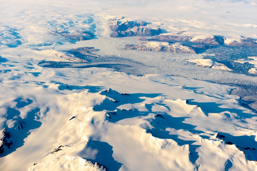
The BedMachine Greenland dataset has unveiled a surprising and significant geological feature: a network of deep, ice-filled corridors that snake across the Greenlandic bedrock. These features, previously only hinted at by sparse data, are now clearly defined and their potential impact on the ice sheet is becoming increasingly understood.
The Morphology of Subglacial Troughs
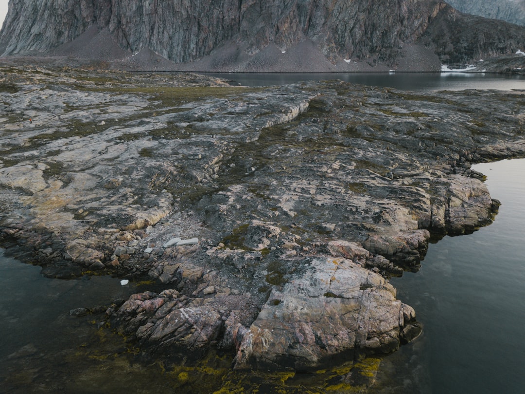
The term “corridor” in this context refers to elongated, often deeply incised troughs in the bedrock. These features bear resemblance to ancient river valleys or glacial erosional features on exposed landmasses, suggesting a significant erosional history carved into the bedrock before the onset of the current ice sheet. Some of these troughs are remarkably deep, extending hundreds of meters below sea level in places. Their steep sides and relatively flat bottoms suggest they were shaped by powerful erosional forces, likely by glaciers or meltwater in the distant past.
Ice Flow Dynamics within the Corridors
The presence and morphology of these subglacial corridors have profound implications for the dynamics of the Greenland ice sheet. Scientists have observed that ice flows significantly faster within these troughs than on the surrounding, higher bedrock. These corridors act as natural conduits, efficiently channeling ice towards the coast and facilitating its discharge into the ocean. This accelerated ice flow can contribute to increased calving rates and, consequently, a greater contribution to global sea-level rise. The shape of the bedrock within these corridors dictates the direction and velocity of ice movement, acting as crucial controlling factors.
Relationship to Exposed Fjords and Glacial Valleys
A compelling aspect of the BedMachine data is the correlation between these hidden subglacial corridors and the visible fjord systems and glacial valleys that characterize Greenland’s coastlines. Many of the deepest subglacial troughs extend directly beneath the ice sheet and emerge at the coast as large fjords, which are themselves carved by glacial action. This strongly suggests that these subglacial corridors are not only remnants of past glacial erosion but also actively shape the present-day drainage of the ice sheet, guiding ice flow towards these established exit points to the ocean.
Implications for Ice Sheet Stability and Sea-Level Rise
The revelation of Greenland’s hidden corridors and their influence on ice flow has significant implications for understanding the stability of the ice sheet in a warming climate and its potential contribution to future sea-level rise. Accurate modeling of these processes is now more feasible with the detailed bedrock information provided by BedMachine.
Accelerated Ice Discharge
The faster ice flow within the subglacial corridors means that more ice is being discharged into the ocean. In a warming climate, this ice discharge can become even more pronounced as meltwater lubricates the base of the ice sheet, further accelerating its movement. The corridors act as critical pathways for this accelerated discharge, making them key areas of interest for monitoring the ice sheet’s response to climate change. Understanding the precise geometry and depth of these corridors is essential for predicting how much ice can be lost from Greenland in the coming decades and centuries.
Vulnerability to Ocean Warming
Many of these subglacial corridors extend below sea level, meaning that the ice at the grounding line—where glaciers transition from resting on bedrock to floating on the ocean—is in contact with relatively warm ocean waters. This contact can lead to increased melting from below, thinning the ice and potentially destabilizing the glaciers that drain through these corridors. The deep, underwater nature of the bedrock at the grounding line can make these glaciers particularly vulnerable to retreat and acceleration, especially if ocean temperatures continue to rise.
Future Sea-Level Rise Projections
The refined understanding of ice flow dynamics facilitated by BedMachine data is crucial for improving the accuracy of sea-level rise projections. By incorporating the influence of these subglacial corridors into ice sheet models, scientists can develop more realistic estimates of Greenland’s future contribution to rising global sea levels. This information is vital for coastal communities worldwide in their planning and adaptation strategies for a changing climate. Without detailed bedrock topography, these projections would remain less certain.
Recent discoveries about the BedMachine Greenland hidden corridor map have shed light on the complex dynamics of ice movement and its implications for climate change. This fascinating topic is closely related to the exploration of hidden influences in various systems, as discussed in a related article that delves into the manipulative tactics used in societal control. For more insights on this intriguing subject, you can read the article here: hidden influences in societal control. Understanding these connections can enhance our awareness of both environmental and social systems.
Future Research Directions and Applications
| Data/Metric | Value |
|---|---|
| Map Name | BedMachine Greenland Hidden Corridor Map |
| Resolution | High resolution |
| Coverage | Greenland |
| Features | Hidden corridors and bedrock topography |
| Source | BedMachine project |
The BedMachine Greenland dataset is not merely a static map; it is a foundational tool that opens up new avenues for scientific inquiry and has practical applications in climate science and glaciology. Continued refinement and application of these data promise to further enhance our understanding of this vast and critical ice sheet.
Improving Ice Sheet Models
The detailed bedrock topography provided by BedMachine is now being integrated into increasingly sophisticated ice sheet models. These models aim to simulate the complex interactions between ice, bedrock, and atmosphere, allowing scientists to forecast future ice sheet behavior with greater accuracy. The identification and characterization of the subglacial corridors are particularly important for accurately representing how ice flows towards the ocean, a critical factor in determining melt rates and ice loss.
Identifying Areas of Interest for Field Research
While direct exploration of the subglacial environment remains challenging, BedMachine data can help scientists identify specific areas where direct measurements would be most valuable. For example, the data can pinpoint locations where the ice is thinning rapidly or where glaciers are experiencing unusual accelerations, suggesting that these areas are prime candidates for targeted field campaigns. Such campaigns might involve deploying sensors on the ice surface or, in specialized circumstances, attempting to drill through the ice to reach the bedrock.
Understanding Greenland’s Geological History
Beyond its implications for ice dynamics, the detailed subglacial topography revealed by BedMachine also offers clues about Greenland’s geological history. The shapes of the troughs and valleys suggest past erosional processes, providing insights into the long-term evolution of the Greenland landmass and the extent and duration of past glacial periods. This information can help geologists reconstruct the paleo-landscape of Greenland and understand the processes that have shaped it over millions of years. The absence of these detailed bedrock maps meant that a significant portion of Greenland’s geological narrative remained unread.
Monitoring Climate Change Impacts
As climate change continues to impact the polar regions, the detailed information provided by BedMachine will be invaluable for monitoring the response of the Greenland ice sheet. By comparing current ice sheet behavior with simulations based on the BedMachine topography, scientists can better detect and quantify the effects of warming temperatures and changing precipitation patterns. This monitoring is essential for informing policy decisions and for understanding the ongoing global changes on our planet. The ability to track changes against a detailed, accurate baseline like BedMachine is a significant advantage in this ongoing effort.
FAQs
What is BedMachine Greenland?
BedMachine Greenland is a project that aims to map the topography and bedrock beneath the Greenland Ice Sheet using data from satellite and airborne missions. The project provides a detailed and accurate map of the bedrock topography, which is crucial for understanding the dynamics of the ice sheet and its potential impact on sea level rise.
What is the “hidden corridor” map in BedMachine Greenland?
The “hidden corridor” map in BedMachine Greenland refers to a newly discovered valley beneath the ice sheet that creates a pathway for the flow of ice from the deep interior of the ice sheet to the ocean. This discovery has significant implications for understanding the behavior of the ice sheet and its potential contribution to sea level rise.
How was the “hidden corridor” map discovered?
The “hidden corridor” map was discovered using data from the BedMachine Greenland project, which combines satellite and airborne measurements of the ice sheet’s surface elevation with ice flow modeling. By analyzing the bedrock topography beneath the ice sheet, researchers were able to identify the presence of the hidden corridor and its potential impact on ice flow.
What are the implications of the “hidden corridor” map for climate change and sea level rise?
The discovery of the “hidden corridor” map has significant implications for understanding the dynamics of the Greenland Ice Sheet and its potential contribution to sea level rise. The pathway created by the hidden corridor could accelerate the flow of ice from the interior of the ice sheet to the ocean, leading to increased ice loss and potential sea level rise.
How does the “hidden corridor” map contribute to our understanding of Greenland’s ice sheet?
The “hidden corridor” map contributes to our understanding of Greenland’s ice sheet by providing valuable insights into the complex dynamics of ice flow and potential pathways for ice loss. By mapping the bedrock topography and identifying hidden corridors, researchers can better predict the behavior of the ice sheet and its impact on global sea levels.