The emergence of Ottoman cartography marked a significant chapter in the history of map-making, reflecting the empire’s vast territorial expanse and its diverse cultural influences. As the Ottoman Empire expanded across three continents, the need for accurate maps became increasingly vital for military, administrative, and trade purposes. The synthesis of knowledge from various cultures, including Byzantine, Persian, and Arab traditions, played a crucial role in shaping Ottoman cartographic practices.
This blending of influences not only enriched the maps produced but also showcased the empire’s position as a center of learning and innovation during the Renaissance period. In the 15th and 16th centuries, the Ottomans began to develop their own unique style of cartography, characterized by intricate designs and detailed representations of both land and sea. The empire’s strategic location at the crossroads of Europe and Asia facilitated the exchange of ideas and techniques among scholars and cartographers.
This period saw the rise of notable figures who contributed to the advancement of map-making, leading to a flourishing of cartographic knowledge that would leave a lasting impact on both the Islamic world and Europe.
Key Takeaways
- Ottoman cartography flourished with significant contributions from figures like Piri Reis, known for his detailed 1513 world map.
- Ottoman maps integrated knowledge from Ptolemy and Arab geographers, enhancing their accuracy and scope.
- These maps played a crucial role in navigation, trade routes, and the exploration of new lands during the Ottoman era.
- Ottoman cartography holds cultural and historical importance, reflecting the empire’s worldview and scientific advancements.
- Preservation and study of these maps continue to provide valuable insights into early modern geography and cross-cultural exchanges.
Piri Reis and His Famous Map
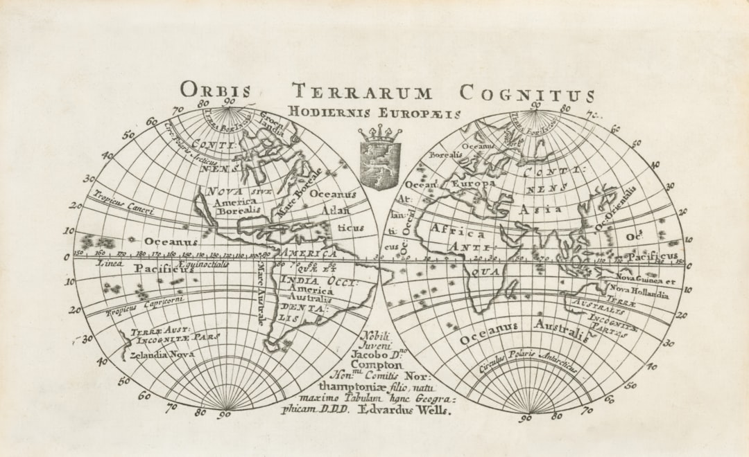
Among the most celebrated figures in Ottoman cartography is Piri Reis, a naval officer and cartographer whose work epitomizes the heights of Ottoman map-making. His most famous creation, the world map drawn in 1513, is renowned for its remarkable detail and artistic flair. Piri Reis’s map is particularly notable for its depiction of the New World, showcasing a level of geographical knowledge that was unprecedented for its time.
Piri Reis’s approach to cartography was innovative; he combined information from earlier maps with his own observations and those of other explorers. This method allowed him to create a comprehensive representation of the known world, blending scientific inquiry with artistic expression.
The map serves as a testament to the interconnectedness of different cultures during the Age of Exploration, highlighting how knowledge was shared and adapted across borders. Piri Reis’s legacy endures not only through his maps but also through his writings, which provide insight into the maritime practices and geographical understanding of his time.
The Importance of 1513 in Ottoman Cartography
The year 1513 stands out as a pivotal moment in the history of Ottoman cartography, primarily due to the creation of Piri Reis’s world map. This map not only captured the geographical knowledge of its era but also symbolized the Ottomans’ growing interest in global exploration and navigation. The significance of 1513 extends beyond Piri Reis’s work; it marks a period when the empire began to assert its influence on maritime trade routes and engage more actively with European powers.
In addition to Piri Reis’s contributions, 1513 was a time when the Ottomans were expanding their naval capabilities. The empire recognized the importance of controlling sea routes for trade and military purposes, leading to advancements in shipbuilding and navigation techniques. This year thus represents a turning point where cartography became an essential tool for asserting dominance on both land and sea, allowing the Ottomans to navigate their vast territories with greater precision.
The Influence of Ptolemy and Arab Geographers
The foundations of Ottoman cartography were significantly influenced by earlier works, particularly those of Ptolemy and various Arab geographers. Ptolemy’s “Geographia,” written in the 2nd century AD, provided a systematic approach to geography that emphasized mathematical precision and coordinate systems. His ideas were instrumental in shaping the way later cartographers viewed the world, including those in the Ottoman Empire.
The Ottomans adopted Ptolemaic principles while also integrating their own observations and local knowledge into their maps. Arab geographers also played a crucial role in shaping Ottoman cartographic practices. Figures such as Al-Idrisi and Ibn Hawqal contributed valuable insights into geography, trade routes, and cultural landscapes that were essential for understanding the regions under Ottoman control.
Their works provided a wealth of information that Ottoman cartographers could draw upon, allowing them to create maps that were not only accurate but also rich in cultural context. This synthesis of Greek and Arab knowledge laid the groundwork for a distinctive Ottoman cartographic tradition that would flourish in subsequent centuries.
The Accuracy of Ottoman Maps
| Year | Cartographer | Map Title | Region Covered | Significance | Medium |
|---|---|---|---|---|---|
| 1513 | Piri Reis | Kitab-ı Bahriye (Book of Navigation) | Mediterranean Sea and surrounding coasts | One of the earliest detailed nautical charts combining European and Islamic knowledge | Manuscript, ink on paper |
| 1513 | Piri Reis | World Map (fragment) | Parts of Europe, Africa, and the Americas | Earliest known Ottoman map showing the New World | Manuscript, ink on paper |
The accuracy of Ottoman maps is a subject of considerable interest among historians and geographers alike. While early maps were often characterized by artistic embellishments and inaccuracies, Ottoman cartographers made significant strides in improving precision. By incorporating data from explorers, traders, and previous maps, they were able to produce increasingly reliable representations of both landmasses and maritime routes.
This commitment to accuracy was essential for navigation and trade, as it allowed merchants and sailors to traverse vast distances with greater confidence. One notable example of this accuracy can be seen in Piri Reis’s maps, which included detailed depictions of coastlines, rivers, and even topographical features. His use of triangulation and other mathematical techniques demonstrated a sophisticated understanding of geography that was ahead of its time.
Furthermore, Ottoman maps often included annotations that provided context about local cultures, resources, and political boundaries, enhancing their utility beyond mere navigation tools. This emphasis on accuracy not only facilitated trade but also contributed to the empire’s administrative efficiency.
The Exploration of New Lands
The Ottoman Empire’s interest in exploration during the 15th and 16th centuries was driven by both economic ambitions and geopolitical considerations. As European powers began to venture into uncharted territories, the Ottomans recognized the need to expand their own knowledge of distant lands. This period saw an increase in maritime expeditions aimed at discovering new trade routes and establishing connections with far-flung regions.
The exploration efforts were often documented through maps that reflected both newfound territories and existing knowledge. Piri Reis’s work exemplifies this spirit of exploration; his maps included not only familiar regions but also newly discovered lands in the Americas. The inclusion of these areas indicated a growing awareness among Ottoman scholars about global geography and trade dynamics.
As they sought to understand these new territories, Ottoman cartographers began to incorporate information from European explorers, creating a dialogue between different cultures that enriched their own understanding of the world.
Trade Routes and Navigation
Trade routes were central to the economic prosperity of the Ottoman Empire, making accurate cartography essential for navigation and commerce.
As such, Ottoman maps often focused on these vital pathways, detailing not only land routes but also maritime passages that facilitated trade across the Mediterranean Sea and beyond.
The significance of navigation cannot be overstated; it was crucial for merchants seeking to transport goods efficiently while avoiding potential hazards. Ottoman cartographers developed maps that highlighted important ports, coastal features, and navigational hazards such as reefs or shallow waters. This attention to detail enabled traders to make informed decisions about their journeys, ultimately contributing to the empire’s economic strength.
Moreover, these maps served as vital tools for naval commanders who needed precise information for military operations along these critical routes.
The Legacy of Ottoman Cartography
The legacy of Ottoman cartography extends far beyond its immediate historical context; it has had a lasting impact on both regional and global mapping traditions. The synthesis of diverse cultural influences within Ottoman maps created a unique style that resonated with later generations of cartographers. This legacy is evident in how subsequent map-making practices incorporated elements from Ottoman techniques while also adapting them to new contexts.
Furthermore, Ottoman maps have become invaluable resources for historians studying the empire’s territorial expansion, trade networks, and cultural exchanges. They provide insights into how people understood their world during this period, reflecting not only geographical knowledge but also social dynamics and political realities. As scholars continue to explore these maps, they uncover layers of meaning that contribute to a richer understanding of Ottoman history and its place within global narratives.
Comparisons with European Cartography
When comparing Ottoman cartography with its European counterparts during the same period, several distinct differences emerge. While European maps often emphasized exploration from a colonial perspective—focusing on conquest and territorial claims—Ottoman maps tended to reflect a more integrated approach that acknowledged existing cultures and trade networks. This difference highlights how geography was perceived through varying lenses depending on cultural contexts.
Moreover, European cartographers were heavily influenced by Renaissance humanism, which emphasized individualism and scientific inquiry. In contrast, Ottoman cartography was shaped by a blend of scientific knowledge with artistic traditions rooted in Islamic culture. This resulted in maps that were not only functional but also visually striking, often adorned with intricate designs that celebrated both geography and artistry.
Such comparisons reveal how different cultural values influenced map-making practices across regions.
The Cultural and Historical Significance of Ottoman Maps
Ottoman maps hold immense cultural and historical significance as they encapsulate a rich tapestry of knowledge from various civilizations. They serve as artifacts that reflect not only geographical understanding but also social hierarchies, trade relationships, and cultural exchanges within the empire. Each map tells a story about how people interacted with their environment and how they perceived their place within it.
Additionally, these maps provide insight into the empire’s administrative practices; they were essential tools for governance as they delineated boundaries and resources across vast territories. By studying these maps, historians can gain a deeper appreciation for how geography influenced political decisions and social dynamics within the empire. Thus, Ottoman cartography stands as a testament to the interconnectedness of culture, history, and geography.
The Preservation and Study of Ottoman Cartography
The preservation and study of Ottoman cartography have become increasingly important in recent years as scholars seek to understand this rich tradition more comprehensively. Many original maps are housed in museums or libraries around the world, where they are carefully maintained to ensure their longevity for future generations. Advances in technology have also facilitated digital preservation efforts, allowing researchers to analyze these maps in greater detail without risking damage to fragile originals.
Academic interest in Ottoman cartography has grown significantly as historians recognize its value in understanding broader historical narratives. Interdisciplinary approaches that combine geography, art history, and cultural studies have emerged to explore these maps’ multifaceted significance fully. As scholars continue to delve into this field, they uncover new insights that enrich our understanding of both Ottoman history and global cartographic traditions.
In conclusion, Ottoman cartography represents a remarkable fusion of artistic expression and scientific inquiry that has left an indelible mark on history. From Piri Reis’s groundbreaking maps to the empire’s strategic use of geography for trade and navigation, this tradition reflects a complex interplay between culture, politics, and exploration that continues to captivate scholars today. As research into this field progresses, it promises to unveil even more layers of meaning within these extraordinary artifacts.
Ottoman cartography in the early 16th century, particularly the famous Piri Reis map of 1513, showcases the intricate blend of scientific knowledge and artistic expression that characterized the period. For a deeper understanding of the historical context and significance of this map, you can explore a related article that delves into the advancements in cartography during the Ottoman Empire. Check it out here: Ottoman Cartography and the Piri Reis Map.
WATCH THIS! 🗺️ The Map That Proves Humans Explored Earth 5,000 Years Too Early
FAQs
What is Ottoman cartography?
Ottoman cartography refers to the map-making practices and traditions developed and used within the Ottoman Empire, which spanned from the late 13th century to the early 20th century. It includes the creation of maps for navigation, military, administrative, and scholarly purposes.
Why is the year 1513 significant in Ottoman cartography?
The year 1513 is notable because it marks the creation of one of the earliest and most important Ottoman world maps by the cartographer Piri Reis. His map is renowned for its detailed depiction of parts of Europe, Africa, and the Americas, showcasing the advanced state of Ottoman geographic knowledge at the time.
Who was Piri Reis?
Piri Reis was an Ottoman admiral, navigator, and cartographer famous for his world maps and charts. He compiled his most famous map in 1513, which included detailed information gathered from various sources, including earlier maps and explorers’ accounts.
What makes the 1513 Ottoman map unique?
The 1513 map by Piri Reis is unique because it combines information from multiple sources, including European and Islamic maps, and it is one of the earliest maps to depict parts of the New World. It demonstrates the Ottoman Empire’s access to global geographic knowledge during the early 16th century.
How were Ottoman maps created in the early 16th century?
Ottoman maps in the early 16th century were created using a combination of traditional Islamic cartographic techniques and information obtained from European explorers and traders. Cartographers like Piri Reis compiled data from various sources, including earlier maps, travelers’ reports, and navigational charts.
What materials and tools did Ottoman cartographers use?
Ottoman cartographers typically used paper or parchment for their maps, along with ink and pigments for drawing and coloring. They employed compasses, astrolabes, and other navigational instruments to gather geographic data and ensure accuracy.
Where can one find surviving examples of Ottoman maps from 1513?
Surviving examples of Ottoman maps from 1513, such as Piri Reis’s world map, are preserved in museums and archives, including the Topkapi Palace Museum in Istanbul, Turkey. These maps are valuable historical artifacts studied by scholars worldwide.
What influence did Ottoman cartography have on later map-making?
Ottoman cartography, especially works like Piri Reis’s maps, influenced both Islamic and European map-making by providing detailed geographic information and demonstrating the integration of diverse sources. They contributed to the broader understanding of world geography during the Age of Exploration.
How accurate were Ottoman maps in 1513?
Ottoman maps from 1513, such as Piri Reis’s map, were relatively accurate for their time, particularly in depicting coastlines and major geographic features. However, some areas were less precise due to limited exploration and the challenges of compiling information from various sources.
What languages were Ottoman maps typically written in?
Ottoman maps were typically annotated in Ottoman Turkish, which used a version of the Arabic script. Some maps also included labels or notes in Arabic or Persian, reflecting the linguistic diversity of the empire and its scholarly traditions.