Piri Reis, a name that resonates through the annals of cartography, represents a unique synthesis of art, science, and exploration. His contributions to the field of map-making during the early 16th century have left an indelible mark on the understanding of geography and navigation. The Piri Reis Map, one of his most famous works, is not merely a representation of landmasses; it is a complex tapestry woven from the threads of various cultures, historical events, and navigational knowledge.
This article delves into the life and works of Piri Reis, exploring the historical context, techniques, and lasting impact of his cartographic endeavors. The allure of Piri Reis lies not only in his skill as a cartographer but also in the mysteries that surround his maps. His work invites questions about the sources he used, the accuracy of his representations, and the implications of his findings for contemporary understanding of geography.
As scholars continue to study his maps, they uncover layers of meaning that reflect the interconnectedness of cultures during a time of exploration and discovery. The synthesis of knowledge that Piri Reis achieved in his cartography serves as a testament to the rich tapestry of human experience and the quest for understanding the world.
Key Takeaways
- Piri Reis was an Ottoman cartographer known for his famous map, which has sparked controversy and speculation.
- Piri Reis had a rich background in navigation and cartography, drawing from various sources and influences.
- The Piri Reis map is a mysterious and controversial piece of cartography, featuring accurate depictions of coastlines and islands.
- Piri Reis utilized innovative cartographic techniques, such as using a grid system and incorporating multiple sources of information.
- The accuracy and precision of Piri Reis’ maps have been a subject of debate, with some claiming they show advanced knowledge of geography.
The History and Background of Piri Reis
Born in 1465 in Gallipoli, Piri Reis was a Turkish admiral and cartographer whose life was deeply intertwined with the Age of Discovery. His early years were marked by a fascination with the sea, which led him to become a naval officer in the Ottoman Empire. This position afforded him opportunities to travel extensively, gaining firsthand experience of various regions and cultures.
His maritime career not only shaped his worldview but also provided him with invaluable insights into navigation and cartography. Piri Reis’s most notable work, the Book of Navigation, was completed in 1513 and showcased his extensive knowledge of geography. This compilation included maps and descriptions of various lands, drawing from both ancient sources and contemporary explorations.
His background as a sailor and navigator informed his approach to map-making, allowing him to create representations that were both practical for navigation and artistically compelling. The historical context in which he operated—marked by the expansion of empires and the thirst for new trade routes—further influenced his work, as he sought to document the rapidly changing world around him.
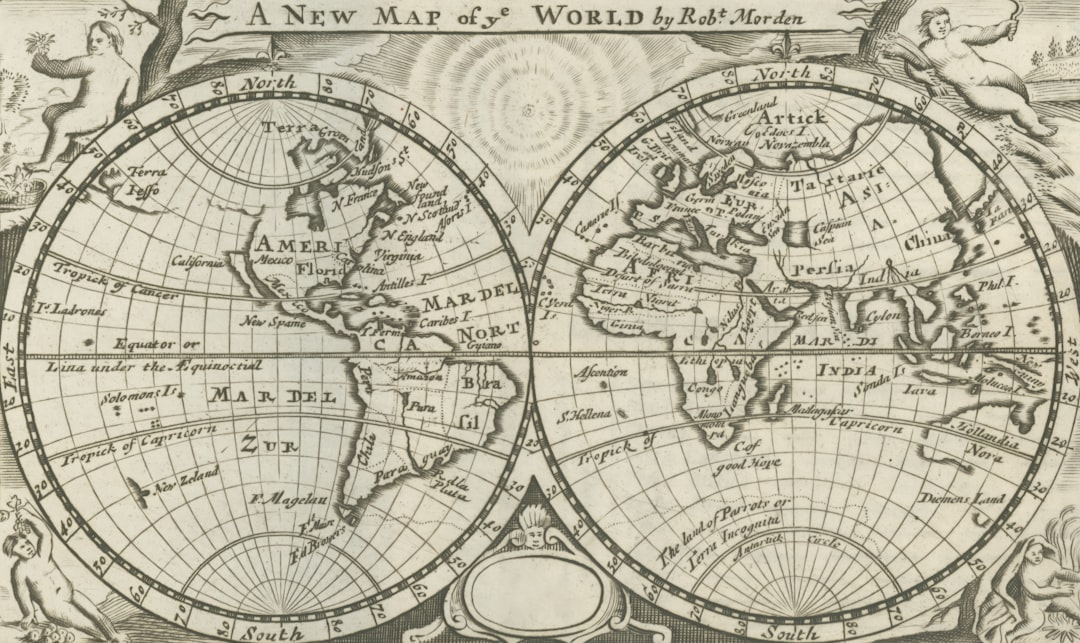
The Piri Reis Map: A Mysterious and Controversial Piece of Cartography
The Piri Reis Map, created in 1513, stands as one of the most enigmatic artifacts in the history of cartography. It depicts parts of Europe, Africa, and South America with remarkable detail, yet it also raises questions about its origins and accuracy. The map is particularly famous for its depiction of the coastlines of South America and its inclusion of features that were not widely known at the time.
This has led to speculation about how Piri Reis obtained such information and whether he had access to lost or ancient sources. Controversy surrounds the map not only due to its content but also because it challenges conventional narratives about the knowledge available during the early 16th century. Some scholars argue that the map reflects advanced geographical knowledge that should not have been possible given the prevailing understanding of the time.
This has sparked debates about potential influences from earlier civilizations or even theories suggesting contact with unknown cultures. The Piri Reis Map thus serves as a focal point for discussions about historical accuracy, cultural exchange, and the evolution of cartographic practices.
The Cartographic Techniques and Innovations Used by Piri Reis
| Cartographic Techniques and Innovations | Description |
|---|---|
| Use of Portolan Charts | Piri Reis utilized portolan charts, which were detailed navigational maps used by sailors, to create his own maps. |
| Incorporation of Geographical Knowledge | He incorporated geographical knowledge from various sources including ancient maps, contemporary explorers, and his own observations. |
| Use of Rhumb Lines | Piri Reis used rhumb lines, which are lines on a map that cross all meridians at the same angle, to aid in navigation and map creation. |
| Integration of Astronomical Information | He integrated astronomical information such as latitudes and longitudes to improve the accuracy of his maps. |
Piri Reis employed a variety of innovative techniques in his cartographic work that set him apart from his contemporaries. One notable aspect was his use of composite mapping, where he integrated information from multiple sources to create a more comprehensive representation of geographical features. This method allowed him to synthesize knowledge from ancient texts, contemporary explorers, and even oral traditions into a single map.
The result was a rich tapestry that reflected both empirical observation and historical accounts. In addition to composite mapping, Piri Reis utilized advanced projection techniques that enhanced the accuracy of his maps. He was adept at translating three-dimensional landscapes onto two-dimensional surfaces while maintaining proportionality and scale.
His attention to detail is evident in the way he depicted coastlines, rivers, and mountain ranges, often incorporating artistic elements that made his maps visually striking. These innovations not only improved navigational accuracy but also contributed to the aesthetic appeal of his work, making it both functional and beautiful.
The Sources and Influences Behind Piri Reis’ Cartography
The sources that informed Piri Reis’s cartography are as diverse as they are intriguing.
Additionally, Piri Reis incorporated information from contemporary explorers who had ventured into uncharted territories.
This blending of ancient wisdom with modern exploration exemplifies his ability to synthesize knowledge across time periods. Moreover, oral traditions played a significant role in shaping Piri Reis’s maps. As he traveled along trade routes and interacted with various cultures, he gathered stories and insights that enriched his understanding of geography.
This cultural exchange is evident in the way he depicted regions that were unfamiliar to European audiences at the time. By integrating diverse sources into his work, Piri Reis not only created maps that were informative but also reflective of a broader human experience that transcended geographical boundaries.
The Accuracy and Precision of Piri Reis’ Maps

The accuracy and precision of Piri Reis’s maps have been subjects of extensive study and debate among historians and cartographers alike. While some aspects of his work demonstrate remarkable accuracy for the period, other elements raise questions about his methods and sources. For instance, his depiction of South America includes details that align closely with modern geographical knowledge, suggesting a sophisticated understanding of coastal features.
However, discrepancies exist as well. Certain areas on the map appear distorted or inaccurately represented, leading some scholars to speculate about potential errors in measurement or interpretation. These inconsistencies highlight the challenges faced by early cartographers who relied on limited technology and incomplete information.
Despite these imperfections, Piri Reis’s maps remain significant for their contributions to navigational practices and their role in shaping perceptions of geography during a transformative era.
The Legacy and Impact of Piri Reis’ Cartography
Piri Reis’s legacy extends far beyond his lifetime; it has influenced generations of cartographers and explorers who followed in his footsteps. His innovative techniques and synthesis of knowledge laid groundwork for future advancements in map-making. The Piri Reis Map itself has become an iconic representation of early modern cartography, inspiring curiosity and scholarly inquiry into its origins and implications.
Furthermore, Piri Reis’s work serves as a reminder of the interconnectedness of cultures during a time when exploration was reshaping global dynamics. His maps reflect not only geographical knowledge but also cultural exchanges that occurred through trade and exploration. As such, they provide valuable insights into the historical context of the Age of Discovery and its lasting impact on world history.
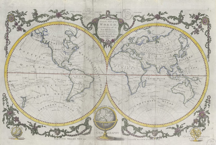
The Piri Reis Map and its Relation to Modern Geography
The relevance of the Piri Reis Map extends into contemporary discussions about geography and cartography. Modern geographers often examine it as a case study in historical mapping practices, analyzing how early cartographers approached representation and navigation. The map’s depiction of coastlines and landforms continues to be compared with modern satellite imagery, revealing both similarities and differences that shed light on changes over time.
Moreover, the Piri Reis Map serves as a reminder of the evolving nature of geographical knowledge. As new discoveries are made and technology advances, understandings of geography continue to shift. The map stands as a testament to human curiosity and the relentless pursuit of knowledge about the world—a pursuit that remains relevant today as societies grapple with issues related to mapping, territory, and identity.
The Theories and Speculations Surrounding the Piri Reis Map
The mysteries surrounding the Piri Reis Map have given rise to numerous theories and speculations over the years. Some scholars propose that it contains evidence of lost civilizations or ancient maritime knowledge that predates known history. These theories often draw on elements within the map that appear to depict features not commonly recognized or documented during Piri Reis’s time.
Additionally, there are suggestions that Piri Reis may have had access to maps or information from other cultures that were more advanced in their geographical understanding than previously thought. This has led to debates about potential interactions between different civilizations long before established historical records suggest such exchanges occurred.
The Significance of the Piri Reis Map in the History of Cartography
The significance of the Piri Reis Map in the history of cartography cannot be overstated. It represents a pivotal moment in which traditional methods began to merge with new explorations, resulting in maps that were more accurate and reflective of contemporary understanding. The map serves as an example of how cartography evolved during a time when global exploration was expanding rapidly.
Moreover, it highlights the importance of cultural exchange in shaping geographical knowledge. The synthesis present in Piri Reis’s work illustrates how different traditions can inform one another, leading to richer understandings of geography that transcend individual cultures. As such, the Piri Reis Map stands as a symbol not only of cartographic achievement but also of humanity’s enduring quest for knowledge about its world.
Piri Reis’ Cartography Synthesis and its Enduring Mystique
In conclusion, Piri Reis’s contributions to cartography represent a remarkable synthesis of knowledge that continues to resonate through history. His innovative techniques, diverse sources, and artistic representations have left an enduring legacy that shapes contemporary understandings of geography. The mysteries surrounding his most famous map invite ongoing exploration and inquiry into its origins and implications.
As scholars delve deeper into Piri Reis’s work, they uncover layers of meaning that reflect broader themes within human history—cultural exchange, exploration, and the quest for understanding our world. The enduring mystique surrounding Piri Reis’s cartography serves as a reminder that even in an age dominated by technology and precision, there remains much to learn from those who came before us in their pursuit of knowledge about our planet.
Cartography has a rich history, and one of the most fascinating examples is the Piri Reis map, which showcases the advanced navigational skills of the early 16th century. For those interested in exploring more about the evolution of cartography and its significance, I recommend checking out a related article on the subject. You can find it here: Cartography and Its Historical Impact. This article delves into various aspects of map-making and its influence on exploration and trade throughout history.
WATCH THIS! Why 99% of History Is Wrong (The Ooparts That Prove It)
FAQs
What is cartography synthesis?
Cartography synthesis is the process of combining and integrating various maps, charts, and geographical data to create a comprehensive and accurate representation of a specific area or region.
Who was Piri Reis?
Piri Reis was an Ottoman admiral, geographer, and cartographer who lived in the 16th century. He is best known for his world map, the Piri Reis map, which is considered one of the most famous and controversial maps in the history of cartography.
What is the Piri Reis map?
The Piri Reis map is a world map drawn by Piri Reis in 1513. It is notable for its depiction of the coastlines of the Americas, which some claim to show evidence of pre-Columbian trans-oceanic contact. The map also includes parts of Europe, Africa, and Asia.
What is the controversy surrounding the Piri Reis map?
The controversy surrounding the Piri Reis map stems from the suggestion that it may contain evidence of advanced knowledge of geography and cartography that was not available to 16th-century explorers. Some researchers claim that the map shows accurate coastlines of Antarctica, which would imply knowledge of the continent before it was officially discovered.
What is cartography synthesis in relation to the Piri Reis map?
In relation to the Piri Reis map, cartography synthesis refers to the process of analyzing and synthesizing the geographical and cartographic information presented on the map to understand its historical significance and accuracy. This may involve comparing the map with other historical maps and geographical data to gain a comprehensive understanding of its content and context.